Embed Size (px)
Citation preview
Ordinary Meeting of Council 7 September 2016
Page 1
3.1 REQUEST FOR A METROPOLITAN REGION SCHEME AMENDMENT - PRECINCT 7 HAZELMERE ENTERPRISE AREA STRUCTURE PLAN - TALBOT ROAD, HAZELMERE
Ward: (Midland/Guildford Ward) (Statutory Planning)
Disclosure of Interest: Nil
Authorised Officer: (Executive Manager Planning and Development)
KEY ISSUES
• Hazelmere Enterprise Area Structure Plan 2011 (HEASP) was adopted by Council on 28 September 2011 and endorsed by the Western Australian Planning Commission (WAPC) on 18 October 2011 to provide guidance on future rezoning of land within part of the Hazelmere locality generally for industrial purposes and to define the land use intent and development requirements for specific precincts within the Structure Plan area.
• The subject land is generally described as being north of Talbot Road bound by Roe Hwy to the east, Abernethy Road to the west and Great Eastern Highway Bypass to the north.
• The WAPC previously initiated a Metropolitan Region Scheme (MRS) Amendment 1254/57 (Hazelmere Enterprise Area Structure Plan Precinct 7 – HEA South) in September 2013, which included the subject land and proposed to rezone the land from ‘Rural’ to ‘Industrial’ under the Metropolitan Region Scheme, this amendment included approximately 74.76ha.
• Following advertising of Amendment 1254/57 The Public Transport Authority WA (PTA) advised that land may be required north of Talbot Road for the future freight railway line realignment. As such the WAPC resolved to exclude the land north of Talbot Road from the MRS amendment until such a time as the PTA resolves the preferred alignment for the freight railway line. The amended version of MRS amendment 1254/57 was gazetted on 9 December 2014.
• The Minister for Planning declared a Special Control Area in October 2015 to reflect the PTA preferred alignment for the freight railway line and the WAPC has written to the City advising the land north of Talbot Road known as Precinct 7 can be considered in a future MRS amendment and supports the City being the proponent for this request.
• The City proposes that the WAPC initiate an MRS amendment for the remainder of the land within Precinct 7 of the HEASP to rezone the land from ‘Rural’ to ‘Industrial’.
It is recommended that the Council resolve to support the request for a Metropolitan Region Scheme Amendment for Precinct 7 of the Hazelmere Enterprise Area Structure Plan to rezone land from ‘Rural’ to ‘Industrial’ and forward the request to the Western Australian Planning Commission for consideration.
Ordinary Meeting of Council 7 September 2016
Page 2
AUTHORITY/DISCRETION
Pursuant to S.35 (1) of the Planning and Development Act 2005, the Western Australian Planning Commission can resolve to prepare an amendment to a Region Planning Scheme.
DETAILS
The Hazelmere Enterprise Area Structure Plan (HEASP) 2011 was adopted by Council on 28 September 2011 and endorsed by the WAPC on 18 October 2011. The HEASP provides guidance on future rezoning of land within part of the Hazelmere locality for predominantly industrial purposes and to define the land use intent and development requirements for specific precincts within the Structure Plan area.
Precinct 7 of the HEASP proposes a zoning change for land from 'Rural' to 'Industrial' under the MRS to facilitate industrial development in the area already predominantly characterised by industrial type uses.
Background MRS Amendment 1254/57
The WAPC previously considered an MRS Amendment for Precinct 7, however during the submission period issues relating to the Midland Freight Railway Realignment were raised by the Public Transport Authority.
The Public Transport Authority (PTA) advised that the land-take option for the preferred alignment will need to be determined by the PTA, and subsequently reserved in the MRS. Until this is undertaken, land located within either rail option should be excluded (i.e. lots north of Talbot Road, Hazelmere) from this amendment. The two railway alignment options being considered by the PTA are as follows:
Option 1
This option (north of Great Eastern Highway Bypass) impacts existing and future industrial land uses within the Hazelmere and Bellevue localities. The alignment will require the acquisition of industrial properties to facilitate creation of a rail reservation within the MRS. The alignment will require the relocation of strategic industrial operations, including the Talloman Rendering Plant.
Option 2
This option (south of Great Eastern Highway Bypass) impacts on small areas of Urban and (future) Industrial zoned land around Clayton Street in Bellevue and Hazelmere. The alignment will require the acquisition of land identified for urban and industrial development. The alignment and its buffer also encroach on existing and proposed residential areas.
In response to the submission made on Amendment 1254/57 by the PTA the WAPC resolved to exclude the land north of Talbot Road until a railway alignment is chosen, after which a separate MRS amendment will reserve the alignment as Railways, and the balance of the land can be zoned appropriately.
Ordinary Meeting of Council 7 September 2016
Page 3
Rail Alignment Progress
The Minister for Planning granted approval for the declaration of a Planning Control Area over land identified for the proposed Midland Freight Rail Realignment on 15 October 2015. This is based on Option 1 listed above. On this basis the alignment will no longer impact on Precinct 7 and as such it is considered appropriate to consider the rezoning of this land. If the MRS amendment is initiated by the WAPC then the proposal will be advertised to government agencies with PTA having the option to comment on whether the rezoning will impact upon the future rail alignment.
Action
The landowners within Precinct 7 have joined together, represented by different consultants, proposing that the City request the WAPC prepare an MRS amendment for the subject area. One landowner group submitted a request to the WAPC for their land to be included within a future omnibus amendment to rezone to 'Industrial'. The WAPC wrote to the City requesting an amendment request encompassing all of the landholdings within Precinct 7. The landowners have prepared a bushfire hazard assessment in accordance with the requirements of State Planning Policy 3.7 to accompany the amendment request.
With the declaration of the Planning Control Area for the freight rail alignment the City is comfortable that the reasons for deferring Precinct 7 in Amendment 1254/57 have now been resolved and it is appropriate for an MRS amendment to be prepared for this land in line with the HEASP.
OPTIONS AND IMPLICATIONS
Option 1: Council may resolve to recommend that the Western Australian Planning Commission prepare an MRS Amendment for the land north of Talbot Road identified in the Hazelmere Enterprise Area Structure Plan as Precinct 7 rezoning the land from ‘Rural’ to ‘Industrial’
Implications: The Council’s resolution will be taken as a formal request to the Western Australian Planning Commission to consider an MRS amendment for this land.
This is the recommended option.
Option 2: Council may resolve to oppose an MRS amendment for Precinct 7 as the reservation for the Midland Freight Railway have not been reserved and there is uncertainty as to the extent of land that may be required and the impact this may have on potential development in this precinct.
Implications: The City will not forward a request to the WAPC to prepare an MRS amendment for the land. Individual landowners in this precinct have the right to request this amendment from the WAPC.
This is not the recommended option.

Ordinary Meeting of Council 7 September 2016
Page 4
CONCLUSION
In 2011 the WAPC resolved to adopt the City’s Hazelmere Enterprise Area Precinct Structure Plan which proposed the rezoning of land for Industrial and other land uses. The City identified Precinct 7 land bound by Great Eastern Highway Bypass to the north and Talbot Road to the south as being suitable for rezoning from ‘Rural’ to ‘Industrial’ under the MRS.
MRS Amendment 1254/57 proposed to rezone the subject land from ‘Rural’ to ‘Industrial’, however following the advertising period of Amendment 1254/57 the Public Transport Authority WA advised that land may be required north of Talbot Road for the future freight railway line realignment. As such the WAPC resolved to exclude the land north of Talbot Road from the MRS amendment until such a time as the PTA resolves the preferred alignment for the freight railway line. The amended version of MRS amendment 1254/57 was gazetted 9 December 2014.
The Minister for Planning declared a Special Control Area in October 2015 to reflect the PTA preferred alignment for the freight railway line and the WAPC has written to the City advising the land north of Talbot road known as Precinct 7 can be considered in a future MRS amendment and supports the City being the proponent for this request.
The City proposes that the WAPC initiate an MRS amendment for the remainder of the land within Precinct 7 of the HEASP to rezone the land from ‘Rural’ to ‘Industrial’.
ATTACHMENTS
Locality Plan
MRS amendment Map
Bushfire Hazard Assessment
STRATEGIC IMPLICATIONS
The amendments will give effect to the HEASP and provide for enhanced Urban and Industrial land within the City.
STATUTORY IMPLICATIONS
If adopted the proposed MRS amendments will require the City to amend its Local Planning Scheme No.17.
FINANCIAL IMPLICATIONS
Nil. The landowners within the precinct have funded the cost of a Bushfire Hazard Assessment for this land to accompany the MRS amendment as requested by the Western Australian Planning Commission.
Ordinary Meeting of Council 7 September 2016
Page 5
VOTING REQUIREMENTS
Simple majority
RECOMMENDATION
That the Council resolve to:
1) Recommend that the Western Australian Planning Commission prepare a Metropolitan Region Scheme Amendment for the land North of Talbot Road identified in the Hazelmere Enterprise Area Structure Plan as Precinct 7 rezoning the land from ‘Rural’ to ‘Industrial’.
2) Forward the resolution to the Western Australian Planning Commission for consideration.
CARRIED


PlanViewWA Map10,746
Legend
1:
Kilometres0 0.50.27
at A3
Notes:
Map was produced using DoP's PlanViewWA.
05-Jul-2016
The data that appears on the map may beout of date, not intended to be used at thescale displayed, or subject to licenseagreements. This information is stored inthe relevant layers metadata. For thesereasons the map should not be distributedoutside of the Department.
INTERNAL USE ONLY
Projection:Link to website
WGS 1984 Web Mercator Auxiliary Sphere Date produced:
Produced by:
Internal Spatial ViewerFUNCTIONALITY TO COME
Local Government AreaCadastre (View 1)Roads
National Highway
Main
Minor
Not Applicable
Region Scheme BoundaryBush Forever AreasEnvironmental ConditionsRegion Scheme Zones and Rese
Industrial
Other regional roads
Parks and recreation
Primary regional roads
Public purposes - Commonwealth Gov
Railways
Rural
Urban
Urban deferred
REF: 16-043 VER: A
August 2016
Bushfire Hazard Level Assessment Talbot Road Hazelmere
LUSH FIRE & PLANNING PO Box 114 Woodanilling WA 6316 0418 954 873 ABN 74 232 678 543

Talbot Road Hazelmere
LUSH Fire & Planning PO Box 114
Woodanilling WA 6316
0418954873 [email protected]
Document Reference Reference Number: 16-043 Project Name: Talbot Road BHL Prepared for: Georgiou Capital Pty Ltd Automotive Properties Pty Ltd Swan Regional Services Author: Geoffrey Lush Date Created: 27th July 2016
Accreditation Statement I hereby declare that I am a BPAD accredited bushfire practitioner:
BPAD Level 1 BAL Assessor Accreditation No 27682
BPAD Level 2 Bushfire Practitioner – Prescriptive Application Pending Approval
Pathway 2 Experienced Practitioner having more than 5 years’ full time experience in a related industry; and more than 3 years’ experience as a bushfire consultant and during that I have completed more than 15 bushfire assessments and reports in support of development / planning applications or similar purpose.
Disclaimer The measures contained in this report do not guarantee that a building will not be damaged in a bush fire. The ultimate level of protection will be dependent upon the design and construction of the dwelling and the level of fire preparedness under taken by the landowner. The severity of a bushfire will depend upon the vegetation fuel loadings; the prevailing weather conditions and the implementation of appropriate fire management measures.
Revision Table
Revision Date Purpose A 04/08/2016 Draft for review

Talbot Road Hazelmere
CONTENTS
1.0 Introduction ..................................................................................................1
2.0 Existing Conditions ........................................................................................1
3.0 Development Framework ...............................................................................6 3.1 Bushfire Prone Land ....................................................................................6 3.2 SPP 3.7 Planning in Bushfire Prone Areas .......................................................6 3.3 Bushfire Protection Criteria ...........................................................................8 3.4 LPS Amendment Regulations ........................................................................8 3.5 Australian Standard AS3959 (2009) ...............................................................8
4.0 Bushfire Hazard ........................................................................................... 10
5.0 Development Issues .................................................................................... 14 5.1 Proposal ................................................................................................... 14 5.2 Bushfire Protection Criteria ......................................................................... 14 5.3 Bushfire Attack Levels ................................................................................ 16
6.0 Conclusion .................................................................................................. 18
7.0 References .................................................................................................. 19
FIGURES Figure 1 Location Plan .............................................................................................. 2 Figure 2 Cadastral Plan ............................................................................................ 3 Figure 3 Existing Conditions ...................................................................................... 4 Figure 4 Contour Plan .............................................................................................. 5 Figure 5 Bushfire Prone Land .................................................................................... 7 Figure 6 BHL Vegetation Classes ............................................................................. 11 Figure 7 Bushfire Hazard Levels Existing Conditions .................................................. 13 Figure 8 Bushfire Hazard Levels Developed Land ...................................................... 15 Figure 9 BHL - BAL Comparison .............................................................................. 17
TABLES Table 1 BHL Vegetation .......................................................................................... 10 Table 2 BAL Setbacks Flat Land .............................................................................. 17
APPENDICIS Appendix 1 Site Photographs
Talbot Road Hazelmere
Page 1
1.0 INTRODUCTION This bushfire hazard level assessment has been prepared for the proposed rezoning of land located on the northern side of Talbot Road Hazelmere. The subject land is located approximately 3.5 kms south of the Midland town centre. It is bounded by Talbot Road, Roe Highway and the Great Eastern Highway By-Pass as shown in Figure 1. State Planning Policy 3.7 Planning in Bushfire Prone Areas (SPP3.7) requires that Amendments include a Bushfire Hazard Level assessment to determine the applicable hazard level(s) across the subject land. The Policy requires that development should only occur in areas which have, or will have, a moderate or low hazard rating. This assessment has been prepared in accordance with the methodology contained in the Guidelines for Planning in Bushfire Prone Areas which include a site inspection. It is considered that the site is suitable for this intended development and complies with the objectives of SPP3.7 Planning in Bushfire Prone Areas.
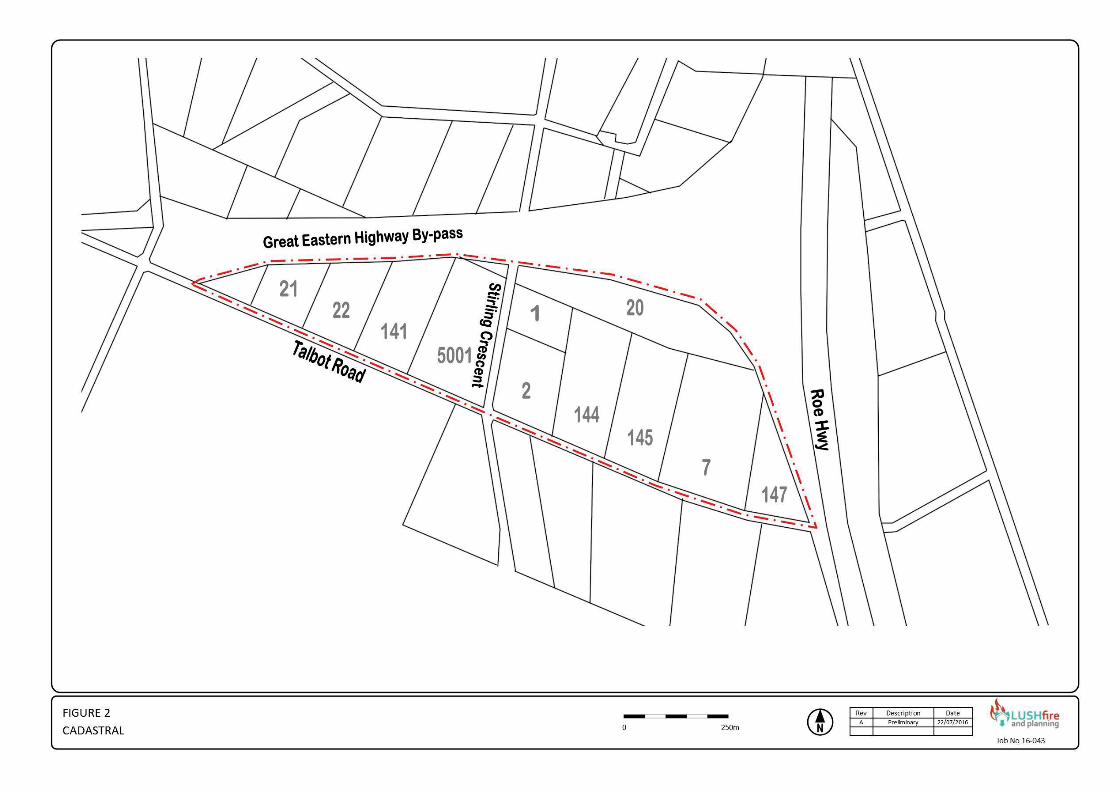
2.0 EXISTING CONDITIONS The subject land has an area of approximately 42 hectares and is comprised of twelve lots as shown in Figure 2. The existing conditions for the site and surrounding land are shown in Figure 3. The area has a mixture of industrial development, vacant lots, several dwellings and there is evidence of previous horticultural operations. The land on the southern side of Talbot Road has also been developed for similar purposes and also contains vacant land. The majority of the area has been cleared with some remnant vegetation on the northern and eastern boundaries adjacent to the highway reserves. Bush Forever Site No 481 is located on the north eastern corner of the subject land and this encroaches into lots 20 and 145. Talbot Road is a sealed access road with a 6 – 8m pavement. The subject land generally has an elevation of between 15 to 25m AHD and slopes to the west. There is a minor ridge on Talbot Road near the boundary of Lots 2 and 144. The gradients on the site are minor and the contour levels are shown in Figure 4. The locality has a Mediterranean climate, characterised by warm dry summers and cool wet winters. During summer (September to March) a belt of anticyclones lies over the region producing dry easterly winds and high temperatures. During winter this belt moves north and the predominant winds blow onshore from the south-west bringing cool temperatures and cold fronts that produce 90% of the region’s total annual rainfall. Average annual rainfall varies between 500mm and 1000mm and the average daily temperatures range from 170C to 300C in summer and from 60C to 170C in winter.

Talbot Road Hazelmere
Page 2
Figure 1 Location Plan
Ta
lbo
t Ro
ad
Ha
zelm
ere
Page 3
Figure 2Cadastral Plan

Ta
lbo
t Ro
ad
Ha
zelm
ere
Page 4
Figure 3Existing Conditions

Ta
lbo
t Ro
ad
Ha
zelm
ere
Page 5
Figure 4Contour Plan
Talbot Road Hazelmere
Page 6
3.0 DEVELOPMENT FRAMEWORK 3.1 Bushfire Prone Land The State Bushfire Prone Maps were released on the came into effect as from the 8th April 2016. Bushfire prone areas are comprised of (1):
• Bushfire prone vegetation; and
• A 100m wide bushfire prone buffer. Vegetation is identified as bushfire prone on the State Map if it contains one of the vegetation classifications identified in Figure 2.3 of AS3959 and meets the following size and proximity requirements:
• Areas of 1 hectare or greater in size;
• Less than 1 hectare to 0.25 hectares in area and 100 metres or less from other bushfire prone vegetation 1 hectare or greater in area;
• Is less than 0.25 hectares in area but is 20 metres or less from bushfire prone vegetation of any size; or
• Strips of vegetation 20 metres or greater in width regardless of length and 20 metres or less from each other or bush fire prone vegetation of any size.
The designation of bushfire prone areas triggers:
• The application of Australian Standard AS3959 Construction of Buildings in Bushfire Prone Areas under the Building Code of Australia (from the 8th April 2016);
• The provisions of the Planning and Development (Local Planning Schemes) Amendment Regulations 2015 (from the 8th April 2016); and
• The application of SPP3.7 Planning in Bushfire Prone Areas (from the 7th December 2015).
Portions of the subject land are defined as being bushfire prone as shown in the extract of the Bushfire Prone Map (Figure 5). 3.2 SPP 3.7 Planning in Bushfire Prone Areas State Planning Policy 3.7 Planning in Bushfire Prone Areas was gazetted on the 7th December 2015. The policy provides the foundation for land use planning to address bushfire risk management in Western Australia. It contains objectives and policy measures, as well as reference to the bushfire protection criteria contained in the Guidelines. The objectives of the policy are to:
1. Avoid any increase in the threat of bushfire to people, property and infrastructure. The preservation of life and the management of bushfire impact are paramount.
2. Reduce vulnerability to bushfire through the identification and consideration of bushfire risks in decision-making at all stages of the planning and development process.
1 DFES (2015) Mapping Standard for Bush Fore Prone Areas.

Talbot Road Hazelmere
Page 7
Figure 5 Bushfire Prone Land
3. Ensure that higher order strategic planning documents, strategic planning proposals, subdivision and development applications take into account bushfire protection requirements and include specified bushfire protection measures.
4. Achieve an appropriate balance between bushfire risk management measures and, biodiversity conservation values, environmental protection and biodiversity management and landscape amenity, with consideration of the potential impacts of climate change.
Clause 6.2 states that planning proposals, subdivision and development applications relating to land that has or will have a Bushfire Hazard Level (BHL) above low and/or where a Bushfire Attack Level (BAL) rating above BAL-LOW apply, is to comply with the policy measures. Where development will have, on completion, a moderate BHL and/or where BAL-12.5 to BAL-29 applies, it may be considered for approval where it can be undertaken in accordance with policy measures 6.3, 6.4 or 6.5. Clause 6.3 applies to scheme amendments and in summary the measures include:
• A Bushfire Hazard Level assessment determining the applicable hazard level(s) across the subject land;
• A Bushfire Attack Level (BAL) Contour Map to determine the indicative acceptable BAL ratings across the subject land;
• The identification of any bushfire hazard issues arising from the relevant assessment; and
• Evidence that the proposal will comply with the Bushfire Protection Criteria.

Talbot Road Hazelmere
Page 8
3.3 Bushfire Protection CriteriaThe Bushfire Protection Criteria are contained in Appendix 4 of the Guidelines for Planning in Bushfire Prone Areas (2015). The criteria contain a set of performance criteria and acceptable solutions that new subdivision and developments are required to meet in bush fire prone areas. The main components are:
Element 1 Location
• A1.1 Development location
Element 2 Siting and Design of Development
• A2.1 Asset Protection Zone (APZ)
• A2.2 Hazard Separation Zone (HSZ)
Element 3 Vehicular Access
• A3.1 Two access routes
• A3.2 Public roads
• A3.3 Cul-de-sac (including a dead-end road)
• A3.4 Battle-axes
• A3.5 Private driveways longer than 50 metres
• A3.6 Emergency access way
• A3.7 Fire service access routes (perimeter roads)
• A3.8 Firebreaks
Element 4 Water
• A4.1 Reticulated areas
• A4.2 Non-reticulated areas
• A4.3 Individual lots within non-reticulated areas 3.4 LPS Amendment Regulations The Planning and Development (Local Planning Schemes) Amendment Regulations 2015 commenced operations on the 8th April 2016. The key feature is that the Regulations require a BAL assessment for any “development” in a bushfire prone area. Development is defined as meaning the construction or use, or construction and use, of any habitable building or specified building. This includes any place of work or where people gather. Where the development site as BAL 40 or BAL Flame Zone rating then a planning application will be required. The development site means that part of the land on which the building will be located. The planning application is in addition to any other provision or requirement in the Planning Scheme. These provisions do not apply to the renovation, alteration, extension, improvement or repair of a building.
3.5 Australian Standard AS3959 (2009) AS3959 Construction of Building in Bush Fire Prone Areas (2) provides measures for improving the ability of buildings to withstand burning debris, radiant heat and flame
2 Standards Australia (2009) AS 3959 – Construction of Buildings in Bush Fire Prone Areas. Sydney. Standards Australia International Ltd.
Talbot Road Hazelmere
Page 9
contact during a bush fire. The lower the separation distance from bushfire prone vegetation, the higher the standard of construction is required for buildings. The construction requirements relate to: -
• Subfloor Supports;
• Floor;
• External Walls;
• External Elements and Doors
• Roofs;
• Verandas, Decks, Steps; and
• Water and gas pipes. The Standard contains six Bushfire Attack Levels (BAL) categories. The BAL rating reduces the further the development is located away from bushfire prone vegetation. The measures contained in the Standard cannot guarantee that a building will survive a bushfire event on every occasion. This is due to the unpredictable nature and behaviour of fire and extreme weather conditions. It is noted that the Building Code of Australia only applies the AS3959 construction standards to Class 1, 2, 3 and 10(a) buildings ie residential buildings and associated outbuildings and decks. It does not apply the standards to commercial or industrial developments.
Talbot Road Hazelmere
Page 10
4.0 BUSHFIRE HAZARD A Bushfire Hazard Level assessment provides a ‘broadbrush’ means of determining the potential intensity of a bushfire for a particular area. The bush fire hazard primarily relates to the vegetation on the site, the type and extent (area) of vegetation and its characteristics. The methodology for determining the bushfire hazard level is contained in the Guidelines for Planning in Bushfire Prone Areas (Section 4.1 and Appendix 2). The classification of the vegetation also takes into account The Visual Guide for Bushfire Risk Assessment in Western Australia (WAPC 2016). The characteristics of the different hazard categories (3) are documented in Table 1. The vegetation classifications are shown in Figure 5 and site photographs are contained in Appendix 1. Table 1 BHL Vegetation
Ref Code Vegetation Description
Low Hazard Rating B Areas devoid of standing native vegetation (less than 0.25ha cumulative area)
N/A Areas which, due too climatic or vegetation (eg. rainforest) conditions, do not experience bushfires.
SA Inner urban or suburban areas with maintained gardens and very limited native standing vegetation (less than 0.25 ha cumulative area).
LTV Low threat vegetation, including grassland managed in a minimal fuel condition (i.e. to a nominal height of 100mm), maintained lawns, vineyard and orchards.
P/C Pasture or cropping areas with very limited standing vegetation that is shrubland, woodland or forest with an effective up slope, on flat land or an effective down slope of less than 10 degrees, for a distance greater than 100 metres.
Moderate Hazard Rating P/C(10) Areas containing pasture or cropping with an effective down slope* in excess of 10 degrees for a
distance greater than 100 metres. UG Unmanaged grasslands.
OW Open woodlands.
OS Open shrublands.
LS Low shrubs on areas with an effective up slope, on flat land or an effective down slope of less than 10 degrees, for a distance greater than 100 metres or flat land.
SA(T) Suburban areas with some tree cover.
FWG Forest and woodlands with a permanent grass understorey or at most, a scrub understory structure consisting of multiple areas of <0.25ha and not within 20 metres of each other or single areas of <1ha and not within 100 metres of other scrub areas.
Extreme Hazard Rating F Forests with a scrub understorey which is multi-tiered.
W Woodlands with a scrub understorey which is multi-tiered.
TS Tall shrubs.
OTH Any area of vegetation not otherwise categorised as low or moderate.
3 WAPC (2015) Guidelines for Planning in Bushfire Prone Areas Appendix 2 page 50
Ta
lbo
t Ro
ad
Ha
zelm
ere
Page 11
Figure 6BH
L Vegetation Classes
Talbot Road Hazelmere
Page 12
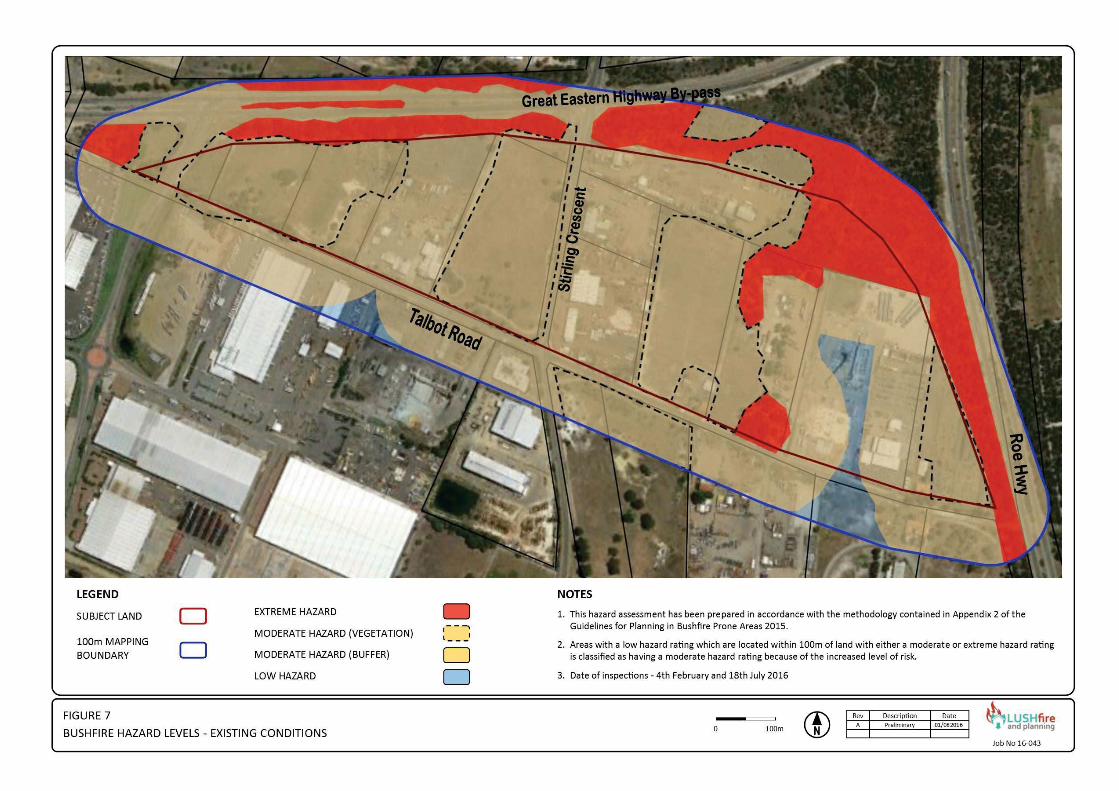
The bushfire hazard levels for the existing site conditions are shown in Figure 7. The site generally has a moderate hazard rating. The adjoining bushland areas have an extreme hazard rating including where these encroach into the subject land. The hazard assessment distinguished between:
a) Vegetation which has a moderate hazard rating; and
b) Land within 100m of areas with either a moderate or extreme hazard rating. This is because Appendix 2 of the Guidelines stipulates that land within 100m of vegetation which has either a moderate or extreme hazard rating is automatically classified as having a moderate hazard rating irrespective of whether there is any vegetation on it or not. This is to reflect the increased level of risk for these adjoining areas. The vacant land is considered to be unmanaged grassland which also has a moderate hazard rating irrespective of whether it is slashed before the fire season. Clause 6.2 of SPP3.7 Planning in Bushfire Prone Areas provides that development may be considered for approval in areas with a moderate bushfire hazard level where it can be undertaken in accordance with policy measures.
Ta
lbo
t Ro
ad
Ha
zelm
ere
Page 13
Figure 7Bushfire H
azard Levels Existing Conditions

Talbot Road Hazelmere
Page 14
5.0 DEVELOPMENT ISSUES The bushfire hazard level assessment is required to:
a) Identify any issues arising from the assessment; and
b) To demonstrate that compliance with the bushfire protection criteria in the Guidelines can be achieved in subsequent planning stages.
These are discussed in the following sections. 5.1 Proposal The proposal is to rezone the land as “industry” under the Metropolitan Region Scheme (MRS) and subsequently then under the Local Planning Scheme. There is no proposed subdivision. Development of the existing lots will occur in accordance with the MRS and Local Planning Scheme provisions. It is expected that under the current development framework that Bush Forever Site 481 will be protected even where this encroaches onto private land. Apart from Bush Forever Site 481, the development of the subject will result in the permanent modification / removal of the classified vegetation within the area. The anticipated bushfire hazard level assessment for the developed land is shown in Figure 8. The majority of the subject land is expected to have a low hazard rating while the portion within 100m of the northern and eastern boundaries will have a moderate hazard rating. 5.2 Bushfire Protection CriteriaAs stated in page 5 of the Guidelines, the policy measures of SPP3.7 and the Guidelines are not to be applied retrospectively. This includes the associated Bushfire Protection Criteria. As there is no proposed subdivision then the Bushfire Protection Criteria do not apply. If in the event that a new development is proposed within the land with a moderate hazard rating, then the policy measures of SPP3.7 and the Guidelines may be applied to it. This has implications primarily for Lots 147, 20 and 21. Development in these areas may be required to be supported by a bushfire management plan which will have to consider:
• If they are vulnerable or high risk land uses; and
• The proposed fire protection measures including building construction. The response to these issues will also depend upon the separation distance between the development and the classified vegetation. This is reflected in the Bushfire Attack Level (BAL) rating.

Ta
lbo
t Ro
ad
Ha
zelm
ere
Page 15
Figure 8Bushfire H
azard Levels Developed Land

Talbot Road Hazelmere
Page 16
5.3 Bushfire Attack Levels Australian Standard AS3959 contains six Bushfire Attack Levels (BAL) categories as follows:
BAL Low The risk is considered to be very low and does not warrant any specific construction requirements.
BAL 12.5 The risk is considered to be low but there is still a risk of ember attack.
BAL 19 The risk is considered to be moderate. There is risk of ember attack and burning debris by wind borne embers and a likelihood of exposure to radiant heat.
BAL 29 The risk is considered to be high. There is an increased risk of ember attack and burning debris by wind borne embers and a likelihood of exposure to an increased level of radiant heat.
BAL 40 The risk is considered to be very high.
BAL FZ The risk is considered to be extreme. The policy measures of SPP3.7 and the Guidelines for Planning in Bushfire Prone Areas have a presumption against any development in areas which will have:
• An extreme bushfire hazard level, or
• Which requires the use of BAL- 40 or BAL Flame Zone (FZ) construction standards.
It might therefore be assumed that:
• Land with a BAL-40 or BAL-FZ rating has an extreme hazard level; and
• Land with a BAL-12.5 to BAL-29 rating has a moderate hazard level. This is not correct as the BAL setbacks commence from the edge of the classified hazard vegetation. Hence land with a moderate hazard level will normally include land that has a BAL-40 and BAL-FZ rating as shown in Figure 9. As the external bushland areas are generally upslope from the development sites the BAL setbacks for the various vegetation types is as shown in Table 2. Hence it is only necessary for building to be setback 21m from the ‘forest’ vegetation to have a BAL-29 rating which meets the policy measures of SPP3.7 and the Guidelines. However, it is desirable for industrial buildings to have a BAL-12.5 setback so as to reduce the potential impacts from radiant heat.

Talbot Road Hazelmere
Page 17
Table 2 BAL Setbacks Flat Land
Vegetation Classification
Bushfire Attack Levels (BALs) BAL - FZ BAL - 40 BAL - 29 BAL - 19 BAL – 12.5
Distance (m) of the site from the predominant vegetation class All upslopes and flat land A Forest < 16 16 - < 21 21 - < 31 31 - < 42 42 - <100 B Woodland < 10 10 - < 14 14 - < 20 20 - < 29 29 - < 100
C Shrubland < 7 7 - < 9 9 - < 13 13 - < 19 19 - < 100
D Scrub < 10 10 - < 13 13 - < 19 19 - < 27 27 - < 100
E Mallee/Mulga < 6 6 - < 8 8 - < 12 12 - < 17 17 - < 100
F Rainforest < 6 6 - < 9 9 - < 13 13 - < 19 19 - < 100
G Grassland < 6 6 - < 8 8 - < 12 12 - < 17 17 - < 50
Figure 9 BHL - BAL Comparison

Talbot Road Hazelmere
Page 18
6.0 CONCLUSION The subject land is located within a bushfire prone area where bushfires occur on a regular basis. Any bushfire can pose a risk to life and property, especially when they are greater than 1 hectare in size (4).
While the development will reduce the bushfire hazard, it will adjoin existing hazard areas. The proposed development is introducing substantial values (property and people) which must be protected from the risk posed by the potential bushfire hazard.
The objectives of SPP3.7 Planning in Bushfire Prone Areas promote that development should not occur in areas with an extreme bushfire hazard rating. Development may occur in areas with a moderate o low hazard rating and/or where a maximum BAL-29 classification is applied.
The potential development of the site will comply with the objectives of SPP3.7 and in particular:
• Through appropriate design it will avoid any increase in the threat of bushfire topeople, property and infrastructure; and
• Through appropriate design it will achieve a balance between bushfire riskmanagement measures and, biodiversity conservation values, environmentalprotection and biodiversity management and landscape amenity.
The issues addressed in the previous section can be addressed in any subsequent development application and/or bushfire management plan.
4 A fire of 1 hectare is the minimum sized used in the modelling for BAL ratings (radiant heat flux) in AS3959.
Talbot Road Hazelmere
Page 19
7.0 REFERENCES
Cheney P & Sullivan A (2008) Grassfires – Fuel, Weather and Fire Behaviour. CSIRO Publishing Collingwood
Department of Planning (2016) Visual Guide for Bushfire Risk Assessment in Western Australia
DFES (2005) Western Australian Emergency Risk Management Guide FESA Perth DFES (2007) Visual Fuel Load Guide. Perth. Fire & Emergency Services Authority of Western
Australia. DFES (2011) Firebreak Location, Construction and Maintenance Guidelines DFES (2012) Prepare Act Survive Perth DFES DFES (2015) Mapping Standard for Bush Fire Prone Areas DFES (undated) Homeowner’s Bush Fire Survival Manual. Ellis, S, Kanowski, P & Whelan, R (2004), National Inquiry on Bushfire Mitigation and
Management, Canberra. Council of Australian Governments. Emergency Management Australia (2002) Manual No 7 Planning Safer Communities – Land
Use Planning for Natural Hazards Commonwealth Attorney General’s Department Handmer J. & Haynes K. (Eds).(2008). Community Bushfire Safety. Collingwood CSIRO
Publishing. Institute of Public Works Engineering Australia WA Division Inc. (2009) Local Government
Subdivisional Guidelines Perth Keelty J (2011) A Shared Responsibility – The Report of the Perth Hills Bushfire February
2011 Review Government Printer Perth Keelty M (2012) Appreciating the Risk – Report of the Special Inquiry into the November
2011 Margaret River Bushfire Government Printer Perth Middelmann, M. H. (Editor) (2007) Natural Hazards in Australia: Identifying Risk Analysis
Requirements. Geoscience Australia, Canberra Ramsay C. & Rudolp L. (2006) Landscape and Building Design for Bushfire Areas.
Collingwood CSIRO Publishing. Ramsay. GC & Dawkins D (1993) SAA HB36-1993 Buildings in Bushfire Prone Areas –
Information and Advice. Sydney. Standards Australia International Ltd. Standards Australia (2004) AS/NZS 4360 Risk Management. Sydney. Standards Australia
International Ltd. Standards Australia (2009) AS 3959 – Construction of Buildings in Bush Fire Prone Areas.
Sydney. Standards Australia International Ltd. Standards Australia (2009) AS/NZS ISO 31000 Risk Management- Principles and Guidelines
Sydney. Standards Australia International Ltd. Victorian Bushfires Royal Commission (2010) Final Report Government Printer Melbourne WAPC (2015) Guidelines for Planning in Bushfire Prone Areas WAPC (2015) SPP3.7 Planning in Bushfire Prone Areas Webster J (2012) Essential Bushfire Safety Tips CSIRO Publishing Collingwood

Talbot Road Hazelmere
Page 20
Appendix 1 – Site Photographs

APPENDIX 1 - Site Photographs
APPENDIX 1 - Site Photographs
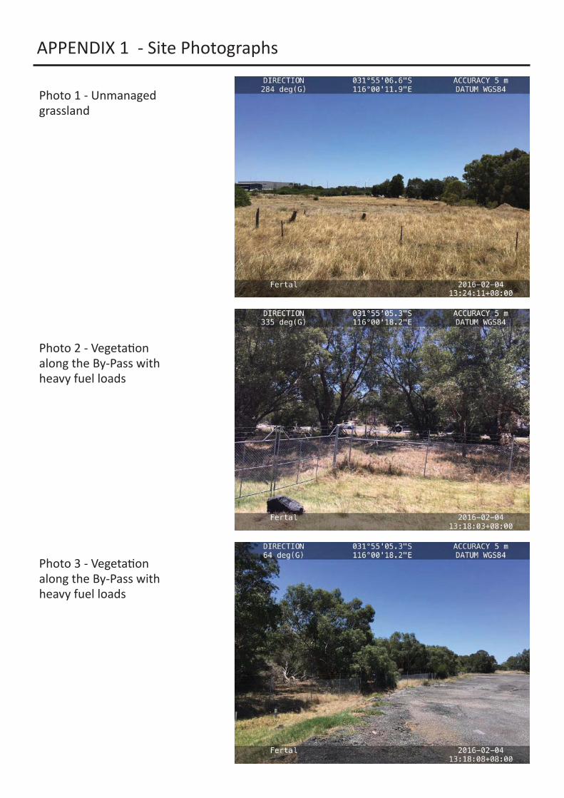
Photo 1 - Unmanaged grassland
Photo 2 - Vegeta on along the By-Pass with heavy fuel loads
Photo 3 - Vegeta on along the By-Pass with heavy fuel loads

APPENDIX 1 - Site Photographs
Photo 4 - Castor oil plant and bamboo
Photo 5 - Area of low shrubland
Photo 6 - Tall shrubland
APPENDIX 1 - Site Photographs
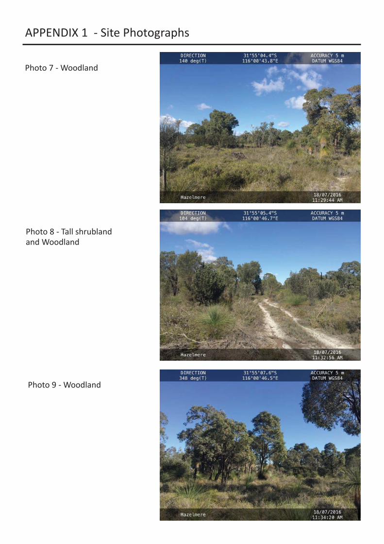
Photo 7 - Woodland
Photo 8 - Tall shrubland and Woodland
Photo 9 - Woodland

APPENDIX 1 - Site Photographs
Photo 10 - Victorian tea tree
Photo 11 - Woodland & Tall shrubland
Photo 12 - Woodland & Low shrubland
APPENDIX 1 - Site Photographs
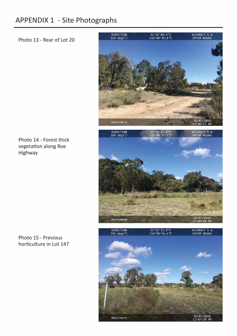
Photo 13 - Rear of Lot 20
Photo 14 - Forest thick vegeta on along Roe Highway
Photo 15 - Previous hor culture in Lot 147
APPENDIX 1 - Site Photographs
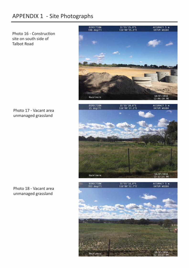
Photo 16 - Construc on site on south side of Talbot Road
Photo 17 - Vacant area unmanaged grassland
Photo 18 - Vacant area unmanaged grassland
APPENDIX 1 - Site Photographs
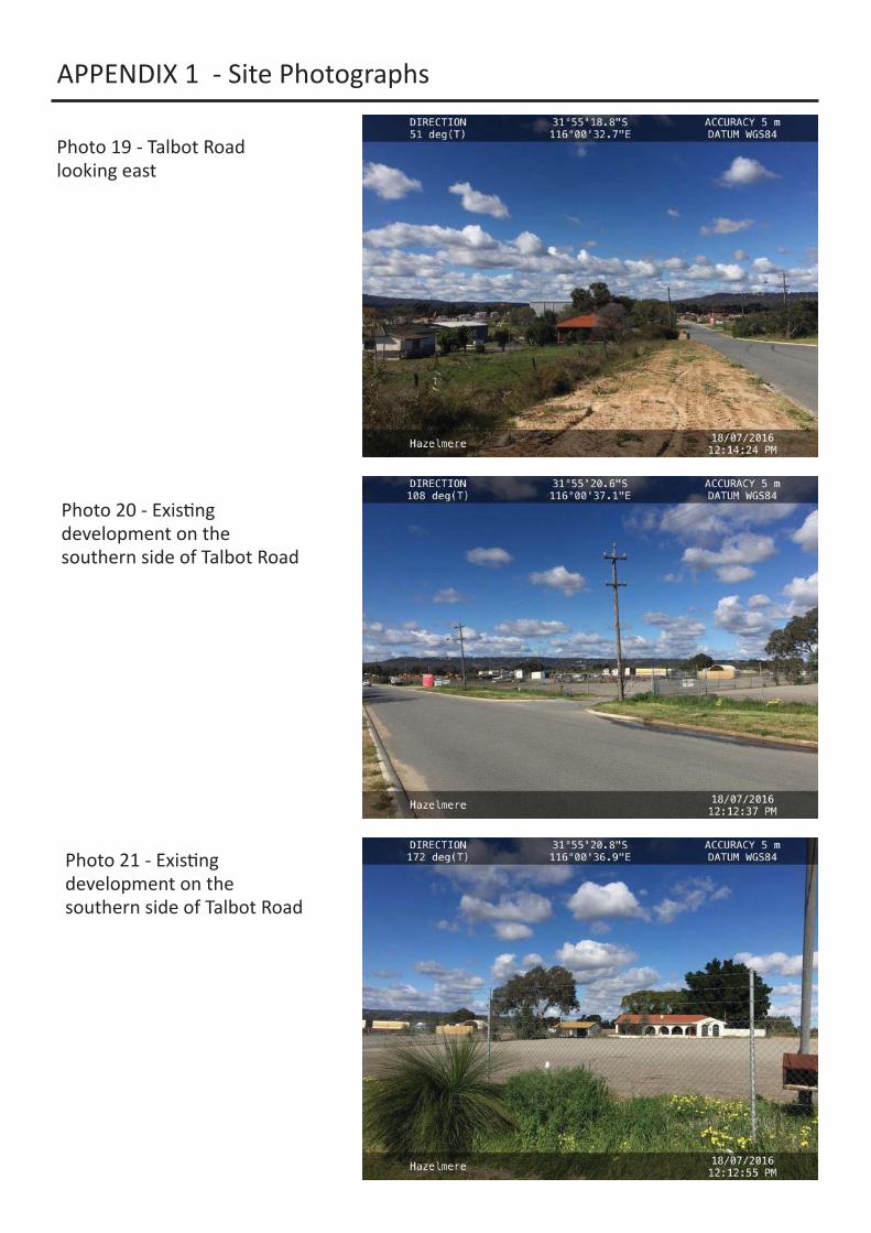
Photo 19 - Talbot Road looking east
Photo 20 - Exis ng development on the southern side of Talbot Road
Photo 21 - Exis ng development on the southern side of Talbot Road

APPENDIX 1 - Site Photographs
Photo 22 - Vacant area unmanaged grassland on the southern side of Talbot Road
Photo 23 - Vacant area unmanaged grassland on Lot 5001
Photo 24 - Vacant area unmanaged grassland on Lot 5001