Embed Size (px)
Citation preview
Republic of C A M E R O O N MINISTRY OF
INDUSTRY, MINES & TECHNOLOGICAL DEVELOPMENT
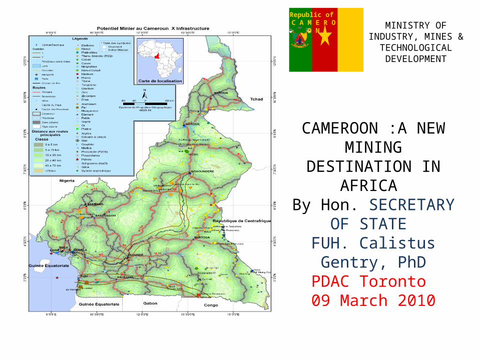
CAMEROON :A NEW MINING
DESTINATION IN AFRICA
By Hon. SECRETARY OF STATE
FUH. Calistus Gentry, PhD
PDAC Toronto 09 March 2010

The REPUBLIC of CAMEROON lies midwaybetween West and Central Africa. It stretchesfrom the Gulf of Guinea in the South-West toLake Chad in the North and liesapproximately between 11° of (attitudes (01°80f - 13° 00f N) and 08° longitude (08° 251 -Yaounde, 2008 216°20f E). It is bounded to the:■ South-West and West by the Gulf of Guinea(the Atlantic Ocean) and the Federal Republicof Nigeria respectively;■ North by Lake Chad;■ North-East and East by the Republics ofChad and Central Africa respectively;■ South by the Republics of Congo, Gabonand Equatorial Guinea.
LOCATIONLOCATION

Infrastructure• Hydroelectric dams of Edea, Song-Loulou, Lagdo for a total of
1200 MW;
• Nyassa in Douala thermic central of gas has been launched for
energy capacity enhancing;
• Construction of Lom-Panger and Memvele hydroelectric dams
starts 2008;
• Construction of a thermic central of gas at Kribi ( 150 MW)
• 5000 km of asphalted roads, 45000 km of maintained laterite
roads;
• Three International ( Douala, Yaounde-Nsimalen & Garoua),
and three national airports for home flights;
Infrastructure (ctd)
• Railway linking Douala – Yaounde – Ngaoundere & western railway (1009 km);
• Deep sea port at Kribi geotechnical & topographical studies have started in january 2010;
• Limbe deep sea port preliminary studies have started.

Simple approach to mineral title
Mineral Permits
ReconnaissanceExploration
Exploitation (Mining)

Licence overviewPermit Quarry Reconnaissance Exploration Exploitation
Purpose Open pit various materials
Geological and geophysical surface work
All types of work for the definition of mineral deposits
Mine development including facilities
Property As necessary According to administrative
boundaries
Polygon, no limitation in depth
Rectangle as per exploitation permit
Area Defined act of allocation
10,0000km2 1,000km2 1,000km2
Validity 5 years, renewable indefinitely for
periods of 3 years years,
Fee per m2
1 year, Renewable
Flat fee
3 years RenewableFee per km2
25 years renewable for 10 years until exhaustion of
resources
Delivery by
Hon. Min. of Mines Hon. Min. of Mines Hon. Min. of Mines HE. President Rep.
Notes Exclusive rights, must have a
sizeable deposit, environmental
impact
Gives priority for exploration permit
Exclusive rights, gives priority for exploitation
permit
Exclusive rights, must have proven deposit, environmental impact study with a mining
convention

Duration for processing applicationsDuration for processing applications• Applications for grant of exploration permit or mining title shall be
processed within the following time-frames: research permit: within 30 (thirty) days of registration of the application; exploration permit: within 45 (forty-five) days of registration of the application; mining permit: within 90 (ninety) days of registration of the application.
• Where the application for mining title is not processed within the time-frame prescribed above, the title shall be considered as granted, unless the service in charge of mines duly informs the applicant, of the extension of the time-limit for examining the application. Such time-limit may not be longer than the initial time-frame.
• Where an application for renewal of a mining title is not processed before the expiry date, such title shall continue to be in force for the land for which the renewal is requested until notification of the renewal or rejection.

Cameroon's geological history begins with the Archaean era between 3.5 and 2.5 billion years (Ga) ago. Its different phases of development are illustrated by geological masses formed during successive orogenic cycles characterized by the formation of mountain ranges, and subsequent extension phases by the splitting of the continental crust.
GEOLOGYGEOLOGY

Cameroon is generally acknowledged to have experienced three orogenic cycles:
1. The Liberian cycle, exemplified by the Ntem complex, which dates from the Archaean era, and is about 2.5 billion years old
2. The Eburnean or Transamazonian cycle, with the Nyong and Ayna, formations, which date from the Palaeoproterozoic period (2.5-1.8 billion years ago);
3. The Pan-African cycle, which comprises formations from the Neoproterozoic era 1,000-600 million years (Ma) ago.
Kitongo granitic Scarp (Poli)
Mintom Limestone
GEOLOGY (ctd)GEOLOGY (ctd)

The extension phases consist of: The Lower Palaeozoic period, during which Mangbaii-type
series were deposited, around 580 million years ago; The Cretaceous era, is exemplified by the Benue trough and its
coastal and continental counterparts, which were formed around 110 million years ago;
The Tertiary era, when the plutonic and volcanic complexes of the Cameroon Line were formed, about 70 million years ago.
The Quaternary period is exemplified chiefly by continental erosion and recent alluvial deposits, particularly on floodplains and in subsidence zones.
Syenites outcrop (Lolodorf)
GEOLOGY (continued)GEOLOGY (continued)

The geology of Cameroon is divided into five geotectonic units: (J. Vicat el al, 1998).The Craton: situated at the extreme south part of the country, it is called the Ntem formations and comprises charnockites, leptynites, gneiss & granodiorites, all cut by greenstones dykes. These formations are estimated to be dated between 2.8 and 3.6 Ga (Archean age) and are composed of Nyong, Ntem and Ayina series (from the W to the E) in which green stones belts have been identify; Craton cover (proterozoic ) is located in the southeast Cameroon on the border of CAR and Congo Republic. It’s discordant with the Mbalam belt and covered partially in the north by the yaounde nappe. This Craton Cover include the upper carbonated), Dja series (650-540 My)
Geological ensembles: Craton of Geological ensembles: Craton of Congo Congo

Geological ensembles (ctd): Congo Craton cover & PanafricanGeological ensembles (ctd): Congo Craton cover & Panafrican
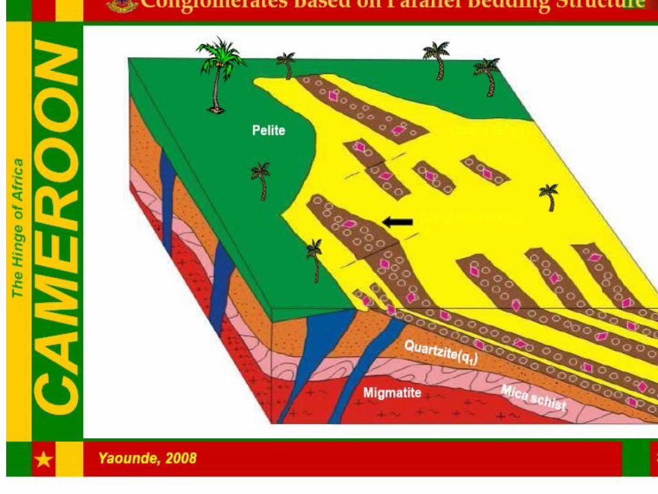
The Bélé-Libongo tillite complex, (850-650 My) the Boulou and Mouloundou sandstones, arkoses, conglomerates and shale series of the lower Dja , and the Lobeke numerous dolerites dykes and sills occur with pillow lava and occasional syenite plutons; the Panafrican Chain is covering the greater part of the territory and its formations have been put in place during the orogeny of the whole continent of
Africa. Mobilong conglomerates

Geological ensembles (ctd): Panafrican ChainGeological ensembles (ctd): Panafrican Chain
Its characterized by a strenching belt directed E-W from Sudan to Gulf of guinea and which extends into Brazil territory. This chain (including two entities) : the christallophyllian and migmatitic formations formations of paraderived origin, and granitoïds which are either anatexic or syn and post - tectonic and most of them are calco-alkili), which belongs to the Oubanguides one, is cut by destral mylonitic shear zones trending NE-SW the Sanaga Fault (SF) and the CCSZ (Central Cameroon Shear Zone).

Geological ensembles (ctd): Sedimentary basinsGeological ensembles (ctd): Sedimentary basins
The Paleozoic and the Cretaceous are the two types identified in Cameroon: (1) Paleozoic (northern part) is azoic volcanic-detrital deposits ( Hoye near Poli) & Mangbei (Chadian border) dated Devonian-Ordovician (370-490 My by K/AR) overlying the Panafrican;(2) Cretaceous:fluvio-lacustrine deposits with Aptian, cenomanian and Turonian sandstone (Mamfé & Benoué areas); Coastal basins (Rio del Rey, Douala & Kribi-Campo, Bakasi area) with deposits dated Eocene & Miocene contain oil & gas.

Geology & Mineral potentialGeology & Mineral potentialThis geology is favorable to the mineralization of
substances as precious metals (gold, diamonds) base metal, rare metals etc, and hydrocarbons. So that we can have for example in :
Congo Craton - Archaean Greenstone belts (South): iron ore (Mbalam, Kribi), uranium (Lolodorf), Diamond (Mobilong)
Central Cameroun shear - Poli series (North): uranium, saphire, gold,
Sanaga shear zone - Lom series (East): gold Pan African Mobile Belt: (Placer gold) Sedimentary basins: oil & gaz (Douala, Campo, Kribi)
salt, sapphire (Mamfé).
SUMARY OF THE EXPLORATION ISSUESFrom 1960 to1990, some of these indices discovered trough the exploration carried out since the beginning of the last century, were investigated with the bilateral cooperation agreements between Cameroon and international bodies like BRGM, UNDP, BGR and others. This resulted in the iron in Mbalam & Kribi, bauxite in Ngaoundal and Minim Martap and Fongo Tongo, Nickel-Cobalt in Lomie, titanium in Akonolinga, Tin in Mayo Darle, Uranium in Poli & Lolodorf, Gold in the East region, Diamond in the south east region. These projects form the current axis of the mineral exploration & exploitation activities in Cameroon.Actually : 87 research permits have been granted to some companies;one mining permit in Ni-Co and 3 for limestone and marble have been issued.The present review has focused its attention to some basic metal and precious substances projects which are going on in Cameroon territory.

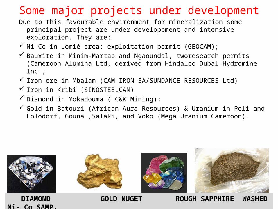
Some major projects under development
DIAMOND GOLD NUGET ROUGH SAPPHIRE WASHED Ni- Co SAMP.
Due to this favourable environment for mineralization some principal project are under developpment and intensive exploration. They are:
Ni-Co in Lomié area: exploitation permit (GEOCAM); Bauxite in Minim-Martap and Ngaoundal, tworesearch permits (Cameroon
Alumina Ltd, derived from Hindalco-Dubal-Hydromine Inc ; Iron ore in Mbalam (CAM IRON SA/SUNDANCE RESOURCES Ltd) Iron in Kribi (SINOSTEELCAM) Diamond in Yokadouma ( C&K Mining); Gold in Batouri (African Aura Resources) & Uranium in Poli and Lolodorf,
Gouna ,Salaki, and Voko.(Mega Uranium Cameroon).

Ni-Co in Nkamouna achievements(1) October 16, 2009: (1) October 16, 2009: Increase in Increase in
resources at the Nkamouna Cobalt resources at the Nkamouna Cobalt ProjectProject
Measured and indicated resources increased Measured and indicated resources increased 97% to 120.6million tonnes .97% to 120.6million tonnes .
Inferred resources increased 25% to Inferred resources increased 25% to 202.5 million tonnes.202.5 million tonnes.
(2) December 9, 2009: (2) December 9, 2009: Lycopodium Lycopodium appointed to update feasibility appointed to update feasibility
studies; deliverable date Q2 2010.studies; deliverable date Q2 2010.
(3) (3) December 16, 2009: December 16, 2009: Standard Standard Chartered Bank engaged by Geovic Chartered Bank engaged by Geovic Mining Corp as financial advisor to Mining Corp as financial advisor to the Nkamouna Cobalt Project.the Nkamouna Cobalt Project.
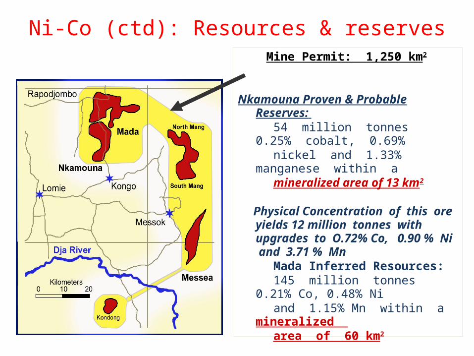
Ni-Co (ctd): Resources & reserves Mine Permit: 1,250 km2
Nkamouna Proven & Probable Reserves: 54 million tonnes 0.25% cobalt, 0.69% nickel and 1.33% manganese within a mineralized area of 13 km2
Physical Concentration of this ore yields 12 million tonnes with upgrades to O.72% Co, 0.90 % Ni and 3.71 % Mn
Mada Inferred Resources: 145 million tonnes 0.21% Co, 0.48% Ni and 1.15% Mn within a mineralized area of 60 km2
Five other deposits contain 264 km2
of mineralized area
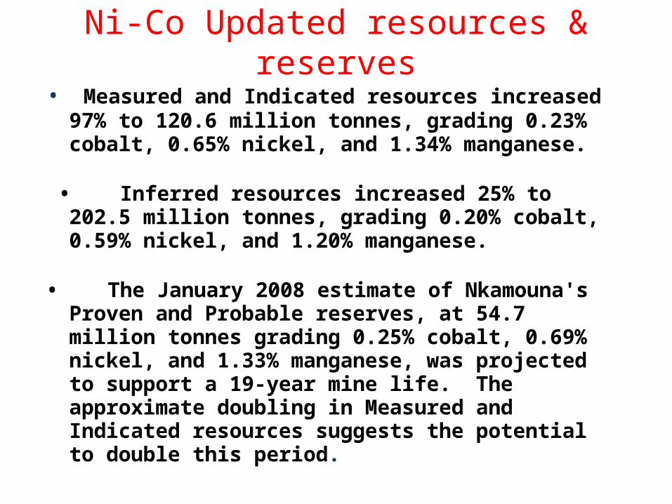
Ni-Co Updated resources & reserves• Measured and Indicated resources increased 97% to
120.6 million tonnes, grading 0.23% cobalt, 0.65% nickel, and 1.34% manganese.
• Inferred resources increased 25% to 202.5 million
tonnes, grading 0.20% cobalt, 0.59% nickel, and 1.20% manganese.
• The January 2008 estimate of Nkamouna's Proven and Probable reserves, at 54.7 million tonnes grading 0.25% cobalt, 0.69% nickel, and 1.33% manganese, was projected to support a 19-year mine life. The approximate doubling in Measured and Indicated resources suggests the potential to double this period.
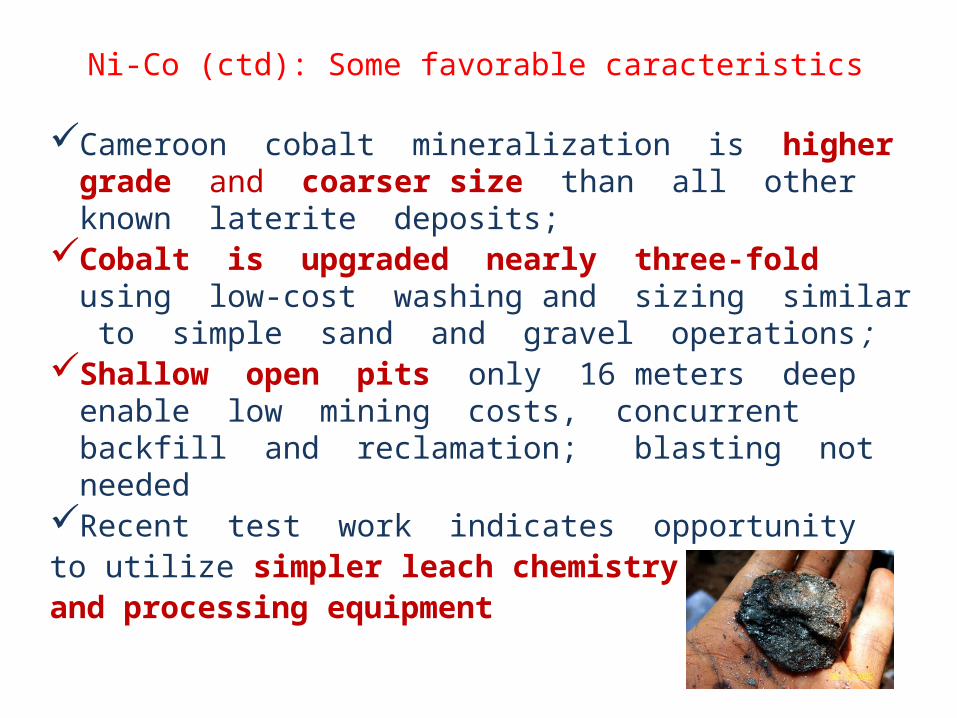
Ni-Co (ctd): Some favorable caracteristics
Cameroon cobalt mineralization is higher grade and coarser size than all other known laterite deposits;
Cobalt is upgraded nearly three-fold using low-cost washing and sizing similar to simple sand and gravel operations ;
Shallow open pits only 16 meters deep enable low mining costs, concurrent backfill and reclamation; blasting not needed
Recent test work indicates opportunity to utilize simpler leach chemistry and processing equipment

Iron ore of Mbalam : Resources & reservesDeposit Resource
categoryTonnage(Mt)
Grade (%)
Fe SiO2 Al2O3 P LOI
Mbarga Indicated 168.7 60.5
9.5 2.1 0.08 1.4
Mbarga Inferred 10.4 57.5
13.0 2.7 0.06 1.6
Mbarga south
Inferred 21.8 58.8
9.4 3.0 0.06 2.9
Metzimevin
Inferred 14.2 61.8
10.3 3.6 0.09 1.8
Total-indicated & inferred resource
215.1 60.2
9.8 2.3 0.08 1.6
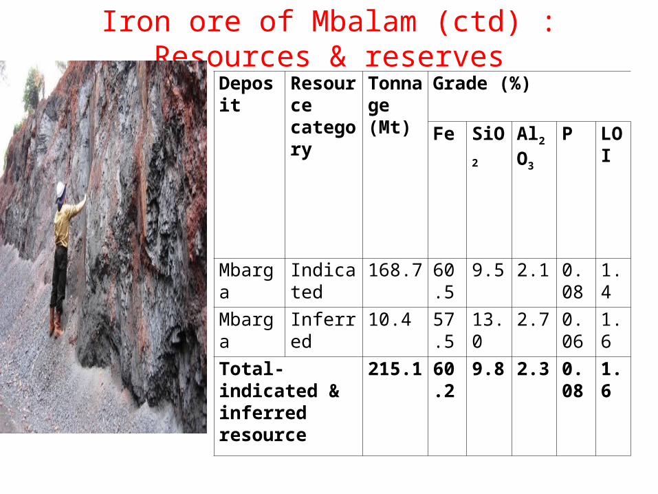
Iron ore of Mbalam (ctd) : Resources & reservesDeposit Resourc
e category
Tonnage(Mt)
Grade (%)
Fe SiO2 Al2O
3
P LOI
Mbarga Indicated
168.7 60.5
9.5 2.1 0.08
1.4
Mbarga Inferred 10.4 57.5
13.0 2.7 0.06
1.6
Total-indicated & inferred resource
215.1 60.2
9.8 2.3 0.08
1.6
Mbalam Iron Ore: Recents achievements
• The indicated resource of itabirite hematite is sufficient to provide beneficiation feed required for the proposed production of high quality Direct Reduction grade and blast furnace grade iron concentrate during the first 20 years of project operation.
• To enhance the high grade hematite, another RP (N°143) has been granted to CAM IRON SA/ SUNDANCES RESOURCES Ltd for further exploration activities.
Mbalam Iron Ore: Recent achievements (ctd)
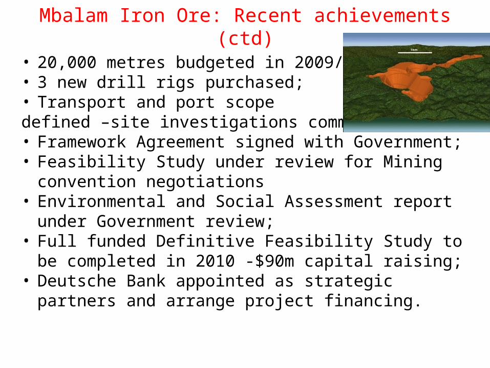
• 20,000 metres budgeted in 2009/10;• 3 new drill rigs purchased;• Transport and port scope defined –site investigations commenced;• Framework Agreement signed with Government;• Feasibility Study under review for Mining convention
negotiations• Environmental and Social Assessment report under
Government review;• Full funded Definitive Feasibility Study to be completed
in 2010 -$90m capital raising;• Deutsche Bank appointed as strategic partners and
arrange project financing.

Yokadouma Diamond: Resources & Reserves
The conglomerates are the source rocks
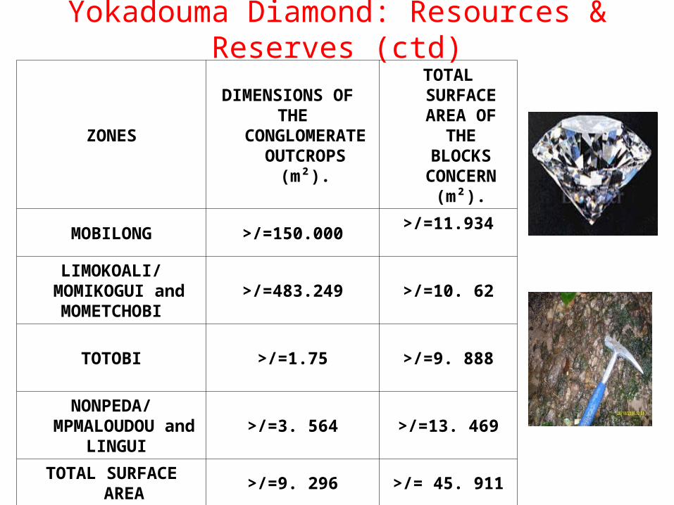
Yokadouma Diamond: Resources & Reserves (ctd)
ZONES
DIMENSIONS OF THE
CONGLOMERATE OUTCROPS
(m²).
TOTAL SURFACE AREA OF
THE BLOCKS
CONCERN (m²).
MOBILONG >/=150.000>/=11.934
LIMOKOALI/MOMIKOGUI and MOMETCHOBI
>/=483.249 >/=10. 62
TOTOBI >/=1.75 >/=9. 888
NONPEDA/MPMALOUDOU
and LINGUI
>/=3. 564 >/=13. 469
TOTAL SURFACE AREA
>/=9. 296 >/= 45. 911

Yokadouma Diamond(ctd): Open pit mining
• Open pit mines are used when deposits of minerals are found near the surface or along kimberlite pipes. This method is used when the "overburden," or surface material covering the deposit, is relatively thin and/or the minerals are imbedded in structurally unstable earth.
• In open cut mining, the ore shall be removed from deposits that crop out at the surface, lie on a hillside, or are covered by a shallow overburden that is stripped before or simultaneously with the removal of the ore.

Yokadouma Diamond (ctd):Environmental issues
• The first step in developing exploitation is the removal of vegetative cover of trees and underbrush. Next, the overburden of topsoil and subsoil is removed and stockpiled for future reclamation. The ore is exploited in the preferred method to be applied.
• Considering the fact that the zone is located in a tropical dense forest area, a detail environmental study is planed to be carried out in the different target zones which include, Mobilong, Limokoali/Momikogui, Momitchobi, Totobi and Nonpeda areas. This shall be done following a well defined reference terms based on socio-economic, flora and fauna that is found in this zone.

Bauxite : Resources & ResrvesExploration campaign was
conducted between January 16th and May 25th 2009. 11
plateaus on Minim-Martap and 3 plateaus on Ngaoundal were
drilled, and 11,358 samples were collected, prepared, and
analyzed. Estimated Bauxite resources
are around 550 Mt with potential for additional 100-200
Mt in the southern region of Minim-Martap deposit.

Bauxite(ctd) : Environmental Issues• Total population in the project area is
around 45,000, but none of them is living on the potential mining pits.
• The base line study covered the Exploration Permits area and a buffer zone of 10 km around their perimeters. It basically showed that the area is fully suitable for implementing mining operations, with no endangered or protected flora and fauna specie, nor any migratory path within. Air, water, and noise monitoring followed the same pattern.
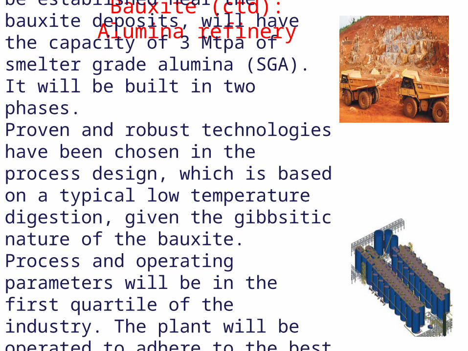
Bauxite (ctd): Alumina refinery
Alumina refinery, planned to be established near the bauxite deposits, will have the capacity of 3 Mtpa of smelter grade alumina (SGA).It will be built in two phases. Proven and robust technologies have been chosen in the process design, which is based on a typical low temperature digestion, given the gibbsitic nature of the bauxite. Process and operating parameters will be in the first quartile of the industry. The plant will be operated to adhere to the best safety, environment, and efficiency standards in the industry.
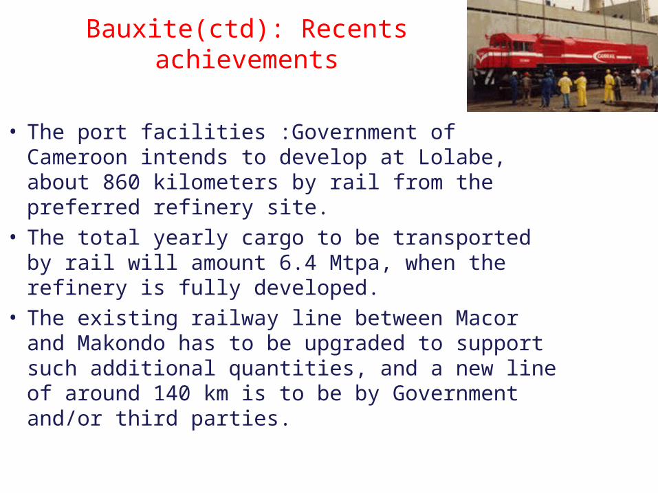
Bauxite(ctd): Recents achievements
• The port facilities :Government of Cameroon intends to develop at Lolabe, about 860 kilometers by rail from the preferred refinery site.
• The total yearly cargo to be transported by rail will amount 6.4 Mtpa, when the refinery is fully developed.
• The existing railway line between Macor and Makondo has to be upgraded to support such additional quantities, and a new line of around 140 km is to be by Government and/or third parties.

Uranium of Poli: Resources Reserves
• Detailed mapping, ground radiometrics, trenching and sampling of the Salaki radiometric anomaly in the Salaki concession, 22 kilometres WSW of Kitongo. The work delineated a 500 metre long zone of elevated radiometric values of 100-12000cps in microdiorite, brecciated basic volcanics and volcaniclastic sediments along a major NW-trending fracture. Ten representative grab samples of the various lithologies in the prospect assayed in the range 324-8293ppm U3O8.
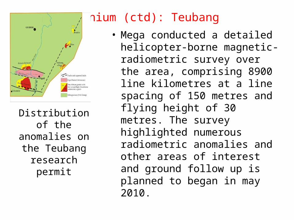
Uranium (ctd): Teubang
• Mega conducted a detailed helicopter-borne magnetic-radiometric survey over the area, comprising 8900 line kilometres at a line spacing of 150 metres and flying height of 30 metres. The survey highlighted numerous radiometric anomalies and other areas of interest and ground follow up is planned to began in may 2010.
Distribution of the anomalies on the Teubang research
permit

Uranium (ctd): Lolodorf• A detailed 7350 line kilometre
helicopter-borne magnetic-
radiometric survey over the entire
Lolodorf property at 150 metres line
spacing and flying height of 30
metres. The more prominent
radiometric anomalies detected in
the survey have been followed up by
ground radiometric surveys,
trenching and geochemical sampling.
Several drilling targets have been
identified, but drilling has been
deferred due to budget constraints.Trenching to expose uranium mineralization in a prospect
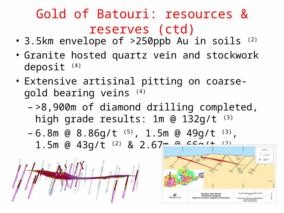
Gold of Batouri: resources & reserves (ctd)• 3.5km envelope of >250ppb Au in soils (2)
• Granite hosted quartz vein and stockwork deposit (4)
• Extensive artisinal pitting on coarse-gold bearing veins (4)
– >8,900m of diamond drilling completed, high grade results: 1m @ 132g/t (3)
– 6.8m @ 8.86g/t (5), 1.5m @ 49g/t (3), 1.5m @ 43g/t (2) & 2.67m @ 66g/t (2)

THANK YOUTHANK YOUFOR YOUR KIND FOR YOUR KIND
ATTENTIONATTENTION