Embed Size (px)
Citation preview
Reprintas at 20 November 2008
Fisheries (Central Area Commercial Fishing) Regulations 1986(SR 1986/217)
NoteChanges authorised by section 17C of the Acts and Regulations Publication Act 1989 have been made in this eprint.A general outline of these changes is set out in the notes at the end of this eprint, together with other explanatory material about this eprint.These regulations are administered in the Ministry of Fisheries.
PURSUANT to section 89 of the Fisheries Act 1983, His Excellency the Governor-General, acting by and with the advice and consent of the Executive Council, hereby makes the following regulations.
Contents
1 Title and commencement2 Interpretation3 All fishing methods prohibited in certain waters3A Minimum set net mesh size4 Trawling and Danish seining prohibited5 Pair trawling prohibited from Cape Runaway to Castlepoint6 Trawling prohibited in certain waters6A Trawling by vessels over 46 m long prohibited in certain waters6B Trawling prohibited in certain seamount areas6C Trawling prohibited from Tirua Point to Pariokariwa Point7 Danish seining prohibited around lower North Island7A Set netting prohibited in shallow waters7B Set net soak time7C Set netting prohibited within 2 miles of Cape Runaway coast7D Set netting prohibited from Tirua Point to Pariokariwa Point8 Set netting prohibited near Mahia Peninsula and Portland Island9 Netting prohibited in Wellington Harbour9A Certain fishing prohibited in Porirua Harbour10 Taking paua and mussels prohibited from Cape Runaway to Blackhead Lighthouse11 Taking of finfish from Wairoa Hard prohibited12 Shellfish prohibitions13 Taking of Kina prohibited in Wellington area13A Taking seaweed prohibited in certain areas14 Restrictions on fishing around Sugar Loaf Islands14A Targeting of certain fish, aquatic life, and seaweed prohibited, unless specially authorised [Revoked]14AA Fish, aquatic life, and seaweed that may be taken subject to competitive or individual quotas, method restrictions, etc. [Revoked]14B Kina season and quotas14C Sea cucumber season and quotas [Revoked]14D Taking of certain paddle crabs prohibited
14E Restriction on method of fishing for octopus or hagfish14F Season and quotas for anchovy, garfish, pilchards, and sprats [Revoked]14G Restrictions on use of nets and dredges14H Restriction on method of taking seaweed14I Taking eels from waters of National Parks prohibited14J Closed season for rock lobster14K Concession relating to male spiny rock lobster14L Method of measurement of male spiny rock lobster tail14M Processing and sale of quota management area 3 male spiny rock lobster15 Taking of eels prohibited [Revoked]16 Offences17 RevocationsSchedule 1Mohaka River catchmentSchedule 2Whanganui River catchmentSchedule 3Catchments containing Pencarrow lakes
1 Title and commencement (1) These regulations may be cited as the Fisheries (Central Area Commercial Fishing)
Regulations 1986.(2) These regulations shall come into force on the 14th day after the date of their notification in the Gazette.
2 Interpretation (1) In these regulations, unless the context otherwise requires,—
Act means the Fisheries Act 1996Act: this definition was substituted, as from 1 October 2001, by regulation 3 Fisheries (Central Area Commercial Fishing) Amendment Regulations (No 3) 2001 (SR 2001/261).Albacore tuna means a fish of the species Thunnus alalungaAnchovy means the fish Engraulis australisBigeye tuna[Revoked]Bigeye tuna: this definition was revoked, as from 1 October 2001, by regulation 3 Fisheries (Central Area Commercial Fishing) Amendment Regulations (No 3) 2001 (SR 2001/261).Black (seal) shark[Revoked]Black (seal) shark: this definition was revoked, as from 1 October 2001, by regulation 3 Fisheries (Central Area Commercial Fishing) Amendment Regulations (No 3) 2001 (SR 2001/261).Blue mackerel[Revoked]Blue mackerel: this definition was revoked, as from 1 October 2001, by regulation 3 Fisheries (Central Area Commercial Fishing) Amendment Regulations (No 3) 2001 (SR 2001/261).Blue moki means a fish of the species Latridopsis ciliarisBlue moki: this definition was inserted by regulation 2(2) Fisheries (Central Area Commercial Fishing) Regulations 1986, Amendment No 6 (SR 1993/280).Blue mussel means a shellfish of the species Mytilus edulis aoteanusBlue shark
[Revoked]Blue shark: this definition was revoked, as from 1 October 2001, by regulation 3 Fisheries (Central Area Commercial Fishing) Amendment Regulations (No 3) 2001 (SR 2001/261).Broad squid[Revoked]Broad squid: this definition was revoked, as from 1 October 2001, by regulation 3 Fisheries (Central Area Commercial Fishing) Amendment Regulations (No 3) 2001 (SR 2001/261).Broadbill swordfish[Revoked]Broadbill swordfish: this definition was revoked, as from 1 October 2001, by regulation 3 Fisheries (Central Area Commercial Fishing) Amendment Regulations (No 3) 2001 (SR 2001/261).Bronze whaler shark[Revoked]Bronze whaler shark: this definition was revoked, as from 1 October 2001, by regulation 3 Fisheries (Central Area Commercial Fishing) Amendment Regulations (No 3) 2001 (SR 2001/261).Butterfish[Revoked]Butterfish: this definition was revoked, as from 1 October 2001, by regulation 3 Fisheries (Central Area Commercial Fishing) Amendment Regulations (No 3) 2001 (SR 2001/261).Butterfly tuna[Revoked]Butterfly tuna: this definition was revoked, as from 1 October 2001, by regulation 3 Fisheries (Central Area Commercial Fishing) Amendment Regulations (No 3) 2001 (SR 2001/261).Cardinal fish means a fish of the Genus EpigonusCatseye[Revoked]Catseye: this definition was revoked, as from 1 October 2001, by regulation 3 Fisheries (Central Area Commercial Fishing) Amendment Regulations (No 3) 2001 (SR 2001/261).Cockle[Revoked]Cockle: this definition was revoked, as from 1 October 2001, by regulation 3 Fisheries (Central Area Commercial Fishing) Amendment Regulations (No 3) 2001 (SR 2001/261).Commercial fisher means
o (a) any person who takes any fish, aquatic life, or seaweed for the purposes of sale:o (b) any person who is engaged in any capacity on a New Zealand fishing vessel:o (c) any person who has a fishing permit issued under section 91 of the Fisheries Act
1996 entitling the person to take any species or class of fish, aquatic life, or seaweed.Commercial fisher: this definition was substituted for the definition of Commercial fisherman, as from 1 October 2001, by regulation 3 Fisheries (Central Area Commercial Fishing) Amendment Regulations (No 3) 2001 (SR 2001/261).Commercial fisherman: paragraph (b) of this definition was amended, as from 26 July 2001, by regulation 3 Fisheries (Central Area Commercial Fishing) Amendment Regulations (No 2) 2001 (SR 2001/156) by inserting the expression “; and”.Commercial fisherman: paragraph (c) of this definition was inserted, as from 26 July 2001, by regulation 3 Fisheries (Central Area Commercial Fishing) Amendment Regulations (No 2) 2001 (SR 2001/156).Container includes any barrel, box, bag carton, can, crate, drum, tank, wrapper , or other package receptacle, or coveringContainer: this definition was inserted, as from 1 April 1996, by regulation 2 (1) Fisheries (Central Area Commercial Fishing) Regulations 1986, Amendment No 9 (SR 1996/21).Cooks turban[Revoked]
Cooks turban: this definition was revoked, as from 1 October 2001, by regulation 3 Fisheries (Central Area Commercial Fishing) Amendment Regulations (No 3) 2001 (SR 2001/261).Crab means the paddle or swimming crab that has the scientific name Ovalipes catharusDanish seine net means any net or part of a net (including any warp, rope, chain, material, or device used in conjunction with or attached to the net) that—
o (a) Has a buoyancy system on the top edge; ando (b) Is weighted on the bottom edge; ando (c) Is operated, without the use of any horizontal net opening device, by surrounding
any fish and being drawn over the bed of any waters, or through any waters, to one or more vessels:
Danish seining means the use of a Danish seine netDay means a period of 24 hours computed from midnight to midnightDog cockle[Revoked]Dog cockle: this definition was revoked, as from 1 October 2001, by regulation 3 Fisheries (Central Area Commercial Fishing) Amendment Regulations (No 3) 2001 (SR 2001/261).Dredge oyster[Revoked]Dredge Oyster: this definition was substituted, as from 1 October 1994, by regulation 2 Fisheries (Central Area Commercial Fishing) Regulations 1986, Amendment No 7 (SR 1994/184).Dredge oyster: this definition was revoked, as from 1 October 2001, by regulation 3 Fisheries (Central Area Commercial Fishing) Amendment Regulations (No 3) 2001 (SR 2001/261).Durvillea[Revoked]Durvillea: this definition was revoked, as from 1 October 2001, by regulation 3 Fisheries (Central Area Commercial Fishing) Amendment Regulations (No 3) 2001 (SR 2001/261).Ecklonia[Revoked]Ecklonia: this definition was revoked, as from 1 October 2001, by regulation 3 Fisheries (Central Area Commercial Fishing) Amendment Regulations (No 3) 2001 (SR 2001/261).Eel means the shortfinned eel (Anguilla australis) and the longfinned eel (Anguilla dieffenbachii)Finfish includes the classes Osteichthyes (boney fishes), Chondrichthyes (cartilaginous fishes), and Agnatha (jawless fishes)Flying fish[Revoked]Flying fish: this definition was revoked, as from 1 October 2001, by regulation 3 Fisheries (Central Area Commercial Fishing) Amendment Regulations (No 3) 2001 (SR 2001/261).Galaxids, adult[Revoked]Galaxids, adult: this definition was revoked, as from 1 October 2001, by regulation 3 Fisheries (Central Area Commercial Fishing) Amendment Regulations (No 3) 2001 (SR 2001/261).Garfish means the fish (also commonly known as piper) that has the scientific name Hyporhamphus ihiGisborne Concession Area[Revoked]Gisborne Concession Area: this definition was inserted by Fisheries (Central Area Commercial Fishing) Regulations 1986, Amendment No 5 (SR 1993/173).Gisborne Concession Area: this definition was revoked, as from 31 March 2003, by regulation 3(1) Fisheries (Central Area Commercial Fishing) Amendment Regulations 2003 (SR 2003/23).Gisborne concession pack[Revoked]
Gisborne concession pack: this definition was inserted by Fisheries (Central Area Commercial Fishing) Regulations 1986, Amendment No 5 (SR 1993/173).Gisborne concession pack: this definition was revoked, as from 1 April 1996, by regulation 2(2)Fisheries (Central Area Commercial Fishing) Regulations 1986, Amendment No 9 (SR 1996/21).Gracilaria[Revoked]Gracilaria: this definition was revoked, as from 1 October 2001, by regulation 3 Fisheries (Central Area Commercial Fishing) Amendment Regulations (No 3) 2001 (SR 2001/261).Green-lipped mussel means a shellfish of the species Perna canaliculus; but excludes green-lipped mussel spatGreen-lipped mussel spat[Revoked]Green-lipped mussel spat: this definition was revoked, as from 1 October 2001, by regulation 3 Fisheries (Central Area Commercial Fishing) Amendment Regulations (No 3) 2001 (SR 2001/261).Greeneye dogfish[Revoked]Greeneye dogfish: this definition was revoked, as from 1 October 2001, by regulation 3 Fisheries (Central Area Commercial Fishing) Amendment Regulations (No 3) 2001 (SR 2001/261).Grey mullet means a fish of the species Mugil cephalusGrey mullet: this definition was inserted by regulation 2(2) Fisheries (Central Area Commercial Fishing) Regulations 1986, Amendment No 6 (SR 1993/280).Hagfish means the common hagfish, or the blind eel that has the scientific name Eptatretus cirrhatusHand-gathering includes shore picking, diving, hand digging for shellfish, and hand cutting of seaweed, but does not include diving using underwater breathing apparatusHapuku/bass means a fish of the species Polyprion oxygeneios or Polyprion moeneHapuku/bass: this definition was inserted by regulation 2(2) Fisheries (Central Area Commercial Fishing) Regulations 1986, Amendment No 6 (SR 1993/280).Horse mussel means a shellfish of the species Atrina zelandicaJack mackerel means the fish that has the scientific name Trachurus sppKahawai means a fish of the species Arripis truttaKina means the shellfish that has the scientific name Evechinus chloroticus, also commonly known as the sea egg; and includes the purple urchin that has the scientific name Centrostephanus rodgersiiKing clam[Revoked]King clam: this definition was revoked, as from 1 October 2001, by regulation 3 Fisheries (Central Area Commercial Fishing) Amendment Regulations (No 3) 2001 (SR 2001/261).Lamprey[Revoked]Lamprey: this definition was revoked, as from 1 October 2001, by regulation 3 Fisheries (Central Area Commercial Fishing) Amendment Regulations (No 3) 2001 (SR 2001/261).Leatherjacket[Revoked]Leatherjacket: this definition was revoked, as from 1 October 2001, by regulation 3 Fisheries (Central Area Commercial Fishing) Amendment Regulations (No 3) 2001 (SR 2001/261).Lessonia[Revoked]Lessonia: this definition was revoked, as from 1 October 2001, by regulation 3 Fisheries (Central Area Commercial Fishing) Amendment Regulations (No 3) 2001 (SR 2001/261).Licensed concession fish packing house[Revoked]
Licensed concession fish packing house: this definition was inserted by Fisheries (Central Area Commercial Fishing) Regulations 1986, Amendment No 5 (SR 1993/173).Licensed concession fish packing house: this definition was revoked, as from 1 April 1996, by regulation 2(2)Fisheries (Central Area Commercial Fishing) Regulations 1986, Amendment No 9 (SR 1996/21).Licensed fish receiver means the person who is the holder of a fish receiver's license or certificate of recognition pursuant to the Fisheries (Licensed Fish Receivers) Regulations 19861
Licensed fish receiver: this definition was inserted, as from 1 April 1996, by regulation 2(3) Fisheries (Central Area Commercial Fishing) Regulations 1986, Amendment No 9 (SR 1996/21).Limpet[Revoked]Limpet: this definition was revoked, as from 1 October 2001, by regulation 3 Fisheries (Central Area Commercial Fishing) Amendment Regulations (No 3) 2001 (SR 2001/261).Longfinned eel means a fish of the species Anguilla dieffenbachiLookdown dory[Revoked]Lookdown dory: this definition was revoked, as from 1 October 2001, by regulation 3 Fisheries (Central Area Commercial Fishing) Amendment Regulations (No 3) 2001 (SR 2001/261).Macrocystis[Revoked]Macrocystis: this definition was revoked, as from 1 October 2001, by regulation 3 Fisheries (Central Area Commercial Fishing) Amendment Regulations (No 3) 2001 (SR 2001/261).Marblefish[Revoked]Marblefish: this definition was revoked, as from 1 October 2001, by regulation 3 Fisheries (Central Area Commercial Fishing) Amendment Regulations (No 3) 2001 (SR 2001/261).Mud snail[Revoked]Mud snail: this definition was revoked, as from 1 October 2001, by regulation 3 Fisheries (Central Area Commercial Fishing) Amendment Regulations (No 3) 2001 (SR 2001/261).Munida[Revoked]Munida: this definition was revoked, as from 1 October 2001, by regulation 3 Fisheries (Central Area Commercial Fishing) Amendment Regulations (No 3) 2001 (SR 2001/261).Mussel means the green-lipped mussel (Perna Canaliculus), the blue mussel (Mytilus edulis aoteanus), and the horse mussel (Atrina zelandica)Net includes any net or part of a net used or capable of being used to take fish; but does not include a whitebait netOctopus means the shellfish Octopus maorumOverall length means the length of a vessel measured by a straight middle line from the extreme forward end to the extreme aft end of the hull of the vesselPacific oyster[Revoked]Pacific oyster: this definition was revoked, as from 1 October 2001, by regulation 3 Fisheries (Central Area Commercial Fishing) Amendment Regulations (No 3) 2001 (SR 2001/261).Paddle crab means a crab of the species Ovalipes catharusPair trawling means using a trawl net that is towed or hauled through the water by more than one vesselPaua includes ordinary paua (Haliotis iris) and yellow foot paua (Haliotis australis); but does not include virgin paua (Haliotis virginea)Periwinkle[Revoked]
Periwinkle: this definition was revoked, as from 1 October 2001, by regulation 3 Fisheries (Central Area Commercial Fishing) Amendment Regulations (No 3) 2001 (SR 2001/261).Pilchard means the fish Sardinops neopilchardusPipi[Revoked]Pipi: this definition was revoked, as from 1 October 2001, by regulation 3 Fisheries (Central Area Commercial Fishing) Amendment Regulations (No 3) 2001 (SR 2001/261).Porae[Revoked]Porae: this definition was revoked, as from 1 October 2001, by regulation 3 Fisheries (Central Area Commercial Fishing) Amendment Regulations (No 3) 2001 (SR 2001/261).Porphyra[Revoked]Porphyra: this definition was revoked, as from 1 October 2001, by regulation 3 Fisheries (Central Area Commercial Fishing) Amendment Regulations (No 3) 2001 (SR 2001/261).Prawn[Revoked]Prawn: this definition was revoked, as from 1 October 2001, by regulation 3 Fisheries (Central Area Commercial Fishing) Amendment Regulations (No 3) 2001 (SR 2001/261).Pterocladia[Revoked]Pterocladia: this definition was revoked, as from 1 October 2001, by regulation 3 Fisheries (Central Area Commercial Fishing) Amendment Regulations (No 3) 2001 (SR 2001/261).Queen scallop[Revoked]Queen scallop: this definition was revoked, as from 1 October 2001, by regulation 3 Fisheries (Central Area Commercial Fishing) Amendment Regulations (No 3) 2001 (SR 2001/261).Quota management area 3 means the Quota Management Area CRA3 — Gisborne as defined in Part 3 of the First Schedule of the Fisheries Act 1996Quota management area 3: this definition was inserted, as from 1 April 1996, by regulation 2(3) Fisheries (Central Area Commercial Fishing) Regulations 1986, Amendment No 9 (SR 1996/21).Quota management area 3: this definition was substituted, as from 31 March 2003, by regulation 3(2) Fisheries (Central Area Commercial Fishing) Amendment Regulations 2003 (SR 2003/23).Ray's bream[Revoked]Rays Bream: this definition was revoked, as from 1 October 2001, by regulation 3 Fisheries (Central Area Commercial Fishing) Amendment Regulations (No 3) 2001 (SR 2001/261).Red moki[Revoked]Red moki: this definition was revoked, as from 1 October 2001, by regulation 3 Fisheries (Central Area Commercial Fishing) Amendment Regulations (No 3) 2001 (SR 2001/261).Ribaldo means a fish of the species Mora moroRock lobster means the fish that has the scientific name Jasus edwardsii (commonly known as the spiny or red rock lobster) or Jasus verreauxi (commonly known as the packhorse or green rock lobster)Rock lobster pot means any pot, whether baited or not, that is capable of catching or holding rock lobsters; and includes any other device capable of catching, holding, or storing rock lobstersRubyfish means a fish of the species Phagiogeneion rubiginosusSaury[Revoked]Saury: this definition was revoked, as from 1 October 2001, by regulation 3 Fisheries (Central Area Commercial Fishing) Amendment Regulations (No 3) 2001 (SR 2001/261).
Scallop[Revoked]Scallop: this definition was revoked, as from 1 October 2001, by regulation 3 Fisheries (Central Area Commercial Fishing) Amendment Regulations (No 3) 2001 (SR 2001/261).Scampi[Revoked]Scampi: this definition was revoked, as from 1 October 2001, by regulation 3 Fisheries (Central Area Commercial Fishing) Amendment Regulations (No 3) 2001 (SR 2001/261).School shark means a fish of the species Galeorhinus australisSchool Shark: this definition was inserted by regulation 2(2) Fisheries (Central Area Commercial Fishing) Regulations 1986, Amendment No 6 (SR 1993/280).Sea cucumber means a holothurian of the Genus StichopusSea hare[Revoked]Sea hare: this definition was revoked, as from 1 October 2001, by regulation 3 Fisheries (Central Area Commercial Fishing) Amendment Regulations (No 3) 2001 (SR 2001/261).Sea horse[Revoked]Sea horse: this definition was revoked, as from 1 October 2001, by regulation 3 Fisheries (Central Area Commercial Fishing) Amendment Regulations (No 3) 2001 (SR 2001/261).Sea perch means a fish of the Genus HelicolenusSea slug[Revoked]Sea slug: this definition was revoked, as from 1 October 2001, by regulation 3 Fisheries (Central Area Commercial Fishing) Amendment Regulations (No 3) 2001 (SR 2001/261).Sea tulip[Revoked]Sea tulip: this definition was revoked, as from 1 October 2001, by regulation 3 Fisheries (Central Area Commercial Fishing) Amendment Regulations (No 3) 2001 (SR 2001/261).Set net includes a gill net, or any other sort of net which acts by enmeshing, entrapping, or entangling any fish; but does not include a fyke net or a hinaki trapSet Net: this definition was further amended by regulation 2(1) Fisheries (Central Area Commercial Fishing) Regulations 1986, Amendment No 6 (SR 1993/280) by omitting the words “drift net, trammel net,”.Set net: this definition was substituted, as from 30 November 1995, by regulation 2(1) Fisheries (Central Area Commercial Fishing) Regulations 1986, Amendment No 8 (SR 1995/232).Seven-gill shark[Revoked]Seven-gill shark: this definition was revoked, as from 1 October 2001, by regulation 3 Fisheries (Central Area Commercial Fishing) Amendment Regulations (No 3) 2001 (SR 2001/261).Shortfinned eel means a fish of the species Anguilla australisShovelnose spiny dogfish[Revoked]Shovelnose spiny dogfish: this definition was revoked, as from 1 October 2001, by regulation 3 Fisheries (Central Area Commercial Fishing) Amendment Regulations (No 3) 2001 (SR 2001/261).Silver dory[Revoked]Silver dory: this definition was revoked, as from 1 October 2001, by regulation 3 Fisheries (Central Area Commercial Fishing) Amendment Regulations (No 3) 2001 (SR 2001/261).Six-gill shark[Revoked]
Six-gill shark: this definition was revoked, as from 1 October 2001, by regulation 3 Fisheries (Central Area Commercial Fishing) Amendment Regulations (No 3) 2001 (SR 2001/261).Skate and ray[Revoked]Skate and ray: this definition was revoked, as from 1 October 2001, by regulation 3 Fisheries (Central Area Commercial Fishing) Amendment Regulations (No 3) 2001 (SR 2001/261).Skipjack tuna[Revoked]Skipjack tuna: this definition was revoked, as from 1 October 2001, by regulation 3 Fisheries (Central Area Commercial Fishing) Amendment Regulations (No 3) 2001 (SR 2001/261).Slender tuna[Revoked]Slender tuna: this definition was revoked, as from 1 October 2001, by regulation 3 Fisheries (Central Area Commercial Fishing) Amendment Regulations (No 3) 2001 (SR 2001/261).Smelt adult[Revoked]Smelt adult: this definition was revoked, as from 1 October 2001, by regulation 3 Fisheries (Central Area Commercial Fishing) Amendment Regulations (No 3) 2001 (SR 2001/261).Snapper means the fish that has the scientific name Chrysophrys auratusSouthern bluefin tuna[Revoked]Southern bluefin tuna: this definition was revoked, as from 1 October 2001, by regulation 3 Fisheries (Central Area Commercial Fishing) Amendment Regulations (No 3) 2001 (SR 2001/261).Sowfish[Revoked]Sowfish: this definition was revoked, as from 1 October 2001, by regulation 3 Fisheries (Central Area Commercial Fishing) Amendment Regulations (No 3) 2001 (SR 2001/261).Spiny dogfish[Revoked]Spiny dogfish: this definition was revoked, as from 1 October 2001, by regulation 3 Fisheries (Central Area Commercial Fishing) Amendment Regulations (No 3) 2001 (SR 2001/261).Spiny rock lobster means the fish of the species Jasus edwardsii (commonly known as the spiny or red rock lobster); and includes any part thereofSpiny rock lobster: this definition was inserted by Fisheries (Central Area Commercial Fishing) Regulations 1986, Amendment No 5 (SR 1993/173).Sponge[Revoked]Sponge: this definition was revoked, as from 1 October 2001, by regulation 3 Fisheries (Central Area Commercial Fishing) Amendment Regulations (No 3) 2001 (SR 2001/261).Spotty[Revoked]Spotty: this definition was revoked, as from 1 October 2001, by regulation 3 Fisheries (Central Area Commercial Fishing) Amendment Regulations (No 3) 2001 (SR 2001/261).Sprat means a fish of the Genus SprattusSurf clam[Revoked]Surf clam: this definition was revoked, as from 1 October 2001, by regulation 3 Fisheries (Central Area Commercial Fishing) Amendment Regulations (No 3) 2001 (SR 2001/261).Surrounding net includes a drag net, Danish seine net, drum seine net, purse seine net, lampara net, and all modes of fishing whereby fish are encircledThresher shark[Revoked]Thresher Shark: this definition was revoked, as from 1 October 2001, by regulation 3 Fisheries (Central Area Commercial Fishing) Amendment Regulations (No 3) 2001 (SR 2001/261).
Trawl net means any net or part of a net (including any warp, rope, chain, material, or device used in conjunction with or attached to the net) that—
o (a) Has a buoyancy system on the top edge; ando (b) Is weighted on the bottom edge; ando (c) Is operated by being drawn over the bed of any waters or through any waters by
one or more vessels underway—but does not include a Danish seine netTrumpeter means a fish of the species Latris lineataTuatua[Revoked]Tuatua: this definition was revoked, as from 1 October 2001, by regulation 3 Fisheries (Central Area Commercial Fishing) Amendment Regulations (No 3) 2001 (SR 2001/261).Ulva[Revoked]Ulva: this definition was revoked, as from 1 October 2001, by regulation 3 Fisheries (Central Area Commercial Fishing) Amendment Regulations (No 3) 2001 (SR 2001/261).Undaria[Revoked]Undaria: this definition was revoked, as from 1 October 2001, by regulation 3 Fisheries (Central Area Commercial Fishing) Amendment Regulations (No 3) 2001 (SR 2001/261).Virgin paua means the shellfish that has the scientific name Haliotis virgineaVolutes[Revoked]Volutes: this definition was revoked, as from 1 October 2001, by regulation 3 Fisheries (Central Area Commercial Fishing) Amendment Regulations (No 3) 2001 (SR 2001/261).Whelk[Revoked]Whelk: this definition was revoked, as from 1 October 2001, by regulation 3 Fisheries (Central Area Commercial Fishing) Amendment Regulations (No 3) 2001 (SR 2001/261).Whitebait net means any net, contrivance, instrument, or device used or capable of being used to take the fish commonly called whitebaitYellow-eyed mullet means a fish of the species Aldichetta forsteriYellowfin tuna[Revoked]Yellowfin tuna: this definition was revoked, as from 1 October 2001, by regulation 3 Fisheries (Central Area Commercial Fishing) Amendment Regulations (No 3) 2001 (SR 2001/261).Yellowtailed kingfish[Revoked]Yellowtailed kingfish: this definition was revoked, as from 1 October 2001, by regulation 3 Fisheries (Central Area Commercial Fishing) Amendment Regulations (No 3) 2001 (SR 2001/261).Zostera[Revoked]Zostera: this definition was revoked, as from 1 October 2001, by regulation 3 Fisheries (Central Area Commercial Fishing) Amendment Regulations (No 3) 2001 (SR 2001/261).(2) In these regulations, a reference to a named quota management area is a reference to the area of that name as defined in Schedule 2 to the Fisheries (Quota Management Areas, Total Allowable Catches, and Catch Histories) Notice 1986 (S.R. 1986/267).
Regulation 2 was substituted by regulation 2(1) Fisheries (Central Area Commercial Fishing) Regulations 1986, Amendment No 2 (SR 1989/292), and further substituted by regulation 2(1) Fisheries (Central Area Commercial Fishing) Regulations 1986, Amendment No 3 (SR 1991/165).
3 All fishing methods prohibited in certain waters
(1) No commercial fisher shall take or have in possession any fish taken by any fishing method from the following waters:
o (a) Horokaka, Mahia Peninsula: All those waters lying inside a line commencing at the point 39 degrees 05.26′S and 177 degrees 57.25′E near Auroa Point; then in a northwesterly direction to a point 39 degrees 04.20′S and 177 degrees 56.21′E; then in a southwesterly direction to the point 39 degrees 05.27′S and 177 degrees 55.42′E; then along the mean high-water mark to the point of commencement:
o (b) Pariokena Point to Rarohenga Stream, Mahia Peninsula: All those waters lying inside a line commencing at Pariokena Point (at 39 degrees 05.30′S and 177 degrees 57.45′E); then in an easterly direction to a point 39 degrees 05.31′S and 177 degrees 59.40′E; then in a southerly direction to the mouth of the Rarohenga Stream (at 39 degrees 06.15′S and 177 degrees 59.42′E; then along the mean high-water mark to the point of commencement:
o (c) Te Hoe Point to Waikokopu Breakwater, Mahia Peninsula: All those waters lying inside a straight line drawn from Te Hoe Point (at 39 degrees 07.10′S and 177 degrees 51.13′E) to the Waikokopu Breakwater (at 39 degrees 04.31′S and 177 degrees 49.45′E):
o (d) Waimarama: All those waters lying inside a line commencing at the mouth of the Waipuka Stream (at 39 degrees 44.8′S and 177 degrees 0.6′E); then in a southeasterly direction to a point 39 degrees 50.1′S and 177 degrees 02.6′E; then in a southwesterly direction to a point 39 degrees 52′S and 176 degrees 58.8′E; then along the mean high-water mark to the point of commencement:
o (e) Ngapuhake: A shallow area known as an upwelling being about 50 square metres in area and to the southeast of Bare Island.
(2) No commercial fisher may take aquatic life by any fishing method, or be in possession of any aquatic life taken from, the following waters:
o (a) the Mohaka River catchment, as described in Schedule 1:o (b) the Whakaki Lagoon (east of Wairoa):o (c) the Whanganui River catchment, as described in Schedule 2, excluding the
following areas: (i) the lower Whanganui River, and any tributaries from the lower Whanganui
River, below the junction of the Kauarapaoa Stream with the Whanganui River (at NZMS 260-R22, 886538, and adjacent to the historic site Kemps Pole):
(ii) all ponds and dams within the Whanganui River catchment that are not connected at any time of the year to either any one of the tributaries leading into the Whanganui River or the Whanganui River itself:
o (d) Lake Poukawa adjacent to Te Hauke:o (e) the catchments containing the Pencarrow lakes, as described in Schedule 3.
Regulations 3 to 6A were amended, as from 1 October 2001, by regulation 4 Fisheries (Central Area Commercial Fishing) Amendment Regulations (No 3) 2001 (SR 2001/261) by substituting the words “commercial fisher” for the words “commercial fisherman” wherever they appear.Subclause (2) was inserted, as from 13 January 2005, by regulation 3 Fisheries (Central Area Commercial Fishing) Amendment Regulations (No 4) 2004 (SR 2004/440).
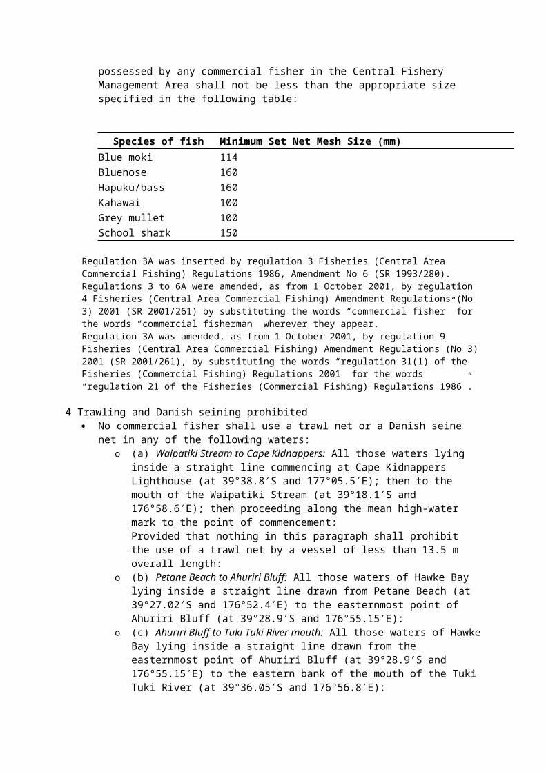
3A Minimum set net mesh size Notwithstanding regulation 31(1) of the Fisheries (Commercial Fishing) Regulations 2001, the
mesh size of any set net used or possessed by any commercial fisher in the Central Fishery Management Area shall not be less than the appropriate size specified in the following table:
Species of fish Minimum Set Net Mesh Size (mm)Blue moki 114
Species of fish Minimum Set Net Mesh Size (mm)Bluenose 160Hapuku/bass 160Kahawai 100Grey mullet 100School shark 150
Regulation 3A was inserted by regulation 3 Fisheries (Central Area Commercial Fishing) Regulations 1986, Amendment No 6 (SR 1993/280).Regulations 3 to 6A were amended, as from 1 October 2001, by regulation 4 Fisheries (Central Area Commercial Fishing) Amendment Regulations (No 3) 2001 (SR 2001/261) by substituting the words “commercial fisher” for the words “commercial fisherman” wherever they appear.Regulation 3A was amended, as from 1 October 2001, by regulation 9 Fisheries (Central Area Commercial Fishing) Amendment Regulations (No 3) 2001 (SR 2001/261), by substituting the words “regulation 31(1) of the Fisheries (Commercial Fishing) Regulations 2001” for the words “regulation 21 of the Fisheries (Commercial Fishing) Regulations 1986”.
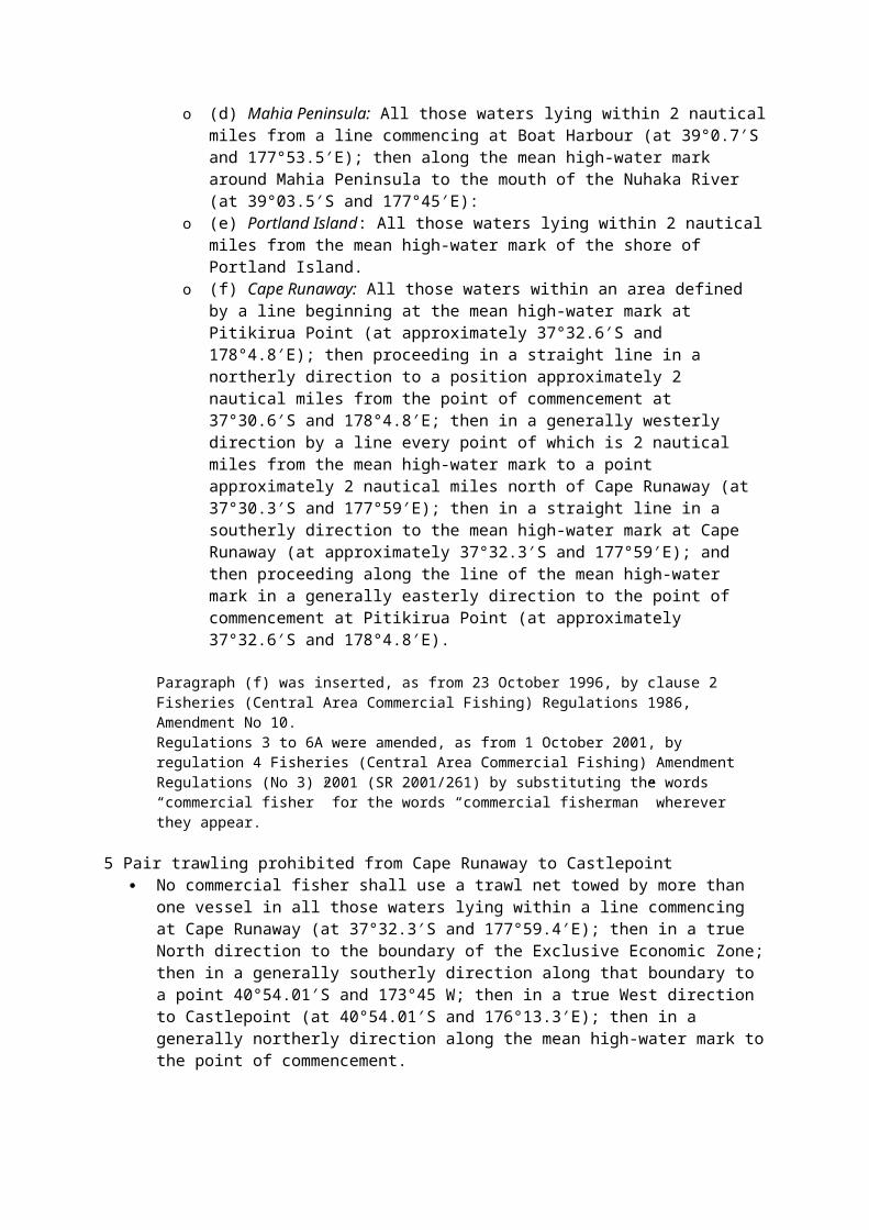
4 Trawling and Danish seining prohibited No commercial fisher shall use a trawl net or a Danish seine net in any of the following
waters:o (a) Waipatiki Stream to Cape Kidnappers: All those waters lying inside a straight line
commencing at Cape Kidnappers Lighthouse (at 39°38.8′S and 177°05.5′E); then to the mouth of the Waipatiki Stream (at 39°18.1′S and 176°58.6′E); then proceeding along the mean high-water mark to the point of commencement:Provided that nothing in this paragraph shall prohibit the use of a trawl net by a vessel of less than 13.5 m overall length:
o (b) Petane Beach to Ahuriri Bluff: All those waters of Hawke Bay lying inside a straight line drawn from Petane Beach (at 39°27.02′S and 176°52.4′E) to the easternmost point of Ahuriri Bluff (at 39°28.9′S and 176°55.15′E):
o (c) Ahuriri Bluff to Tuki Tuki River mouth: All those waters of Hawke Bay lying inside a straight line drawn from the easternmost point of Ahuriri Bluff (at 39°28.9′S and 176°55.15′E) to the eastern bank of the mouth of the Tuki Tuki River (at 39°36.05′S and 176°56.8′E):
o (d) Mahia Peninsula: All those waters lying within 2 nautical miles from a line commencing at Boat Harbour (at 39°0.7′S and 177°53.5′E); then along the mean high-water mark around Mahia Peninsula to the mouth of the Nuhaka River (at 39°03.5′S and 177°45′E):
o (e) Portland Island: All those waters lying within 2 nautical miles from the mean high-water mark of the shore of Portland Island.
o (f) Cape Runaway: All those waters within an area defined by a line beginning at the mean high-water mark at Pitikirua Point (at approximately 37°32.6′S and 178°4.8′E); then proceeding in a straight line in a northerly direction to a position approximately 2 nautical miles from the point of commencement at 37°30.6′S and 178°4.8′E; then in a generally westerly direction by a line every point of which is 2 nautical miles from the mean high-water mark to a point approximately 2 nautical miles north of Cape Runaway (at 37°30.3′S and 177°59′E); then in a straight line in a southerly direction to the mean high-water mark at Cape Runaway (at approximately 37°32.3′S and 177°59′E); and then proceeding along the line of the mean high-water mark in a generally easterly direction to the point of commencement at Pitikirua Point (at approximately 37°32.6′S and 178°4.8′E).
Paragraph (f) was inserted, as from 23 October 1996, by clause 2 Fisheries (Central Area Commercial Fishing) Regulations 1986, Amendment No 10.
Regulations 3 to 6A were amended, as from 1 October 2001, by regulation 4 Fisheries (Central Area Commercial Fishing) Amendment Regulations (No 3) 2001 (SR 2001/261) by substituting the words “commercial fisher” for the words “commercial fisherman” wherever they appear.
5 Pair trawling prohibited from Cape Runaway to Castlepoint No commercial fisher shall use a trawl net towed by more than one vessel in all those waters
lying within a line commencing at Cape Runaway (at 37°32.3′S and 177°59.4′E); then in a true North direction to the boundary of the Exclusive Economic Zone; then in a generally southerly direction along that boundary to a point 40°54.01′S and 173°45 W; then in a true West direction to Castlepoint (at 40°54.01′S and 176°13.3′E); then in a generally northerly direction along the mean high-water mark to the point of commencement.
Regulations 3 to 6A were amended, as from 1 October 2001, by regulation 4 Fisheries (Central Area Commercial Fishing) Amendment Regulations (No 3) 2001 (SR 2001/261) by substituting the words “commercial fisher” for the words “commercial fisherman” wherever they appear.
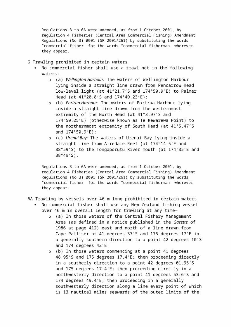
6 Trawling prohibited in certain waters No commercial fisher shall use a trawl net in the following waters:
o (a) Wellington Harbour: The waters of Wellington Harbour lying inside a straight line drawn from Pencarrow Head low-level light (at 41°21.7′S and 174°50.9′E) to Palmer Head (at 41°20.8′S and 174°49.23′E):
o (b) Porirua Harbour: The waters of Porirua Harbour lying inside a straight line drawn from the westernmost extremity of the North Head (at 41°3.97′S and 174°50.25′E) (otherwise known as Te Rewarewa Point) to the northernmost extremity of South Head (at 41°5.47′S and 174°50.9′E):
o (c) Urenui Bay: The waters of Urenui Bay lying inside a straight line from Airedale Reef (at 174°14.5′E and 38°59′S) to the Tongaporutu River mouth (at 174°35′E and 38°49′S).
Regulations 3 to 6A were amended, as from 1 October 2001, by regulation 4 Fisheries (Central Area Commercial Fishing) Amendment Regulations (No 3) 2001 (SR 2001/261) by substituting the words “commercial fisher” for the words “commercial fisherman” wherever they appear.
6A Trawling by vessels over 46 m long prohibited in certain waters No commercial fisher shall use any New Zealand fishing vessel over 46 m in overall length
for trawling at any time—o (a) In those waters of the Central Fishery Management Area (as defined in a notice
published in the Gazette of 1986 at page 412) east and north of a line drawn from Cape Palliser at 41 degrees 37′S and 175 degrees 17′E in a generally southern direction to a point 42 degrees 10′S and 174 degrees 42′E:
o (b) In those waters commencing at a point 41 degrees 48.95′S and 175 degrees 17.4′E; then proceeding directly in a southerly direction to a point 42 degrees 01.95′S and 175 degrees 17.4′E; then proceeding directly in a northwesterly direction to a point 41 degrees 53.6′S and 174 degrees 49.4′E; then proceeding in a generally southwesterly direction along a line every point of which is 13 nautical miles seawards of the outer limits of the territorial sea to its intersection with the boundary of the Central Fishery Management Area (as so defined); then proceeding in a generally northerly direction along that boundary to its intersection with the outer limits of the territorial sea off the south coast of the North Island; then proceeding along the outer limits of the territorial sea to the point of commencement:
o (c) In those waters enclosed by a line commencing at a point 40 degrees 40.6′S and 174 degrees 44.6′E; then proceeding in a northwesterly direction to a point 40 degrees 34.8′S and 174 degrees 37.2′E; then proceeding along a line every point of which is 8 nautical miles seawards of the outer limits of the territorial sea to the boundary of the Central Fishery Management Area (as so defined) then proceeding in a generally
easterly direction to the outer limits of the territorial sea; then proceeding in a generally southerly direction to the point of commencement.
Regulation 6A was inserted, as from 1 October 1986, by regulation 2 Fisheries (Central Area Commercial Fishing) Regulations 1986, Amendment No 1 (SR 1986/252).Paragraph (a) was amended, as from 23 October 1996, by clause 2 Fisheries (Central Area Commercial Fishing) Regulations 1986, Amendment No 10 by substituting the expression “175 degrees 17′E” for the expression “173 degrees 17′E”.Regulation 6A was amended, as from 5 November 1998, by regulation 2 Fisheries (Central Area Commercial Fishing) Amendment Regulations 1998 (SR 1998/303) by substituting the expression “46 m” for the expression “43 m”.Regulations 3 to 6A were amended, as from 1 October 2001, by regulation 4 Fisheries (Central Area Commercial Fishing) Amendment Regulations (No 3) 2001 (SR 2001/261) by substituting the words “commercial fisher” for the words “commercial fisherman” wherever they appear.
6B Trawling prohibited in certain seamount areas (1) No person may use a trawl net for fishing in any closed seamount area.
(2) In this regulation, closed seamount area means all waters within the following areas:o (a) the area located in fisheries management area 2 that is bounded by—
(i) the latitudes 34°45'S and 34°56'S; and (ii) the longitudes 179°00'E and 179°10'E:
o (b) the area located in fisheries management area 2 that is bounded by— (i) the latitudes 35°35'S and 35°55'S; and (ii) the longitudes 178°20'E and 178°40'E.
Regulation 6B was inserted, as from 10 May 2001, by regulation 3 Fisheries (Central Area Commercial Fishing) Amendment Regulations 2001 (SR 2001/66).
6C Trawling prohibited from Tirua Point to Pariokariwa Point (1) A commercial fisher must not use a trawl net for fishing in the waters lying within an area
bounded by a line that—o (a) extends from Tirua Point (at 38°23.22′S and 174°38.04′E), then follows a line in a
generally southerly direction by the mean high-water mark to the southernmost point of the north bank of the Awakino River (at 38°39.88′S and 174°37.24′E); and
o (b) then proceeds in a straight line across the Awakino River to a point on the south bank of the Awakino River (at 38°39.92′S and 174°37.22′E), then follows a line along the mean high-water mark to the southernmost point on the north bank of the Mokau River (at 38°42.36′S and 174°37.03′E); and
o (c) then proceeds in a straight line across the Mokau River to a point on the south bank of the Mokau River (at 38°42.40′S and 174°37.01′E), then follows a line along the mean high-water mark to the north bank of the Tongaporutu River (at 38°48.88′S and 174°35.23′E); and
o (d) then proceeds in a straight line across the Tongaporutu River to a point on the south bank of the Tongaporutu River (at 38°48.98′S and 174°35.23′E), then follows a line along the mean high-water mark to Pariokariwa Point (at 38°53.49′S and 174°30.35′E); and
o (e) then proceeds generally north-west 2 nautical miles to 38°52.23′S and 174°28.27′E; and
o (f) then proceeds in a northerly direction along a line 2 nautical miles from the mean high-water mark to a point (at 38°22.84′S and 174°35.55′E); and
o (g) then proceeds in a straight line along the Central Fishery Management Area boundary in an easterly direction to Tirua Point (at 38°23.22′S and 174°38.04′E).
(2) For the purposes of the area defined in subclause (1), a straight line joining the mean high-water marks at each side of a harbour entrance or, as the case may be, the natural entrance points of a river mouth must be treated as the inner boundary of that area if it extends
seawards or as the outer boundary of that area if it extends landwards, except in the case of any harbours and rivers where specific co-ordinates are provided.
Regulation 6C: inserted, on 1 October 2008, by regulation 4 of the Fisheries (Central Area Commercial Fishing) Amendment Regulations 2008 (SR 2008/269).Regulation 6C(1)(f): substituted, on 20 November 2008, by regulation 4 of the Fisheries (Central Area Commercial Fishing) Amendment Regulations (No 2) 2008 (SR 2008/403).Regulation 6C(1)(g): substituted, on 20 November 2008, by regulation 4 of the Fisheries (Central Area Commercial Fishing) Amendment Regulations (No 2) 2008 (SR 2008/403).
7 Danish seining prohibited around lower North Island No commercial fisher shall use a Danish seine net within 3 nautical miles seaward of the mean
high-water mark of the east coast of the North Island south of Cape Runaway (at 37 degrees 32.3′S and 177 degrees 59.4′E), the south coast of the North Island, and the west coast of the North Island south of the marine automatic light on Tirua Point (at 38 degrees 23′S and 174 degrees 38.5′E).
Regulation 7 was amended by regulation 3 Fisheries (Central Area Commercial Fishing) Regulations 1986, Amendment No 3 (SR 1991/165) by substituting the expression “Tirua Point . . . 174 degrees 38.5′E)” for the expression “Tauroa Point (at 35 degrees 11.3′S and 173 degrees 3.5′E)”.Regulations 7 to 10 were amended, as from 1 October 2001, by regulation 4 Fisheries (Central Area Commercial Fishing) Amendment Regulations (No 3) 2001 (SR 2001/261) by substituting the words “commercial fisher” for the words “commercial fisherman” wherever they appear.
7A Set netting prohibited in shallow waters Notwithstanding anything in regulation 65(8) of the Fisheries (Commercial Fishing)
Regulations 2001, no commercial fisher shall use or possess in the waters of the Central Fishery Management Area a set net having a total length exceeding 500 metres unless—
o (a) The net is set in waters 30 metres or more in depth, and no part of the upper surface of the net, when set, is 2 metres or less from the surface of the water; or
o (b) In any case where— (i) The net is set in waters less than 30 metres in depth; or (ii) Any part of the upper surface of the net, when set, is 2 metres or less from
the surface of the water—the set net has surface floats attached to it at intervals of not more than 500 metres or part thereof.
Regulations 7A, 7B, and 7C were inserted, as from 23 October 1996, by regulation 4 Fisheries (Central Area Commercial Fishing) Regulations 1986, Amendment No 10.Regulations 7 to 10 were amended, as from 1 October 2001, by regulation 4 Fisheries (Central Area Commercial Fishing) Amendment Regulations (No 3) 2001 (SR 2001/261) by substituting the words “commercial fisher” for the words “commercial fisherman” wherever they appear.Regulation 7A was amended, as from 1 October 2001, by regulation 9 Fisheries (Central Area Commercial Fishing) Amendment Regulations (No 3) 2001 (SR 2001/261), by substituting the words “regulation 65(8) of the Fisheries (Commercial Fishing) Regulations 2001” for the words “regulation 42(4) of the Fisheries (Commercial Fishing) Regulations 1986”.
7B Set net soak time Notwithstanding anything in regulation 66 of the Fisheries (Commercial Fishing) Regulations
2001, no commercial fisher shall leave any set net in the waters of the Central Fishery Management Area for more than 24 hours without underrunning the net and removing any fish that have been caught.
Regulations 7A, 7B, and 7C were inserted, as from 23 October 1996, by regulation 4 Fisheries (Central Area Commercial Fishing) Regulations 1986, Amendment No 10.
Regulations 7 to 10 were amended, as from 1 October 2001, by regulation 4 Fisheries (Central Area Commercial Fishing) Amendment Regulations (No 3) 2001 (SR 2001/261) by substituting the words “commercial fisher” for the words “commercial fisherman” wherever they appear.Regulation 7B was amended, as from 1 October 2001, by regulation 9 Fisheries (Central Area Commercial Fishing) Amendment Regulations (No 3) 2001 (SR 2001/261), by substituting the words “regulation 66 of the Fisheries (Commercial Fishing) Regulations 2001” for the words “regulation 42A of the Fisheries (Commercial Fishing) Regulations 1986”.
7C Set netting prohibited within 2 miles of Cape Runaway coast No commercial fisher shall use any set net within these waters defined by a line beginning at
the mean high-water mark at Pitikirua Point (at approximately 37 degrees 32.6′S and 178 degrees 4.8′E); then proceeding in a straight line in a northerly direction to a position approximately 2 nautical miles from the point of commencement at 37 degrees 30.6′S and 178 degrees 4.8′E; then in a generally westerly direction by a line every point of which is 2 nautical miles from the mean high-water mark to a point approximately 2 nautical miles north of Cape Runaway (at 37°30.3′S and 177°59′E); then in a straight line in a southerly direction to the mean high-water mark at Cape Runaway (at approximately 37°32.3′S and 177°59′E); and then proceeding along the line of the mean high-water mark in a generally easterly direction to the point of commencement at Pitikirua Point (at approximately 37°32.6′S and 178°4.8′E).
Regulations 7A, 7B, and 7C were inserted, as from 23 October 1996, by regulation 4 Fisheries (Central Area Commercial Fishing) Regulations 1986, Amendment No 10.Regulations 7 to 10 were amended, as from 1 October 2001, by regulation 4 Fisheries (Central Area Commercial Fishing) Amendment Regulations (No 3) 2001 (SR 2001/261) by substituting the words “commercial fisher” for the words “commercial fisherman” wherever they appear.
7D Set netting prohibited from Tirua Point to Pariokariwa Point (1) A commercial fisher must not use a set net for fishing in the waters lying within an area
bounded by a line that—o (a) extends from Tirua Point (at 38°23.22′S and 174°38.04′E), then follows a line in a
generally southerly direction by the mean high-water mark to the southernmost point of the north bank of the Awakino River (at 38°39.88′S and 174°37.24′E); and
o (b) then proceeds in a straight line across the Awakino River to a point on the south bank of the Awakino River (at 38°39.92′S and 174°37.22′E), then follows a line along the mean high-water mark to the southernmost point on the north bank of the Mokau River (at 38°42.36′S and 174°37.03′E); and
o (c) then proceeds in a straight line across the Mokau River to a point on the south bank of the Mokau River (at 38°42.40′S and 174°37.01′E), then follows a line along the mean high-water mark to the north bank of the Tongaporutu River (at 38°48.88′S and 174°35.23′E); and
o (d) then proceeds in a straight line across the Tongaporutu River to a point on the south bank of the Tongaporutu River (at 38°48.98′S and 174°35.23′E), then follows a line along the mean high-water mark to Pariokariwa Point (at 38°53.49′S and 174°30.35′E); and
o (e) then proceeds generally north-west 7 nautical miles to 38°49.23′S and 174°23.23′E; and
o (f) then proceeds in a northerly direction along a line 7 nautical miles from the mean high-water mark to a point (at 38°21.80′S and 174°29.43′E); and
o (g) then proceeds in a straight line along the Central Fishery Management Area boundary in an easterly direction to Tirua Point (at 38°23.22′S and 174°38.04′E).
(2) For the purposes of the area defined in subclause (1), a straight line joining the mean high-water marks at each side of a harbour entrance or, as the case may be, the natural entrance points of a river mouth must be treated as the inner boundary of that area if it extends seawards or as the outer boundary of that area if it extends landwards, except in the case of any harbours and rivers where specific co-ordinates are provided.
Regulation 7D: substituted, on 1 October 2008, by regulation 5 of the Fisheries (Central Area Commercial Fishing) Amendment Regulations 2008 (SR 2008/269).Regulation 7D(1)(f): substituted, on 20 November 2008, by regulation 5 of the Fisheries (Central Area Commercial Fishing) Amendment Regulations (No 2) 2008 (SR 2008/403).Regulation 7D(1)(g): substituted, on 20 November 2008, by regulation 5 of the Fisheries (Central Area Commercial Fishing) Amendment Regulations (No 2) 2008 (SR 2008/403).7D was inserted, as from 21 September 2001, by regulation 3 Fisheries (Central Area Commercial Fishing) Amendment Regulations (No 4) 2001 (SR 2001/278).Regulation 7D was substituted, as from 2 October 2003, by regulation 3 Fisheries (Central Area Commercial Fishing) Amendment Regulations (No 2) 2003 (SR 2003/225).Regulation 7D was substituted, as from 1 October 2005, by regulation 3 Fisheries (Central Area Commercial Fishing) Amendment Regulations 2005 (SR 2005/192).
8 Set netting prohibited near Mahia Peninsula and Portland Island No commercial fisher shall use a set net in the following waters:
o (a) Mahia Peninsula: All those waters lying within 2 nautical miles from a line commencing at Boat Harbour (at 39 degrees 0.7′S and 177 degrees 53.5′E) and proceeding along the mean high-water mark around Mahia Peninsula to the mouth of the Nuhaka River (at 39 degrees 03.5′S and 177 degrees 45′E):
o (b) Portland Island: All those waters lying within 2 nautical miles from the mean high water mark of the shore of Portland Island.
Regulations 7 to 10 were amended, as from 1 October 2001, by regulation 4 Fisheries (Central Area Commercial Fishing) Amendment Regulations (No 3) 2001 (SR 2001/261) by substituting the words “commercial fisher” for the words “commercial fisherman” wherever they appear.
9 Netting prohibited in Wellington Harbour (1) Oriental Bay: No commercial fisher shall at any time between the 1st day of November in
any year and the 30th day of April in the following year (both days inclusive) use any net for taking fish in the waters of Oriental Bay in Wellington Harbour which lie within a straight line from the northeastern corner of the boat harbour (at 41 degrees 17.53′S and 174 degrees 47.36′E) to Post Point at the eastern end of Oriental Bay (at 41 degrees 17.45′S and 174 degrees 47.83′E).(2) South of Matiu/Somes Island: No commercial fisher shall use a set net in the waters of Wellington Harbour lying south of a line drawn from the eastern bank of the Hutt River mouth (at 41°14.87'S and 174 degrees 53.92′E), then to the southern extremity of Matiu/Somes Island (at 41 degrees 15.82′S and 174 degrees 51.98′E), then to a point on the foreshore immediately below the entrance to the Johnsonville rail tunnel (at 41 degrees 15.32′S and 174 degrees 48.32′E).(3) Palmer Head to Pencarrow Head: No commercial fisher shall use a box or teichi net, trawl net, surrounding net, or set nets of a total length in excess of 1000 metres, in the waters of Wellington Harbour lying inside a straight line drawn from Palmer Head (at 41 degrees 20.80′S and 174 degrees 49.30′E) to Pencarrow Head (at 41 degrees 21.68′S and 174 degrees 50.90′E).(4) No commercial fisher shall set any net within 60 metres of any other net within the waters described in subclause (1) or subclause (3) of this regulation.
Regulation 9(2) was substituted and subclauses (3) and (4) were inserted by regulation 4 of Fisheries (Central Area Commercial Fishing) Regulations 1986, Amendment No 6 (SR 1993/280).Subclause (2) was amended, as from 26 July 2001, by regulation 4(a) Fisheries (Central Area Commercial Fishing) Amendment Regulations (No 2) 2001 (SR 2001/156) by substituting the expression “41°14.87'S” for the expression “41°17.87'S”.Subclause (2) was amended, as from 26 July 2001, by regulation 4(b) Fisheries (Central Area Commercial Fishing) Amendment Regulations (No 2) 2001 (SR 2001/156) by substituting the words “Matiu/Somes Island” for the words “Soames Island”.
Regulations 7 to 10 were amended, as from 1 October 2001, by regulation 4 Fisheries (Central Area Commercial Fishing) Amendment Regulations (No 3) 2001 (SR 2001/261) by substituting the words “commercial fisher” for the words “commercial fisherman” wherever they appear.
9A Certain fishing prohibited in Porirua Harbour (1) No commercial fisher shall take fish from the waters of Porirua Harbour lying inside a
straight line drawn between the 2 un-named headland points, from West Head (at 41 degrees 05.50′S and 174 degrees 51.20′E) to East Head (at 41 degrees 05.10′S and 174 degrees 51.70′E).(2) Notwithstanding subclause (1) of this regulation, a commercial fisher may take crab from the waters described in that subclause by the method of potting.
Regulation 9A was inserted by regulation 5 Fisheries (Central Area Commercial Fishing) Regulations 1986, Amendment No 6 (SR 1993/280).Regulations 7 to 10 were amended, as from 1 October 2001, by regulation 4 Fisheries (Central Area Commercial Fishing) Amendment Regulations (No 3) 2001 (SR 2001/261) by substituting the words “commercial fisher” for the words “commercial fisherman” wherever they appear.
10 Taking paua and mussels prohibited from Cape Runaway to Blackhead Lighthouse No commercial fisher shall take or have in possession any paua or mussels taken from those
waters below the mean high-water mark between Cape Runaway (at 37 degrees 32.3′S and 177 degrees 59.4′E) in the north, and Blackhead Lighthouse (at 40 degrees 13.2′S and 176 degrees 47.2′E) in the south, or from the waters within 1000 metres of the coast of Portland Island or the waters within 1000 metres of the coast of East Island.
Regulations 7 to 10 were amended, as from 1 October 2001, by regulation 4 Fisheries (Central Area Commercial Fishing) Amendment Regulations (No 3) 2001 (SR 2001/261) by substituting the words “commercial fisher” for the words “commercial fisherman” wherever they appear.
11 Taking of finfish from Wairoa Hard prohibited No person shall take any finfish from all those waters of Hawke Bay enclosed by a line
commencing at the mouth of the Moeangiangi River at a point 39 degrees 14.9′S and 177 degrees 01.4′E; then in a southeasterly direction to a point 39 degrees 16.6′S and 177 degrees 07.6′E; then in a northeasterly direction to a point 39 degrees 11.3′S and 177 degrees 21.2′E; then in a northwesterly direction to the Waihua River mouth to a point 39 degrees 05.7′S and 177 degrees 17.1′E; then along the mean high-water mark to the northernmost bank of the mouth of the Mohaka River (at 39 degrees 07.03′S and 177 degrees 11.03′E), then by a straight line to the southernmost bank of the mouth of the Mohaka River (at 39 degrees 07.04′S and 177 degrees 11.02′E); then along the mean high-water mark to the point of commencement.
12 Shellfish prohibitions (1) Paretu to Nuhaka River: No commercial fisher shall take or have in possession any
shellfish (except rock lobsters) taken from the area below the mean high-water mark between Paretu (at 38 degrees 57.05′S and 177 degrees 54.2′E) and the mouth of the Nuhaka River (at 39 degrees 03.5′S and 177 degrees 45′E), or from the waters within 2 nautical miles of Mahia Peninsula, or the waters within 2 nautical miles of Portland Island.(2) Wellington Harbour: No commercial fisher shall take by any fishing method or have in possession any shellfish (except rock lobsters and crabs) taken from the waters of Wellington Harbour lying inside a straight line drawn from Pencarrow Head low level light (at 41 degrees 21.7′S and 174 degrees 50.9′E) to Palmer Head (at 41 degrees 20.8′S and 174 degrees 49.23′E).(3) Wanganui River Mouth: No commercial fisher shall take by any fishing method, or have in possession, any paua or mussels taken from those waters lying within 5 nautical miles due west of the mean high-water mark between Tirua Point (at 38 degrees 23.5′S and 174 degrees
38′E) and the Wanganui River mouth south mole (at 39 degrees 57.1′S and 174 degrees 59.9′E).(4) Waikanae River Mouth: No commercial fisher shall take by any fishing method, or have in possession, any paua, mussels, cockles, or pipis taken from those waters lying within 5 nautical miles due west of the mean high-water mark between the Waikanae River mouth (at 40 degrees 52.4′S and 175 degrees 00.4′E) and Turakirae Head (at 41 degrees 26.4′S and 174 degrees 55′E), and including those waters lying within 2 nautical miles of Mana Island (at 41 degrees 05.3′S and 174 degrees 47′E) and Kapiti Island (at 40 degrees 51.5′S and 174 degrees 55′E).
Regulation 12(1) was amended by regulation 4 Fisheries (Central Area Commercial Fishing) Regulations 1986, Amendment No 6 (SR 1991/165) by substituting the expression “2 nautical miles” for the expression “1000 metres” in both places where it occurred.Regulations 12 to 14 were amended, as from 1 October 2001, by regulation 4 Fisheries (Central Area Commercial Fishing) Amendment Regulations (No 3) 2001 (SR 2001/261) by substituting the words “commercial fisher” for the words “commercial fisherman” wherever they appear.
13 Taking of Kina prohibited in Wellington area No commercial fisher shall take or have in possession any Kina taken from the following
areas:o (a) Those waters enclosed by a straight line drawn from Paraparaumu Beach (at 40
degrees 53.20′S and 174 degrees 59.0′E) to the North Point of the entrance to Porirua Harbour (at 41 degrees 03.0′S and 174 degrees 50.70′E):
o (b) Those waters enclosed by a straight line drawn from the North Point of the entrance to Porirua Harbour (at 41 degrees 03.0′S and 174 degrees 50.70′E) to Rock Point (at 41 degrees 07.90′S and 174 degrees 47.30′E):
o (c) those waters enclosed by a straight line drawn from Red Rocks (at 41°21.6'S and 174°43.20'E) to Baring Head (at 41°24.60'S and 174°52.20'E) including Wellington Harbour.
Regulation 13 was substituted by regulation 6 Fisheries (Central Area Commercial Fishing) Regulations 1986, Amendment No 3 (SR 1993/280).Regulations 12 to 14 were amended, as from 1 October 2001, by regulation 4 Fisheries (Central Area Commercial Fishing) Amendment Regulations (No 3) 2001 (SR 2001/261) by substituting the words “commercial fisher” for the words “commercial fisherman” wherever they appear.Paragraph (c) was substituted, as from 21 October 2004, by regulation 3 Fisheries (Central Area Commercial Fishing) Amendment Regulations (No 3) 2004 (SR 2004/330).
13A Taking seaweed prohibited in certain areas (1) No commercial fisher shall take or have in possession any seaweed taken from any of the
following areas:o (a) Cape Kidnappers: Within a 1 nautical mile radius of Cape Kidnappers (at 30
degrees 38.6′S and 177 degrees 42.1′E):o (b) Porongahau Estuary: Within a 3 nautical mile radius of Porongahau Estuary (at 40
degrees 15.4′S and 176 degrees 42.1′E):o (c) Herbertville Beach: Within a 2 nautical mile radius of Wainui River Mouth (at 40
degrees 29.8′S and 176 degrees 33.7′E):o (d) Owahanga River Mouth and beach: Within a 2 nautical mile radius of Owahanga
River Mouth (at 40 degrees 40.8′S and 176 degrees 21.2′E):o (e) Castlepoint: Within a half nautical mile radius of the Castlepoint basin (at 40
degrees 54.7′S and 176 degrees 13.4′E):o (f) Cape Palliser: Within a 1 nautical mile radius of the Cape Palliser lighthouse (at
41 degrees 36.9′S and 175 degrees 17.3′E).(2) Nothing in subclause (1) of this regulation shall apply to the taking of any seaweed of the class Rhodophyceae that is floating free and unattached, or that has been cast ashore.
Regulation 13A was inserted by regulation 3 Fisheries (Central Area Commercial Fishing) Regulations 1986, Amendment No 3 (SR 1989/292).Regulations 12 to 14 were amended, as from 1 October 2001, by regulation 4 Fisheries (Central Area Commercial Fishing) Amendment Regulations (No 3) 2001 (SR 2001/261) by substituting the words “commercial fisher” for the words “commercial fisherman” wherever they appear.
14 Restrictions on fishing around Sugar Loaf Islands (1) No commercial fisher shall take or have in possession any fish taken within the prescribed
area other than as permitted under subclauses (2) and (3) of this regulation.(2) Subject to subclause (3) of this regulation, any commercial fisher may take by trolling a combined total of 100 kingfish and kahawai within the prescribed area in any day.(3) Where more than one commercial fisher is on board any vessel, the maximum combined total of kingfish and kahawai that may be taken within the prescribed area from that vessel shall be 100.(4) No commercial fisher shall be in possession of any fishing gear within the prescribed area that is not permitted to be used in that area unless the gear is stowed or sealed in such a manner that it cannot readily be used for fishing.(5) For the purposes of this regulation—
o (a) The expression prescribed area means the waters and islands bounded by a line commencing at the mean high-water mark drawn from a point 39°04′19.75″S and 174°01′10.85″E; then in a westerly direction to a point 39°03′56.37″S and 173°59′57.10″E then along the line of an arc of 900m radius from a point 39°03′29.34″S and 174°00′11.21″E on Waikaranga (Seal Rock) to a point 39°03′10.69″S and 173°59′42.41″E; then in a line to a point 39°02′31.90″S and 174°00′23.72″E; then along the line of an arc of 900 m radius from a point 39°02′50.54″S and 174°00′52.51″E on Matumahanga (Saddleback Island) to a point 39°02″28.42″S and 174°01′16.93″E; then along a line from the navigation light on the lee breakwater of Port Taranaki at 39°03′24.15″S and 174°02′39.98″E to a point where this line intersects the northwestern boundary of the New Plymouth Roadstead extended; then to a point where the northwestern boundary of the New Plymouth Roadstead crosses the mean high-water mark in the vicinity of Paritutu; then in a southwesterly direction along the mean high water mark to the point of commencement:
o (b) The expression trolling means line fishing using an artificial lure with the line being towed by a vessel making way.
Regulations 12 to 14 were amended, as from 1 October 2001, by regulation 4 Fisheries (Central Area Commercial Fishing) Amendment Regulations (No 3) 2001 (SR 2001/261) by substituting the words “commercial fisher” for the words “commercial fisherman” wherever they appear.
14A Targeting of certain fish, aquatic life, and seaweed prohibited, unless specially authorised [Revoked]
Regulations 14A to 14I were inserted, as from 1 November 1989, by regulation 4 Fisheries (Central Area Commercial Fishing) Regulations 1986, Amendment No 2 (SR 1989/292).Regulation 14A was substituted and regulation 14AA was inserted, as from 26 September 1991, by regulation 6 Fisheries (Central Area Commercial Fishing) Regulations 1986, Amendment No 3 (SR 1991/165).Regulation 14A was revoked, as from 1 October 2001, by regulation 5 Fisheries (Central Area Commercial Fishing) Amendment Regulations (No 3) 2001 (SR 2001/261).
14AA Fish, aquatic life, and seaweed that may be taken subject to competitive or individual quotas, method restrictions, etc.
[Revoked]
Regulation 14A was substituted and regulation 14AA was inserted, as from 26 September 1991, by regulation 6 Fisheries (Central Area Commercial Fishing) Regulations 1986, Amendment No 3 (SR 1991/165).Subclause (1) was amended by regulation 7 Fisheries (Central Area Commercial Fishing) Regulations 1986, Amendment No 6 (SR 1993/280) by substituting the words “to subclause (2) of this regulation and any other regulation and any” for the words “any regulations or” in subclause (1).Subclause (1) was further amended, as from 1 October 1996, by regulation 5 Fisheries (Central Area Commercial Fishing) Regulations 1986, Amendment No 10 by omitting the words “Jack mackerel”.Subclause (1) was amended, as from 5 November 1998, by regulation 3 Fisheries (Central Area Commercial Fishing) Amendment Regulations 1998 (SR 1998/303) by omitting from Part A of the table the items “Cardinal fish”, “Ribaldo”, “Rubyfish”, “Sea perch”, “Trumpeter”, and “Yellow-eyed mullet”.Subclause (2) was inserted by regulation 7 Fisheries (Central Area Commercial Fishing) Regulations 1986, Amendment No 6 (SR 1993/280).Regulation 14AA was revoked, as from 1 October 2001, by regulation 6 Fisheries (Central Area Commercial Fishing) Amendment Regulations (No 3) 2001 (SR 2001/261) by substituting the words “commercial fisher” for the words “commercial fisherman” whenever they appear.
14B Kina season and quotas (1) [Revoked]
(2) [Revoked](3) [Revoked](4) No commercial fisher shall take any kina from the waters between the south bank of the Tukituki River at 39°36.1′S and 176°56.2′E) and the mouth of the Waipuku Stream (at 39°44.0′S and 177°0.6′E).(5) No commercial fisher shall take any kina from the waters of quota management area SUR2A or quota management area SUR2B or quota management area SUR8, for the purpose of sale, by any means other than hand-gathering.Regulations 14A to 14I were inserted, as from 1 November 1989, by regulation 4 Fisheries (Central Area Commercial Fishing) Regulations 1986, Amendment No 2 (SR 1989/292).Regulations 14B to 14G were amended, as from 1 October 2001, by regulation 3 Fisheries (Central Area Commercial Fishing) Amendment Regulations (No 3) 2001 (SR 2001/261) by substituting the words “commercial fisher” for the words “commercial fisherman” wherever they appear.
Regulations 14B, 14C, 14F and 14L were amended, as from 1 October 2001, by regulation 7 Fisheries (Central Area Commercial Fishing) Amendment Regulations (No 3) 2001 (SR 2001/261) by substituting the words “chief executive” for the words “Director General” whenever they appear.Subclauses (1) to (3) were revoked, as from 2 October 2003, by regulation 4(1) Fisheries (Central Area Commercial Fishing) Amendment Regulations (No 2) 2003 (SR 2003/225).Subclause (5) was amended, as from 2 October 2003, by regulation 4(2) Fisheries (Central Area Commercial Fishing) Amendment Regulations (No 2) 2003 (SR 2003/225) by substituting the words “quota management area SUR2A or quota management area SUR2B or quota management area SUR8” for the words “quota management area 2 or quota management area 8”.
14C Sea cucumber season and quotas [Revoked]
Regulations 14A to 14I were inserted, as from 1 November 1989, by regulation 4 Fisheries (Central Area Commercial Fishing) Regulations 1986, Amendment No 2 (SR 1989/292).Regulations 14B to 14G were amended, as from 1 October 2001, by regulation 3 Fisheries (Central Area Commercial Fishing) Amendment Regulations (No 3) 2001 (SR 2001/261) by substituting the words “commercial fisher” for the words “commercial fisherman” wherever they appear.Regulations 14B, 14C, 14F and 14L were amended, as from 1 October 2001, by regulation 7 Fisheries (Central Area Commercial Fishing) Amendment Regulations (No 3) 2001 (SR 2001/261) by substituting the words “chief executive” for the words “Director General” whenever they appear.Regulation 14C was revoked, as from 1 April 2004, by regulation 3 Fisheries (Central Area Commercial Fishing) Amendment Regulations 2004 (SR 2004/69).
14D Taking of certain paddle crabs prohibited No commercial fisher shall take from the waters of quota management area 2 or quota
management area 8 any paddle crab that is carrying any external eggs or from which any of the external eggs have been removed by artificial means, or be in possession of any such paddle crab if it has been taken from either of those waters.Regulations 14A to 14I were inserted, as from 1 November 1989, by regulation 4 Fisheries (Central Area Commercial Fishing) Regulations 1986, Amendment No 2 (SR 1989/292).Regulations 14B to 14G were amended, as from 1 October 2001, by regulation 3 Fisheries (Central Area Commercial Fishing) Amendment Regulations (No 3) 2001 (SR 2001/261) by substituting the words “commercial fisher” for the words “commercial fisherman” wherever they appear.
14E Restriction on method of fishing for octopus or hagfish (1) No commercial fisher shall use any methods other than hand-gathering or the use of a pot
(not being a rock-lobster pot) to fish for any octopus or hagfish in the waters of quota management area 2 or quota management area 8.(2) Nothing in subclause (1) of this regulation shall apply to any commercial fisher who is lawfully fishing for any rock lobster in either of those waters.(3) Nothing in subclause (1) of this regulation shall apply to any commercial fisher who takes any octopus or hagfish as an inevitable consequence of the lawful taking of other fish, aquatic life, or seaweed.
Regulation 14E was inserted, as from 1 November 1989, by regulation 4 Fisheries (Central Area Commercial Fishing) Regulations 1986, Amendment No 2 (SR 1989/292).Regulations 14B to 14G were amended, as from 1 October 2001, by regulation 3 Fisheries (Central Area Commercial Fishing) Amendment Regulations (No 3) 2001 (SR 2001/261) by substituting the words “commercial fisher” for the words “commercial fisherman” wherever they appear.Subclause (1) was amended, as from 1 October 2002, by regulation 3(1) Fisheries (Central Area Commercial Fishing) Amendment Regulations (No 2) 2002 (SR 2002/275), by substituting the words “octopus or hagfish” for the words “paddle crab, octopus, or hagfish”.Subclause (3) was amended, as from 1 October 2002, by regulation 3(2) Fisheries (Central Area Commercial Fishing) Amendment Regulations (No 2) 2002 (SR 2002/275), by substituting the words “octopus or hagfish” for the words “paddle crab, octopus, or hagfish”.
14F Season and quotas for anchovy, garfish, pilchards, and sprats [Revoked]
Regulation 14F was inserted by regulation 4 Fisheries (Central Area Commercial Fishing) Regulation 1986, Amendment No 2 1989 (SR 1989/292).Regulations 14B to 14G were amended, as from 1 October 2001, by regulation 3 Fisheries (Central Area Commercial Fishing) Amendment Regulations (No 3) 2001 (SR 2001/261) by substituting the words “commercial fisher” for the words “commercial fisherman” wherever they appear.Regulation 14F was amended, as from 1 October 2001, by regulation 7 Fisheries (Central Area Commercial Fishing) Amendment Regulations (No 3) 2001 (SR 2001/261) by substituting the words “chief executive” for the words “Director General” whenever they appear.Regulation 14F was revoked, as from 1 October 2002, by regulation 4 Fisheries (Central Area Commercial Fishing) Amendment Regulations (No 2) 2002 (SR 2002/275).
14G Restrictions on use of nets and dredges (1) No commercial fisher shall use any trawl net, set net, or surrounding net to take any fish or
aquatic life from the waters of quota management area 2 or quota management area 8, unless that method of netting is specifically authorised by a fishing permit held by that commercial fisher.(2) No commercial fisher shall use any dredge to take any fish or aquatic life from the waters of quota management area 2 or quota management area 8, unless that method is specifically authorised by a fishing permit held by that commercial fisher.
Regulations 14A to 14I were inserted, as from 1 November 1989, by regulation 4 Fisheries (Central Area Commercial Fishing) Regulations 1986, Amendment No 2 (SR 1989/292).Regulations 14B to 14G were amended, as from 1 October 2001, by regulation 3 Fisheries (Central Area Commercial Fishing) Amendment Regulations (No 3) 2001 (SR 2001/261) by substituting the words “commercial fisher” for the words “commercial fisherman” wherever they appear.
14H Restriction on method of taking seaweed (1) No person shall take any seaweed from the waters of quota management area 2 or quota
management area 8 by any method other than hand gathering.(2) Nothing in subclause (1) shall apply to the taking of seaweed of the class Rhodophyceae that is floating free and unattached, or that has been cast ashore.
Regulations 14A to 14I were inserted, as from 1 November 1989, by regulation 4 Fisheries (Central Area Commercial Fishing) Regulations 1986, Amendment No 2 (SR 1989/292).
14I Taking eels from waters of National Parks prohibited (1) No commercial fisher shall take any eel from the waters of any National Park within quota
management area 2 or quota management area 8.(2) For the purposes of this regulation, National Park means any area declared to be a National Park pursuant to the provisions of the National Parks Act 1980.
Regulations 14A to 14I were inserted, as from 1 November 1989, by regulation 4 Fisheries (Central Area Commercial Fishing) Regulations 1986, Amendment No 2 (SR 1989/292).Regulations 14I and 14J were amended, as from 1 October 2001, by regulation 3 Fisheries (Central Area Commercial Fishing) Amendment Regulations (No 3) 2001 (SR 2001/261) by substituting the words “commercial fisher” for the words “commercial fisherman” wherever they appear.
14J Closed season for rock lobster (1) No commercial fisher shall take any rock lobster from the waters of quota management
area 3, or be in possession of any rock lobster taken from those waters, or fish using any rock lobster pot in those waters, during—
o (a) The month of May in any yearo (b) [Revoked]o (c) [Revoked]
(2) Notwithstanding subclause (1) of this regulation, a commercial fisher may possess any rock lobster taken from the waters of quota management area 3 during any period specified in that subclause, if the rock lobster was taken from those waters on a day to which that subclause does not apply.(3) No person shall sell or possess for sale or process rock lobster taken from the waters of quota management area 3 during any period specified in subclause (1) of this regulation.(4) Notwithstanding subclause (3) of this regulation, a person may sell or possess for sale or process any rock lobster taken from the waters of quota management area 3 in any period specified in subclause (1) of this regulation, if the rock lobster was taken from those waters on a day to which subclause (1) of this regulation does not apply.(5) [Revoked](6) [Revoked](7) [Revoked](8) [Revoked]
Regulation 14J was inserted, as from 22 April 1993, by regulation 2 Fisheries (Central Area Commercial Fishing) Regulations 1986, Amendment No 4 (SR 1993/46).Regulation 14J was substituted, as from 18 June 1993, by regulation 3 Fisheries (Central Area Commercial Fishing) Regulations 1986, Amendment No 5 (SR 1993/173).Regulation 14J was substituted, as from 1 April 1996, by regulation 3 Fisheries (Central Area Commercial Fishing) Regulations 1986, Amendment No 9 (SR 1996/21).
Subclause (1)(a) was amended, as from 31 August 2002, by regulation 3(1)(a) Fisheries (Central Area Commercial Fishing) Amendment Regulations (No 2) 2002 (SR 2002/246) by omitting the word “; or”.Subclause (1)(b) was substituted, as from 1 September 2000, by regulation 3(1) Fisheries (Central Area Commercial Fishing) Amendment Regulations 2000 (SR 2000/158).Subclause (1)(b) was revoked, as from 31 August 2002, by regulation 3(1)(b) Fisheries (Central Area Commercial Fishing) Amendment Regulations (No 2) 2002 (SR 2002/246).Subclause (1)(c) was inserted, as from 1 September 2000, by regulation 3(1) Fisheries (Central Area Commercial Fishing) Amendment Regulations 2000 (SR 2000/158).Subclause (1)(c) was revoked, as from 31 August 2002, by regulation 3(1)(b) Fisheries (Central Area Commercial Fishing) Amendment Regulations (No 2) 2002 (SR 2002/246).Subclause (5) was revoked, as from 31 August 2002, by regulation 3(2) Fisheries (Central Area Commercial Fishing) Amendment Regulations (No 2) 2002 (SR 2002/246).Subclauses (6) and (8) were amended, as from 1 September 2000, by regulation 3(2) Fisheries (Central Area Commercial Fishing) Amendment Regulations 2000 (SR 2000/158) by inserting the words “, or during the month of September in the year 2000”.Subclauses (6) to (8) were revoked, as from 31 August 2002, by regulation 3(2) Fisheries (Central Area Commercial Fishing) Amendment Regulations (No 2) 2002 (SR 2002/246).Regulations 14I and 14J were amended, as from 1 October 2001, by regulation 3 Fisheries (Central Area Commercial Fishing) Amendment Regulations (No 3) 2001 (SR 2001/261) by substituting the words “commercial fisher” for the words “commercial fisherman” wherever they appear.
14K Concession relating to male spiny rock lobster (1) Notwithstanding regulation 37 of the Fisheries (Commercial Fishing) Regulations 2001,
but subject to regulation 41 of those regulations, any person authorised under a quota to take spiny rock lobster from quota management area 3 may take or be in possession of or sell to a licensed fish receiver an undersize male spiny rock lobster, if—
o (a) The spiny rock lobster is taken from quota management area 3 during the months of June, July, or August in any year, or during the month of September in the year 2000; and
o (b) Either— (i) The spiny rock lobster was, or (if on board a fishing vessel) is to be, landed
at a point lying within quota management area 3; or (ii) The spiny rock lobster was, or (if on board a fishing vessel) is to be,
landed at a point lying outside quota management area 3 with the prior approval of the chief executive of the Ministry of Fisheries, and in accordance with such conditions as the chief executive imposes; and
o (c) The spiny rock lobster is, or (if on board a fishing vessel) is to be, delivered and sold to a licensed fish receiver; and
o (d) The width of the tail of the spiny rock lobster is not less than 52mm when measured in accordance with regulation 14L of these regulations.
(2) Notwithstanding regulation 37(2) of the Fisheries (Commercial Fishing) Regulations 2001, but subject to regulation 14M of these regulations, a licensed fish receiver may sell or possess or process a male spiny rock lobster, or male spiny rock lobster tail, taken in accordance with subclause (1) of this regulation.
Regulation 14J was substituted and regulations 14K to 14M were inserted, as from 18 June 1993, by regulation 3 Fisheries (Central Area Commercial Fishing) Regulations 1986, Amendment No 5 (SR 1993/173).Subclause (1) was amended, as from 1 October 2001, by regulation 9 Fisheries (Central Area Commercial Fishing) Amendment Regulations (No 3) 2001 (SR 2001/261), by substituting the words “regulation 37 of the Fisheries (Commercial Fishing) Regulations 2001” for the words “regulation 27 of the Fisheries (Commercial Fishing) Regulations 1986”. Subclause (1) was further amended, by substituting the expression “regulation 41” for the expression “regulation 29”.Subclause (1) was amended, as from 31 March 2003, by regulation 4 Fisheries (Central Area Commercial Fishing) Amendment Regulations 2003 (SR 2003/23), by substituting the words “quota management area 3” for the words “the Gisborne Concession Area” wherever they occur.
Subclause (1)(a) was amended, as from 1 September 2000, by regulation 4 Fisheries (Central Area Commercial Fishing) Amendment Regulations 2000 (SR 2000/158) by inserting, after the word “year”, the words “, or during the month of September in the year 2000”.Subclause (2) was amended, as from 1 October 2001, by regulation 9 Fisheries (Central Area Commercial Fishing) Amendment Regulations (No 3) 2001 (SR 2001/261), by substituting the words “regulation 37(2) of the Fisheries (Commercial Fishing) Regulations 2001” for the words “regulation 27(2) of the Fisheries (Commercial Fishing) Regulations 1986”.
14L Method of measurement of male spiny rock lobster tail (1) For the purposes of regulation 14K of these regulations the width of the tail of a male
spiny rock lobster shall be measured in accordance with regulation 38 of the Fisheries (Commercial Fishing) Regulations 2001, subject to the following modifications:
o (a) References in that regulation to the expression “54” (wherever it occurs) shall be read as if there were substituted for that expression (in each case) the expression “52”:
o (b) Instead of measuring a male spiny rock lobster by means of the tail width measuring device referred to in that regulation, the rock lobster shall be measured by means of a tail width measuring device supplied by the chief executive and bearing a MAF mark and identifying number, and consisting of a handle with an attachment comprising one set of rigid calliper type arms. This set of calliper type arms has one arm that bears a raised L- shaped projection (hereinafter called the measuring bar), and a second arm that is marked with a line some 2mm away from and parallel to the projected edge of the central column of the device, and the expressions “52” and “M”, and is inscribed with the words “CRA3 Gisborne Concession”.
(2) The measurement of the tail width of a male spiny rock lobster by a tail width measuring device supplied by the chief executive and bearing an MAF mark and an identifying number shall not be in accordance with subclause (1) of this regulation unless the device is referred to in a report that—
o (a) Is issued by either the Measurement Standards Laboratory of New Zealand (as defined in the National Standards Regulations 1976) or an Inspector of Weights and Measures or accredited person as defined in section 2 of the Weights and Measures Act 1987); and
o (b) Certifies the device as an accurate tail width measuring device.
Regulation 14J was substituted and regulations 14K to 14M were inserted, as from 18 June 1993, by regulation 3 Fisheries (Central Area Commercial Fishing) Regulations 1986, Amendment No 5 (SR 1993/173).Subclause (1) was amended, as from 1 October 2001, by regulation 9 Fisheries (Central Area Commercial Fishing) Amendment Regulations (No 3) 2001 (SR 2001/261), by substituting the words “regulation 38 of the Fisheries (Commercial Fishing) Regulations 2001” for the words “regulation 28 of the Fisheries (Commercial Fishing) Regulations 1986”.Regulations 14B, 14C, 14F and 14L were amended, as from 1 October 2001, by regulation 7 Fisheries (Central Area Commercial Fishing) Amendment Regulations (No 3) 2001 (SR 2001/261) by substituting the words “chief executive” for the words “Director General” whenever they appear.
14M Processing and sale of quota management area 3 male spiny rock lobster (1) Any person who sells or possesses or processes male spiny rock lobsters or male spiny
rock lobster tails pursuant to the authority of regulation 14K of these regulations shall ensure that, except as otherwise authorised by these regulations,—
o (a) All tailing and processing of male spiny rock lobsters and processing of male spiny rock lobster tails is carried out by a licensed fish receiver; and
o (b) Male spiny rock lobsters and male spiny rock lobster tails are held in a container clearly and legibly marked with the words “Gisborne Rock Lobsters”.
(2) No licensed fish receiver shall sell or otherwise transfer to any person within New Zealand other than a licensed fish receiver any rock lobster with a tail, or any rock lobster tail, measuring less than 54mm.
Regulation 14J was substituted and regulations 14K to 14M were inserted, as from 18 June 1993, by regulation 3 Fisheries (Central Area Commercial Fishing) Regulations 1986, Amendment No 5 (SR 1993/173).Regulation 14M was substituted, as from 1 April 1996, by regulation 4 Fisheries (Central Area Commercial Fishing) Regulations 1986, Amendment No 9 (SR 1996/21).The heading to regulation 14M was amended, as from 31 March 2003, by regulation 5 Fisheries (Central Area Commercial Fishing) Amendment Regulations 2003 (SR 2003/23), by substituting the words “quota management area 3” for the words “Gisborne Concession Area”.
15 Taking of eels prohibited [Revoked]
Regulation 15 were amended, as from 1 October 2001, by regulation 3 Fisheries (Central Area Commercial Fishing) Amendment Regulations (No 3) 2001 (SR 2001/261) by substituting the words “commercial fisher” for the words “commercial fisherman”.Regulation 15 was revoked, as from 5 January 2006, by regulation 3 Fisheries (Central Area Commercial Fishing) Amendment Regulations (No 2) 2005 (SR 2005/315).
16 Offences (1) A person commits an offence and is liable on summary conviction to a fine not exceeding
$20,000 if the person acts in contravention of, or fails to comply with, any of regulations 7B, 13, 13A, 14B(4) or (5), 14D, or 14E.(2) A person commits an offence and is liable on summary conviction to a fine not exceeding $100,000 if the person acts in contravention of, or fails to comply with, any of regulations 3, 3A, 4 to 6, 6A, 6B, 6C, 7, 7A, 7C, 7D, 8, 9, 9A, 10 to 12, 14, 14G, 14H, 14I, 14J, 14M, or 15.
The original subclause (1) was substituted, as from 18 June 1993, by regulation 4(1) Fisheries (Central Area Commercial Fishing) Regulations 1986, Amendment No 5 (SR 1993/173).Subclause (1) was amended, as from 10 May 2001, by regulation 4 Fisheries (Central Area Commercial Fishing) Amendment Regulations 2001 (SR 2001/66) by inserting, after the expression “6A,” the expression “6B,”.Regulation 16 was substituted, as from 1 October 2001, by regulation 8 Fisheries (Central Area Commercial Fishing) Amendment Regulations (No 3) 2001 (SR 2001/261).Subclause (1) was amended, as from 2 October 2003, by regulation 5(1) Fisheries (Central Area Commercial Fishing) Amendment Regulations (No 2) 2003 (SR 2003/225) by substituting the expression “14B(4) or (5)” for the expression “14B(3), (4), or (5)”.Subclause (1) was amended, as from 1 April 2004, by regulation 4(1) Fisheries (Central Area Commercial Fishing) Amendment Regulations 2004 (SR 2004/69) by omitting the expression “14C(1),”.Regulation 16(2): amended, on 1 October 2008, by regulation 6 of the Fisheries (Central Area Commercial Fishing) Amendment Regulations 2008 (SR 2008/269).Subclause (2) was amended, as from 11 July 2002, by regulation 3 Fisheries (Central Area Commercial Fishing) Amendment Regulations 2002 (SR 2002/160) by inserting the expression “14B(1),” before the expression “14B(2),”.Subclause (2) was amended, as from 1 October 2002, by regulation 5 Fisheries (Central Area Commercial Fishing) Amendment Regulations (No 2) 2002 (SR 2002/275), by omitting the expression “14F,”.Subclause (2) was amended, as from 2 October 2003, by regulation 5(2) Fisheries (Central Area Commercial Fishing) Amendment Regulations (No 2) 2003 (SR 2003/225) by omitting the expression “14B(1), 14B(2),”.Subclause (2) was amended, as from 1 April 2004, by regulation 4(2) Fisheries (Central Area Commercial Fishing) Amendment Regulations 2004 (SR 2004/69) by omitting the expression “14C(2) or (3),”.
17 Revocations
The following notices are hereby revoked—o (a) The Fisheries (Palmerston North Commercial Fishing Restrictions) Notice 1983
(SR 1983/312):o (b) The Fisheries (Hastings Commercial Fishing Restrictions) Notice 1984, published
in the Gazette of 1984 at p 576.
Schedule 1Mohaka River catchment
r 3(2)(a)
Schedules 1 to 3 were inserted, as from 13 January 2005, by regulation 4 Fisheries (Central Area Commercial Fishing) Amendment Regulations (No 4) 2004 (SR 2004/440).
The Mohaka River catchment comprises the waters enclosed by a line— (1) commencing at the mean high-water mark at approximately NZMS 260-X15, 736229,
being approximately 1 km from the true left bank of the Mohaka River; then (2) proceeding in a generally northerly direction towards the easternmost section of the
Mohaka Township Road, via a coastal promontory of 129 m, and following the high points to Taumatataua; then
(3) proceeding in a generally northerly direction along the high points over the top of the Mohaka Tunnel and onto a trig named Taumatakaramu; then
(4) following the Te Kahu Road and Ridge Road to a trig named Tirotirowhetu; then (5) continuing in a generally north-westerly direction along the high ground towards a trig
named BL No 2 around the headwaters of the Mangaturanga Stream; then (6) following the high points along the ridge line adjacent to the Pukahu Road past a trig
named Puketikitiki, along the high points adjacent to the Putere Road, passing on the eastern side of a trig named Pihanui No 2, around the headwaters of the Otara Stream, and following the ridge line through a trig named Pukakaramea; then
(7) in a generally westerly direction to a trig named Te Ihuorurumaioterangi, a trig named HML No 2, the high point Te Rata (598 m), and a high point of 682 m, and crossing the Te Hoe Road lying to the west of the headwaters of the Mangahopai Stream; then
(8) lying adjacent to the southern side of the Te Hoe Road before reaching a high point of approximately 942 m near the junction between Lake Road and Te Hoe Road (Maungataniwha Forest); then
(9i) proceeding in a generally northerly direction adjacent to the tributaries and headwaters of the Mangahouanga Stream, passing by a high point of approximately 957 m near the end of Stihl Road; then
(10) proceeding to 2 high points of approximately 998 m and 730 m at the headwaters of the Tatua Stream; then
(11) proceeding in a generally westerly direction around the headwaters of the Mangahouanga Stream to the southern of 2 high points of approximately 1 020 m; then
(12) following the ridge line in a generally south-westerly direction to a high point of approximately 1 001 m, traversing a saddle in a generally northerly direction to high points of approximately 910 m, 962 m, 1 115 m, and 1 145 m at the headwaters of the Mangakahia Stream; then
(13) following high points to a trig named Maungataniwha No 2; then (14) proceeding in a generally westerly direction along the high points of approximately 1 361
m, 1 374 m, and 1 260 m, and the saddle at the headwaters of the Moerangi Stream; then (15) proceeding along the high points of approximately 1 001 m, 1 023 m, 1 048 m, 1 084 m,
1 013 m, 1 150 m, and 1 240 m; then (16) proceeding in a generally southerly direction around the headwaters of the Te Hoe River
and the Kakaiti Stream, to high points of approximately 1 032 m, 1 219 m, 1 220 m, 1 210 m, and 1 210 m; then
(17) proceeding in a generally westerly direction around the headwaters of the Whirinaki River (passing adjacent to trig numbered 10451), and a high point of 1 006 m; then
(18) proceeding in a generally northerly direction through high points of approximately 1 010 m, 976 m, and 984 m, then proceeding in a generally westerly direction to a trig named 10421 adjacent to Plateau Road; then
(19) proceeding around the southern side of the Plateau Road wetland to a trig numbered 52A, then proceeding to the road junction between Plateau Road and Pine Milling Road; then
(20) proceeding in a generally north-westerly direction to a high point of approximately 826 m near the intersection of Motukuri Road and Boundary Road; then
(21) proceeding in a generally westerly direction, across Pine Ridge Road, to a high point of approximately 854 m; then
(22) proceeding in a generally southerly direction across Motutoa Road to a high point of approximately 801 m and to a trig named Kokomoka; then
(23) proceeding along the high ground to the west of the tributaries of the Waipunga River to a high point of approximately 914 m and to a road-end trig named MW, a high point of 901 m; then
(24) proceeding in a generally south-westerly direction to a high point of approximately 762 m adjacent to Matea Road and crossing State Highway 5 to reach a high point of approximately 894 m; then
(25) following the high points to a high point named Orangikino (1 090 m), and to a high point of approximately 757 m; then
(26) proceeding between the headwaters of the Tirikahu Stream and the Takahiapo Stream, to the high point named Ngapouatu, a high point of approximately 1 013 m, and around the headwaters of the Tirikahu Stream in a generally north-westerly direction following the high points of approximately 979 m, 1 019 m, 906 m, 904 m (at the headwaters of the Ripia River), 1 010 m, 867 m, 910 m, 934 m, and 891 m; then
(27) crossing the Pahautea Road to a high point of approximately 815 m, to the road junction between Taharua Road and Southern Boundary Road, then to a point at NZMS 260, U18-935534; then
(28) proceeding in a generally southerly direction to a trig named Wairango No 2 at the headwaters of the Mangakahakaha Stream, and high points of approximately 876 m and 854 m, crossing Homestead Road; then
(29) continuing along the high points of approximately 1 005 m, crossing Clements Mill Road, to a high point named Manawakarau (1 009 m) at the headwaters of the Ngararanui Stream, continuing to high points of approximately 1 173 m, Te Iringa, around the headwaters of the Tikitiki Stream, to a high point named Whangatikitiki, continuing to follow the ridge line; then
(30) across the Kaipo Saddle, to a high point of approximately 1 097 m, around the headwaters of the Cascade Stream to a high point named Maungaorangi (1 436 m), and to a high point of approximately 1 319 m, around the headwaters of the Oamaru River to a high point named Pukekotare (1 266 m); then
(31) proceeding in a generally south-easterly direction to the Waitawhero Saddle, around the Waitawhero Stream head-waters to the Otorehinaiti Saddle, the Mangapapa Saddle, around the headwaters of the Mangatainoka River passing high points of approximately 1 260 m, 1 259 m, 1 269 m, and 1 429 m, the named high point Te Pukeohikarua (1 455 m), the headwaters of the Makino River (near a high point named Venison Top), a high point named Whetu (1 650 m), and a trig named North Kaweka 65A; then
(32) near the trig named Kaweka, proceeding in a generally easterly direction down the Makahu Spur around the southern side of the Pinnacle Stream to the end of the Kaweka Road; then
(33) generally following the high points adjacent to the road to an unnamed trig of approximately 1 083 m, a high point of approximately 869 m, and the road junction between Kaweka Road and Lotkow Road; then
(34) proceeding around the southern side of the tributaries of the Anawhenua Stream, crossing the Pakaututu Road at the northern end of the Balls Clearing Reserve, to a trig numbered 12411 at the headwaters of the Mangatutu Stream; then
(35) proceeding in a southerly direction to a high point of approximately 690 m, to the road junction between Puketitiri Road and Brownlie Road, then around the headwaters of the Inangatahi Stream; then
(36) proceeding in a generally easterly direction to a trig named A (675 m) near Little Bush Road, proceeding to the Maniaroa Range (near a high point of approximately 722 m); then
(37) proceeding in a generally north-easterly direction to a trig named A (812 m), and high points of approximately 767 m, 875 m, and 990 m (Te Waka Range), and a trig named Te Waka No 2, then across State Highway 5 near the Titiokura Summit to trigs named E No 2 (852 m), Wakaateo No 2, Kopua No 2, and Taraponui No 2, and following the Maungaharuru Range, passing through trigs named XIII and Kokohitoa XXVIII; then
(38) proceeding along the high ground adjacent to the southern-most section of Borrie Road, then along Anaura Road, Willowflat Road, across State Highway 2, to a trig named Kotaumataopurua (near Haliburton Road), along the high ground to a trig numbered XX (331 m), following Ponui Road, then around the headwaters of the Coquet Stream to a trig named Mohaka 85 (249 m); then
(39) proceeding along the Mohaka Coast Road to a point at NZMS 260-W19, 710230; then (40) proceeding in a generally southerly direction to the coast adjacent to the end of Mclvor
Road, and the mean high-water mark at approximately NZMS 260-W19, 714220; then (41) proceeding along the mean high-water mark, across the mouth of the Mohaka River, to
the point of commencement.
Schedule 2Whanganui River catchment
r 3(2)(c)
Schedules 1 to 3 were inserted, as from 13 January 2005, by regulation 4 Fisheries (Central Area Commercial Fishing) Amendment Regulations (No 4) 2004 (SR 2004/440).
The Whanganui River catchment comprises the waters enclosed by a line— (1) commencing at the mean high-water mark of the tip of the northern bank of the
Whanganui River mouth (at approximately NZMS 260-R22, 793378); then (2) proceeding in a generally north-westerly direction along the mean high-water mark to a
point adjacent the northernmost road end (near the golf course) within the suburb of Castlecliff (at approximately NZMS 260-R22, 777408); then
(3) proceeding inland in a generally easterly direction crossing the road ends of Waitai Street and Manuka Street, past the sawmill to a high point of approximately 65 m, crossing Clarkson Avenue, passing through the junction of Mosston and Tayforth Roads, and the junction of State Highway 3 and Virginia Road; then
(4) proceeding in a generally northerly direction to the trig of Mt Russell (125 m), passing on the eastern side of the junction of State Highway 3 and Blueskin Road; then
(5) proceeding along Blueskin Road and Brunswick Road to Tokomaru East Road; then (6) proceeding along part of the Tokomaru East Road around the headwaters of the Tauraroa
Stream, reaching a trig named Momemome (219 m), and high points above the tributaries of the Whanganui River of approximately 223 m, 242 m (above the headwaters of the Kaipua Stream), and 283 m (adjacent to the Tokomaru East Road); then
(7) proceeding in a generally north-westerly direction following the adjacent Tokomaru East Road to high points of approximately 406 m (near the locality Mangaiti), 416 m (between the tributaries of the Tatarongo Stream and the Mangaiti Stream), 483 m, 505 m, 302 m, 374 m, and 393 m (near Bruce Road); then
(8) proceeding in a generally northerly direction to high points of approximately 454 m (adjacent to Rangitatau East Road), and 434 m (Te Tuhi Junction); then
(9) following the ridge line adjacent to Watershed Road to near the road-end locality of Taunoka, to the high point of Purakau (630 m), and high points of approximately 546 m (on
the true left side of the Kaitieke Stream), and 570 m (at the site of the derelict Maungarau Hut); then
(10) following the Matemateaonga Track to a high point of approximately 623 m (at the headwaters of the Mangaone Stream), the Otaraheke Shelter, the trig named Mt Humphries (Whakaihuwaka), the Omaru Hut, a high point of approximately 558 m (at the headwaters of the Tanawapiti Stream), a trig numbered 12021, crossing the Upper Mangaehu Road to high points of approximately 444 m (at the headwaters of the Taumata Stream), 469 m, 503 m (at the headwaters of the Miro Stream), and 509 m, over a tunnel site, to a high point of approximately 364 m (adjacent to State Highway 43 at the Whangamomona Saddle), around the headwaters of the Mangare Stream to a high point of approximately 438 m; then
(11) proceeding in a generally north-easterly direction to a trig named Kaieto West, crossing State Highway 43 near the Tahora Saddle, and to exclude the Tangarakau sub-catchment; then
(12) proceeding in a generally southerly direction to high points of approximately 405 m (passing tributaries of the Whitianga Stream, and headwaters of the Kohuratahi Stream), and 314 m (near the junction of the Kohuratahi and Putikituna Roads), a trig numbered 11052, past Canoe Flat to a trig numbered 11081, then high points of approximately 395 m and 371 m; then
(13) proceeding in a generally easterly direction to a trig numbered 11085, then to the junction of the Tangarakau River with the Whanganui River (at NZMS 260-R20, 725168); then
(14) proceeding to a high point on the true right side of the Tangarakau River of approximately 243 m; then
(15) proceeding in a generally northeasterly direction to high points of approximately 399 m, 492 m (Waiamaru), 391 m (Heao), 518 m (Tukutahora), and 439 m (around the head-waters of the Ohuraiti Stream); then
(16) proceeding in a generally easterly direction to a high point of approximately 279 m (above the Ngatukuwaru Reach of the Whanganui River), to the junction of the Ohura River with the Whanganui River; then
(17) proceeding in a generally northerly direction to high points of approximately 380 m, 409 m (Taumatamaire), and 370 m, along Koiro Road (adjacent to a trig named Otu), across River Road to high points of approximately 397 m, and 398 m (adjacent to the Kururau Road), a trig numbered 10141 (named Parapara, at the southern side of the Nihoniho Forest), and further high points Te Tawa (554 m, at the headwaters of the Kakahi Stream) and Timi (553 m); then
(18) proceeding in a generally north-easterly direction to a high point named Opotiki (569 m); then
(19) proceeding in a generally southerly direction along ridge lines to a high point named Okaihae (557 m), then around the headwaters of the Okaihae Stream to a high point of approximately 534 m; then
(20) proceeding in a generally south-easterly direction to a trig named Te Peka 1698 (adjacent to Taumarunui); then
(21) proceeding to the junction of the Whanganui and Ongarue Rivers; then (22) proceeding in a generally north-easterly direction along ridge lines to a trig named
Whatawhata 1712, high points of approximately 410 m, 350 m (on the southern side of the Ngakonui Stream), 442 m, and 472 m (at the headwaters of the Ngapuke Stream), then across the Taumarunui Ngapuke Road; then
(23) proceeding to a high point of approximately 580 m, a trig named Ngapuketurua (693 m), and a high point of approximately 750 m (at the headwaters of the Tatateoro Stream), then crossing a road, continuing to high points in the Pureora Forest of approximately 1 010 m and 1 002 m; then
(24) proceeding in a generally southerly direction to high points of approximately 803 m (at the headwaters of the Pungapunga River, and adjacent to Keepa Road), 1 070 m, a trig named Hauhangaroa 1711, a high point of approximately 945 m (east of Waituhi Lookout), crossing State Highway 41 in a generally southerly direction to high points of approximately 807 m, 784 m, Tahua (801 m), and 666 m, then a summit called Maungaku, a trig named Maungakatote (862 m), and a high point of approximately 740 m; then
(25) proceeding in a generally southerly direction to the base of the Otamangakau Dam, then along the western side of the Otamangakau Canal to the base of the Te Whaiau Dam, along its western edge, then between the Whanganui River tributaries and Te Whaiau Stream to a trig named Papaki B (751 m); then
(26) proceeding in a generally south-easterly direction to high points of approximately 1 909 m (adjacent to North Crater) and 1 886 m (adjacent to Red Crater), then proceeding in a generally southerly direction to a trig named Mt Ngauruhoe D and high points of approximately 1 650 m (on the western ridge of the Upper Tama lake) and 1 334 m (on the western side of the Lower Tama lake); then
(27) proceeding up the Waihohonu Ridge to high points of approximately 2 732 m (Te Heuheu), Pyramid Peak (Mt Ruapehu), a trig named Tahurangi (2 797 m); then
(28) proceeding in a generally south-westerly direction to a trig named E No 2 (1 725 m, Turoa Skifield), down Sunset Ridge to high points of approximately 1 340 m, 1 193 m (at the headwaters of the Mangaeteroa Stream), 1 020 m, 772 m (on State Highway 4), and 726 m (on the southern side of Orautoha Stream), along the northern side of the Makara Stream and its tributaries to the trig named Ngataumaro (620 m), and to the high point of approximately 667 m, then along a ridge line to a trig called Ameku (757 m, at the headwaters of the Mangaetoroa Stream); then
(29) proceeding in a generally southerly direction around the western side of the Mangaetoroa Stream headwaters, crossing Mangaeturoa North Road, passing the headwaters of the Aramahoe Stream, reaching a trig named Okahurea (682 m), then to a high point of approximately 637 m, then a trig named Waipuna (749 m), following the Waipuna Road and ridge line to a trig called Ngarakauwhakarara (654 m, at the headwaters of the Whataumu Stream), then high points of approximately 576 m, and 650 m (at the headwaters of the Motuaruhe Stream), Te Konia (676 m), 621 m, and Harawera (681 m); then
(30) proceeding in a generally south-westerly direction along the Koriniti Harawira Road at the headwaters of the Raupiu Stream to high points of approximately 624 m, Paotamariki (615 m, on the southern side of the Aramaire Stream), and 593 m; then
(31) proceeding in a generally southerly direction to a trig named Tauakira (715 m), then to high points of approximately 620 m, 597 m, and 580 m, joining the Parihauhau Road at the headwaters of the Kahakaha Stream, continuing past high points of approximately 429 m and 275 m; then
(32) proceeding around the headwaters of the Kaparu Stream to high points of approximately 263 m, 268 m (where the line crosses State Highway 4), 391 m (north-eastern part of Lismore Forest), Tutu (372 m, at the headwaters of the Waimatao Stream), and 286 m, a trig named Mt Mitchell (315 m), high points of approximately 297 m (adjacent to the airstrip), 272 m (at the headwaters of the Kaukatea Stream), 239 m, and 224 m (at the end of Denlair Road), reaching the Kauangaroa Road, continuing around the head-waters of the Matarawa Stream; then
(33) proceeding in a generally westerly direction over the Marton New Plymouth Railway tunnel, crossing Station Road (Fordell) and roads to Onedia and Aird, Union Line road, near the end of Holmwood Road, State Highway 3, and Kaitoke Road; then
(34) proceeding around the northern side of Kaitoke Lake, to a high point of approximately 42 m to the north of Kaitoke Stream, crossing Airport and Landguard Roads, to a trig named Landguard (38 m); then
(35) proceeding to the mean high-water mark of the Whanganui River directly below the trig named Landguard, and following the true west bank of the Whanganui River to the westernmost point of the southern mouth (at approximately NZMS 260-R22, 798378); then
(36) crossing the river to the point of commencement.
Schedule 3Catchments containing Pencarrow lakes
r 3(2)(e)
Schedules 1 to 3 were inserted, as from 13 January 2005, by regulation 4 Fisheries (Central Area Commercial Fishing) Amendment Regulations (No 4) 2004 (SR 2004/440).
The catchments containing the Pencarrow lakes comprise the Pencarrow lakes (Lake Kohangapiripiri and Lake Kohangatera) and their tributaries enclosed by a line—
(1) commencing at the mean high-water mark at a sewer outlet near Bluff Point (NZMS 260-R27, 648808); then
(2) proceeding in a generally northerly direction to a promontory of approximately 96 m elevation; then
(3) proceeding in a north-westerly direction to the easternmost lighthouse for Pencarrow Head; then
(4) proceeding in a generally northerly direction along the ridge line to Mt Cameron, and high points of 188 m, a saddle above Camp Bay, a high point of 178 m, a trig named Hawtrey (AA; 343 m), and a trig called Lowry (BB; 373 m) at the headwaters of the Gollans Stream; then
(5) proceeding in a generally southerly direction along the ridge line to high points of approximately 360 m, 285 m, 232 m, 238 m, and Sugarloaf (302 m), and along the Link Ridge to the Valley View Hill (east of Lake Kohangatera), and Finger Hill (at NZMS 260-R28, 670799); then
(6) following a four-wheel drive track part-way down to the coast and continuing in a straight line to the memorial of the SS Paiaka (at NZMS 260-R28, 663795) and onto the mean high-water mark (at NZMS 260-R28, 663795); then
(7) proceeding to the point of commencement.
P G MILLEN,Clerk of the Executive Council.
Issued under the authority of the Regulations Act 1936.Date of notification in Gazette: 4 September 1986.