Embed Size (px)
Citation preview

REPORT ON THE UN-REDD+/CRAWFORD FUND SOILS TRAINING COURSE, LAE, PAPUA
NEW GUINEA, 10–14 NOVEMBER 2014
P.D. McIntosh (Forest Practices Authority, Hobart) R. Doyle (University of Tasmania, Hobart) P. Nimiago (Forest Research Institute, Lae)
January 2015
Best quote from the course:
“At first they were just rocks, but now they have meaning” – Dr H. Abe
Citation:
McIntosh, P.D.; Doyle, R.; Nimiago, P. 2015. Report on the UN-REDD+/Crawford Fund soils training course, Lae, Papua New Guinea, 10–14 November 2014. Forest Practices Authority, Hobart. FPA TRIM file reference: 2015/39328; final edits 24 March 2015.
REPORT ON THE UN-REDD+/CRAWFORD FUND SOILS TRAINING COURSE, LAE, PAPUA NEW GUINEA, 10-14 DECEMBER 2014 P.D. McIntosh (Forest Practices Authority, Hobart), Richard Doyle (University of Tasmania, Hobart) and P. Nimiago (PNG Forest Research Institute, Lae)
Background The Papua New Guinea Forest Authority (PNGFA), with the support of FAO and the EU, is currently preparing the first National Forest Inventory (NFI) for Papua New Guinea (PNG). The NFI will be a basis for planning sustainable forest management in relation to ecosystem carbon stocks and fluxes. The NFI will also be a key element of the National Forest Monitoring System that PNG is required to establish in order to participate in the expected UNFCCC mechanism on REDD+ and will be a major source of data for the PNG national greenhouse gas (GHG) inventory. Soil carbon is one of the five forest carbon pools which need to be reported under UNFCCC. The NFI includes soil carbon assessment so that total ecosystem carbon in PNG forests can be systematically estimated. Estimating carbon stored in the soil is important when assessing PNG forest carbon stocks as initial results indicate that up to 50% of PNG forest carbon is held in the soil and at some sites a significant proportion of soil carbon may be held below the topsoil layer (Nimiago et al. 2014, summarising results of Edwards and Grubb 1977, Matsuura 1997, Abe 2007, and Nimiago 2011). The first phase of NFI assessment, based on remote sensing, was completed in March 2014: land use and vegetation type were assessed at more than 25,000 1-ha plots. A subset of these plots will be sampled to measure their soil carbon content. It is important to standardise procedures for soil carbon measurement and relate soil carbon to landscape factors such as geology, vegetation and altitude, so that results can be confidently extrapolated over the PNG forest estate. However, many foresters have no formal training in soils and geology, and others have different levels of expertise, so to ensure consistency when formal soil sampling takes place, the UN-REDD+ organisation in PNG and The Crawford Fund funded a soils training course for potential supervisors of soil sampling and soil description. A core group of 16 foresters and forest scientists with demonstrated technical ability and/or interest in soil science were selected by the PNGFA to undertake training in soil sampling, soil description and record-keeping techniques required for this project. The aim was to provide a pool of foresters, all trained to about the same level of expertise, who will be able to supervise soil sampling and description during the UN-REDD+ project and will also have a better understanding of the fundamentals of geology and soils science to enable them to reduce risks in forest operations, particularly in steep and erosion-prone country. With the financial support of the UN-REDD+ program and The Crawford Fund of Australia the soils training course was run at the Forest Research Institute in Lae on the 10–14 December 2014. The course was organised and coordinated by Dr Peter McIntosh, Manager, Earth Sciences and Cultural Heritage, Forest Practices Authority, Hobart; Dr Richard Doyle, Senior Lecturer in Soil Science, School of Land and Food, University of Tasmania, Hobart; and Patrick Nimiago, Senior Scientific Officer, PNGFA, Lae.
Course Structure With the UN-REDD NFI organisers it was agreed the following training topics would be covered:
• Geology of Papua New Guinea • The major rock types of PNG • Soil forming processes and landforms • Climate and soils • Weathering and soil chemical processes • Factors influencing carbon accumulation in soils • Soil description and soil analysis • Soil sampling and record keeping • Soil classification
Participants Sixteen foresters attended the course as well as two senior manager of the UN REDD+ program in PNG (Dr Hitofumi Abe and Dr Goodwill Amos).
Attendee Affiliation Email address Phone number Jason Alonk UPNG [email protected] 70478792 Damien Dolo NFS Vanimo [email protected] 71119577 Gewa Gamoga PNGFA Boroko [email protected]
Michael Gamung NFS Kavieng [email protected] 7008840 Mondo Karmar FRI Bulolo [email protected] 71658100 Miller Kawanamo FRI Lae [email protected] 4724188/72066325 Leroy Moripi Unitech Lae [email protected] 71458264 Lucas Nasai SBLC Kimbe [email protected] 72383446 Douglas Nawe NFS Wewak [email protected] 72169584 Patrick Nimiago FRI Lae [email protected]
[email protected] 72823964
Phillip Pomoso NFS Madang [email protected] 71691505 Stanley Pundiye PNGFA Boroko 7035185 Nailish Sam FRI Lae [email protected] Gaima Supa Takai NFS Simbu 70842180 Gilberto Tom NFS Dami [email protected] 71118872 Gavis Visan NFS Central [email protected] 73812359 The following senior managers also attended: Hitofumi Abe PNGFA Boroko [email protected] 72095156 Goodwill Amos PNGFA Boroko [email protected] 3277907
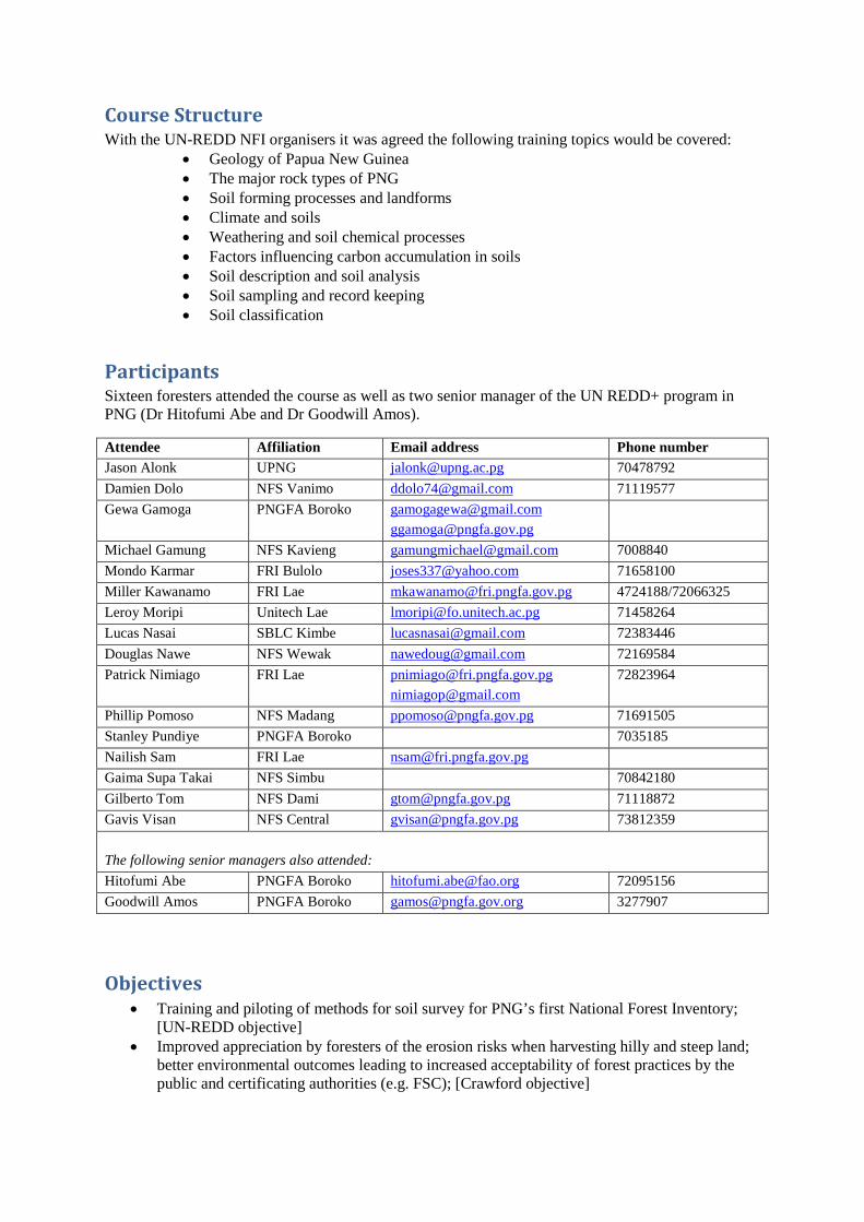
Objectives • Training and piloting of methods for soil survey for PNG’s first National Forest Inventory;
[UN-REDD objective] • Improved appreciation by foresters of the erosion risks when harvesting hilly and steep land;
better environmental outcomes leading to increased acceptability of forest practices by the public and certificating authorities (e.g. FSC); [Crawford objective]

• Improved communication between personnel in research and teaching institutions and foresters, which should lead to more applied research being done in future; [Crawford objective]
• Training in soil and land assessment for key land managers who potentially should become “champions” of high environmental standards and good land use in PNG. [Crawford objective].
Course participants and coordinators. Back row: Gaima Supa Takai, Damian Dolo, Gilberto Tom, Gavis Visan, Peter McIntosh, Gewa Gamoga, Richard Doyle, Douglas Nawe, Michael Gamung, Mondo Karmar and Lucas Nasai. Front row: Jason Alonk, Nalish Sam, Stanley Pundiye, Phillip Pomoso, Leroy Moripi, Miller Kawanamo and Patrick Nimiago (standing)
Programme A five-day programme was planned for Monday 10 November to Friday 14 November. The formal course presentation (see the programme below) was preceded by preparation of talks and field guides, manufacture of field equipment and organisation of logistical matters in Tasmania and preparation of course materials and field sites in PNG (Wednesday 5 November to Sunday 9 November). Each course day except the last included fieldwork so that long sessions indoors were avoided and attendees had a chance to apply what was learnt in the talks to real situations involving soil description, geology and landscape interpretation.
Time Activity Notes
Monday 10 November 8.00 am Registration 8.15 am Goodwill Amos: Welcome 8.20 am Prof Simon Saulei: Opening Remarks and Programme outline 8.40 am Gewa Gamoga: Introduction to the UN-REDD+ NFI project: the PNG
project in the context of global initiatives to reduce the effects of GHG emissions
9.05 am PDM: Introduction to the course and Acknowledgements ppt 01 9.15 am Patrick Nimiago and PDM: Soil carbon research in PNG ppt 02 9.45 am RD: The carbon cycle – factors influencing carbon accumulation and
carbon loss in soils; soil carbon and climate change ppt 03
10.45 am Morning tea 11.00 am PDM: Geology of Papua New Guinea ppt 04 12.00 pm PDM: Rock types of PNG ppt 05 12.30 pm Lunch and Rock identification and Discussion 1.15 pm RD: Introduction to soil description ppt 06 2.00 pm Field exercise: Divide into 2 groups: practical session on basic soil
description at 2 pits in FRI grounds; using the profile description cards and Munsell books; nomenclature, origin of sediments, drainage, basic classification concepts
4.10 pm Discussion on methods 4.40 pm Close
Tuesday 11 November 8.30 am PDM: Landforms and landscape processes ppt 07 9.00 am RD: Overview of soil forming processes: climate and weathering and time;
importance of clays ppt 08
10.00 am PDM: Concept of soil parent material ppt 09 10.15 am Morning tea 10.45 am RD: Nutrients and soil chemistry and measuring carbon in soils ppt 10 11.45 am RD: Why we classify soils ppt 11 12.00 pm PDM: Brief summary of FAO soil classification system ppt 12 12.30 pm Lunch 1.00 pm Field Exercise: Sampling soils for carbon content and Classifying the FRI
soils using the FAO system
2.50 pm RD: The Australian Soil Classification System ppt 13 (not presented*)
3.30 pm RD: The USDA Soil Classification System ppt 14 4.00 pm Discussion 4.30 pm Close
Wednesday 12 November 8.30 am Gewa Gamoga: The NFI project design – principles of site selection, site
stratification and extrapolation of results
9.00 am PDM: Measuring soil carbon – field techniques ppt 15 9.30 am Lab Exercise: 4 groups: Predicting Carbon Complexing Ability of soils
from rock types shown on geological maps
10.15 am Morning tea 10.30 am PDM: Using the soil description card; role of the site supervisor; report
writing ppt 16
11.00 am Drive to NARI 11.30 am Introduction to NARI 12.00 pm Lunch 12.30 pm At NARI split into 2 groups to describe, classify and sample soils on alluvial
fans
3.00 pm Discussion on site – procedures and soil classification and rock types and parent material
3.45 pm Drive to Lae 4.15 pm Close
Thursday 13 November 8.30 am Leave Lae About 9.30 am
Meet landowners (John and Moses). Introduction to Oomsis block by Moses or John.
10.00 am Field exercise. Oomsis. Soil description and sampling following NFI protocols. 2. Hill country soils. Visit Oomsis. Split into 2 groups; dig profiles at hill country sites; describe and sample soils. (Groups swap at lunchtime.)
3.15 pm Travel to FRI 4.15 pm Back in Lae - Close
Friday 14 November 8.30 am Make good copies of field notes; procedures for sorting samples;
subsampling; preparing samples for drying Not presented*
9.00 am Lab. Exercise. Weighing oven-dry samples and calculating carbon content of profiles
Not presented*
9.45 am Discussion and feedback: issues and questions re. field and laboratory protocols. Improvements required in draft field manual
10.45 am Morning tea 11.00 am All foresters: Presentations by attendees on soils and rock types in their own
areas
12.00 pm Lunch 12.30 pm Dr Ruth Turia: Issue of certificates and closing remarks c. 1.00 pm Close *See text.
Preparation The following talks were presented as powerpoint presentations and issued to participants as handouts. Additional electronic versions are available from the authors or from Gewa Gamoga (see list of participants), either as powerpoint presentations or PDFs.
01. Introduction and Acknowledgements 02. Measuring Soil carbon in PNG forests. Part 1. Previous Research. 03. PNG Soil carbon and Climate change. 04. Introduction to PNG Geology. 05. Rock types of PNG. 06. PNG Soil Profile Description. 07. Landforms and Landscape Processes. 08. PNG Soil Formation Processes: Weathering, Climate and Clays. 09. A note on parent rock and parent material. 10. Soil fertility, soil chemistry and soil carbon. 11. Principles of Soil Classification. 12. FAO Soil Classification for PNG. 13. The Australian soil classification system. [not presented: see text] 14. USDA Soil Taxonomy. A Simplified Key. 15. Measuring Soil Carbon in PNG Forests: Part 2. Field techniques. 16. Notes on soil profile description.

In addition, a draft soil description and sampling guide was distributed during the course. This was revised and improved to take into account the practical issues encountered on the course and the experiences of participants and is available as a separate report (McIntosh and Doyle 2015).
Brief Summary of Course
Pre-course preparation Before the course was presented four major tasks were completed in Tasmania: (1) preparation of presentations (mostly powerpoint talks); (2) ordering and manufacturing of field equipment; (3) liaison with PNG managers concerning course participants, organising accommodation and vehicle hire; and lastly, (4) preparation of handouts and draft field guides for participants. Richard Doyle and Peter McIntosh travelled to Port Moresby on Tuesday 4 November and continued to Lae on Wednesday 5 November. We met fellow course coordinator Patrick Nimiago at FRI on Wednesday and ran through the proposed programme with him. We checked on the venue (the main lecture hall at FRI) and Patrick arranged for soil pits to be dug in the grounds of FRI. On Thursday we visited the proposed field sites at Oomsis forest, south of the Markham River and with the help of FRI staff prepared two soil pits on steep sites for use in the soil description and field sampling exercise. On Friday we visited the National Agricultural Research Institute (NARI) where we met with director Dr Sim Sar, with whom Richard Doyle has previously worked, and gained his permission to use a sequence of sites on NARI land in a soil description and soil sampling exercise. We visited these sites, ranging from the hill country, to proximal and then distal alluvial fan deposits, and prepared profiles for examination by course participants. The weekend was spent finalising the programme, getting course booklets printed commercially, buying field and course materials, organising a geological display, preparing indoor and field exercises for participants, and ensuring that meals and refreshments for participants were arranged.
Monday 10 November Dr Goodwill Amos (Manager of REDD+ and Climate Change at PNGFA) welcomed participants to the course. Professor Simon Saulei outlined the programme and Gewa Gamoga (coordinator of REDD+ and Climate Change at PNGFA) put the course in the larger context of REDD+ research in PNG. Peter McIntosh presented some notes on the course aims and content, pointing out that forest utilisation and subsistence agriculture contribute to most of PNG’s carbon dioxide emissions and that the PNG government has committed to reducing these emissions by 50% by 2030. Also, that up to 50% of PNG’s forest carbon is held in the soil and the effect of land-use change on soil carbon is not well known. He summarised the UN-REDD+ aims as follows:
• To develop standardised methods of soil survey and soil carbon assessment that can be used across the entire PNG forest estate

• To develop methods that build on IPCC guidelines and can be integrated with the above-ground assessments of the UN-REDD National Forest Inventory
• To train potential soil survey supervisors who can apply these methods at NFI sites. He emphasised that in order to sample and describe soils correctly, it is essential to know the geology of the site, as soil carbon accumulation is dependent on geology (as well as on other factors like climate, erosion and land use) and geological map units can be used to extrapolate information gained at individual sites over the larger forest area. He explained why the course concentrated on understanding geology and soils and landform processes, as well as looking at the practical issues of sampling soils for carbon. Peter acknowledged the financial and in-kind support provided by UN-REDD+, The Crawford Fund, PNGFA in Port Moresby and PNGFRI in Lae, NARI staff and landowners at Oomsis. Three presentations (powerpoint talks) were then given on the general geology of PNG, rock identification, and principles of soil description. (These and other talks are not be summarised in this report; all scientific talks were reproduced as handouts and also made available electronically to all participants.) At lunchtime participants were encouraged to hone their rock identification skills using a display of a variety rocks collected in PNG as well as in Tasmania and New Zealand; this display of reference rocks was available throughout the course.
On Monday afternoon the principles of soil description were introduced, using two profiles in the FRI grounds. From the rocks found in the soils participants deduced that the local soils were formed in alluvial fan deposits of the Busu River. This river originates in the Busu Mountain area north of Lae, underlain by igneous and sedimentary rocks. Immediately adjacent to the pits was a steep-sided gully downcut by the Butibum stream, in response to land uplift by earthquakes.
Miller Kawanamo examining the rock collection.
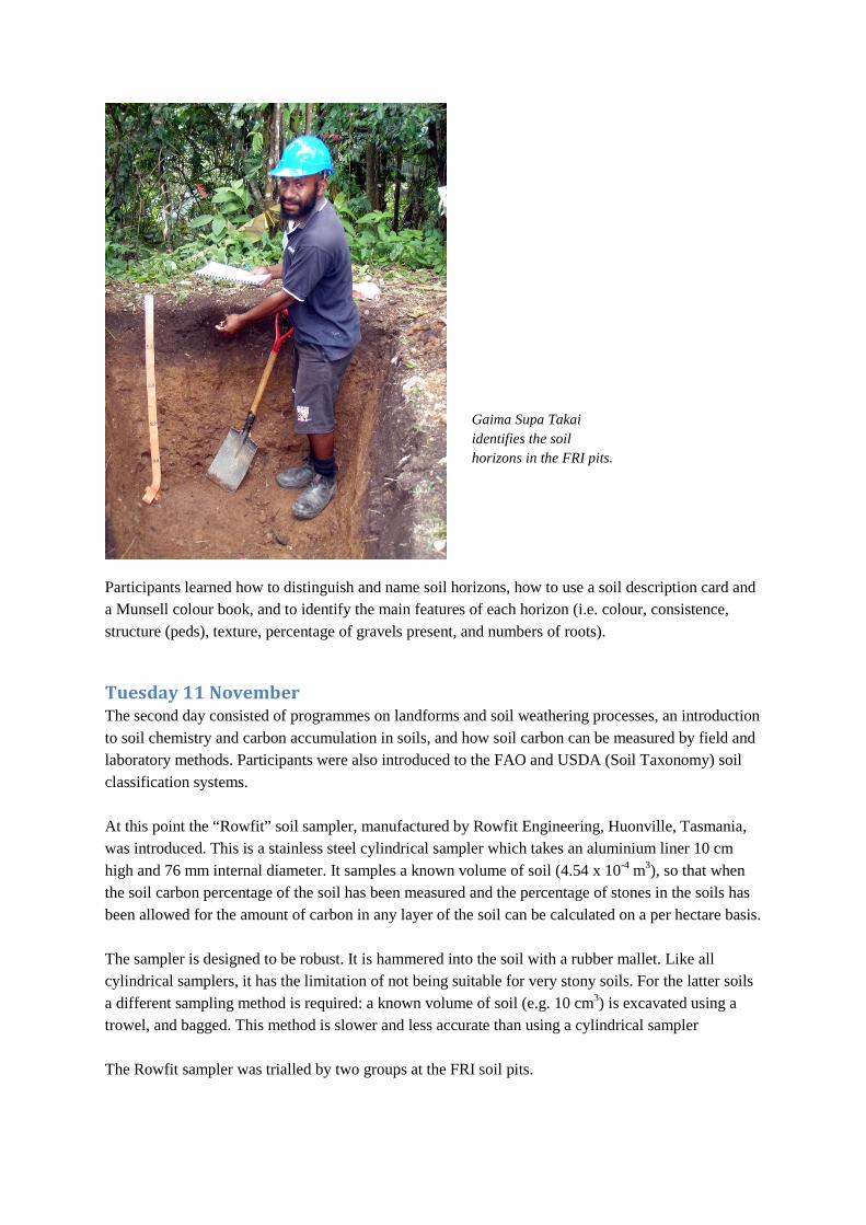
Participants learned how to distinguish and name soil horizons, how to use a soil description card and a Munsell colour book, and to identify the main features of each horizon (i.e. colour, consistence, structure (peds), texture, percentage of gravels present, and numbers of roots).
Tuesday 11 November The second day consisted of programmes on landforms and soil weathering processes, an introduction to soil chemistry and carbon accumulation in soils, and how soil carbon can be measured by field and laboratory methods. Participants were also introduced to the FAO and USDA (Soil Taxonomy) soil classification systems. At this point the “Rowfit” soil sampler, manufactured by Rowfit Engineering, Huonville, Tasmania, was introduced. This is a stainless steel cylindrical sampler which takes an aluminium liner 10 cm high and 76 mm internal diameter. It samples a known volume of soil (4.54 x 10⁻⁴ m3), so that when the soil carbon percentage of the soil has been measured and the percentage of stones in the soils has been allowed for the amount of carbon in any layer of the soil can be calculated on a per hectare basis. The sampler is designed to be robust. It is hammered into the soil with a rubber mallet. Like all cylindrical samplers, it has the limitation of not being suitable for very stony soils. For the latter soils a different sampling method is required: a known volume of soil (e.g. 10 cm3) is excavated using a trowel, and bagged. This method is slower and less accurate than using a cylindrical sampler The Rowfit sampler was trialled by two groups at the FRI soil pits.
Gaima Supa Takai identifies the soil horizons in the FRI pits.

We worked through the FAO key with participants and decided that because of their dark thick topsoils and lack of other defining features the soils at the FRI pits would classify as Umbrisols if subsoils are acid and have low base status, or Cambisols if the FAO base status criteria for Umbrisols are not met. The equivalent classification in USDA system (Soil Taxonomy) is a Humudept: the soils are Inceptisols because of limited (but identifiable) soil development, and Humudepts because they are found in humid conditions (Udic moisture regime) and have strong accumulation of humus in the topsoil.
Wednesday 12 November Day three started with a recapitulation session on sampling strategy. Then participants divided into four groups who were asked to rank geological units shown on 1:250 000 geological maps by their carbon complexing potential, using a scale developed for the NFI project by PDM in consultation with Dr. H. Abe, and outlined in presentation 02. A spokesperson for each group then presented the group’s rankings.
Using the Rowfit sampler: From top left: hammering the sampler into the soil using a rubber mallet; extracting the sampler using a trowel; unscrewing the top in order to extract the internal aluminium liner; cutting excess sample from the base of the internal liner of the sampler before bagging the sample.

Before lunch we drove to NARI, which is situated on the western flank of the Atzera Range (Pliocene sedimentary rocks) to describe and sample the topographic sequence of soils previously mentioned. Dr Sim Sar (Director of the Agricultural Systems Programme) explained the work done at the research station, which varies from field trials on vegetable varieties and rice cultivars, to technological research such as designing low-cost rice driers. We then visited the highest part of the research station, where soils are developed in slope colluvium with many angular fragments of siltstone and sandstone. The soil had few diagnostic features other than topsoil development and a structured B horizon. It was classified as a Cambisol in the FAO Classification. There was discussion at the site whether the “hummocky” landforms at the site were caused by past landslides. At this site and others Richard Doyle demonstrated the usefulness of a soil pH test kit that uses indicator dyes to measure pH to the nearest 0.5 of a pH unit. Developed primarily for gardeners, the kits provide a cheap assessment of pH and base status if laboratory information is not available.
In the absence of good soil maps point observations of carbon content in forest soils will need to be extrapolated on the basis of geological units and climate zones. As soil carbon values will not be measured on all geological units, these units need to be grouped by the carbon complexing ability of their associated soils before soil carbon results can be extrapolated nationwide. Here participants rank the mapped units on the Markham 1: 250 000 geological map into groups of geological units of similar carbon complexing ability.
The highest site on NARI had a soil developed in slope colluvium. This rather featureless soil profile shows little pedological development and is therefore classified as a Cambisol in the FAO classification.

Further downslope a stream is actively reworking an older fan. The group divided into two to sample the older fan material (no longer on the floodplain) and the younger fan material (immediately next to the stream). The soil on the older material had slight development of structure in the B horizon and was therefore classified as a Cambisol in the FAO classification. In contrast the soil on the younger fluvial sediment had loose sandy gravels below the A horizon and was classified as a Fluvisol (see photograph below). At both sites the groups wrote a soil profile description and sampled the entire profile for carbon using the protocols developed in the draft field manual. The stony subsoils could not be sampled using the Rowfit sampler and were therefore sampled by excavating a 10 x 10 cm square of soil to 10 cm depth. The importance of accurately recording the sampling techniques used in the field on a field record sheet (provided to participants as part of the draft field guide) was emphasised, especially if different sampling techniques are used for different sampling depths in the same soil profile.
Richard Doyle demonstrates the usefulness of the soil pH test kit.
Sampling a Fluvisol at NARI. Stony subsoil layers in this soil had to be sampled for carbon by excavating a known volume of soil.

After describing and sampling these two soils we drove downslope and across the main road to the gently sloping land forming the distal fans of streams draining the Atzera Range. The soils here are formed in silty alluvium. Most of the area has been terraced for rice production, but at the boundary of NARI and the adjoining property a strip of unterraced land next to a man-made drain allowed almost undisturbed profiles to be inspected. Here the group divided into two in order to identify the soil profile features and classify profiles using the FAO Soil Classification. Although we expected the soils to classify as Fluvisols, because of their obvious layering, in fact both groups independently came to the conclusion that they better fitted the Phaeozem classification on account of their dark topsoils (mollic properties) and likely high base status in subsoils (the pH kit showed near-neutral pH). This classification exercise brought day three to a close.
Thursday 13 November The whole day was dedicated to describing and sampling soils in difficult eroding steep terrain. The location was deliberately chosen so that we could test the soil sampling methodology in a challenging but realistic environment that will probably resemble that at many NFI sites. We chose an area in Oomsis forest in steep schist terrain (c. 30o slopes) containing landslides. This land is owned by the family of Moses Reuben. We had planned for Moses to give an introductory talk to participants but this was not possible as he unexpectedly had to travel to Lae. We therefore proceeded straight to the sites up an old forest track.
Pre-sampling discussion At a steep site showing obvious landslide scars (now revegetated) we discussed (1) erosion risk and processes; (2) protocols for selecting profile sites; and (3) protocols for selecting multiple topsoil sites within NFI plots. It was agreed that the profile site should be on the dominant land unit (i.e. the non-eroded soils at Oomsis) but that topsoil sampling sites should be distributed proportionally between the land units present (i.e. between the eroded and non-eroded soils at Oomsis) so that sampling is truly representative of the soil variation at any NFI plot.
Profile description and sampling Working in two groups, we described two profiles from pits which had been previously prepared. As far as possible PDM and RD took a “back seat” and let the trainees describe the profiles using the soil description card, Munsell soil colour books and the draft field guide provided. Topsoils were too thin and pale for the soils to be classified as Phaeozems or Umbrisols, and there were few other diagnostic criteria present so they classified as Cambisols (Inceptisols in Soil Taxonomy). Lower level classification was not attempted. Soil profile description by horizon was shared within the group, so that pairs of foresters worked on each horizon. Estimating soil texture (the proportion of sand silt and clay) by the “feel” of the soil proved to be difficult for most participants. (Training in soil texture estimation is best done by reference to samples with measured sand, silt and clay, but this was not possible on this course.)

Once the respective profiles were described, each group divided into two and one subgroup sampled the profile for soil carbon (at 0-10 cm, 10-20 cm, and 20-30 cm depth; then 40-50 cm and 75-85 cm) using the Rowfit sampler for most topsoil sampling and the fixed volume method for stony subsoils. The other subgroup worked on taking topsoil samples (0-10 cm; 10-20 cm and 20-30 cm) from locations within the theoretical NFI plot, taking into account landscape variation (see above). The three jobs (profile description, profile sampling, and topsoil sampling at multiple sites) proceeded at a slower pace than expected, and each group only managed to finish the profile work and four independent topsoil sampling sites in the time available. (The draft NFI field guide for soils specifies nine independent topsoil sampling sites are required.) However, the slow pace was undoubtedly due to most tasks being new to participants, and it is considered that once experience has been gained, a trained supervisor with a technician and at least two extra people to help with the physical work of digging pits should be able to complete the soil work at an NFI site in one day.
Post-sampling discussion • It was suggested that if five people are available for soil work at each NFI site, two (the
supervisor and a technician) could describe and sample the profile, while another two (the “topsoil team”) could sample topsoils and a fifth person could dig topsoil pits with prepared benches at 10 and 20 cm ahead of the “topsoil team”. Such a division of labour could significantly speed up the soils work.
• Another suggestion was that all soil work should occur on the perimeter of NFI plots, so that NFI plots remain in a relatively undisturbed state. (This would also have the advantage that if NFI plots were later resurveyed to look at changes over time, soil samples could be taken within NFI plots on the second sampling visit, in the knowledge that previously disturbed ground was not being sampled.)
The soils of the schist steeplands at Oomsis have poorly developed topsoils, because they have been subject to regular erosion (landslides) and soil mixing, possibly after fires or cyclones.

• A further suggestion was that profile samples should be analysed for a full range of soil chemistry (e.g. N, P, pH, exchangeable cations, CEC) and not just carbon. This is an excellent idea in principle, but implementing it will depend on funds available.
Friday 14 November On Friday the initial plan was to run through procedures for preparing soils for laboratory analysis and the method of calculating carbon content of soils on a per hectare basis, using invented laboratory values for soil carbon content, dry weight of soil, and field estimates of percentage of stones. This part of the course was dropped in favour giving participants more time to discuss what they had gained from the course and what they needed more training on, and allowing more time for participants to present talks on the soils in their own areas.
To stimulate feedback responses, a list of nine questions was prepared. All participants were also invited to comment on any other points they considered to be important. The anonymous responses are given below, almost verbatim.
Feedback from Participants 1. Did the course meet your expectations?
• Yes, but I really want the course to be conducted again. We should have two weeks course. • I was expecting the course was going to involve soil description and profiling and sample collection for
carbon. Little did I expect soil genesis to be involved (rocks). So the course was a lot more in depth than I expected. Overall the subject matter was OK. However, geology technical terms was a bit new.
• Yes, but need to know more on rock type nomenclature, same with soils. • Yes. • Yes. • The course did meet my expectations, though there was a lot to learn within a short period of time. • The course was really fun. • Greatly appreciate the structure of the course. • The course did definitely meet our expectations and the subject matters were OK but there was very
much limited time. • Generally met expectations, however relatively new. • Maybe.
2. Was the subject matter appropriate?
• Yes, but more time needed. • Overall the subject matter was OK. However, geology technical terms was a bit new, especially when
classifying soils. • Yes. • Yes. • The subject matter was OK, but for someone from a different background there was so much within a
week to learn, not to mention the technical terms I need to understand so that I do not keep looking back into the notes.
• The subject on soil is very helpful to sustainably manage or forest resource. • Good but needs more information. • The subjects covered were important and needed more time to adequately cover the basics, particularly
linking geology to soil types. • Yes. • Subject matter is very good.

3. Should other subjects be covered? • Yes, example is vegetation. The course should also cover the vegetation. We should know which
vegetation is dominant on each soil type. • Yes: more on chemical composition and processes in soil. • Need to cover other subjects related to soil and rock weathering, probably weather [climate]. • Forest types + peat soils + mangrove forest soil. • Climate. • Other subjects that needed to be covered were basic vegetation types – this very much indicate what
types of soils on rock types from a particular area. • Generally fine. • Not sure.
4. Were subjects well explained?
• Yes, but we need more time. • Yes. • The subjects were well explained, however, due to limited time, they were bundled up. • Yes – excellent. • The subjects were well explained . . . but I think the technical terms used need to be broken down to
our understanding. • Yes. • Explanations well received. • Could be improved.
5. Were the handouts OK or could they be improved?
• Handouts could be improved. • The handouts could be improved by involving definitions of technical terms. • Handouts could be improved. • Geological, soil, forest types/vegetation, landuse maps should also be provided/included. • Handouts were OK – very informative. • The handouts were OK. • Handouts need to be improved. • Handouts were OK but could be better if diagrams were also used, e.g. diagrams of horizons etc. • OK. • Require field manual suited to PNG conditions; participants’ input is greatly needed.
6. Was the course too long or too short?
• Too short. • Most slides are too long, however most important things were covered. • Too short. • Too short, needs more than a week to cover in detail. • The course for me personally was too short . . . everything was squashed into just one week of training
and we had to catch up to the pace of the coordinators. There was so much to learn within a short space of time. I believe my fellow colleagues share the same sentiments.
• I think personally the course should be done in 2–3 weeks. • May require another week or more to successfully complete this training. • The time was too short. • Timing is too short considering the amount of information that needs to be digested. • The course was too short. I would prefer to have more time to study rock samples associated with
different soil types. • A minimum of two weeks of the course would have been better. There is a need for more training,
particularly using a number of representative soil types. • The course was quite short – too much for a week. • The course was very short in terms of subject covered, therefore need additional training after this one.
7. Did you want more fieldwork or less fieldwork?
• More fieldwork is needed.
• The fieldwork was sufficient for us to understand and carry out. We would only need important needy [essential?] materials, especially the book [tailor-made field guide?] so we can read it in our own time to better understand and improve soil knowledge.
• More fieldwork • More practical and field work needed. • More fieldwork needed. • I think more fieldwork is needed to get more understanding of the soil to make us better supervisor in
collecting soil samples for the NFI. • I would very much want more field work on different locations e.g. peat soils. • We need more time, emphasising more on field work and practicals so supervisors are confident. • I would like to have more field work. • More fieldwork. Practical exercise was good. Field work should be done in different types of landuse
or landscape. • Need to spend more time on field practicals.
8. Was there enough time for discussion?
• No. • No. • We did have enough time for discussion; however, the course should have been run for 2–3 weeks. • Not enough time for discussion. • Discussion indoor and outdoor practical was good. • More practicals and more discussions needed. • Yes,
9. Where do we go from here? Is there a need for more training or are you happy
now to supervise soil sampling and soil description at NFI sites? • I need more training before I can supervise soil sampling and soil description. • Need more training on rock, soil descriptions and chemical processes involved. • There should be more training as a follow-up on this training. • Need one more training, this time at higher altitude (highlands) • I think more fieldwork is needed to get more understanding of the soil to make us better supervisor in
collecting soil samples for the NFI. There should be another training to better equip us for what to expect come the NFI.
• I think we need to have another training before the NFI starts. • Need more time to properly establish confidence in field data collection through doing more sampling
at different locations. • It would be better if another course is organised with more practicals or fieldwork involved as most of
us are not involved in soils, rather with what is on the soil, i.e. trees. • We need more practical [experience] in different forest area, i.e. high altitude/montane forest areas;
mid montane; lowlands; islands. • Organise anther workshop which will require more hands on experience. • Finalise the field manual then conduct another training – this time more time on practical exercises and
field work.
10. Do you have any further comments? • We need to do carbon calculation in the lab. • I would like to thank both of you, Dr McIntosh and Dr Doyle, for your time and patience. • Also [need] more reading material for our information. • We have to do the carbon calculation with you. • Need to add some more tools and equipment: books, axe, bushknives, soils [Munsell?] book, geology
book, pH kits for every participant. • The method that will be used in the NFI should be explained to us and another practical course of
fieldwork should be organised. • Didn’t learn about the analysis part of soil in the lab. • Happy with training, but I suggest that we (the learners) should do our recording in the field and then
Richard and Peter should do theirs, and we check our answer together to find out where we went wrong.

• The study of geology is new to foresters therefore we need more time to study/understand rock parent materials and soil formation. If we do understand the above [then] as supervisors we can collect accurate information for the NFI.
• Participants should be doing more of the descriptions etc. in the field. • Materials and equipment needed for this training need to be fully provided. • As a researcher with some experience in soil studies, I know it takes time to really understand the
basics of soil classification and sampling. The structure and content of the course was excellent – we only needed more time to fully grasp the information and techniques covered in the course.
• I would greatly appreciate if I can have more additional course on soils as I am interested in doing further studies in relationships between soils and growth of trees
Summary Most participants wanted the course to be longer, with more practical sessions and fieldwork and more opportunity for discussion. For many participants the course time was too short to be able to become familiar with new technical terms in the geological and soil subject areas. Several participants wanted to have an extra course (concentrating or practical sessions in other forest types including peats and mangroves) before they consider they will be competent to sample for the NFI survey. On more detailed matters: Several participants wanted improved handouts. Their comments probably relate largely to the field manual, which was only presented in draft form at the course. (A comprehensive and updated field manual has been written.) Some wanted more background reading. Several wanted a chance to go through soil carbon calculations. (A session on calculating soil carbon from raw data was scheduled but had to be dropped because of lack of time.)
Participants’ presentations Most participants gave short talks on soils in a geographical area they were familiar with. These presentations were put together by the attendees during the week. Unfortunately the talks were not able to be recorded, but they demonstrated the ability of the participants to focus on subject areas (soils and geology) which have often been neglected in PNG forest management. Each talk was followed by brief question and answer sessions.
Mondo Karmar presented a talk on the soils of the Bulolo plantation, and the benefits and limitations of soil mapping for predicting production of forest health problems.

Presentation of Certificates After formal proceedings had closed Peter McIntosh invited Dr Ruth Turia, Director of Forest Policy and Planning at PNGFA, to present Crawford Fund Certificates of Attendance to all participants. These were prepared by Marchien Vanoostende (The Crawford Fund). Participants departed about 2 pm.
Top: The Crawford Fund Certificate (left) and Gilberto Tom receiving his certificate from Dr Ruth Turia (right). Bottom: group photograph at the end of the course.

Acknowledgements The soils training course was funded by UN-REDD+ and The Crawford Fund. The assistance and enthusiastic support of staff at PNGFA, PNGFRI (especially Patrick Nimiago’s assistant Janet) and NARI and the landowner at Oomsis (Moses Reuben) is gratefully acknowledged.
References Abe, H. 2007. Forest management impacts on growth, diversity and nutrient cycling of lowland
tropical rainforest and plantations, Papua New Guinea, Thesis, University of Western Australia, Perth.
Edwards, P.J.; Grubb, P.J. 1977. Studies of mineral cycling in a montane rain forest in New Guinea. I. The distribution of organic matter in the vegetation and soil. Journal of Ecology 65: 943–969.
Matsuura, Y. 1997. Short-term expert (soil science) report, (1997 Feb. 4th to March 16th). Unpublished report, Hokkaido Research Centre, Forest and Forest Products Research Institute, Sapporo, Japan.
McIntosh, P.D.; Doyle, R. 2015. Field guide for sampling and describing soils in the Papua New Guinea National Forest Inventory. Report for UN-REDD+ and The Crawford Fund. Forest Practices Authority, Hobart.
Nimiago, P.L. 2011. Assessment of forest soil carbon stock in Papua New Guinea. In J.C. Fox, R.J. Keenan, C.L. Brack and S. Saulei (eds): Native forest management in Papua New Guinea: advances in assessment, modelling and decision making. ACIAR Proceedings No. 135, Australian Centre for International Agricultural Research, Canberra, pp.100–104.
Nimiago, P.L.; Abe, H.; McIntosh, P.D. 2014. Proposal for assessment of soil carbon in the First National Forest Inventory in Papua New Guinea. Submitted paper, UN REDD workshop, Hodava Hotel, 22 May 2014. (Copies available from [email protected]).