Embed Size (px)
Citation preview
Report of Dagstuhl Seminar 15461
Vision for Autonomous Vehicles and ProbesEdited byAndrés Bruhn1, Atsushi Imiya2, Aleš Leonardis3, andTomas Pajdla4
1 Universität Stuttgart, DE, [email protected] Chiba University, JP, [email protected] University of Birmingham, GB, [email protected] Czech Technical University Prague, CZ, [email protected]
AbstractThe vision-based autonomous driving and navigation of vehicles has a long history. In 2013,
Daimler succeeded autonomous driving on a public drive way. Today, the Curiosity mars roveris sending video views from Mars to Earth. Computer vision plays a key role in advanceddriver assistance systems (ADAS) as well as in exploratory and service robotics. Continuingtopics of interest in computer vision are scene and environmental understanding using single-and multiple-camera systems, which are fundamental techniques for autonomous driving, navig-ation in unknown environments and remote visual exploration. Therefore, we strictly focuses onmathematical, geometrical and computational aspects of autonomous vehicles and autonomousvehicular technology which make use of computer vision and pattern recognition as the centralcomponent for autonomous driving and navigation and remote exploration.
Seminar November 8–13, 2015 – http://www.dagstuhl.de/154611998 ACM Subject Classification I.2.9 Robotics, I.2.10 Vision and Scene Understanding, I.4.5
Reconstruction, I.4.6 Segmentation, I.4.8 Scene AnalysisKeywords and phrases Vision-based autonomous driving and navigation, Exploratory rovers,
Dynamic 3D scene understanding, Simultaneous localization and mapping, On-board al-gorithms
Digital Object Identifier 10.4230/DagRep.5.11.36Edited in cooperation with Akihiro Torii (Tokyo Institute of Technology, JP) and Hayato Itoh
(Chiba University, JP)
1 Executive Summary
Andrés BruhnAtsushi Imiya
License Creative Commons BY 3.0 Unported license© Andrés Bruhn and Atsushi Imiya
Computer vision plays a key role in advanced driver assistance systems (ADAS) as well as inexploratory and service robotics. Visual odometry, trajectory planning for Mars exploratoryrovers and the recognition of scientific targets in images are examples of successful applications.In addition, new computer vision theory focuses on supporting autonomous driving andnavigation as applications to unmanned aerial vehicles (UAVs) and underwater robots. Fromthe viewpoint of geometrical methods for autonomous driving, navigation and exploration,the on-board calibration of multiple cameras, simultaneous localisation and mapping (SLAM)in non-human-made environments and the processing of non-classical features are some of
Except where otherwise noted, content of this report is licensedunder a Creative Commons BY 3.0 Unported license
Vision for Autonomous Vehicles and Probes, Dagstuhl Reports, Vol. 5, Issue 11, pp. 36–61Editors: André Bruhn, Atsushi Imiya, Aleš Leonardis and Tomas Pajdla
Dagstuhl ReportsSchloss Dagstuhl – Leibniz-Zentrum für Informatik, Dagstuhl Publishing, Germany
Andrés Bruhn and Atsushi Imiya 37
current problems. Furthermore, the adaptation of algorithms to long image sequences, imagepairs with large displacements and image sequences with changing illumination is desiredfor robust navigation and exploration. Moreover, the extraction of non-verbal and graphicalinformation from environments to remote driver assistance is required.
Based on these wide range of theoretical interests from computer vision for new possibilityof practical applications of computer vision and robotics, 38 participants (excluding organisers)attended from variety of countries: 4 from Australia, 3 from Austria, 3 from Canada, 1 fromDenmark, 11 from Germany, 1 from Greece, 1 from France, 3 from Japan, 4 from Spain, 2from Sweden, 4 from Switzerland and 3 from the US.
The seminar was workshop style. The talks are 40 mins and 30 mins for young researchersand for presenters in special sessions. The talks have been separated into sessions on aerialvehicle vision, under water and space vision, map building, three-dimensional scene andmotion understanding as well as a dedicated session on robotics. In these tasks, various typesof autonomous systems such as autonomous aerial vehicles, under water robots, field andspace probes for remote exploration and autonomous driving cars were presented. Moreover,applications of state-of-the-art computer vision techniques such as global optimizationmethods, deep learning approaches as well as geometrical methods for scene reconstructionand understanding were discussed. Finally, with Seminar 15462 a joint session on autonomousdriving with leading experts in the field was organised.
The working groups are focused on “Sensing,” “Interpretation and Map building” and“Deep leaning.” Sensing requires fundamental methodologies in computer vision. Low-levelsensing is a traditional problem in computer vision. For applications of computer-vision al-gorithms to autonomous vehicles and probes, reformulation of problems for various conditionsare required. Map building is a growing area including applications to autonomous roboticsand urban computer vision. Today, application to autonomous map generation involvesclassical SLAM and large-scale reconstruction from indoor to urban sizes. Furthermore, forSLAM on-board and on–line computation is required. Deep learning, which goes back itsorigin to ’70s, is a fundamental tool for image pattern recognition and classification. Althoughthe method showed significant progress in image pattern recognition and discrimination,for applications to spatial recognition and three-dimensional scene understanding, we needdetailed discussion and developments.
Through talks-and-discussion and working-group discussion, the seminar clarified thatfor designing of platforms for visual interpretation and understanding of three-dimensionalworld around the system, machine vision provides fundamental and essential methodologies.There is the other methodology which uses computer vision as a sensing system for theacquisition of geometrical data and analysis of motion around cars. For these visual servosystems, computer vision is a part of the platform for intelligent visual servo system. Theformer methodology is a promising one to provide a fundamental platform which is commonto both autonomous vehicles, which are desired for consumer intelligence, and probes, whichare used for remote exploration.
15461
38 15461 – Vision for Autonomous Vehicles and Probes
2 Table of Contents
Executive SummaryAndrés Bruhn and Atsushi Imiya . . . . . . . . . . . . . . . . . . . . . . . . . . . . 36
Overview of Talks . . . . . . . . . . . . . . . . . . . . . . . . . . . . . . . . . . . . . 41
Talks Abstracts . . . . . . . . . . . . . . . . . . . . . . . . . . . . . . . . . . . . . . 42
Real-world Semantic SegmentationJosé Alvarez . . . . . . . . . . . . . . . . . . . . . . . . . . . . . . . . . . . . . . . . 42
Perception for Mobile RoboticsJuan Andrade-Cetto . . . . . . . . . . . . . . . . . . . . . . . . . . . . . . . . . . . 42
Vehicular Instrumentation for the Study of Driver Intent and Related ApplicationsSteveb S. Beauchemin . . . . . . . . . . . . . . . . . . . . . . . . . . . . . . . . . . 44
Recursive Joint Estimation of Dense Scene Structure and Camera Motion in anAutomotive ScenarioFlorian Becker . . . . . . . . . . . . . . . . . . . . . . . . . . . . . . . . . . . . . . 44
Semantic RGB-D Perception for Cognitive RobotsSven Behnke . . . . . . . . . . . . . . . . . . . . . . . . . . . . . . . . . . . . . . . 44
Second-Order Recursive Filtering on the Rigid-Motion Group SE(3) Based onNonlinear Observations from Monocular VideosJohannes Berger . . . . . . . . . . . . . . . . . . . . . . . . . . . . . . . . . . . . . 45
Robust Coupling of Perception to Actuation in Dynamic EnvironmentsDarius Burschka . . . . . . . . . . . . . . . . . . . . . . . . . . . . . . . . . . . . . 45
Direct and Dense Methods for 3D Reconstruction and Visual SLAMDaniel Cremers . . . . . . . . . . . . . . . . . . . . . . . . . . . . . . . . . . . . . . 45
Pose Estimation and 3D Segmentation using 3D Knowledge in Dynamic Environ-mentsCédric Demonceaux . . . . . . . . . . . . . . . . . . . . . . . . . . . . . . . . . . . . 46
Learning to DriveMichael Felsberg . . . . . . . . . . . . . . . . . . . . . . . . . . . . . . . . . . . . . 46
Drone Vision – Computer Vision Algorithms for DronesFriedrich Fraundorfer . . . . . . . . . . . . . . . . . . . . . . . . . . . . . . . . . . 47
Structured Indoor Modeling and/or Uncanny Valley for 3D ReconstructionYasutaka Furukawa . . . . . . . . . . . . . . . . . . . . . . . . . . . . . . . . . . . . 47
Underwater Vision: Robots that “see” beneath the surfaceRafael Garcia . . . . . . . . . . . . . . . . . . . . . . . . . . . . . . . . . . . . . . . 47
Semantic Maps for High Level Robot NavigationAntonios Gasteratos . . . . . . . . . . . . . . . . . . . . . . . . . . . . . . . . . . . 48
High-level Knowledge in Low-level VisionAndreas Geiger . . . . . . . . . . . . . . . . . . . . . . . . . . . . . . . . . . . . . . 48
Hyperpoints and Fine Vocabularies for Large-Scale Location RecognitionMichal Havlena . . . . . . . . . . . . . . . . . . . . . . . . . . . . . . . . . . . . . . 49
Andrés Bruhn and Atsushi Imiya 39
Visual-Inertial Navigation for Mobile RobotsHeiko Hirschmuller (Roboception GmbH – München, DE) . . . . . . . . . . . . . . 49
Planetary Robotic Vision Processing for Rover MissionsBen Huber . . . . . . . . . . . . . . . . . . . . . . . . . . . . . . . . . . . . . . . . . 50
Model-based Object and Deformation Tracking with Robust Global OptimizationReinhard Koch . . . . . . . . . . . . . . . . . . . . . . . . . . . . . . . . . . . . . . 50
Image based Navigation for Exploration ProbeTakashi Kubota . . . . . . . . . . . . . . . . . . . . . . . . . . . . . . . . . . . . . . 51
Stereo Vision for Future Autonomous Space Exploration RobotsLazaros Nalpantidis . . . . . . . . . . . . . . . . . . . . . . . . . . . . . . . . . . . . 51
Structure and Motion – Challenges and solutions for real time geometric estimationfrom videoMikael Persson . . . . . . . . . . . . . . . . . . . . . . . . . . . . . . . . . . . . . . 51
Efficient Block Optimization Methods for Computer VisionThomas Pock . . . . . . . . . . . . . . . . . . . . . . . . . . . . . . . . . . . . . . . 52
Toward Highly Intelligent AutomobilesDanil V. Prokhorov . . . . . . . . . . . . . . . . . . . . . . . . . . . . . . . . . . . . 52
Efficient Multi-view Semantic SegmentationHayko Riemenschneider . . . . . . . . . . . . . . . . . . . . . . . . . . . . . . . . . 53
The Limits of Pose Estimation in Very Large MapsTorsten Sattler . . . . . . . . . . . . . . . . . . . . . . . . . . . . . . . . . . . . . . 53
From Frames to Events: Vision for High-speed RoboticsDavide Scaramuzza . . . . . . . . . . . . . . . . . . . . . . . . . . . . . . . . . . . . 53
Towards 3D Scene UnderstandingBernt Schiele . . . . . . . . . . . . . . . . . . . . . . . . . . . . . . . . . . . . . . . 54
Tracking and Mapping in Project TangoJürgen Sturm . . . . . . . . . . . . . . . . . . . . . . . . . . . . . . . . . . . . . . . 54
Deep Learning for Visual Place Recognition and Online 3D ReconstructionNiko Sünderhauf . . . . . . . . . . . . . . . . . . . . . . . . . . . . . . . . . . . . . 55
Large-scale Visual Place Recognition – Current challengesAkihiro Torii . . . . . . . . . . . . . . . . . . . . . . . . . . . . . . . . . . . . . . . 55
3D Scene Understanding for Autonomous DrivingRaquel Urtasun . . . . . . . . . . . . . . . . . . . . . . . . . . . . . . . . . . . . . . 55
Direct SLAM Techniques for Vehicle Localization and Autonomous NavigationVladyslav Usenko . . . . . . . . . . . . . . . . . . . . . . . . . . . . . . . . . . . . . 56
Learning See in a Virtual WorldDavid Vázquez Bermudez . . . . . . . . . . . . . . . . . . . . . . . . . . . . . . . . 56
Realizing Self-Driving CarAndreas Wendel . . . . . . . . . . . . . . . . . . . . . . . . . . . . . . . . . . . . . . 56
Working groups . . . . . . . . . . . . . . . . . . . . . . . . . . . . . . . . . . . . . . 57
Sensing . . . . . . . . . . . . . . . . . . . . . . . . . . . . . . . . . . . . . . . . . . 57
15461

40 15461 – Vision for Autonomous Vehicles and Probes
Mapping for Autonomous Vehicles and Probes . . . . . . . . . . . . . . . . . . . . 58
Beyond Deep Learning . . . . . . . . . . . . . . . . . . . . . . . . . . . . . . . . . . 60
Participants . . . . . . . . . . . . . . . . . . . . . . . . . . . . . . . . . . . . . . . . . 61
Andrés Bruhn and Atsushi Imiya 41
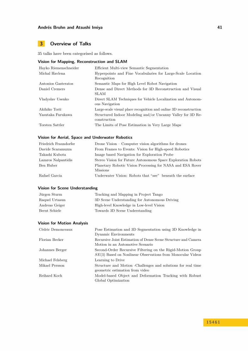
3 Overview of Talks
35 talks have been categorised as follows.
Vision for Mapping, Reconstruction and SLAMHayko Riemenschneider Efficient Multi-view Semantic SegmentationMichal Havlena Hyperpoints and Fine Vocabularies for Large-Scale Location
RecognitionAntonios Gasteratos Semantic Maps for High Level Robot NavigationDaniel Cremers Dense and Direct Methods for 3D Reconstruction and Visual
SLAMVladyslav Usenko Direct SLAM Techniques for Vehicle Localization and Autonom-
ous NavigationAkihiko Torii Large-scale visual place recognition and online 3D reconstructionYasutaka Furukawa Structured Indoor Modeling and/or Uncanny Valley for 3D Re-
constructionTorsten Sattler The Limits of Pose Estimation in Very Large Maps
Vision for Aerial, Space and Underwater RoboticsFriedrich Fraundorfer Drone Vision – Computer vision algorithms for dronesDavide Scaramuzza From Frames to Events: Vision for High-speed RoboticsTakashi Kubota Image based Navigation for Exploration ProbeLazaros Nalpantidis Stereo Vision for Future Autonomous Space Exploration RobotsBen Huber Planetary Robotic Vision Processing for NASA and ESA Rover
MissionsRafael Garcia Underwater Vision: Robots that “see” beneath the surface
Vision for Scene UnderstandingJürgen Sturm Tracking and Mapping in Project TangoRaquel Urtasun 3D Scene Understanding for Autonomous DrivingAndreas Geiger High-level Knowledge in Low-level VisionBernt Schiele Towards 3D Scene Understanding
Vision for Motion AnalysisCédric Demonceaux Pose Estimation and 3D Segmentation using 3D Knowledge in
Dynamic EnvironmentsFlorian Becker Recursive Joint Estimation of Dense Scene Structure and Camera
Motion in an Automotive ScenarioJohannes Berger Second-Order Recursive Filtering on the Rigid-Motion Group
SE(3) Based on Nonlinear Observations from Monocular VideosMichael Felsberg Learning to DriveMikael Persson Structure and Motion -Challenges and solutions for real time
geometric estimation from videoReihard Koch Model-based Object and Deformation Tracking with Robust
Global Optimization
15461
42 15461 – Vision for Autonomous Vehicles and Probes
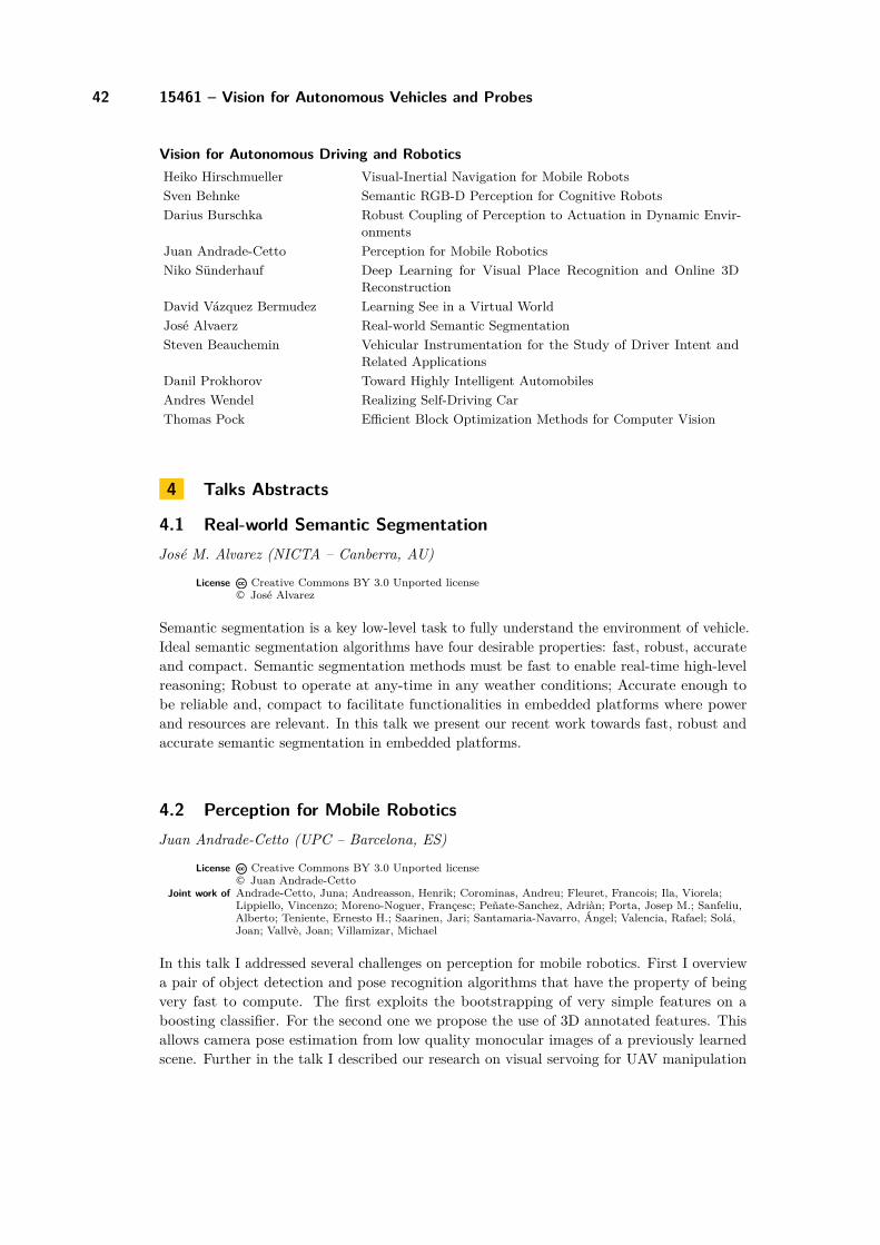
Vision for Autonomous Driving and RoboticsHeiko Hirschmueller Visual-Inertial Navigation for Mobile RobotsSven Behnke Semantic RGB-D Perception for Cognitive RobotsDarius Burschka Robust Coupling of Perception to Actuation in Dynamic Envir-
onmentsJuan Andrade-Cetto Perception for Mobile RoboticsNiko Sünderhauf Deep Learning for Visual Place Recognition and Online 3D
ReconstructionDavid Vázquez Bermudez Learning See in a Virtual WorldJosé Alvaerz Real-world Semantic SegmentationSteven Beauchemin Vehicular Instrumentation for the Study of Driver Intent and
Related ApplicationsDanil Prokhorov Toward Highly Intelligent AutomobilesAndres Wendel Realizing Self-Driving CarThomas Pock Efficient Block Optimization Methods for Computer Vision
4 Talks Abstracts
4.1 Real-world Semantic SegmentationJosé M. Alvarez (NICTA – Canberra, AU)
License Creative Commons BY 3.0 Unported license© José Alvarez
Semantic segmentation is a key low-level task to fully understand the environment of vehicle.Ideal semantic segmentation algorithms have four desirable properties: fast, robust, accurateand compact. Semantic segmentation methods must be fast to enable real-time high-levelreasoning; Robust to operate at any-time in any weather conditions; Accurate enough tobe reliable and, compact to facilitate functionalities in embedded platforms where powerand resources are relevant. In this talk we present our recent work towards fast, robust andaccurate semantic segmentation in embedded platforms.
4.2 Perception for Mobile RoboticsJuan Andrade-Cetto (UPC – Barcelona, ES)
License Creative Commons BY 3.0 Unported license© Juan Andrade-Cetto
Joint work of Andrade-Cetto, Juna; Andreasson, Henrik; Corominas, Andreu; Fleuret, Francois; Ila, Viorela;Lippiello, Vincenzo; Moreno-Noguer, Françesc; Peñate-Sanchez, Adriàn; Porta, Josep M.; Sanfeliu,Alberto; Teniente, Ernesto H.; Saarinen, Jari; Santamaria-Navarro, Ángel; Valencia, Rafael; Solá,Joan; Vallvè, Joan; Villamizar, Michael
In this talk I addressed several challenges on perception for mobile robotics. First I overviewa pair of object detection and pose recognition algorithms that have the property of beingvery fast to compute. The first exploits the bootstrapping of very simple features on aboosting classifier. For the second one we propose the use of 3D annotated features. Thisallows camera pose estimation from low quality monocular images of a previously learnedscene. Further in the talk I described our research on visual servoing for UAV manipulation
Andrés Bruhn and Atsushi Imiya 43
and UAV odometry estimation using tight sensor data fusion. I then proceeded talking aboutmapping for mobile robots, and in particular about using principled information theoreticmetrics to keep the map size tractable. These very same information metrics can also be usedfor optimal navigation, exploration and optimal sensor placement as explained also in thetalk. I concluded the talk with the application of these research results for the autonomousdriving of trucks and heavy load AGVs in cargo container terminals.
References1 V. Ila, J.M. Porta and J. Andrade-Cetto, Information-based compact Pose SLAM, IEEE
Transactions on Robotics, 26(1), 78–93, 2010.2 V. Ila, J.M. Porta and J. Andrade-Cetto, Amortized constant time state estimation in
Pose SLAM and hierarchical SLAM using a mixed Kalman-information filter, Roboticsand Autonomous Systems, 59(5), 310–318, 2011.
3 A. Peñate-Sanchez, J. Andrade-Cetto and F. Moreno-Noguer, Exhaustive linearization forrobust camera pose and focal length estimation, IEEE Transactions on Pattern Analysisand Machine Intelligence, 35(10), 2387–2400, 2013.
4 A. Peñate-Sanchez, F. Moreno-Noguer, J. Andrade-Cetto and F. Fleuret, LETHA: Learningfrom high quality inputs for 3D pose estimation in low quality images, Proc. of 2nd Int’lConf. on 3D Vision:Tokyo, 517–524, 2014.
5 Á. Santamaria-Navarro and J. Andrade-Cetto, Uncalibrated image-based visual servoing,Proc. of 2013 IEEE Int’l Conf. on Robotics and Automation, Karlsruhe, 5247–5252, 2013.
6 Á. Santamaria-Navarro, V. Lippiello and J. Andrade-Cetto, Task priority control for aer-ial manipulation, Proceedings of 2014 IEEE Int’l Symp. on Safety, Security and RescueRobotics, Toyako-cho, 1–6, 2014.
7 Á. Santamaria-Navarro, J. Solá and J. Andrade-Cetto, High-frequency MAV state estima-tion using low-cost inertial and optical flow measurement units, Proc. of 2015 IEEE/RSJInt’l Conf. on Intelligent Robots and Systems:Hamburg, 1864–1871, 2015.
8 E.H. Teniente and J. Andrade-Cetto, HRA∗: Hybrid randomized path planning for complex3D environments, Proc. of 2013 IEEE/RSJ Int’l Conf. on Intelligent Robots and Systems,Tokyo, 1766–1771, 2013.
9 R. Valencia, M. Morta, J. Andrade-Cetto and J.M. Porta. Planning reliable paths withpose SLAM, IEEE Transactions on Robotics, 29(4), 1050-1059, 2013.
10 R. Valencia, J. Saarinen, H. Andreasson, J. Vallvè, J. Andrade-Cetto and A. Llilienthal,Localization in highly dynamic environments using dual-timescale NDT-MCL, Proc. of2014 IEEE Int’l Conf. on Robotics and Automation, Hong Kong, 956–3962, 2014.
11 J. Vallvè and J. Andrade-Cetto, Dense entropy decrease estimation for mobile robot ex-ploration, Proceedings of 2014 IEEE Int’l Conf. on Robotics and Automation, Hong Kong,6083-6089, 2014.
12 J. Vallvè and J. Andrade-Cetto, Potential information fields for mobile robot exploration,Robotics and Autonomous Systems, 69, 68–79, 2015.
13 J. Vallvè and J. Andrade-Cetto, Active Pose SLAM with RRT*, Proc. of 2015 IEEE Int’lConf. on Robotics and Automation, Seattle, 2167–2173, 2015.
14 M. Villamizar, F. Moreno-Noguer, J. Andrade-Cetto and A. Sanfeliu, Efficient rotationinvariant object detection using boosted random Ferns, Proc. of 2010 IEEE CS Conf. onComputer Vision and Pattern Recognition:San Francisco, 1038–1045, 2010.
15 M. Villamizar, J. Andrade-Cetto, A. Sanfeliu and F. Moreno-Noguer, Bootstrapping boos-ted random Ferns for discriminative and efficient object classification, Pattern Recognition,45(9): 3141–3153, 2012.
15461
44 15461 – Vision for Autonomous Vehicles and Probes
4.3 Vehicular Instrumentation for the Study of Driver Intent andRelated Applications
Steven S. Beauchemin (University of Western Ontario – London, CA)
License Creative Commons BY 3.0 Unported license© Steveb S. Beauchemin
In this contribution we describe a vehicular instrumentation for the study of driver intent.Our instrumented vehicle is capable of recording the 3D gaze of the driver and relating itto the frontal depth map obtained with a stereo system in real-time, including the sumof vehicular parameters actuator motion, speed, and other relevant driving parameters.Additionally, we describe other real-time algorithms that are implemented in the vehicle,such as a frontal vehicle recognition system, a free lane space estimation method, and a GPSposition-correcting technique using lane recognition as land marks.
4.4 Recursive Joint Estimation of Dense Scene Structure and CameraMotion in an Automotive Scenario
Florian Becker (Sony – Stuttgart, DE)
License Creative Commons BY 3.0 Unported license© Florian Becker
The optical flow induced by a camera moving through a static 3d scene contains valuableinformation on the geometry. We present an approach to jointly estimating camera motionand a depth map from real-life monocular image sequences which parametrize a flow field.Temporal consistency is exploited in a recursive manner which allows to reduce the estimationtask to a series of two-frame problems complemented by an additional temporal smoothnessprior. Results for image sequences recorded in a real world traffic scenario are presented.
4.5 Semantic RGB-D Perception for Cognitive RobotsSven Behnke (Universität Bonn, DE)
License Creative Commons BY 3.0 Unported license© Sven Behnke
Cognitive robots need to understand their surroundings not only in terms of geometry, butthey also need to categorize surfaces, detect objects, estimate their pose, etc. In the talk, Iwill report on efficient methods to address these tasks, which are based on RGB-D sensors.We learn semantic segmentation using random forests and aggregate the surface category in3D by RGB-D SLAM. We use deep learning methods to categorize surfaces, to recognizeobjects and to estimate their pose. Efficient RGB-D registration methods are the basis forthe manipulation of known objects. They have been extended to non-rigid registration, whichallows for transferring manipulation skills to novel objects.
Andrés Bruhn and Atsushi Imiya 45
4.6 Second-Order Recursive Filtering on the Rigid-Motion GroupSE(3) Based on Nonlinear Observations from Monocular Videos
Johannes Berger (Universität Heidelberg, DE)
License Creative Commons BY 3.0 Unported license© Johannes Berger
Joint camera motion and depth map estimation from observed scene features is a key task inorder to reconstruct 3D scene structure using low-cost monocular video sensors. Due to thenonlinear measurement equations that connect ego-motion with the high-dimensional depthmap and optical flow, the task of stochastic state-space filtering is intractable.
After introducing the overall problem, the talk focuses on a novel second-order minimumenergy approximation that exploits the geometry of SE(3) and recursively estimates the statebased on a higher-order kinematic model and the nonlinear measurements. Experimentalresults for synthetic and real sequences (e.g. KITTI benchmark) demonstrate that ourapproach achieves the accuracy of modern visual odometry methods.
4.7 Robust Coupling of Perception to Actuation in DynamicEnvironments
Darius Burschka (TU München, DE)
License Creative Commons BY 3.0 Unported license© Darius Burschka
I will present methods to represent the state of dynamic environments at a level that is leastsensitive to errors in calibration parameters of the sensors. The method is used for a fail-safeimplementation of instinctive behaviours on vehicles, like obstacle avoidance. The presentedmethod allows a monitoring of large areas around the vehicle, where a Cartesian representationis not appropriate due to the with distance increasing error in the reconstruction of thethree-dimensional information. I will present also the first implementations of this system ona car.
4.8 Direct and Dense Methods for 3D Reconstruction and VisualSLAM
Daniel Cremers (TU München, DE)
License Creative Commons BY 3.0 Unported license© Daniel Cremers
Joint work of Cremers, Daniel; Engel, Jakob; Kerl, Christian; Oswald, Martin R; Stuckler, Jorg; Sturm, Jürgen;Stuhmer, Jan; Usenko, Vladyslav
The reconstruction of the 3D world from images is among the central challenges in computervision. Having started in the 2000s, researchers have pioneered algorithms which canreconstruct camera motion and sparse feature-points in real-time. In my talk, I will presentspatially dense methods for camera tracking and reconstruction. They do not require featurepoint estimation, they exploit all available input data and they recover dense geometry ratherthan sparse point clouds.
15461
46 15461 – Vision for Autonomous Vehicles and Probes
4.9 Pose Estimation and 3D Segmentation using 3D Knowledge inDynamic Environments
Cédric Demonceaux (University of Bourgogne, FR)
License Creative Commons BY 3.0 Unported license© Cédric Demonceaux
When 2D and 3D cameras observe the same scene, their measurements are usually com-plementary to each other for scene reconstruction and understanding. A classic exampleincludes 2D cameras capturing high quality texture information and 3D cameras providingaccurate location of the scene points. Fusing these complementary measurements has manypotential applications such as change detection, scene gaps filling, camera pose correction,and visual odometry. In this talk, we show that the 3D localization of 2D cameras canbe improved knowing 3D structure of the scene. Thus, we develop two methods using 3Dinformation on the scene for camera pose estimation. The first one doesn’t require 3D featureextraction and doesn’t need any geometric hypothesis but it converges in a local optimum.The second one supposes that the scene is composed of planar patches and converges tothe global optimum. Then, this 3D information will be used conjointly with 2D images forextracting and reconstructing the background and the dynamic objects of the scene.
4.10 Learning to DriveMichael Felsberg (Linköping University, SE)
License Creative Commons BY 3.0 Unported license© Michael Felsberg
Driving a car is a prototypical example for graded autonomy, where the human driverand the assistance system co-operate. There are various legal, technological, and practicalreasons why the human driver is kept in the loop and should be able to override the system’sdecisions. However, the co-operation, and thus graded autonomy, should be more than justtaking over power of command. It is desirable that the assistance system seamlessly acquiresnew capabilities during the driver’s manual intervention, in order to increase the level ofautonomy in subsequent operation. Thus, the task for the system is to use input, or precepts,as observed by the human user and output, or actions, as provided by the human user toextend the systems capabilities on the fly. We address this task in the present work andpropose a novel approach to online perception-action learning, which lifts human-machineinteraction clearly beyond current methods based on switching command. We evaluate ourapproach on the problem of road following with a model RC-car on reconfigurable tracksindoors, outdoors, and at night. The system’s capabilities are continuously extended byinterchangeably applying supervised learning (by demonstration), instantaneous reinforcementlearning, and unsupervised learning (self-reinforcement learning). The resulting autonomouscapabilities go beyond those of existing methods and of the human driver with respect tospeed, accuracy, and functionality.
Andrés Bruhn and Atsushi Imiya 47
4.11 Drone Vision – Computer Vision Algorithms for DronesFriedrich Fraundorfer (TU Graz, AT)
License Creative Commons BY 3.0 Unported license© Friedrich Fraundorfer
Drone Vision – Computer Drones are small scale flying robots and it is predicted thatthe drone market will see a major growth in the near future. Computer vision will play amajor role in controlling and developing autonomous drones. My proposal is to utilize tightIMU-vision coupling for ego-motion estimation of drones. This will result in a new class offundamental algorithms for ego-motion estimation, being more robust and lots faster. IMUmeasurements can be used to transform the complex estimation problems into a simplerformulation of vision algorithms for drones.
4.12 Structured Indoor Modeling and/or Uncanny Valley for 3DReconstruction
Yasutaka Furukawa (Washington University – St. Louis, US)
License Creative Commons BY 3.0 Unported license© Yasutaka Furukawa
Depending on how our discussion will go, I will give a talk on one of the following two topicsor a mix.
Structured indoor reconstruction. We propose a novel indoor scene reconstruction al-gorithm. The approach produces a structured 3D model in a top-down manner. Thereconstruction algorithm is driven by a indoor structure grammar. The new model represent-ation enables many new applications such as novel indoor scene visualization, inverse CAD,floorplan generation, and tunable reconstruction.
Uncanny Valley for 3D Reconstruction. Accurate 3D reconstruction is usually the keyto high quality visualization applications. However, very often, improving reconstructionaccuracy degrades the quality of visualization. This issue is little known to researchers, yetvery important in practice.
4.13 Underwater Vision: Robots that “see” beneath the surfaceRafael Garcia (University of Girona, ES)
License Creative Commons BY 3.0 Unported license© Rafael Garcia
Using vision underwater is a difficult endeavor due to the transmission properties of themedium. Light is absorbed and scattered by the particles suspended in the water column,producing degraded images with limited range, blurring, low contrast and weak colours,among other effects. Moreover, artificial lighting tends to provide non-uniform illuminationand introduces shadows in the scene, generating a motion flow that does not obey thedominant motion of the camera.
15461
48 15461 – Vision for Autonomous Vehicles and Probes
However, with the adequate processing pipeline, vision can be a powerful tool for under-water robots to explore the ocean.
In this talk we will explain how computer vision techniques can be adapted to theunderwater environment if we understand and deal with the different associated problems.An approach to create accurate three-dimensional textured models of the seafloor will bepresented. The method de-hazes the images to improve signal-to-noise ratio, then generatesa dense cloud of 3D points and is able to compute a meshed surface being robust to commondefects in underwater imaging such as high percentage of outliers (due to light backscatter)and point-cloud noise (due to the blurring of forward scattering).
4.14 Semantic Maps for High Level Robot NavigationAntonios Gasteratos (Democritus University of Thrace – Xanthi, GR)
License Creative Commons BY 3.0 Unported license© Antonios Gasteratos
In the near future domestic robots should be equipped with the potential of producingmeaningful internal retalks of their own environment, allowing them to cope a wide range ofreal-life tasks. Intense research efforts occur to build cognitive robots able to perceive andunderstand their surroundings in a human-centred manner. Semantic mapping in mobilerobotics can constitute a definite solution for this challenge. The semantic map is an aug-mented representation of the environment that –supplementary to the geometrical knowledge– encapsulates characteristics compatible with human understanding. It provides severalalgorithmic opportunities for innovative development of applications that will eventually leadto the human robot interaction. This talk will describe the construction of accurate andconsistent semantic maps facilitating adequate robot deployment in domestic environments.
4.15 High-level Knowledge in Low-level VisionAndreas Geiger (MPI für Intelligente Systeme – Tübingen, DE)
License Creative Commons BY 3.0 Unported license© Andreas Geiger
1. Stereo techniques have witnessed tremendous progress over the last decades, yet someaspects of the problem still remain challenging today. Striking examples are reflecting andtextureless surfaces which cannot easily be recovered using traditional local regularizers.In this work, we therefore propose to regularize over larger distances using object-category specific disparity proposals (displets) which we sample using inverse graphicstechniques based on a sparse disparity estimate and a semantic segmentation of theimage. The proposed displets encode the fact that objects of certain categories are notarbitrarily shaped but typically exhibit regular structures. We integrate them as non-localregularizer for the challenging object class “car” into a superpixel based CRF frameworkand demonstrate its benefits on the KITTI stereo evaluation.
2. This work proposes a novel model and dataset for 3D scene flow estimation with anapplication to autonomous driving. Taking advantage of the fact that outdoor scenesoften decompose into a small number of independently moving objects, we represent eachelement in the scene by its rigid motion parameters and each superpixel by a 3D plane
Andrés Bruhn and Atsushi Imiya 49
as well as an index to the corresponding object. This minimal representation increasesrobustness and leads to a discrete-continuous CRF where the data term decomposes intopairwise potentials between superpixels and objects. Moreover, our model intrinsicallysegments the scene into its constituting dynamic components. We demonstrate theperformance of our model on existing benchmarks as well as a novel realistic dataset withscene flow ground truth. We obtain this dataset by annotating 400 dynamic scenes fromthe KITTI raw data collection using detailed 3D CAD models for all vehicles in motion.Our experiments also reveal novel challenges which can’t be handled by existing methods.
4.16 Hyperpoints and Fine Vocabularies for Large-Scale LocationRecognition
Michal Havlena (ETH Zürich, CH)
License Creative Commons BY 3.0 Unported license© Michal Havlena
Structure-based localization is the task of finding the absolute pose of a given query imagew.r.t. a pre-computed 3D model. While this is almost trivial at small scale, special care mustbe taken as the size of the 3D model grows, because straight-forward descriptor matchingbecomes ineffective due to the large memory footprint of the model, as well as the strictnessof the ratio test in 3D. Recently, several authors have tried to overcome these problems,either by a smart compression of the 3D model or by clever sampling strategies for geometricverification. Here we explore an orthogonal strategy, which uses all the 3D points and standardsampling, but performs feature matching implicitly, by quantization into a fine vocabulary.We show that although this matching is ambiguous and gives rise to 3D hyperpoints whenmatching each 2D query feature in isolation, a simple voting strategy, which enforces thefact that the selected 3D points shall be co-visible, can reliably find a locally unique 2D-3Dpoint assignment. Experiments on two large-scale datasets demonstrate that our methodachieves state-of-the-art performance, while the memory footprint is greatly reduced, sinceonly visual word labels but no 3D point descriptors need to be stored.
4.17 Visual-Inertial Navigation for Mobile RobotsHeiko Hirschmuller (Roboception GmbH – München, DE)
License Creative Commons BY 3.0 Unported license© Heiko Hirschmuller (Roboception GmbH – München, DE)
Joint work of Hirschmuller, Heiko; Schmid, Korbinian; Suppa, Michael; Lutz, Philipp; Tomic, Teodor; MairElmar
Navigation of mobile robots is still challenging, especially in environments that are notprepared for robotics, like at home or outdoors. At the German Aerospace Center (DLR)we have developed passive stereo-vision based navigation that is supported by an inertialmeasurement unit (IMU). The ego-motion estimation is precise due to visual odometry,robust due to the IMU and fulfils hard-real time constraints for using it directly in the controlloop of robots, like for autonomously flying highly agile quadcopters. Several experimentswith rovers and flying systems in mixed indoor/outdoor settings proved the concept.
15461
50 15461 – Vision for Autonomous Vehicles and Probes
In the DLR spin-off Roboception GmbH we are going to bring such technology as plugand play device into the marked. The talk covers the main concepts and new developments.One of them is the extension of the Semi-Global Matching method for delivering not justdisparity, but also error and confidence values for each pixel. The error is given in disparitiesand has a value of 0.5 for most of the pixels, but can go up to 2. The confidence is theprobability that the true disparity is within a three times error interval around the measureddisparity. Thus, the error is seen as the standard deviation of an Gaussian error, while theconfidence is the probability that the measured value is not an outlier.
References1 Heiko Hirschmuller, Korbinian Schmid and Michael Suppa, Computer vision for mobile
robot navigation, Proceedings of Photogrammetric Week 2015:Stuttgart, 143–154, 2015.2 Korbinian Schmid, Philipp Lutz, Teodor Tomic, Elmar Mair and Heiko Hirschmuller,
Autonomous vision-based micro air vehicle for indoor and outdoor navigation, Journalof Field Robotics, Special Issue on Low Altitude Flight of UAVs, 31(4), 537–570 2014.
3 Heiko Hirschmuller, Stereo Processing by semi-global matching and mutual information,IEEE Transactions on Pattern Analysis and Machine Intelligence, 30(2), 328–341, 2008.
4.18 Planetary Robotic Vision Processing for Rover MissionsBen Huber (Joanneum Research – Graz, AT)
License Creative Commons BY 3.0 Unported license© Ben Huber
The international community of planetary science and exploration has successfully launched,landed and operated about thirty human and robotic missions to the planets and the Moon.They have collected differing numbers of surface imagery that have only been partiallyutilized throughout these missions and thereafter for further scientific application purposes.The data for most of these missions including meta-data is publicly available. Many of thementioned missions rely on stereo imagery for navigation and offer huge datasets that can bereconstructed in 3D and put into a common coordinate context. By doing this we generatedatasets with a huge benefit for scientific geological analysis in rendered 3D space based onmission data that has been almost forgotten in planetary data archives.
The research leading to these results has received funding from the European Com-munity’s Seventh Framework Programme (FP7/2007-2013) under grant agreement n◦ 312377PRoViDE.
4.19 Model-based Object and Deformation Tracking with RobustGlobal Optimization
Reinhard Koch (Universität Kiel, DE)
License Creative Commons BY 3.0 Unported license© Reinhard Koch
Model-based analysis, also termed Analysis-by-Synthesis or Analysis from Generative models,is a powerful tool to solve ill-posed problems like 3D object surface tracking from images. Aparametric model of the object in focus is generated and the visual appearance and motion
Andrés Bruhn and Atsushi Imiya 51
of the object is synthesized from the model and compared with the visual input by a costor fitness function. Adapting the model parameters according to the cost function solvesthe tracking problem. In order to cope with possibly high-dimensional parameter space,efficient and robust non-local stochastic estimators are needed. In my talk I will outline theAbS principle and discuss the optimizer and applications. Examples are tracking of multipleanimals in confined housing, deformation of thin plate models for human user interaction,and others.
4.20 Image based Navigation for Exploration ProbeTakashi Kubota (ISAS/JAXA, JP)
License Creative Commons BY 3.0 Unported license© Takashi Kubota
This talk firstly introduces future lunar or planetary exploration plans, which consist of lunar,Mars and asteroid exploration. Then robotics technology is shown for lunar or planetaryexploration. Vision system makes important roles in deep space exploration for efficient andsafe exploration. This talk presents the intelligent system for navigation, path planning,sampling, etc. Especially image based navigation schemes are presented in detail.
4.21 Stereo Vision for Future Autonomous Space Exploration RobotsLazaros Nalpantidis (Aalborg University Copenhagen, DK)
License Creative Commons BY 3.0 Unported license© Lazaros Nalpantidis
Space exploration rovers need to be highly autonomous because the vehicle should spendas much of its traverse time as possible moving, rather than waiting for delayed and ofteninterrupted teleoperation commands. Autonomous behavior can be supported by visionsystems that provide wide views to enable navigation and 3D reconstruction, as well asclose-up views ensuring safety and providing reliable odometry data.
This talk presents the design, development and testing of such a stereo vision system fora space exploration rover. This system was designed with the intention of being efficient,low-cost, accurate and was ultimately implemented on an FPGA platform. We are discussingour experiences with this system and highlight useful lessons learned.
4.22 Structure and Motion – Challenges and solutions for real timegeometric estimation from video
Mikael Persson (Linköping University, SE)
License Creative Commons BY 3.0 Unported license© Mikael Persson
In this talk I introduce the cv4x SfM system, which achieved state of the art results on thechallenging KITTI odometry benchmark earlier this year(2015). I motivate the choice inreconstruction method, the bootstrap tracking by matching scheme used and how perceptual
15461
52 15461 – Vision for Autonomous Vehicles and Probes
aliasing was addressed. Visual odometry systems such as cv4x, in particular if fused with astrong loop closure system, achieve excellent and more importantly sufficient results, butseveral challenges remain: The trajectory prediction of independently moving objects is ofparticular interest in autonomous driving and is principally, if not practically, the sameproblem as IMU-free VO and as such my current focus of research.
4.23 Efficient Block Optimization Methods for Computer VisionThomas Pock (TU Graz, AT)
License Creative Commons BY 3.0 Unported license© Thomas Pock
In this talk I will discuss recent advances in block optimization methods for minimizingnon-smooth optimization problems in computer vision and image processing. It turns outthat a large class of 2D and 3D total-variation regularized problems can be reduced to analgorithm that computes exact solutions with respect to certain subsets of the variables ineach iteration. For example, if the subsets are 1D total variation problems, we can efficientlycompute their solutions based on dynamic programming. Furthermore, we can make useof gradient acceleration techniques to additionally speed up the algorithms. I will showapplications to computing globally optimal minimizers of total variation regularized stereoproblems.
4.24 Toward Highly Intelligent AutomobilesDanil V. Prokhorov (Toyota Research Institute North America – Ann Arbor, US)
License Creative Commons BY 3.0 Unported license© Danil V. Prokhorov
Intelligent automobiles a.k.a. self-driving, autonomous or highly automated cars are capturingpeople’s imagination while opening up new opportunities for research in many areas includingrobotics, machine learning and vision. In my talk I overview the state of art in highlyautomated cars and discuss an example of near-production AHDA car of Toyota, as well asmy personal experience with ACC-equipped vehicles. Then I discuss an example of on-goingresearch project of a car capable of making a variety of autonomous decisions on public roads,with the focus on the roundabout maneuver. This maneuver illustrates an importance of theholistic perception-action system approach, rather than module-by-module considerationsstill prevalent in this field. In conclusion I offer my view of open challenges for intelligentautomobiles.
Andrés Bruhn and Atsushi Imiya 53
4.25 Efficient Multi-view Semantic SegmentationHayko Riemenschneider(ETH Zürich, CH)
License Creative Commons BY 3.0 Unported license© Hayko Riemenschneider
There is an increasing interest in semantically annotated 3D models, e.g. of cities. The typicalapproaches start with the slow semantic labelling of all the images used for the 3D model.The inherent redundancy among the overlapping images calls for more efficient solutions.This work deals with two an alternative approaches. First, we exploit the geometry of a 3Dmesh model to predict the best view before the actual labelling. For this we find the singleimage part that bests supports the correct semantic labelling of each face of the underlying3D mesh. Second, we directly use the 3D point cloud itself, skipping any image processingentirely. This pure 3D approach relies solely on 3D surface features (and a bit of classic RGB)and provides state-of-the-art results without any heavy 2D image features. In both works weshow how to significantly speedup the semantic segmentation and even increase the accuracy– leaving the question – how much of 2D images is needed for 3D semantic segmentation?
4.26 The Limits of Pose Estimation in Very Large MapsTorsten Sattler (ETH Zürich, CH)
License Creative Commons BY 3.0 Unported license© Torsten Sattler
In many applications of autonomous vehicles, we can safely assume that there exists a 3D mapof the scene the vehicle operates in, which can be used for navigation and localization. Onemajor problem of maps covering a very large area is that they contain many structures withglobally repeating appearance, causing problems when trying to match structures between aquery image and the map. Common large-scale localization approaches operate under theassumption that we can recover the pose of the query image as long as we find enough goodmatches and as long as the pose estimation process is robust enough to large quantities ofwrong matches. Unfortunately, current pose estimation strategies have problems dealingwith too many matches. In this talk, I will discuss a truly scalable pose estimation strategy.Using this strategy, we will show that there are limits to the approach of just using moreand more matches and hoping that pose estimation will be able to recover the correct pose.
4.27 From Frames to Events: Vision for High-speed RoboticsDavide Scaramuzza (Universität Zürich, CH)
License Creative Commons BY 3.0 Unported license© Davide Scaramuzza
Autonomous micro drones will soon play a major role in search-and-rescue and remote-inspection missions, where a fast response is crucial. They can navigate quickly throughunstructured environments, enter and exit buildings through narrow gaps, and fly throughcollapsed buildings. However, their speed and maneuverability are still far from those ofbirds. Indeed, agile navigation through unknown, indoor environments poses a number of
15461
54 15461 – Vision for Autonomous Vehicles and Probes
challenges for robotics research in terms of perception, state estimation, planning, and control.In this talk, I will give an overview of my research activities on visual inertial navigation ofquadrotors, from slow navigation (using standard frame-based cameras) to agile flight (usingevent-based cameras).
4.28 Towards 3D Scene UnderstandingBernt Schiele (MPI für Informatik – Saarbrücken, DE)
License Creative Commons BY 3.0 Unported license© Bernt Schiele
Inspired by the ability of humans to interpret and understand 3D scenes nearly effortlessly, theproblem of 3D scene understanding has long been advocated as the "holy grail" of computervision. In the early days this problem was addressed in a bottom-up fashion without enablingsatisfactory or reliable results for scenes of realistic complexity. In recent years there hasbeen considerable progress on many sub-problems of the overall 3D scene understandingproblem. As the performance for these sub-tasks starts to achieve remarkable performancelevels we argue that the problem to automatically infer and understand 3D scenes should beaddressed again.
This talk highlights recent progress on some essential components (such as object recog-nition and person detection), on our attempt towards 3D scene understanding, as well as onour work towards activity recognition and the ability to describe video content with naturallanguage. These efforts are part of a longer-term agenda towards visual scene understanding.While visual scene understanding has long been advocated as the “holy grail” of computervision, we believe it is time to address this challenge again, based on the progress in recentyears.
4.29 Tracking and Mapping in Project TangoJürgen Sturm (Google – München, DE)
License Creative Commons BY 3.0 Unported license© Jürgen Sturm
Google’s Project Tango aims to provide a mobile solution for visual-inertial 6-DOF motionestimation and dense 3D reconstruction. In my talk, I will give a technical presentation ofthe algorithms underlying the Tango API, including visual-inertial odometry, SLAM, loopclosure detection, re-localization and 3D reconstruction. During my talk, I will presentseveral live demos on a Tango tablet.
Andrés Bruhn and Atsushi Imiya 55
4.30 Deep Learning for Visual Place Recognition and Online 3DReconstruction
Niko Sünderhauf (Queensland University of Technology – Brisbane, AU)
License Creative Commons BY 3.0 Unported license© Niko Sünderhauf
In the first part of this talk I will summarize our recent work on visual place recognition inchanging environments using deep convolutional network features.
In the second part I talk about some lessons learned when applying ConvNets in robotics(e.g. for object detection on a mobile robot) and the gaps between the computer visioncommunity and robotics in that particular area. I hope to induce a discussion on what we asa community can do to bridge this gap.
4.31 Large-scale Visual Place Recognition – Current challengesAkihiko Torii (Tokyo Institute of Technology, JP)
License Creative Commons BY 3.0 Unported license© Akihiro Torii
Large-scale visual place recognition (VPR) takes an important role for localization of robotsand autonomous cars, e.g. rough initial localization. In this seminar, we first compare keyproperties of compact image descriptors – Bag of Visual Words (BoVW) and Vector of LocallyAggregated Descriptors (VLAD) – popularly used in VPR. On top of the decent analysisof these image retalks, we discuss challenges in VPR, e.g. repetition, illumination changes,change of seasons, and aging that give major appearance changes among testing-query anddatabase images. We show that the adaptive soft-assignment scheme on BoVW is effectiveon the street-level visual place recognition. We also show dense feature detection followedby VLAD representation gives a significant improvement in localization performance andexpanding the database by view synthesis gives an additional gain on the challenging datasets.
4.32 3D Scene Understanding for Autonomous DrivingRaquel Urtasun (University of Toronto, CA)
License Creative Commons BY 3.0 Unported license© Raquel Urtasun
Developing autonomous systems that are able to assist humans in everyday’s tasks is one ofthe grand challenges in modern computer science. Notable examples are personal robotics forthe elderly and people with disabilities, as well as autonomous driving systems which can helpdecrease fatalities caused by traffic accidents. In order to perform tasks such as navigation,recognition and manipulation of objects, these systems should be able to efficiently extract3D knowledge of their environment. In this talk, I’ll show how graphical models provide agreat mathematical formalism to extract this knowledge. In particular, I’ll focus on a fewexamples, including 3D reconstruction, 3D object and layout estimation and self-localization.
15461
56 15461 – Vision for Autonomous Vehicles and Probes
4.33 Direct SLAM Techniques for Vehicle Localization andAutonomous Navigation
Vladyslav Usenko (TU München, DE)
License Creative Commons BY 3.0 Unported license© Vladyslav Usenko
Joint work of Cremers, Daniel; Engel, Jakob; Jorg Stuckler, Jorg; von Stumberg, Lukas; Usenko, Vladyslav
Localization and mapping are two very important challenges for autonomous vehicles. Eventhough many different types of sensors can be used for this purpose, camera based solutionsgain popularity because of the low costs, small weight and simple mechanical design. Inmy talk I present several extensions to the LSD-SLAM – camera based large-scale directsemi-dense slam method, that enable reliable operation on the real-world data from thevehicles. In particular, I present an extension of the method to the stereo-camera setupand tight integration with Inertial Measurement Unit, and demonstrate an autonomousexploration and control on a consumer grade flying robot.
4.34 Learning See in a Virtual WorldDavid Vázquez Bermudez (Autonomous University of Barcelona, ES)
License Creative Commons BY 3.0 Unported license© David Vázquez Bermudez
The ADAS group from the Computer Vision Center based at the Universitat Autònoma deBarcelona, has an extensive experience developing ADAS systems such as Lane DepartureWarning, Collision Warning, Automatic Cruise Control, Pedestrian Protection, HeadlightsControl, etc. Currently ADAS is developing an Autonomous Vehicle based on relativelycheap sensors such cameras, IMU and GPS. In this talk we will give a short overview of theADAS systems developed until now by the group and the Autonomous Vehicle project. Thenwe will explain in more detail two parts of the autonomous vehicle that has been awarded bythe IEEE Intelligent Transportation Systems Society Spanish Chapter. The use of virtualimages to training models that are able to operate in a real world (Best Ph.D. Thesis award)and a vehicle localization system based on GPS, IMU and cameras (Accesit M.Sc award).
4.35 Realizing Self-Driving CarAndres Wendel (Google Inc. – Mountain View, US)
License Creative Commons BY 3.0 Unported license© Andreas Wendel
Self-driving vehicles are coming. They will save lives, save time and offer mobility to thosewho otherwise don’t have it. Eventually they will reshape the world we live in. A dedicatedteam at Google has spent the last few years moving self-driving vehicles closer to reality.New algorithms, increased processing power, innovative sensors and massive amounts of dataenable our vehicles to see further, understand more and handle a wide variety of challengingdriving scenarios. Our vehicles have driven over a million miles on highways, suburban andurban streets. Through this journey, we’ve learned a lot; not just about how to drive, butabout interacting with drivers, users and others on the road, and about what it takes to
Andrés Bruhn and Atsushi Imiya 57
bring an incredibly complex system to fruition. In my talk, I share some insights in how thetechnology works, how we have rolled out our new prototype vehicles to public roads, andwhich edge case situations we have to solve.
5 Working groups
5.1 SensingEditor: Andrés BruhnTopic: Low-Level Sensing
5.1.1 Workgroup members in alphabetical order
Andrés Bruhn (Universität Stuttgart, DE)Florian Becker (Sony – Stuttgart, DE)Johannes Berger (Universität Heidelberg, DE)Darius Burschka (TU München, DE)Ben Huber (Joanneum Research-Graz, AT)Reinhard Koch (Universität Kiel, DE)Lazaros Nalpantidis (Aalborg University Copenhagen, DK)Thomas Pock (TU Graz, AT)
5.1.2 Discussion Summary
This working group discussed aspects of low-level sensing methods for autonomous vehiclesand probes. While most systems for autonomous driving rely on the same types of modules –e.g. algorithms for motion estimation, stereo reconstruction, and scene flow computation –those modules are typically designed and evaluated separately from the remaining system.Evidently, this makes it difficult to integrate feedback in terms of scene understanding,which would be likely to improve the robustness of such algorithms in difficult situations,i.e. under adverse weather conditions. Moreover, the learning of suitable models or modelcomponents for specific scenarios is becoming increasingly important as the integration ofpreviously learned priors may improve the quality of the algorithms as well. Also from anevaluation viewpoint, there is a clear need for improvement. Currently there is a clear lackof suitable benchmarks to evaluate the quality of vision algorithms for autonomous driving.While there are at least some benchmarks that can be used to evaluate the performance oflow-level algorithms separately (e.g. the KITTI Benchmark Suite), it remains unclear whichaccuracy and robustness demands complex systems for autonomous driving actually havew.r.t. to the performance of their underlying modules. Hence it is hardly possible to predictthe performance and robustness of such methods for real applications such as autonomousdriving. Finally, the use of different hardware for image acquisition may significantly improveboth performance and speed of low-level algorithms. One the one hand, one may considerthe use of high speed cameras to avoid ambiguous large displacements which still pose aproblem for most applications. On the other hand, it may be worthwhile to investigate theusefulness of “differential” cameras that allow an reduction of the processed data by onlyproviding information in terms of image changes. In detail, the following research questionshave been discussed:
15461
58 15461 – Vision for Autonomous Vehicles and Probes
How can low-level models be further improved?flexible system design (modules) vs. robustness (high level knowledge).however: jointly solving strongly related tasks may improve performance.need of joint modelling and inference in terms of holistic approaches.moreover: learning of model components based on given application.
How can benchmarking be improved towards practical relevance?in practice: absolute accuracy not that important.algorithm must be “sufficiently accurate” for a certain application.evaluation as part of the entire vision system.robustness matters: determine breaking point under certain degradations.
How can the image acquisition process be improved?in general: higher frame rates desirable for motion estimation.simpler algorithms sufficient → faster computation.less complex motion, smaller displacements → higher accuracy.
What are suitable representations when extracting information?typically: not all pixels needed for making decisions.only consider locations that deviate from expected behaviour(e.g. intensity changes, deviations from high-level models).“differential” cameras (e.g. event cameras).
5.2 Mapping for Autonomous Vehicles and ProbesEditor: Hayko RiemenschneiderTopic: Offline Mapping
5.2.1 Workgroup members in alphabetical order
Yasutaka Furukawa (Washington University St. Louis, US)Antonios Gasteratos (Democritus University of Thrace – Xanthi, GR)Michal Havlena (ETH Zürich, CH)Hayko Riemenschneider (ETH , Zürich, CH)Torsten Sattler (ETH Zürich, CH)Akihiko Torii (Tokyo Institute of Technology, JP)Vladyslav Usenko (TU München, DE)
5.2.2 Discussion Summary
The what, where, when, how, and who of mapping. This working group defined map-ping as the process to create (offline/online) environment maps including road an urbanenvironment, lane markings and traffic symbols as well as dynamic obstacles like pedestriansor weather conditions. One main topic is the distinction between offline prior mapping andonline mapping. The group concluded that the hard cases, those which currently pose themost challenges (dynamic objects and up to date information), can only be solved in onlinemapping whereas offline mapping can provide a solid environment yet by definition willalways be out of date. Hence, the question arises of the use cases for offline mapping, e.g.route navigation planning.
Andrés Bruhn and Atsushi Imiya 59
How to technically create environment maps?offline mapping will benefits from the richness of all sensors (vision, LIDAR, etc).online mapping also, yet for real time purposes needs specializations (instant LIDARresults vs stixel like abstractions).transfer manual annotation from 2D to 3D or vice versa, needed for guarantee on quality.define levels of details for roads, surroundings and buildings.formalism of maps, structures, relationships of contents in there (roads are connecting).
When to create environment maps?temporally changing maps, need for continuously updating.integrating visual information acquired by different companies, people, cars, ...collecting data, by own cars, taxi, trams, community services.how fast should be the update vs on the drive will always be fastest.how to integrate multimodal data coming apart from visual data.long term changes, building construction.short term changes, e.g. parking cars, construction sites, people movement updating mapsgive more useful prior information for autonomous driving/routing, e.g. once constructionsigns found, we have no need to drive there.other important issues: security, redundancy, fall back of the map creation.
Who is responsible for the creation of maps?service levels agreement for quality.will there be a uniform/standard format of global map?consortium of car companies and users to define these standards no common maps sincebusiness model. coverage of the countries in terms of where are maps needed and to whatdetail.accuracy of the maps w.r.t. coverage, not everywhere is a cm/time accuracy needed.crowdsourcing for every car.human control and verification of structural changes (suggested by vision, LIDAR).
Where and what is included in the environment maps?we should know limitations of online/offline mapping!what is the difference between online/offline mapping?online: annotation, change detection → impossible to do online. only the surroundingareas.only does simple dynamic obstacles/events detection (no understanding what it is).what if non standard events happen. if the roads are covered by bus. deadlock situation.offline: semantics: soft not binary decision: continuous occlusion space and object classes.classifiers on actions/intent of others, to allow high level interpretation when breakingrules.
15461
60 15461 – Vision for Autonomous Vehicles and Probes
5.3 Beyond Deep LearningEditor: Michael FelsbergTopic: Deep Learning
5.3.1 Workgroup members in alphabetical order
Andreas Geiger (MPI für Intelligente Systeme – Tübingen, DE)Atsushi Imiya (Chiba University, JP)Bernt Schiele (MPI für Informatik – Saarbrücken, DE)José M. Alvarez (NICTA – Canberra, AU)Jürgen Sturm (Google – München, DE)Michael Felsberg (Linköping University, SE)Niko Sünderhauf (Queensland University of Technology – Brisbane, AU)Rafael Garcia (University of Girona, ES)Raquel Urtasun (University of Toronto, CA)Sven Behnke (Universität Bonn, DE)
5.3.2 Discussion Summary
Recurrent and Dynamic Networks with Structural Models. Future work will have toaddress procedural fundamentals of the learning algorithm and the network:
How to realize deep learning of recurrent networks?How to realize networks that learn layered dynamic processes?How to regularize with known structural and geometrical models?How to enforce invariance beyond shift invariance?How to inject hard constraints?
These issues establish an engineering – understanding trade-off. Advanced visualizations andmodelling of solution manifolds are required for future progress.
Learning Process and Training Data. It has been reflected that previous research oftenevaluated sub-tasks, such as detection or recognition, instead of system-level performance.The latter will, in most cases, require embodiment and thus perception-action learning.Future challenges will include:
How to perform reinforcement learning on deep networks?How to generate training data with sufficient volume and quality?How to synthesize and augment data?How to regularize learning with known stochastic models to avoid overfitting?How to assess performance on system-level tasks in relation to other techniques such asrandom forests?
These issues establish a major challenge on the empirical analysis of deep learning. Anevaluation methodology has to be developed to assess progress properly.
Andrés Bruhn and Atsushi Imiya 61
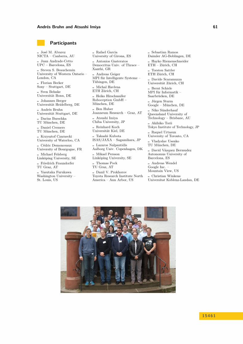
Participants
José M. AlvarezNICTA – Canberra, AU
Juan Andrade-CettoUPC – Barcelona, ES
Steven S. BeaucheminUniversity of Western Ontario –London, CA
Florian BeckerSony – Stuttgart, DE
Sven BehnkeUniversität Bonn, DE
Johannes BergerUniversität Heidelberg, DE
Andrés BruhnUniversität Stuttgart, DE
Darius BurschkaTU München, DE
Daniel CremersTU München, DE
Krzysztof CzarneckiUniversity of Waterloo, CA
Cédric DemonceauxUniversity of Bourgogne, FR
Michael FelsbergLinköping University, SE
Friedrich FraundorferTU Graz, AT
Yasutaka FurukawaWashington University –St. Louis, US
Rafael GarciaUniversity of Girona, ES
Antonios GasteratosDemocritus Univ. of Thrace –Xanthi, GR
Andreas GeigerMPI für Intelligente Systeme –Tübingen, DE
Michal HavlenaETH Zürich, CH
Heiko HirschmullerRoboception GmbH –München, DE
Ben HuberJoanneum Research – Graz, AT
Atsushi ImiyaChiba University, JP
Reinhard KochUniversität Kiel, DE
Takashi KubotaISAS/JAXA – Sagamihara, JP
Lazaros NalpantidisAalborg Univ. Copenhagen, DK
Mikael PerssonLinköping University, SE
Thomas PockTU Graz, AT
Danil V. ProkhorovToyota Research Institute NorthAmerica – Ann Arbor, US
Sebastian RamosDaimler AG-Boblingen, DE
Hayko RiemenschneiderETH – Zürich, CH
Torsten SattlerETH Zürich, CH
Davide ScaramuzzaUniversität Zürich, CH
Bernt SchieleMPI für Informatik –Saarbrücken, DE
Jürgen SturmGoogle – München, DE
Niko SünderhaufQueensland University ofTechnology – Brisbane, AU
Akihiko ToriiTokyo Institute of Technology, JP
Raquel UrtasunUniversity of Toronto, CA
Vladyslav UsenkoTU München, DE
David Vázquez BermudezAutonomus University ofBarcelona, ES
Andreas WendelGoogle Inc. –Mountain View, US
Christian WinkensUniversitat Koblenz-Landau, DE
15461