Embed Size (px)
Citation preview

REMOTE SENSING DATA DISTRIBUTION POLICY
INDONESIA EXPERIENCE
Dedi Irawadi Director of
Remote Sensing Technology and Data Center LAPAN
Kuala Lumpur, September 30, 2015
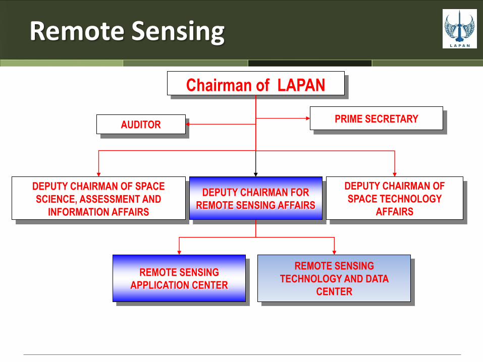
Remote Sensing
Chairman of LAPAN
PRIME SECRETARY AUDITOR
DEPUTY CHAIRMAN FOR
REMOTE SENSING AFFAIRS
DEPUTY CHAIRMAN OF
SPACE TECHNOLOGY
AFFAIRS
DEPUTY CHAIRMAN OF SPACE
SCIENCE, ASSESSMENT AND
INFORMATION AFFAIRS
REMOTE SENSING
APPLICATION CENTER
REMOTE SENSING
TECHNOLOGY AND DATA
CENTER

National Policy on Remote Sensing
Presidential Special Instructions : INPRES No. 6 Tahun 2012
Indonesian Space Law : UU RI No. 21 Tahun 2013 tentang Keantariksaan

Presidential Special Instruction
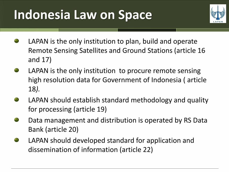
Indonesia Law on Space
LAPAN is the only institution to plan, build and operate Remote Sensing Satellites and Ground Stations (article 16 and 17)
LAPAN is the only institution to procure remote sensing high resolution data for Government of Indonesia ( article 18).
LAPAN should establish standard methodology and quality for processing (article 19)
Data management and distribution is operated by RS Data Bank (article 20)
LAPAN should developed standard for application and dissemination of information (article 22)
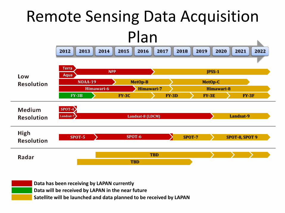
Remote Sensing Data Acquisition Plan
SPOT-8, SPOT 9 SPOT-7 SPOT-6
Landsat-9 Landsat-8 (LDCM)
Himawari-8 Himawari-7
JPSS-1
MetOp-C
NPP
MetOp-B
2012 2013 2014 2015 2016 2017 2018 2019 2020 2021 2022
Terra
Aqua
NOAA-19
Himawari-6
SPOT-4
Landsat-7
SPOT-5
TBD
TBD
FY-3F FY-3E FY-3D FY-3C FY-3B
Data has been receiving by LAPAN currently
Data will be received by LAPAN in the near future
Satellite will be launched and data planned to be received by LAPAN
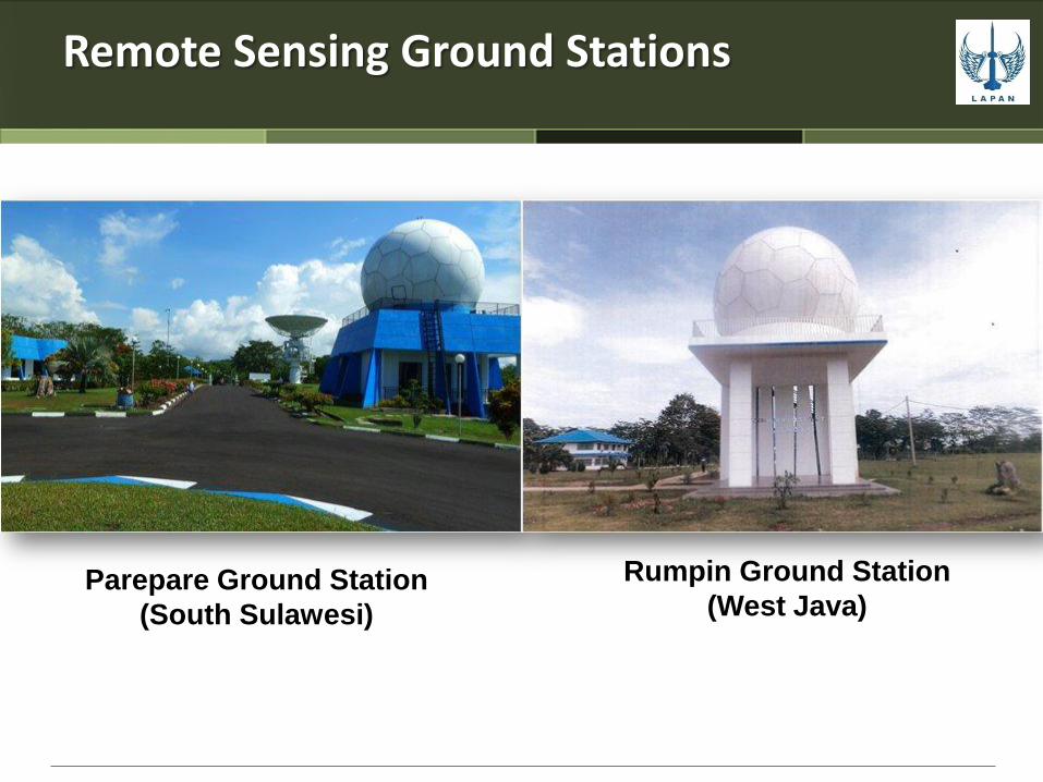
Remote Sensing Ground Stations
Parepare Ground Station
(South Sulawesi)
Rumpin Ground Station
(West Java)

Ground station footprints
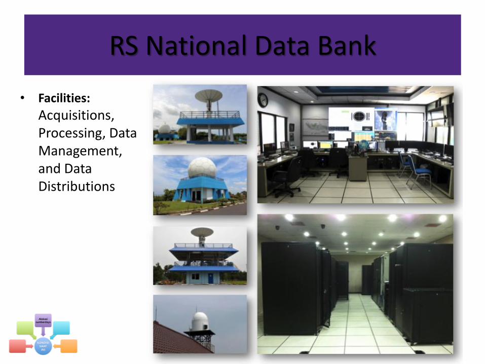
RS National Data Bank
• Facilities:
Acquisitions, Processing, Data Management, and Data Distributions

Data acquired at LAPAN’s Remote Sensing Ground Stations
Aqua
Landsat-8
SPOT-5
SPOT-6
Terra
Landsat-7
A
High Res.
• Terra/Aqua
• NPP
• NOAA-18/19
• Metop
• MTSAT-1R
B
Medium Res.
• Landsat-7
• Landsat-8
C
High Res.
• SPOT-6
• SPOT-7
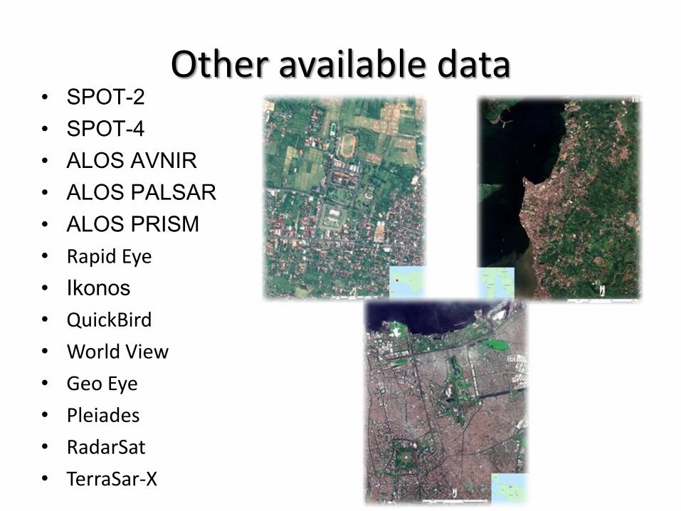
Other available data • SPOT-2
• SPOT-4
• ALOS AVNIR
• ALOS PALSAR
• ALOS PRISM
• Rapid Eye
• Ikonos
• QuickBird
• World View
• Geo Eye
• Pleiades
• RadarSat
• TerraSar-X

Terra/Aqua MODIS catalog

Landsat-5/7/8 data catalog
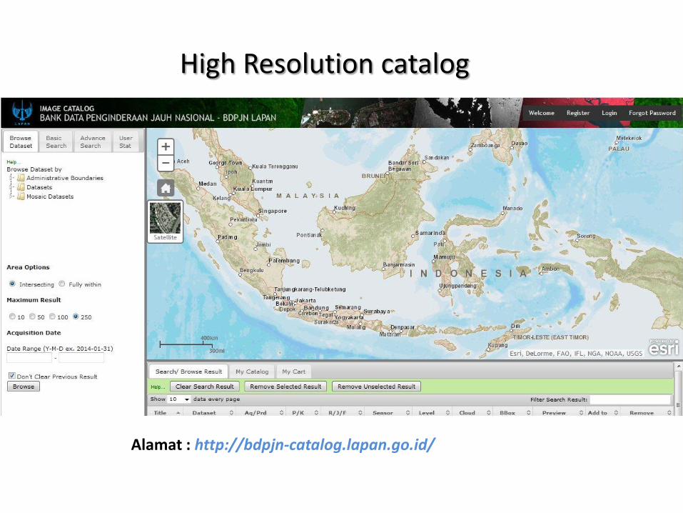
High Resolution catalog
Alamat : http://bdpjn-catalog.lapan.go.id/
Remote Sensing Application Activities High Resolution

Mount Sinabung (SPOT6 23 Sep 2013)
Volcanic mountains monitoring
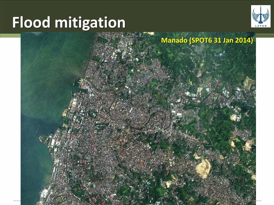
Flood mitigation Manado (SPOT6 31 Jan 2014)

Forest Fire SPOT-6 (res. 1.5m) Siak, Riau (18 Jun 2013)

Environment
Kapuas Kalteng
(Citra SPOT6, 5 Mei 2013)

Mining activities Tambang Freeport (Citra SPOT6, 6 Okt 2013)

Mapping for taxation (1)
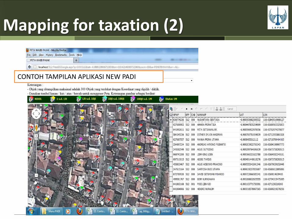
CONTOH TAMPILAN APLIKASI NEW PADI
Mapping for taxation (2)

Medium Resolution
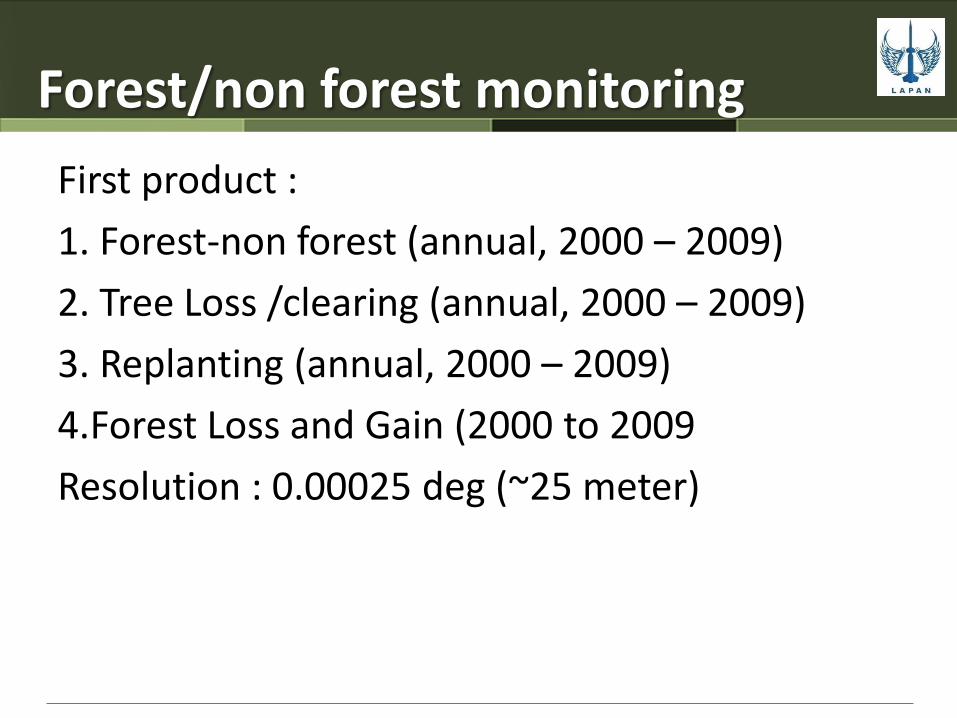
Forest/non forest monitoring
First product :
1. Forest-non forest (annual, 2000 – 2009)
2. Tree Loss /clearing (annual, 2000 – 2009)
3. Replanting (annual, 2000 – 2009)
4.Forest Loss and Gain (2000 to 2009
Resolution : 0.00025 deg (~25 meter)

Forest cover loss and gain (Indonesia, 2000-2009)

Forest cover loss and gain (Sumatera, 2000-2009)
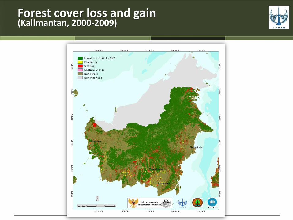
Forest cover loss and gain (Kalimantan, 2000-2009)

Forest cover loss and gain (Sulawesi and Maluku, 2000-2009)

Forest cover loss and gain (Papua, 2000-2009)

Forest cover loss and gain (Java, 2000-2009)

Forest cover loss and gain (Nusa Tenggara, 2000-2009)

Low Resolution

Forest Fire Monitoring (1)
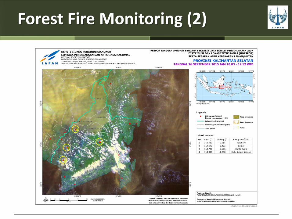
Forest Fire Monitoring (2)
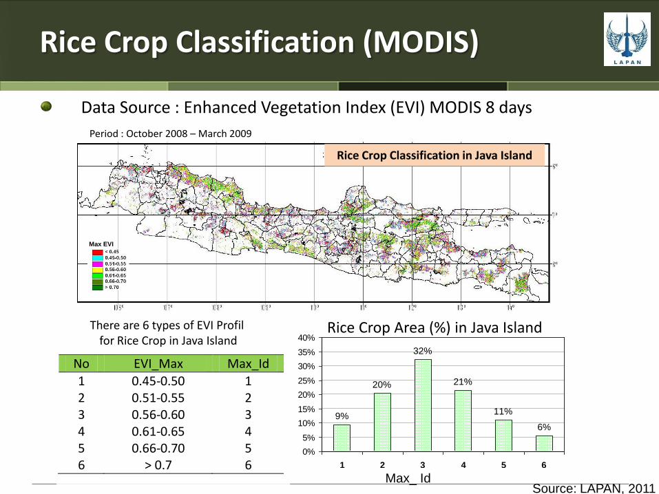
Rice Crop Classification (MODIS)
Data Source : Enhanced Vegetation Index (EVI) MODIS 8 days
Rice Crop Classification in Java Island
Max EVI
Period : October 2008 – March 2009
No EVI_Max Max_Id
1 0.45-0.50 1 2 0.51-0.55 2 3 0.56-0.60 3 4 0.61-0.65 4 5 0.66-0.70 5 6 > 0.7 6
Persentase Luas Kelas Padi Sawah di P.Jawa
9%
20%
32%
21%
11%
6%
0%
5%
10%
15%
20%
25%
30%
35%
40%
1 2 3 4 5 6
Klas Lahan Sawah Berdasarkan EVI Max
% Sawah
Max_ Id
Rice Crop Area (%) in Java Island There are 6 types of EVI Profil for Rice Crop in Java Island
Source: LAPAN, 2011

Rice Crop Growth Model
Vegetative Phase Generative Phase
Early planting: EVI <= 0.2
Harvest
Day after planting
Example of Rice Crop Growth Profile for Max EVI >0.7
VEGETATIVE PHASE:
YVegetative = 151.868 + 0.4857 X + 0.0289 X2 -0.0003 X3
(R2 = 97.2 %, Standart error= 4.37)
GENERATIVE PHASE:
YGenerative = 122.19 + 5.581 X - 0.0887 X2 + 0.0004 X3
(R2 = 99.3 %, Standart error= 2.13)
Data Source : Enhanced Vegetation
Index (EVI) MODIS 8 days
Source: LAPAN, 2011
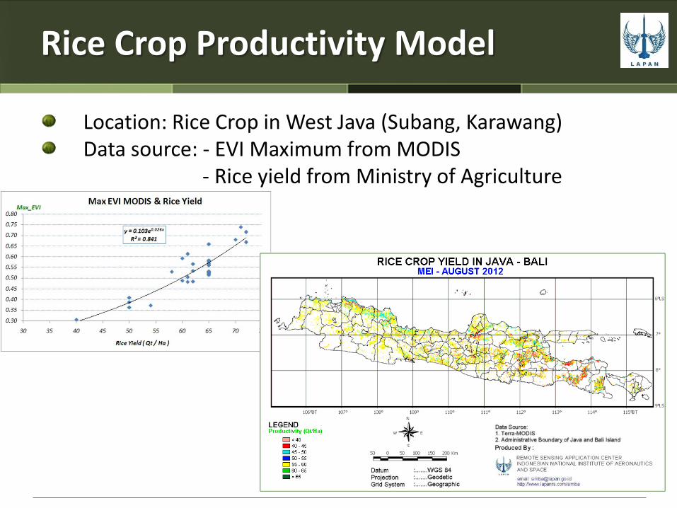
Rice Crop Productivity Model
Location: Rice Crop in West Java (Subang, Karawang) Data source: - EVI Maximum from MODIS
- Rice yield from Ministry of Agriculture
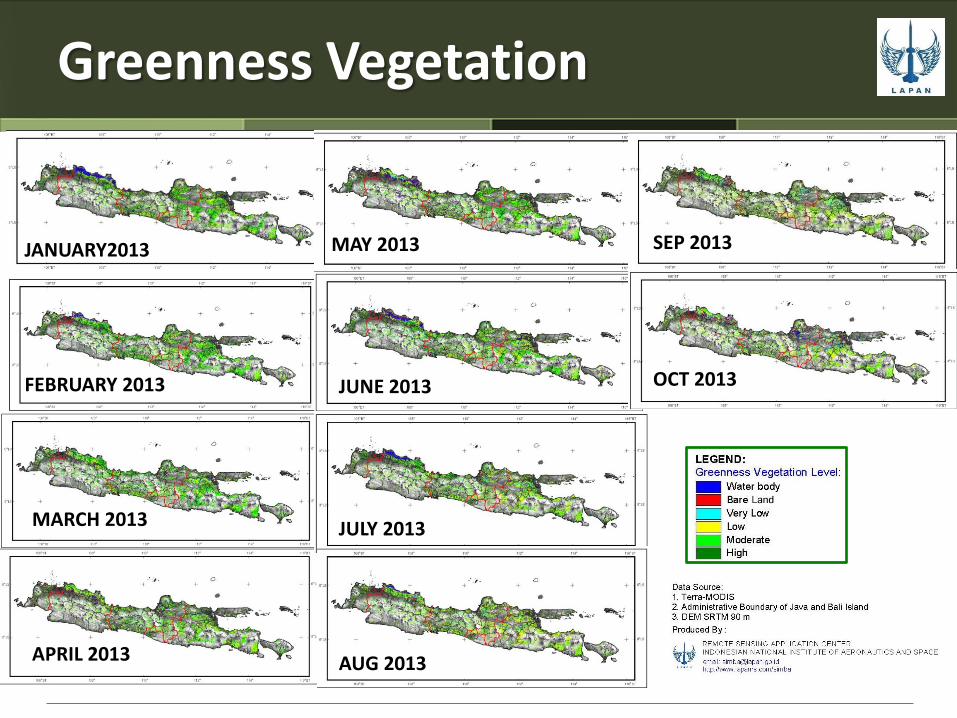
Greenness Vegetation
JANUARY2013
FEBRUARY 2013
MARCH 2013
APRIL 2013
JUNE 2013
MAY 2013
JULY 2013
AUG 2013
SEP 2013
OCT 2013

Growth Phase of Paddy
25 JAN – 1 FEB 2013
18 – 25 FEB 2013
25 MAY – 2 JUN 2013
22 – 29 MAR 2013
15 – 22 APR 2013
26 JUN – 3 JUL 2013
20 – 27 JUL 2013
21 – 28 AUG 2013
22 – 29 SEP 2013
16 – 23 OKT 2013

Flood and Drought Potential
FLOOD – JANUARY 2013
DROUGHT – AUGUST 2013

Harvest Prediction

Remarks
Providing RS data for Indonesia is challenging any available data is good data
The need of Satellite RS data (multi sensors & resolution ) is very high Mechanism for accessing data from international providers is needed.


Main activities of Remote Sensing Technology and Data Center
National Remote Sensing Data Bank
Data acquisition
Data processing
Data management
R&D and Operation