Embed Size (px)
Citation preview
Kārlis Kalviškis, University of Latvia
Quantum GIS users session
QGIS as tool for teaching
Valmiera2013. 04.12.
P a r a l l e l s e s s i o n f o r Q G I S u s e r s f r o m L a t v i a , V a l m i e r a , 2 0 1 3 . 0 4 . 1 2
K ā r l i s K a l v i š k i s , F a c u l t y o f B i o l o g y , U n i v e r s i t y o f L a t v i a
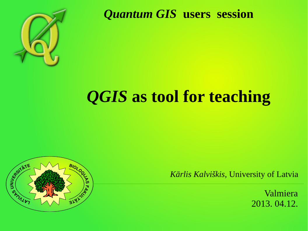
About the author
● Background – biology.● Occupation – IT specailist at Faculty of Biology, University
of Latvia.● The first step in GIS field – in 1991.
P a r a l l e l s e s s i o n f o r Q G I S u s e r s f r o m L a t v i a , V a l m i e r a , 2 0 1 3 . 0 4 . 1 2
K ā r l i s K a l v i š k i s , F a c u l t y o f B i o l o g y , U n i v e r s i t y o f L a t v i a
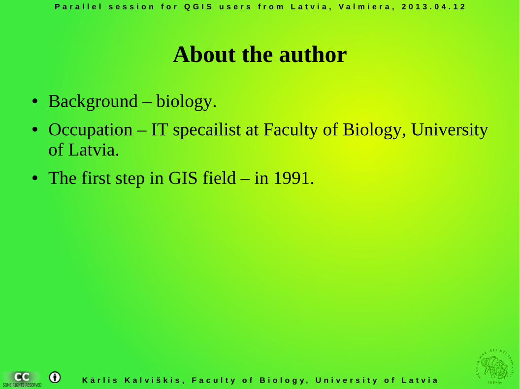
Software experience:
● ESRI ArcGIS● ESRI ArcInfo● ESRI ArcView● ER Mapper● Idrisi● MapGrafix● MapInfo● Microimages TNT lite
● Microstation
– Descartes
– Geographer● TRETOP
● ImageJ● Media Cybernetics Image-
Pro Plus
P a r a l l e l s e s s i o n f o r Q G I S u s e r s f r o m L a t v i a , V a l m i e r a , 2 0 1 3 . 0 4 . 1 2
K ā r l i s K a l v i š k i s , F a c u l t y o f B i o l o g y , U n i v e r s i t y o f L a t v i a
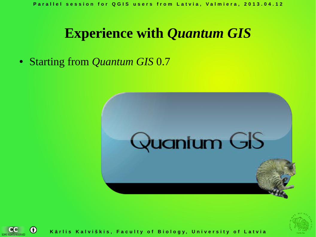
Experience with Quantum GIS
● Starting from Quantum GIS 0.7
P a r a l l e l s e s s i o n f o r Q G I S u s e r s f r o m L a t v i a , V a l m i e r a , 2 0 1 3 . 0 4 . 1 2
K ā r l i s K a l v i š k i s , F a c u l t y o f B i o l o g y , U n i v e r s i t y o f L a t v i a
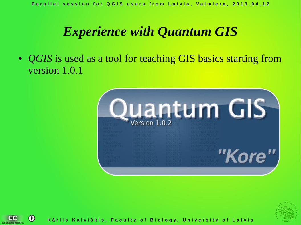
Experience with Quantum GIS
● QGIS is used as a tool for teaching GIS basics starting from version 1.0.1
P a r a l l e l s e s s i o n f o r Q G I S u s e r s f r o m L a t v i a , V a l m i e r a , 2 0 1 3 . 0 4 . 1 2
K ā r l i s K a l v i š k i s , F a c u l t y o f B i o l o g y , U n i v e r s i t y o f L a t v i a
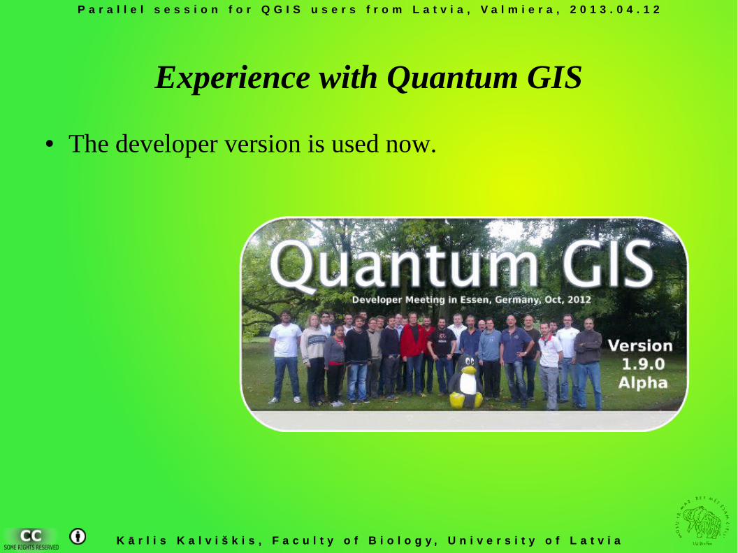
Experience with Quantum GIS
● The developer version is used now.
Kārlis Kalviškis, University of Latvia
Quantum GIS users session
Why to use QGIS?
P a r a l l e l s e s s i o n f o r Q G I S u s e r s f r o m L a t v i a , V a l m i e r a , 2 0 1 3 . 0 4 . 1 2
K ā r l i s K a l v i š k i s , F a c u l t y o f B i o l o g y , U n i v e r s i t y o f L a t v i a
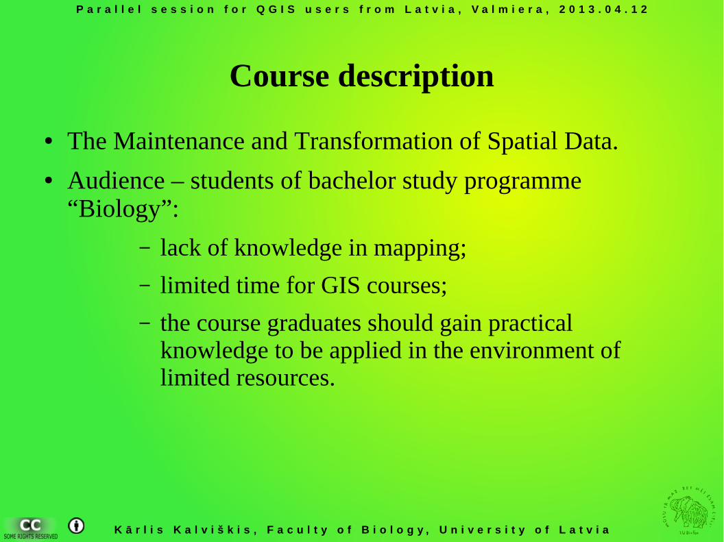
Course description
● The Maintenance and Transformation of Spatial Data.● Audience – students of bachelor study programme
“Biology”:
– lack of knowledge in mapping;
– limited time for GIS courses;
– the course graduates should gain practical knowledge to be applied in the environment of limited resources.
P a r a l l e l s e s s i o n f o r Q G I S u s e r s f r o m L a t v i a , V a l m i e r a , 2 0 1 3 . 0 4 . 1 2
K ā r l i s K a l v i š k i s , F a c u l t y o f B i o l o g y , U n i v e r s i t y o f L a t v i a
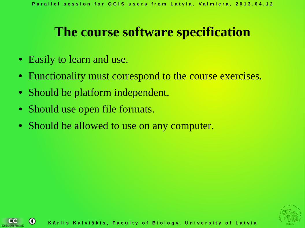
The course software specification
● Easily to learn and use.● Functionality must correspond to the course exercises.● Should be platform independent.● Should use open file formats.● Should be allowed to use on any computer.
P a r a l l e l s e s s i o n f o r Q G I S u s e r s f r o m L a t v i a , V a l m i e r a , 2 0 1 3 . 0 4 . 1 2
K ā r l i s K a l v i š k i s , F a c u l t y o f B i o l o g y , U n i v e r s i t y o f L a t v i a
Com
pute
r d
rawing and mapping
Image interpretation and analysis
Remot
e se
nsing
GIS
Data analysis Data manag
emen
t
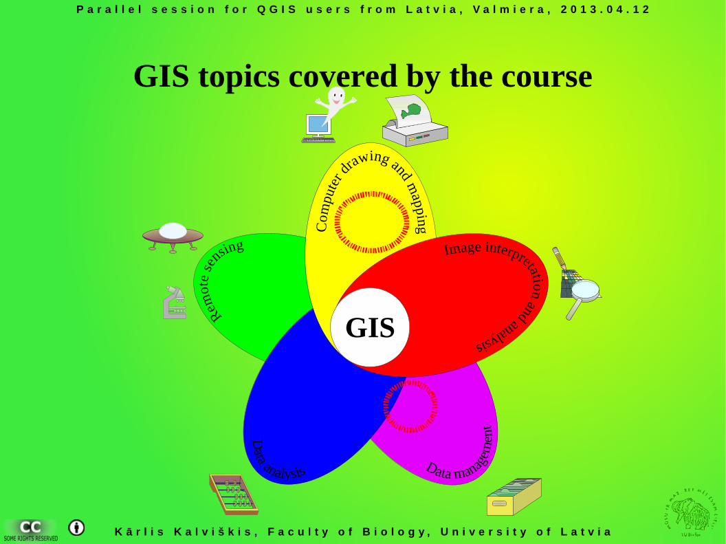
GIS topics covered by the course
P a r a l l e l s e s s i o n f o r Q G I S u s e r s f r o m L a t v i a , V a l m i e r a , 2 0 1 3 . 0 4 . 1 2
K ā r l i s K a l v i š k i s , F a c u l t y o f B i o l o g y , U n i v e r s i t y o f L a t v i a
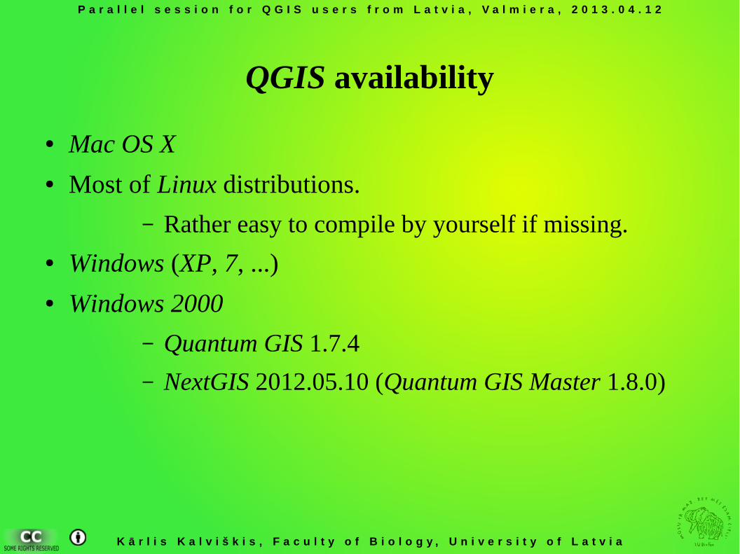
QGIS availability
● Mac OS X● Most of Linux distributions.
– Rather easy to compile by yourself if missing. ● Windows (XP, 7, ...)● Windows 2000
– Quantum GIS 1.7.4
– NextGIS 2012.05.10 (Quantum GIS Master 1.8.0)
P a r a l l e l s e s s i o n f o r Q G I S u s e r s f r o m L a t v i a , V a l m i e r a , 2 0 1 3 . 0 4 . 1 2
K ā r l i s K a l v i š k i s , F a c u l t y o f B i o l o g y , U n i v e r s i t y o f L a t v i a
QGIS availability
● Quantum GIS functionality and interface is platform independent.
P a r a l l e l s e s s i o n f o r Q G I S u s e r s f r o m L a t v i a , V a l m i e r a , 2 0 1 3 . 0 4 . 1 2
K ā r l i s K a l v i š k i s , F a c u l t y o f B i o l o g y , U n i v e r s i t y o f L a t v i a
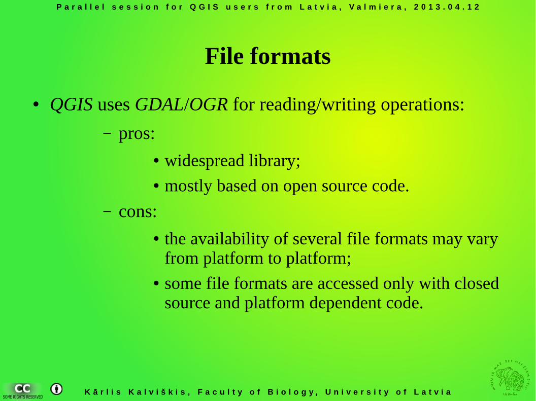
File formats
● QGIS uses GDAL/OGR for reading/writing operations:
– pros:● widespread library;● mostly based on open source code.
– cons:● the availability of several file formats may vary
from platform to platform;● some file formats are accessed only with closed
source and platform dependent code.
P a r a l l e l s e s s i o n f o r Q G I S u s e r s f r o m L a t v i a , V a l m i e r a , 2 0 1 3 . 0 4 . 1 2
K ā r l i s K a l v i š k i s , F a c u l t y o f B i o l o g y , U n i v e r s i t y o f L a t v i a
License
● Quantum GIS is open source software available under the terms of the GNU General Public License.
P a r a l l e l s e s s i o n f o r Q G I S u s e r s f r o m L a t v i a , V a l m i e r a , 2 0 1 3 . 0 4 . 1 2
K ā r l i s K a l v i š k i s , F a c u l t y o f B i o l o g y , U n i v e r s i t y o f L a t v i a
Useful features
● Different data sources are accessed differently. Users should understand the data structure – good for teaching purposes.
● The user interface is available in many languages.● The GUI is rather common for GIS packages – the obtained
skills maybe used to work with other GIS software.
Kārlis Kalviškis, University of Latvia
Quantum GIS users session
Topics covered by the course “The Maintenance and
Transformation of Spatial Data”
P a r a l l e l s e s s i o n f o r Q G I S u s e r s f r o m L a t v i a , V a l m i e r a , 2 0 1 3 . 0 4 . 1 2
K ā r l i s K a l v i š k i s , F a c u l t y o f B i o l o g y , U n i v e r s i t y o f L a t v i a
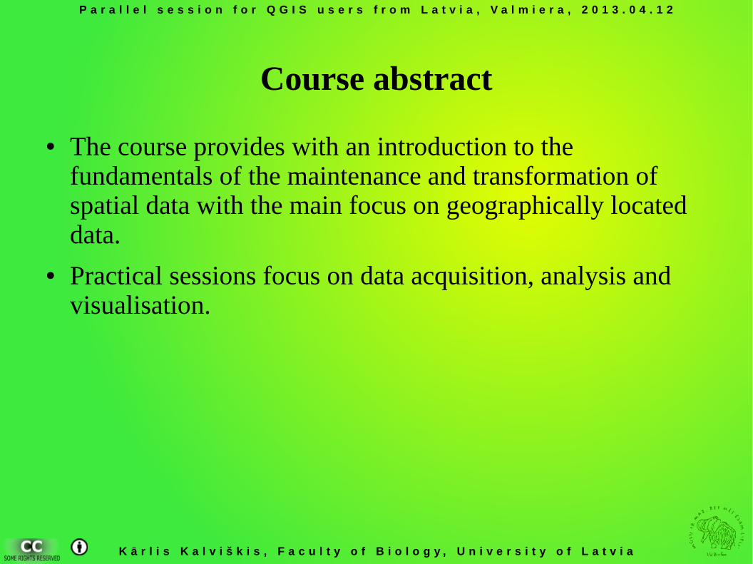
Course abstract
● The course provides with an introduction to the fundamentals of the maintenance and transformation of spatial data with the main focus on geographically located data.
● Practical sessions focus on data acquisition, analysis and visualisation.
P a r a l l e l s e s s i o n f o r Q G I S u s e r s f r o m L a t v i a , V a l m i e r a , 2 0 1 3 . 0 4 . 1 2
K ā r l i s K a l v i š k i s , F a c u l t y o f B i o l o g y , U n i v e r s i t y o f L a t v i a
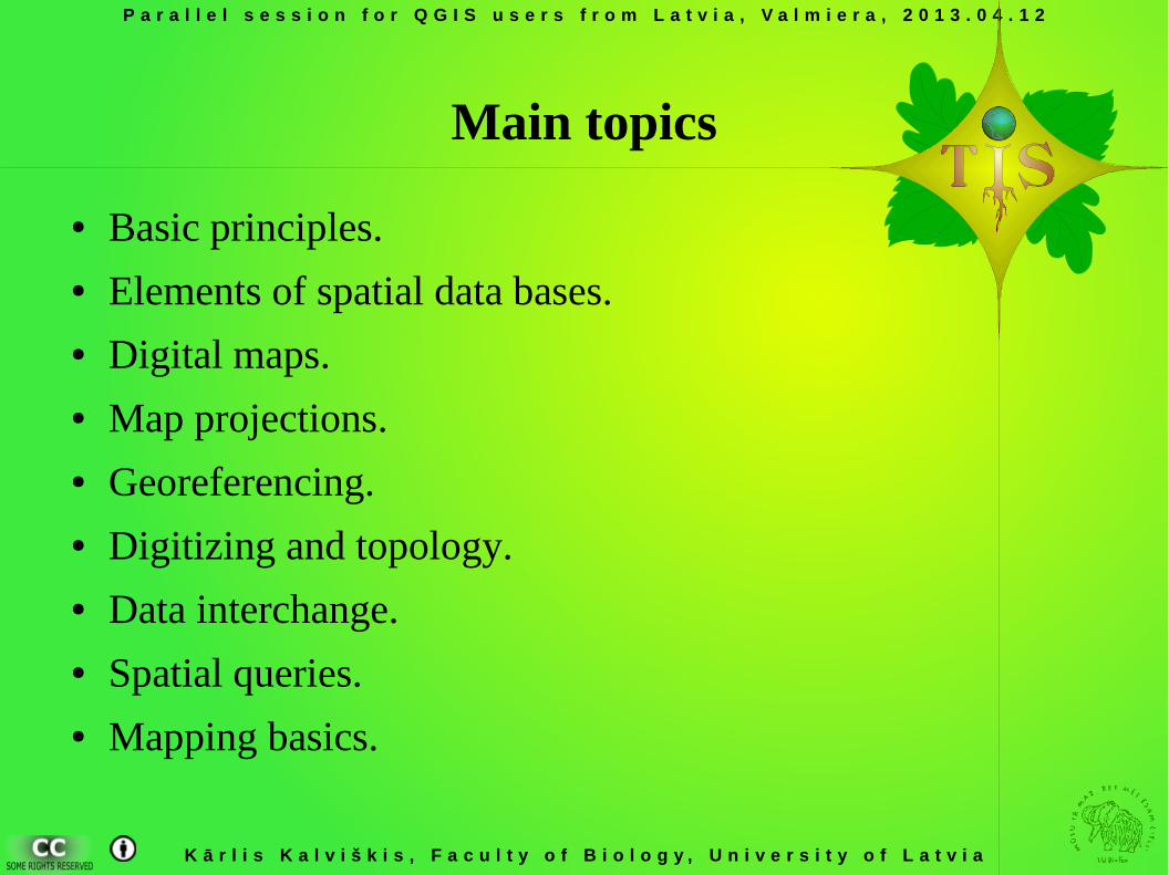
Main topics
● Basic principles.● Elements of spatial data bases.● Digital maps.● Map projections.● Georeferencing.● Digitizing and topology.● Data interchange.● Spatial queries.● Mapping basics.
P a r a l l e l s e s s i o n f o r Q G I S u s e r s f r o m L a t v i a , V a l m i e r a , 2 0 1 3 . 0 4 . 1 2
K ā r l i s K a l v i š k i s , F a c u l t y o f B i o l o g y , U n i v e r s i t y o f L a t v i a
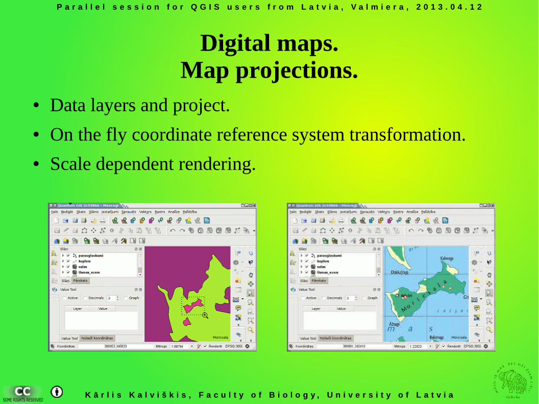
Digital maps.Map projections.
● Data layers and project.● On the fly coordinate reference system transformation.● Scale dependent rendering.
P a r a l l e l s e s s i o n f o r Q G I S u s e r s f r o m L a t v i a , V a l m i e r a , 2 0 1 3 . 0 4 . 1 2
K ā r l i s K a l v i š k i s , F a c u l t y o f B i o l o g y , U n i v e r s i t y o f L a t v i a
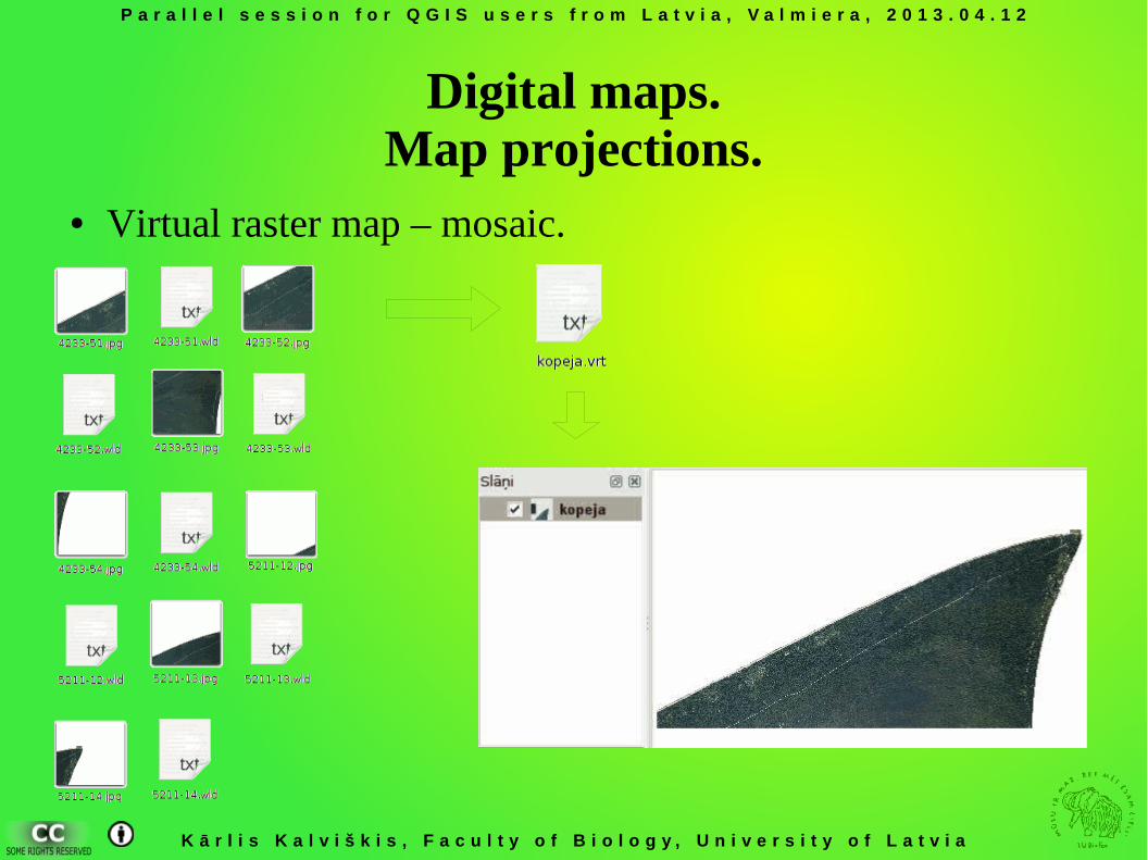
Digital maps.Map projections.
● Virtual raster map – mosaic.
P a r a l l e l s e s s i o n f o r Q G I S u s e r s f r o m L a t v i a , V a l m i e r a , 2 0 1 3 . 0 4 . 1 2
K ā r l i s K a l v i š k i s , F a c u l t y o f B i o l o g y , U n i v e r s i t y o f L a t v i a
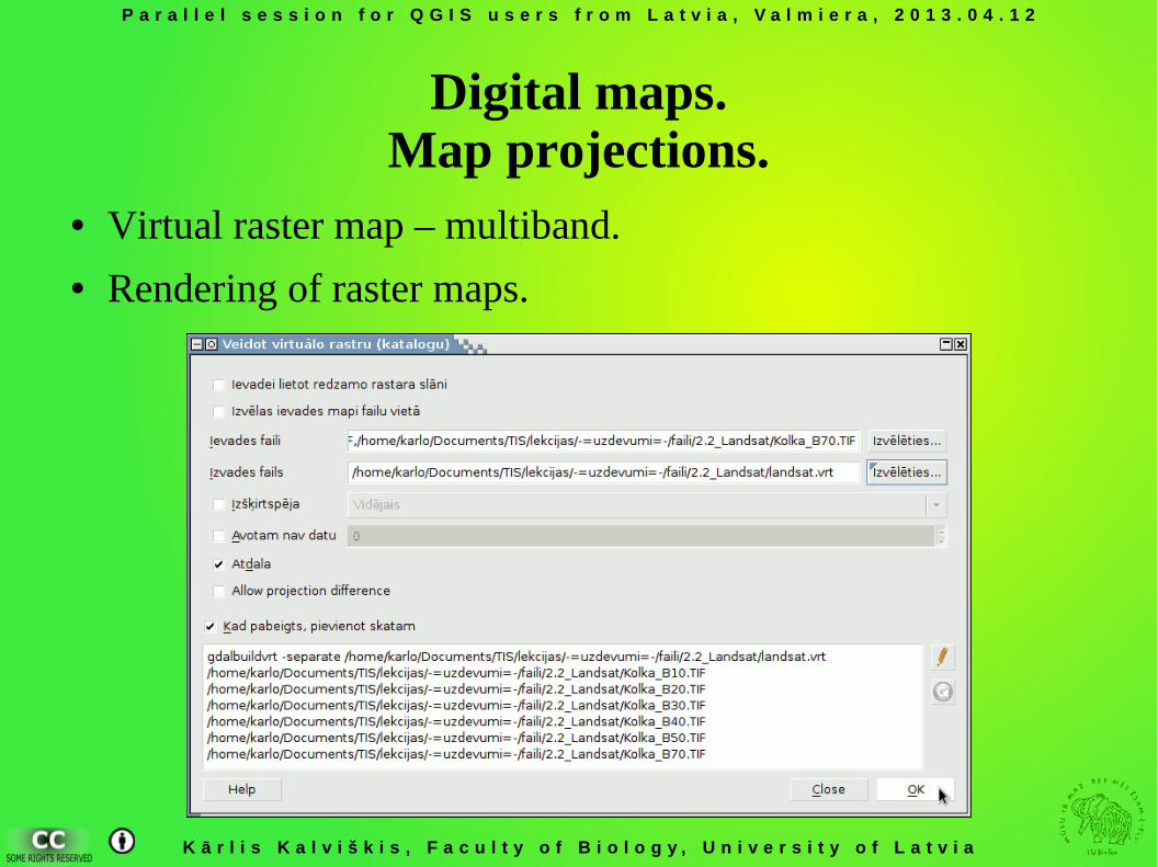
Digital maps.Map projections.
● Virtual raster map – multiband.● Rendering of raster maps.
P a r a l l e l s e s s i o n f o r Q G I S u s e r s f r o m L a t v i a , V a l m i e r a , 2 0 1 3 . 0 4 . 1 2
K ā r l i s K a l v i š k i s , F a c u l t y o f B i o l o g y , U n i v e r s i t y o f L a t v i a
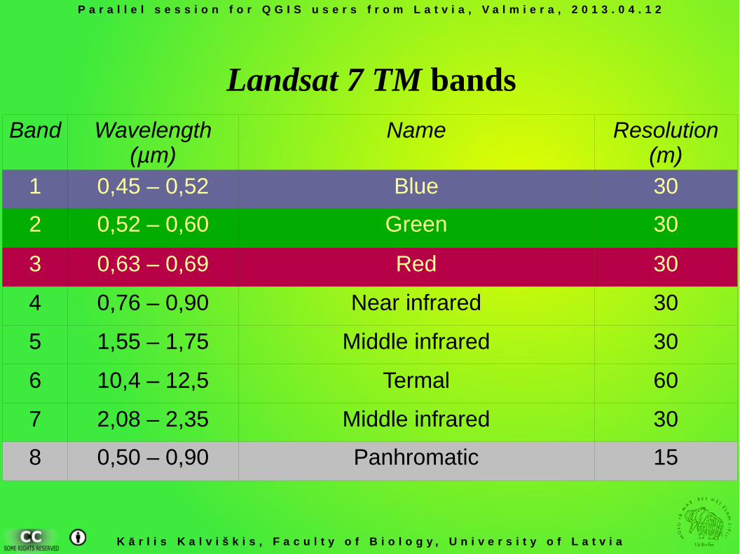
Band Wavelength (µm)
Name Resolution (m)
1 0,45 – 0,52 Blue 30
2 0,52 – 0,60 Green 30
3 0,63 – 0,69 Red 30
4 0,76 – 0,90 Near infrared 30
5 1,55 – 1,75 Middle infrared 30
6 10,4 – 12,5 Termal 60
7 2,08 – 2,35 Middle infrared 30
8 0,50 – 0,90 Panhromatic 15
Landsat 7 TM bands
P a r a l l e l s e s s i o n f o r Q G I S u s e r s f r o m L a t v i a , V a l m i e r a , 2 0 1 3 . 0 4 . 1 2
K ā r l i s K a l v i š k i s , F a c u l t y o f B i o l o g y , U n i v e r s i t y o f L a t v i a
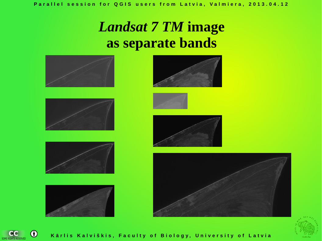
Landsat 7 TM imageas separate bands
P a r a l l e l s e s s i o n f o r Q G I S u s e r s f r o m L a t v i a , V a l m i e r a , 2 0 1 3 . 0 4 . 1 2
K ā r l i s K a l v i š k i s , F a c u l t y o f B i o l o g y , U n i v e r s i t y o f L a t v i a
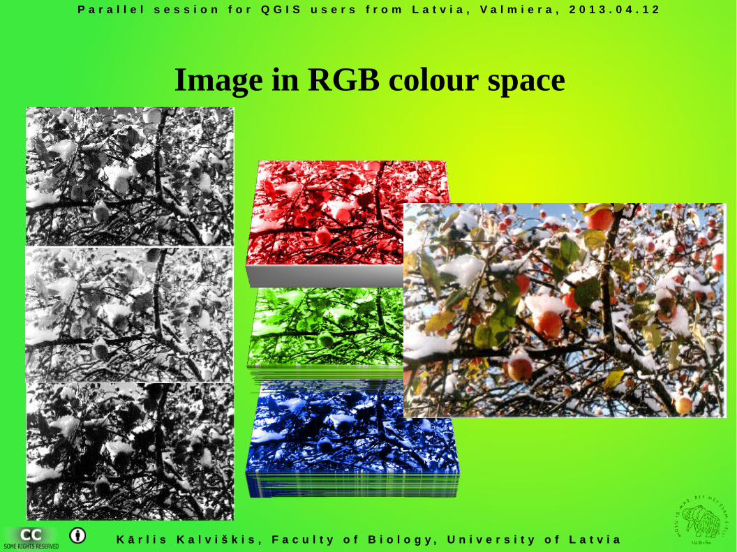
Image in RGB colour space
P a r a l l e l s e s s i o n f o r Q G I S u s e r s f r o m L a t v i a , V a l m i e r a , 2 0 1 3 . 0 4 . 1 2
K ā r l i s K a l v i š k i s , F a c u l t y o f B i o l o g y , U n i v e r s i t y o f L a t v i a
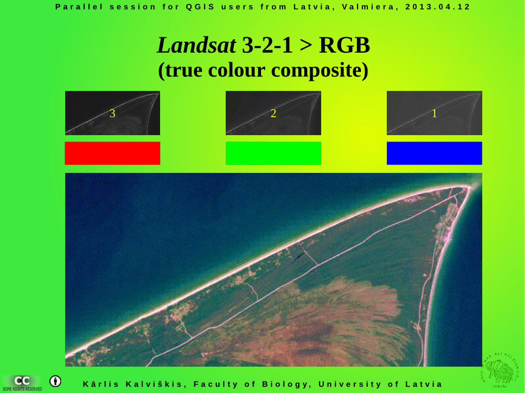
Landsat 3-2-1 > RGB(true colour composite)
123
P a r a l l e l s e s s i o n f o r Q G I S u s e r s f r o m L a t v i a , V a l m i e r a , 2 0 1 3 . 0 4 . 1 2
K ā r l i s K a l v i š k i s , F a c u l t y o f B i o l o g y , U n i v e r s i t y o f L a t v i a
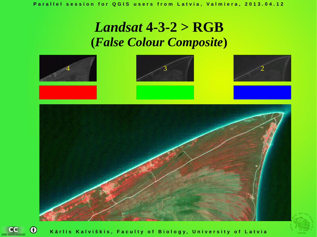
Landsat 4-3-2 > RGB(False Colour Composite)
234
P a r a l l e l s e s s i o n f o r Q G I S u s e r s f r o m L a t v i a , V a l m i e r a , 2 0 1 3 . 0 4 . 1 2
K ā r l i s K a l v i š k i s , F a c u l t y o f B i o l o g y , U n i v e r s i t y o f L a t v i a
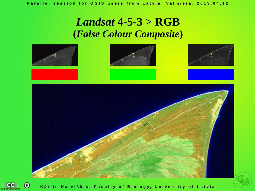
Landsat 4-5-3 > RGB(False Colour Composite)
354
P a r a l l e l s e s s i o n f o r Q G I S u s e r s f r o m L a t v i a , V a l m i e r a , 2 0 1 3 . 0 4 . 1 2
K ā r l i s K a l v i š k i s , F a c u l t y o f B i o l o g y , U n i v e r s i t y o f L a t v i a
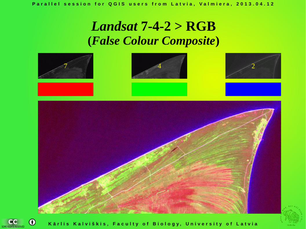
Landsat 7-4-2 > RGB(False Colour Composite)
247
P a r a l l e l s e s s i o n f o r Q G I S u s e r s f r o m L a t v i a , V a l m i e r a , 2 0 1 3 . 0 4 . 1 2
K ā r l i s K a l v i š k i s , F a c u l t y o f B i o l o g y , U n i v e r s i t y o f L a t v i a
Georeferencing.
● Georeferencing using image corner points.● Georeferencing using points from other maps.● Clipping raster maps.
P a r a l l e l s e s s i o n f o r Q G I S u s e r s f r o m L a t v i a , V a l m i e r a , 2 0 1 3 . 0 4 . 1 2
K ā r l i s K a l v i š k i s , F a c u l t y o f B i o l o g y , U n i v e r s i t y o f L a t v i a
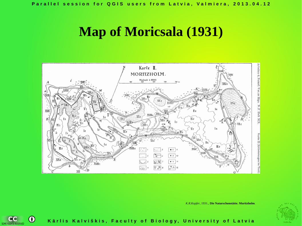
Map of Moricsala (1931)
K.R.Kupfer, 1931., Die Naturschonstätte. Moritzholm.
P a r a l l e l s e s s i o n f o r Q G I S u s e r s f r o m L a t v i a , V a l m i e r a , 2 0 1 3 . 0 4 . 1 2
K ā r l i s K a l v i š k i s , F a c u l t y o f B i o l o g y , U n i v e r s i t y o f L a t v i a
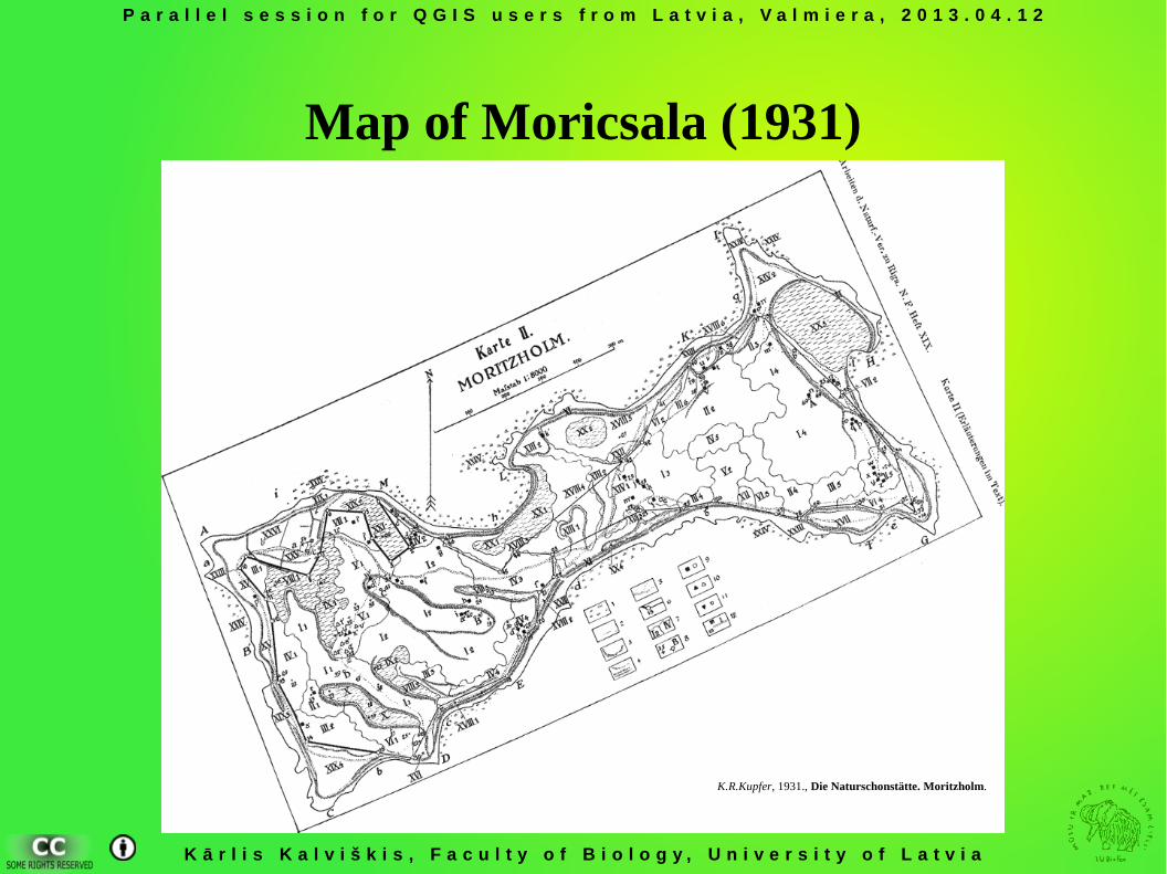
Map of Moricsala (1931)
K.R.Kupfer, 1931., Die Naturschonstätte. Moritzholm.
P a r a l l e l s e s s i o n f o r Q G I S u s e r s f r o m L a t v i a , V a l m i e r a , 2 0 1 3 . 0 4 . 1 2
K ā r l i s K a l v i š k i s , F a c u l t y o f B i o l o g y , U n i v e r s i t y o f L a t v i a
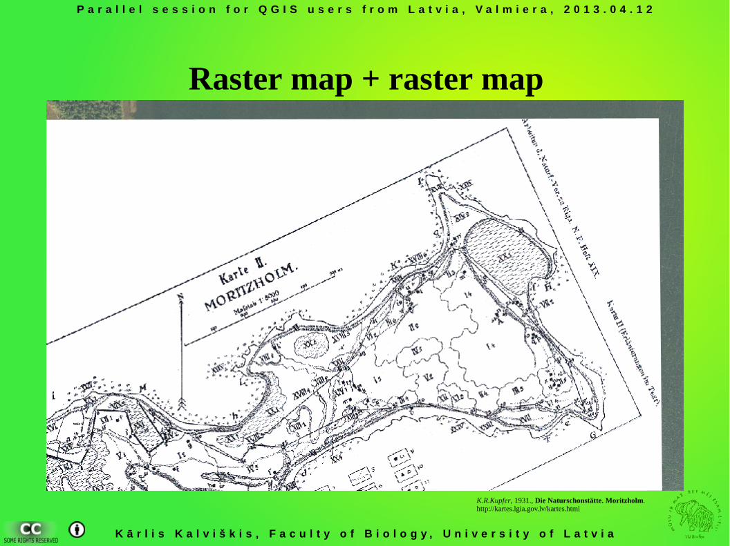
Raster map + raster map
K.R.Kupfer, 1931., Die Naturschonstätte. Moritzholm.http://kartes.lgia.gov.lv/kartes.html

P a r a l l e l s e s s i o n f o r Q G I S u s e r s f r o m L a t v i a , V a l m i e r a , 2 0 1 3 . 0 4 . 1 2
K ā r l i s K a l v i š k i s , F a c u l t y o f B i o l o g y , U n i v e r s i t y o f L a t v i a
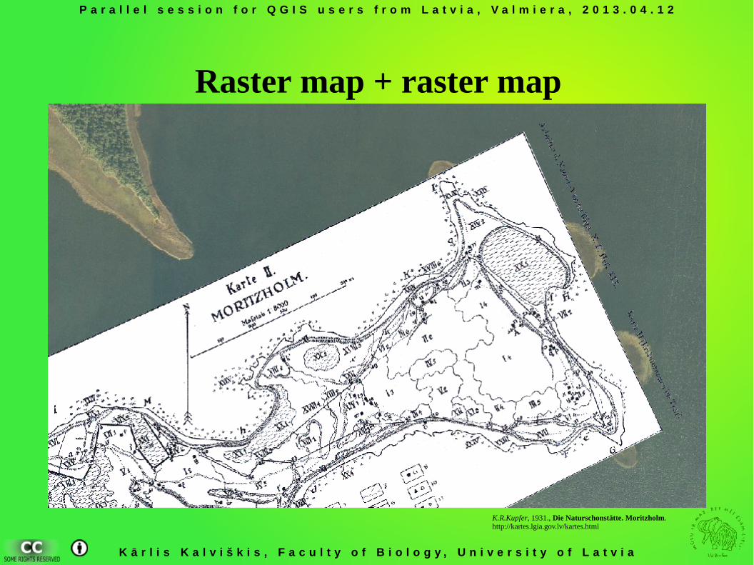
Raster map + raster map
K.R.Kupfer, 1931., Die Naturschonstätte. Moritzholm.http://kartes.lgia.gov.lv/kartes.html
P a r a l l e l s e s s i o n f o r Q G I S u s e r s f r o m L a t v i a , V a l m i e r a , 2 0 1 3 . 0 4 . 1 2
K ā r l i s K a l v i š k i s , F a c u l t y o f B i o l o g y , U n i v e r s i t y o f L a t v i a
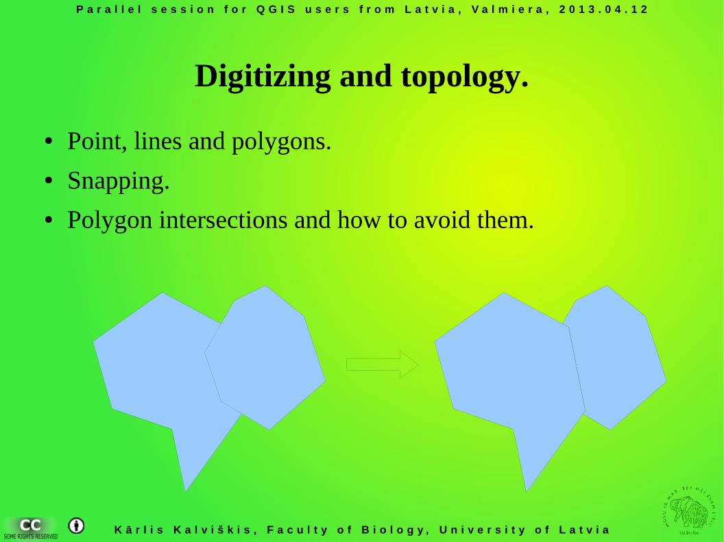
Digitizing and topology.
● Point, lines and polygons.● Snapping.● Polygon intersections and how to avoid them.
P a r a l l e l s e s s i o n f o r Q G I S u s e r s f r o m L a t v i a , V a l m i e r a , 2 0 1 3 . 0 4 . 1 2
K ā r l i s K a l v i š k i s , F a c u l t y o f B i o l o g y , U n i v e r s i t y o f L a t v i a
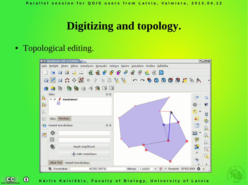
Digitizing and topology.
● Topological editing.
P a r a l l e l s e s s i o n f o r Q G I S u s e r s f r o m L a t v i a , V a l m i e r a , 2 0 1 3 . 0 4 . 1 2
K ā r l i s K a l v i š k i s , F a c u l t y o f B i o l o g y , U n i v e r s i t y o f L a t v i a
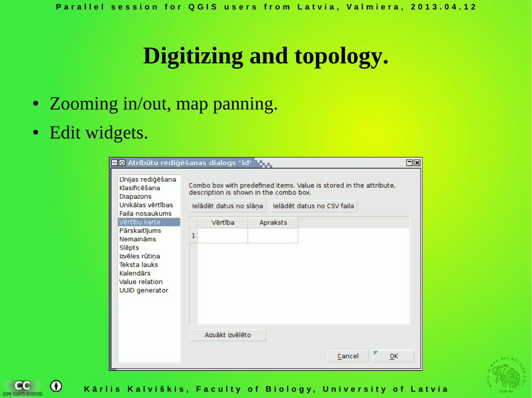
Digitizing and topology.
● Zooming in/out, map panning.● Edit widgets.
P a r a l l e l s e s s i o n f o r Q G I S u s e r s f r o m L a t v i a , V a l m i e r a , 2 0 1 3 . 0 4 . 1 2
K ā r l i s K a l v i š k i s , F a c u l t y o f B i o l o g y , U n i v e r s i t y o f L a t v i a
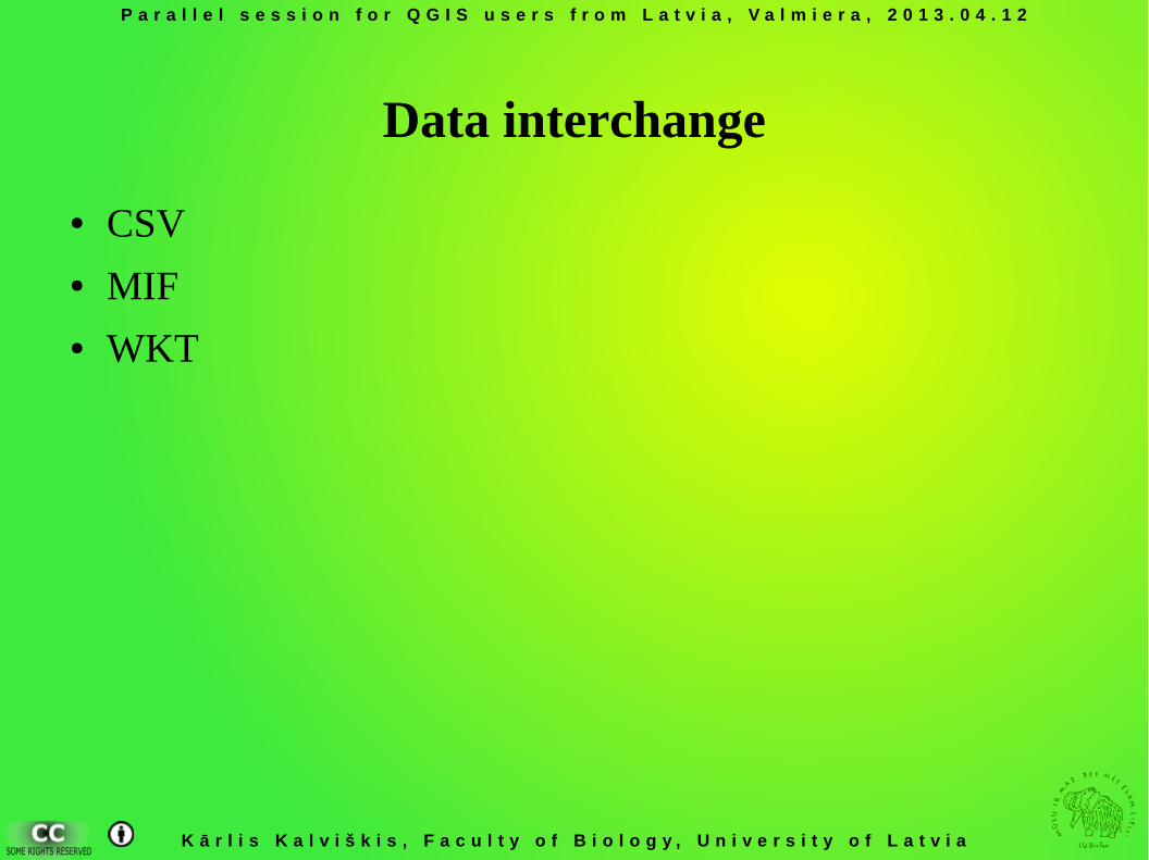
Data interchange
● CSV● MIF● WKT
P a r a l l e l s e s s i o n f o r Q G I S u s e r s f r o m L a t v i a , V a l m i e r a , 2 0 1 3 . 0 4 . 1 2
K ā r l i s K a l v i š k i s , F a c u l t y o f B i o l o g y , U n i v e r s i t y o f L a t v i a
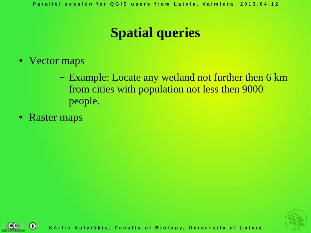
Spatial queries
● Vector maps
– Example: Locate any wetland not further then 6 km from cities with population not less then 9000 people.
● Raster maps
P a r a l l e l s e s s i o n f o r Q G I S u s e r s f r o m L a t v i a , V a l m i e r a , 2 0 1 3 . 0 4 . 1 2
K ā r l i s K a l v i š k i s , F a c u l t y o f B i o l o g y , U n i v e r s i t y o f L a t v i a
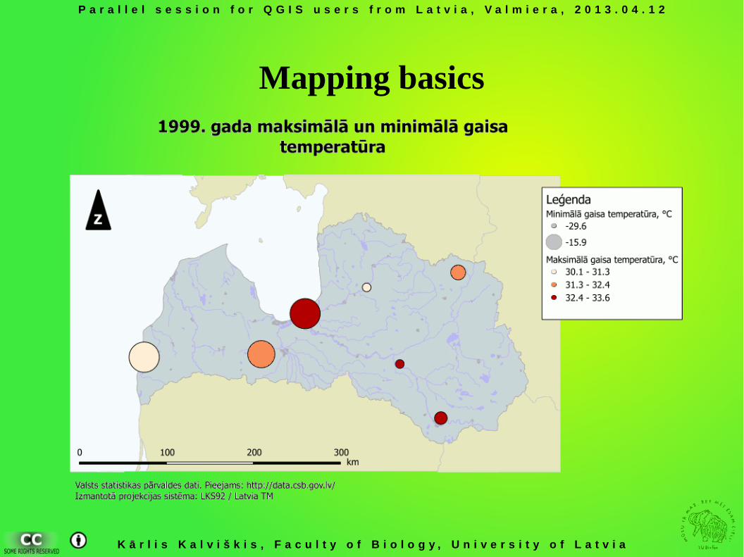
Mapping basics
Kārlis Kalviškis, University of Latvia
Quantum GIS users session
Quantum GIS user community
P a r a l l e l s e s s i o n f o r Q G I S u s e r s f r o m L a t v i a , V a l m i e r a , 2 0 1 3 . 0 4 . 1 2
K ā r l i s K a l v i š k i s , F a c u l t y o f B i o l o g y , U n i v e r s i t y o f L a t v i a
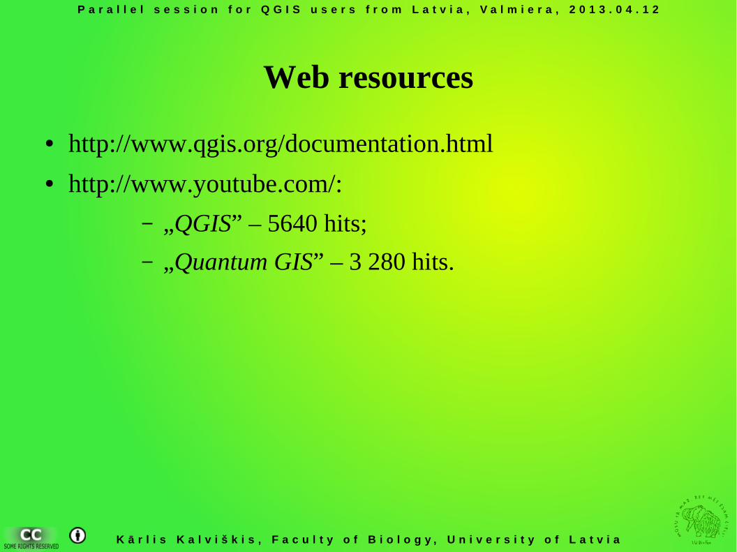
Web resources
● http://www.qgis.org/documentation.html● http://www.youtube.com/:
– „QGIS” – 5640 hits;
– „Quantum GIS” – 3 280 hits.
P a r a l l e l s e s s i o n f o r Q G I S u s e r s f r o m L a t v i a , V a l m i e r a , 2 0 1 3 . 0 4 . 1 2
K ā r l i s K a l v i š k i s , F a c u l t y o f B i o l o g y , U n i v e r s i t y o f L a t v i a
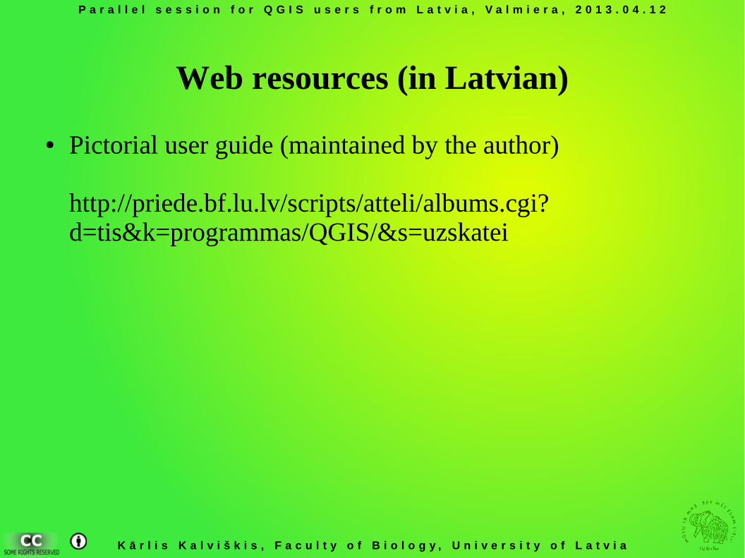
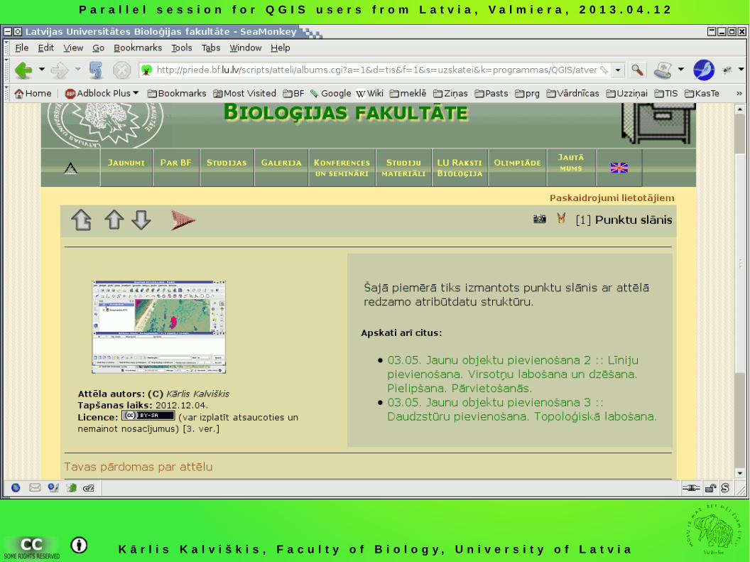
Web resources (in Latvian)
● Pictorial user guide (maintained by the author)
http://priede.bf.lu.lv/scripts/atteli/albums.cgi?d=tis&k=programmas/QGIS/&s=uzskatei
P a r a l l e l s e s s i o n f o r Q G I S u s e r s f r o m L a t v i a , V a l m i e r a , 2 0 1 3 . 0 4 . 1 2
K ā r l i s K a l v i š k i s , F a c u l t y o f B i o l o g y , U n i v e r s i t y o f L a t v i a
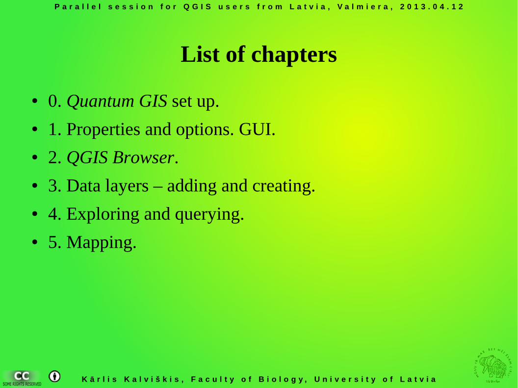
List of chapters
● 0. Quantum GIS set up. ● 1. Properties and options. GUI. ● 2. QGIS Browser. ● 3. Data layers – adding and creating.● 4. Exploring and querying. ● 5. Mapping.
P a r a l l e l s e s s i o n f o r Q G I S u s e r s f r o m L a t v i a , V a l m i e r a , 2 0 1 3 . 0 4 . 1 2
K ā r l i s K a l v i š k i s , F a c u l t y o f B i o l o g y , U n i v e r s i t y o f L a t v i a
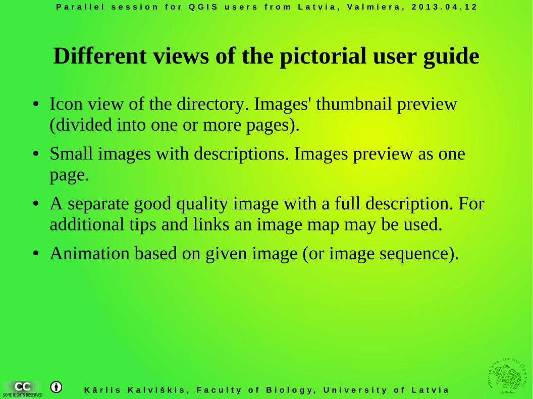
Different views of the pictorial user guide
● Icon view of the directory. Images' thumbnail preview (divided into one or more pages).
● Small images with descriptions. Images preview as one page.
● A separate good quality image with a full description. For additional tips and links an image map may be used.
● Animation based on given image (or image sequence).
P a r a l l e l s e s s i o n f o r Q G I S u s e r s f r o m L a t v i a , V a l m i e r a , 2 0 1 3 . 0 4 . 1 2
K ā r l i s K a l v i š k i s , F a c u l t y o f B i o l o g y , U n i v e r s i t y o f L a t v i a
P a r a l l e l s e s s i o n f o r Q G I S u s e r s f r o m L a t v i a , V a l m i e r a , 2 0 1 3 . 0 4 . 1 2
K ā r l i s K a l v i š k i s , F a c u l t y o f B i o l o g y , U n i v e r s i t y o f L a t v i a
Any questions?


![2013.04.12 #4 - Slideshare - B2B [cloud] inbound marketing - Don't ask for permission, just do it - Loic Simon](https://img.pdfslide.us/doc/110x75/54c1d9724a79598f4a8b459d/20130412-4-slideshare-b2b-cloud-inbound-marketing-dont-ask-for-permission-just-do-it-loic-simon.jpg)
![2013.04.12 #2 - Blogging ? B2B [cloud] Inbound Marketing - Don't ask for permission, just do it.ppt - Loic Simon](https://img.pdfslide.us/doc/110x75/54c1d9724a79593b4e8b457e/20130412-2-blogging-b2b-cloud-inbound-marketing-dont-ask-for-permission-just-do-itppt-loic-simon.jpg)