Embed Size (px)
Citation preview
MotivationMain contribution
Discussion
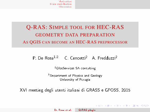
Q-RAS: SIMPLE TOOL FOR HEC-RASGEOMETRY DATA PREPARATION
AS QGIS CAN BECOME AN HEC-RAS PREPROCESSOR
P. De Rosa1,2 C. Cencetti2 A. Fredduzzi2
1GfosServices SA consulting
2Department of Physics and Geology
University of Perugia
XVI meeting degli utenti italiani di GRASS e GFOSS, 2015
De Rosa et al. Q-RAS plugin
MotivationMain contribution
Discussion
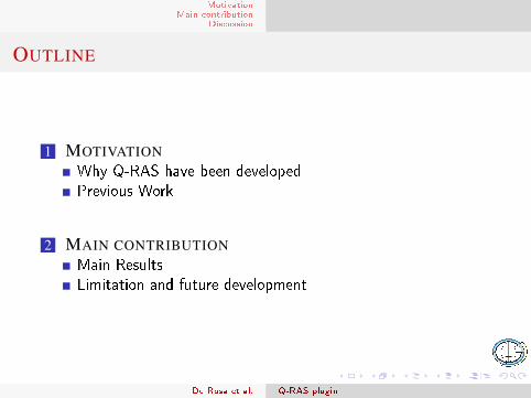
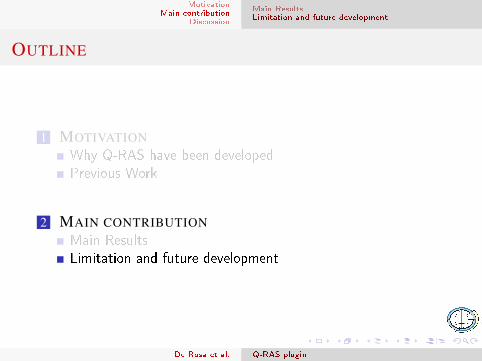
OUTLINE
1 MOTIVATIONWhy Q-RAS have been developedPrevious Work
2 MAIN CONTRIBUTIONMain ResultsLimitation and future development
De Rosa et al. Q-RAS plugin
MotivationMain contribution
Discussion
why Q-RASPrevious Work
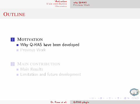
OUTLINE
1 MOTIVATIONWhy Q-RAS have been developedPrevious Work
2 MAIN CONTRIBUTIONMain ResultsLimitation and future development
De Rosa et al. Q-RAS plugin
MotivationMain contribution
Discussion
why Q-RASPrevious Work
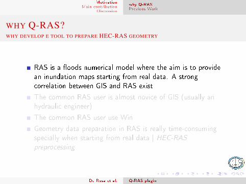
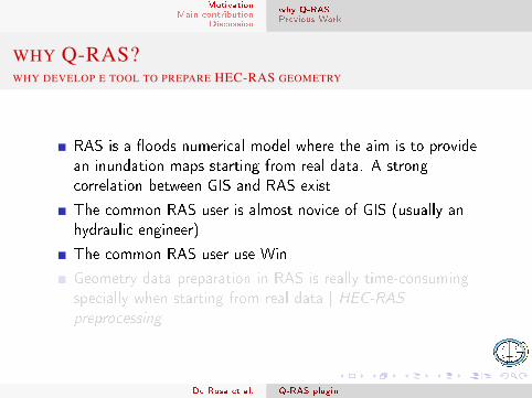
WHY Q-RAS?WHY DEVELOP E TOOL TO PREPARE HEC-RAS GEOMETRY
RAS is a �oods numerical model where the aim is to providean inundation maps starting from real data. A strongcorrelation between GIS and RAS exist
The common RAS user is almost novice of GIS (usually anhydraulic engineer)
The common RAS user use Win
Geometry data preparation in RAS is really time-consumingspecially when starting from real data | HEC-RASpreprocessing
De Rosa et al. Q-RAS plugin
MotivationMain contribution
Discussion
why Q-RASPrevious Work
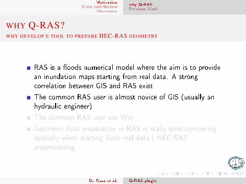
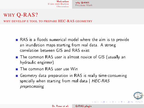
WHY Q-RAS?WHY DEVELOP E TOOL TO PREPARE HEC-RAS GEOMETRY
RAS is a �oods numerical model where the aim is to providean inundation maps starting from real data. A strongcorrelation between GIS and RAS exist
The common RAS user is almost novice of GIS (usually anhydraulic engineer)
The common RAS user use Win
Geometry data preparation in RAS is really time-consumingspecially when starting from real data | HEC-RASpreprocessing
De Rosa et al. Q-RAS plugin
MotivationMain contribution
Discussion
why Q-RASPrevious Work
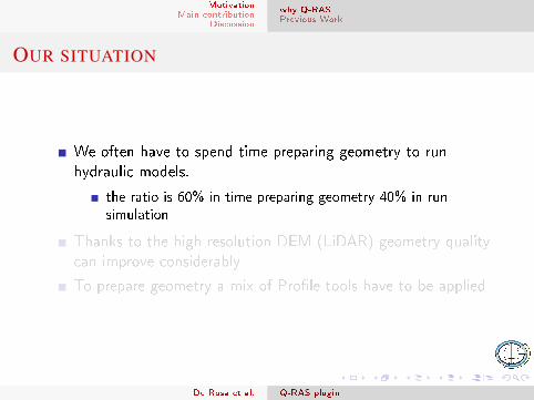
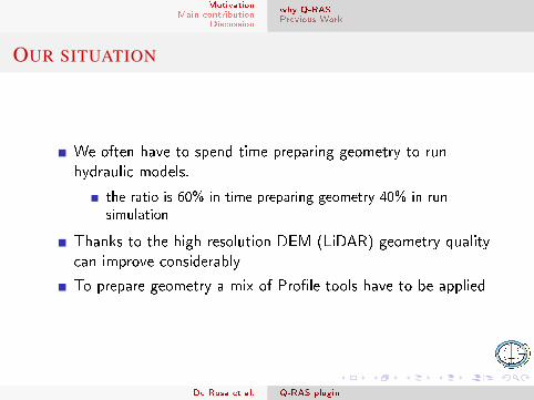
OUR SITUATION
We often have to spend time preparing geometry to runhydraulic models.
the ratio is 60% in time preparing geometry 40% in runsimulation
Thanks to the high resolution DEM (LiDAR) geometry qualitycan improve considerably
To prepare geometry a mix of Pro�le tools have to be applied
De Rosa et al. Q-RAS plugin
MotivationMain contribution
Discussion
why Q-RASPrevious Work
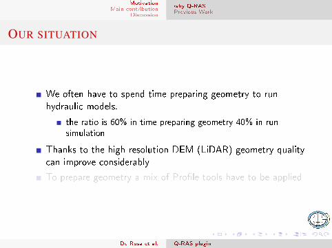
OUTLINE
1 MOTIVATIONWhy Q-RAS have been developedPrevious Work
2 MAIN CONTRIBUTIONMain ResultsLimitation and future development
De Rosa et al. Q-RAS plugin
MotivationMain contribution
Discussion
why Q-RASPrevious Work
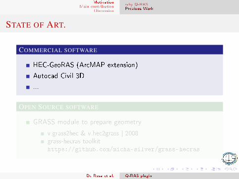
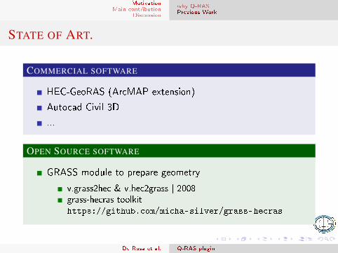
STATE OF ART.
COMMERCIAL SOFTWARE
HEC-GeoRAS (ArcMAP extension)
Autocad Civil 3D
...
OPEN SOURCE SOFTWARE
GRASS module to prepare geometry
v.grass2hec & v.hec2grass | 2008grass-hecras toolkit |https://github.com/micha-silver/grass-hecras
De Rosa et al. Q-RAS plugin
MotivationMain contribution
Discussion
why Q-RASPrevious Work
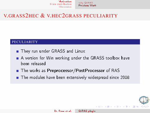
V.GRASS2HEC & V.HEC2GRASS PECULIARITY
PECULIARITY
They run under GRASS and Linux
A version for Win working under the GRASS toolbox havebeen released
The works as Preprocessor/PostProcessor of RAS
The modules have been extensively widespread since 2008
De Rosa et al. Q-RAS plugin
MotivationMain contribution
Discussion
Main ResultsLimitation and future development
OUTLINE
1 MOTIVATIONWhy Q-RAS have been developedPrevious Work
2 MAIN CONTRIBUTIONMain ResultsLimitation and future development
De Rosa et al. Q-RAS plugin
MotivationMain contribution
Discussion
Main ResultsLimitation and future development
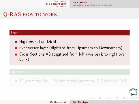
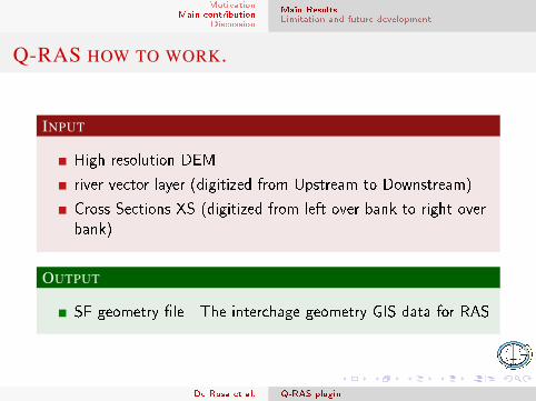
Q-RAS HOW TO WORK.
INPUT
High resolution DEM
river vector layer (digitized from Upstream to Downstream)
Cross Sections XS (digitized from left over bank to right overbank)
OUTPUT
SF geometry �le - The interchage geometry GIS data for RAS
De Rosa et al. Q-RAS plugin
MotivationMain contribution
Discussion
Main ResultsLimitation and future development
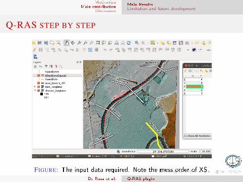
Q-RAS STEP BY STEP
FIGURE: The input data required. Note the mess order of XS.De Rosa et al. Q-RAS plugin
MotivationMain contribution
Discussion
Main ResultsLimitation and future development
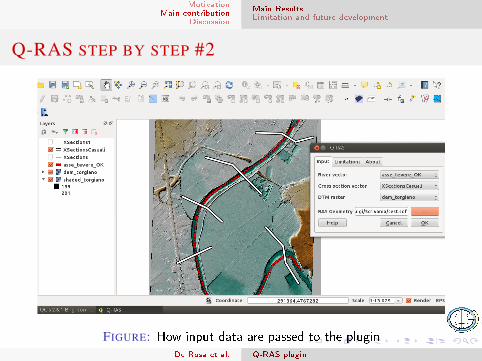
Q-RAS STEP BY STEP #2
FIGURE: How input data are passed to the pluginDe Rosa et al. Q-RAS plugin
MotivationMain contribution
Discussion
Main ResultsLimitation and future development
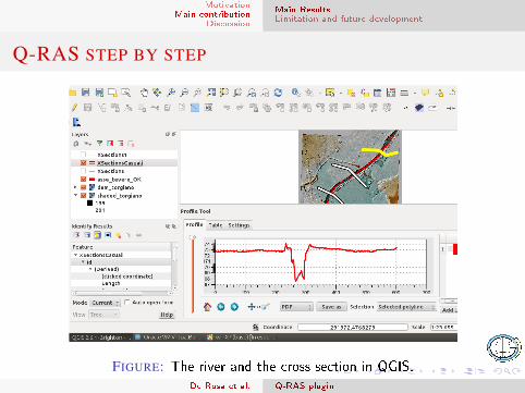
Q-RAS STEP BY STEP
FIGURE: The river and the cross section in QGIS.De Rosa et al. Q-RAS plugin
MotivationMain contribution
Discussion
Main ResultsLimitation and future development
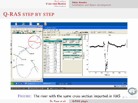
Q-RAS STEP BY STEP
FIGURE: The river with the same cross section imported in RASDe Rosa et al. Q-RAS plugin
MotivationMain contribution
Discussion
Main ResultsLimitation and future development
OUTLINE
1 MOTIVATIONWhy Q-RAS have been developedPrevious Work
2 MAIN CONTRIBUTIONMain ResultsLimitation and future development
De Rosa et al. Q-RAS plugin
MotivationMain contribution
Discussion
Main ResultsLimitation and future development
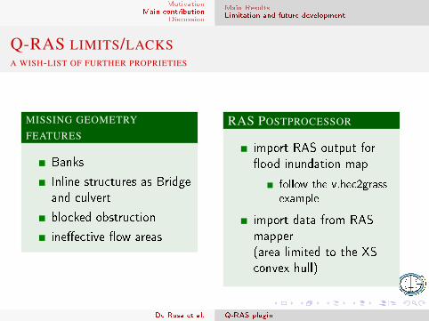
Q-RAS LIMITS/LACKSA WISH-LIST OF FURTHER PROPRIETIES
MISSING GEOMETRY
FEATURES
Banks
Inline structures as Bridgeand culvert
blocked obstruction
ine�ective �ow areas
RAS POSTPROCESSOR
import RAS output for�ood inundation map
follow the v.hec2grassexample
import data from RASmapper(area limited to the XSconvex hull)
De Rosa et al. Q-RAS plugin
MotivationMain contribution
Discussion
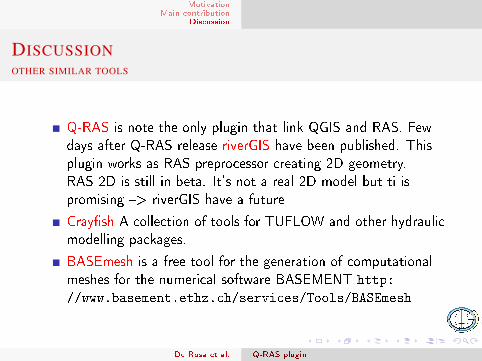
DISCUSSIONOTHER SIMILAR TOOLS
Q-RAS is note the only plugin that link QGIS and RAS. Fewdays after Q-RAS release riverGIS have been published. Thisplugin works as RAS preprocessor creating 2D geometry.RAS 2D is still in beta. It's not a real 2D model but ti ispromising �> riverGIS have a future
Cray�sh A collection of tools for TUFLOW and other hydraulicmodelling packages.
BASEmesh is a free tool for the generation of computationalmeshes for the numerical software BASEMENT http:
//www.basement.ethz.ch/services/Tools/BASEmesh
De Rosa et al. Q-RAS plugin
Appendix For Further Reading
FOR FURTHER READING I
Chiraz P. & Ricci A. 2007http://www.gitonline.eu/GITTMP/GIT2007/GIT_
Bevagna_2007/Lavori_GIT_2007_pdf/6-Presentazione_
Chiraz.pdf
Convegno GIT, 2007.
http://rivergis.com/
https:
//github.com/lutraconsulting/qgis-crayfish-plugin
De Rosa et al. Q-RAS plugin
Appendix For Further Reading
FOR FURTHER READING II
Hinkelammert, F., Volz, C., Boes, R.M. (2012).Einsatz eines freien Geoinformationssystems (GIS) für diehydraulische 2D-Modellierung.Symposium der Wasserbau-Institute TU München, TU Grazund ETH Zürich, Graz, Austria.
Chiraz , P., Ricci , A. 2008Veri�che idrauliche: Processi di automazione edinteroperabilità a livello dati tra GRASS ed HEC - RAS,IX Meeting degli Utenti Italiani di GRASS GIS � GFOSS ,Perugia .
De Rosa et al. Q-RAS plugin