Embed Size (px)
Citation preview

JBSA-Randolph Joint Land Use Study
Public Workshop
Workshop #1 October 16, 2013

JBSA-Randolph Joint Land Use Study
Today’s Meeting
Agenda
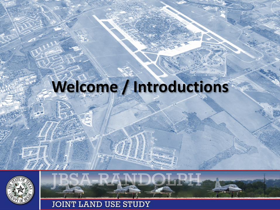
Welcome / Introductions
JLUS Overview
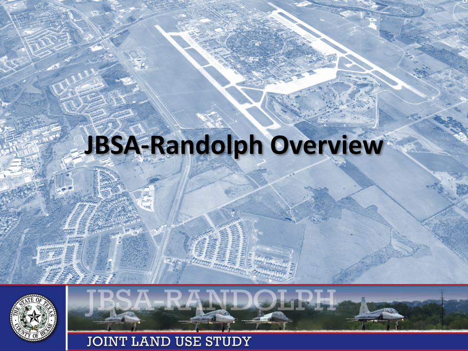
JBSA-Randolph Overview
Overview of Compatibility Factors
Next Steps
Compatibility Factor Workshop Exercise
Adjourn
JBSA-Randolph Joint Land Use Study
Welcome / Introductions

JBSA-Randolph Joint Land Use Study
Welcome / Introductions
JLUS Partners Bexar County City of Converse City of Garden Ridge City of Live Oak City of San Antonio City of Schertz City of Selma City of Universal City Guadalupe County City of Cibolo City of Seguin JBSA – Randolph
Project Committees
Executive Committee Advisory Committee
Consultant to Bexar County Matrix Design Group Celeste Werner, AICP
• Project Manager Mike Hrapla
• Deputy Project Manager Tracy Wieczorek

JBSA-Randolph Joint Land Use Study
Project Administrator: Bexar County
County of Bexar Public Works Department Malik Jabeir Email [email protected] Phone 210.335.0726
233 N Pecos La Trinidad, Suite 420 San Antonio, TX 78207

JBSA-Randolph Joint Land Use Study
Matrix Completed JLUS Projects

JBSA-Randolph Joint Land Use Study
JLUS Overview
JBSA-Randolph Joint Land Use Study
What is a JLUS?
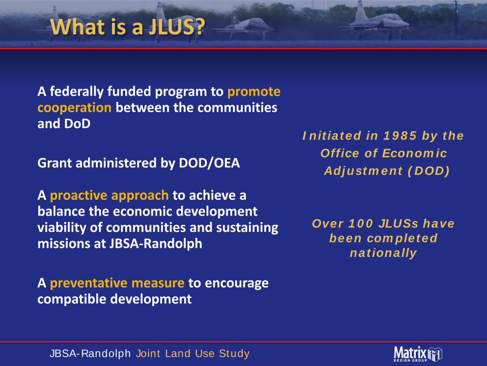
A federally funded program to promote cooperation between the communities and DoD Grant administered by DOD/OEA A proactive approach to achieve a balance the economic development viability of communities and sustaining missions at JBSA-Randolph A preventative measure to encourage compatible development
Initiated in 1985 by the Office of Economic
Adjustment (DOD)
Over 100 JLUSs have been completed
nationally
JBSA-Randolph Joint Land Use Study
JLUS Facts
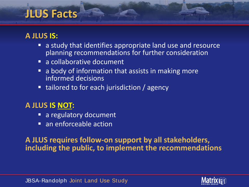
A JLUS IS: a study that identifies appropriate land use and resource
planning recommendations for further consideration a collaborative document a body of information that assists in making more
informed decisions tailored to for each jurisdiction / agency
A JLUS IS NOT: a regulatory document an enforceable action
A JLUS requires follow-on support by all stakeholders, including the public, to implement the recommendations
JBSA-Randolph Joint Land Use Study
Overview of Joint Land Use Studies
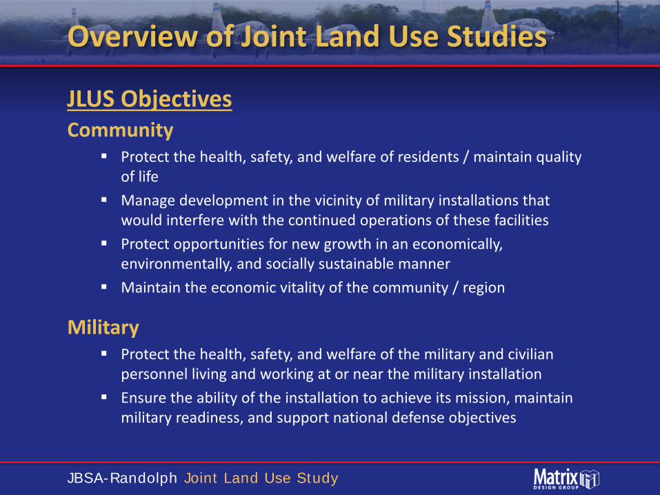
JLUS Objectives Community
Protect the health, safety, and welfare of residents / maintain quality of life
Manage development in the vicinity of military installations that would interfere with the continued operations of these facilities
Protect opportunities for new growth in an economically, environmentally, and socially sustainable manner
Maintain the economic vitality of the community / region
Military Protect the health, safety, and welfare of the military and civilian
personnel living and working at or near the military installation Ensure the ability of the installation to achieve its mission, maintain
military readiness, and support national defense objectives

JBSA-Randolph Joint Land Use Study
Who is Engaged in JLUS
Elected & Appointed Officials JBSA-Randolph Representatives
Sponsor Bexar County
JLUS Executive Committee
Policy Direction Study Oversight Monitoring Report Adoption
Advisory Committee
Technical Issues Alternatives Report Development Recommendations
Coordination Accountability Grant Management Financial Contribution
Participants Responsibilities
Public Public Input Public Comments
All interested persons
Planning Staff Engineering Staff Technical Specialists Special Interests
Bexar County
JBSA-Randolph Joint Land Use Study
Input / Flow
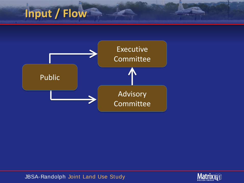
Public
Advisory Committee
Executive Committee

JBSA-Randolph Joint Land Use Study
JLUS Study Area
JBSA-Randolph Joint Land Use Study
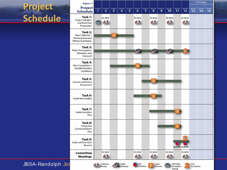
Project Schedule
JBSA-Randolph Joint Land Use Study
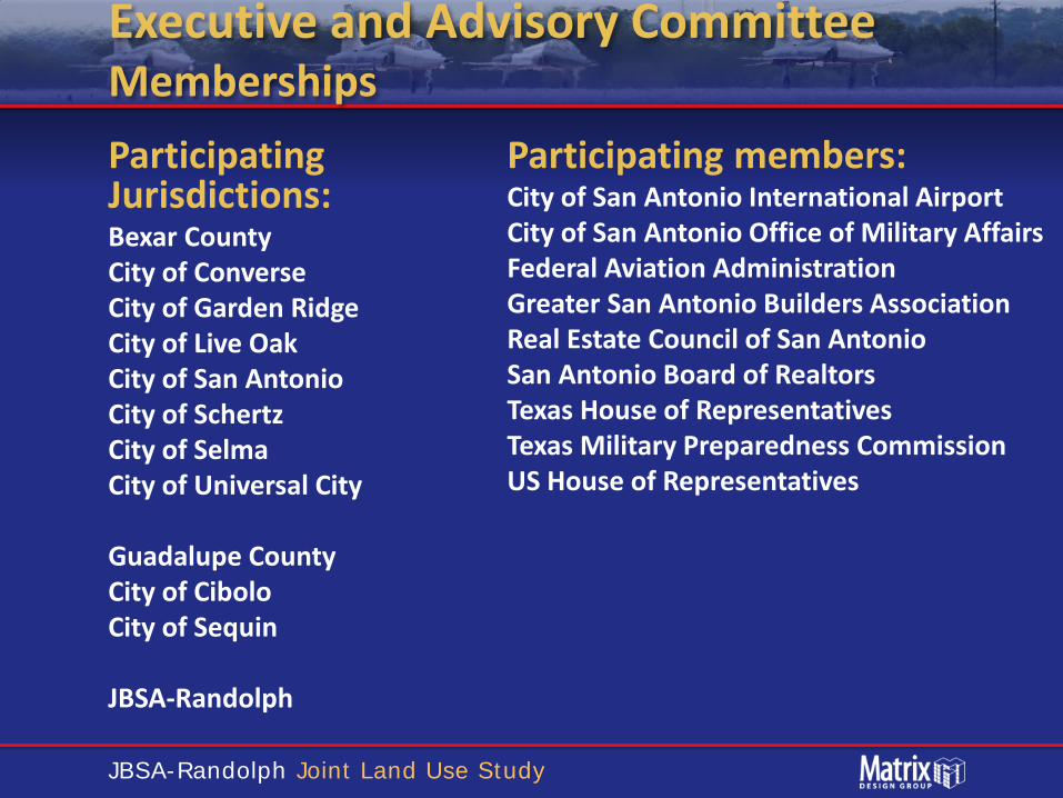
Executive and Advisory Committee Memberships Participating Jurisdictions: Bexar County City of Converse City of Garden Ridge City of Live Oak City of San Antonio City of Schertz City of Selma City of Universal City Guadalupe County City of Cibolo City of Sequin JBSA-Randolph
Participating members: City of San Antonio International Airport City of San Antonio Office of Military Affairs Federal Aviation Administration Greater San Antonio Builders Association Real Estate Council of San Antonio San Antonio Board of Realtors Texas House of Representatives Texas Military Preparedness Commission US House of Representatives
JBSA-Randolph Joint Land Use Study
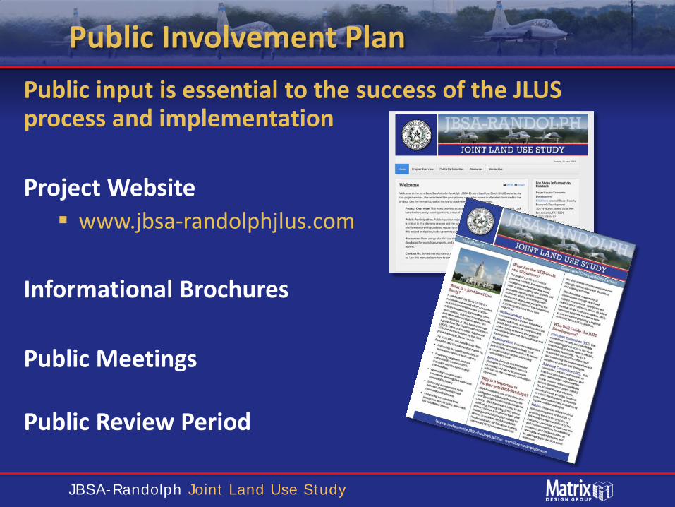
Public Involvement Plan Public input is essential to the success of the JLUS process and implementation Project Website www.jbsa-randolphjlus.com
Informational Brochures
Public Meetings Public Review Period
JBSA-Randolph Joint Land Use Study
Issue Identification
How Are Issues Identified Technical expertise / experience Data research Interviews with local stakeholders
• Jurisdictions • Military • Agencies • Organizations
Committee inputs Public inputs
JBSA-Randolph Joint Land Use Study
JBSA-Randolph Overview
JBSA-Randolph Joint Land Use Study
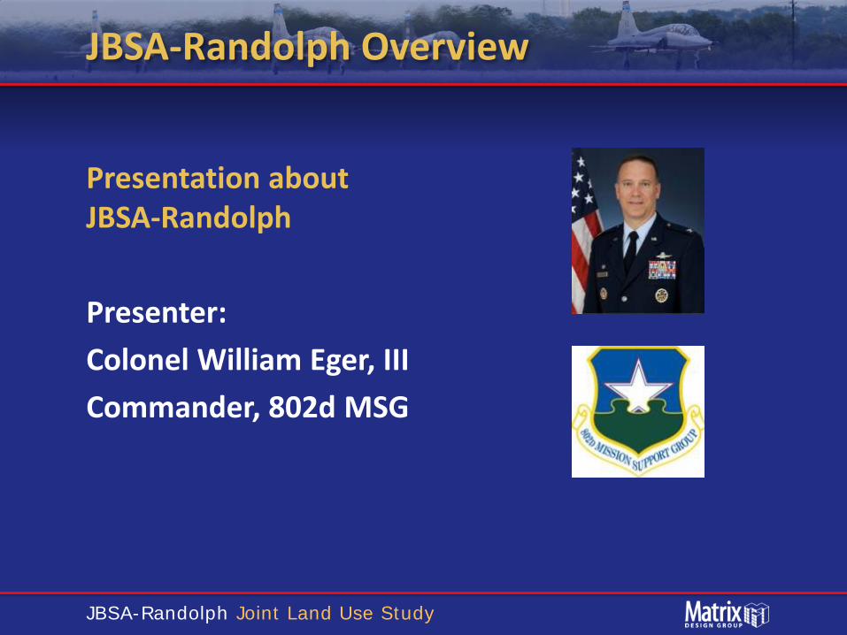
JBSA-Randolph Overview
Presentation about JBSA-Randolph Presenter: Colonel William Eger, III Commander, 802d MSG

JBSA-Randolph Joint Land Use Study
Overview of Compatibility Factors

JBSA-Randolph Joint Land Use Study
Compatibility Factors
JBSA-Randolph Joint Land Use Study
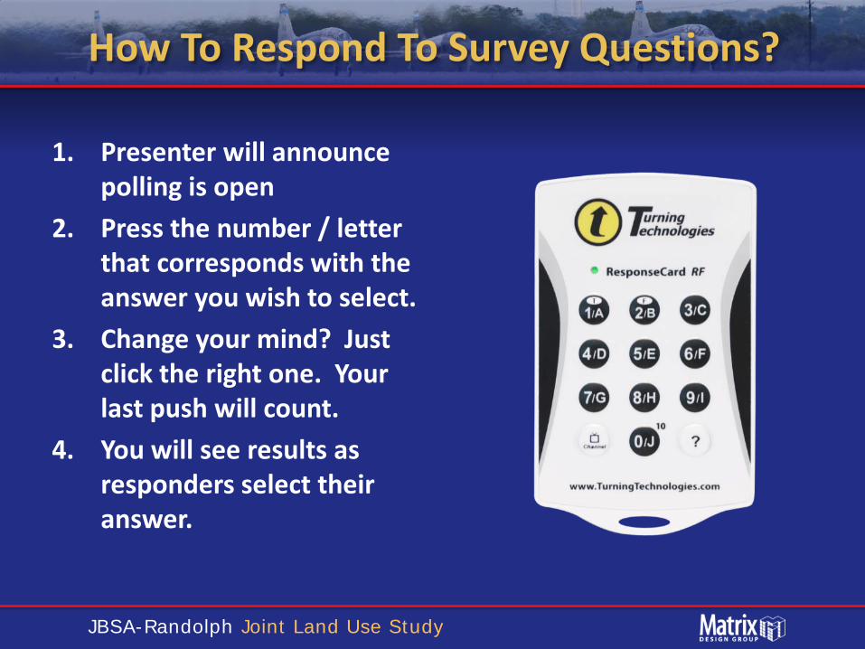
How To Respond To Survey Questions?
1. Presenter will announce polling is open
2. Press the number / letter that corresponds with the answer you wish to select.
3. Change your mind? Just click the right one. Your last push will count.
4. You will see results as responders select their answer.

JBSA-Randolph Joint Land Use Study
How long have you lived in the area?
A. < 1 year B. 1-5 years C. 6-10 years D. 11-20 years E. > 20 years
< 1 year
1-5 years
6-10 years
11-20 years
> 20 years
0%
50%
13%
6%
31%

JBSA-Randolph Joint Land Use Study
What City do you live in?
A. City of Cibolo B. City of Converse C. City of Garden Ridge D. City of Live Oak E. City of San Antonio F. City of Schertz G. City of Seguin H. City of Selma I. City of Universal City
1 2 3 4 5 6 7 8 9
9%
0%
9% 9%
0%0%0%
73%
0%

JBSA-Randolph Joint Land Use Study
What Unincorporated County do you live in?
A. County of Bexar B. County of Guadalupe
A. B.
0%
100%
JBSA-Randolph Joint Land Use Study
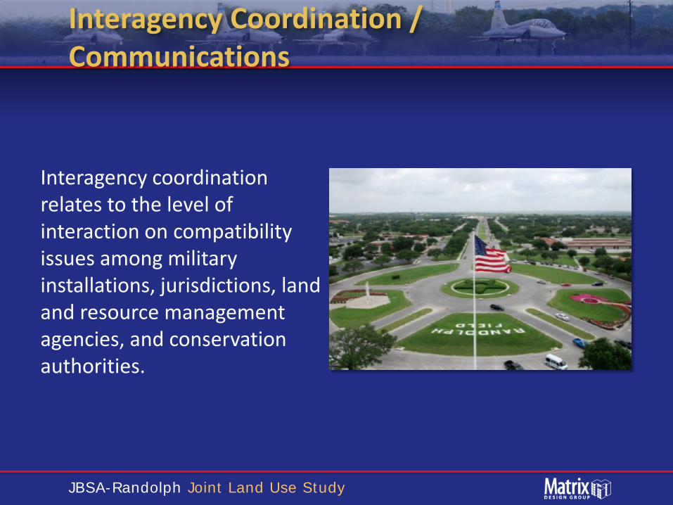
Interagency Coordination / Communications
Interagency coordination relates to the level of interaction on compatibility issues among military installations, jurisdictions, land and resource management agencies, and conservation authorities.

JBSA-Randolph Joint Land Use Study
If you had a question or concern about JBSA-Randolph, did you know who to call?
A. Yes B. No C. Not Applicable
YesNo
Not Applic
able
6%
38%
56%
JBSA-Randolph Joint Land Use Study
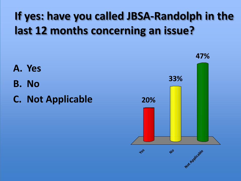
If yes: have you called JBSA-Randolph in the last 12 months concerning an issue?
A. Yes B. No C. Not Applicable
YesNo
Not Applic
able
47%
33%
20%

JBSA-Randolph Joint Land Use Study
Land Use
The basis of land use planning relates to the government’s role in protecting the public’s health, safety, and welfare. County and local jurisdictions’ comprehensive plans, growth policy, and zoning ordinances can be the most effective tools for avoiding, or resolving, land use compatibility issues. These tools ensure the separation of land uses that differ significantly in character. Land use separation also applies to properties where the use of one property may impact the use of another. For instance, industrial uses are often separated from residential uses to avoid impacts related to noise, odors, lighting, etc.
JBSA-Randolph Joint Land Use Study
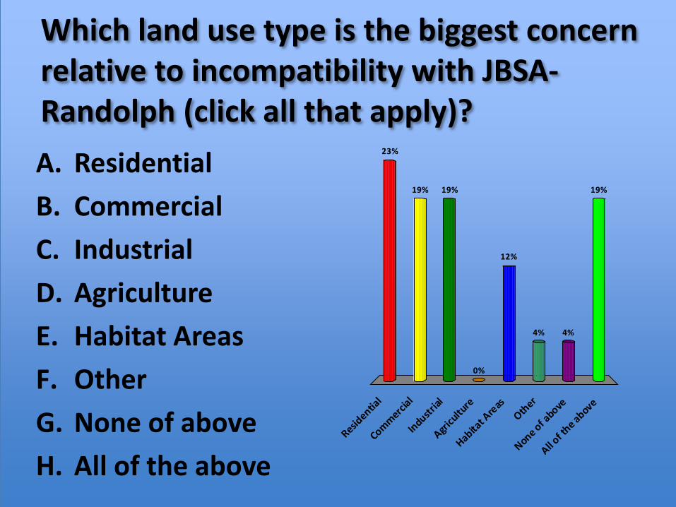
Which land use type is the biggest concern relative to incompatibility with JBSA-Randolph (click all that apply)? A. Residential B. Commercial C. Industrial D. Agriculture E. Habitat Areas F. Other G. None of above H. All of the above
Residentia
l
Commercial
Industrial
Agricu
lture
Habitat A
reasOther
None of above
All of th
e above
23%
19% 19% 19%
4%4%
12%
0%

JBSA-Randolph Joint Land Use Study
Safety Zones
Safety zones are areas in which development should be more restrictive, in terms of use and concentrations of people, due to the higher risks to public safety. Issues to consider include aircraft accident potential zones, weapons firing range safety zones, and explosive safety zones.

JBSA-Randolph Joint Land Use Study
How concerned are you about the potential for aircraft accidents?
A. Extremely B. Somewhat C. Slightly D. Not at all
Extremely
Somewhat
Slightly
Not at a
ll
19%
31%
25%25%

JBSA-Randolph Joint Land Use Study
Do you feel it is necessary for local governments to ensure citizens are protected from the potential of aircraft mishaps?
A. Yes B. No C. I don’t know
A. B. C.
0%
20%
80%

JBSA-Randolph Joint Land Use Study
Vertical Obstructions
Vertical obstructions are created by buildings, trees, structures, or other features that may encroach into the navigable airspace used for military operations (aircraft approach, transitional, inner horizontal, outer horizontal, and conical areas, as well as military training routes). These can present a safety hazard to both the public and military personnel and potentially impact military readiness.

JBSA-Randolph Joint Land Use Study
Imaginary Surfaces

JBSA-Randolph Joint Land Use Study
Imaginary Surfaces

JBSA-Randolph Joint Land Use Study
Are you aware of FAA height restrictions surrounding airfields / airports?
A. Yes B. Yes, but not clear
how to apply C. No
A. B. C.
7%
33%
60%

JBSA-Randolph Joint Land Use Study
Infrastructure Extensions
This factor covers the extension or provision of infrastructure (roads, sewer, water, etc.) in the vicinity of the installation. Infrastructure can enhance the operations of the installation by providing needed services, such as sanitary sewer treatment capacity and transportation systems. However, enhanced or expanded infrastructure could also encourage growth into areas near the installation that might not be compatible with current or future missions.

JBSA-Randolph Joint Land Use Study
Anti-Terrorism / Force Protection
Anti-Terrorism / Force Protection (AT / FP) relates to the safety of personnel, facilities, and information on an installation from outside threats. Methods to protect the installation and its supportive facilities can impact off-installation uses.

JBSA-Randolph Joint Land Use Study
Noise
From a technical perspective, sound is mechanical energy transmitted by pressure waves in a compressible medium such as air. More simply stated, sound is what we hear. As sounds reach unwanted levels, this is referred to as noise. The central issue of noise is the impact, or perceived impact, on people, animals (wild and domestic), and general land use compatibility. Exposure to high noise levels can have a significant impact on human activity, health, and safety.

JBSA-Randolph Joint Land Use Study
Is noise from aircraft operations at JBSA-Randolph an issue?
A. Yes B. Rarely C. No D. Not now, but could
be in future E. I don’t know
Yes
Rarely No
Not now, b
ut could be in
...
I don’t k
now
36%
7%
0%
14%
43%

JBSA-Randolph Joint Land Use Study
If “Yes” or “Rarely”, at what times / days do you experience this?
A. Weekday (daytime) B. Weekday (night) C. Weekend (daytime) D. Weekend (night) E. Varies F. N/A
A. B. C. D. E. F.
27%
9%
36%
27%
0%0%

JBSA-Randolph Joint Land Use Study
If “Yes” or “Rarely”, at what times do you experience this?
A. Midnight to 7 a.m. B. 7 a.m. to noon C. Noon to 8 p.m. D. 8 p.m. to Midnight
Midnight to 7 a.m
.
7 a.m. to
noon
Noon to 8 p.m
.
8 p.m. to
Midnight
20%
0%
20%
60%

JBSA-Randolph Joint Land Use Study
Vibration
Vibration is an oscillation or motion that alternates in opposite directions and may occur as a result of an impact, explosion, noise, mechanical operation, or other change in the environment. Vibration may be caused by military and/or civilian activities.
JBSA-Randolph Joint Land Use Study
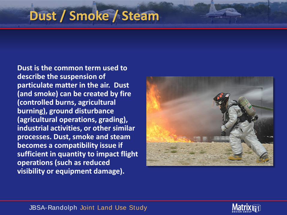
Dust / Smoke / Steam
Dust is the common term used to describe the suspension of particulate matter in the air. Dust (and smoke) can be created by fire (controlled burns, agricultural burning), ground disturbance (agricultural operations, grading), industrial activities, or other similar processes. Dust, smoke and steam becomes a compatibility issue if sufficient in quantity to impact flight operations (such as reduced visibility or equipment damage).
JBSA-Randolph Joint Land Use Study
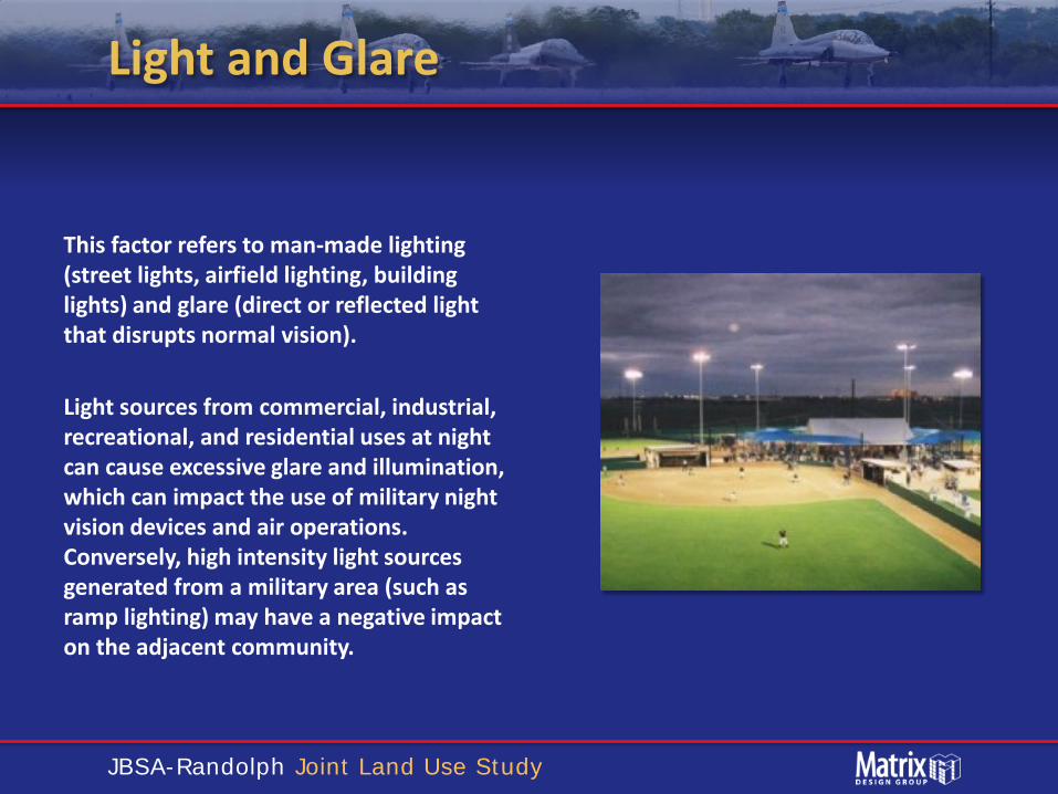
Light and Glare
This factor refers to man-made lighting (street lights, airfield lighting, building lights) and glare (direct or reflected light that disrupts normal vision). Light sources from commercial, industrial, recreational, and residential uses at night can cause excessive glare and illumination, which can impact the use of military night vision devices and air operations. Conversely, high intensity light sources generated from a military area (such as ramp lighting) may have a negative impact on the adjacent community.

JBSA-Randolph Joint Land Use Study
Public Trespassing
This factor addresses public trespassing, either purposeful or unintentional, onto a military installation. The potential for trespassing increases when public use areas are in close proximity to the installation.

JBSA-Randolph Joint Land Use Study
Cultural Resources
Cultural resources may prevent development, apply development constraints, or require special access by Native American tribes, other groups, or governmental regulatory authorities.
JBSA-Randolph Joint Land Use Study
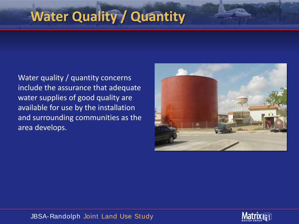
Water Quality / Quantity
Water quality / quantity concerns include the assurance that adequate water supplies of good quality are available for use by the installation and surrounding communities as the area develops.

JBSA-Randolph Joint Land Use Study
Is availability of water a concern / limitation for your community?
A. Yes B. No C. I don’t know
A. B. C.
7%
20%
73%
JBSA-Randolph Joint Land Use Study
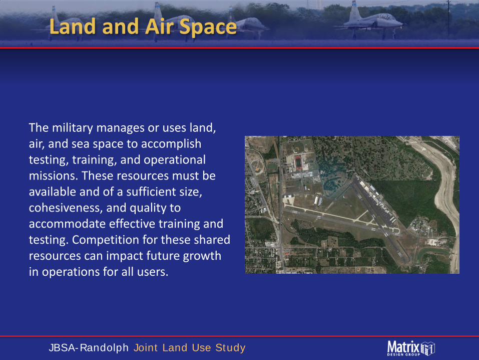
Land and Air Space
The military manages or uses land, air, and sea space to accomplish testing, training, and operational missions. These resources must be available and of a sufficient size, cohesiveness, and quality to accommodate effective training and testing. Competition for these shared resources can impact future growth in operations for all users.

JBSA-Randolph Joint Land Use Study
Do you have concerns about flight training increasing at JBSA-Randolph?
A. Yes, significant B. Yes, some C. No concerns D. No opinion at this
time
Yes, sig
nifican
t
Yes, so
me
No concern
s
No opinion at this t
ime
8%15%
77%
0%

JBSA-Randolph Joint Land Use Study
Roadway Capacity
Roadway Capacity relates to the ability of existing freeways, highways, arterials, and other local roads to provide adequate mobility and access between military installations and their surrounding communities.
JBSA-Randolph Joint Land Use Study
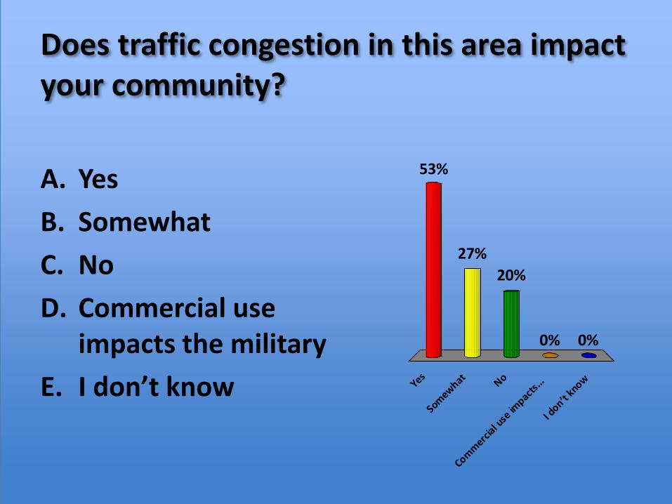
Does traffic congestion in this area impact your community?
A. Yes B. Somewhat C. No D. Commercial use
impacts the military E. I don’t know Yes
Somewhat No
Commercial u
se im
pacts...
I don’t k
now
53%
0%0%
20%27%

JBSA-Randolph Joint Land Use Study
Compatibility Factor Workshop Exercise

JBSA-Randolph Joint Land Use Study
Compatibility Factor Workshop Exercise
JBSA-Randolph Joint Land Use Study
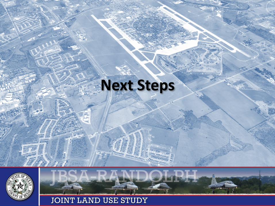
Next Steps
JBSA-Randolph Joint Land Use Study
For Questions Contact:
Bexar County Public Works Department 233 N Pecos La Trinidad, Suite 420 San Antonio, TX 78207 E. [email protected] P. (210) 335-0726
www.jbsa-randolphjlus.com

JBSA-Randolph Joint Land Use Study
QUESTIONS
Q & A