Embed Size (px)
Citation preview

PS7 Geography Revision for Summative Assessment in PS7 Geography Revision for Summative Assessment in February 2018February 2018
Your second summative assessment in Geography will take place in week 7week 7 of the
Spring Term 2018.
You can achieve a possible 10%10% in this assessment which will go towards your Holmwood House Certificate. Holmwood House Certificate. The assessment will also provide invaluable
practice for your geography scholarship examination in Year 8.
This assessment will last 1 hourThis assessment will last 1 hour
The assessment will cover knowledge, understanding and skills covered in Year 6 and Year 7. You will be expected to respond to a number of written questions
covering the following areas of study:-
Global LocationGlobal Location
OS Map SkillsOS Map Skills
(we will revise both of the above during lessons and prep in week 6)
Earthquakes and VolcanoesEarthquakes and Volcanoes
Coastal features, processes and managementCoastal features, processes and management
MAKE SURE YOU COMPLETE THE PRACTICE QUESTIONS! -MAKE SURE YOU COMPLETE THE PRACTICE QUESTIONS! - given to you in lesson on Wednesday 7th February.given to you in lesson on Wednesday 7th February.
Some questions will require factual recall and some will involve responding to data (this can take the form of a graph/s, table/s, picture/s, map/s and/or a video
clip).
This will be the format of the assessment:-
Section ASection A asks questions about Global LocationGlobal Location.

Section BSection B tests your map skills and is based on an OS map extractOS map extract.
Section C Section C covers the main topics of ‘Earthquakes and Volcanoes’ and ‘Coastal features, processes and management.’
Knowledge of case studiescase studies is required for Section CSection C.
You are required to answer all the questionsanswer all the questions on the paper within one hour.hour.
Part of the paper will involve responding to data - this may take the form of a graph/s, table/s, picture/s, map/s and/or a video clip.
To start with you need to know where to find information on the topics we have studied.
Below is a list of sources for revision:-
● Years 6 and Year 7 exercise books – Years 6 and Year 7 exercise books – these contain class and prep work on our main units of study so far ‘Volcanoes and Earthquakes’ and ‘Coastal features, processes and management.’
● CGP KS3 Geography Revision Guide (RG) CGP KS3 Geography Revision Guide (RG).
● Practice questions Practice questions - these were given to you in the lesson on Wednesdaylesson on Wednesday 7th February 2018.7th February 2018.
● Class Learning LogClass Learning Log – this contains extra information sheets and your assessment for the end of Year 6 and your first summative assessment in November 2017 (worth having another look at again).
● E Learning Log E Learning Log - contains slideshows e.g. group work on coastal management.
● School website - School website - here you will find exercises on ‘Global Location’ and ‘OS Map Skills.’
● Essentials sheets Essentials sheets – also on the website. You have copies in your Learning Log. For this summative assessment. refer to the following essentials sheets only:-
Map Skills - the essentialsMap Skills - the essentials
Earthquakes and Volcanoes – the essentials!Earthquakes and Volcanoes – the essentials!
Coasts - the essentials!Coasts - the essentials!

Here is a breakdown of each section of the paper (Here is a breakdown of each section of the paper (RG = Revision Guide):-:-
Section A of the paperSection A of the paper
You have 10 minutes10 minutes to complete Section Acomplete Section A of the paper.
● You have to revise the names and locations of continents, oceans,
countries, cities, rivers, mountain ranges and deserts.
● This section can be based on either a map of the British IslesBritish Isles, a map of Europe, Europe, a map of Asia, Asia, a map of Africa Africa, a map of North America, North America, a map of South America South America or a map of the World.World.
● You have revision activities on Global Location on the web site.You have revision activities on Global Location on the web site.
● Below is a list of the Global places and features that you may be asked about. You will not be asked to locate anywhere that is not on this list!You will not be asked to locate anywhere that is not on this list!
Major global physical featuresMajor global physical features Continents: Africa, Antarctica, Asia, Oceania, Europe, North and South America. Mountain ranges: Alps, Andes, Himalayas, Pyrenees and Rockies. Desert: Sahara Oceans: Arctic, Indian, Atlantic and Pacific. Rivers: Amazon, Mississippi, Nile, Rhine and Yangtze. Other global featuresOther global features Arctic Circle, Antarctic Circle, Equator, International Dateline, North Pole, Prime Meridian, South Pole, Tropics of Cancer and Capricorn British IslesBritish Isles Countries: The countries of the UK and the Republic of Ireland Sea areas: English Channel, Irish Sea and North Sea. Rivers: Severn, Thames, Trent, Clyde and Shannon. Hills: Grampians, Lake District, Pennines and Snowdonia. Major cities: Belfast, Birmingham, Cardiff, Dublin, Edinburgh, Glasgow, Liverpool, London, Manchester and Newcastle. CountriesCountries
Europe: Europe: France, Germany, Greece, Italy, Poland, Spain, Sweden, Switzerland and Ukraine. Africa: Africa: Egypt, Ethiopia, Kenya, Nigeria and South Africa. Americas: Americas: Brazil, Canada, Mexico and USA. Asia: Asia: Afghanistan, Bangladesh, China, India, Indonesia, Iran, Iraq, Japan, Pakistan, Russia and Saudí Arabia. Oceania: Oceania: Australia and New Zealand Major cities and city states: Major cities and city states: Beijing, Berlin, Cairo, Delhi, Los Angeles, Madrid, Mexico City, Moscow, New York, Paris, Rio de Janeiro, Rome, Sydney, Tokyo, Warsaw and Washington DC.
Section B of the paperSection B of the paper
You have 10 minutes10 minutes to complete Section B Section B of the paper.
In this section you are required to study an OS Map extractOS Map extract.
Make sure you know your fourfour and six figure grid referencessix figure grid references, directionsdirections (N, S, E and W), distances distances and scale scale as well as contour lines.contour lines. If you are unsure about any of these check out the map reading section in your Revision Guide (RG pages 146 –
150). Also, look at the information below:-
Section B - Ordnance Survey Map workSection B - Ordnance Survey Map work You will have to know the following:-You will have to know the following:-
● 4 and 6 figure grid references (RG page 147).
● Map Symbols – these come with the map! (the key) but it would be useful to know major symbols to speed up answers in the examination.
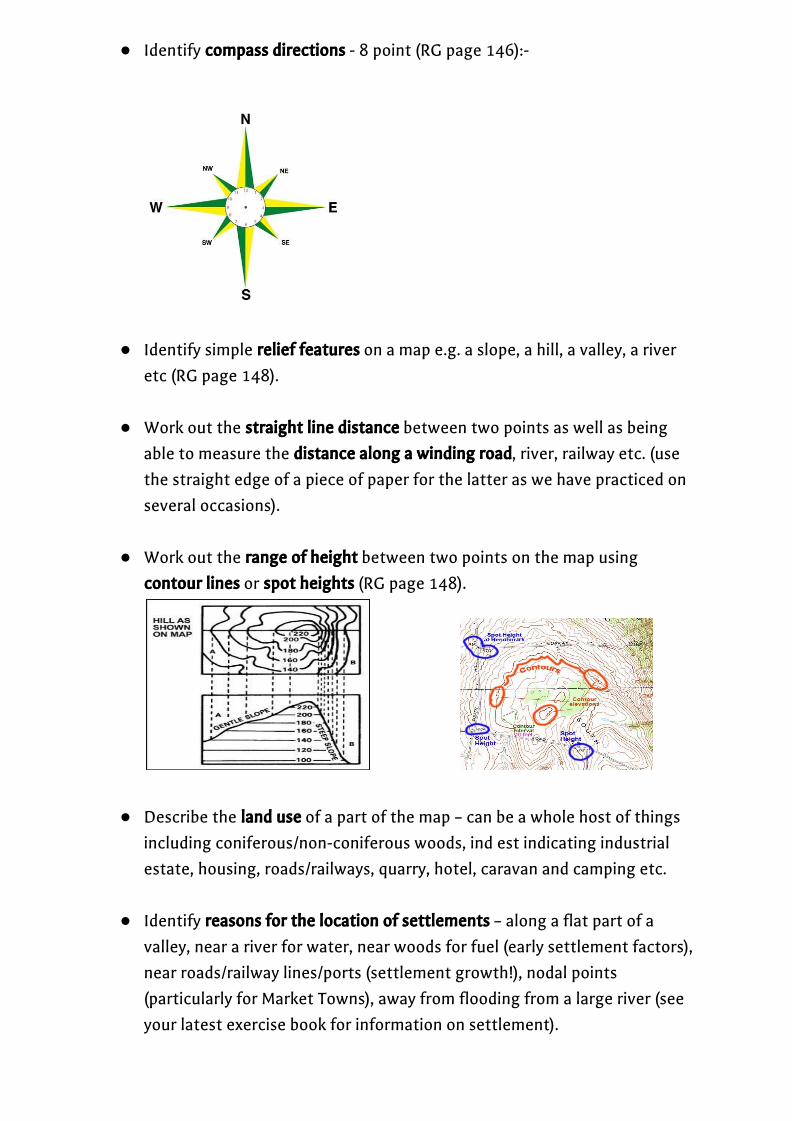
● Identify compass directionscompass directions - 8 point (RG page 146):-
● Identify simple relief featuresrelief features on a map e.g. a slope, a hill, a valley, a river etc (RG page 148).
● Work out the straight line distancestraight line distance between two points as well as being able to measure the distance along a winding roaddistance along a winding road, river, railway etc. (use the straight edge of a piece of paper for the latter as we have practiced on several occasions).
● Work out the range of heightrange of height between two points on the map using
contour linescontour lines or spot heights spot heights (RG page 148).
● Describe the land use land use of a part of the map – can be a whole host of things including coniferous/non-coniferous woods, ind est indicating industrial estate, housing, roads/railways, quarry, hotel, caravan and camping etc.
● Identify reasons for the location of settlementsreasons for the location of settlements – along a flat part of a valley, near a river for water, near woods for fuel (early settlement factors), near roads/railway lines/ports (settlement growth!), nodal points (particularly for Market Towns), away from flooding from a large river (see your latest exercise book for information on settlement).

● Identify reasons for the location of land usereasons for the location of land use such as industrial estates,industrial estates, airports, seaports, retail parks, business parks etc.airports, seaports, retail parks, business parks etc. – flat land for space and expansion, near urban area for source of labour, not too near an urban area as to cause too much disruption, near transport routes for bringing supplies/raw materials in and transporting finished products to other towns/cities, away from potential flooding of large rivers etc.
● Identify different types of economic activityeconomic activity on a map e.g. Primary. Primary (farm, Quarry, Coal Mine, fishing port), Secondary Secondary (Industrial Estate, works, mill, etc.) and Tertiary Tertiary (Hotels, Supermarkets/Retail Parks, Tourist facilities such as camping etc.).
● Describe the course of a rivercourse of a river on a map from the source (where land is
higher indicated by tighter contour lines), through the middle stage (where land becomes gentler indicated by wider contour lines) to the final mature stage (where the land is virtually flat indicated by very wide spacing in contour lines on a map). Please note that you may be asked to describe the changing shape of the channel as well as the changing shape of the valley.
● Identify which way a river is flowing on a mapwhich way a river is flowing on a map – look at spot
heights/contour heights along the course of the river; the river will always flow from the higher points towards the lower points. The river always gets wider as it flows downstream.
● Be able to work out the area of a place/land use such as woods using the
scale at the bottom of the OS map extract – usually each square on a 1:50,000 map = 1 square Km (1c.m. on the map = 0.5 km on the ground, so 2cm = 1 km on the ground).
Section C of the paperSection C of the paper
This is the Thematic Studies Thematic Studies section of the paper. You have 40 minutes to complete this section; you are required to complete activities on your main topics of ‘Earthquakes and Volcanoes’ ‘Earthquakes and Volcanoes’ and ‘Coastal features, processes and‘Coastal features, processes and
management.’management.’
Below is a list of topics to revise for the Trial. topics to revise for the Trial. I have provided page numbers from your new revision guide to help structure your revision but you will also need to
refer to your exercise books, your Learning Log and work done on Walton-on-the-Naze.
RG = Revision GuideRG = Revision Guide
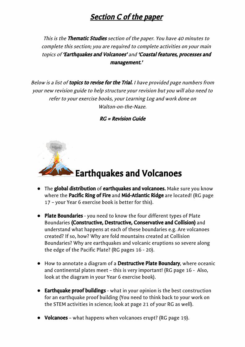
Earthquakes and VolcanoesEarthquakes and Volcanoes
● The global distributionglobal distribution of earthquakes and volcanoes.earthquakes and volcanoes. Make sure you know where the Pacific Ring of FirePacific Ring of Fire and Mid-Atlantic RidgeMid-Atlantic Ridge are located! (RG page 17 – your Year 6 exercise book is better for this).
● Plate BoundariesPlate Boundaries - you need to know the four different types of Plate
Boundaries (Constructive, Destructive, Conservative and Collision) (Constructive, Destructive, Conservative and Collision) and understand what happens at each of these boundaries e.g. Are volcanoes created? If so, how? Why are fold mountains created at Collision Boundaries? Why are earthquakes and volcanic eruptions so severe along the edge of the Pacific Plate? (RG pages 16 - 20).
● How to annotate a diagram of a Destructive Plate BoundaryDestructive Plate Boundary, where oceanic and continental plates meet – this is very important! (RG page 16 - Also, look at the diagram in your Year 6 exercise book).
● Earthquake proof buildingsEarthquake proof buildings - what in your opinion is the best construction
for an earthquake proof building (You need to think back to your work on the STEM activities in science; look at page 21 of your RG as well).
● Volcanoes Volcanoes – what happens when volcanoes erupt? (RG page 19).

● Different types of volcanoes – a Shield volcano Shield volcano and a Composite volcanoComposite volcano (RG page 19).
● The internal structure internal structure of a volcano volcano – layers of ash and lava, main cone,
secondary cone, main vent, secondary vent, magma chamber (RG page 19).
● What happens when a volcano erupts? Eye witness and scientist accounts (look through recent work in your exercise book).
CoastsCoasts
● Processes of coastal erosion - Processes of coastal erosion - Abrasion, Hydraulic Action, Corrosion and Attrition (RG page 59).
● Processes of coastal deposition and transportation along the coast Processes of coastal deposition and transportation along the coast - sandy, gentle beaches and steep, stony beaches (Destructive and Constructive waves). Longshore Drift Longshore Drift is the process whereby material is moved along the coast (RG page 59).
● Coastal landforms landforms created by erosionerosion - the formation of caves, arches caves, arches and stacks stacks (RG page 60)..
● Coastal landforms landforms from deposition - deposition - the formation of Spits, Tombolos Spits, Tombolos and Barrier Beaches Barrier Beaches (RG - page 61).
● Coastal managementCoastal management - you need to understand the differences between Hard and Soft engineering approaches to managing the British coastline (RG pages 63 and 64).
● Conflicts Conflicts between different interest groups along the coast (RG page 62). ● Coastal managementCoastal management at Walton-on-the-Naze. Make sure you read through
work done in your exercise book. A fun website to look at is https://www.google.co.uk/url?sa=i&source=images&cd=&ved=2ahUKEwiK8Mjowo7eAhWmyIUKHfw0CxoQjxx6BAgBEAI&url=http%3A%2F%2Fwww.geographypods.com%2F3-coasts.html&psig=AOvVaw29eUgQ4CwCikgCuyjf-8Rm&ust=1539901646338068
There are some good videos to aid understanding of features and processes.
![[Naze Culture & Communlty Center, Arnaml City!!] ICC (B ... · [Naze Culture & Communlty Center, Arnaml City!!] ICC (B) : 00—5 : 00 0997-52-1816 (FAX) 0997-57-0507 (E-mail) naze-kouminkan@wateraocn.neajp](https://img.pdfslide.us/doc/110x75/5e894c530ee66d27a61bd53a/naze-culture-communlty-center-arnaml-city-icc-b-naze-culture-.jpg)