Embed Size (px)
Citation preview
Projections and Coordinate Systems Revisited
You Must Understand This To Become Proficient in GIS
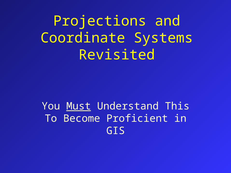
Different Projections for Different Purposes
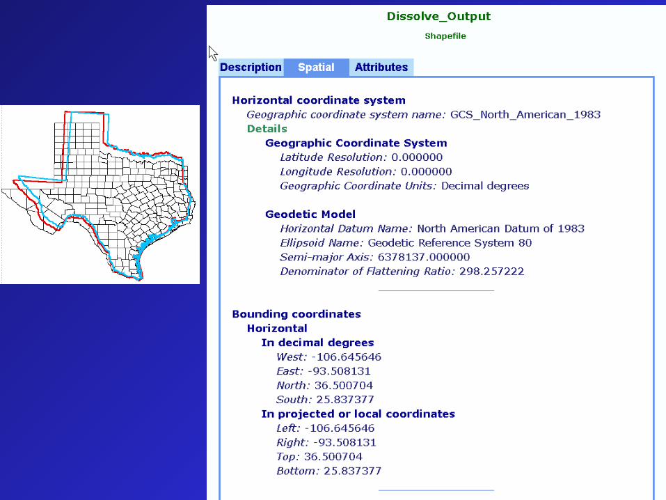
Geographic
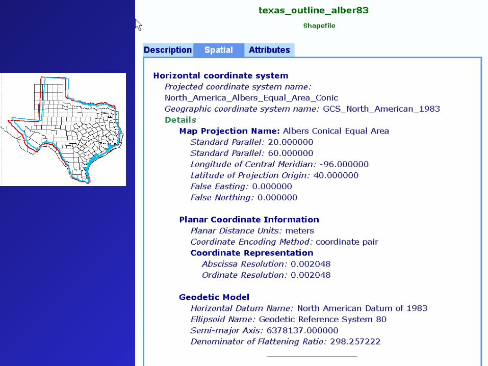
Albers Equal Area
Lambert Conformal Conic
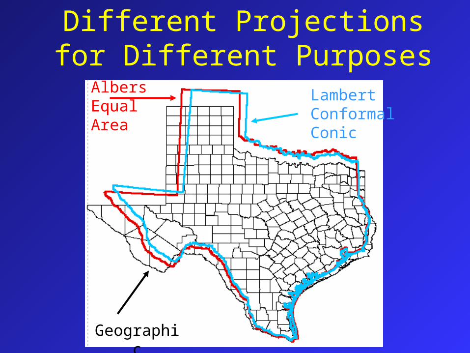
Notice that there is no information about the coordinate system nor the projection for this shapefile.
Everything is assumed but may not be correct.
The shapefile does not have that information until someone DEFINES it.
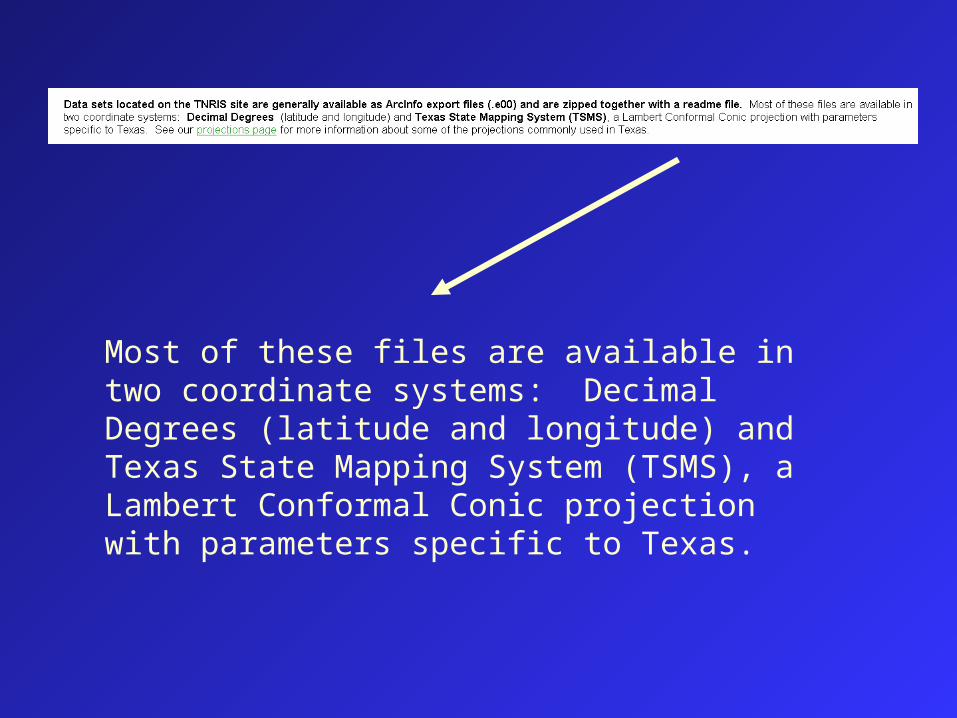
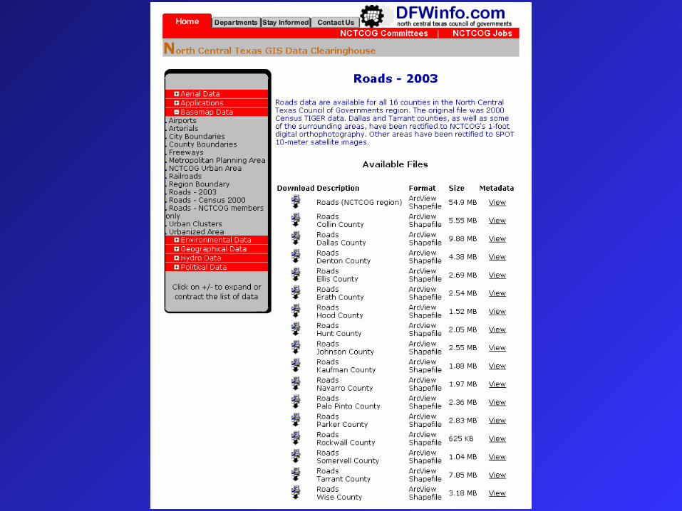
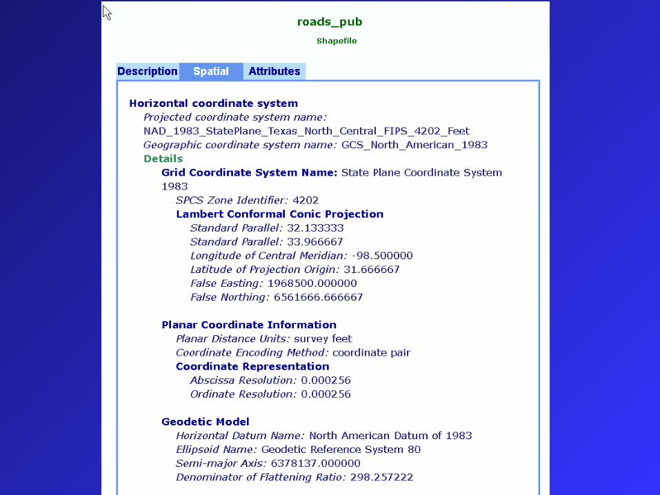
Most of these files are available in two coordinate systems: Decimal Degrees (latitude and longitude) and Texas State Mapping System (TSMS), a Lambert Conformal Conic projection with parameters specific to Texas.
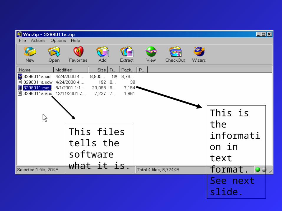
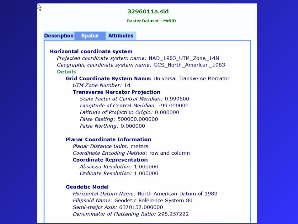
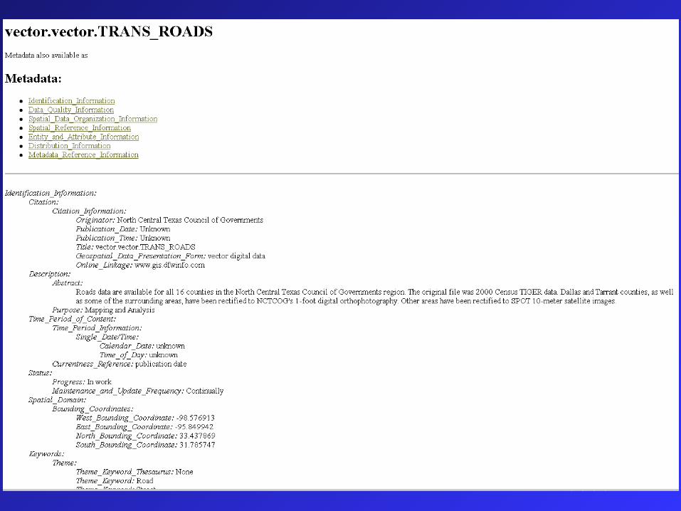
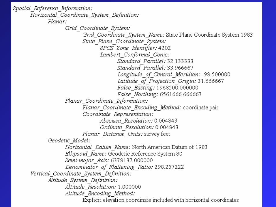
This is the information in text format. See next slide.
This files tells the software what it is.
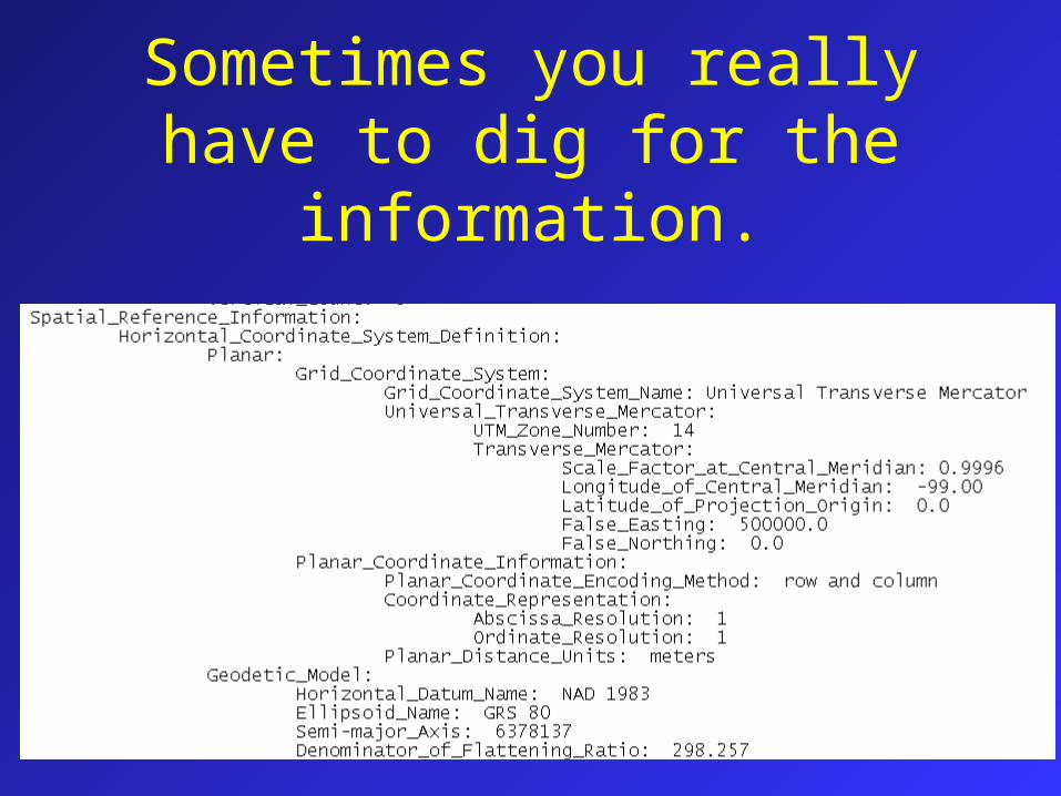
Sometimes you really have to dig for the information.
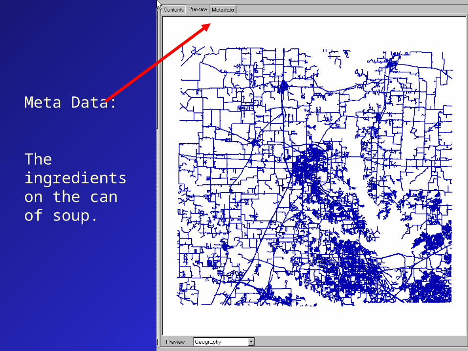
Meta Data:
The ingredients on the can of soup.
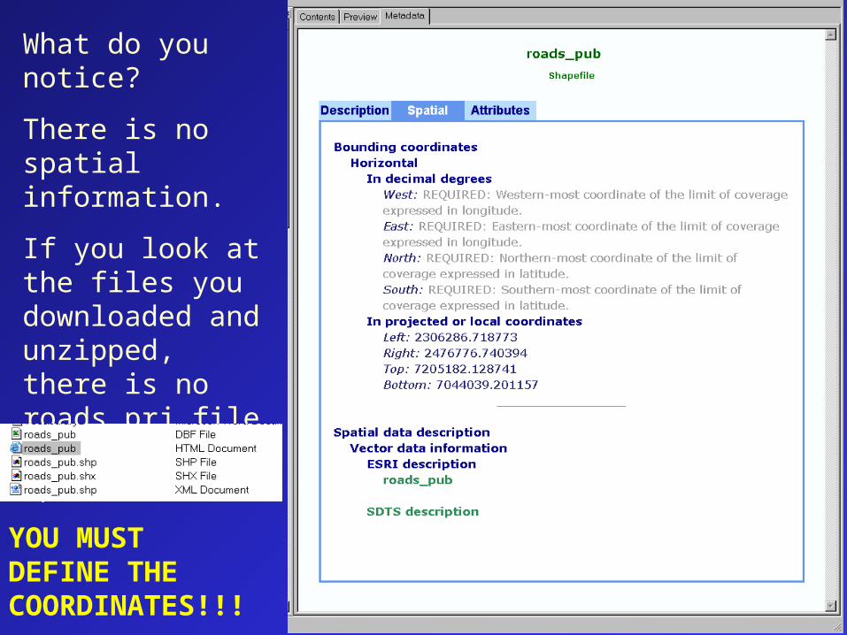
What do you notice?
There is no spatial information.
If you look at the files you downloaded and unzipped, there is no roads.prj file to house the spatial info.
YOU MUST DEFINE THE COORDINATES!!!
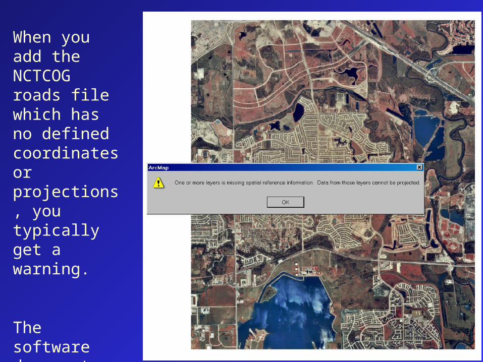
When you add the NCTCOG roads file which has no defined coordinates or projections, you typically get a warning.
The software does not know how to match the files.
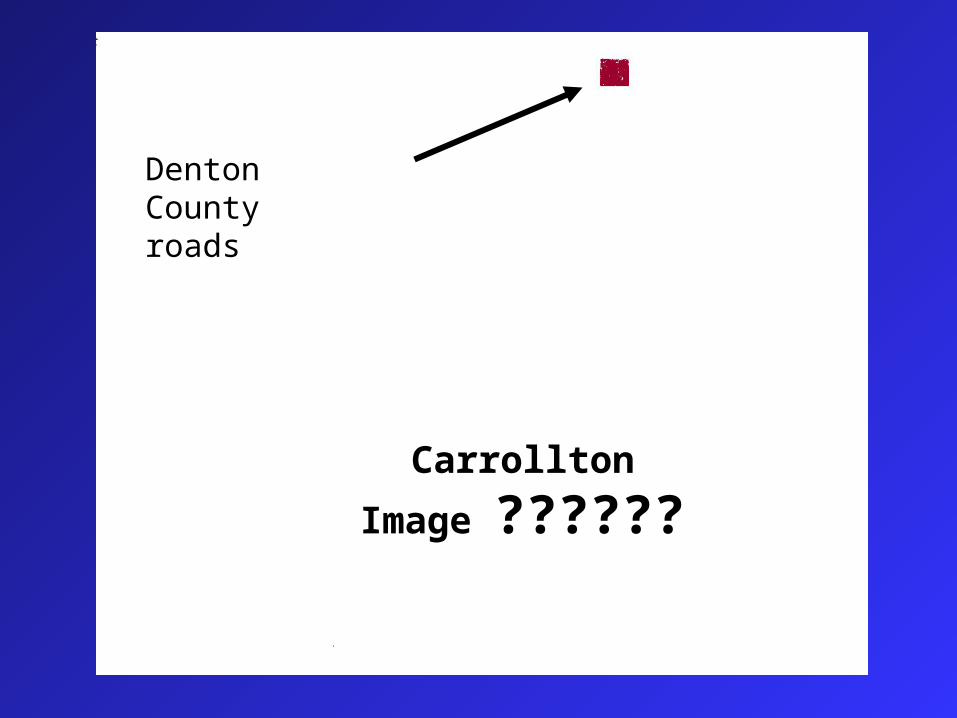
Denton County roads
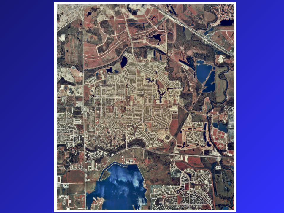
Carrollton
Image ??????
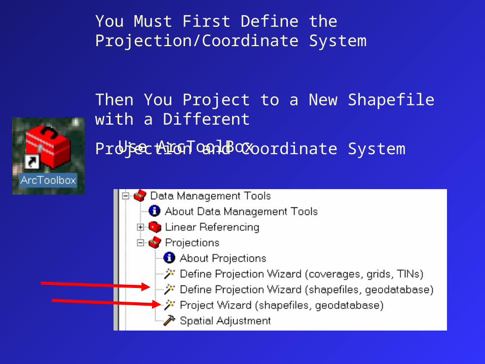
You Must First Define the Projection/Coordinate System
Then You Project to a New Shapefile with a Different
Projection and Coordinate System
Use ArcToolBox

How does ArcGIS remember projections?
Projected Coordinate System: Name: PCS_Transverse_Mercator Alias: Abbreviation: Remarks: Projection: Transverse_MercatorParameters: False_Easting: 500000.000000 False_Northing: 0.000000 Central_Meridian: -117.000000 Scale_Factor: 0.999600 Latitude_Of_Origin: 0.000000Linear Unit: Meter (1.000000)Geographic Coordinate System: Name: GCS_North_American_1983
PRJ file
Shapefiles
Coverages
World file CAD files
Images
RDBMS table Geodatabase
• Projection information is stored in various ways
AUX file
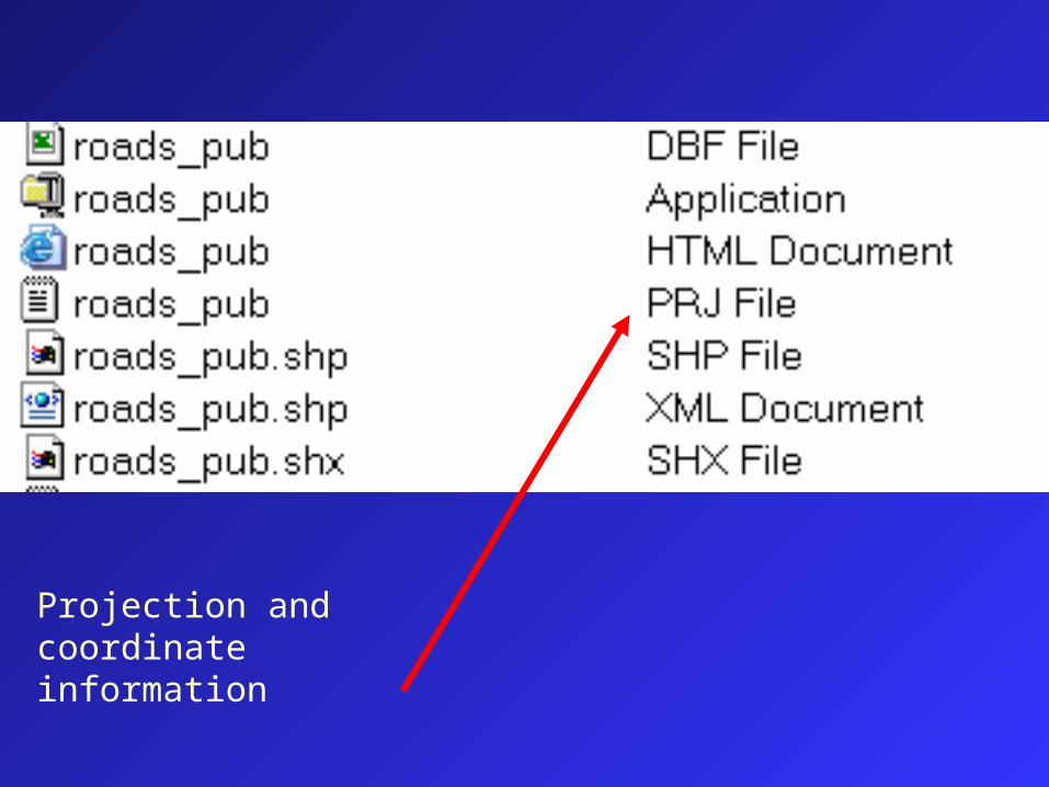
Projection and coordinate information
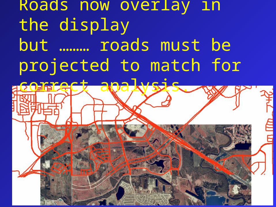
Roads now overlay in the displaybut ……… roads must be projected to match for correct analysis.
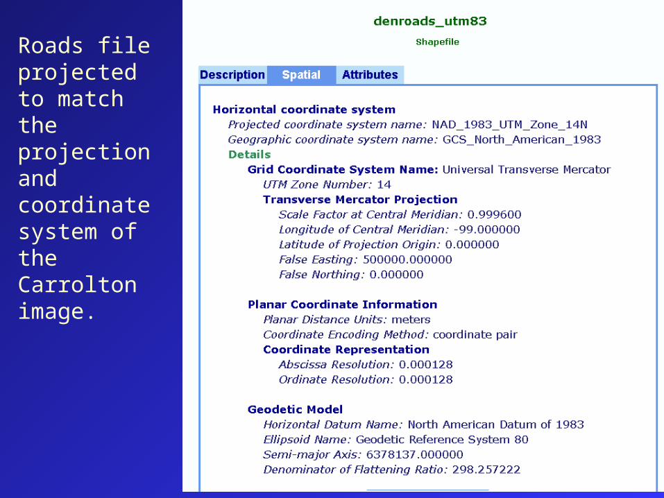
Roads file projected to match the projection and coordinate system of the Carrolton image.
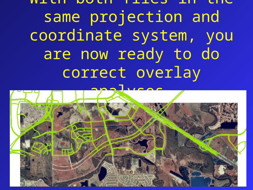
With both files in the same projection and coordinate system, you are now ready to do correct
overlay analyses.