Embed Size (px)
Citation preview
Becky RolandExecutive DirectorPLSC, IncPO Box 441069Aurora, CO 80044
Prst stdU.S. Postage
PAIDDenver, CO
Permit No. 1222
SIDE SHOTS
SIDE SHOTS
SIDE SHOTS
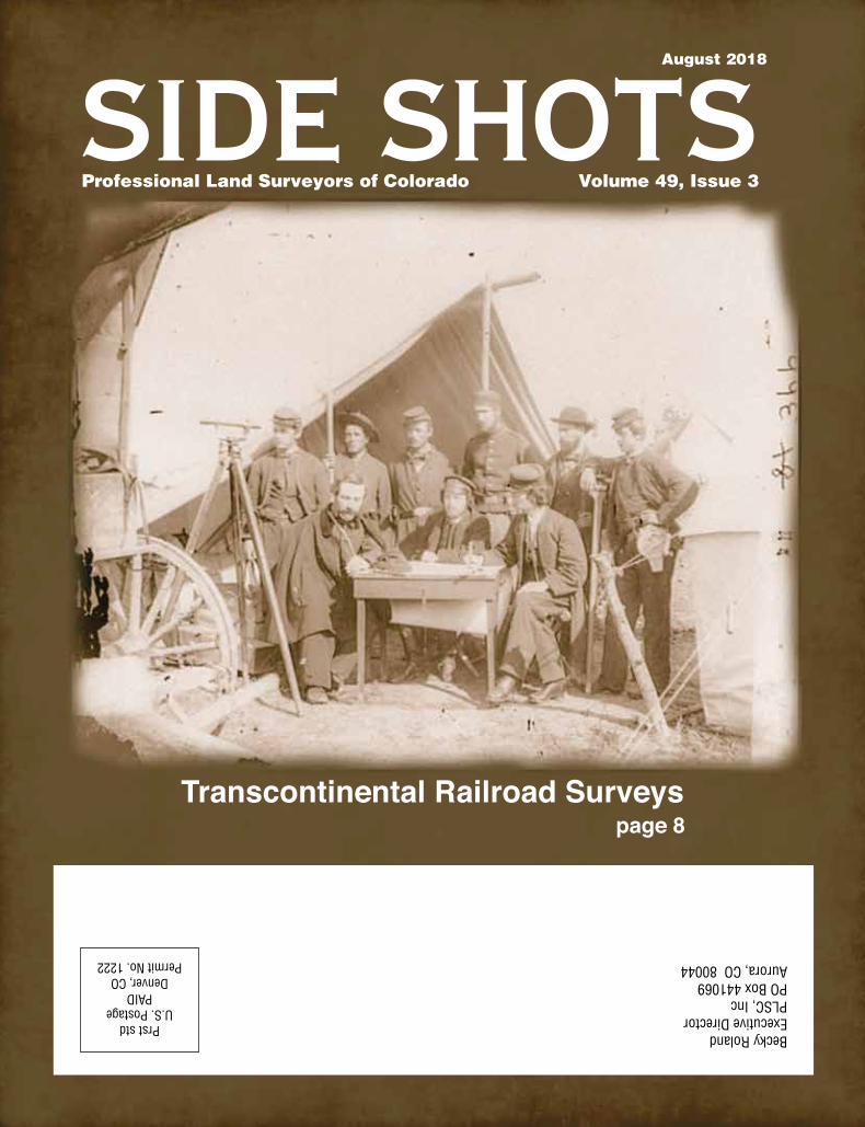
Transcontinental Railroad Surveyspage 8
Professional Land Surveyors of Colorado Volume 49, Issue 3
August 2018

SIDE SHOTS • AUGUST 2018 3
Professional Land Surveyors of Colorado, Inc.
AFFILIATE—NATIONAL SOCIETY OF PROFESSIONAL SURVEYORS
MEMBER—COLORADO ENGINEERING COUNCILMEMBER—WESTERN FEDERATION OF
PROFESSIONAL SURVEYORS
OFFICERS (2018)
Todd BeersPresident
[email protected]: 303-353-3528
steve ParkerVice President
[email protected]: 719-641-3355
Alan BlairSecretary/Treasurer
[email protected]: 303-808-0981
Becky RolandExecutive Director
PO Box 441069, Aurora, CO 80044 • [email protected] AMC O: (303) 551-3266 F: (720) 230-4846
2018 PLSC CHAPTER ORGANIZATION
CENTRAL COLORADO PROFESSIONAL SURVEYORSPresident, Shwan Clarke
Vice President, Robert Boehm; Secretary, Shaun Lee Treasurer, Scott Throm
Directors: Devon Arnold, Brian Socia, Randy Fortuin, Julie Keilman, Gavin Puckett, Derek Brown, Daniel Davis
NORTHERN CHAPTER - PLSC, INC.President: Steve Parks
President-elect: Vacant; Secretary/Treasurer, Heather LassnerDirectors: Pete Paulus, Tony Fendick, Laine Landau
President Emeritus: Kayce Keane
NORTHWEST 1/4 COLORADO LAND SURVEYORSPresident: Brian T. Kelly
Vice President, William Whelan; Secretary/Treasurer, Jeff GustafsonImmediate Past President and Director, Gordon Dowling
Directors: Thomas H. Effinger, Skidge Moon, Walter Magill, Lloyd Powers, Peter Epp
SOUTHERN COLORADO PROFESSIONAL LAND SURVEYORSPresident: Don R. Hulsey
Vice President: Spencer Barron; Secretary: Steve Parker Treasurer: Dan Hanten
Directors: Jon Tessin, Steve Rutzen, Mark Johannes, Eric White,
Joseph Alessi, III, Kenneth Gould, Jr., Nathan LiraPresident Emeritus: Steve Parker
SOUTHWESTERN Chapter - PLSC, Inc.President: Parker Newby
Vice President: Todd Johnson; Secretary: Josh Casselberry; Treasurer: Dave Seiler
WESTERN COLORADO LAND SURVEYORSPresident: Alec Thoas
Vice President: Chris Ransier; Secretary-Treasurer: Alex LheritierDirectors: Brian Bowker, Scott Thompson, Peter Krick,
Tom Sylvester, Les Doehling, Sean Mullen, Kurt Shepherd
Side Shots is the official publication of the Professional Land Surveyors of Colorado, Inc. and is published quarterly for the betterment of the surveying profession.
Todd Beers Steve Parker President Vice President
For Editorial Correspondence, contact:John B. Guyton
Editor: Side Shots5385 Centennial Trail, Boulder, CO 80303303-443-7001 • [email protected]
This publication is not copyrighted and articles may be reprinted with due credit. Statements made and opinions expressed are from the contributors and do not necessarily
express the official views of the Professional Land Surveyors of Colorado, Inc.Deadlines for editorials, articles, pictures and advertising are January 1, April 1, July 1 and October 1. All material received after the current deadline will appear
in the next issue of Side Shots.
We would like to invite anyone who is interested to advertise in Side Shots. Do you have something you want to sell, trade or buy? Why not use Side Shots for your
next ad? We can also reproduce business cards for advertising. Ad space reservation must be arranged with Becky Roland, PO Box 441069, Aurora, CO 80044; 303-551-3266.
(Deadlines: January 1, April 1, July 1 and October 1).
Current Advertising Rates:Business card size or less - Member $25.00; Non-member $30.00
One-Half Page - Member $115.00; Non-member $150.00Full Page - Member $225.00; Non-member $300.00
Color advertisements — add 33 percent
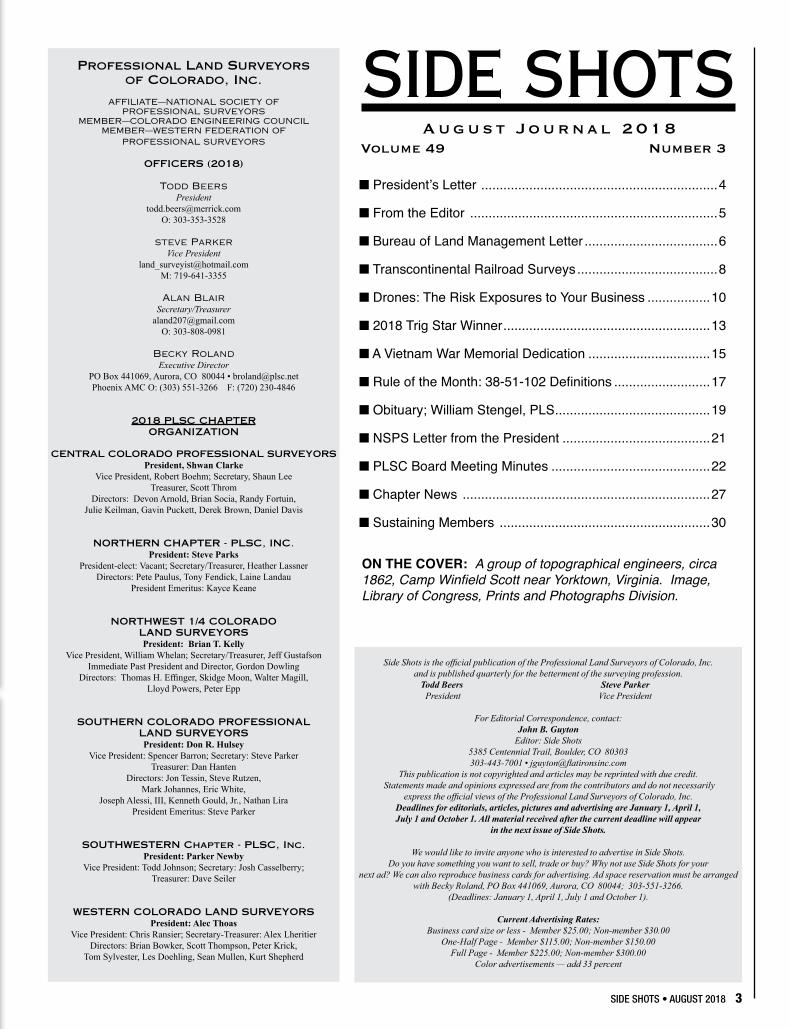
SIDE SHOTSAugust Journal 2018
Volume 49 Number 3
■ President’s Letter ................................................................4
■ From the Editor ...................................................................5
■ Bureau of Land Management Letter ....................................6
■ Transcontinental Railroad Surveys ......................................8
■ Drones: The Risk Exposures to Your Business .................10
■ 2018 Trig Star Winner ........................................................13
■ A Vietnam War Memorial Dedication .................................15
■ Rule of the Month: 38-51-102 Definitions ..........................17
■ Obituary; William Stengel, PLS ..........................................19
■ NSPS Letter from the President ........................................21
■ PLSC Board Meeting Minutes ...........................................22
■ Chapter News ...................................................................27
■ Sustaining Members .........................................................30
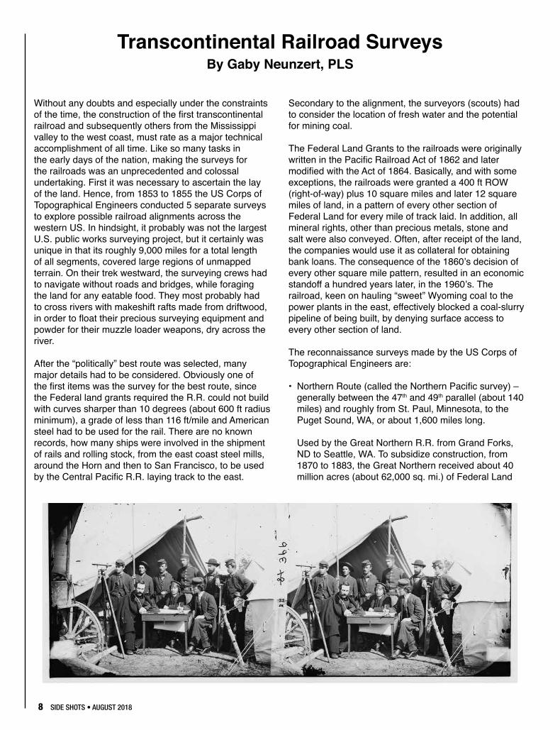
ON THE COVER: A group of topographical engineers, circa 1862, Camp Winfield Scott near Yorktown, Virginia. Image, Library of Congress, Prints and Photographs Division.
4 SIDE SHOTS • AUGUST 2018
PROFESSIONAL LAND SURVEYORS OF COLORADO, INC.PO Box 441069, Aurora, CO 80044
AFFILIATE – NATIONAL SOCIETY OF PROFESSIONAL SURVEYORSMEMBER- WESTERN FEDERATION OF PROFESSIONAL SURVEYORS
OFFICERS (2017-2018)
STEVE PARKERVICE PRESIDENTM: (719) 641-3355
ROGER NELSONPAST PRESIDENTO: (303) 589-1875
TODD BEERSPRESIDENT
O: (303) 353-3528 [email protected]
BECKY ROLANDEXECUTIVE DIRECTOR
O: (303) [email protected]
ALAN BLAIRSECRETARY- TREASURER
O: (303) 808-0981 [email protected]
DIRECTORS (2017-2020)
BRIAN DENNISO: (719) 337-1262
LEIF JOYO: (970) 878-5292
TOM SYLVESTER O: (970) 255-7386
TERESA SMITHSON O: (303) 223-5820
DIRECTORS (2015-2018)
PAUL BACUSO: (720) 890-0182
ERIC CARSONO: (303) 980-9104
PAUL DeGRAFFO: (303) 955-6080
RALPH PETTITO: (720) 865-3031
WFPS DELEGATES (2015-2016)
ROGER NELSONO: (303) 353-3916
NSPS DIRECTOR(2017-2018)
JOHN B. GUYTONO: (303) 443-7001
Dear Fellow Members of PLSC:
Happy summer to all our members! By the time you receive this issue of Side Shots we will have experienced some very hot days and dry weather. Please be careful working outdoors and be sure to drink plenty of water throughout the day. Also, please be wary of potential fire starters such as hot vehicle tail pipes driving through dry fields with tall grass and brush. There are already too many fires raging in our great state, let’s not contribute to starting any!
The planning of the 2019 Rocky Mountain Surveyors Summit (RMSS) is in full swing being led by Steve Parker, the Education Committee Chair. The RMSS will be presented once again at the Arvada Center on February 6-8, 2019. Please contact the PLSC or any planning committee member for suggestions of speakers or topics, or if you would like to present on an interesting subject. This year’s conference was well attended, and we would like to improve the program for 2019!
Activities for the remainder of the year for PLSC members will include the GIS in the Rockies Conference in September, the conference of Colorado State School Guidance Counselors in October, the NSPS Lobby day and meeting in October, Adams County Middle School student conference in November and potential events with the boy/girl scouting community. As I mentioned in my last letter the PLSC has set up a committee to coordinate the various outreach and education requests from high school and middle school counselors for land surveyors to attend career days in their schools. Brian Dennis from the Southern Chapter has accepted the Chair position for this committee. Please contact Brian if you would be interested in participating in career days at the schools. The school year is just around the corner and there will be requests for volunteers to participate in career days, so please let Brian know if you have an interest in this important outreach program.
The Colorado Geospatial Advisor working group along with Pam Fromhertz, has been busy presenting webinars on the GPS on Benchmarks program, and with the assistance of interested parties, hopefully the benchmarks of interest identified by the State of Colorado will be observed for input into the 2022 hybrid geoid. Please contact Pam, John Hunter, Joey Stone or Tom Breitnauer if you desire to participate.
As a reminder, we will be having elections for most of the positions on the PLSC Board including President, Vice President, Secretary-Treasurer and four director positions. If you have an interest for any position, please contact the PLSC.net email address.
Please remember that there may be someone who has gone above and beyond in assisting the surveying community or advancing our mission and can be recognized with an award at the RMSS. Please consult the web site for nominations and award categories.
Have a safe and healthy summer.
Sincerely, Todd Beers, PLS-PLSC President
SIDE SHOTS • AUGUST 2018 5
F R O M T H E E D I T O R
In this hot and dry summer, it is nice to think about the Rocky Mountain Surveyor’s Summit coming up in the cold month of February, as Todd mentioned. If you have a great idea for a presentation or know of a good speaker who might be interested, please consider getting involved.
And make plans to attend.
The cover shows an image taken of the U.S. Army Corps of Topographic Engineers, courtesy of the Library of Congress. This sets the stage for Gaby Neunzert’s article in this issue about the five surveys that were done in the mid-1800’s for the transcontinental railroads, across 9,000 miles. It was an incredible accomplishment, and a story well told by Gaby.
Lisa Isom has agreed to resume contributing some informational articles on the topics of insurance and risk that are of interest to surveyors. In this issue, she talks about the sometimes unexpected liability issues
surrounding the commercial use of drones. If a UAV is in your future plans, this is a must read.
There are several other items in this issue – the 2018 TrigStar winner is announced in a good story by Heather Lassner, a poem from Dean Glorso, an excellent rule of the month on definitions from Earl Henderson, and an obituary for the late William Stengel. For those of you concerned about the proposed $10 per year dues increase for the NSPS, there is a letter from the new President, Kim Leavitt, that explains it very well. The PLSC board minutes of May 9th, 2018 and the chapter news round out this issue.
As a reminder, or news to those of you who don’t know, a pdf version of Side Shots is available on the PLSC website, at https://plsc.net/ in case you see an article or notice that you would like to share with a colleague by email. Most back issues are there as well. Your continued interest in, and support of this magazine is appreciated.
JB Guyton, Editor
A masterful documentation andhistorical perspective of eachinitial surveying point for federalpublic lands in the United States.Published in 9x12 format, InitialPoints of the Rectangular SurveySystem features a 4-color sectionwith more than 130 photosdepicting monuments andlandmarks.
C. Albert White's second book,
INITIAL POINTSOF THE RECTANGULAR SURVEY SYSTEM
Never before, in the history of surveying, has so much pertinent and interesting material been someticulously compiled in one publication. (White personally visited EVERY Initial Point.)
Published by the Colorado Professional Land Surveyors Educational Foundation, Inc., a non-profit foundation, Initial Points of the Rectangular Survey System is undertaken in the spirit of, and dedication to, Mr. White's remarkable contributions to his field.
Net proceeds from its sale will be returned to the Professional Land Surveyors of Colorado Inc. Scholarship Fund.
1 $892-5 $796-10 $69
Number of copies Price
Call 303-428-9529 to order
Mr. White's first book, A History of the Rectangular Survey System, published by theBLM in 1983, is considered the definitive work on the U.S. Public Land Survey System.Arguably the most distinguished authority on the history of nineteenth and twentiethcentury public lands surveying, White began his career with the General Land Office in1946. Both as BLM and a private surveyor, he applied his zeal to a wide range ofactivities. White's expertise represents a bridge between the wisdom and experience ofthe American heritage of land settlement and the contemporary uses of surveyingtechnology.
Required Notice
In 2018, the Professional Land Surveyors of Colorado will spend 33% of membership dues income on professional lobbyists.
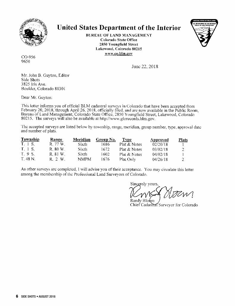
6 SIDE SHOTS • AUGUST 2018
8 SIDE SHOTS • AUGUST 2018
Without any doubts and especially under the constraints of the time, the construction of the first transcontinental railroad and subsequently others from the Mississippi valley to the west coast, must rate as a major technical accomplishment of all time. Like so many tasks in the early days of the nation, making the surveys for the railroads was an unprecedented and colossal undertaking. First it was necessary to ascertain the lay of the land. Hence, from 1853 to 1855 the US Corps of Topographical Engineers conducted 5 separate surveys to explore possible railroad alignments across the western US. In hindsight, it probably was not the largest U.S. public works surveying project, but it certainly was unique in that its roughly 9,000 miles for a total length of all segments, covered large regions of unmapped terrain. On their trek westward, the surveying crews had to navigate without roads and bridges, while foraging the land for any eatable food. They most probably had to cross rivers with makeshift rafts made from driftwood, in order to float their precious surveying equipment and powder for their muzzle loader weapons, dry across the river.
After the “politically” best route was selected, many major details had to be considered. Obviously one of the first items was the survey for the best route, since the Federal land grants required the R.R. could not build with curves sharper than 10 degrees (about 600 ft radius minimum), a grade of less than 116 ft/mile and American steel had to be used for the rail. There are no known records, how many ships were involved in the shipment of rails and rolling stock, from the east coast steel mills, around the Horn and then to San Francisco, to be used by the Central Pacific R.R. laying track to the east.
Secondary to the alignment, the surveyors (scouts) had to consider the location of fresh water and the potential for mining coal.
The Federal Land Grants to the railroads were originally written in the Pacific Railroad Act of 1862 and later modified with the Act of 1864. Basically, and with some exceptions, the railroads were granted a 400 ft ROW (right-of-way) plus 10 square miles and later 12 square miles of land, in a pattern of every other section of Federal Land for every mile of track laid. In addition, all mineral rights, other than precious metals, stone and salt were also conveyed. Often, after receipt of the land, the companies would use it as collateral for obtaining bank loans. The consequence of the 1860’s decision of every other square mile pattern, resulted in an economic standoff a hundred years later, in the 1960’s. The railroad, keen on hauling “sweet” Wyoming coal to the power plants in the east, effectively blocked a coal-slurry pipeline of being built, by denying surface access to every other section of land.
The reconnaissance surveys made by the US Corps of Topographical Engineers are:
• Northern Route (called the Northern Pacific survey) – generally between the 47th and 49th parallel (about 140 miles) and roughly from St. Paul, Minnesota, to the Puget Sound, WA, or about 1,600 miles long.
Used by the Great Northern R.R. from Grand Forks, ND to Seattle, WA. To subsidize construction, from 1870 to 1883, the Great Northern received about 40 million acres (about 62,000 sq. mi.) of Federal Land
Transcontinental Railroad SurveysBy Gaby Neunzert, PLS
SIDE SHOTS • AUGUST 2018 9
Grants. The Northern Pacific R.R. from Fargo ND, through Billings MT to Portland OR, on the other hand, was the only privately financed railroad in the US.
• Central Route (called the Central Pacific survey) – the survey was roughly located between the 37th and the 38th parallel, from St. Louis, MO, west following the Kansas and Arkansas River, though northern Utah and the Sierras and then to San Francisco, California. Starting in Omaha, the Union Pacific R.R. laid track westward and going eastward from San Francisco, the Central Pacific R.R. moved until they met in May 10, 1869 at Promontory Summit, Utah, after laying a total 1774 miles of track. As a direct subsidy the two companies received 33 million acres (about 51,560 sq. miles) in alternating sections, 6 miles on either side of the ROW. At its largest the Union Pacific controlled 32,100 route miles of track.
• Southern Routes (called the Southern Pacific surveys) – two routes were surveyed. The first alignment was along the 35th parallel, from Oklahoma City roughly following the modern highway I-40 westward through Albuquerque, N.M.to Los Angeles. This alignment later was used by the Santa Fe R.R. The second route, along the 32nd parallel was used by the Southern Pacific R.R. and it extended from New Orleans, LA through southern Texas and El Paso, TX to San Diego, CA, Ultimately the Southern Pacific had 13,848 route miles of track.
• Pacific Coast Route (called the Pacific Coast survey)– followed the coast for about 1200 miles, from San Diego to Seattle and was used by the Pacific Coast R.R.
An astute reader undoubtedly will notice that the names given above are only generic and do not refer to a specific railroad. Anecdotally, it appears that during the
last 150 years it was much easier to change the R.R’s name, time and time again, or to merge with other railroads, than face bankruptcy or liquidation. A listing of the transpired permutations with name and track changes from mergers, would be very lengthy.
And then there were others:
• Canada’s Intercolonial R.R. – Canada faced almost identically the same problems as the US, except later in time. The Canadian Pacific R.R., from Winnipeg, MB to Vancouver, BC was about 1,000 miles long and was built from 1881 to 1885 with private funding. Like some of its US counterparts it also received 25 million acres of land grants.
• Trans-Australian R.R. – About 1243 miles from Port Augusta, S.A. to Kalgoorlie W.A., was surveyed from 1907 to 1909 and with federal funding, construction was completed in 1917. It is unique even though, built in standard gauge (4 ft - 8 ½ in.), economic development was handicapped since the connecting track on either end was a 3 ft narrow gauge.
• Trans-Siberian R.R. – Reported length of 5,772 miles from Moscow to Vladivostok was originally built from 1891 to 1916, with side spurs still being added at present. Unusual for the casual reader is the Russian gauge of 1520 mm (4 ft - 11 27/32 in.)
References:
Holbrook, Steward H. 1947, The Story of American Railroads; Crown Publishers, New York, N.Y.
Wikipedia – Miscellaneous entries relating to subjects above.
10 SIDE SHOTS • AUGUST 2018
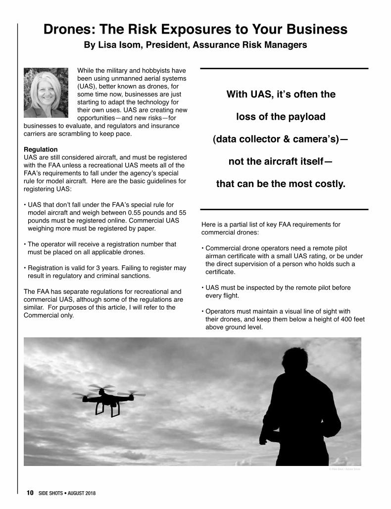
While the military and hobbyists have been using unmanned aerial systems (UAS), better known as drones, for some time now, businesses are just starting to adapt the technology for their own uses. UAS are creating new opportunities—and new risks—for
businesses to evaluate, and regulators and insurance carriers are scrambling to keep pace.
RegulationUAS are still considered aircraft, and must be registered with the FAA unless a recreational UAS meets all of the FAA’s requirements to fall under the agency’s special rule for model aircraft. Here are the basic guidelines for registering UAS:
• UAS that don’t fall under the FAA’s special rule for model aircraft and weigh between 0.55 pounds and 55 pounds must be registered online. Commercial UAS weighing more must be registered by paper.
• The operator will receive a registration number that must be placed on all applicable drones.
• Registration is valid for 3 years. Failing to register may result in regulatory and criminal sanctions.
The FAA has separate regulations for recreational and commercial UAS, although some of the regulations are similar. For purposes of this article, I will refer to the Commercial only.
Here is a partial list of key FAA requirements for commercial drones:
• Commercial drone operators need a remote pilot airman certificate with a small UAS rating, or be under the direct supervision of a person who holds such a certificate.
• UAS must be inspected by the remote pilot before every flight.
• Operators must maintain a visual line of sight with their drones, and keep them below a height of 400 feet above ground level.
Drones: The Risk Exposures to Your BusinessBy Lisa Isom, President, Assurance Risk Managers
With UAS, it’s often the
loss of the payload
(data collector & camera’s)—
not the aircraft itself—
that can be the most costly.
© Riko Best / Adobe Stock
SIDE SHOTS • AUGUST 2018 11
• Operators cannot fly the drone over anyone who is not directly participating in the drone’s operation.
• Drones may carry an external load if it’s securely attached and doesn’t adversely affect the controllability of the aircraft.
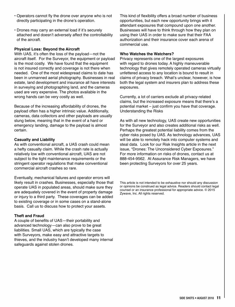
Physical Loss: Beyond the AircraftWith UAS, it’s often the loss of the payload—not the aircraft itself. For the Surveyor, the equipment or payload is the most costly. We have found that the equipment is not insured correctly and coverage is not there when needed. One of the most widespread claims to date has been in unmanned aerial photography. Businesses in real estate, land development and insurance all have interests in surveying and photographing land, and the cameras used are very expensive. The photos available in the wrong hands can be very costly as well.
Because of the increasing affordability of drones, the payload often has a higher intrinsic value. Additionally, cameras, data collectors and other payloads are usually slung below, meaning that in the event of a hard or emergency landing, damage to the payload is almost certain.
Casualty and LiabilityAs with conventional aircraft, a UAS crash could mean a hefty casualty claim. While the crash rate is actually relatively low with conventional aircraft, UAS are not subject to the tight maintenance requirements or the stringent operator regulations that make conventional commercial aircraft crashes so rare.
Eventually, mechanical failures and operator errors will likely result in crashes. Businesses, especially those that operate UAS in populated areas, should make sure they are adequately covered in the event of property damage or injury to a third party. These coverages can be added to existing coverage or in some cases on a stand-alone basis. Call us to discuss how to protect your assets.
Theft and FraudA couple of benefits of UAS—their portability and advanced technology—can also prove to be great liabilities. Small UAS, which are typically the case with Surveyors, make easy and attractive targets to thieves, and the industry hasn’t developed many internal safeguards against stolen drones.
This kind of flexibility offers a broad number of business opportunities, but each new opportunity brings with it attendant exposures that compound upon one another. Businesses will have to think through how they plan on using their UAS in order to make sure that their FAA authorization and their insurance cover each arena of commercial use.
Who Watches the Watchers?Privacy represents one of the largest exposures with regard to drones today. A highly maneuverable technology that gives remotely operated cameras virtually unfettered access to any location is bound to result in claims of privacy breach. What’s unclear, however, is how both the legal system and insurers plan to address these exposures.
Currently, a lot of carriers exclude all privacy-related claims, but the increased exposure means that there’s a potential market – just confirm you have that coverage. Understanding the Risks
As with all new technology, UAS create new opportunities for the Surveyor and also creates additional risks as well. Perhaps the greatest potential liability comes from the cyber risks posed by UAS. As technology advances, UAS will be able to remotely hack into computer systems and steal data. Look for our Risk Insights article in the next issue, “Drones: The Unconsidered Cyber Exposures.” For more information on risks of drones, contact us at 888-454-9562. At Assurance Risk Managers, we have been protecting Surveyors for over 25 years.
This article is not intended to be exhaustive nor should any discussion or opinions be construed as legal advice. Readers should contact legal counsel or an insurance professional for appropriate advice. © 2015 Zywave, Inc. All rights reserved.
12 SIDE SHOTS • AUGUST 2018
Proudly SupportingPLSC Since 1999
Buildingrelationships, one monument at a time.
Berntsen International, Inc. • PO Box 8670 • Madison, WI 53704-8670 • Toll Free: 877.686.8561 • Fax: 800.249.9794 • Email: [email protected]
877.686.8561 • www.berntsen.com
PLSC Since 1999
SIDE SHOTS • AUGUST 2018 13
Occasionally you have the opportunity to meet a truly exceptional youth. If you are really lucky, you get to meet a few of them at once.
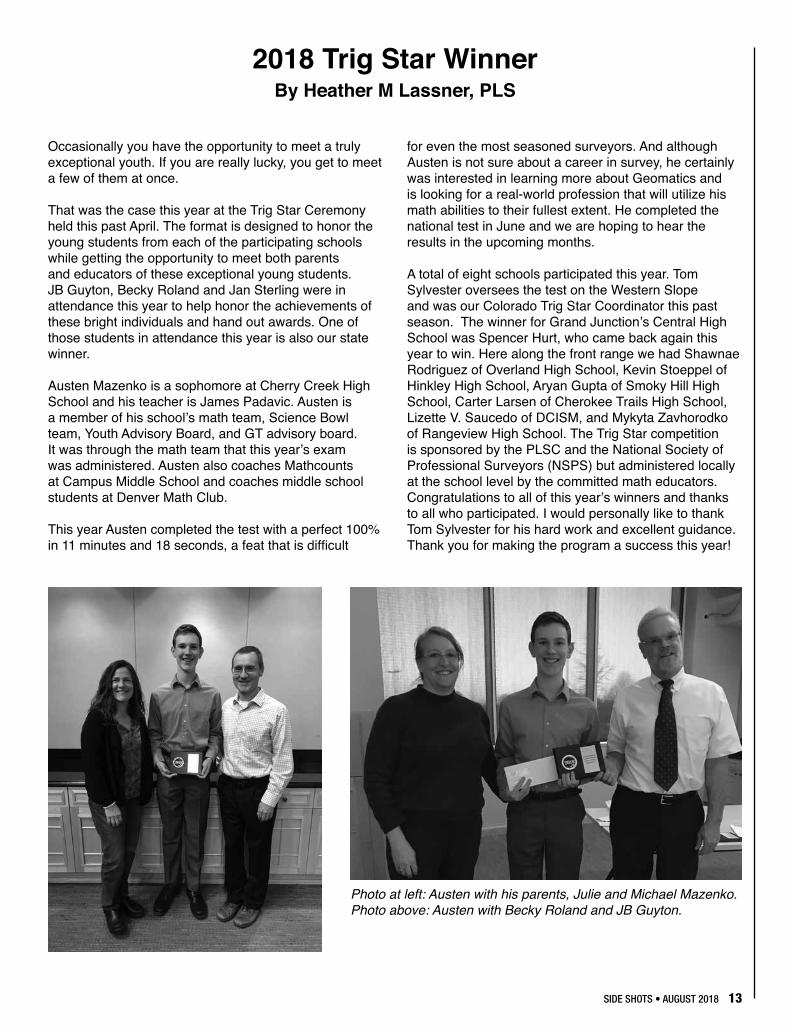
That was the case this year at the Trig Star Ceremony held this past April. The format is designed to honor the young students from each of the participating schools while getting the opportunity to meet both parents and educators of these exceptional young students. JB Guyton, Becky Roland and Jan Sterling were in attendance this year to help honor the achievements of these bright individuals and hand out awards. One of those students in attendance this year is also our state winner.
Austen Mazenko is a sophomore at Cherry Creek High School and his teacher is James Padavic. Austen is a member of his school’s math team, Science Bowl team, Youth Advisory Board, and GT advisory board. It was through the math team that this year’s exam was administered. Austen also coaches Mathcounts at Campus Middle School and coaches middle school students at Denver Math Club.
This year Austen completed the test with a perfect 100% in 11 minutes and 18 seconds, a feat that is difficult
for even the most seasoned surveyors. And although Austen is not sure about a career in survey, he certainly was interested in learning more about Geomatics and is looking for a real-world profession that will utilize his math abilities to their fullest extent. He completed the national test in June and we are hoping to hear the results in the upcoming months.
A total of eight schools participated this year. Tom Sylvester oversees the test on the Western Slope and was our Colorado Trig Star Coordinator this past season. The winner for Grand Junction’s Central High School was Spencer Hurt, who came back again this year to win. Here along the front range we had Shawnae Rodriguez of Overland High School, Kevin Stoeppel of Hinkley High School, Aryan Gupta of Smoky Hill High School, Carter Larsen of Cherokee Trails High School, Lizette V. Saucedo of DCISM, and Mykyta Zavhorodko of Rangeview High School. The Trig Star competition is sponsored by the PLSC and the National Society of Professional Surveyors (NSPS) but administered locally at the school level by the committed math educators. Congratulations to all of this year’s winners and thanks to all who participated. I would personally like to thank Tom Sylvester for his hard work and excellent guidance. Thank you for making the program a success this year!
2018 Trig Star WinnerBy Heather M Lassner, PLS
Photo at left: Austen with his parents, Julie and Michael Mazenko. Photo above: Austen with Becky Roland and JB Guyton.
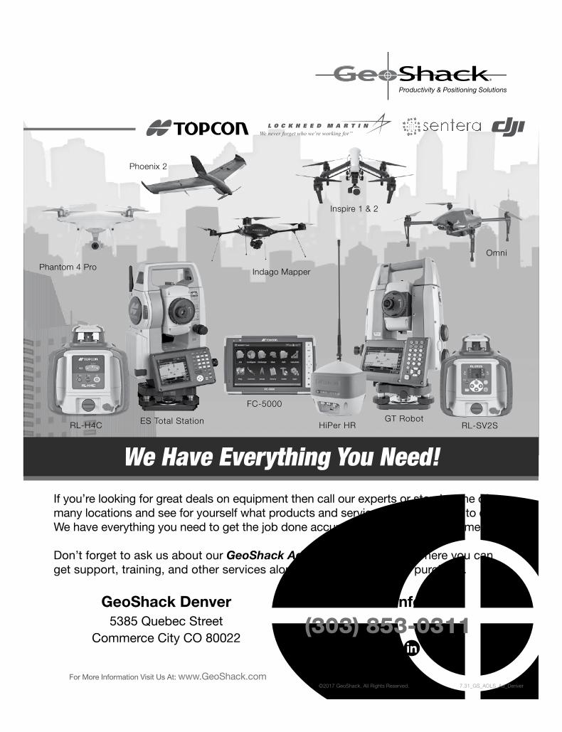
If you’re looking for great deals on equipment then call our experts or stop by one of our many locations and see for yourself what products and services GeoShack has to offer. We have everything you need to get the job done accurately and right the first time.
Don’t forget to ask us about our GeoShack Advantage programs – where you can get support, training, and other services along with your equipment purchase.
We Have Everything You Need!
GeoShack Denver 5385 Quebec Street
Commerce City CO 80022
For more info call
(303) 853-0311
For More Information Visit Us At: www.GeoShack.com©2017 GeoShack. All Rights Reserved. 7.31_GS_AOLS_Ad_Denver
Indago MapperPhantom 4 Pro
Phoenix 2
Inspire 1 & 2
Omni
RL-H4C ES Total Station
FC-5000
RL-SV2SGT Robot
HiPer HR
SIDE SHOTS • AUGUST 2018 15
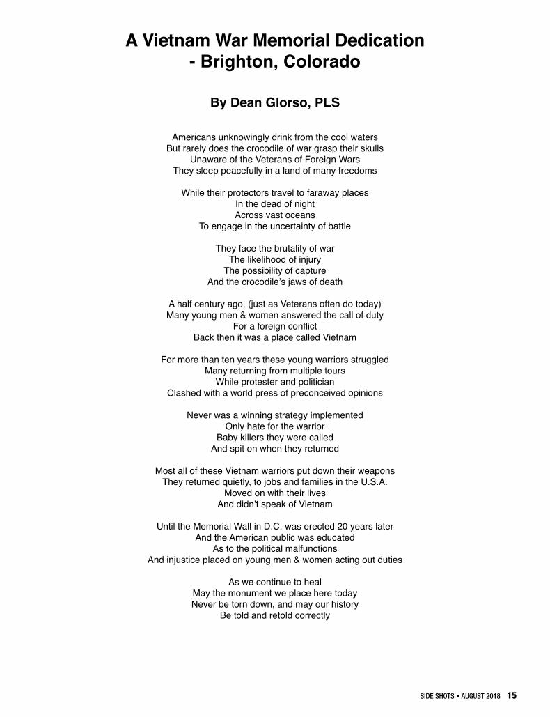
A Vietnam War Memorial Dedication - Brighton, Colorado
By Dean Glorso, PLS
Americans unknowingly drink from the cool watersBut rarely does the crocodile of war grasp their skulls
Unaware of the Veterans of Foreign Wars They sleep peacefully in a land of many freedoms
While their protectors travel to faraway placesIn the dead of nightAcross vast oceans
To engage in the uncertainty of battle
They face the brutality of warThe likelihood of injury
The possibility of capture And the crocodile’s jaws of death
A half century ago, (just as Veterans often do today)Many young men & women answered the call of duty
For a foreign conflictBack then it was a place called Vietnam
For more than ten years these young warriors struggledMany returning from multiple tours
While protester and politicianClashed with a world press of preconceived opinions
Never was a winning strategy implementedOnly hate for the warrior
Baby killers they were calledAnd spit on when they returned
Most all of these Vietnam warriors put down their weaponsThey returned quietly, to jobs and families in the U.S.A.
Moved on with their lives And didn’t speak of Vietnam
Until the Memorial Wall in D.C. was erected 20 years laterAnd the American public was educated
As to the political malfunctionsAnd injustice placed on young men & women acting out duties
As we continue to healMay the monument we place here today Never be torn down, and may our history
Be told and retold correctly
16 SIDE SHOTS • AUGUST 2018
- AutoCAD LT- AutoCAD- Map 3D- Civil 3D- Infrastructure Design Suites- Infrastructure Map Server- Raster Design- Design Review- Subscription
- State of the art training facility- Implementation & customization- Workflow analysis consulting- Styles & standards set-up- License activation support- License compliance- Techincal support- Pilot projects- Transition assistance- On-site consulting- Government Specialist
with customized drafting and design software solutions since 1994
Architecture, Engineering & ConstructionSilver Partner
Authorized Government Partner
WCCC OFFERS TWO PROGRAMS:
• Associates in Applied Science Degree in LandSurveying and Geomatics for those without priorcollege coursework. This program is designed to becompleted within two years.
• Post-baccalaureate Technical Certificate for thosewith a minimum of a Bachelor of Science or Bachelorof Arts degree who need the required surveyingcurriculum to meet the education requirements to sitfor the PLS exams. The Technical Certificate programis designed to be completed in one year.
CHANGE YOUR LIFE WITH COLORADO’S ONLY LAND SURVEYING DEGREE PROGRAMSponsored by the PLSC, the Land Surveying and Geomatics programs at Western Colorado Community College are designed for students on a career pathway toward becoming a licensed Professional Land Surveyor.
Learn more at coloradomesa.edu/wccc/programs/land-surveying-geomatics
Contact WCCC Students Services at 970.255.2600 for admissions, registration and financial aid information.
SIDE SHOTS • AUGUST 2018 17
I have often heard fellow PLS’s talk about completing a “Monumented Land Survey Plat”. Which is why I’ve often thought about writing this article. There is no such animal in our statutes or rules. I’d say, “look it up”, but it’s just not there to look up. Before I get into that further though, allow me to digress so you’ll understand where I’m coming from, where I’m going to and what I’m doing.
I’ve noticed that Engineers and Architects and the like have difficulty grasping certain land surveying concepts. It’s my opinion that one of the key reasons for their difficulty is the direction of flow of information. An Engineer or Architect produces a set of plans of proposed concepts on paper. These are imagined ideas, designed flawlessly of course, that are then built into a real and tangible object. If any issues or questions come up during the construction of that object, the plans are referred to as the authority and the construction adjusts to the proposed plans. The direction of flow of information is from the plans to the ground. The plans guide what the contractor does. During a retracement land survey the direction of flow of information is in the opposite direction. We first complete a lot of research that we take into the field in order to find evidence. We then measure that evidence, take the data back to the office, analyze it, make decisions and describe those decisions on a map. The proper direction of flow of information is from the ground (evidence) to the map, opposite to the Engineers and Architects. What we do guides what we show on the plat. In fact, as an aside, we really have more in common with lawyers than with Engineers and Architects because we’re supposed to be making legal decisions about the evidence we find. We should not be completing calculations from maps and descriptions and simply staking them on to the ground regardless of where they fall relative to anything else (can you say “pincushion”?). But that’s an article for another time.
So, keeping in mind the correct direction of flow of information, let’s review the definitions of a few terms found in the Colorado Revised Statutes. CRS 38-51-102(11) defines a “Land Survey” as “a series of observations and measurements...for the purpose of locating or restoring any real property boundary.” The
definition of a Land Survey is defined in more detail in Board Rule 6.5.1, which I highly encourage you to review. But a Land Survey is an activity we participate in, a physical action we perform. This is clearly something we do. Moving along, CRS 38-51-102(13) defines a “Monumented Land Survey” (notice that the word “plat” is not included) as “..a Land Survey in which monuments are either found or set...”. Again, clearly something we do. The distinction between a “Land Survey” and a “Monumented Land Survey” is obviously that there are monuments involved in the latter. I can’t remember if I’ve ever completed a “Land Survey” where there weren’t any monuments involved, but I’m now open to the possibility. If you review CRS 38-51-102 you’ll see that these are the only two terms that define something we do.
Once we’re done though, how do we communicate what we’ve done to our client and the rest of the public? We all know we show them our results and the decisions we made on a plat. You may be surprised to hear this, but in Colorado there’s only one kind of plat and that’s a “Land Survey Plat”, defined in CRS 38-51-102(12) as “...a plat that shows the information developed by a monumented land survey...”. Now I know right now you’re thinking to yourself, “Has this dummy never heard of an ‘Improvement Survey Plat’?”. The thing is, CRS 38-51-102(9) defines an “Improvement Survey Plat” as “...a land survey plat...” just with more details in the definition. So an ISP is a form of LSP, just with more requirements. But those are your two choices on how to document what you did during your retracement survey and communicate it, a LSP or an ISP. You’re thinking it again aren’t you? I’m purposely leaving an ALTA/NSPS Land Title Survey out of this because it’s not defined in the Colorado Revised Statutes. You should definitely review Board Rule 6.12 about ALTA/NSPS Land Title Surveys, but that’s as far as I’m going with that for the purposes of this article.
So let’s go back to the beginning where I digressed. If you follow the string of the definitions you’ll see the progression. First we do, by means of a “Land Survey”, and then we document, by means of a “Land Survey Plat”. That’s the direction of flow of information. We
Rule of the Month 38-51-102 Definitions
(Subtitled – What the Heck are We Doing?)By Earl Henderson, PLS
18 SIDE SHOTS • AUGUST 2018
simply can’t document before we do. There wouldn’t be anything there to document. The picture, the LSP, shows what we did. But the LSP is not what we did or what we’re doing. It is the documentation of what we did. Although the land owner wants to know (or be communicated) what we did via a LSP, what they are most interested in is not the documentation of what we did but the actuality of what we did, meaning understanding where their property corners and lines are on the ground, not on the paper. “The map is not the territory.”*
These may be simple distinctions, but that doesn’t make them any less important. Because if you think you’re working on a Monumented Land Survey Plat, then you don’t understand the definition of what you’re doing and how to document what you did. And if you don’t know what you’re doing then how can you communicate what you’ve done to your client, the public and your fellow
professionals? You have to know what you’re doing to do it correctly, after all, but also how to communicate what you did.
There. I’m done. Now if you’ll excuse me, I have something I have to go do.
Be safe out there.
*We should all thank Alfred Korzybski for this one.
SIDE SHOTS • AUGUST 2018 19
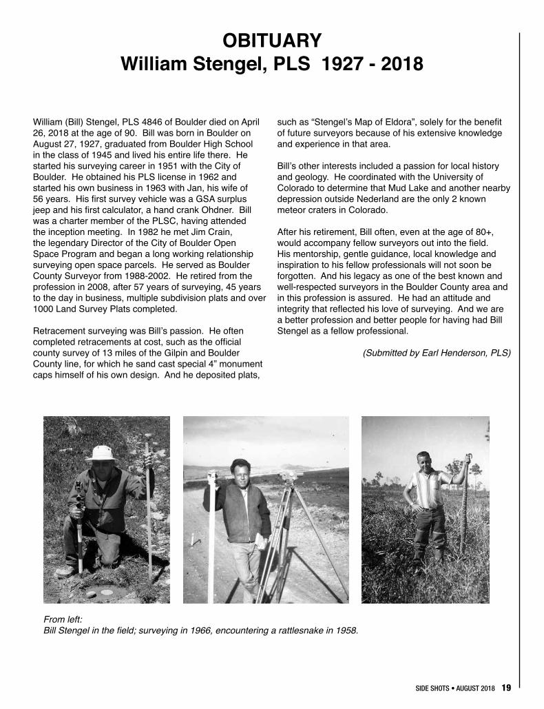
William (Bill) Stengel, PLS 4846 of Boulder died on April 26, 2018 at the age of 90. Bill was born in Boulder on August 27, 1927, graduated from Boulder High School in the class of 1945 and lived his entire life there. He started his surveying career in 1951 with the City of Boulder. He obtained his PLS license in 1962 and started his own business in 1963 with Jan, his wife of 56 years. His first survey vehicle was a GSA surplus jeep and his first calculator, a hand crank Ohdner. Bill was a charter member of the PLSC, having attended the inception meeting. In 1982 he met Jim Crain, the legendary Director of the City of Boulder Open Space Program and began a long working relationship surveying open space parcels. He served as Boulder County Surveyor from 1988-2002. He retired from the profession in 2008, after 57 years of surveying, 45 years to the day in business, multiple subdivision plats and over 1000 Land Survey Plats completed.
Retracement surveying was Bill’s passion. He often completed retracements at cost, such as the official county survey of 13 miles of the Gilpin and Boulder County line, for which he sand cast special 4” monument caps himself of his own design. And he deposited plats,
such as “Stengel’s Map of Eldora”, solely for the benefit of future surveyors because of his extensive knowledge and experience in that area.
Bill’s other interests included a passion for local history and geology. He coordinated with the University of Colorado to determine that Mud Lake and another nearby depression outside Nederland are the only 2 known meteor craters in Colorado.
After his retirement, Bill often, even at the age of 80+, would accompany fellow surveyors out into the field. His mentorship, gentle guidance, local knowledge and inspiration to his fellow professionals will not soon be forgotten. And his legacy as one of the best known and well-respected surveyors in the Boulder County area and in this profession is assured. He had an attitude and integrity that reflected his love of surveying. And we are a better profession and better people for having had Bill Stengel as a fellow professional.
(Submitted by Earl Henderson, PLS)
OBITUARYWilliam Stengel, PLS 1927 - 2018
From left: Bill Stengel in the field; surveying in 1966, encountering a rattlesnake in 1958.
20 SIDE SHOTS • AUGUST 2018
SEPTEMBER 19-20 DENVER, COEXCEPTIONAL CONTENT-RICHCONFERENCE:• Outstanding Professional
Workshops & Presentations• Presentation Opportunities:
Sessions & Posters• Networking• Exhibitors• Career Development Academy• Social Events
gisintherockies.org
JOIN US FOR THE 31ST ANNUALGIS IN THE ROCKIES CONFERENCE!
Dreaming of incorporating UAS into your business?
Wanting to get FAA Remote Pilot Certified?
Let the FAASTeam help you build YOUR professional UAS team.
This UAS Certification Training course gives you the tools you need to pass your FAA Remote Pilot written exam. This one-day course will cover the key main elements of the 107 exam and provides you with additional at home study materials, including Air Craft’s proprietary study guide, FAA manuals, practice exams, log book, and even flight exercises.
Join us for our next UAS Certification Class in Denver
Saturday, May 19th
Email [email protected] for more info or to register.
Our Instructors: FAA Certified (Commercial & UAS)
FAA Safety Team Representatives
Hundreds of hours of real – world UAS flight operation experience.
What you get:
Eight hours ground school
Proprietary study guide saves study time.
Practice Exams
All FAA Exam Study Materials
Flight Exercises
Bonus flying techniques
SIDE SHOTS • AUGUST 2018 21
National Society of Professional Surveyors5119 Pegasus Court, Suite Q, Frederick, MD 21704
Phone: 240-439-4615 * Fax: 240-439-4952 www.nsps.us.com
June 11, 2018
Dear NSPS Members,
After carefully scrutinizing all of the factors associated with a proposal to raise NSPS membership dues, and hearing from the NSPS Directors who represent the respective state societies, the NSPS Executive Committee is asking for your support of a dues increase of $10 per year. This increase is necessary in order for NSPS to remain fiscally solvent in supporting its projected five-year budget. As with any enterprise, the cost of doing business continues to rise and, in the case of NSPS (and the state societies), revenues are declining due significantly to lower membership levels resulting, in part, from increasing numbers of retiring Surveyors.
As always, the emphasis of NSPS leadership and staff is to be responsible for each expenditure, and being transparent in doing so. The amount of effort required to represent 17,000 members is daunting, and is not taken lightly. NSPS leadership and members commend the staff for their efforts to manage this task and still remain fiscally responsible. This request itself is a result of the staff looking to the future and watching out for our needs.
The NSPS leadership team also realizes that each state society needs to have its membership ratify this change, and to make requisite changes to its MOU with NSPS. If a dues increase were to be approved now, NSPS really wouldn’t see any actual revenue increases for six months to a year.
The NSPS Executive Committee would also like to thank the NSPS Directors for their input and general support for this necessary dues increase. Most ExCom members have been Directors or Governors and realize the anguish associated with asking membership to vote to raise dues. We believe that all NSPS members recognize the importance of a strong national organization supporting the role, and yes survival, of our profession. As you have all witnessed, there are more issues each year requiring our attention and advocacy efforts. With this increase in the number and impact of issues, the support and proactive engagement of all the Surveyors in the nation is essential in all aspects of our profession.
We would also like to encourage Directors and members to identify, and educate, those who are not yet members and stress to them the importance of joining our ranks. We can certainly use more input and ideas. With your continued support we can make this profession that we all love even better than it already is.
Yours Truly,Kim H. Leavitt, PLS, NSPS President
22 SIDE SHOTS • AUGUST 2018
1. Call to Order 4:31PM
Name Position Chapter Attending?
Todd Beers President Central MSteve Parker Vice President Southern PAlan Blair Secretary/
TreasurerCentral M
Becky Roland Executive Director
n/a M
Paul Bacus Director Northern MTeresa Smith-son
Director Central/ Western
P
Eric Carson Director Central MBrian Dennis Director Southern MLeif Joy Director NW ¼Ralph Pettit Director CentralPaul DeGraff Director CentralTom Sylvester
Director Western P
Parker Newby
Ex-Officio Southwest
Roger Nelson Non-Voting Past President
and WFPS Delegate
J.B. Guyton Non-Voting NSPS Delegate
P
Guests:Pam Fromhertz
NOAA/NGS
John Hunter Colorado Geomatics Coordinator
P
Heather Lassner
TrigStar Coordinator
Northern P
M = in person P = on phone
2. Determination of Quorum (6 voting) confirmed
3. Approval of Minutes from previous Meeting
MOTION: To approve the Minutes as presented. (Blair/Bacus)
Approved unanimously
4. Review of Action Items from Last Meeting – Beers a. Becky Roland will set up a business account at
Costco and make necessary changes to use Costco’s payment processing services.
b. Subsequent meetings will be set to review possible contractors for website work.
c. Brian Dennis to develop a committee with 1-2 volunteers in each Chapter that can present at Career Days by end of June.
d. Todd Beers will write a letter asking each Chapter Board to identify volunteers for Career Days.
e. Pam Fromhertz will send an email to the original Working Group thanking them for their work and inviting them to stay involved in the process.
f. Steve Parker will ask for volunteers to serve on the GIS in the Rockies Board for PLSC at the Summit. He will send the email language to Becky Roland to send to membership.
g. Alan Blair volunteered to serve on the 6th PM. The offer is for each state group to pay $1,056 to replace the plaque and include logos of the state groups. There is also a donor who is willing to pay for the full cost if their logo is included.
MOTION: To approve payment of $1,056 towards a new plaque contingent on no private donor logo being added. If a private donor logo is added, PLSC will not participate. (Dennis/Smithson)Approved unanimously
5. Financial Items – Beers/Blair/Roland a. 2018 FinancialsMOTION: To pay $50,000 to the CMU Endowment on July 15. (Bacus/Blair)Approved unanimously (Sylvester abstained) MOTION: To approve full payment of requested funds for the PLSC Summit to Central, Northern and Southern Chapters. (Bacus/Dennis)Approved unanimously b. Investment Update from Key Bank c. 2018 Summit d. NSPS Dues Increase – Guyton i. JB Guyton will email draft text to Becky
Roland and Todd Beers for approval. The email will be to request NSPS directly communicate with the membership on the benefits of NSPS and the need for a dues increase.
ii. JB Guyton will relay that PLSC approves a dues increase but the new MOU will need to state no dues increase for a period of time (suggest 5 years).
PLSC Board Meeting MinutesMay 9, 2018
Merrick & Co. (M) and Conference Call (C)
SIDE SHOTS • AUGUST 2018 23
e. WestFed contribution ($1,000) – Nelson/Beers i. Todd Beers and Roger Nelson will send
their report to the Board from the recent meeting. A decision on a contribution from PLSC to WestFed will be tabled to the next meeting.
6. Membership Drive Update (input from chapters) Beers
a. Northern Chapter – no report; Central Chapter – no report; Southern Chapter – no report; Western Chapter has made calls, finds many are close to or retired.
b. The Board would like to discuss a multi-year dues renewal at a future meeting. In addition, they would like to have the Summit registration fee include membership.
c. The Board approved for staff to call all lapsed members since 2016.
d. In the future, membership renewal reminders should be sent monthly beginning in October.
e. Honorary members should be asked to pay NSPS dues.
f. Tom Sylvester will send information he received on ASCE Surveying Engineers.
7. Bylaw Review – Member Type Requirements – Beers a. Consider a Bylaw change that changes Voting
Member to Professional Member. b. Board consensus is to not require PLS to be
Voting Members. Instead, PLSC needs to enhance Voting Member benefits.
8. Workforce Development – tabled
9. PLSC Breakfast (April 24, 2018) – Beers a. Five members attended and 20 legislators
including the Senate Speaker and House President.
10. QBS Update – Blair a. Meeting in June for outreach. b. Alan Blair sent the link to the presentation to the
Board.11. Colorado Coordinator Activities – Beers/Hunter
a. GPS on Benchmarks i. Deadline is August 18. John Hunter will
send the information to Becky Roland to send to membership asking for volunteers.
ii. There will be webinars every other Thursday from May 24 to June 21. There is an online signup.
b. State Plane Coordinates i. Federal Regulation Notice – comments
to NGS are due August 31 and need to be submitted as a unified review from Colorado.
ii. Email for all members of the Colorado Coordinator Group is [email protected].
12. Reports a. NGS – no report b. Scholarship – Sylvester i. Tom Sylvester encouraged everyone
to promote the scholarship and WCCC program.
ii. WCCC is doing classroom and distance learning.
c. Membership Committee - Nothing further to report i. Lists to Chapters d. Executive Director – Roland i. PLSC hosted the NSPS State Executives
meeting. ii. Some states charge a convenience fee to
use credit cards. iii. The NSPS Foundation will manage funds
under their 501c3 for States. Becky Roland will get more information for discussion at the next Board meeting.
e. Rocky Mountain Surveyors Summit – call on Monday
f. Lobbyist/Legislative Committee – Bacus i. Session is over at midnight ii. Rep. Valdez showed interest in presenting
legislation on the County Surveyor & section corner perpetuation
iii. While the continuing education bill did not pass, PLSC will continue to try to move this issue forward.
g. Education Committee – Parker/Blair/Beers i. Geoshack/TopCon July 17-18 1. PLSC has been asked if we want to
present a topic at TopCon. 2. Board consensus approved posting
Sustaining Member events to the web calendar.
h. Ethics and Fair Practices Committee – no report i. Trig Star Report – Sylvester/Lassner i. An event was held in Aurora; two of the
seven awardees showed up; timing of announcements may have been a factor; JB Guyton presented; Heather Lassner will put together a “Lessons Learned” document
ii. Board approved Heather Lassner being named PLSC TrigStar Coordinator
j. GIS in the Rockies – Parker i. Will be held at Inverness Hotel ii. Steve Parker is looking for a volunteer to
serve on the GIS in the Rockies Board on behalf of PLSC.
k. NSPS Delegate’s Report – Guyton i. Todd Beers and Becky Roland attended
the NSPS Lobby Day and held five visits.
24 SIDE SHOTS • AUGUST 2018
Next NSPS Meeting and Lobby Day will be in October.
l. WSPS Delegates’ Report – Beers/Nelson i. Todd Beers and Roger Nelson attended
the recent meeting in Albuquerque. They will send their report to the Board at a later date.
13. Chapter Reports a. Southern i. Golf tournament has all holes sponsored and
nine teams signed up so far. b. Central – no report c. Northern – no report d. NW ¼ – no report e. Western – no report f. Southwestern – no report14. Next Meeting Date and Location – August 22 at
Merrick & Co.Adjourn (Bacus/Dennis)
Summary of Action Items:1. Becky Roland will set up a business account at
Costco and make necessary changes to use Costco’s payment processing services.
2. Subsequent meetings will be set to review possible contractors for website work.
3. Brian Dennis to develop a committee with 1-2 volunteers in each Chapter that can present at Career Days by end of June.
4. Todd Beers will write a letter asking each Chapter Board to identify volunteers for Career Days.
5. Pam Fromhertz will send an email to the original Working Group thanking them for their work and inviting them to stay involved in the process.
6. Steve Parker will ask for volunteers to serve on the GIS in the Rockies Board for PLSC at the Summit. He will send the email language to Becky Roland to send to membership.
7. Alan Blair volunteered to serve on the 6th PM. The offer is for each state group to pay $1056 to replace the plaque and include logos of the state groups. There is also a donor who is willing to pay for the full cost if their logo is included. Board consensus is to not include PLSC if the donor is used, and approve $1056 if the donor is not used.
8. JB Guyton will email draft text to Becky Roland and Todd Beers for approval. The email will be to request NSPS directly communicate with the membership on the benefits of NSPS and the need for a dues increase.
9. Todd Beers and Roger Nelson will send their report to the Board from the recent meeting. A decision on a contribution from PLSC to WestFed will be tabled to the next meeting.
10. The Board would like to discuss a multi-year dues renewal at a future meeting. In addition, they would like to have the Summit registration fee include membership.
11. The Board approved for staff to call all lapsed members since 2016.
12. Tom Sylvester will send information he received on ASCE Surveying Engineers.
13. GPS on Benchmarks deadline is August 18. John Hunter will send the information to Becky Roland to send to membership asking for volunteers.
14. The NSPS Foundation will manage funds under their 501c3 for States. Becky Roland will get more information for discussion at the next Board meeting.
15. Heather Lassner will put together a “Lessons Learned” document for TrigStar
16. Steve Parker is looking for a volunteer to serve on the GIS in the Rockies Board on behalf of PLSC.
17. Next Meeting Date and Location – August 22 at Merrick & Co.
Treasurer’s ReportAs of July 1, 2018
PLSC Investments = $ 251,807.25PLSC Savings = $ 106,572.70PLSC Checking = $ 80,286.75
PLSC Total Assets = $ 438,676.70
National Oceanic and Atmospheric Administration l National Geodetic Survey
National Geodetic Survey Positioning America for the Future geodesy.noaa.gov
NOAA’s National Geodetic Survey encourages anyone with survey-grade Global Positioning System (GPS) receivers to help perform GPS on Bench Marks (GPS on BMs) to support the development of GEOID18 and transformation tools that will be produced for the North American-Pacific Geopotential Datum of 2022 (NAPGD2022). GPS on BM data for GEOID18 will be accepted through the end of August 2018.
The nation’s height system, the North American Vertical Datum of 1988 (NAVD 88), is founded on historic geodetic leveling surveys that use thousands of bench marks, most of which have not been positioned with GPS. Adding GPS coordinates to these marks allows them to be used in NGS’ modern height reference-surface modeling. GEOID18 will be the last hybrid geoid model NGS will produce to enable GPS-derived NAVD88 heights.
1. Find local bench marks. Visit our website at Geodesy. noaa.gov/GPSonBM for a priority listing of marks to occupy and maps to help you find them. Contact your NGS geodetic advisor for more details, or email us at [email protected].
2. Collect GPS on your selected bench mark following careful field procedures.
�g Complete reconnaissance at your selected mark to ensure its usability, and submit a mark recovery via DSWorld.
g Collect a 4+-hour GPS data file.
�g Use a fixed-height tripod (recommended), and brace the legs with sandbags or chain.
g Verify antenna type, height, and plumb.
�g Take two photos of the mark, and note any changes to the existing mark description. (Optional: use observer field log with this step.)
3. Share your data by uploading to our Online Positioning User Service (OPUS) on the NGS website Geodesy.noaa.gov/OPUS.
NGS will use data collected to develop GEOID18, increase access to NAVD 88, and enable conversions to NAPGD2022.
GPS on Bench Marks
What is it?
WhyParticipate?
How to do it? It’s 1-2-3:
Find
Collect
Share
Contribute!
1
The PLSC represents land surveyors’ interests in the State, proposes new legisla�on and changes to exis�ng legisla�on as the industry’s needs change, and works with the State Board of Licensure as an advocate for Land Surveyors. PLSC Chapters include: Central Colorado Professional Surveyors (CCPS), Northern Chapter—PLSC (NCPLSC), Northwest 1/4 Colorado Land Surveyors (NW1/4CLS), Southern Colorado Professional Land Surveyors (SCPLS), Southwest Chapter PLSC (SWPLSC) and Western Colorado Land Surveyors (WCLS). Vo�ng membership includes NSPS membership. Others can add this op�on.
1. Member Informa�on:
Name:
Company:
Address: Home Work
City, State Zip:
Day�me Phone:
Email:
PLS or LSI Number(s) and State(s):
Please do not include my informa�on in the PLSC Member Directory or online directory.
2. Membership Informa�on: Membership Type: Sustaining—$230 Vo�ng—$150 Associate—$75 Student—$30 Re�red—$60 (Please check.)
Included Chapter: CCPS NCPLSC NW1/4CLS SCPLS SWPLSC WCLS (Each membership includes one free Chapter membership. Please check—see above for descrip�ons.)
Addi�onal Chapter: CCPS NCPLSC NW1/4CLS SCPLS SWPLSC WCLS (addi�onal Chapter memberships are $20 each. Please check.) NSPS Membership (included in Vo�ng Membership): $40 for professionals/$10 for students
3. Payment Informa�on: Membership Type: $ Payment Type:
Add’l Chapters/NSPS: $ Check # Total Enclosed $ Credit Card No.: Exp. Date: CVV: Credit Card Billing Address: same as above or: Mail to: PLSC, PO Box 441069, Aurora, CO 80044 Phone: 303-551-3266 Fax: 720-230-4846 [email protected]
SIDE SHOTS • AUGUST 2018 27
NC-PLSCBusiness in Northern Colorado has been booming and with the summer, comes the long hours of construction. The Northern Chapter is currently on our summer hiatus which encompasses the months of June-August. Please look to joining us starting again in September.
After the RMSS, the northern chapter held our April meeting at the PVREA Community Room located in Windsor. We invited both the Larimer County Clerk and the Weld County Clerk to discuss the topic of electronic recordation and had an open format of questions and answers.
Our closing meeting for May celebrated our newest PLSs at Zwei Brewing in Fort Collins. Congrats to Tony Fendick! Tony gave us some tips for taking the exam and noted the most helpful resources including Jan Van Sickle’s Surveying Fundamentals Problems, Brown’s Boundary Control and Legal Principles by Robillard, Wilson and Brown, and Definitions of Surveying and Associated Terms. He did recommend looking at the
published breakdown of question types more than the available practice exams, as the practice exam has not been updated recently.
Heather Lassner, PLSSecretary/Treasurer NC-PLSC
NW ¼ PLSCThe NW ¼ met at the Clarion Inn on May 15th in Craig, Colorado. Our agenda had three main items on it: Certifications of Improvement Location Certificates vs. Improvement Surveys; Elevation Certificates and the County Lidar.
The discussion on the ILC’s vs. Improvement Surveys centered on what is being certified or stated and to whom or what entity. It was agreed that limiting the scope of the certification was important, both as to the scope of the work as well as the entities involved.
Elevation Certificates in our Counties are an interesting thing. We suspect that they are in most counties. Due to
Complete Photogrammetric Services
MAP WORKSContact: Ralph Vomaske, Certified Photogrammetist, ASPRS
7625 W. 5th Ave. #110D • Lakewood, CO 80226
Phone: 303-667-3540
E-mail: [email protected]
C H A P T E R N E W S
28 SIDE SHOTS • AUGUST 2018
the remote nature of the Northwestern part of the State, many of the floodways and floodplains away from the core towns of Steamboat Springs, Craig and Meeker are not well established. The real curse is the “Zone A” designation in rural areas where there are no established Base Flood Elevations. FEMA draws the Zone A line, it becomes the gospel for Flood Insurance, and many of these lines have no semblance to reality. They show Flood Plains on sage hilltops some 25’ vertically above the bottom of a 500’ wide stream floodplain that would have to have the water volume of a Columbia River to begin to Flood the shown area! Then you are put in the “Do loop” of contacting FEMA representatives on how to get a particular structure out of the Zone A designation with either a LOMA or LOMR. But then the next topic- the County wide Lidar- arrived on our agenda. It turns out the State of Colorado Natural Resources had most of the private land within Routt County and parts of Moffat County mapped as part of a LIDAR project. Early investigations into this mapping by Tom Effinger, County Surveyor, and William Whelan, PLS would seem to indicate that the contours and spot elevations that can be retrieved from the data is accurate, within 0.2’ to 0.3’ of a foot vertically. The main downside of the LIDAR mapping is the sheer size of the files, which exceed a Trigabyte?(one trillion) of memory and the sheer scope of it. The LIDAR map is in State Plane Coordinates, so it is possible to locate an individual land parcel within the LIDAR map. The trick appears to be memory, data retrieval and perhaps a dedicated computer. We suspect FEMA was also somehow involved in this mapping project due to the issue raised above. More to follow on this matter, but the quantum jump in technology and mapping is exciting!
Brian T. Kelly, PLSPresident, NW ¼
SC-PLSCOur April members meeting was held at Farnsworth Group. Our guest speakers were Tim Sherlock and Ralph Pettit. These guys shared lots of valuable information on the “Denver Range Point Rehabilitation Program.” Tim and Ralph are Land Surveyor Supervisors and are employed with City and County of Denver.
The May Board of Directors meeting was held at the Gold Dust Salon “Upper Room” in Pueblo. This location gives our southern members the chance to meet close to
home and enjoy a Pueblo- famous “Slopper Burger.” We talked about general business and future guest speakers and topics.
Our June members meeting was held at the Miramont Castle in Manitou Springs. The castle crew cooked us a homemade pot roast with all the trimming and a great chocolate dessert. We also were able to honor our 2018 Academic Scholarship recipient Austin Bingham from Aztec Consultants in Littleton, Colorado. Austin met all the requirements for our $1000 award. Austin originally started out with a degree in Criminal Justice and has since changed his career path to a full-time surveyor.
The Paul Grout Memorial Golf Tournament on June 24th was a great success at the Hollydot Golf Course in Colorado City. We ended up with 33 players. The “Hixon Manufacturing” team took 1st place with a $400-dollar prize, and 2 Aztec Consultants, Inc. teams tied for 2nd place with a $200-dollar prize. Aztec made the choice to donate their winnings back to the Southern Chapter. Thank you, Team “AzTec.” The players also enjoyed breakfast and lunch at the clubhouse.
Check out our monthly meeting dates and other info on our website at www.scpls.net.
Don R. Hulsey, PLSPresident – Southern Chapter
SWC-PLSCThe SW Chapter met on May 15th for a regular meeting. Guest speaker for the meeting was Butch Knowlton, La Plata County Emergency Management and Building Department Director. Butch spoke on some of the details that the county requires and provided clarification regarding some of the issues that arise during the building permit process and the final elevation certification. He also reviewed the flood plain data that is available on the county web site and offered suggestions on how to address benchmark sources and datum references on the certifications. The Chapter would like to thank Butch for taking time out of his busy summer (and fire!) schedule to meet with us and share this information Dave Seiler with CDOT Region 5 gave an update on the progress on the new CORS installations at Cortez and Alamosa. These new locations will be helpful for
C H A P T E R N E W S
SIDE SHOTS • AUGUST 2018 29
surveyors throughout the four corners area and the chapter is working with CDOT to install and maintain these stations. CDOT is in the process of collecting the required data sets to be submitted to NGS as the first step in the approval process into the National CORS network. Additional tests will be conducted in Alamosa later this month. We are all optimistic that these stations will be up and running by September and are looking forward to seeing them on the Mesa County network.
Our next meeting is scheduled for late August or early September and I’ll keep the chapter members updated on the date, time and speaker/event. Have a safe summer, everyone!
Parker S. Newby, P.L.S SW Chapter President
WCLSThe WCLS Spring Seminar was held at the Grand Vista Hotel from 8am-4pm on Friday May 4th with 23 in attendance. Three of those attending were students from the WCCC Land Surveying and Geomatics program.
The WCLS spring seminar featured a morning presentation, “Best Practices in Drone Surveying,” by Daniel Katz of Aerotas, a drone consulting firm out of Costa Mesa, California. The material covered everything from financial investment to technical demands and outsourcing data processing.The afternoon lecture, “Point cloud acquisition and processing,” featured two speakers from Vectors Inc, Chuck Hutchins and Dustin Hoaglin. As the name implies, they discussed point cloud acquisition and processing using Trimble Business Center and Trimble Realworks.
A brief WCLS meeting was held after the presentations with a review of meeting minutes from March and discussion of a July picnic location.
The WCLS is contacting persons on the western slope with a PLS or LSI in an effort to increase membership and participation, we also encourage others who are participants to spread the word and perpetuate interest in PLSC and WCLS.
Alec Thomas, PLSPresident, WCLS
C H A P T E R N E W S
30 SIDE SHOTS • AUGUST 2018
ASSURANCE RISK MANAGERS, INC.Lisa Isom
10651 E. Bethany Drive, Suite 300Aurora, CO 80014
ATWELL, LLC.Lindsey Palmer
143 Union BoulevardLakewood, CO 80228
BEARING TREE LAND SURVEYINGJake Carroll
4201 North Barnes Ave.Oklahoma City, OK 73112
CAD-1Kelly Marrill
12130 N. Pennsylvania St.Thornton, CO 80241
CARDNO, INC.Andrew SylvestBranch Manager
14142 Denver West ParkwaySuite 280
Lakewood, CO 80401720-556-5245
CARLSON SOFTWAREJim Reinbold
Regional Sales Director12161 W. Layton AveMorrison, CO 80465
COMM-TECHDouglas Howell
5398 Manhattan CircleBoulder, CO 80303
DIVERSIFIED UNDERGROUND INC.Richard Chuapoco
2851 S. County Rd. 137Bennett, CO 80102
FLATIRONS SURVEYING, INC.John B. Guyton
3825 Iris Ave., Ste. 395Boulder, CO 80301
FRONTIER PRECISION INC.Mel Philbrook
5480 W 60th Ave., Unit AArvada, CO 80003
GEOSHACK7000 E. 47th Avenue, Suite 900
Denver, CO 80216303-853-0311
HIXON MFG. & SUPPLY CO.Ken Perry
1001 Smithfield Dr.Fort Collins, CO 80524
HOLMANS USA LLCAnnette Bumbarger
6201 Jefferson St. NEAlbuquerque, NM 87109
KINETIC ENERGY SERVICES, LLCDustin MuirPO Box 530
Milliken, CO 80543720-442-1162
LEPTRON UNMANNED AIRCRAFT SYSTEMS, INC.
Joe Leonard2650 E 40th Ave.
Denver, CO [email protected]
MERRICK & COMPANYTodd Beers
Survey Project Manager5970 Greenwood Plaza Blvd.
Greenwood Village, CO 80111303-751-0741
POWER SURVEYING COMPANY INC.Richard GabrielSurvey Manager120 W. 84th Ave
Thornton, CO 80260303-702-1617
RDO INTEGRATED CONTROLSJason Pearson
2000 Industrial Dr.Bismark, ND [email protected]
TOM RICHARDSON LLC2771 S Pagosa St.Aurora, CO 80013
SKLD INFORMATION SERVICESKelly Mulé
Sales Representative9540 East Jewell Ave
Suite ADenver, CO 80247
(303)[email protected]
SURVEYING AND MAPPING, LLC (SAM)Ronald Ilk
8697 Zircon WayArvada, CO 80007
TERRAMETRA RESOURCESLynn Patten
2919 Bryn Mawr PlaceLongmont, CO 80503
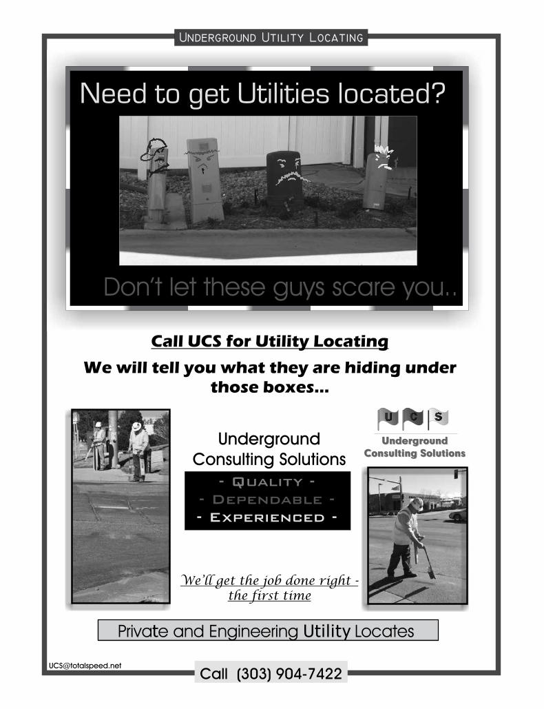
UNDERGROUND CONSULTING SOLUTIONSKelly Goff
2701 W. Oxford Ave., Suite 6Englewood, CO 80110
VECTORS, INCChuck Hutchins
Sales10670 E Bethany Dr.
Bldg. 4Aurora, CO 80014
These firms support our organization. Please show them your appreciation with your patronage. To become a Sustaining Member,
please contact Becky Roland at [email protected], or 303-551-3266.
s u s t a i n i n g m e m b e r s
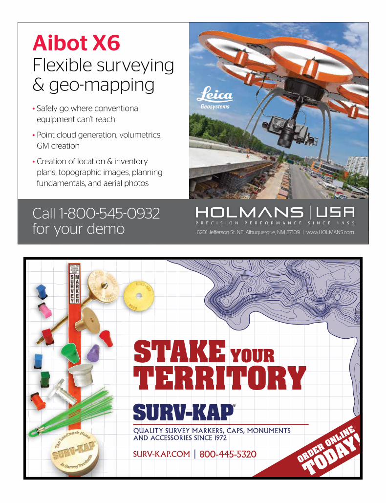
• Safely go where conventional equipment can’t reach
• Point cloud generation, volumetrics, GM creation
• Creation of location & inventory plans, topographic images, planning fundamentals, and aerial photos
Call 1-800-545-0932 for your demo 6201 Jefferson St. NE, Albuquerque, NM 87109 | www.HOLMANS.com
Aibot X6Flexible surveying & geo-mapping
SURV-KAP.COM | 800-445-5320
QUALITY SURVEY MARKERS, CAPS, MONUMENTS AND ACCESSORIES SINCE 1972
STAKE YOUR
TERRITORY
ORDER ONLINE
TODAY!
Hixon Mfg. & Supply Co.