Embed Size (px)
Citation preview
1/30/2014
1
Prof. Samuel G. Paikowsky
Lecture 2 - SUBSURFACE EXPLORATION AND SOIL PARAMETERS
1
Geotechnical Engineering Research LaboratoryUniversity of Massachusetts Lowell
USA
14.528 Drilled Deep FoundationsSpring 2014
Prof. Samuel G. Paikowsky
Lecture 2 – Part I - Basic Review Soil Origin and Deposition
N.E. Geology
2
Geotechnical Engineering Research LaboratoryUniversity of Massachusetts Lowell
USA
14.528 Drilled Deep FoundationsSpring 2014
1/30/2014
2
14.528 Drilled Deep Foundations – Samuel Paikowsky 3 of 180
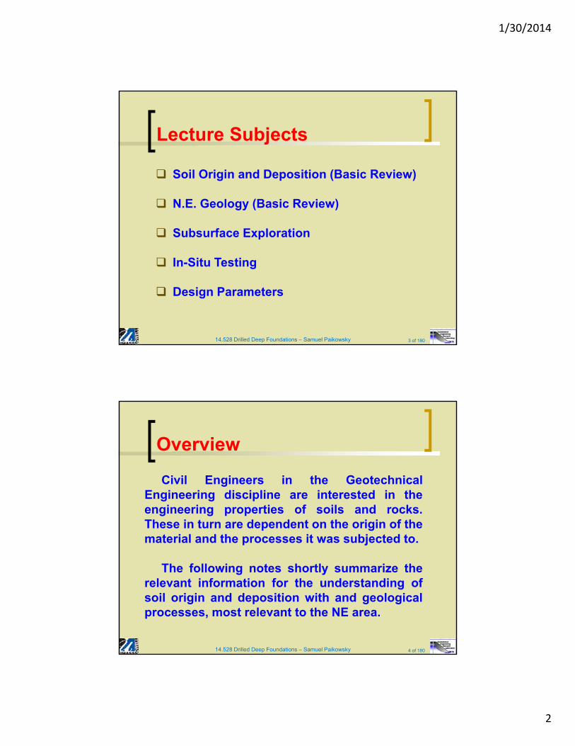
Soil Origin and Deposition (Basic Review)
N.E. Geology (Basic Review)
Subsurface Exploration
In-Situ Testing
Design Parameters
Lecture Subjects
14.528 Drilled Deep Foundations – Samuel Paikowsky 4 of 180
Civil Engineers in the GeotechnicalEngineering discipline are interested in theengineering properties of soils and rocks.These in turn are dependent on the origin of thematerial and the processes it was subjected to.
The following notes shortly summarize therelevant information for the understanding ofsoil origin and deposition with and geologicalprocesses, most relevant to the NE area.
Overview
1/30/2014
3
14.528 Drilled Deep Foundations – Samuel Paikowsky 5 of 180
Basic Definition
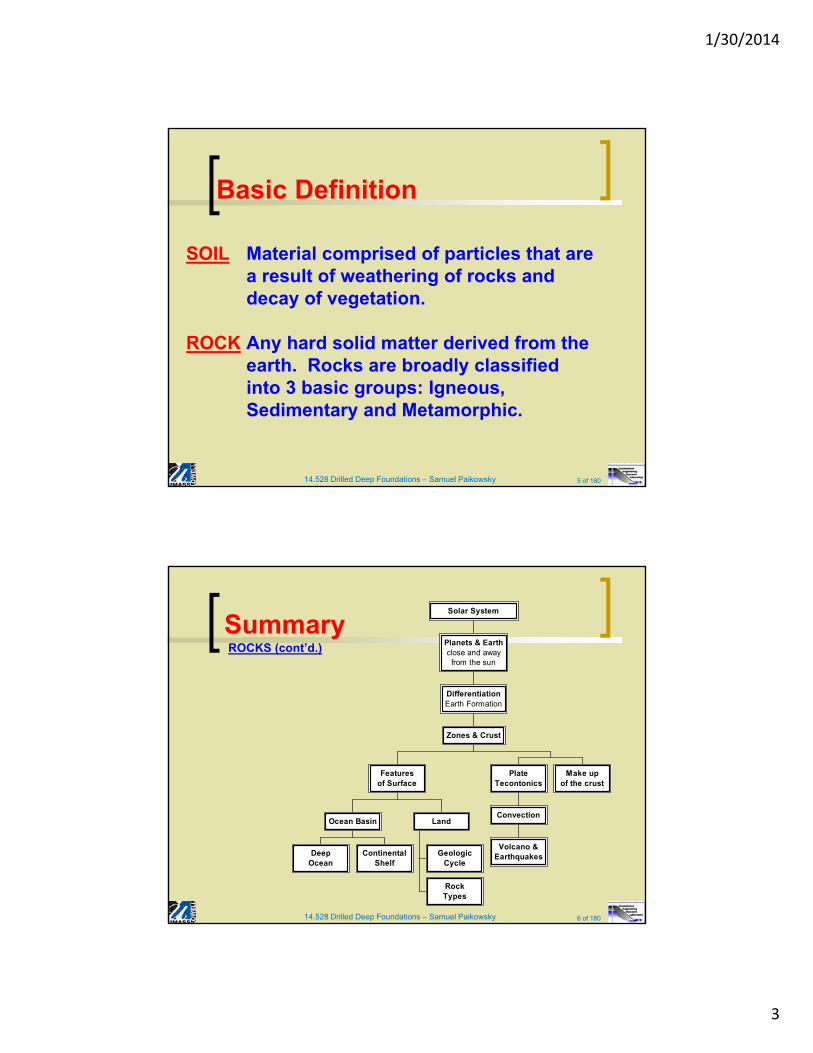
SOIL Material comprised of particles that are a result of weathering of rocks and decay of vegetation.
ROCK Any hard solid matter derived from the earth. Rocks are broadly classified into 3 basic groups: Igneous, Sedimentary and Metamorphic.
14.528 Drilled Deep Foundations – Samuel Paikowsky 6 of 180
SummaryROCKS (cont’d.)
DeepOcean
ContinentalShelf
Ocean Basin
GeologicCycle
RockTypes
Land
Featuresof Surface
Volcano &Earthquakes
Convection
PlateTecontonics
Make upof the crust
Zones & Crust
DifferentiationEarth Formation
Planets & Earthclose and away
from the sun
Solar System
1/30/2014
4
14.528 Drilled Deep Foundations – Samuel Paikowsky 7 of 180
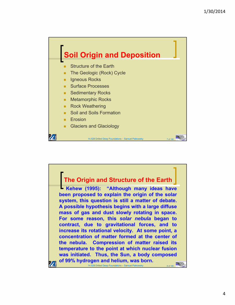
Structure of the Earth
The Geologic (Rock) Cycle
Igneous Rocks
Surface Processes
Sedimentary Rocks
Metamorphic Rocks
Rock Weathering
Soil and Soils Formation
Erosion
Glaciers and Glaciology
Soil Origin and Deposition
14.528 Drilled Deep Foundations – Samuel Paikowsky 8 of 180
Kehew (1995): “Although many ideas havebeen proposed to explain the origin of the solarsystem, this question is still a matter of debate.A possible hypothesis begins with a large diffusemass of gas and dust slowly rotating in space.For some reason, this solar nebula began tocontract, due to gravitational forces, and toincrease its rotational velocity. At some point, aconcentration of matter formed at the center ofthe nebula. Compression of matter raised itstemperature to the point at which nuclear fusionwas initiated. Thus, the Sun, a body composedof 99% hydrogen and helium, was born.
The Origin and Structure of the Earth
1/30/2014
5
14.528 Drilled Deep Foundations – Samuel Paikowsky 9 of 180
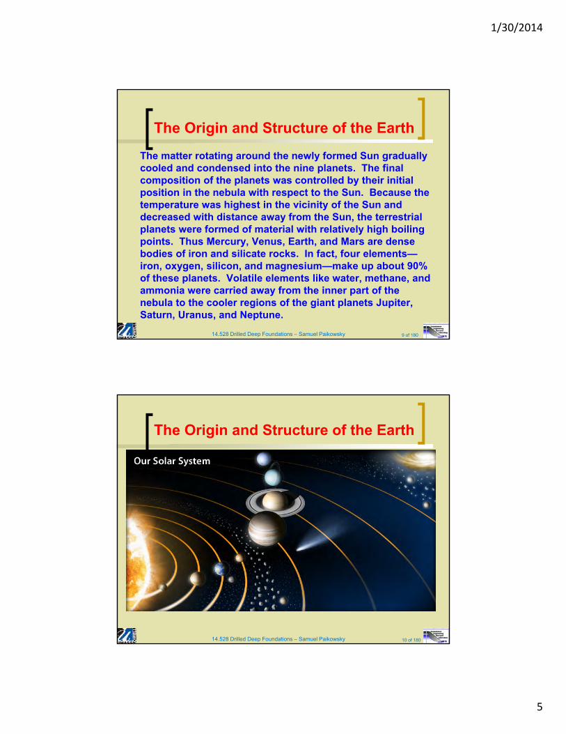
The matter rotating around the newly formed Sun gradually cooled and condensed into the nine planets. The final composition of the planets was controlled by their initial position in the nebula with respect to the Sun. Because the temperature was highest in the vicinity of the Sun and decreased with distance away from the Sun, the terrestrial planets were formed of material with relatively high boiling points. Thus Mercury, Venus, Earth, and Mars are dense bodies of iron and silicate rocks. In fact, four elements—iron, oxygen, silicon, and magnesium—make up about 90% of these planets. Volatile elements like water, methane, and ammonia were carried away from the inner part of the nebula to the cooler regions of the giant planets Jupiter, Saturn, Uranus, and Neptune.
The Origin and Structure of the Earth
14.528 Drilled Deep Foundations – Samuel Paikowsky 10 of 180
The Origin and Structure of the Earth
1/30/2014
6
14.528 Drilled Deep Foundations – Samuel Paikowsky 11 of 180
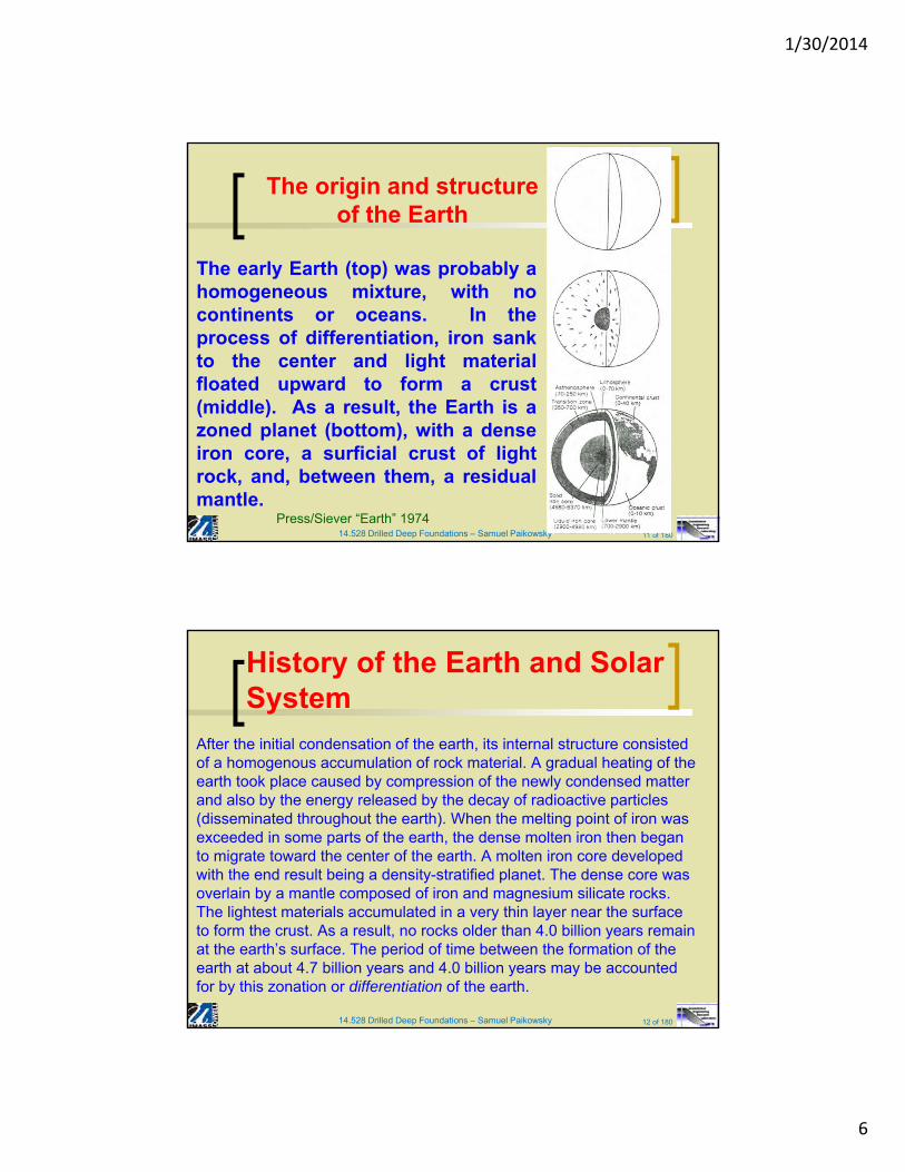
The early Earth (top) was probably ahomogeneous mixture, with nocontinents or oceans. In theprocess of differentiation, iron sankto the center and light materialfloated upward to form a crust(middle). As a result, the Earth is azoned planet (bottom), with a denseiron core, a surficial crust of lightrock, and, between them, a residualmantle.
The origin and structureof the Earth
Press/Siever “Earth” 1974
14.528 Drilled Deep Foundations – Samuel Paikowsky 12 of 180
After the initial condensation of the earth, its internal structure consisted of a homogenous accumulation of rock material. A gradual heating of the earth took place caused by compression of the newly condensed matter and also by the energy released by the decay of radioactive particles (disseminated throughout the earth). When the melting point of iron was exceeded in some parts of the earth, the dense molten iron then began to migrate toward the center of the earth. A molten iron core developed with the end result being a density-stratified planet. The dense core was overlain by a mantle composed of iron and magnesium silicate rocks. The lightest materials accumulated in a very thin layer near the surface to form the crust. As a result, no rocks older than 4.0 billion years remain at the earth’s surface. The period of time between the formation of the earth at about 4.7 billion years and 4.0 billion years may be accounted for by this zonation or differentiation of the earth.
History of the Earth and Solar System
1/30/2014
7
14.528 Drilled Deep Foundations – Samuel Paikowsky 13 of 180
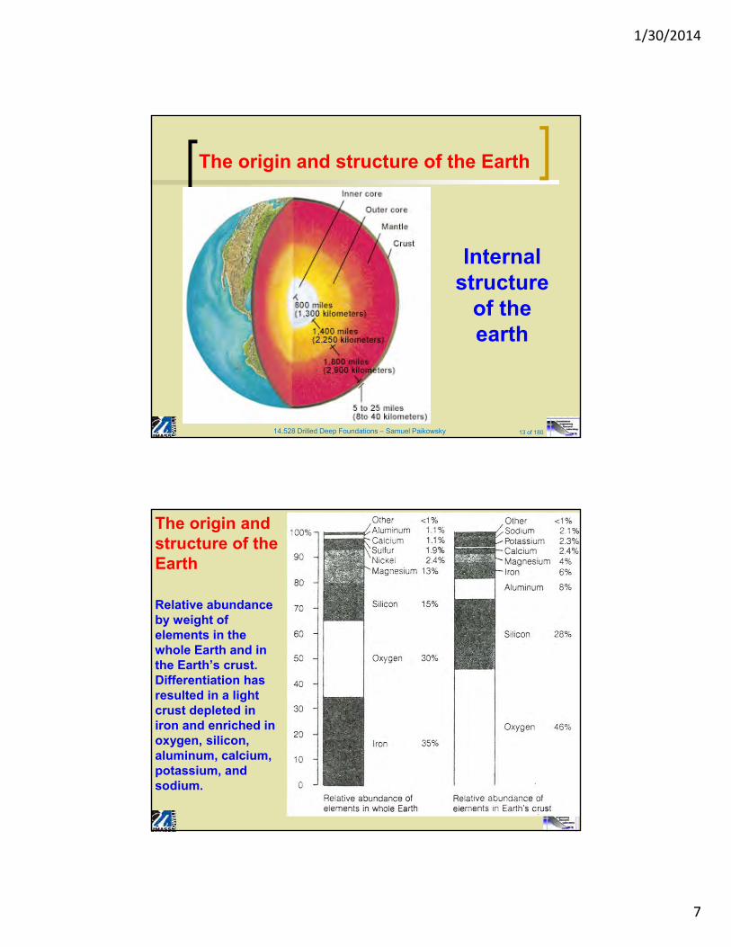
The origin and structure of the Earth
Internal structure
of the earth
Relative abundance by weight of elements in the whole Earth and in the Earth’s crust. Differentiation has resulted in a light crust depleted in iron and enriched in oxygen, silicon, aluminum, calcium, potassium, and sodium.
The origin and structure of the Earth
1/30/2014
8
14.528 Drilled Deep Foundations – Samuel Paikowsky 15 of 180
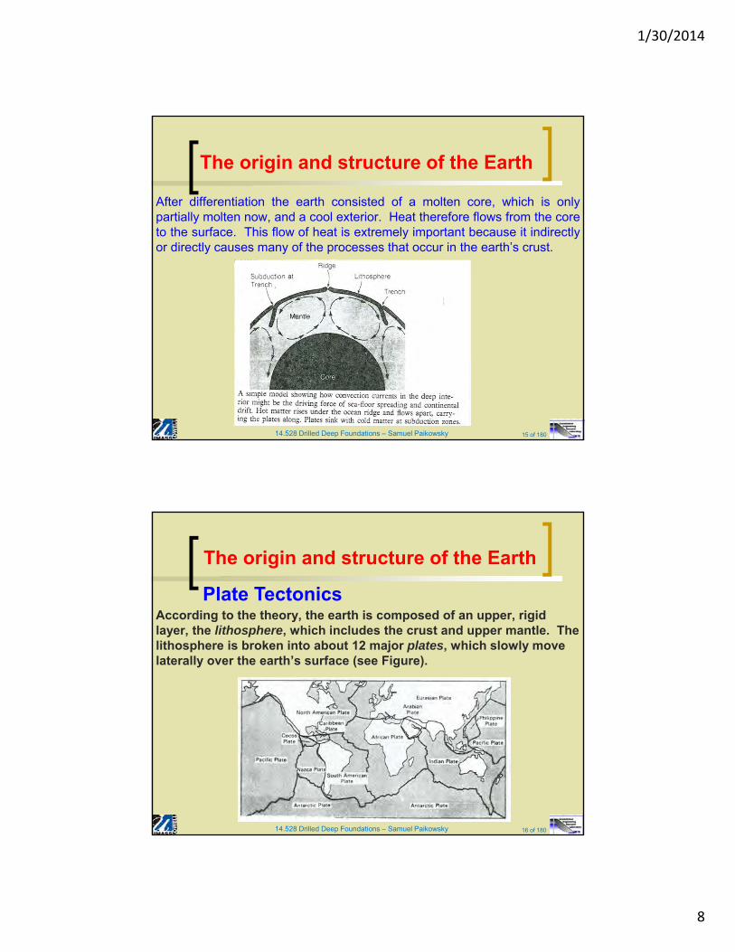
After differentiation the earth consisted of a molten core, which is onlypartially molten now, and a cool exterior. Heat therefore flows from the coreto the surface. This flow of heat is extremely important because it indirectlyor directly causes many of the processes that occur in the earth’s crust.
The origin and structure of the Earth
14.528 Drilled Deep Foundations – Samuel Paikowsky 16 of 180
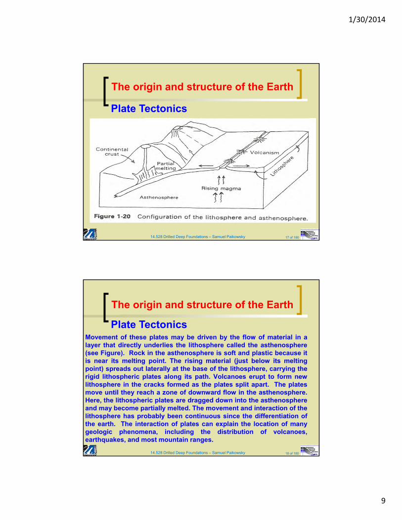
According to the theory, the earth is composed of an upper, rigid layer, the lithosphere, which includes the crust and upper mantle. The lithosphere is broken into about 12 major plates, which slowly move laterally over the earth’s surface (see Figure).
Plate Tectonics
The origin and structure of the Earth
1/30/2014
9
14.528 Drilled Deep Foundations – Samuel Paikowsky 17 of 180
Plate Tectonics
The origin and structure of the Earth
14.528 Drilled Deep Foundations – Samuel Paikowsky 18 of 180
Movement of these plates may be driven by the flow of material in alayer that directly underlies the lithosphere called the asthenosphere(see Figure). Rock in the asthenosphere is soft and plastic because itis near its melting point. The rising material (just below its meltingpoint) spreads out laterally at the base of the lithosphere, carrying therigid lithospheric plates along its path. Volcanoes erupt to form newlithosphere in the cracks formed as the plates split apart. The platesmove until they reach a zone of downward flow in the asthenosphere.Here, the lithospheric plates are dragged down into the asthenosphereand may become partially melted. The movement and interaction of thelithosphere has probably been continuous since the differentiation ofthe earth. The interaction of plates can explain the location of manygeologic phenomena, including the distribution of volcanoes,earthquakes, and most mountain ranges.
Plate Tectonics
The origin and structure of the Earth
1/30/2014
10
14.528 Drilled Deep Foundations – Samuel Paikowsky 19 of 180
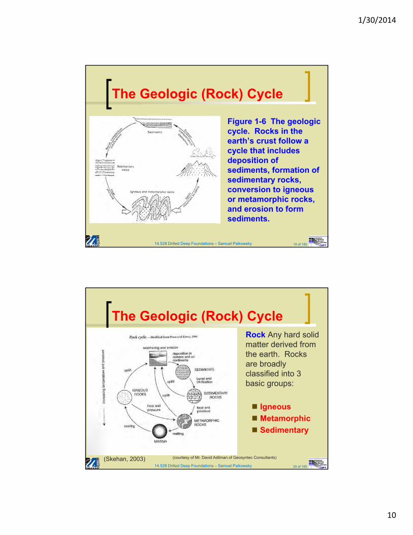
Figure 1-6 The geologic cycle. Rocks in the earth’s crust follow a cycle that includes deposition of sediments, formation of sedimentary rocks, conversion to igneous or metamorphic rocks, and erosion to form sediments.
The Geologic (Rock) Cycle
14.528 Drilled Deep Foundations – Samuel Paikowsky 20 of 180
Rock Any hard solid matter derived from the earth. Rocks are broadly classified into 3 basic groups:
Igneous
Metamorphic
Sedimentary
The Geologic (Rock) Cycle
(Skehan, 2003) (courtesy of Mr. David Adilman of Geosyntec Consultants)
1/30/2014
11
14.528 Drilled Deep Foundations – Samuel Paikowsky 21 of 180
Igneous Rocks - Rocks formed by solidification of hot mobile rock material (magma) including those formed and cooled at great depth. Igneous rocks comprise the bulk of the earth’s crust. In a general way, the igneous rocks are classified by the degree to which they have crystallized and by the kind of minerals of which they are comprised.
Magma is generated by local heating and melting of rocks within the earth’s crust, mostly at depths between 10 and around 100 km. Most compositions of rock melt at temperatures of 800-1200°C. When the magma cools, it solidifies by crystallizing into a mosaic of minerals, to form an igneous rock.
Pyroclastic Rocks (meaning fire fragmental) are formed of material, collectively known as tephra, thrown into the air from an explosive volcano. Most tephra is cooled in flight, and lands to form various types of ash, tuff and agglomerate.
Igneous Rocks
14.528 Drilled Deep Foundations – Samuel Paikowsky 22 of 180
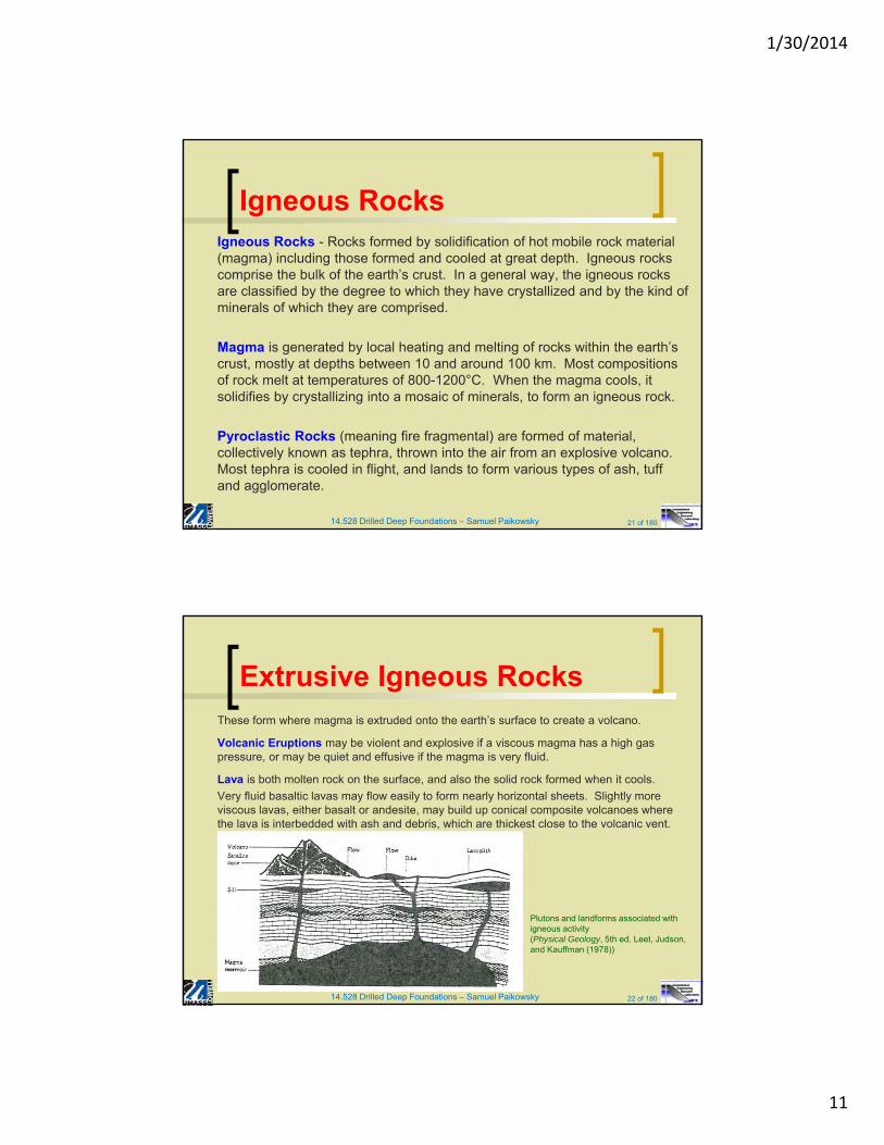
These form where magma is extruded onto the earth’s surface to create a volcano.
Volcanic Eruptions may be violent and explosive if a viscous magma has a high gas pressure, or may be quiet and effusive if the magma is very fluid.
Lava is both molten rock on the surface, and also the solid rock formed when it cools.
Very fluid basaltic lavas may flow easily to form nearly horizontal sheets. Slightly more viscous lavas, either basalt or andesite, may build up conical composite volcanoes where the lava is interbedded with ash and debris, which are thickest close to the volcanic vent.
Extrusive Igneous Rocks
Plutons and landforms associated with igneous activity(Physical Geology, 5th ed. Leet, Judson, and Kauffman (1978))
1/30/2014
12
14.528 Drilled Deep Foundations – Samuel Paikowsky 23 of 180
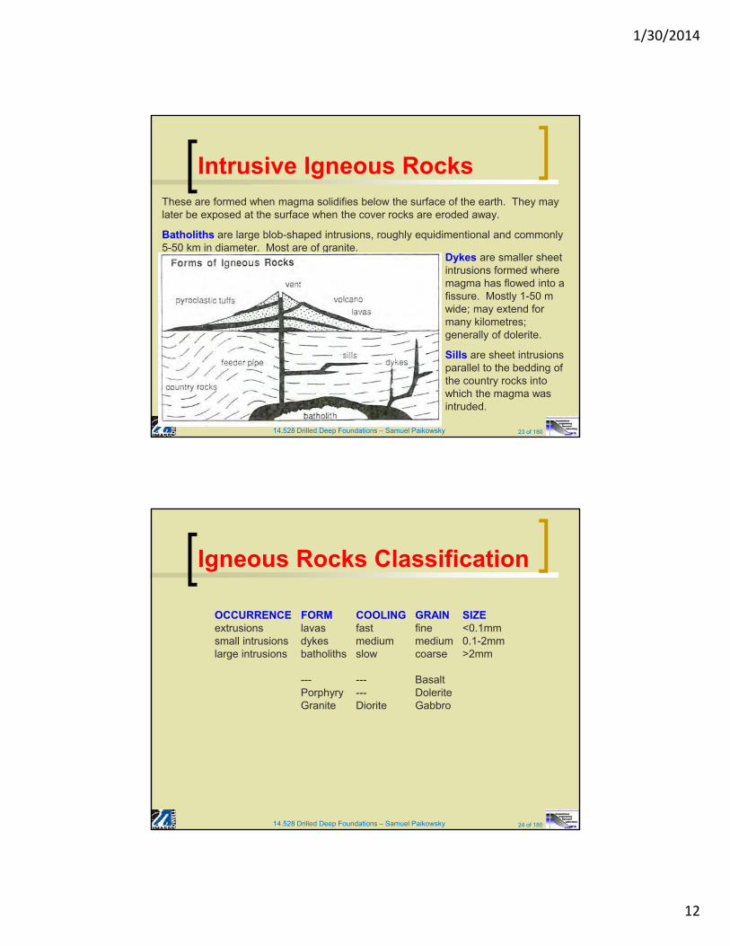
These are formed when magma solidifies below the surface of the earth. They may later be exposed at the surface when the cover rocks are eroded away.
Batholiths are large blob-shaped intrusions, roughly equidimentional and commonly 5-50 km in diameter. Most are of granite.
Intrusive Igneous Rocks
Dykes are smaller sheet intrusions formed where magma has flowed into a fissure. Mostly 1-50 m wide; may extend for many kilometres; generally of dolerite.
Sills are sheet intrusions parallel to the bedding of the country rocks into which the magma was intruded.
14.528 Drilled Deep Foundations – Samuel Paikowsky 24 of 180
Igneous Rocks Classification
OCCURRENCE FORM COOLING GRAIN SIZEextrusions lavas fast fine <0.1mmsmall intrusions dykes medium medium 0.1-2mmlarge intrusions batholiths slow coarse >2mm
--- --- BasaltPorphyry --- DoleriteGranite Diorite Gabbro
1/30/2014
13
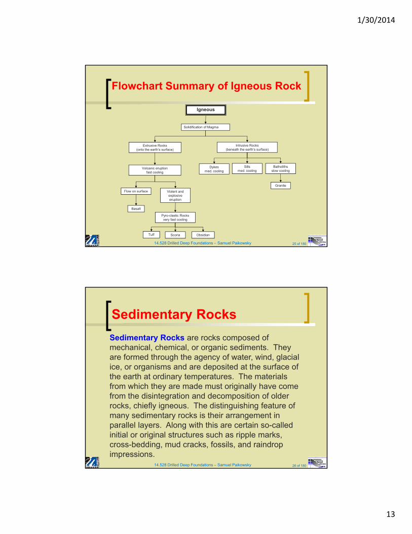
14.528 Drilled Deep Foundations – Samuel Paikowsky 25 of 180
Flowchart Summary of Igneous Rock
Solidification of Magma
Igneous
Extrusive Rocks(onto the earth’s surface)
Intrusive Rocks(beneath the earth’s surface)
Volcanic eruption fast cooling
Dykesmed. cooling
Sillsmed. cooling
Batholithsslow cooling
Flow on surface Violent and explosive eruption
Basalt
Pyro-clastic Rocksvery fast cooling
Tuff Scoria Obsidian
Granite
14.528 Drilled Deep Foundations – Samuel Paikowsky 26 of 180
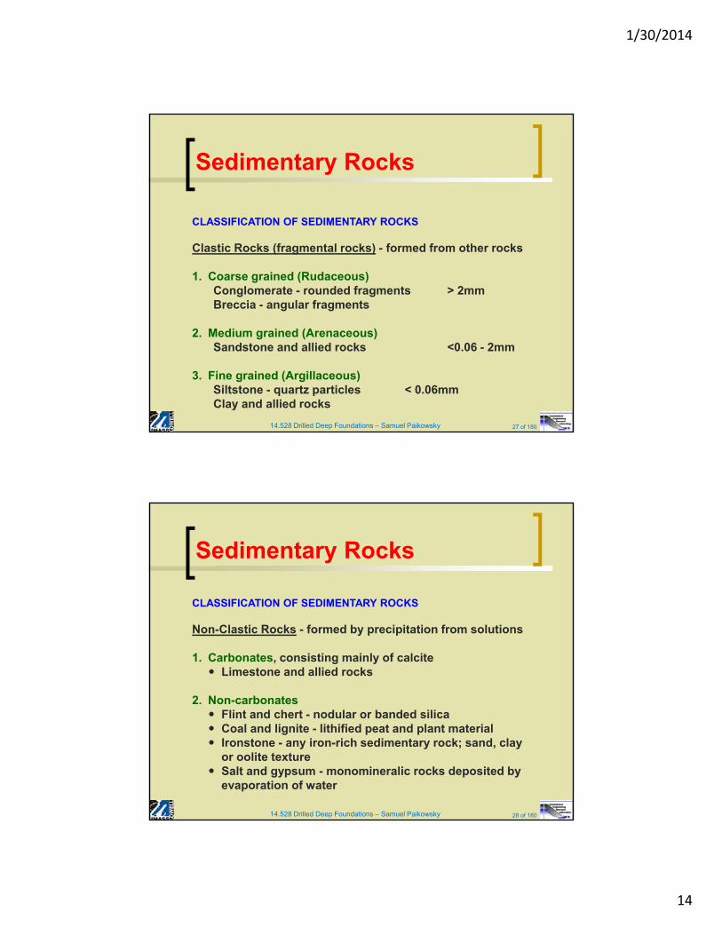
Sedimentary Rocks
Sedimentary Rocks are rocks composed of mechanical, chemical, or organic sediments. They are formed through the agency of water, wind, glacial ice, or organisms and are deposited at the surface of the earth at ordinary temperatures. The materials from which they are made must originally have come from the disintegration and decomposition of older rocks, chiefly igneous. The distinguishing feature of many sedimentary rocks is their arrangement in parallel layers. Along with this are certain so-called initial or original structures such as ripple marks, cross-bedding, mud cracks, fossils, and raindrop impressions.
1/30/2014
14
14.528 Drilled Deep Foundations – Samuel Paikowsky 27 of 180
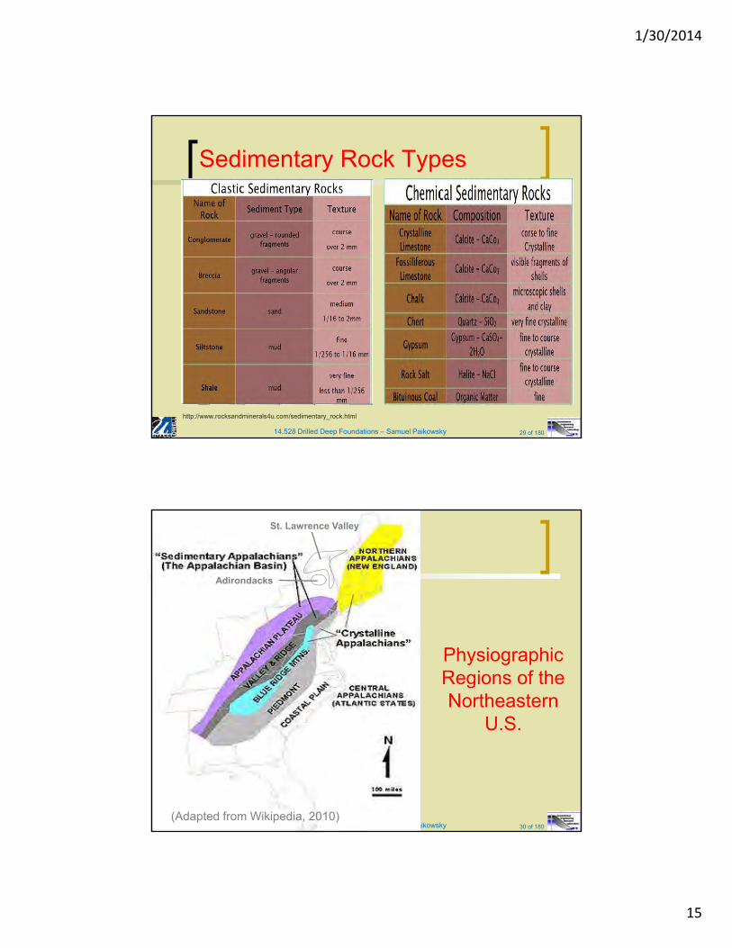
Sedimentary Rocks
CLASSIFICATION OF SEDIMENTARY ROCKS
Clastic Rocks (fragmental rocks) - formed from other rocks
1. Coarse grained (Rudaceous)Conglomerate - rounded fragments > 2mmBreccia - angular fragments
2. Medium grained (Arenaceous)Sandstone and allied rocks <0.06 - 2mm
3. Fine grained (Argillaceous)Siltstone - quartz particles < 0.06mmClay and allied rocks
14.528 Drilled Deep Foundations – Samuel Paikowsky 28 of 180
Sedimentary Rocks
CLASSIFICATION OF SEDIMENTARY ROCKS
Non-Clastic Rocks - formed by precipitation from solutions
1. Carbonates, consisting mainly of calcite Limestone and allied rocks
2. Non-carbonates Flint and chert - nodular or banded silica Coal and lignite - lithified peat and plant material Ironstone - any iron-rich sedimentary rock; sand, clay
or oolite texture Salt and gypsum - monomineralic rocks deposited by
evaporation of water
1/30/2014
15
14.528 Drilled Deep Foundations – Samuel Paikowsky 29 of 180
Sedimentary Rock Types
http://www.rocksandminerals4u.com/sedimentary_rock.html
14.528 Drilled Deep Foundations – Samuel Paikowsky 30 of 180
(Adapted from Wikipedia, 2010)
St. Lawrence Valley
Adirondacks
PhysiographicRegions of the Northeastern
U.S.
1/30/2014
16
14.528 Drilled Deep Foundations – Samuel Paikowsky 31 of 180
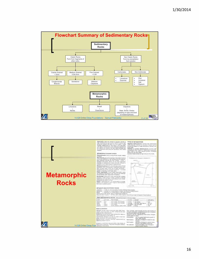
Flowchart Summary of Sedimentary Rocks
Sedimentary Rocks
Clastic RocksForm from fragments of
other rocks.
Non Clastic RocksForm by precipitation
from solution
Coarse Grained> 2mm
Medium Grained0.06-2mm
Fine Grained< 0.06
ConglomerateBreccia
Sandstone SiltstoneClaystone
Carbonates Non-Carbonate
Limestone Dolomite
Flint Ironstone Salt Gypsum
Metamorphic Rocks
Limestone↓
Marble
Basalt↓
Greenstone
Claystone↓
Slate, Schist, Gneiss (depeding on type and level
of metamorphosis)
14.528 Drilled Deep Foundations – Samuel Paikowsky 32 of 180
Metamorphic Rocks
1/30/2014
17
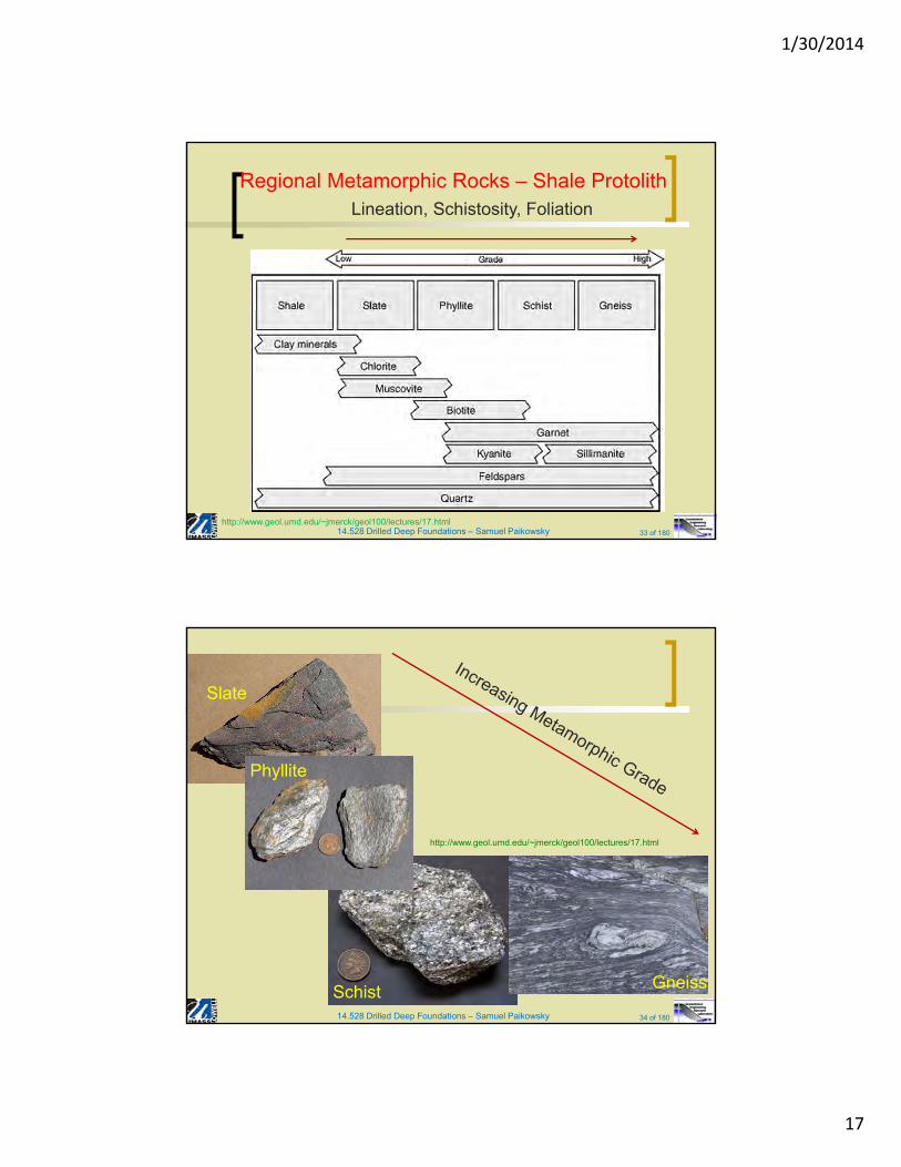
14.528 Drilled Deep Foundations – Samuel Paikowsky 33 of 180
Regional Metamorphic Rocks – Shale ProtolithLineation, Schistosity, Foliation
http://www.geol.umd.edu/~jmerck/geol100/lectures/17.html
14.528 Drilled Deep Foundations – Samuel Paikowsky 34 of 180
34
Slate
GneissSchist
Phyllite
http://www.geol.umd.edu/~jmerck/geol100/lectures/17.html
1/30/2014
18
14.528 Drilled Deep Foundations – Samuel Paikowsky 35 of 180
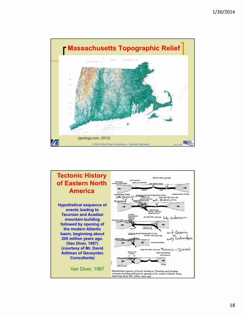
Massachusetts Topographic Relief
(geology.com, 2012)
36Van Diver, 1987
Tectonic History of Eastern North
America
Hypothetical sequence of events leading to
Taconian and Acadian mountain-building
followed by opening of the modern Atlantic
basin, beginning about 200 million years ago.
(Van Diver, 1987) (courtesy of Mr. David Adilman of Geosyntec
Consultants)
1/30/2014
19
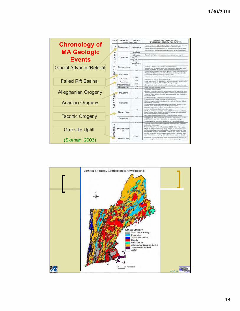
37
Chronology of MA Geologic
EventsGlacial Advance/Retreat
Failed Rift Basins
Alleghanian Orogeny
Acadian Orogeny
Taconic Orogeny
Grenville Uplift
(Skehan, 2003)
14.528 Drilled Deep Foundations – Samuel Paikowsky 38 of 180
38
1/30/2014
20
14.528 Drilled Deep Foundations – Samuel Paikowsky 39 of 180
39
14.528 Drilled Deep Foundations – Samuel Paikowsky 40 of 180
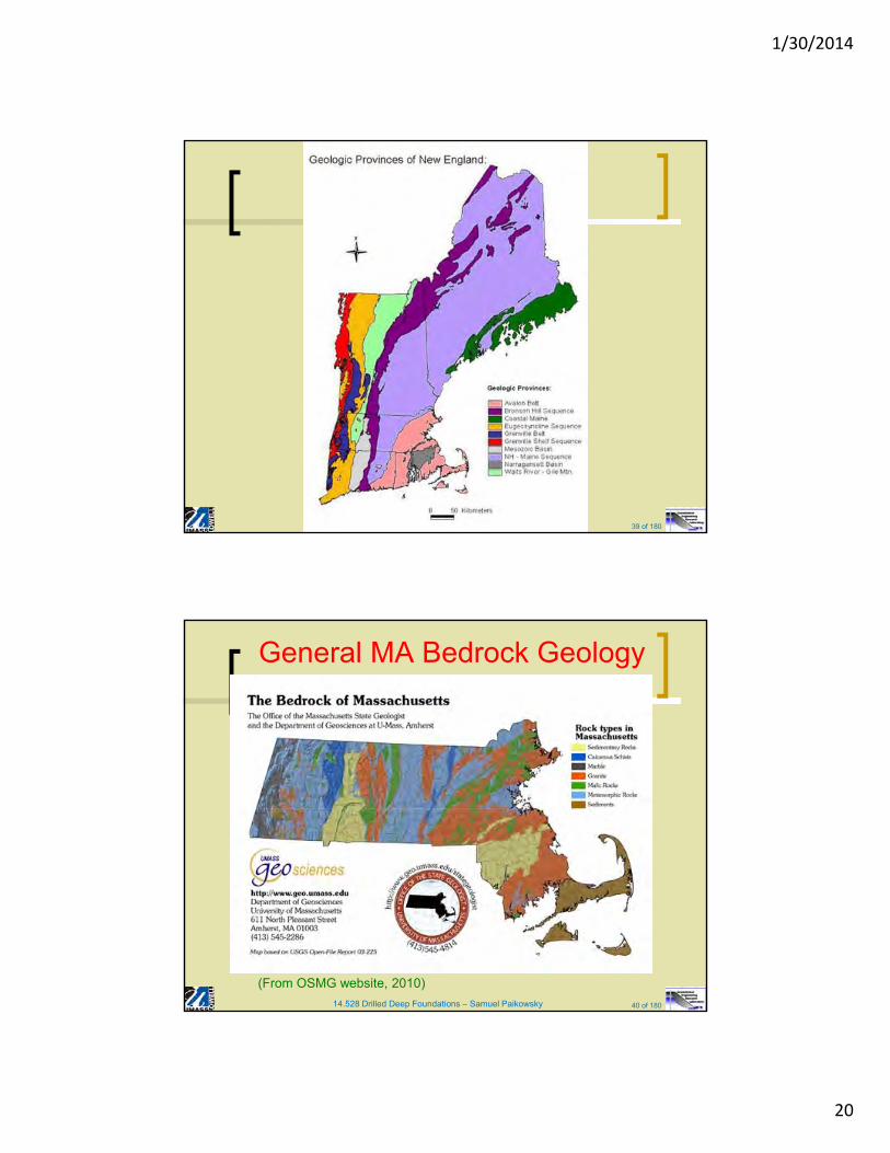
General MA Bedrock Geology
(From OSMG website, 2010)
1/30/2014
21
14.528 Drilled Deep Foundations – Samuel Paikowsky 41 of 180
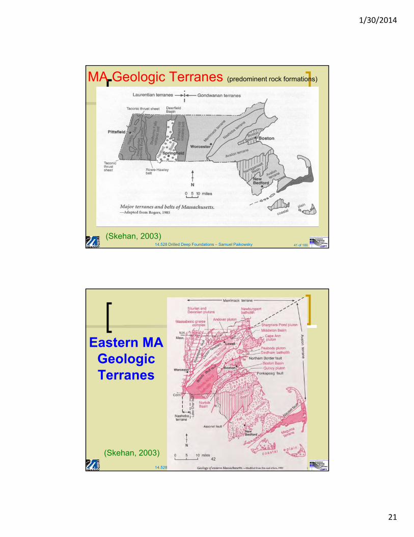
MA Geologic Terranes (predominent rock formations)
(Skehan, 2003)
14.528 Drilled Deep Foundations – Samuel Paikowsky 42 of 180
42
Eastern MA Geologic Terranes
(Skehan, 2003)
1/30/2014
22
14.528 Drilled Deep Foundations – Samuel Paikowsky 43 of 180
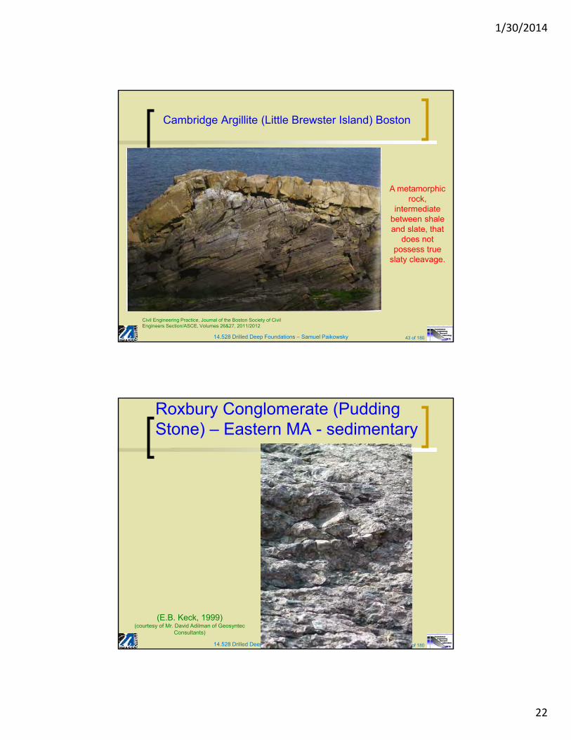
Cambridge Argillite (Little Brewster Island) Boston
Civil Engineering Practice, Journal of the Boston Society of CivilEngineers Section/ASCE, Volumes 26&27, 2011/2012
A metamorphic rock,
intermediate between shale and slate, that
does not possess true
slaty cleavage.
14.528 Drilled Deep Foundations – Samuel Paikowsky 44 of 180
Roxbury Conglomerate (Pudding Stone) – Eastern MA - sedimentary
44
(E.B. Keck, 1999)(courtesy of Mr. David Adilman of Geosyntec
Consultants)
1/30/2014
23
14.528 Drilled Deep Foundations – Samuel Paikowsky 45 of 180
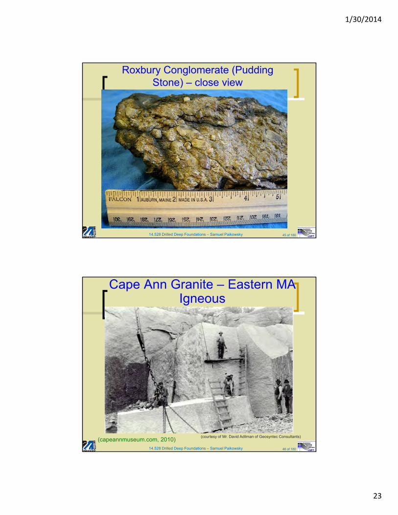
Roxbury Conglomerate (Pudding Stone) – close view
14.528 Drilled Deep Foundations – Samuel Paikowsky 46 of 180
Cape Ann Granite – Eastern MAIgneous
(capeannmuseum.com, 2010)(courtesy of Mr. David Adilman of Geosyntec Consultants)
1/30/2014
24
14.528 Drilled Deep Foundations – Samuel Paikowsky 47 of 180
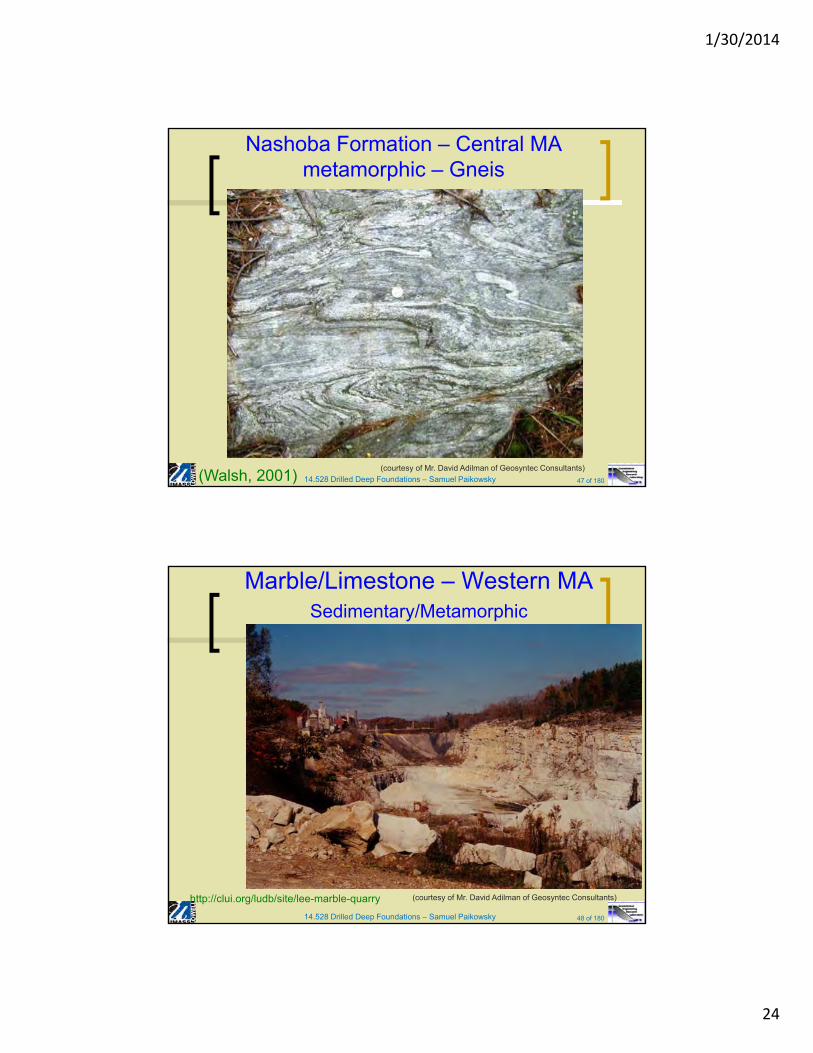
Nashoba Formation – Central MAmetamorphic – Gneis
(Walsh, 2001)(courtesy of Mr. David Adilman of Geosyntec Consultants)
14.528 Drilled Deep Foundations – Samuel Paikowsky 48 of 180
Marble/Limestone – Western MASedimentary/Metamorphic
http://clui.org/ludb/site/lee-marble-quarry (courtesy of Mr. David Adilman of Geosyntec Consultants)
1/30/2014
25
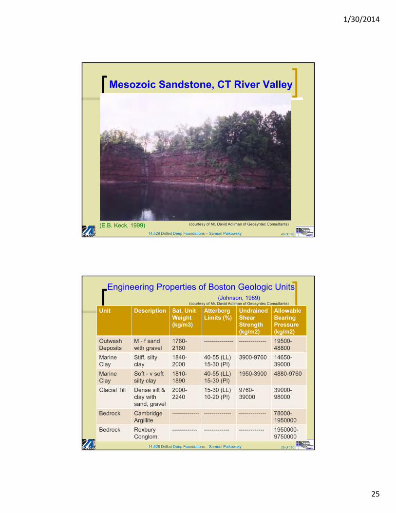
14.528 Drilled Deep Foundations – Samuel Paikowsky 49 of 180
Mesozoic Sandstone, CT River Valley
(E.B. Keck, 1999) (courtesy of Mr. David Adilman of Geosyntec Consultants)
14.528 Drilled Deep Foundations – Samuel Paikowsky 50 of 180
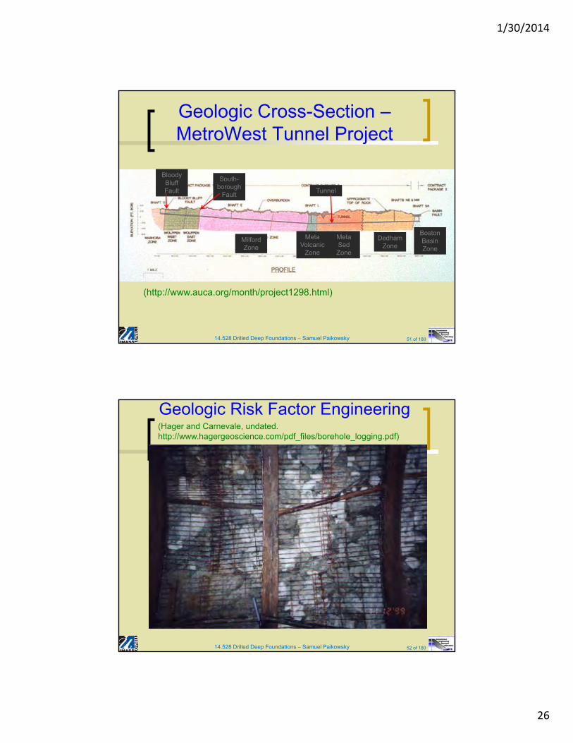
Engineering Properties of Boston Geologic Units
Unit Description Sat. Unit Weight (kg/m3)
AtterbergLimits (%)
UndrainedShear Strength(kg/m2)
Allowable Bearing Pressure (kg/m2)
OutwashDeposits
M - f sand with gravel
1760-2160
--------------- -------------- 19500-48800
Marine Clay
Stiff, siltyclay
1840-2000
40-55 (LL) 15-30 (Pl)
3900-9760 14650-39000
Marine Clay
Soft - v soft silty clay
1810-1890
40-55 (LL) 15-30 (Pl)
1950-3900 4880-9760
Glacial Till Dense silt & clay with sand, gravel
2000-2240
15-30 (LL)10-20 (Pl)
9760-39000
39000-98000
Bedrock Cambridge Argillite
-------------- -------------- -------------- 78000-1950000
Bedrock RoxburyConglom.
------------- ------------- ------------- 1950000-9750000
(Johnson, 1989)(courtesy of Mr. David Adilman of Geosyntec Consultants)
1/30/2014
26
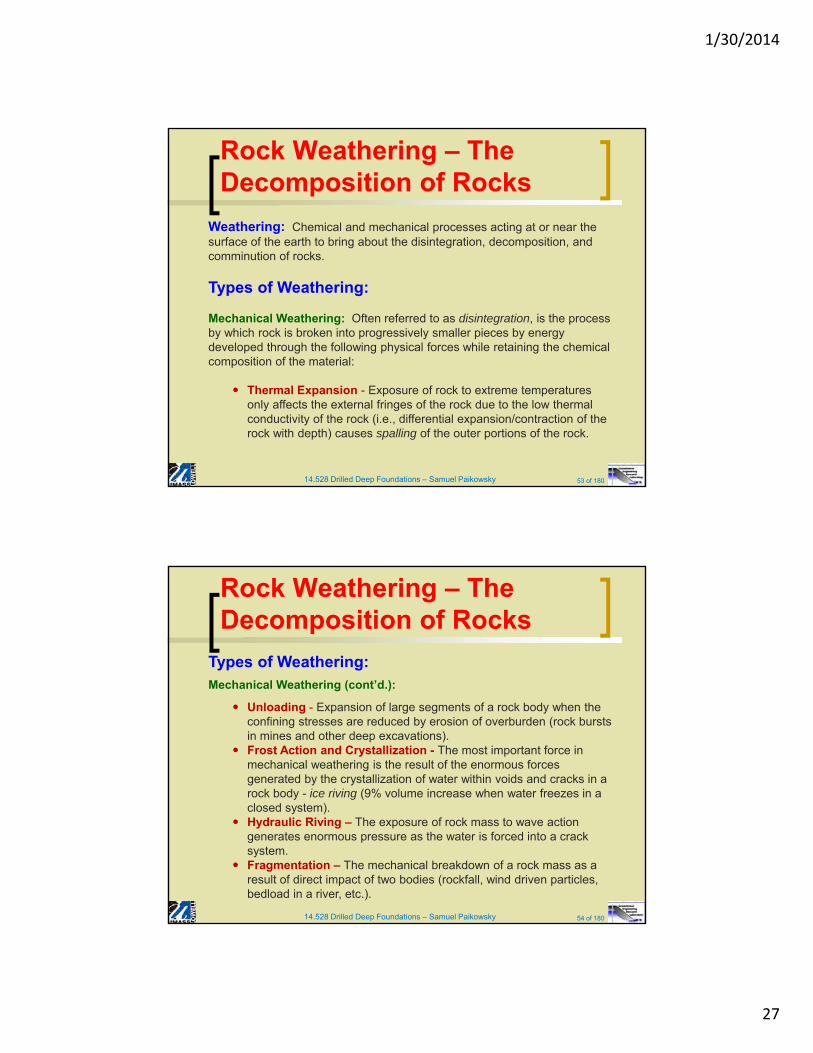
14.528 Drilled Deep Foundations – Samuel Paikowsky 51 of 180
Geologic Cross-Section –MetroWest Tunnel Project
(http://www.auca.org/month/project1298.html)
Dedham Zone
Boston Basin Zone
Meta SedZone
Meta Volcanic
Zone
Milford Zone
Bloody Bluff Fault
South-borough
FaultTunnel
14.528 Drilled Deep Foundations – Samuel Paikowsky 52 of 180
Geologic Risk Factor Engineering(Hager and Carnevale, undated. http://www.hagergeoscience.com/pdf_files/borehole_logging.pdf)
1/30/2014
27
14.528 Drilled Deep Foundations – Samuel Paikowsky 53 of 180
Rock Weathering – The Decomposition of Rocks
Weathering: Chemical and mechanical processes acting at or near the surface of the earth to bring about the disintegration, decomposition, and comminution of rocks.
Types of Weathering:
Mechanical Weathering: Often referred to as disintegration, is the process by which rock is broken into progressively smaller pieces by energy developed through the following physical forces while retaining the chemical composition of the material:
Thermal Expansion - Exposure of rock to extreme temperatures only affects the external fringes of the rock due to the low thermal conductivity of the rock (i.e., differential expansion/contraction of the rock with depth) causes spalling of the outer portions of the rock.
14.528 Drilled Deep Foundations – Samuel Paikowsky 54 of 180
Rock Weathering – The Decomposition of Rocks
Types of Weathering:Mechanical Weathering (cont’d.):
Unloading - Expansion of large segments of a rock body when the confining stresses are reduced by erosion of overburden (rock bursts in mines and other deep excavations).
Frost Action and Crystallization - The most important force in mechanical weathering is the result of the enormous forces generated by the crystallization of water within voids and cracks in a rock body - ice riving (9% volume increase when water freezes in a closed system).
Hydraulic Riving – The exposure of rock mass to wave action generates enormous pressure as the water is forced into a crack system.
Fragmentation – The mechanical breakdown of a rock mass as a result of direct impact of two bodies (rockfall, wind driven particles, bedload in a river, etc.).
1/30/2014
28
14.528 Drilled Deep Foundations – Samuel Paikowsky 55 of 180
Rock Weathering – The Decomposition of Rocks
Types of Weathering:
Chemical Weathering: Referred to as decomposition, involves a change in the composition of the material weathered. The rate of chemical weathering increases as the particle size decreases due to the increased surface area exposed to the weathering environment. Thus chemical weathering works in conjunction with mechanical weathering.
Chemical weathering of rocks produces a byproduct that can have a entirely different chemical composition and crystalline structure.
Mechanisms of Chemical Weathering
Oxidation and Reduction - occurs in iron, magnesium, and sulfur rich rocks - caused by an expansion of the material during oxidation or reduction
14.528 Drilled Deep Foundations – Samuel Paikowsky 56 of 180
Rock Weathering – The Decomposition of Rocks
Types of Weathering:
Chemical Weathering (cont’d.):
Solution - Solution of calcite by carbonic acid (weak) formed by solution of carbon dioxide in rain or ground water.
Equations of Solution Weathering
CO2 (g) + H2O(1) = H2CO3(aq)
Ca CO3(s) + H2CO3(aq) Ca2+ (aq) + 2HCO3(aq)
1/30/2014
29
14.528 Drilled Deep Foundations – Samuel Paikowsky 57 of 180
Rock Weathering – The Decomposition of Rocks
Types of Weathering:
Chemical Weathering (cont’d.):
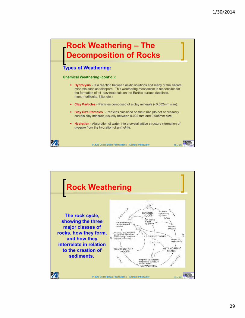
Hydrolysis - Is a reaction between acidic solutions and many of the silicate minerals such as feldspars. This weathering mechanism is responsible for the formation of all clay materials on the Earth’s surface (kaolinite, montrmorillonite, illite, etc.).
Clay Particles - Particles composed of a clay minerals (0.002mm size).
Clay Size Particles - Particles classified on their size (do not necessarily contain clay minerals) usually between 0.002 mm and 0.005mm size.
Hydration - Absorption of water into a crystal lattice structure (formation of gypsum from the hydration of anhydrite.
14.528 Drilled Deep Foundations – Samuel Paikowsky 58 of 180
Rock Weathering
The rock cycle, showing the three major classes of
rocks, how they form, and how they
interrelate in relation to the creation of
sediments.
1/30/2014
30
14.528 Drilled Deep Foundations – Samuel Paikowsky 59 of 180
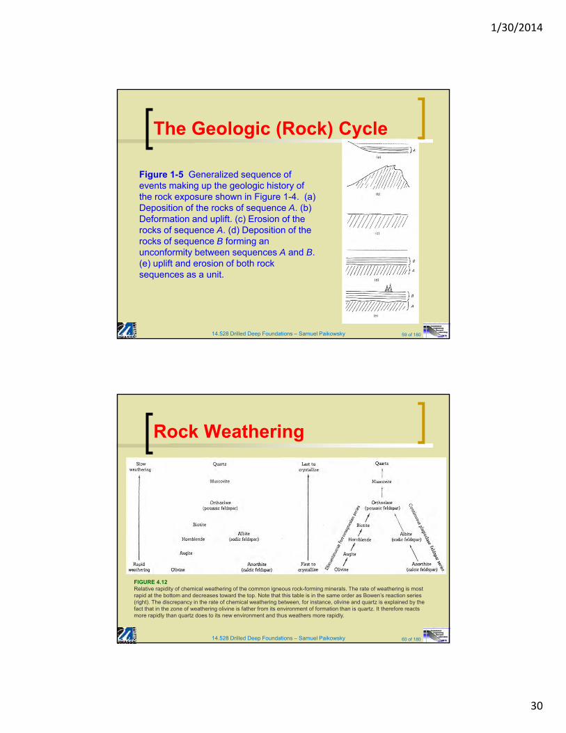
Figure 1-5 Generalized sequence of events making up the geologic history of the rock exposure shown in Figure 1-4. (a) Deposition of the rocks of sequence A. (b) Deformation and uplift. (c) Erosion of the rocks of sequence A. (d) Deposition of the rocks of sequence B forming an unconformity between sequences A and B. (e) uplift and erosion of both rock sequences as a unit.
The Geologic (Rock) Cycle
14.528 Drilled Deep Foundations – Samuel Paikowsky 60 of 180
Rock Weathering
FIGURE 4.12Relative rapidity of chemical weathering of the common igneous rock-forming minerals. The rate of weathering is most rapid at the bottom and decreases toward the top. Note that this table is in the same order as Bowen’s reaction series (right). The discrepancy in the rate of chemical weathering between, for instance, olivine and quartz is explained by the fact that in the zone of weathering olivine is father from its environment of formation than is quartz. It therefore reacts more rapidly than quartz does to its new environment and thus weathers more rapidly.
1/30/2014
31
14.528 Drilled Deep Foundations – Samuel Paikowsky 61 of 180
Soils and Soil Formation
1) Soil: Formed by the chemical and mechanical weathering of rocks. Usually divided into the following 2 categories:
a) Transported Soils: The products of rock weathering which are then transported from the parent rock to another location by physical processes
Transporting Agents: Alluvial or fluvial - transported and deposited by running water Glacial - transported and deposited by glacial processes Aeolian - transported and deposited by wind
b) Residual Soils: Soils that are formed in place by predominantly chemical weathering processes.
14.528 Drilled Deep Foundations – Samuel Paikowsky 62 of 180
Soils and Soil Formation
2) Major Soil Types:
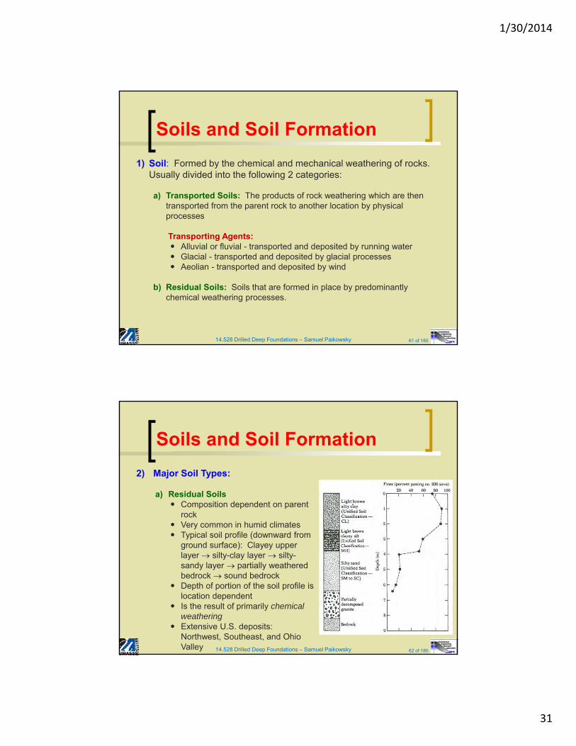
a) Residual Soils Composition dependent on parent
rock Very common in humid climates Typical soil profile (downward from
ground surface): Clayey upper layer silty-clay layer silty-sandy layer partially weathered bedrock sound bedrock
Depth of portion of the soil profile is location dependent
Is the result of primarily chemical weathering
Extensive U.S. deposits: Northwest, Southeast, and Ohio Valley
1/30/2014
32
14.528 Drilled Deep Foundations – Samuel Paikowsky 63 of 180
Soils and Soil Formation
2) Major Soil Types (cont’d.):
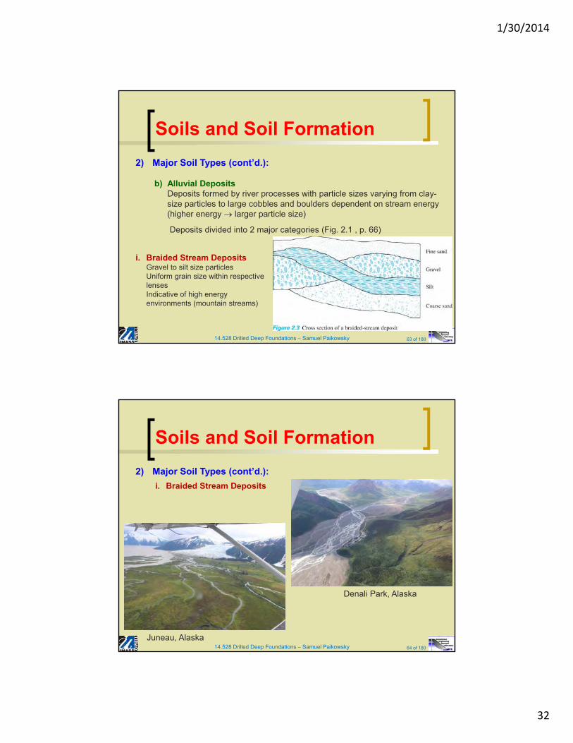
b) Alluvial DepositsDeposits formed by river processes with particle sizes varying from clay-size particles to large cobbles and boulders dependent on stream energy (higher energy larger particle size)
Deposits divided into 2 major categories (Fig. 2.1 , p. 66)
i. Braided Stream DepositsGravel to silt size particlesUniform grain size within respective lensesIndicative of high energy environments (mountain streams)
14.528 Drilled Deep Foundations – Samuel Paikowsky 64 of 180
Soils and Soil Formation
2) Major Soil Types (cont’d.):
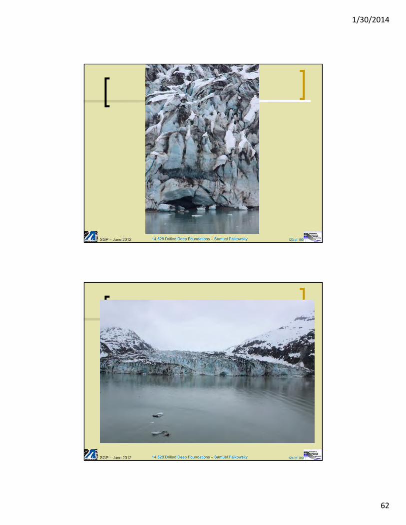
i. Braided Stream Deposits
Juneau, Alaska
Denali Park, Alaska
1/30/2014
33
14.528 Drilled Deep Foundations – Samuel Paikowsky 65 of 180
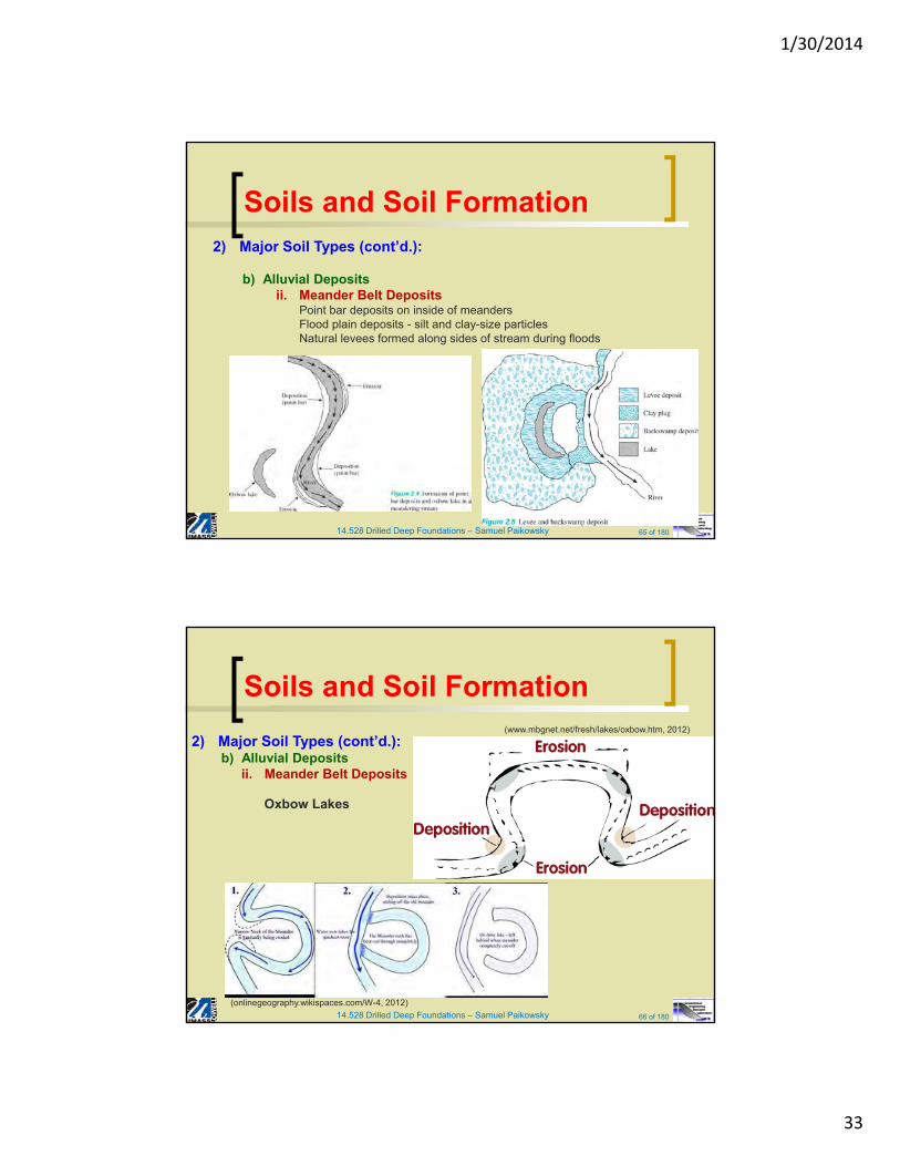
Soils and Soil Formation2) Major Soil Types (cont’d.):
b) Alluvial Depositsii. Meander Belt Deposits
Point bar deposits on inside of meandersFlood plain deposits - silt and clay-size particlesNatural levees formed along sides of stream during floods
14.528 Drilled Deep Foundations – Samuel Paikowsky 66 of 180
Soils and Soil Formation
2) Major Soil Types (cont’d.):b) Alluvial Deposits
ii. Meander Belt Deposits
(onlinegeography.wikispaces.com/W-4, 2012)
(www.mbgnet.net/fresh/lakes/oxbow.htm, 2012)
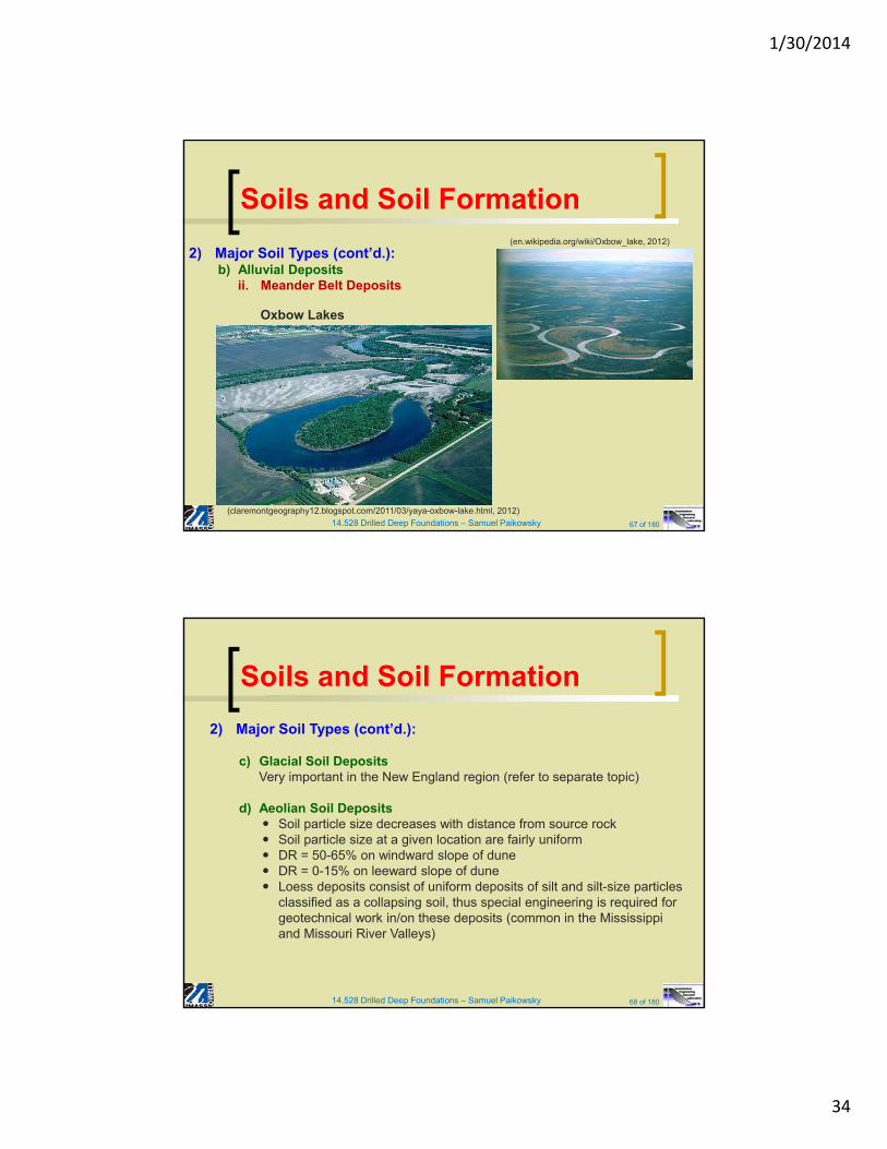
Oxbow Lakes
1/30/2014
34
14.528 Drilled Deep Foundations – Samuel Paikowsky 67 of 180
Soils and Soil Formation
2) Major Soil Types (cont’d.):b) Alluvial Deposits
ii. Meander Belt Deposits
(claremontgeography12.blogspot.com/2011/03/yaya-oxbow-lake.html, 2012)
(en.wikipedia.org/wiki/Oxbow_lake, 2012)
Oxbow Lakes
14.528 Drilled Deep Foundations – Samuel Paikowsky 68 of 180
Soils and Soil Formation
2) Major Soil Types (cont’d.):
c) Glacial Soil DepositsVery important in the New England region (refer to separate topic)
d) Aeolian Soil Deposits Soil particle size decreases with distance from source rock Soil particle size at a given location are fairly uniform DR = 50-65% on windward slope of dune DR = 0-15% on leeward slope of dune Loess deposits consist of uniform deposits of silt and silt-size particles
classified as a collapsing soil, thus special engineering is required for geotechnical work in/on these deposits (common in the Mississippi and Missouri River Valleys)
1/30/2014
35
14.528 Drilled Deep Foundations – Samuel Paikowsky 69 of 180
Soils and Soil Formation
2) Major Soil Types (cont’d.):
e) Organic Soil Found in low lying areas where the GWT is near or above the ground
surface Formed from the decomposition of aquatic plants (swamp fauna) Common in coastal marshes and glaciated regions (peat) with muck
(geologically older than peat) is nearly fully decomposed organic matter and is substantially denser than peat.
Usually a highly compressible material - not suitable for building on/with due to large settlements of soil under applied loads
14.528 Drilled Deep Foundations – Samuel Paikowsky 70 of 180
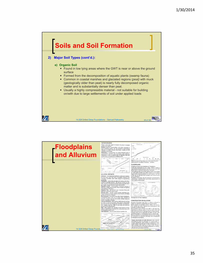
Floodplains and Alluvium
1/30/2014
36
14.528 Drilled Deep Foundations – Samuel Paikowsky 71 of 180
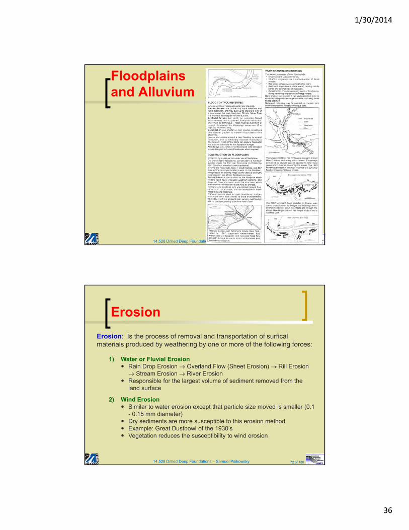
Floodplains and Alluvium
14.528 Drilled Deep Foundations – Samuel Paikowsky 72 of 180
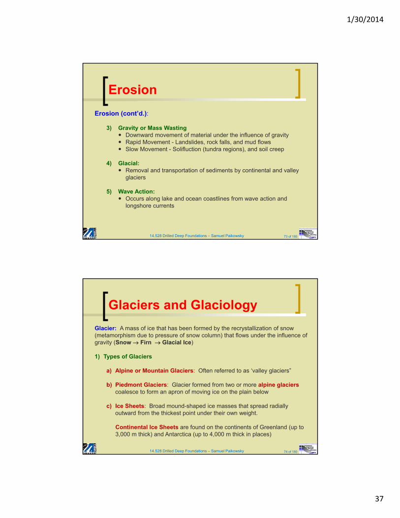
Erosion
Erosion: Is the process of removal and transportation of surficalmaterials produced by weathering by one or more of the following forces:
1) Water or Fluvial Erosion Rain Drop Erosion Overland Flow (Sheet Erosion) Rill Erosion
Stream Erosion River Erosion Responsible for the largest volume of sediment removed from the
land surface
2) Wind Erosion Similar to water erosion except that particle size moved is smaller (0.1
- 0.15 mm diameter) Dry sediments are more susceptible to this erosion method Example: Great Dustbowl of the 1930’s Vegetation reduces the susceptibility to wind erosion
1/30/2014
37
14.528 Drilled Deep Foundations – Samuel Paikowsky 73 of 180
Erosion
Erosion (cont’d.):
3) Gravity or Mass Wasting Downward movement of material under the influence of gravity Rapid Movement - Landslides, rock falls, and mud flows Slow Movement - Solifluction (tundra regions), and soil creep
4) Glacial: Removal and transportation of sediments by continental and valley
glaciers
5) Wave Action: Occurs along lake and ocean coastlines from wave action and
longshore currents
14.528 Drilled Deep Foundations – Samuel Paikowsky 74 of 180
Glaciers and Glaciology
Glacier: A mass of ice that has been formed by the recrystallization of snow (metamorphism due to pressure of snow column) that flows under the influence of gravity (Snow Firn Glacial Ice)
1) Types of Glaciers
a) Alpine or Mountain Glaciers: Often referred to as ‘valley glaciers”
b) Piedmont Glaciers: Glacier formed from two or more alpine glacierscoalesce to form an apron of moving ice on the plain below
c) Ice Sheets: Broad mound-shaped ice masses that spread radially outward from the thickest point under their own weight.
Continental Ice Sheets are found on the continents of Greenland (up to 3,000 m thick) and Antarctica (up to 4,000 m thick in places)
1/30/2014
38
14.528 Drilled Deep Foundations – Samuel Paikowsky 75 of 180
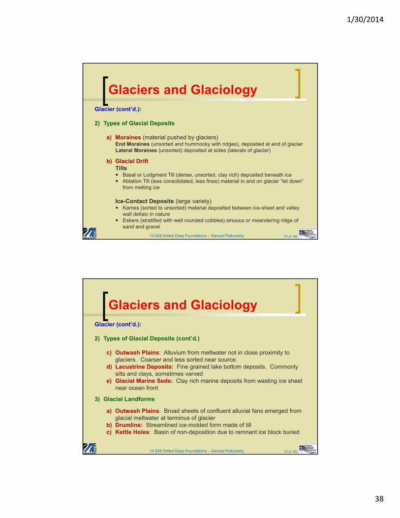
Glaciers and GlaciologyGlacier (cont’d.):
2) Types of Glacial Deposits
a) Moraines (material pushed by glaciers)End Moraines (unsorted and hummocky with ridges), deposited at end of glacierLateral Moraines (unsorted) deposited at sides (laterals of glacier)
b) Glacial DriftTills Basal or Lodgment Till (dense, unsorted, clay rich) deposited beneath ice Ablation Till (less consolidated, less fines) material in and on glacier “let down”
from melting ice
Ice-Contact Deposits (large variety) Kames (sorted to unsorted) material deposited between ice-sheet and valley
wall deltaic in nature Eskers (stratified with well rounded cobbles) sinuous or meandering ridge of
sand and gravel
14.528 Drilled Deep Foundations – Samuel Paikowsky 76 of 180
Glaciers and GlaciologyGlacier (cont’d.):
2) Types of Glacial Deposits (cont’d.)
c) Outwash Plains: Alluvium from meltwater not in close proximity to glaciers. Coarser and less sorted near source.
d) Lacustrine Deposits: Fine grained lake bottom deposits. Commonly silts and clays, sometimes varved
e) Glacial Marine Seds: Clay rich marine deposits from wasting ice sheet near ocean front
3) Glacial Landforms
a) Outwash Plains: Broad sheets of confluent alluvial fans emerged from glacial meltwater at terminus of glacier
b) Drumlins: Streamlined ice-molded form made of tillc) Kettle Holes: Basin of non-deposition due to remnant ice block buried
1/30/2014
39
14.528 Drilled Deep Foundations – Samuel Paikowsky 77 of 180
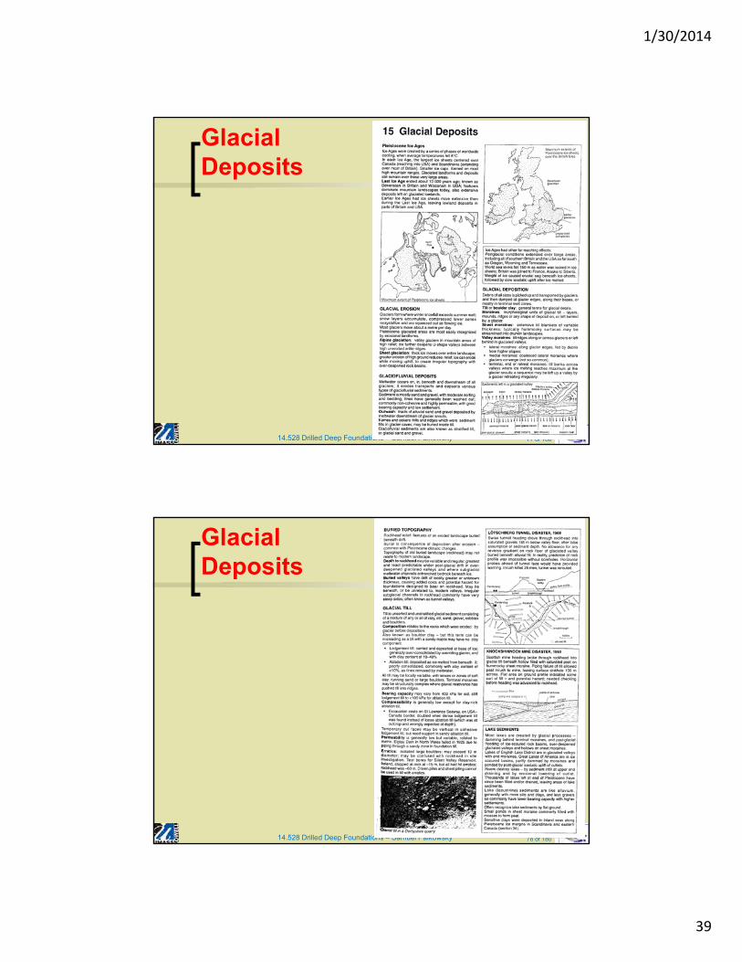
Glacial Deposits
14.528 Drilled Deep Foundations – Samuel Paikowsky 78 of 180
Glacial Deposits
1/30/2014
40
14.528 Drilled Deep Foundations – Samuel Paikowsky 79 of 180
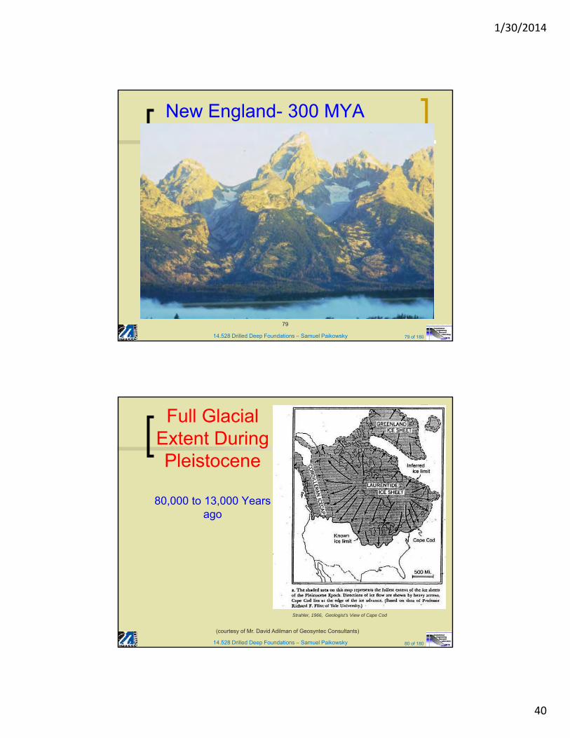
New England- 300 MYA
79
14.528 Drilled Deep Foundations – Samuel Paikowsky 80 of 180
Full Glacial Extent During Pleistocene
80,000 to 13,000 Years ago
Strahler, 1966, Geologist’s View of Cape Cod
(courtesy of Mr. David Adilman of Geosyntec Consultants)
1/30/2014
41
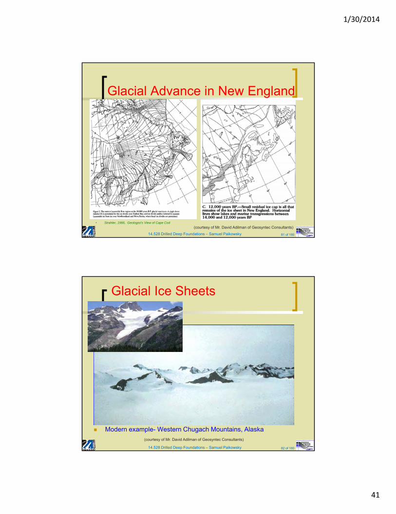
14.528 Drilled Deep Foundations – Samuel Paikowsky 81 of 180
Glacial Advance in New England
• Strahler, 1966, Geologist’s View of Cape Cod
(courtesy of Mr. David Adilman of Geosyntec Consultants)
14.528 Drilled Deep Foundations – Samuel Paikowsky 82 of 180
Glacial Ice Sheets
Modern example- Western Chugach Mountains, Alaska
(courtesy of Mr. David Adilman of Geosyntec Consultants)
1/30/2014
42
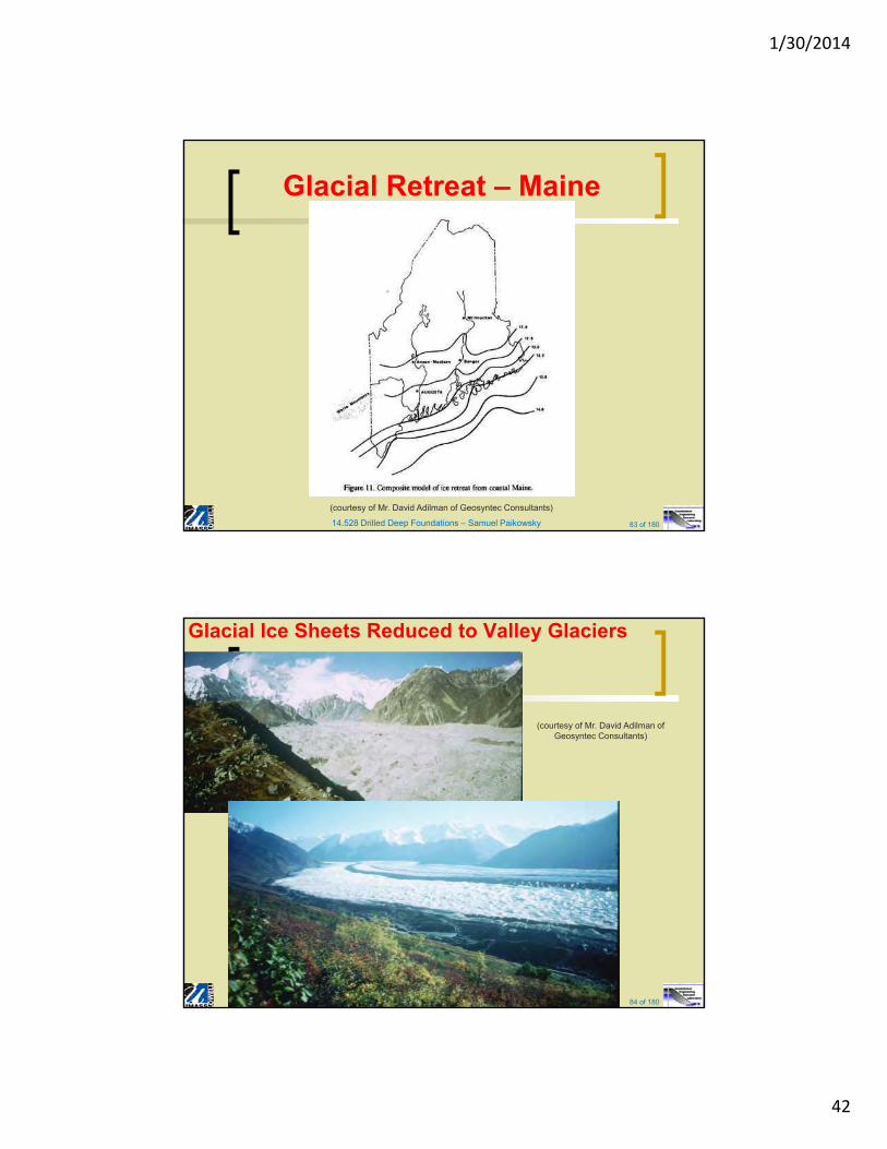
14.528 Drilled Deep Foundations – Samuel Paikowsky 83 of 180
Glacial Retreat – Maine
(courtesy of Mr. David Adilman of Geosyntec Consultants)
14.528 Drilled Deep Foundations – Samuel Paikowsky 84 of 180
Glacial Ice Sheets Reduced to Valley Glaciers
84
(courtesy of Mr. David Adilman of Geosyntec Consultants)
1/30/2014
43
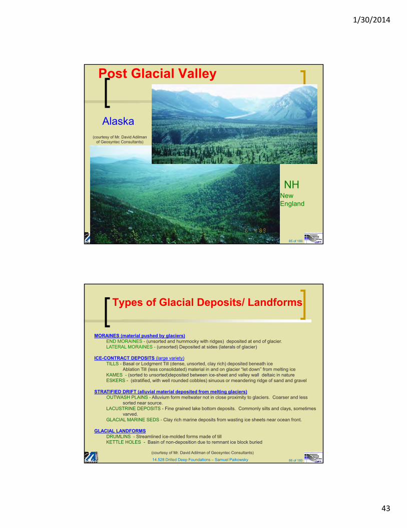
14.528 Drilled Deep Foundations – Samuel Paikowsky 85 of 180
Post Glacial Valley
Alaska
85
New England
NH
(courtesy of Mr. David Adilmanof Geosyntec Consultants)
14.528 Drilled Deep Foundations – Samuel Paikowsky 86 of 180
Types of Glacial Deposits/ Landforms
MORAINES (material pushed by glaciers)END MORAINES - (unsorted and hummocky with ridges) deposited at end of glacier. LATERAL MORAINES - (unsorted) Deposited at sides (laterals of glacier)
ICE-CONTRACT DEPOSITS (large variety)TILLS - Basal or Lodgment Till (dense, unsorted, clay rich) deposited beneath ice
Ablation Till (less consolidated) material in and on glacier “let down” from melting iceKAMES - (sorted to unsorted)deposited between ice-sheet and valley wall deltaic in natureESKERS - (stratified, with well rounded cobbles) sinuous or meandering ridge of sand and gravel
STRATIFIED DRIFT (alluvial material deposited from melting glaciers)OUTWASH PLAINS - Alluvium form meltwater not in close proximity to glaciers. Coarser and less
sorted near source. LACUSTRINE DEPOSITS - Fine grained lake bottom deposits. Commonly silts and clays, sometimes
varved.GLACIAL MARINE SEDS - Clay rich marine deposits from wasting ice sheets near ocean front.
GLACIAL LANDFORMSDRUMLINS - Streamlined ice-molded forms made of tillKETTLE HOLES - Basin of non-deposition due to remnant ice block buried
(courtesy of Mr. David Adilman of Geosyntec Consultants)
1/30/2014
44
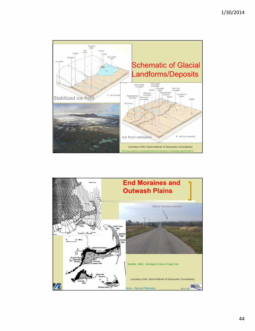
Schematic of Glacial Landforms/Deposits
Stabilized ice front
Ice front retreated
http://www.polartrec.com/expeditions/drumlin-formation-in-iceland/journals/2013-06-14
(courtesy of Mr. David Adilman of Geosyntec Consultants)
14.528 Drilled Deep Foundations – Samuel Paikowsky 88 of 180
End Moraines and Outwash Plains
Illinois Terminal moraine
Strahler, 1966, Geologist’s View of Cape Cod
(courtesy of Mr. David Adilman of Geosyntec Consultants)
1/30/2014
45
14.528 Drilled Deep Foundations – Samuel Paikowsky 89 of 180
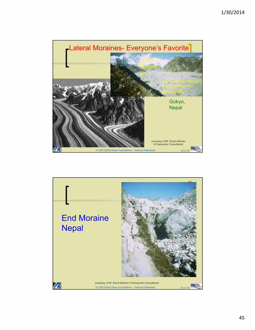
Lateral Moraines- Everyone’s Favorite
89
Ice- covered with rock debris (becomes ablation till)
Lateral Moraine
Gokyo, Nepal
(courtesy of Mr. David Adilmanof Geosyntec Consultants)
14.528 Drilled Deep Foundations – Samuel Paikowsky 90 of 180
End Moraine Nepal
(courtesy of Mr. David Adilman of Geosyntec Consultants)
1/30/2014
46
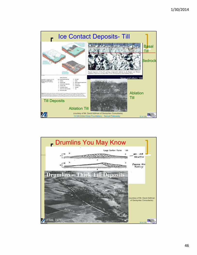
14.528 Drilled Deep Foundations – Samuel Paikowsky 91 of 180
Ice Contact Deposits- Till
Till Deposits
Basal Till
Ablation Till
Ablation Till
Bedrock
(courtesy of Mr. David Adilman of Geosyntec Consultants)
14.528 Drilled Deep Foundations – Samuel Paikowsky 92 of 180
Drumlins You May Know
92
(courtesy of Mr. David Adilmanof Geosyntec Consultants)
1/30/2014
47
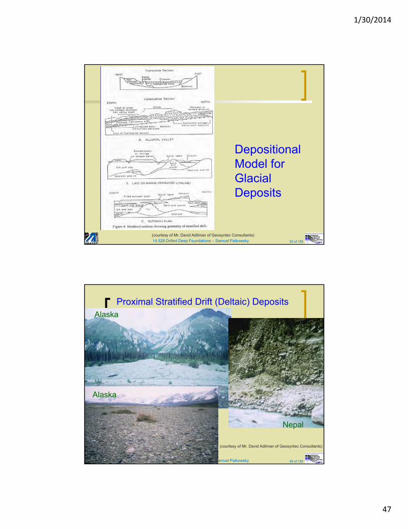
14.528 Drilled Deep Foundations – Samuel Paikowsky 93 of 180
Depositional Model for Glacial Deposits
(courtesy of Mr. David Adilman of Geosyntec Consultants)
14.528 Drilled Deep Foundations – Samuel Paikowsky 94 of 180
Proximal Stratified Drift (Deltaic) Deposits
94
Alaska
Nepal
Alaska
(courtesy of Mr. David Adilman of Geosyntec Consultants)

1/30/2014
48
14.528 Drilled Deep Foundations – Samuel Paikowsky 95 of 180
Kame Terrace, Nepal
(courtesy of Mr. David Adilman of Geosyntec Consultants)
14.528 Drilled Deep Foundations – Samuel Paikowsky 96 of 180
Pro-Glacial Lake Deposits
Massachusetts(Skehan, 2001)
New Hampshire –VermontVan Diver, 1987
Lacustrine varves, Glacial Lake
Hitchcock(Stone and others, 1998) (courtesy of Mr. David Adilman of Geosyntec Consultants)
1/30/2014
49
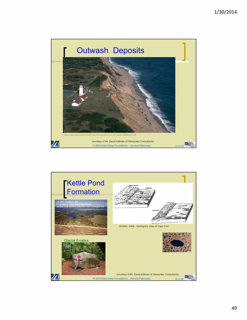
14.528 Drilled Deep Foundations – Samuel Paikowsky 97 of 180
Outwash Deposits
http://www.capecodbeachchair.com/beachguide/index.cfm?page=3&BeachId=64
(courtesy of Mr. David Adilman of Geosyntec Consultants)
14.528 Drilled Deep Foundations – Samuel Paikowsky 98 of 180
Kettle Pond Formation
Glacial Erratics
Strahler, 1966, Geologist’s View of Cape Cod
(courtesy of Mr. David Adilman of Geosyntec Consultants)
1/30/2014
50
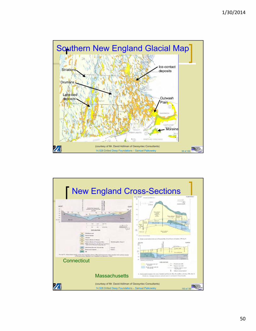
14.528 Drilled Deep Foundations – Samuel Paikowsky 99 of 180
Southern New England Glacial Map
(courtesy of Mr. David Adilman of Geosyntec Consultants)
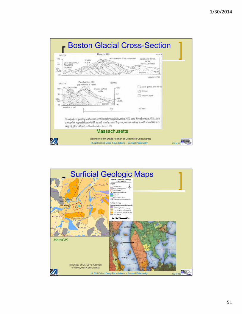
14.528 Drilled Deep Foundations – Samuel Paikowsky 100 of 180
New England Cross-Sections
Connecticut
Massachusetts
(courtesy of Mr. David Adilman of Geosyntec Consultants)
1/30/2014
51
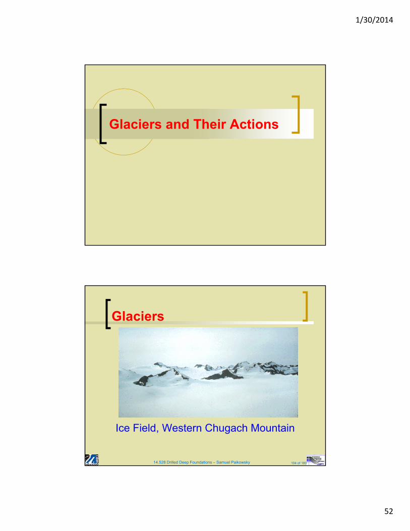
14.528 Drilled Deep Foundations – Samuel Paikowsky 101 of 180
Boston Glacial Cross-Section
Massachusetts
(courtesy of Mr. David Adilman of Geosyntec Consultants)
14.528 Drilled Deep Foundations – Samuel Paikowsky 102 of 180
Surficial Geologic Maps
102
MassGIS
(courtesy of Mr. David Adilmanof Geosyntec Consultants)
1/30/2014
52
Glaciers and Their Actions
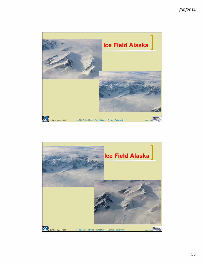
14.528 Drilled Deep Foundations – Samuel Paikowsky 104 of 180
Glaciers
Ice Field, Western Chugach Mountain
1/30/2014
53
14.528 Drilled Deep Foundations – Samuel Paikowsky 105 of 180
Ice Field Alaska
SGP – June 2012
14.528 Drilled Deep Foundations – Samuel Paikowsky 106 of 180
Ice Field Alaska
SGP – June 2012
1/30/2014
54
14.528 Drilled Deep Foundations – Samuel Paikowsky 107 of 180
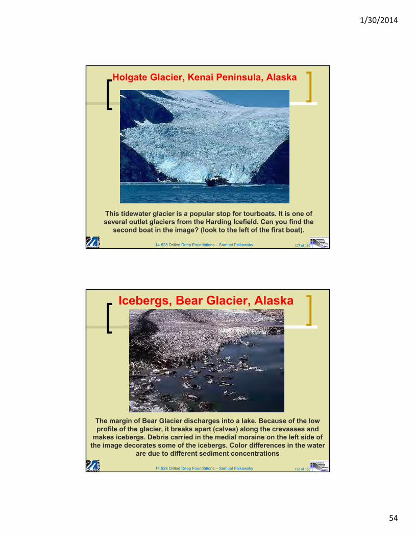
Holgate Glacier, Kenai Peninsula, Alaska
This tidewater glacier is a popular stop for tourboats. It is one of
several outlet glaciers from the Harding Icefield. Can you find the second boat in the image? (look to the left of the first boat).
14.528 Drilled Deep Foundations – Samuel Paikowsky 108 of 180
Icebergs, Bear Glacier, Alaska
The margin of Bear Glacier discharges into a lake. Because of the low profile of the glacier, it breaks apart (calves) along the crevasses and
makes icebergs. Debris carried in the medial moraine on the left side of the image decorates some of the icebergs. Color differences in the water
are due to different sediment concentrations
1/30/2014
55
14.528 Drilled Deep Foundations – Samuel Paikowsky 109 of 180
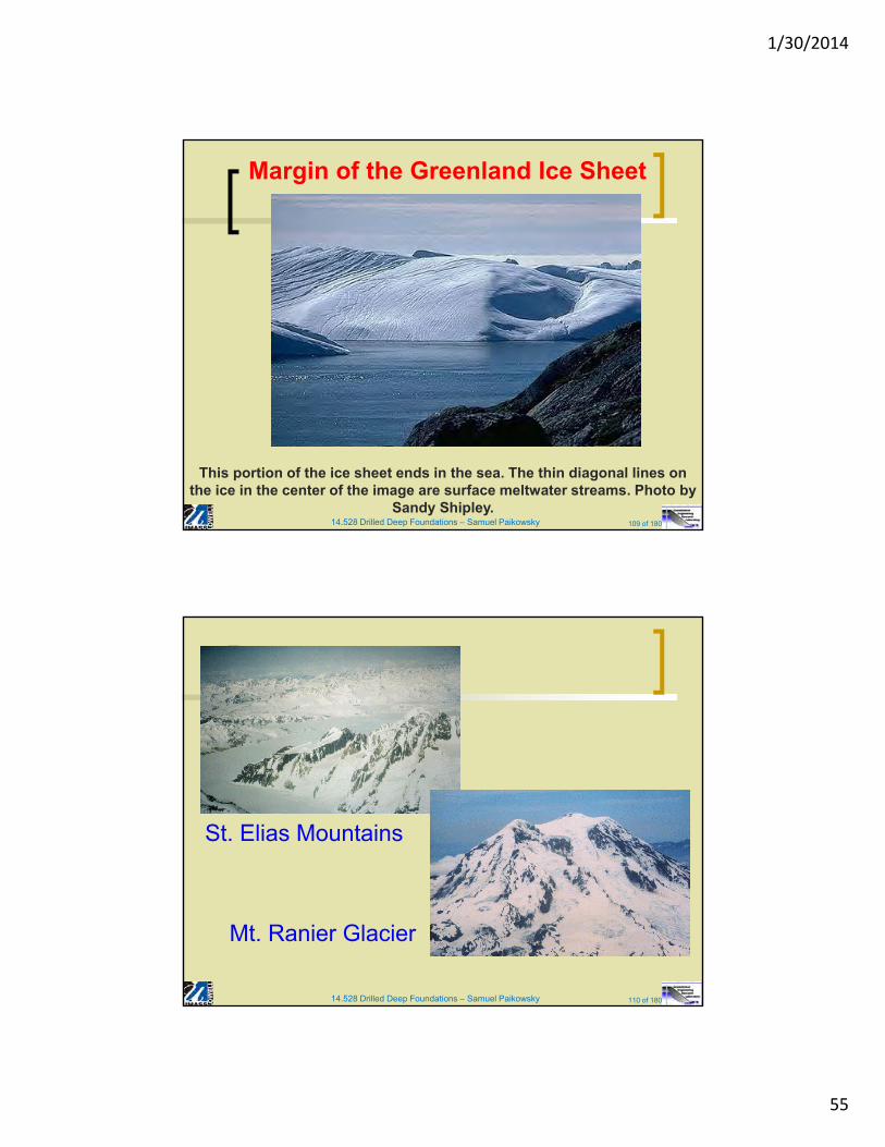
Margin of the Greenland Ice Sheet
This portion of the ice sheet ends in the sea. The thin diagonal lines on the ice in the center of the image are surface meltwater streams. Photo by
Sandy Shipley.
14.528 Drilled Deep Foundations – Samuel Paikowsky 110 of 180
St. Elias Mountains
Mt. Ranier Glacier
1/30/2014
56
14.528 Drilled Deep Foundations – Samuel Paikowsky 111 of 180
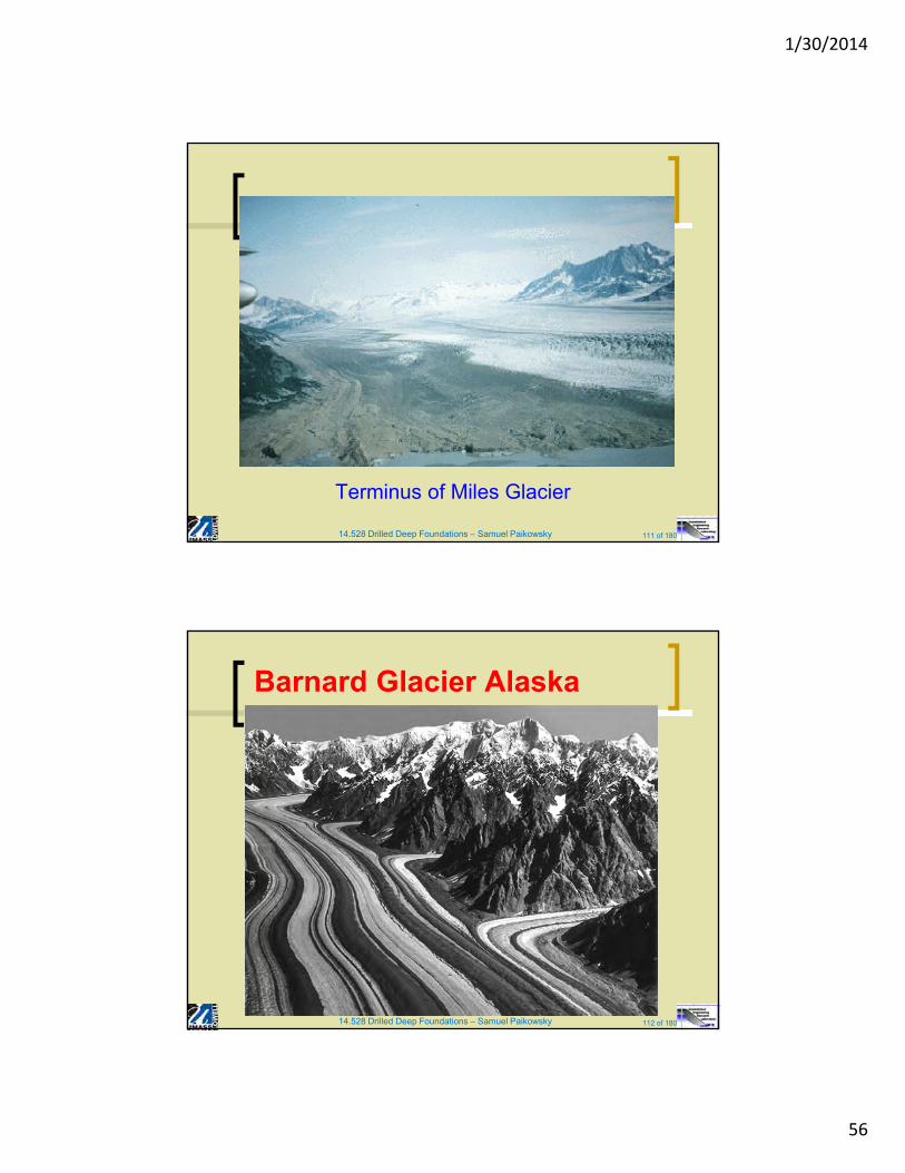
Terminus of Miles Glacier
14.528 Drilled Deep Foundations – Samuel Paikowsky 112 of 180
Barnard Glacier Alaska
1/30/2014
57
14.528 Drilled Deep Foundations – Samuel Paikowsky 113 of 180
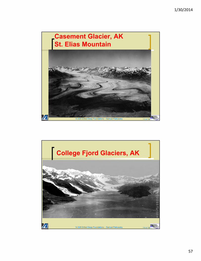
Casement Glacier, AKSt. Elias Mountain
14.528 Drilled Deep Foundations – Samuel Paikowsky 114 of 180
College Fjord Glaciers, AK
1/30/2014
58
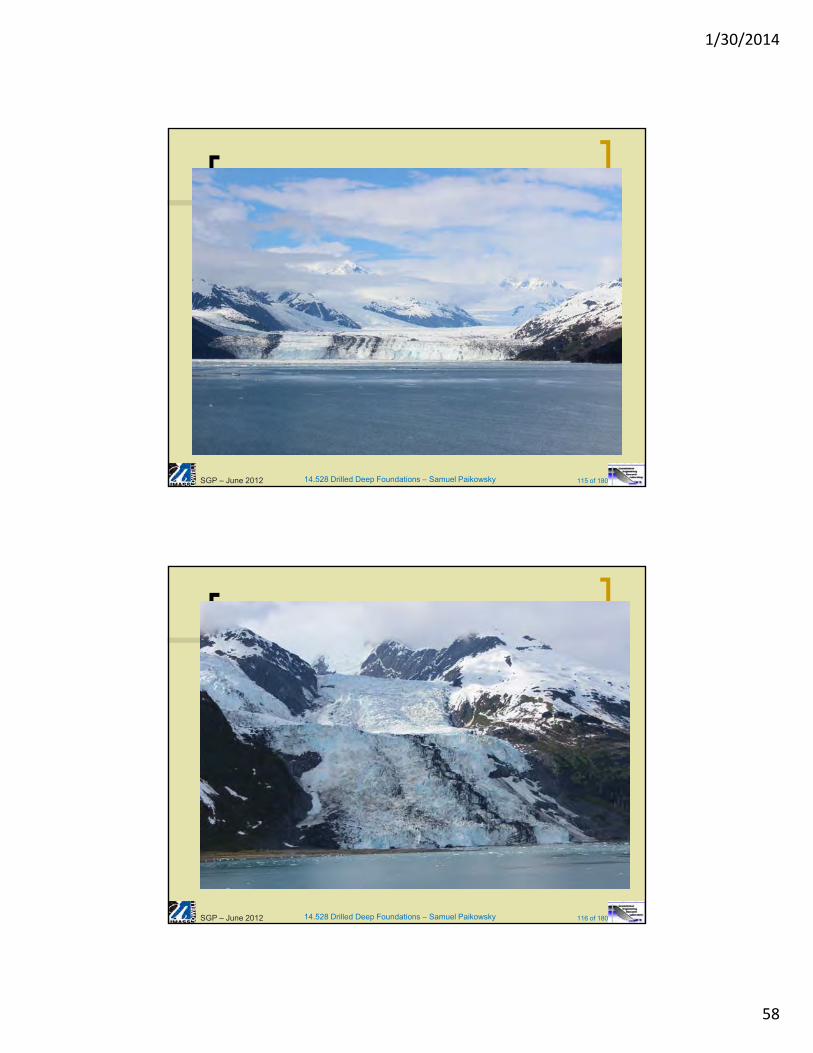
14.528 Drilled Deep Foundations – Samuel Paikowsky 115 of 180SGP – June 2012
14.528 Drilled Deep Foundations – Samuel Paikowsky 116 of 180SGP – June 2012
1/30/2014
59
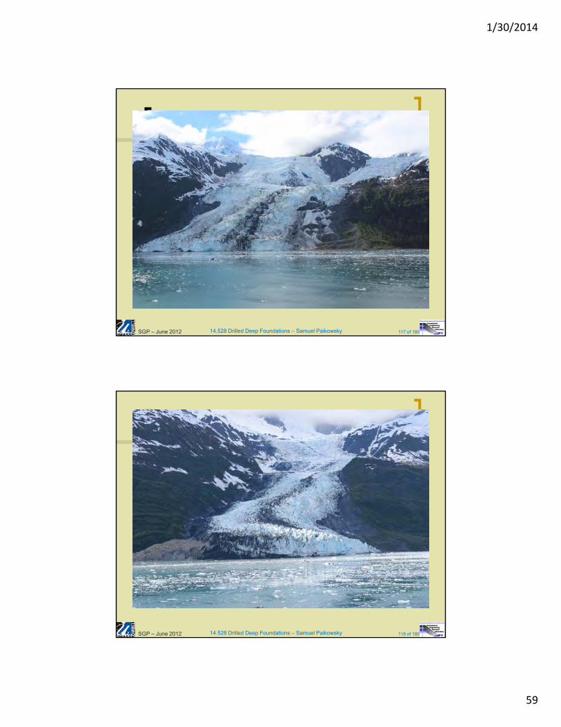
14.528 Drilled Deep Foundations – Samuel Paikowsky 117 of 180SGP – June 2012
14.528 Drilled Deep Foundations – Samuel Paikowsky 118 of 180SGP – June 2012
1/30/2014
60
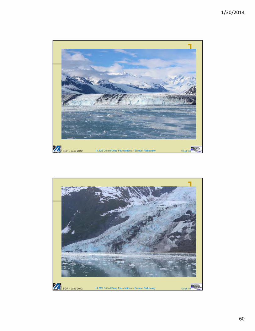
14.528 Drilled Deep Foundations – Samuel Paikowsky 119 of 180SGP – June 2012
14.528 Drilled Deep Foundations – Samuel Paikowsky 120 of 180SGP – June 2012
1/30/2014
61
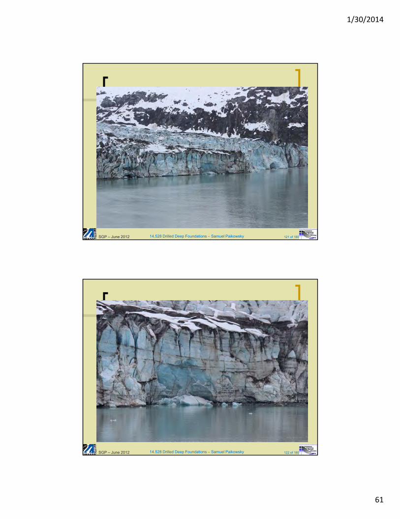
14.528 Drilled Deep Foundations – Samuel Paikowsky 121 of 180SGP – June 2012
14.528 Drilled Deep Foundations – Samuel Paikowsky 122 of 180SGP – June 2012
1/30/2014
62
14.528 Drilled Deep Foundations – Samuel Paikowsky 123 of 180SGP – June 2012
14.528 Drilled Deep Foundations – Samuel Paikowsky 124 of 180SGP – June 2012
1/30/2014
63
14.528 Drilled Deep Foundations – Samuel Paikowsky 125 of 180
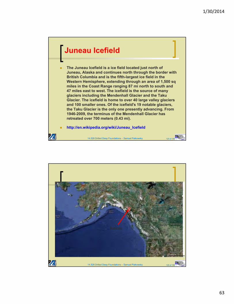
Juneau Icefield
The Juneau Icefield is a ice field located just north of Juneau, Alaska and continues north through the border with British Columbia and is the fifth-largest ice field in the Western Hemisphere, extending through an area of 1,500 sqmiles in the Coast Range ranging 87 mi north to south and 47 miles east to west. The icefield is the source of many glaciers including the Mendenhall Glacier and the TakuGlacier. The icefield is home to over 40 large valley glaciers and 100 smaller ones. Of the icefield's 19 notable glaciers, the Taku Glacier is the only one presently advancing. From 1946-2009, the terminus of the Mendenhall Glacier has retreated over 700 meters (0.43 mi).
http://en.wikipedia.org/wiki/Juneau_Icefield
14.528 Drilled Deep Foundations – Samuel Paikowsky 126 of 180
Juneau
1/30/2014
64
14.528 Drilled Deep Foundations – Samuel Paikowsky 127 of 180
14.528 Drilled Deep Foundations – Samuel Paikowsky 128 of 180SGP – June 2012
1/30/2014
65
14.528 Drilled Deep Foundations – Samuel Paikowsky 129 of 180SGP – June 2012
14.528 Drilled Deep Foundations – Samuel Paikowsky 130 of 180SGP – June 2012
1/30/2014
66
14.528 Drilled Deep Foundations – Samuel Paikowsky 131 of 180SGP – June 2012
14.528 Drilled Deep Foundations – Samuel Paikowsky 132 of 180SGP – June 2012
1/30/2014
67
14.528 Drilled Deep Foundations – Samuel Paikowsky 133 of 180SGP – June 2012
14.528 Drilled Deep Foundations – Samuel Paikowsky 134 of 180SGP – June 2012
1/30/2014
68
14.528 Drilled Deep Foundations – Samuel Paikowsky 135 of 180SGP – June 2012
14.528 Drilled Deep Foundations – Samuel Paikowsky 136 of 180SGP – June 2012
1/30/2014
69
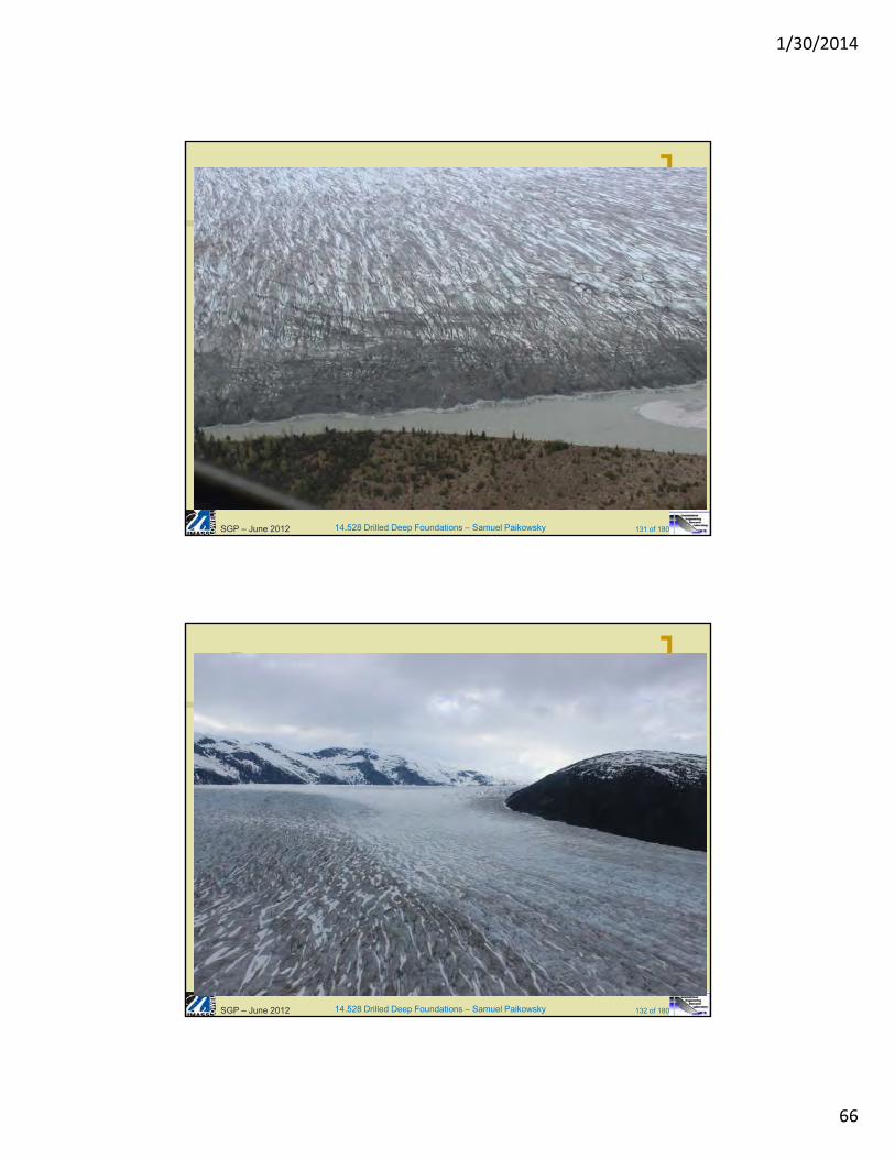
14.528 Drilled Deep Foundations – Samuel Paikowsky 137 of 180SGP – June 2012
14.528 Drilled Deep Foundations – Samuel Paikowsky 138 of 180SGP – June 2012
1/30/2014
70
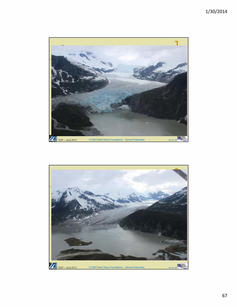
14.528 Drilled Deep Foundations – Samuel Paikowsky 139 of 180
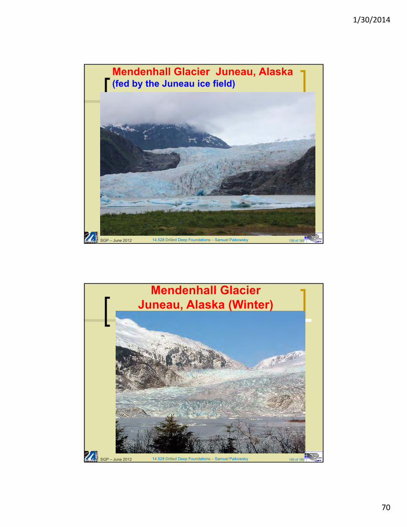
Mendenhall Glacier Juneau, Alaska (fed by the Juneau ice field)
SGP – June 2012
14.528 Drilled Deep Foundations – Samuel Paikowsky 140 of 180
Mendenhall GlacierJuneau, Alaska (Winter)
SGP – June 2012
1/30/2014
71
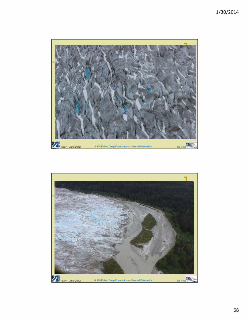
14.528 Drilled Deep Foundations – Samuel Paikowsky 141 of 180
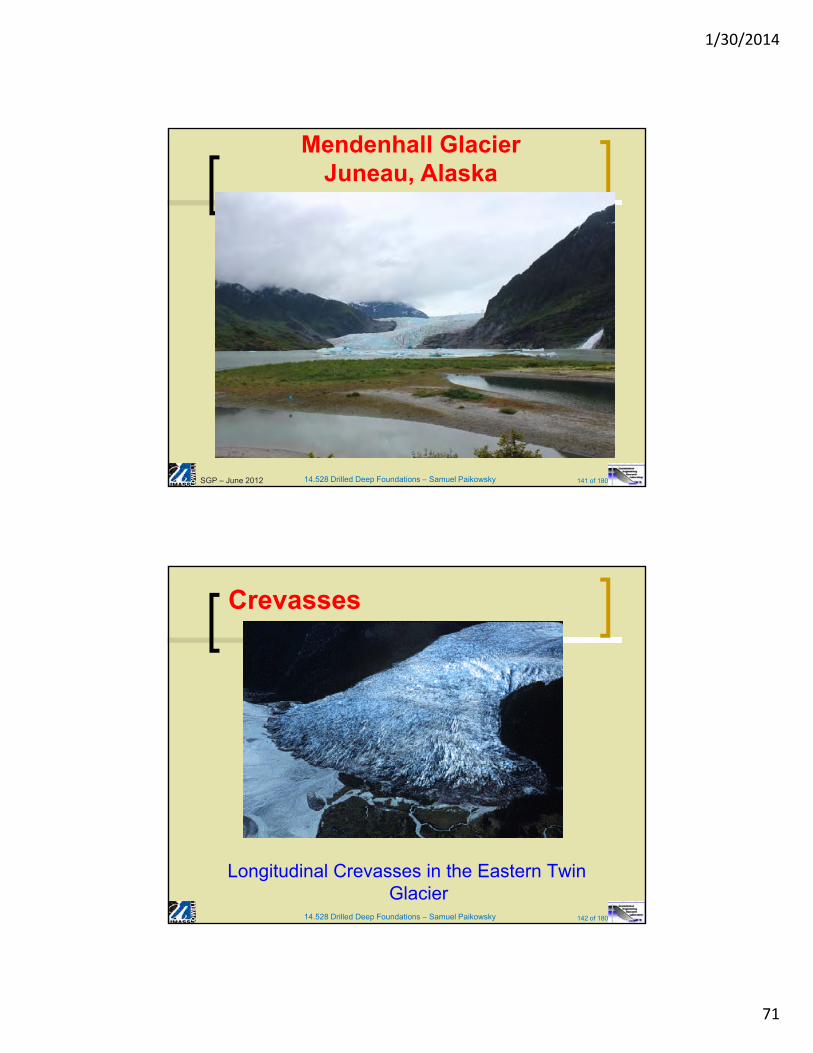
Mendenhall GlacierJuneau, Alaska
SGP – June 2012
14.528 Drilled Deep Foundations – Samuel Paikowsky 142 of 180
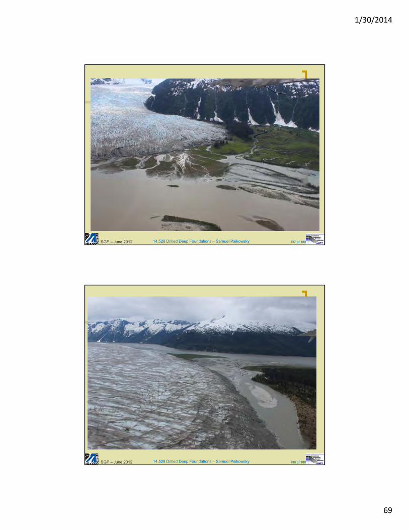
Crevasses
Longitudinal Crevasses in the Eastern Twin Glacier
1/30/2014
72
14.528 Drilled Deep Foundations – Samuel Paikowsky 143 of 180
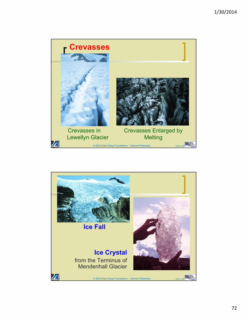
Crevasses
Crevasses in Lewellyn Glacier
Crevasses Enlarged by Melting
14.528 Drilled Deep Foundations – Samuel Paikowsky 144 of 180
Ice Fall
Ice Crystalfrom the Terminus of
Mendenhall Glacier
1/30/2014
73
14.528 Drilled Deep Foundations – Samuel Paikowsky 145 of 180
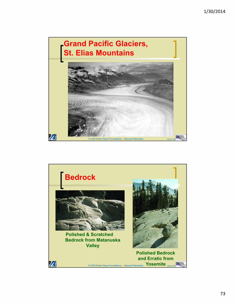
Grand Pacific Glaciers, St. Elias Mountains
14.528 Drilled Deep Foundations – Samuel Paikowsky 146 of 180
Bedrock
Polished & Scratched Bedrock from Matanuska
Valley
Polished Bedrock and Erratic from
Yosemite
1/30/2014
74
14.528 Drilled Deep Foundations – Samuel Paikowsky 147 of 180
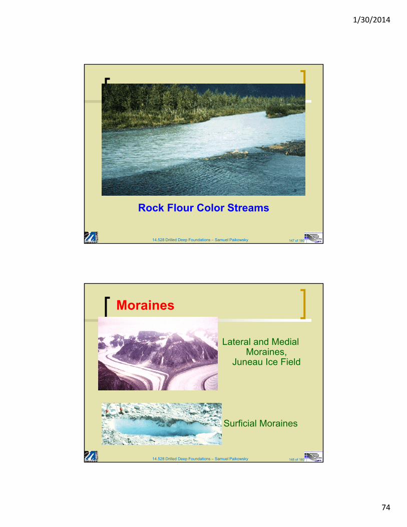
Rock Flour Color Streams
14.528 Drilled Deep Foundations – Samuel Paikowsky 148 of 180
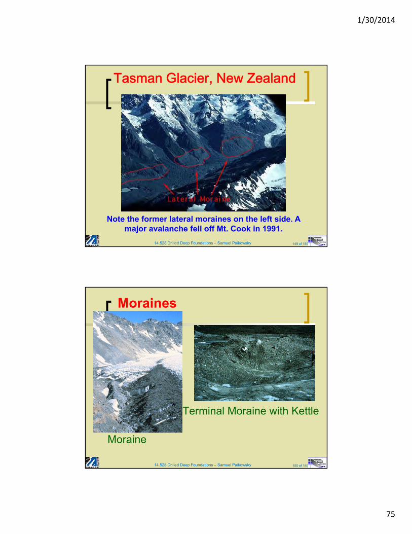
Moraines
Lateral and Medial Moraines,
Juneau Ice Field
Surficial Moraines
1/30/2014
75
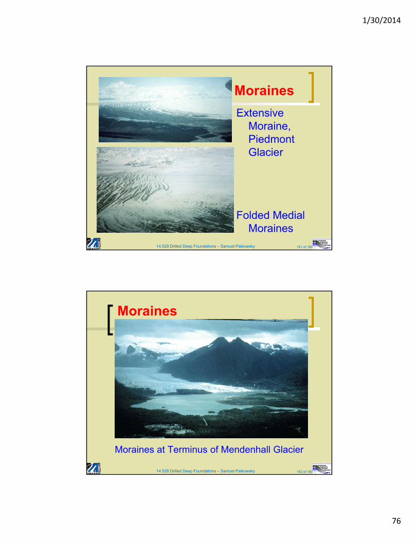
14.528 Drilled Deep Foundations – Samuel Paikowsky 149 of 180
Tasman Glacier, New Zealand
Note the former lateral moraines on the left side. A major avalanche fell off Mt. Cook in 1991.
14.528 Drilled Deep Foundations – Samuel Paikowsky 150 of 180
Moraines
Terminal Moraine with Kettle
Moraine
1/30/2014
76
14.528 Drilled Deep Foundations – Samuel Paikowsky 151 of 180
Moraines
Extensive Moraine, Piedmont Glacier
Folded Medial Moraines
14.528 Drilled Deep Foundations – Samuel Paikowsky 152 of 180
Moraines
Moraines at Terminus of Mendenhall Glacier
1/30/2014
77
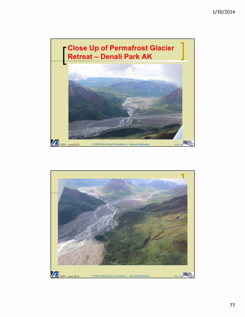
14.528 Drilled Deep Foundations – Samuel Paikowsky 153 of 180
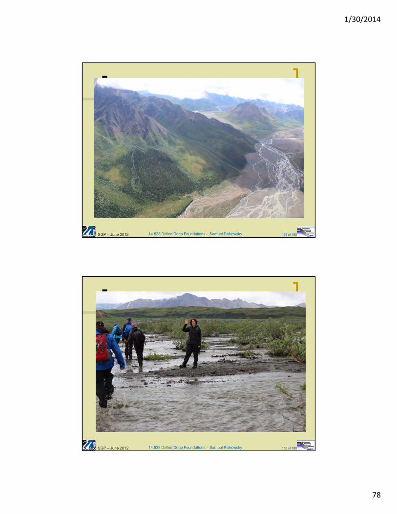
Close Up of Permafrost Glacier Retreat – Denali Park AK
SGP – June 2012
14.528 Drilled Deep Foundations – Samuel Paikowsky 154 of 180SGP – June 2012
1/30/2014
78
14.528 Drilled Deep Foundations – Samuel Paikowsky 155 of 180SGP – June 2012
14.528 Drilled Deep Foundations – Samuel Paikowsky 156 of 180SGP – June 2012
1/30/2014
79
14.528 Drilled Deep Foundations – Samuel Paikowsky 157 of 180SGP – June 2012
14.528 Drilled Deep Foundations – Samuel Paikowsky 158 of 180SGP – June 2012
1/30/2014
80
14.528 Drilled Deep Foundations – Samuel Paikowsky 159 of 180SGP – June 2012
14.528 Drilled Deep Foundations – Samuel Paikowsky 160 of 180SGP – June 2012
1/30/2014
81
14.528 Drilled Deep Foundations – Samuel Paikowsky 161 of 180SGP – June 2012
14.528 Drilled Deep Foundations – Samuel Paikowsky 162 of 180SGP – June 2012
1/30/2014
82
14.528 Drilled Deep Foundations – Samuel Paikowsky 163 of 180SGP – June 2012
14.528 Drilled Deep Foundations – Samuel Paikowsky 164 of 180SGP – June 2012
1/30/2014
83
14.528 Drilled Deep Foundations – Samuel Paikowsky 165 of 180SGP – June 2012
14.528 Drilled Deep Foundations – Samuel Paikowsky 166 of 180SGP – June 2012
1/30/2014
84
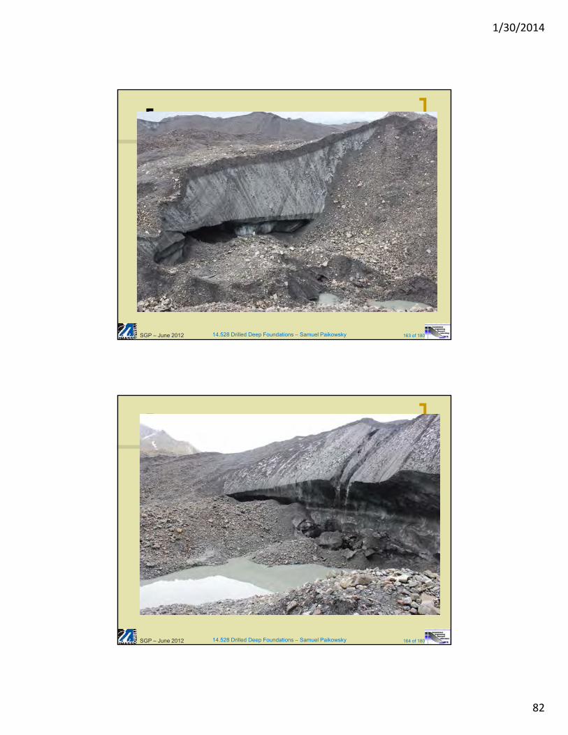
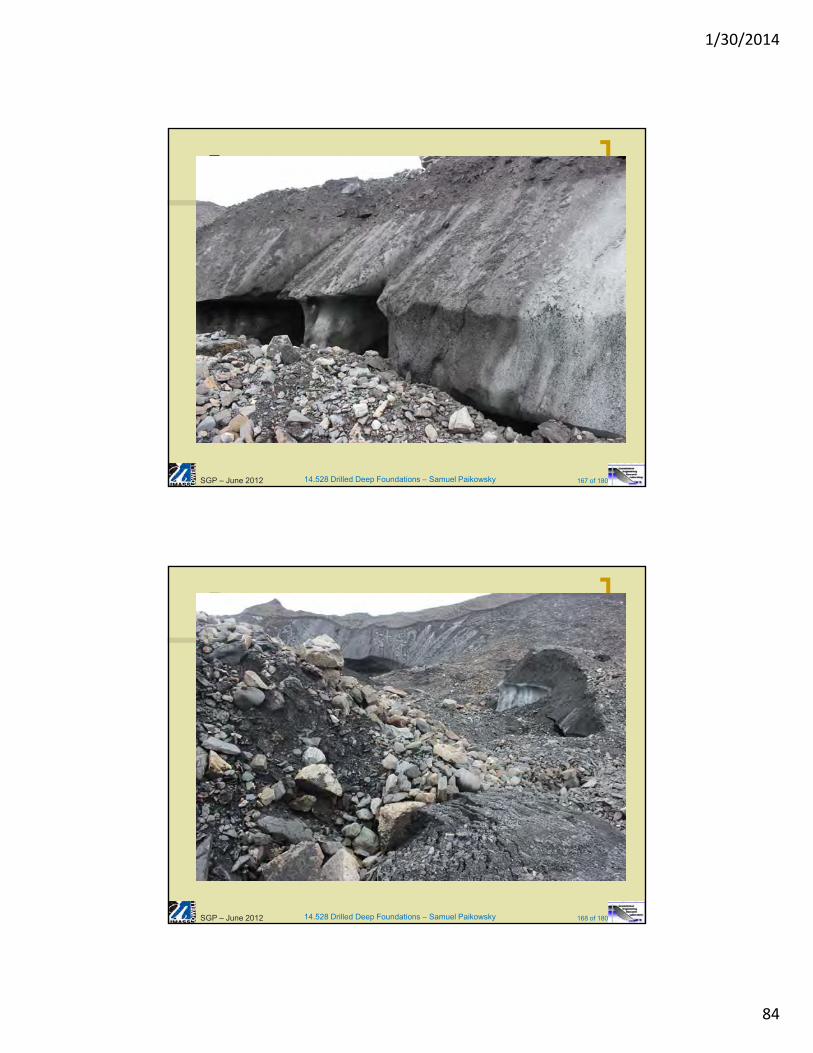
14.528 Drilled Deep Foundations – Samuel Paikowsky 167 of 180SGP – June 2012
14.528 Drilled Deep Foundations – Samuel Paikowsky 168 of 180SGP – June 2012
1/30/2014
85
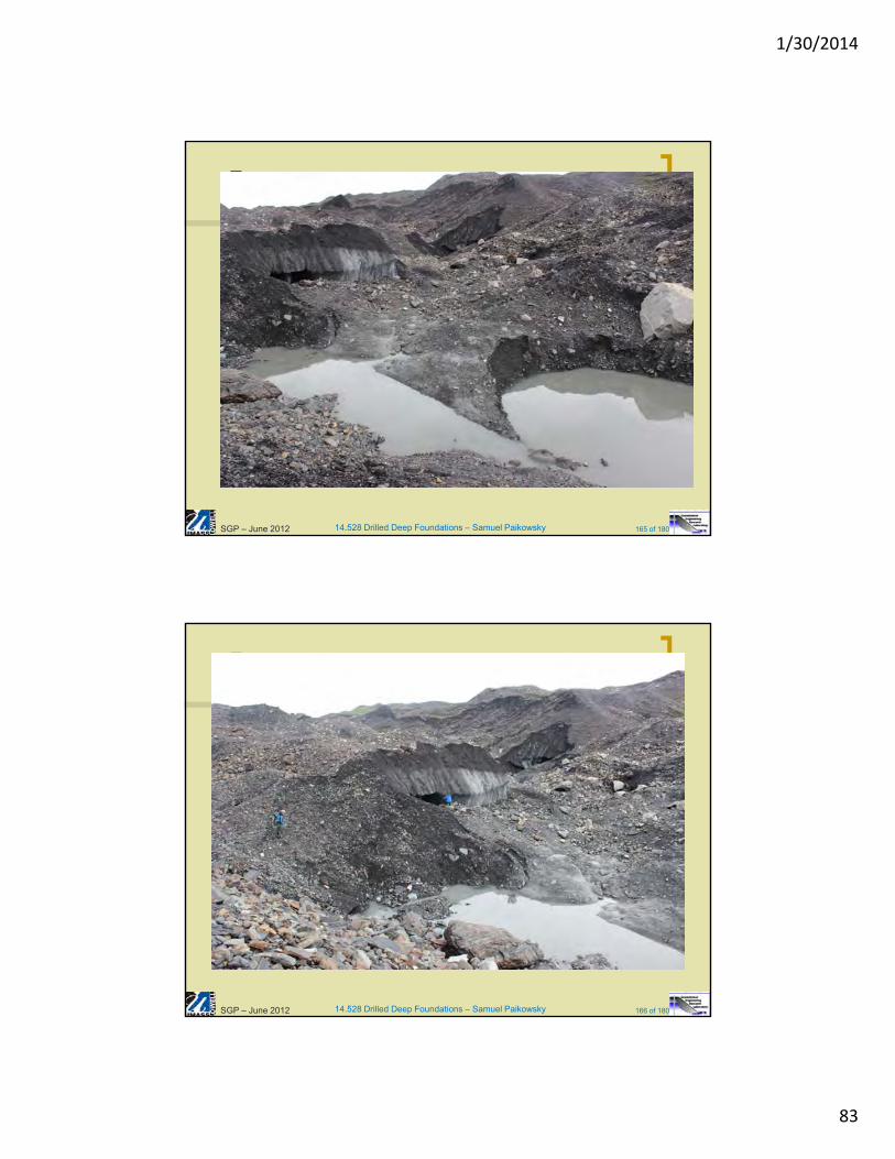
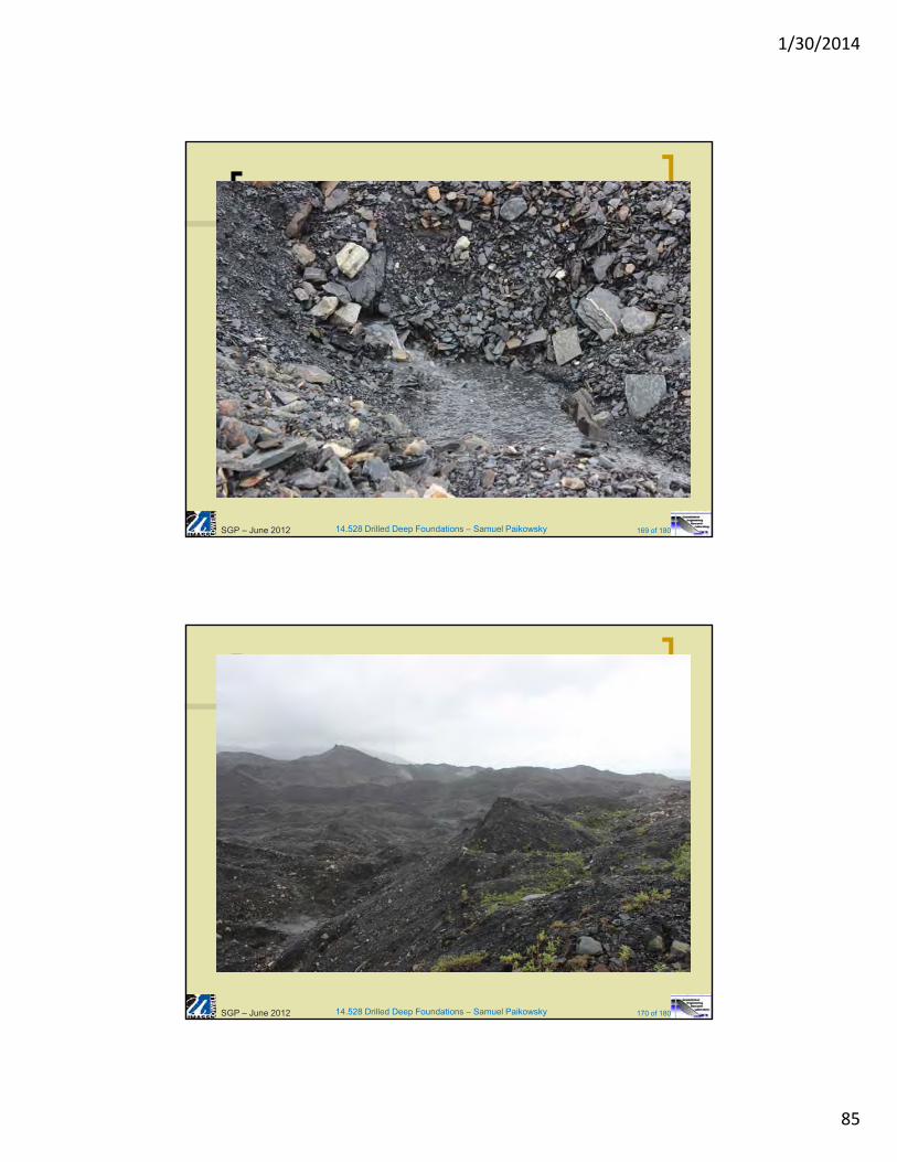
14.528 Drilled Deep Foundations – Samuel Paikowsky 169 of 180SGP – June 2012
14.528 Drilled Deep Foundations – Samuel Paikowsky 170 of 180SGP – June 2012
1/30/2014
86
14.528 Drilled Deep Foundations – Samuel Paikowsky 171 of 180
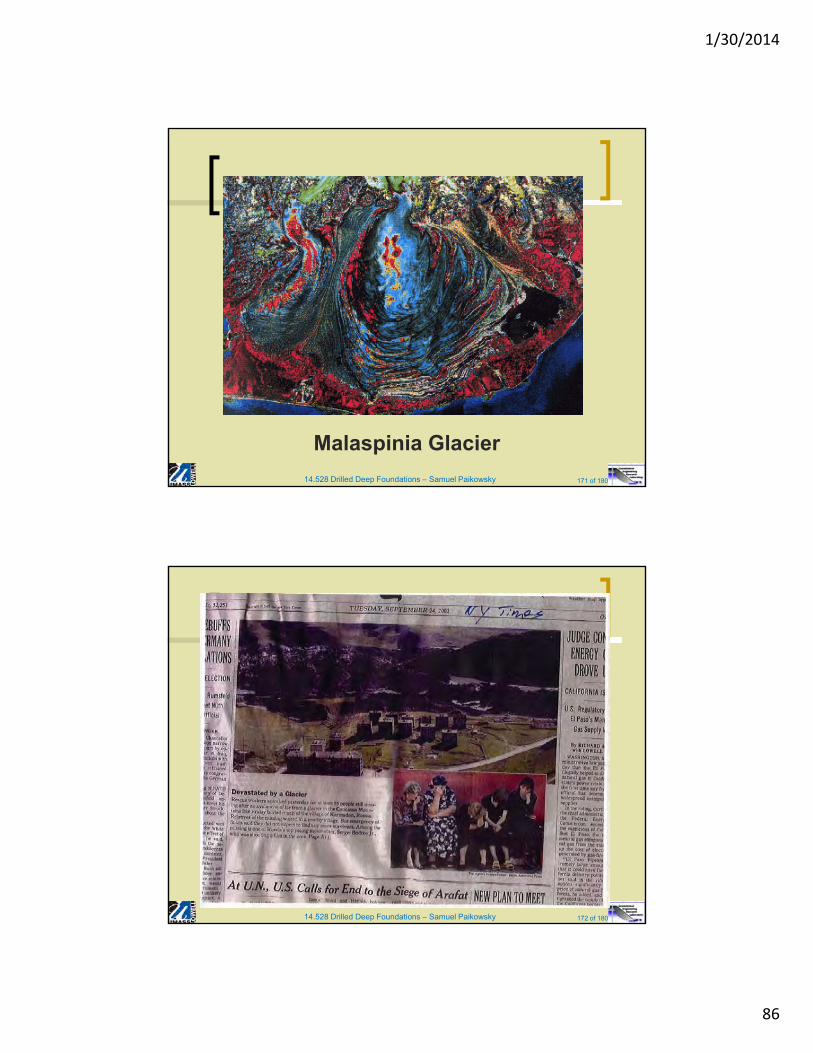
Malaspinia Glacier
14.528 Drilled Deep Foundations – Samuel Paikowsky 172 of 180
1/30/2014
87
14.528 Drilled Deep Foundations – Samuel Paikowsky 173 of 180
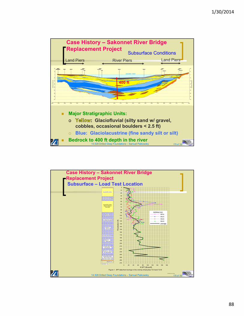
Case History – Sakonnet River
Bridge Replacement Project
• Route 24 between Portsmouth and Tiverton, RI
• 2,265 ft (690m) long Replacement Bridge South of Existing Bridge
• Two Designs: Steel and Concrete Alternatives
• AASHTO-Load and Resistance Factor Design (LRFD) with Recommendations from NCHRP Report 507 (Paikowsky et al., 2004)
Location and Project Overview
14.528 Drilled Deep Foundations – Samuel Paikowsky 174 of 180
Case History – Sakonnet River Bridge Replacement Project
Location and Project Overview
1/30/2014
88
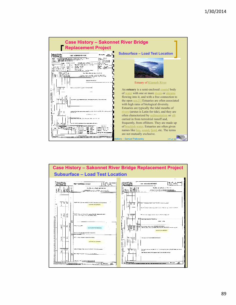
14.528 Drilled Deep Foundations – Samuel Paikowsky 175 of 180
Major Stratigraphic Units:
Glaciofluvial (silty sand w/ gravel, cobbles, occasional boulders < 2.5 ft)
Blue: Glaciolacustrine (fine sandy silt or silt)
Bedrock to 400 ft depth in the river
River Piers Land PiersLand Piers
400 ft
Case History – Sakonnet River Bridge Replacement Project
Subsurface Conditions
14.528 Drilled Deep Foundations – Samuel Paikowsky 176 of 180
Case History – Sakonnet River BridgeReplacement ProjectSubsurface – Load Test Location
GLACIOFLUVIALdense coarse to
fine sand
GLACIOLACUSTRINE
GLACIOFLUVIALv. dense sandy silt &silty fine to med. sand
dense silt
v. dense fine sand
dense to v. dense silt
v. dense sand silttrace gravel
dense to v. densesilt (laminated)
dense tov. dense silt
GLACIOFLUVIAL
GLACIOLACUSTRINE
BEDROCK
GLACIAL TILL0 20 40 60 80 100 120 140 160 180
N SPT (Blows/ft)
270
260
250
240
230
220
210
200
190
180
170
160
150
140
130
120
110
100
90
80
70
60
50
40
30
20
10
0
Pe
ne
tra
tion
(ft)
BORING NO.HA-4
HA-5
HA-6
HA-9
average
Figure 1. SPT data from borings in the vicinity of test piles 72-II and 72-III
MPS/SGP
1/30/2014
89
14.528 Drilled Deep Foundations – Samuel Paikowsky 177 of 180
Case History – Sakonnet River Bridge Replacement Project
An estuary is a semi-enclosed coastal body of water with one or more rivers or streamsflowing into it, and with a free connection to the open sea.[1] Estuaries are often associated with high rates of biological diversity.Estuaries are typically the tidal mouths of rivers (aestus is Latin for tide), and they are often characterized by sedimentation or siltcarried in from terrestrial runoff and, frequently, from offshore. They are made up of brackish water. Estuaries are often given names like bay, sound, fjord, etc. The terms are not mutually exclusive.
Estuary of Klamath River
Subsurface – Load Test Location
Case History – Sakonnet River Bridge Replacement Project
Subsurface – Load Test Location
1/30/2014
90
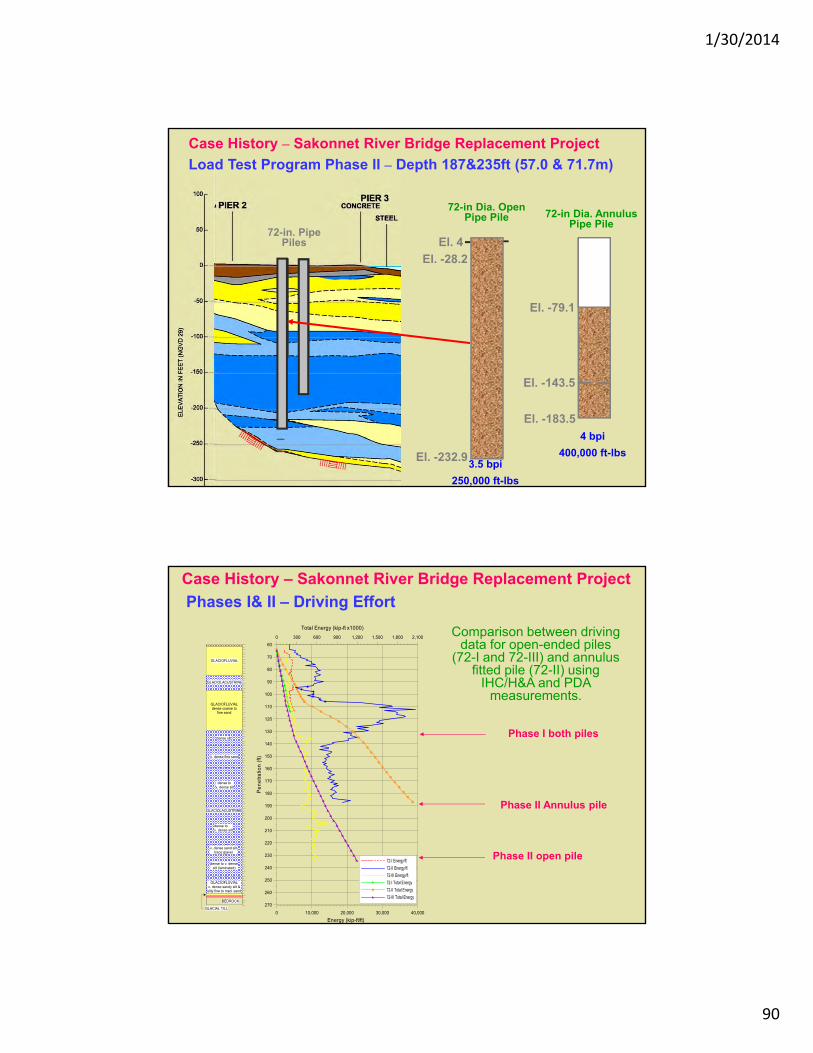
Case History – Sakonnet River Bridge Replacement Project
Load Test Program Phase II – Depth 187&235ft (57.0 & 71.7m)
El. -232.9
El. 4
El. -28.2
El. -79.1
El. -143.5
El. -183.5
4 bpi
400,000 ft-lbs3.5 bpi
250,000 ft-lbs
72-in Dia. Open Pipe Pile 72-in Dia. Annulus
Pipe Pile72-in. Pipe
Piles
Case History – Sakonnet River Bridge Replacement Project
Phases I& II – Driving Effort
GLACIOFLUVIALdense coarse to
fine sand
GLACIOLACUSTRINE
GLACIOFLUVIALv. dense sandy silt &silty fine to med. sand
dense silt
v. dense fine sand
dense to v. dense silt
v. dense sand silttrace gravel
dense to v. densesilt (laminated)
dense tov. dense silt
GLACIOFLUVIAL
GLACIOLACUSTRINE
BEDROCK
GLACIAL TILL0 10,000 20,000 30,000 40,000
Energy (kip-ft/ft)
0 300 600 900 1,200 1,500 1,800 2,100
Total Energy (kip-ft x1000)
270
260
250
240
230
220
210
200
190
180
170
160
150
140
130
120
110
100
90
80
70
60
Pe
ne
tra
tion
(ft)
72-I Energy/ft
72-II Energy/ft
72-III Energy/ft
72-I Total Energy
72-II Total Energy
72-III Total Energy
Comparison between driving data for open-ended piles
(72-I and 72-III) and annulus fitted pile (72-II) using
IHC/H&A and PDA measurements.
Phase I both piles
Phase II Annulus pile
Phase II open pile