Embed Size (px)
Citation preview
EP
Geography and Cultures
Printables:
Levels 5-8
This book belongs to:
__________________________________________________________
Geography/Cultures
Levels 5-8
Lesson
3
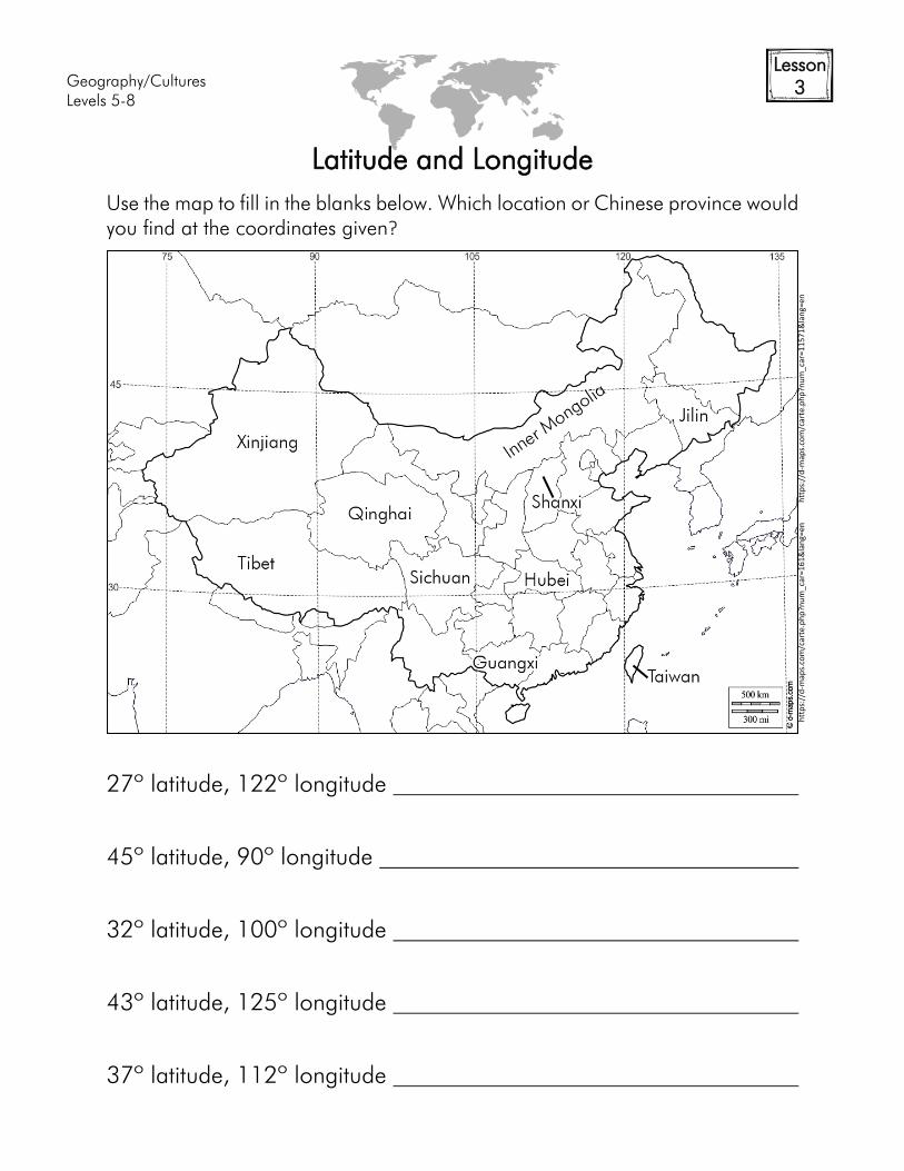
Latitude and Longitude
Use the map to fill in the blanks below. Which location or Chinese province would
you find at the coordinates given?
27º latitude, 122º longitude
45º latitude, 90º longitude
32º latitude, 100º longitude
43º latitude, 125º longitude
37º latitude, 112º longitude
htt
ps:
//d
-map
s.co
m/c
arte
.ph
p?n
um
_car
=16
1&
lan
g=en
h
ttp
s://
d-m
aps.
com
/car
te.p
hp
?nu
m_c
ar=
11
57
1&
lan
g=en
Geography/Cultures
Levels 5-8
Lesson
6
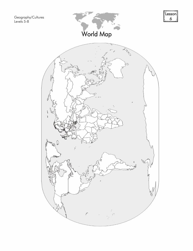
World Map
Geography/Cultures
Levels 5-8
Lesson
6
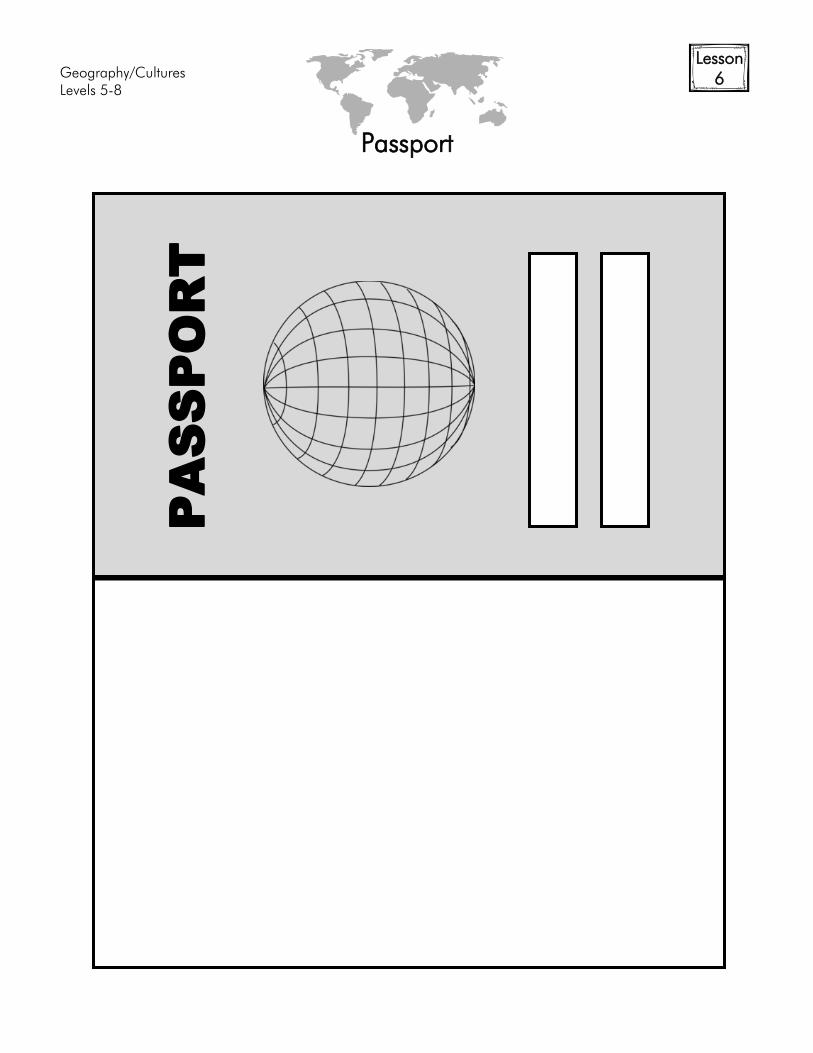
Passport
PA
SS
PO
RT
Geography/Cultures
Levels 5-8
Lesson
6
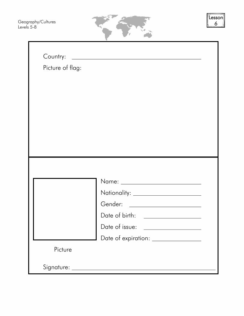
Country:
Picture of flag:
Name:
Nationality:
Gender:
Date of birth:
Date of issue:
Date of expiration:
Picture
Signature:
Geography/Cultures
Levels 5-8
Lesson
6
Countries visited:
Countries visited:

Geography/Cultures
Levels 5-8
Lesson
6
Countries visited:
Countries visited:
Geography/Cultures
Levels 5-8
Lesson
7
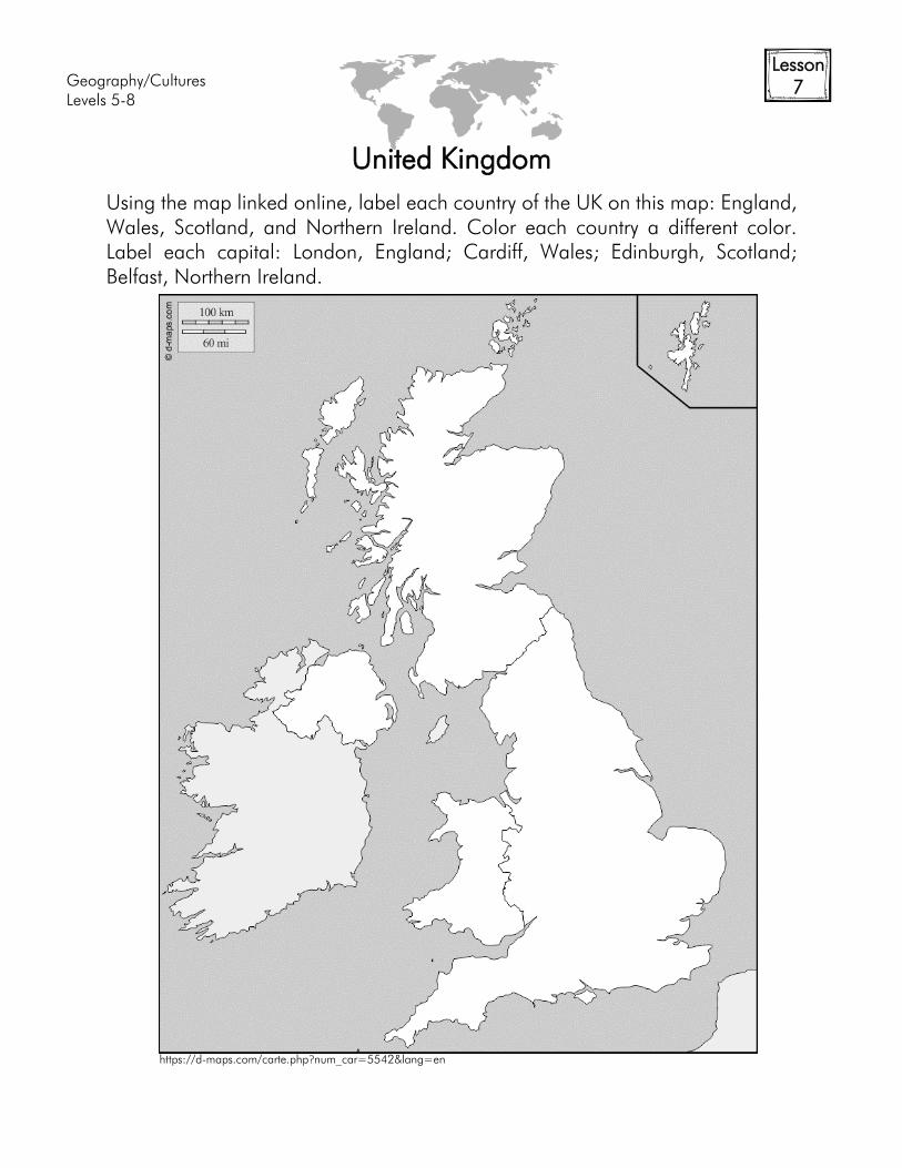
United Kingdom
Using the map linked online, label each country of the UK on this map: England,
Wales, Scotland, and Northern Ireland. Color each country a different color.
Label each capital: London, England; Cardiff, Wales; Edinburgh, Scotland;
Belfast, Northern Ireland.
https://d-maps.com/carte.php?num_car=5542&lang=en
Geography/Cultures
Levels 5-8
Lesson
7
History of England
Population
Languages
Religions
Government
Industries/Resources
Exports
Map:
History:
Flag:
Geography/Cultures
Levels 5-8
Lesson
7+
World Map
https://d-m
aps.com
/m
/w
orld
/centreeurope/centreeurope2
2.gif
Geography/Cultures
Levels 5-8
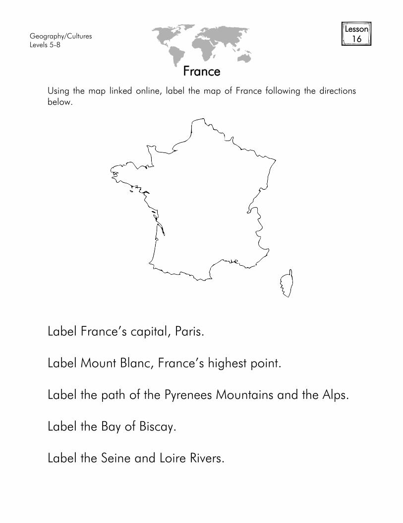
Lesson
16
France
Using the map linked online, label the map of France following the directions
below.
Label France’s capital, Paris.
Label Mount Blanc, France’s highest point.
Label the path of the Pyrenees Mountains and the Alps.
Label the Bay of Biscay.
Label the Seine and Loire Rivers.

Geography/Cultures
Levels 5-8
Lesson
17+
History of France
Population
Languages
Religions
Government
Industries/Resources
Exports
Map:
History:
Flag:
Geography/Cultures
Levels 5-8
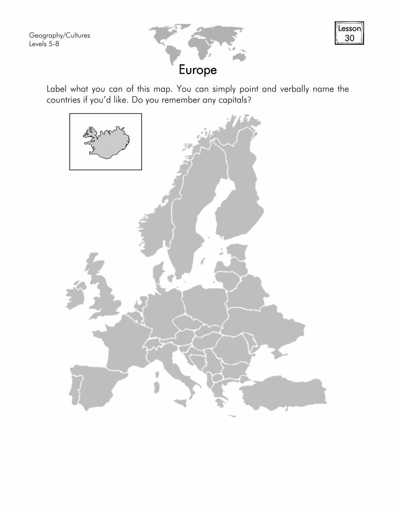
Lesson
30
Europe
Label what you can of this map. You can simply point and verbally name the
countries if you’d like. Do you remember any capitals?
Geography/Cultures
Levels 5-8
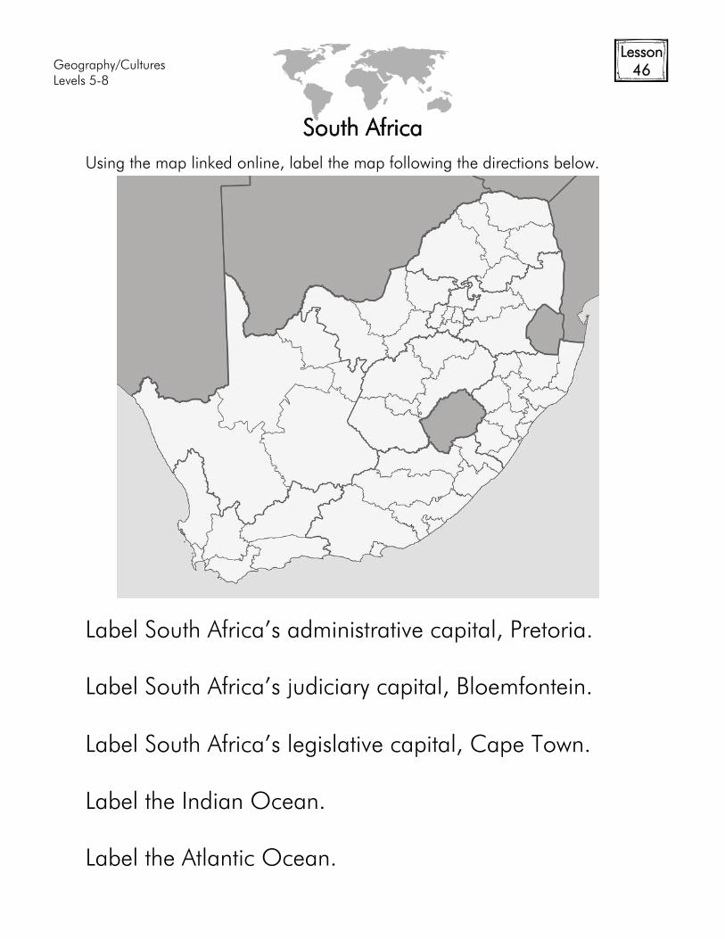
Lesson
46
South Africa
Using the map linked online, label the map following the directions below.
Label South Africa’s administrative capital, Pretoria.
Label South Africa’s judiciary capital, Bloemfontein.
Label South Africa’s legislative capital, Cape Town.
Label the Indian Ocean.
Label the Atlantic Ocean.
Geography/Cultures
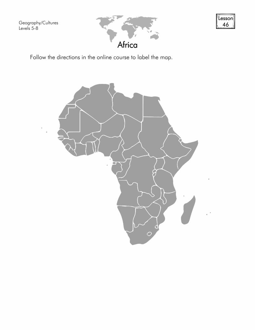
Levels 5-8
Lesson
46
Africa
Follow the directions in the online course to label the map.
Geography/Cultures
Levels 5-8
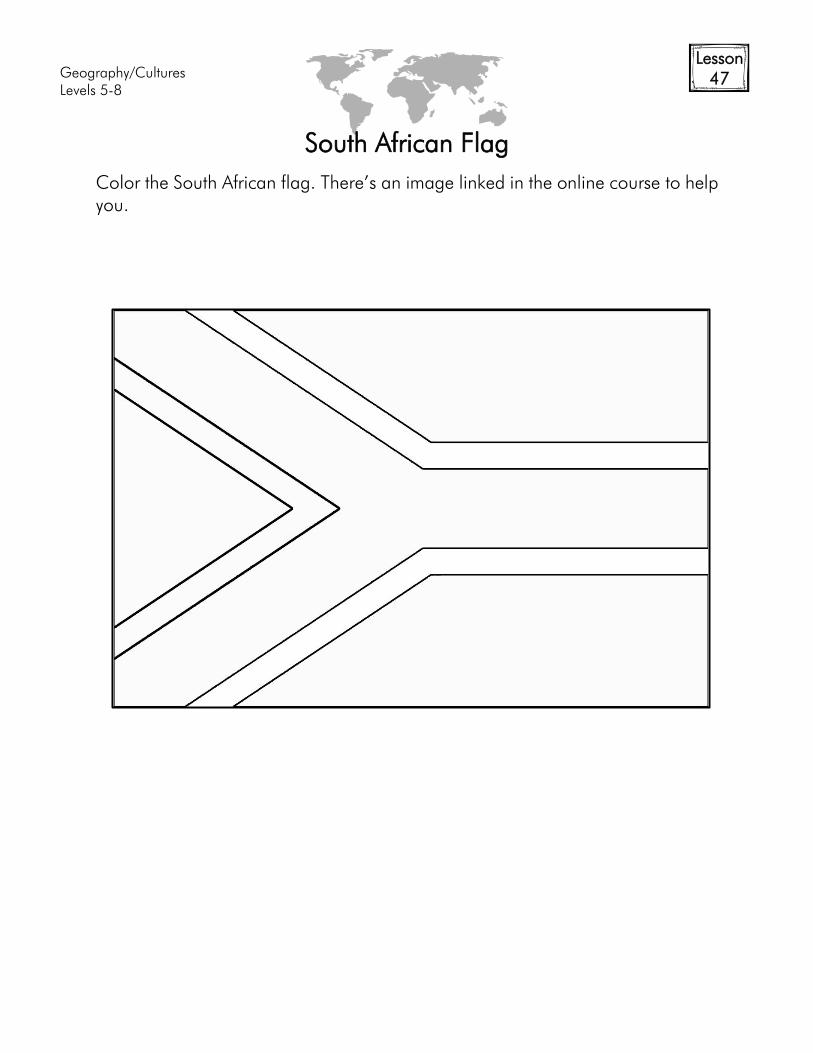
Lesson
47
South African Flag
Color the South African flag. There’s an image linked in the online course to help
you.
Geography/Cultures
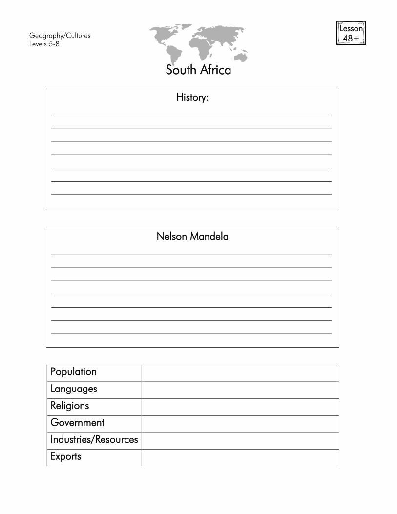
Levels 5-8
Lesson
48+
South Africa
Population
Languages
Religions
Government
Industries/Resources
Exports
Nelson Mandela
History:
Geography/Cultures
Levels 5-8
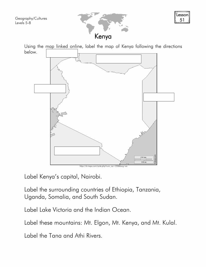
Lesson
51
Kenya
Using the map linked online, label the map of Kenya following the directions
below.
Label Kenya’s capital, Nairobi.
Label the surrounding countries of Ethiopia, Tanzania,
Uganda, Somalia, and South Sudan.
Label Lake Victoria and the Indian Ocean.
Label these mountains: Mt. Elgon, Mt. Kenya, and Mt. Kulal.
Label the Tana and Athi Rivers.
https://d-maps.com/carte.php?num_car=228&lang=en
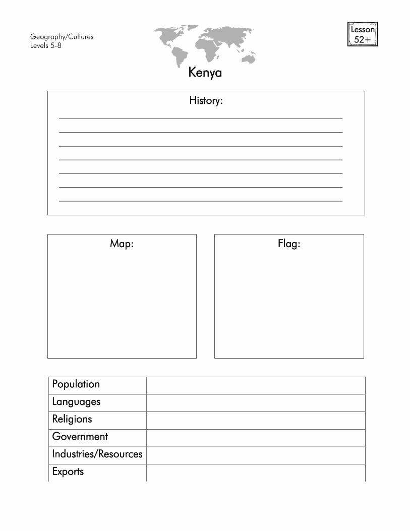
Geography/Cultures
Levels 5-8
Lesson
52+
Kenya
Population
Languages
Religions
Government
Industries/Resources
Exports
History:
Map:
Flag:
Geography/Cultures
Levels 5-8
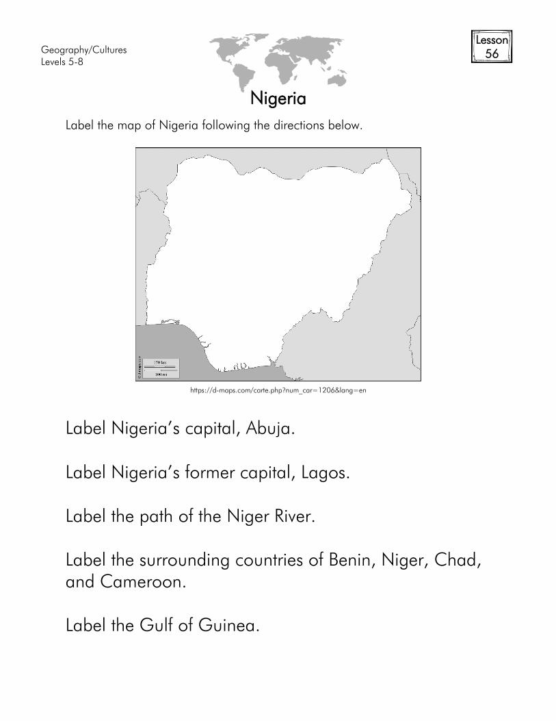
Lesson
56
Nigeria
Label the map of Nigeria following the directions below.
Label Nigeria’s capital, Abuja.
Label Nigeria’s former capital, Lagos.
Label the path of the Niger River.
Label the surrounding countries of Benin, Niger, Chad,
and Cameroon.
Label the Gulf of Guinea.
https://d-maps.com/carte.php?num_car=1206&lang=en
Geography/Cultures
Levels 5-8
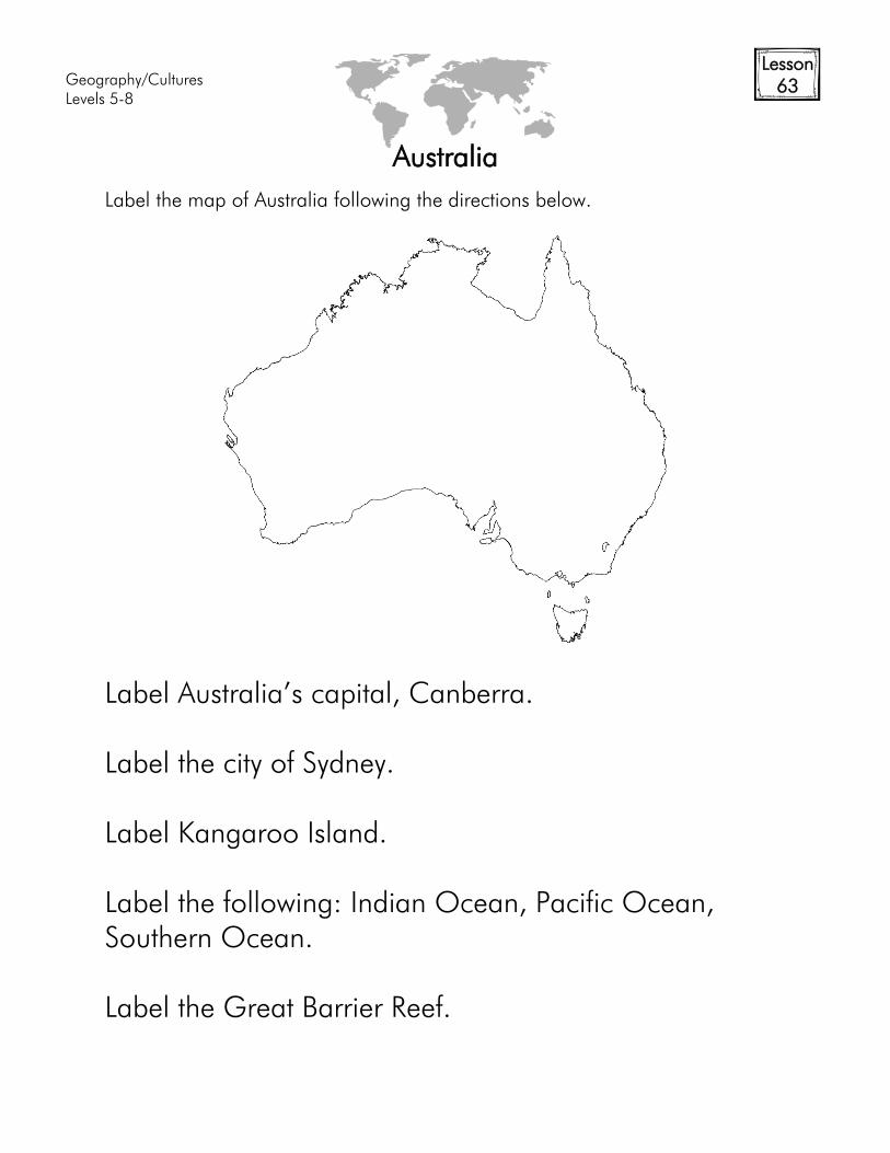
Lesson
63
Australia
Label the map of Australia following the directions below.
Label Australia’s capital, Canberra.
Label the city of Sydney.
Label Kangaroo Island.
Label the following: Indian Ocean, Pacific Ocean,
Southern Ocean.
Label the Great Barrier Reef.
Geography/Cultures
Levels 5-8
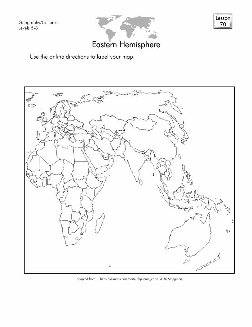
Lesson
70
Eastern Hemisphere
Use the online directions to label your map.
adapted from: https://d-maps.com/carte.php?num_car=13181&lang=en
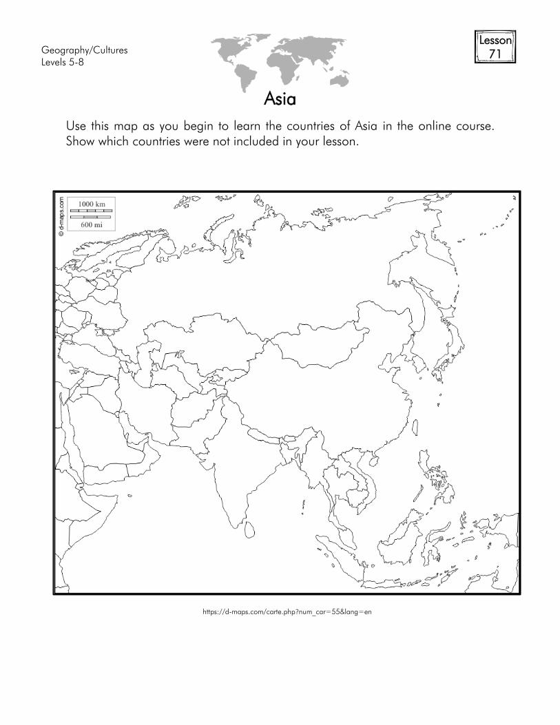
Geography/Cultures
Levels 5-8
Lesson
71
Asia
Use this map as you begin to learn the countries of Asia in the online course.
Show which countries were not included in your lesson.
https://d-maps.com/carte.php?num_car=55&lang=en
Geography/Cultures
Levels 5-8
Lesson
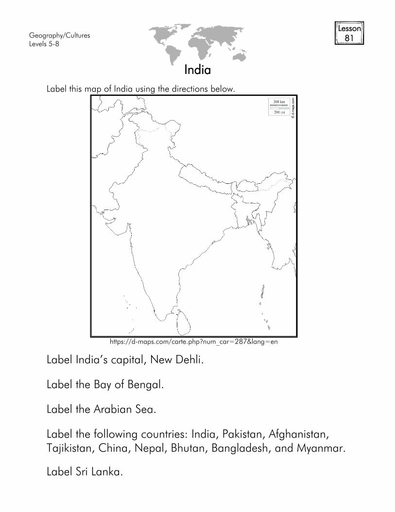
81
India
Label this map of India using the directions below.
Label India’s capital, New Dehli.
Label the Bay of Bengal.
Label the Arabian Sea.
Label the following countries: India, Pakistan, Afghanistan,
Tajikistan, China, Nepal, Bhutan, Bangladesh, and Myanmar.
Label Sri Lanka.
https://d-maps.com/carte.php?num_car=287&lang=en

Geography/Cultures
Levels 5-8
Lesson
82+
History of India
Population
Languages
Religions
Government
Industries/Resources
Exports
History:
Map:
Flag:
Geography/Cultures
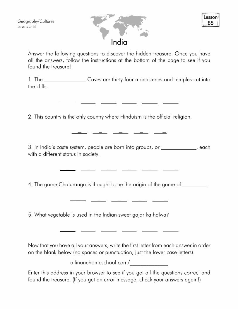
Levels 5-8
Lesson
85
India
Answer the following questions to discover the hidden treasure. Once you have
all the answers, follow the instructions at the bottom of the page to see if you
found the treasure!
1. The Caves are thirty-four monasteries and temples cut into
the cliffs.
E L E L E E
2. This country is the only country where Hinduism is the official religion.
E L E L E
3. In India’s caste system, people are born into groups, or , each
with a different status in society.
E L E L E E
4. The game Chaturanga is thought to be the origin of the game of .
E L E L E
5. What vegetable is used in the Indian sweet gajar ka halwa?
E L E L E E
Now that you have all your answers, write the first letter from each answer in order
on the blank below (no spaces or punctuation, just the lower case letters):
allinonehomeschool.com/______________
Enter this address in your browser to see if you got all the questions correct and
found the treasure. (If you get an error message, check your answers again!)
Geography/Cultures
Levels 5-8
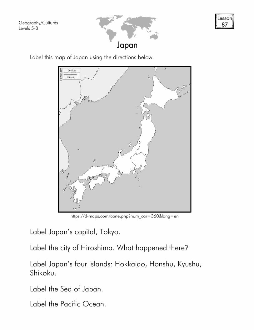
Lesson
87
Japan
Label this map of Japan using the directions below.
Label Japan’s capital, Tokyo.
Label the city of Hiroshima. What happened there?
Label Japan’s four islands: Hokkaido, Honshu, Kyushu,
Shikoku.
Label the Sea of Japan.
Label the Pacific Ocean.
https://d-maps.com/carte.php?num_car=360&lang=en

Geography/Cultures
Levels 5-8
Lesson
93+
History of Russia
Population
Languages
Religions
Government
Industries/Resources
Exports
History:
Map:
Flag:
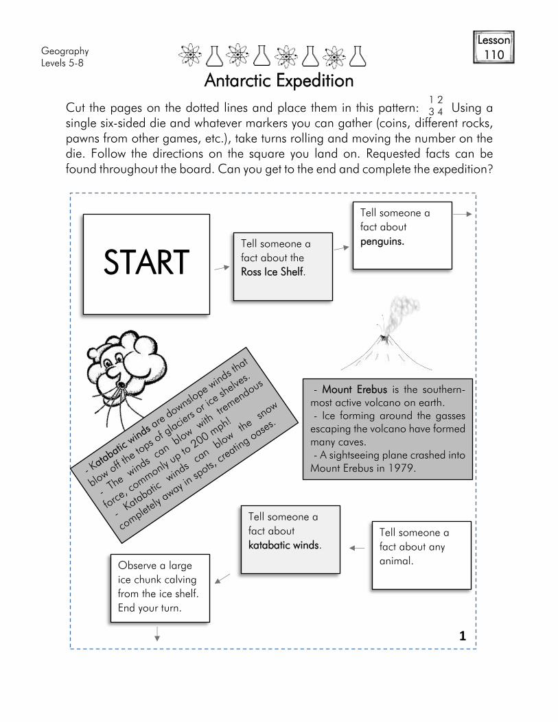
Geography
Levels 5-8
Lesson
110
Antarctic Expedition
Cut the pages on the dotted lines and place them in this pattern: Using a
single six-sided die and whatever markers you can gather (coins, different rocks,
pawns from other games, etc.), take turns rolling and moving the number on the
die. Follow the directions on the square you land on. Requested facts can be
found throughout the board. Can you get to the end and complete the expedition?
START
1 2
3 4
Tell someone a
fact about the
Ross Ice Shelf.
Tell someone a
fact about
penguins.
Tell someone a
fact about any
animal.
Tell someone a
fact about
katabatic winds.
Observe a large
ice chunk calving
from the ice shelf.
End your turn.
- Mount Erebus is the southern-
most active volcano on earth.
- Ice forming around the gasses
escaping the volcano have formed
many caves.
- A sightseeing plane crashed into
Mount Erebus in 1979.
1
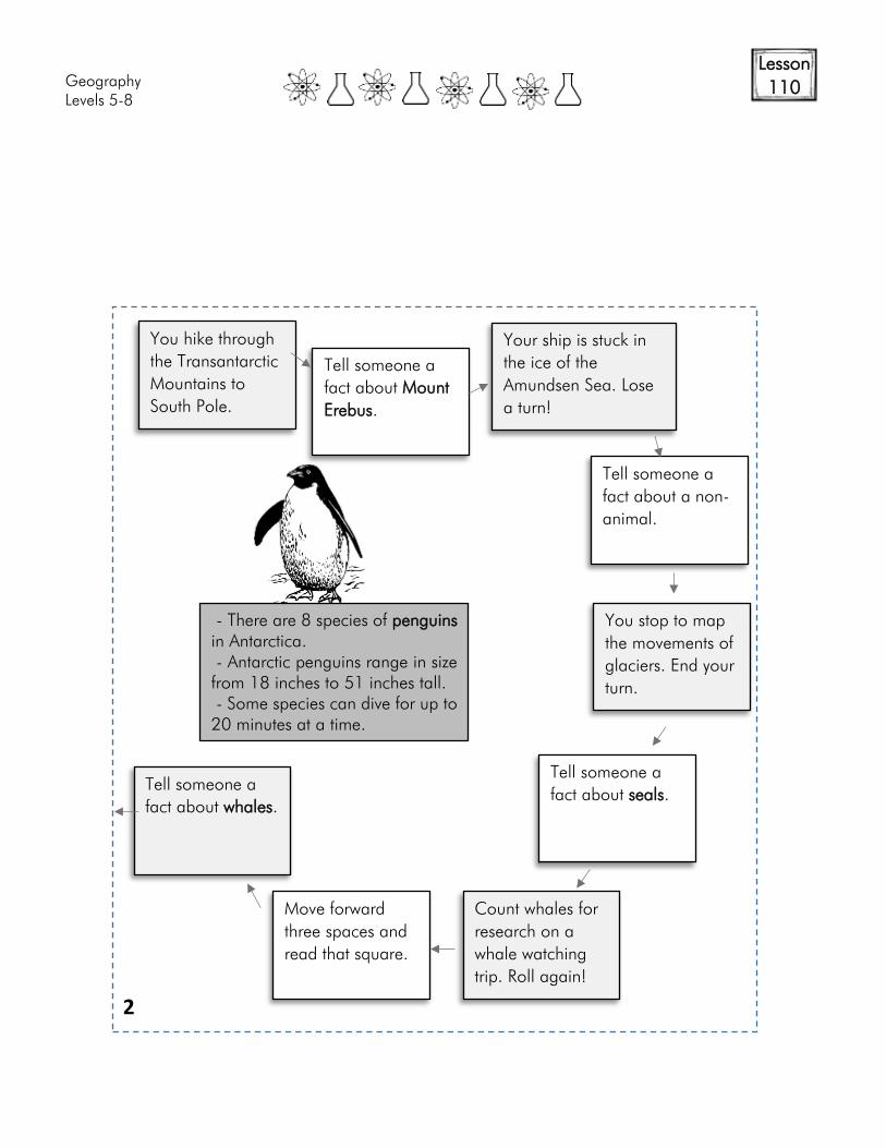
Geography
Levels 5-8
Lesson
110
You hike through
the Transantarctic
Mountains to
South Pole.
Tell someone a
fact about Mount
Erebus.
Tell someone a
fact about a non-
animal.
You stop to map
the movements of
glaciers. End your
turn.
Tell someone a
fact about seals.
Count whales for
research on a
whale watching
trip. Roll again!
Move forward
three spaces and
read that square.
Tell someone a
fact about whales.
- There are 8 species of penguins
in Antarctica.
- Antarctic penguins range in size
from 18 inches to 51 inches tall.
- Some species can dive for up to
20 minutes at a time.
2
Your ship is stuck in
the ice of the
Amundsen Sea. Lose
a turn!
Geography
Levels 5-8
Lesson
110
Tell someone a
fact about the
Ross Ice Shelf.
Tell someone a
fact about a non-
animal.
Tell someone a
fact about Mount
Erebus.
Rough seas stop
you in your tracks.
End your turn.
Tell any fact that
hasn’t been told
so far to avoid a
blizzard!
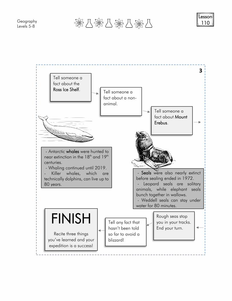
FINISH
Recite three things
you’ve learned and your
expedition is a success!
- Antarctic whales were hunted to
near extinction in the 18th
and 19th
centuries.
- Whaling continued until 2019.
- Killer whales, which are
technically dolphins, can live up to
80 years.
- Seals were also nearly extinct
before sealing ended in 1972.
- Leopard seals are solitary
animals, while elephant seals
bunch together in wallows.
- Weddell seals can stay under
water for 80 minutes.
3
Geography
Levels 5-8
Lesson
110
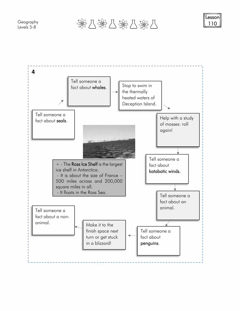
Tell someone a
fact about seals.
Tell someone a
fact about whales.
Stop to swim in
the thermally
heated waters of
Deception Island.
Help with a study
of mosses: roll
again!
Tell someone a
fact about
katabatic winds.
Tell someone a
fact about an
animal.
Tell someone a
fact about
penguins.
Make it to the
finish space next
turn or get stuck
in a blizzard!
Tell someone a
fact about a non-
animal.
+ - The Ross Ice Shelf is the largest
ice shelf in Antarctica.
- It is about the size of France –
500 miles across and 200,000
square miles in all.
- It floats in the Ross Sea.
4
Geography/Cultures
Levels 5-8
Lesson
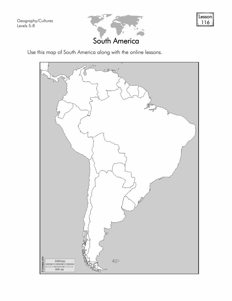
116
South America
Use this map of South America along with the online lessons.

Geography/Cultures
Levels 5-8
Lesson
118+
History of Brazil
Population
Languages
Religions
Government
Industries/Resources
Exports
History:
Map:
Flag:
Geography/Cultures
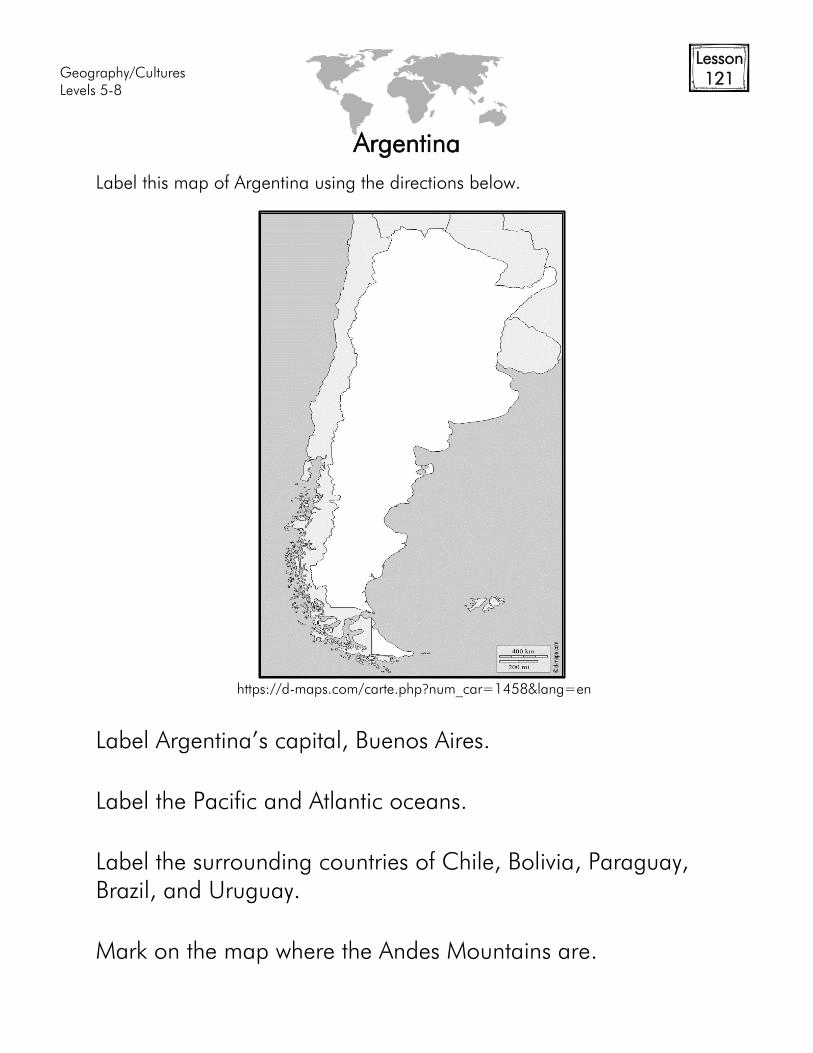
Levels 5-8
Lesson
121
Argentina
Label this map of Argentina using the directions below.
Label Argentina’s capital, Buenos Aires.
Label the Pacific and Atlantic oceans.
Label the surrounding countries of Chile, Bolivia, Paraguay,
Brazil, and Uruguay.
Mark on the map where the Andes Mountains are.
https://d-maps.com/carte.php?num_car=1458&lang=en
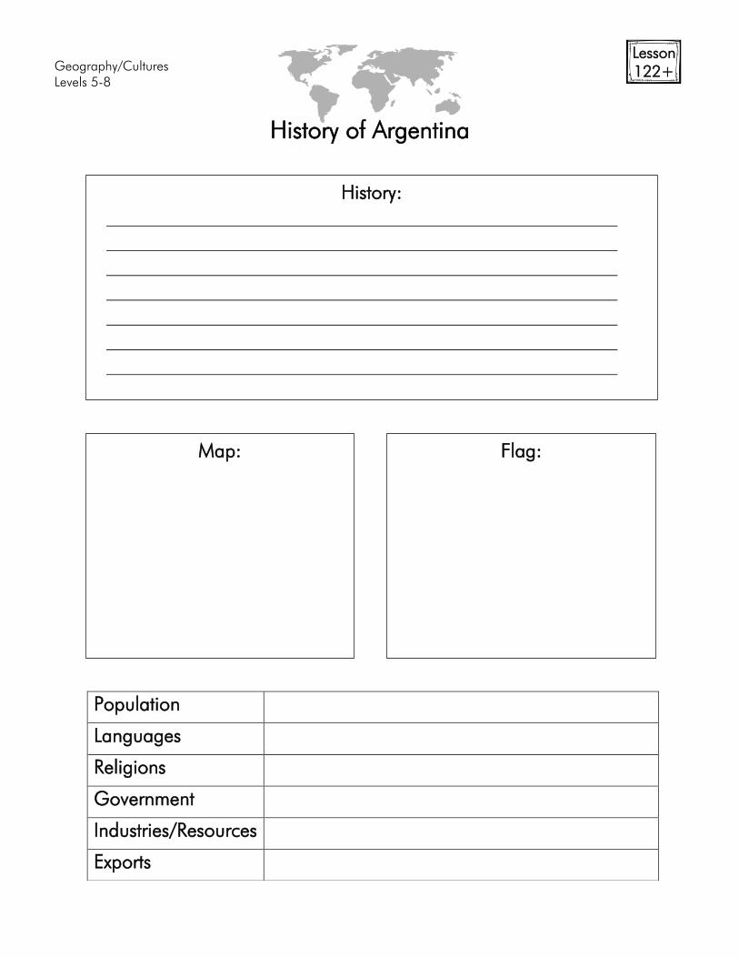
Geography/Cultures
Levels 5-8
Lesson
122+
History of Argentina
Population
Languages
Religions
Government
Industries/Resources
Exports
History:
Map:
Flag:
Geography/Cultures
Levels 5-8
Lesson
133
Landforms of the World
Fill in definitions or pictures of the words. The important thing is knowing what
they are.
Altitude
Archipelago Arroyo
Badlands
Basin Bay
Bluff
Branch (tributary) Canal
Cliff
Delta Estuary
Fjord
Glacier Inlet
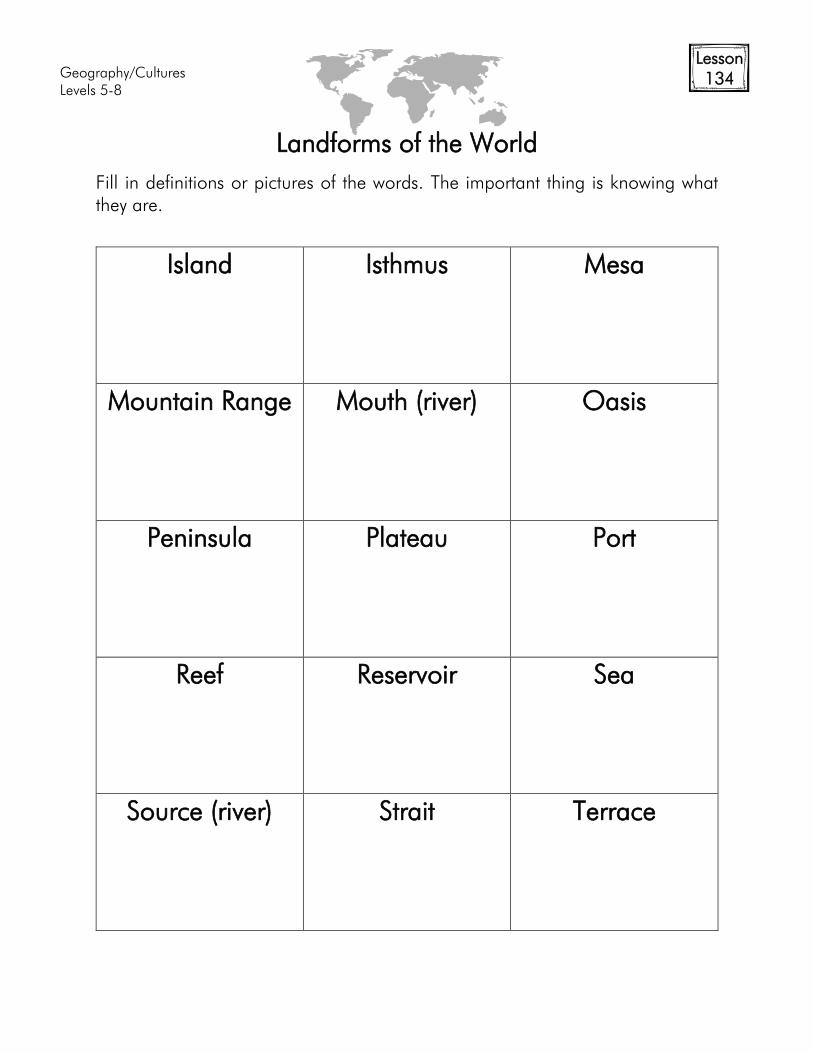
Geography/Cultures
Levels 5-8
Lesson
134
Landforms of the World
Fill in definitions or pictures of the words. The important thing is knowing what
they are.
Island
Isthmus Mesa
Mountain Range
Mouth (river) Oasis
Peninsula
Plateau Port
Reef
Reservoir Sea
Source (river)
Strait Terrace
Geography/Cultures
Levels 5-8
Lesson
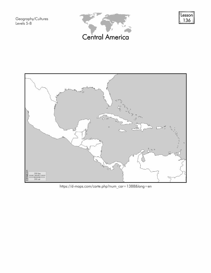
136
Central America
https://d-maps.com/carte.php?num_car=1388&lang=en
Geography/Cultures
Levels 5-8
Lesson
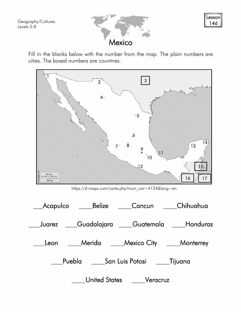
146
Mexico
Fill in the blanks below with the number from the map. The plain numbers are
cities. The boxed numbers are countries.
Acapulco Belize Cancun Chihuahua
Juarez Guadalajara Guatemala Honduras
Leon Merida Mexico City Monterrey
Puebla San Luis Potosi Tijuana
United States Veracruz
https://d-maps.com/carte.php?num_car=4124&lang=en
3
1
2
4
5
6
7 8
9
10
11
12
13
16
15
17
14
Geography/Cultures
Levels 5-8
Lesson
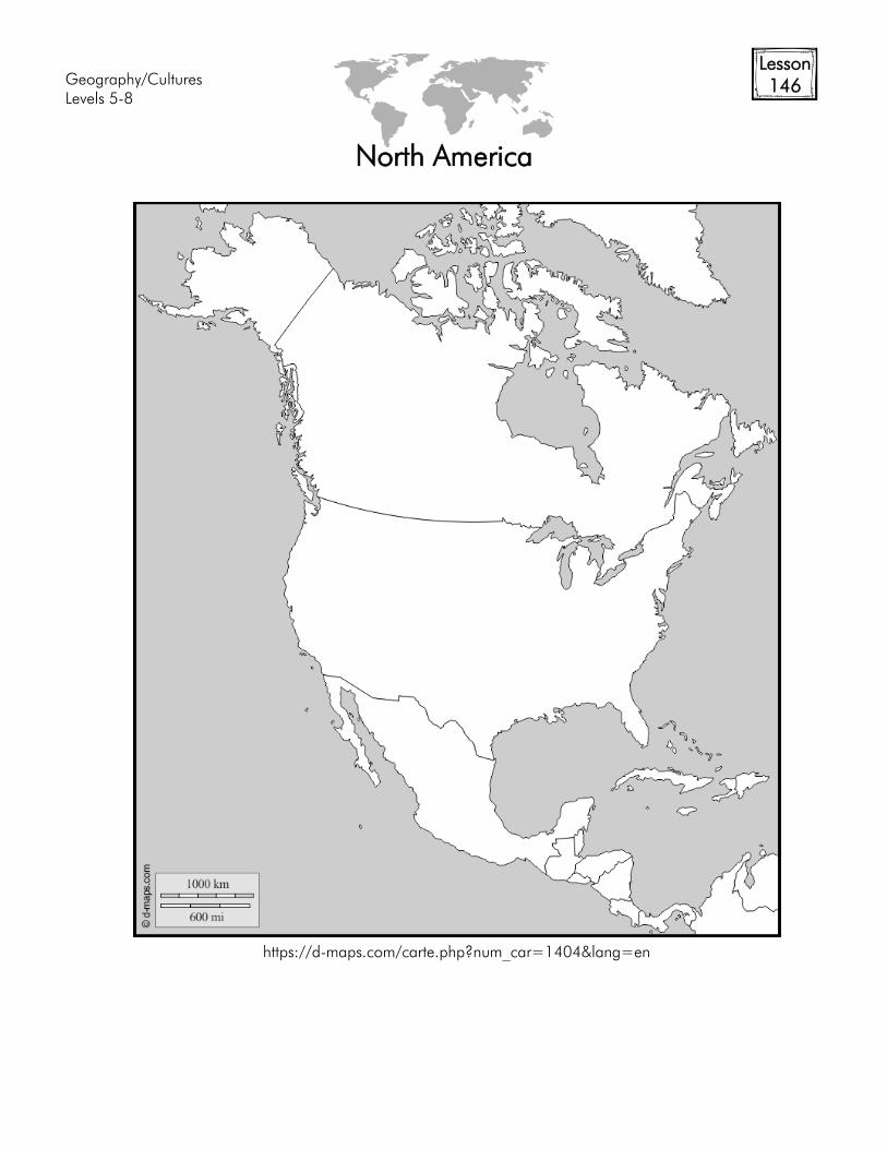
146
North America
https://d-maps.com/carte.php?num_car=1404&lang=en

Geography/Cultures
Levels 5-8
Lesson
147+
History of Mexico
Population
Languages
Religions
Government
Industries/Resources
Exports
History:
Map:
Flag:
Geography/Cultures
Levels 5-8
Lesson
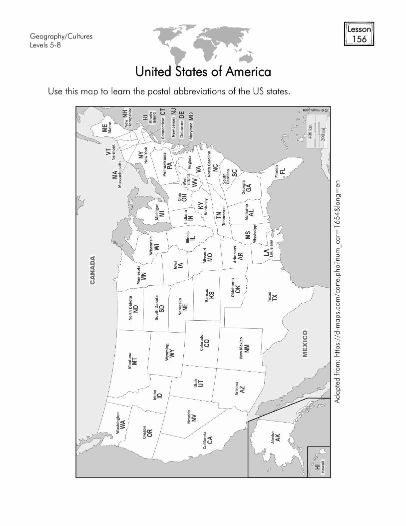
156
United States of America
Use this map to learn the postal abbreviations of the US states.
Adapte
d from
: https://d-m
aps.com
/carte
.php?n
um
_car=
16
54
&la
ng=
en
Geography/Cultures
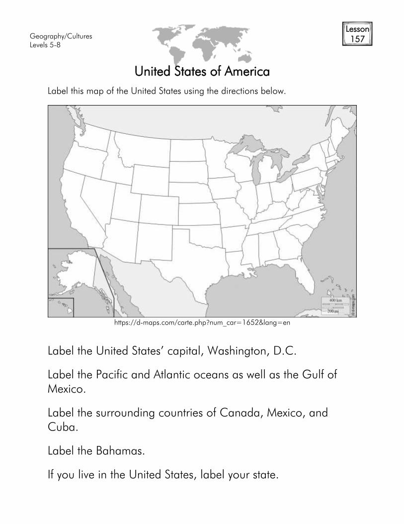
Levels 5-8
Lesson
157
United States of America
Label this map of the United States using the directions below.
Label the United States’ capital, Washington, D.C.
Label the Pacific and Atlantic oceans as well as the Gulf of
Mexico.
Label the surrounding countries of Canada, Mexico, and
Cuba.
Label the Bahamas.
If you live in the United States, label your state.
https://d-maps.com/carte.php?num_car=1652&lang=en
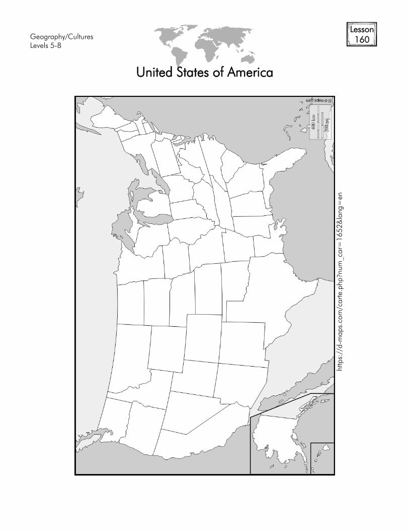
Geography/Cultures
Levels 5-8
Lesson
160
United States of America
https://d-m
aps.com
/carte
.php?n
um
_car=
16
52&
lang=
en
Geography/Cultures
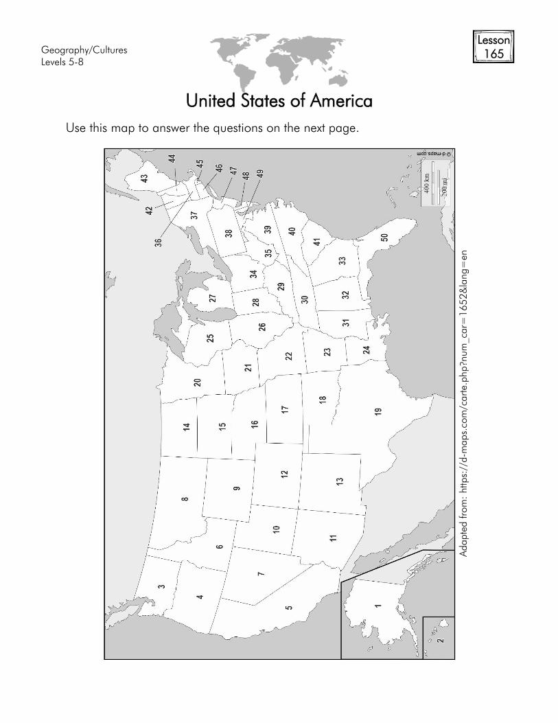
Levels 5-8
Lesson
165
United States of America
Use this map to answer the questions on the next page.
Adapte
d from
: https://d-m
aps.com
/carte
.php?n
um
_car=
16
52
&la
ng=
en
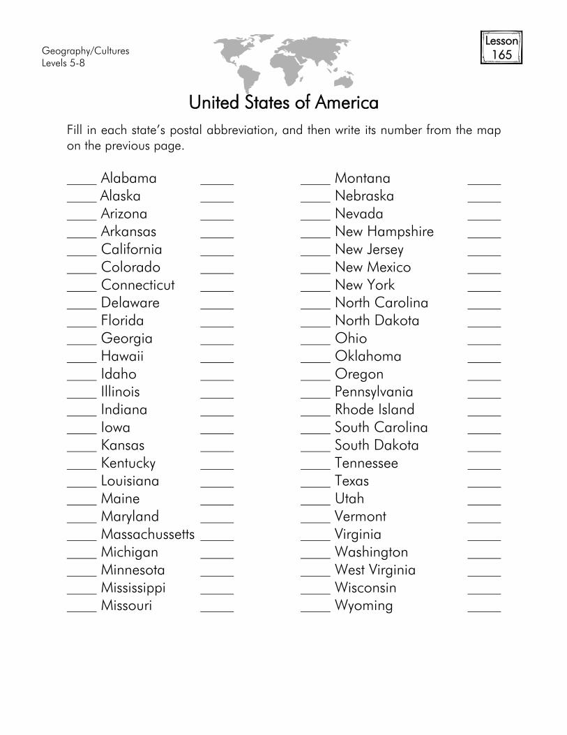
Geography/Cultures
Levels 5-8
Lesson
165
United States of America
Fill in each state’s postal abbreviation, and then write its number from the map
on the previous page.
Alabama Montana
Alaska Nebraska
Arizona Nevada
Arkansas New Hampshire
California New Jersey
Colorado New Mexico
Connecticut New York
Delaware North Carolina
Florida North Dakota
Georgia Ohio
Hawaii Oklahoma
Idaho Oregon
Illinois Pennsylvania
Indiana Rhode Island
Iowa South Carolina
Kansas South Dakota
Kentucky Tennessee
Louisiana Texas
Maine Utah
Maryland Vermont
Massachussetts Virginia
Michigan Washington
Minnesota West Virginia
Mississippi Wisconsin
Missouri Wyoming
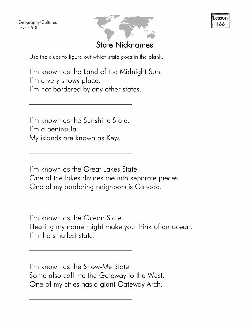
Geography/Cultures
Levels 5-8
Lesson
166
State Nicknames
Use the clues to figure out which state goes in the blank.
I’m known as the Land of the Midnight Sun.
I’m a very snowy place.
I’m not bordered by any other states.
I’m known as the Sunshine State.
I’m a peninsula.
My islands are known as Keys.
I’m known as the Great Lakes State.
One of the lakes divides me into separate pieces.
One of my bordering neighbors is Canada.
I’m known as the Ocean State.
Hearing my name might make you think of an ocean.
I’m the smallest state.
I’m known as the Show-Me State.
Some also call me the Gateway to the West.
One of my cities has a giant Gateway Arch.