Embed Size (px)
DESCRIPTION
Water Quality Monitoring & Mapping Assessment for Watershed Scale Restoration Planning in the Cheat Watershed. Presented March 17 th 2009 By Friends of the Cheat. History. Friends of the Cheat formed in 1994, in response to the T & T Mine blowout. - PowerPoint PPT Presentation
Citation preview
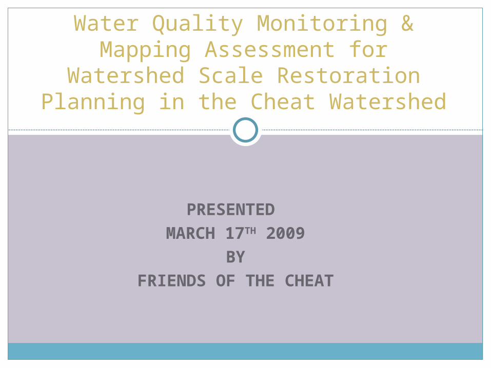
PRESENTED MARCH 17TH 2009
BYFRIENDS OF THE CHEAT
Water Quality Monitoring & Mapping Assessment for Watershed Scale Restoration Planning in the
Cheat Watershed
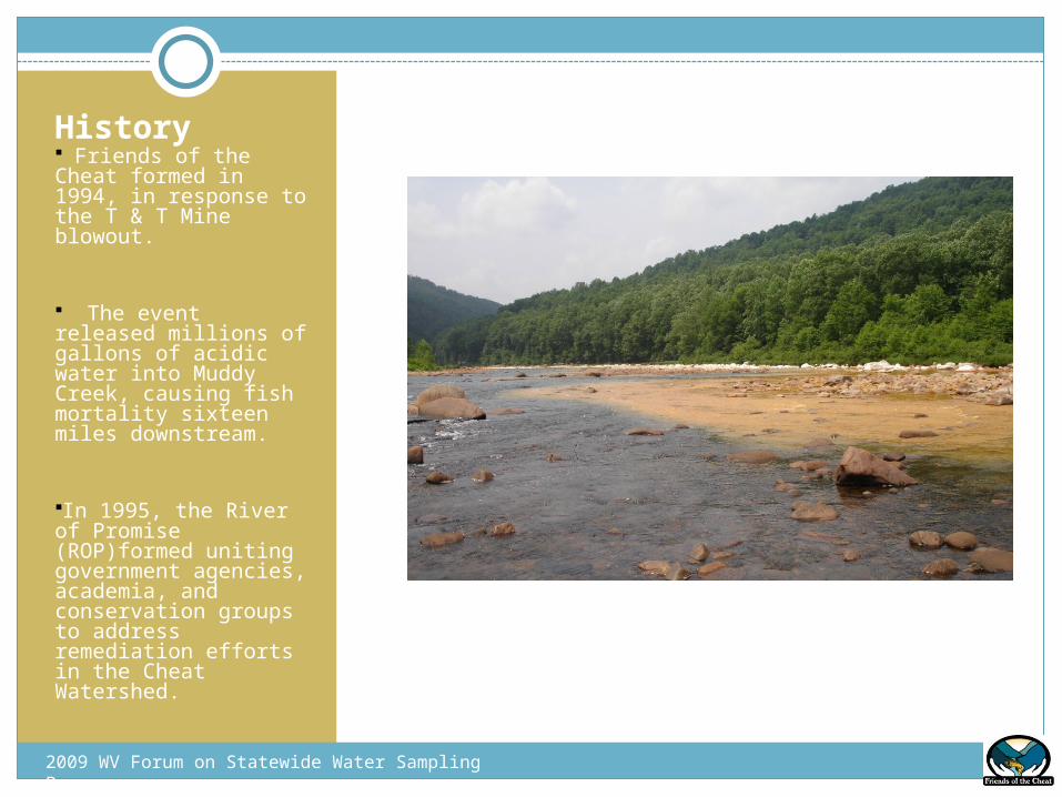
History Friends of the Cheat formed in 1994, in response to the T & T Mine blowout.
The event released millions of gallons of acidic water into Muddy Creek, causing fish mortality sixteen miles downstream.
In 1995, the River of Promise (ROP)formed uniting government agencies, academia, and conservation groups to address remediation efforts in the Cheat Watershed.
2009 WV Forum on Statewide Water Sampling Programs
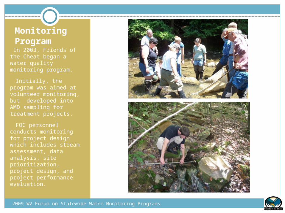
Monitoring Program
In 2003, Friends of the Cheat began a water quality monitoring program.
• Initially, the program was aimed at volunteer monitoring, but developed into AMD sampling for treatment projects.
• FOC personnel conducts monitoring for project design which includes stream assessment, data analysis, site prioritization, project design, and project performance evaluation.
2009 WV Forum on Statewide Water Monitoring Programs
Methodology
2009 WV Forum on Statewide Water Sampling Programs
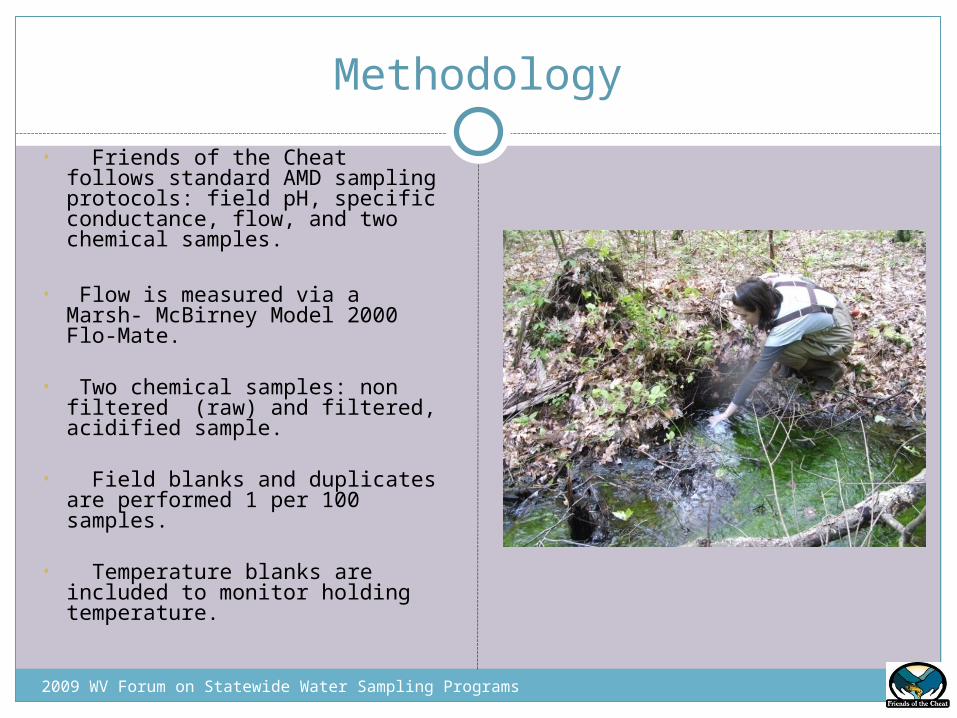
• Friends of the Cheat follows standard AMD sampling protocols: field pH, specific conductance, flow, and two chemical samples.
• Flow is measured via a Marsh- McBirney Model 2000 Flo-Mate.
• Two chemical samples: non filtered (raw) and filtered, acidified sample.
• Field blanks and duplicates are performed 1 per 100 samples.
• Temperature blanks are included to monitor holding temperature.
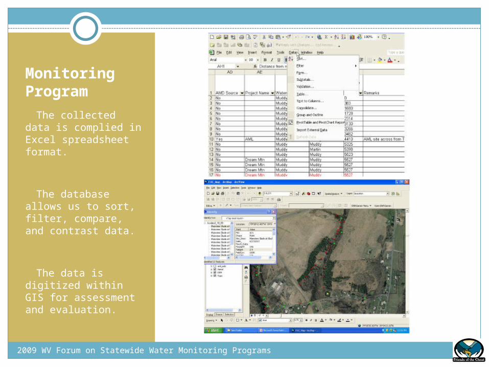
Monitoring Program• The collected data is complied in Excel spreadsheet format.
• The database allows us to sort, filter, compare, and contrast data.
• The data is digitized within GIS for assessment and evaluation.
2009 WV Forum on Statewide Water Monitoring Programs
Restoration Planning
2009 WV Forum on Statewide Water Monitoring Programs
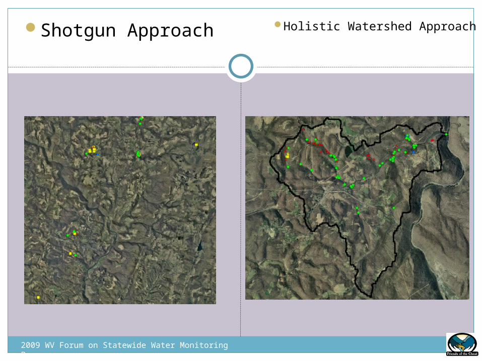
• Early AMD Projects were a shotgun approach
• Treatments were scattered throughout the watershed
• Effectiveness?
• FOC is currently taking a more holistic watershed approach
• Use mass balancing methodology to prioritize acid sources and determine future treatment sites
Source TPY x 100% = % Relative Mouth Load Mouth TPY
• This approach will be more effective in the recovery of the Cheat mainstem
2009 WV Forum on Statewide Water Monitoring Programs
Shotgun Approach Holistic Watershed Approach
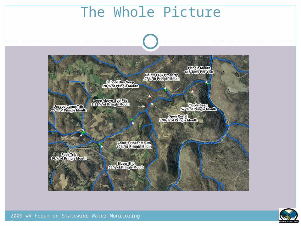
The Whole Picture
2009 WV Forum on Statewide Water Monitoring Programs
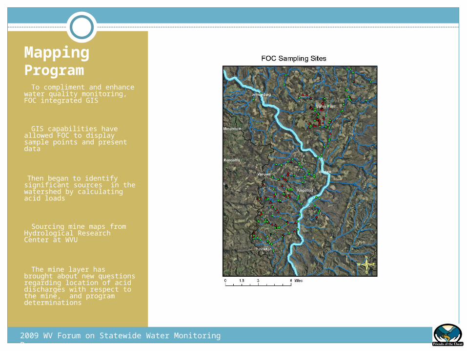
Mapping Program • To compliment and enhance water quality monitoring, FOC integrated GIS
• GIS capabilities have allowed FOC to display sample points and present data
•Then began to identify significant sources in the watershed by calculating acid loads
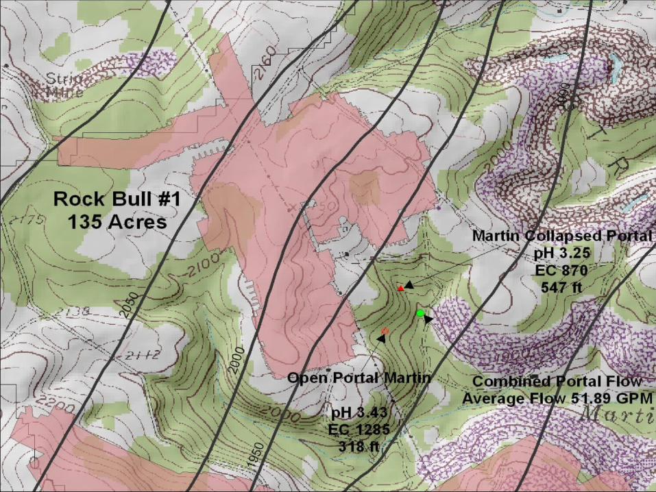
• Sourcing mine maps from Hydrological Research Center at WVU
• The mine layer has brought about new questions regarding location of acid discharges with respect to the mine, and program determinations
2009 WV Forum on Statewide Water Monitoring Programs
Thank You