Embed Size (px)
DESCRIPTION
GIS DATA MODELS. Prepared by Abzamiyeva Laura Candidate of the department of KKGU named after Al- Farabi Kizilorda , Kazakstan 2012. Object. I ntroduction of GIS Data modeling. What is GIS ?. - PowerPoint PPT Presentation
Citation preview
Prepared by Abzamiyeva LauraCandidate of the department of KKGU
named after Al-FarabiKizilorda, Kazakstan 2012
Object
• Introduction of GIS
• Data modeling
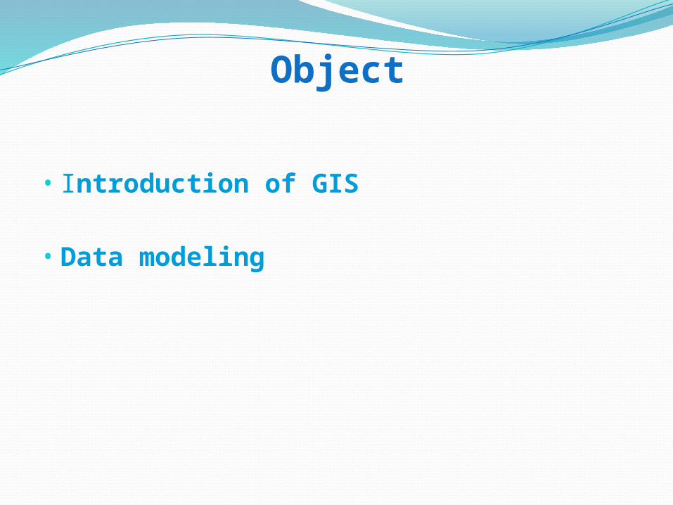
“GIS is a computer-based system that provides the following four sets of capabilities to handle geo-referenced data:
1. Input
2. Data management (storage and retrieval)
3. Manipulation and analysis
4. Output.”
(Aronoff, 1989)
What is GIS ?
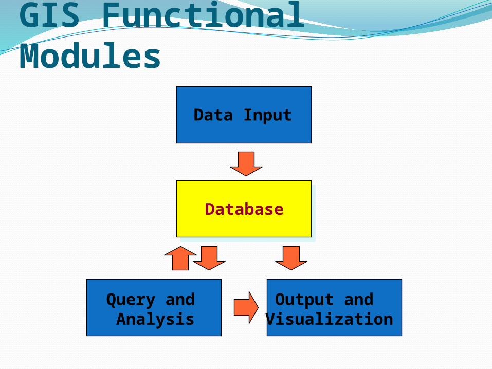
GIS Functional Modules
Database
Query and Analysis
Output and Visualization
Data Input
→ https://www.e-education.psu.edu/natureofgeoinfo/book/export/html/1604
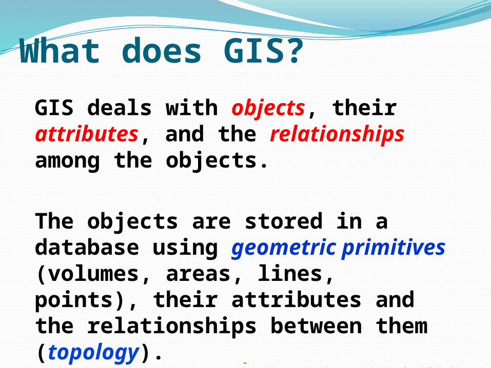
What does GIS?
GIS deals with objects, their attributes, and the relationships among the objects.
The objects are stored in a database using geometric primitives (volumes, areas, lines, points), their attributes and the relationships between them (topology).
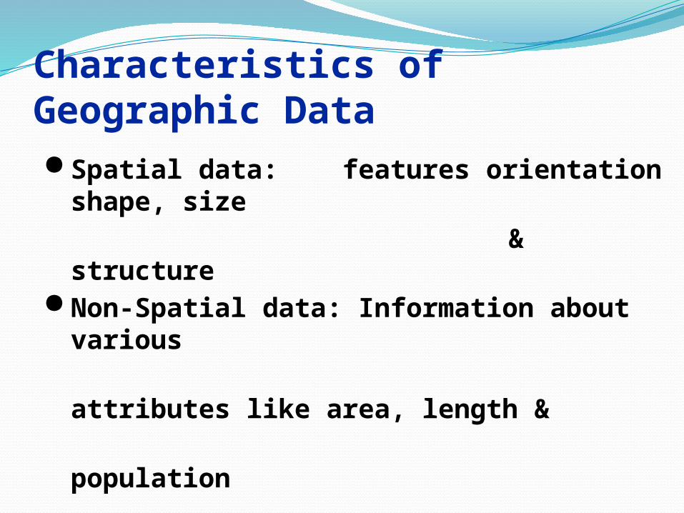
Characteristics of Geographic Data
Spatial data: features orientation shape, size
& structure Non-Spatial data: Information about various
attributes like area, length &
population
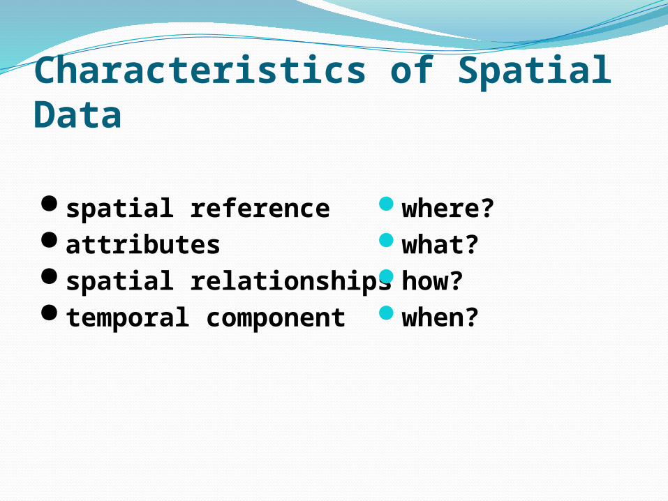
spatial reference attributes spatial relationships temporal component
Characteristics of Spatial Data
where?what?how?when?
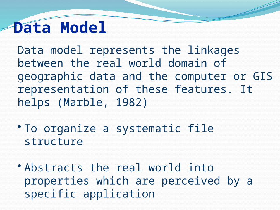
Data ModelData model represents the linkages between the real world domain of geographic data and the computer or GIS representation of these features. It helps (Marble, 1982)
• To organize a systematic file structure
• Abstracts the real world into properties which are perceived by a specific application
How to represent the really data?
?
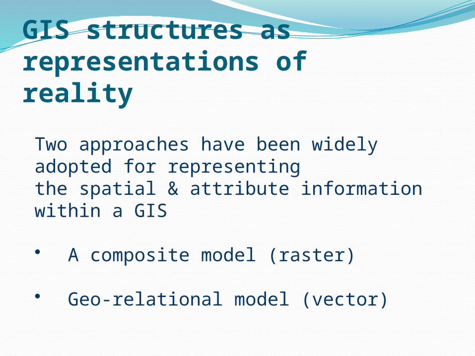
GIS structures as representations of reality
Two approaches have been widely adopted for representingthe spatial & attribute information within a GIS
• A composite model (raster)
• Geo-relational model (vector)
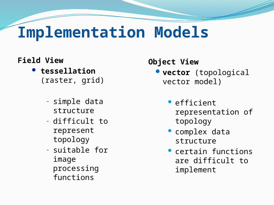
Implementation Models
Field View tessellation (raster,
grid)
– simple data structure– difficult to represent
topology– suitable for image
processing functions
Object Viewvector (topological vector
model)
efficient representation of topology
complex data structure certain functions are
difficult to implement
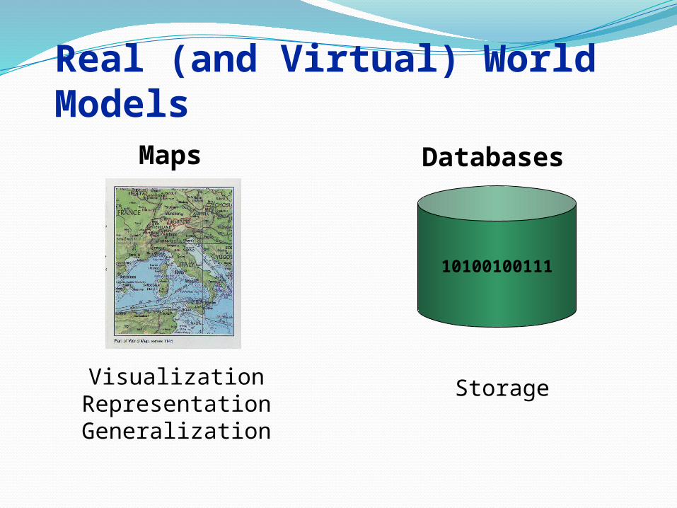
Real (and Virtual) World Models
10100100111
Maps Databases
VisualizationRepresentationGeneralization
Storage
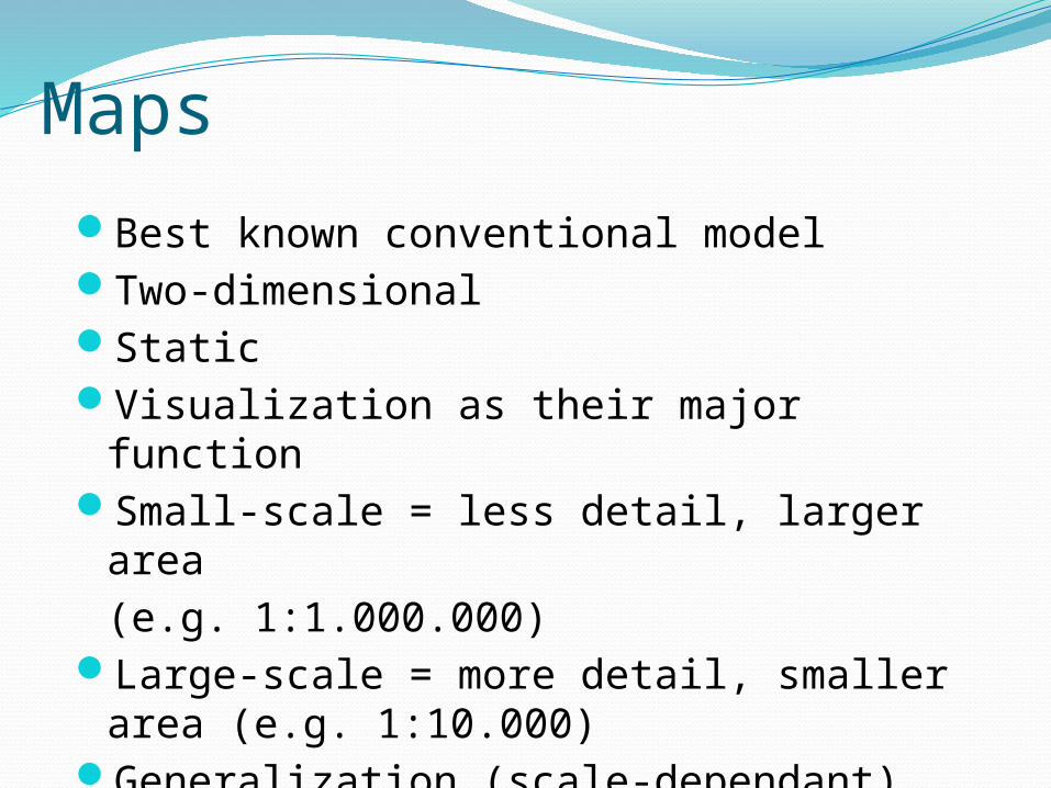
Best known conventional modelTwo-dimensionalStaticVisualization as their major functionSmall-scale = less detail, larger area
(e.g. 1:1.000.000)Large-scale = more detail, smaller area
(e.g. 1:10.000)Generalization (scale-dependant)
Maps
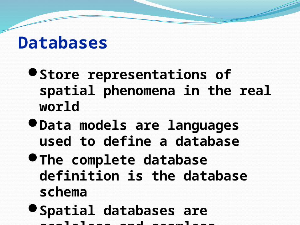
Databases
Store representations of spatial phenomena in the real world
Data models are languages used to define a database
The complete database definition is the database schema
Spatial databases are scaleless and seamless
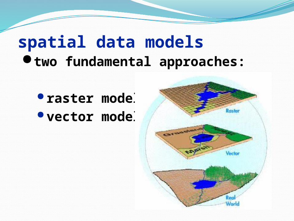
spatial data models two fundamental approaches:
raster model vector model
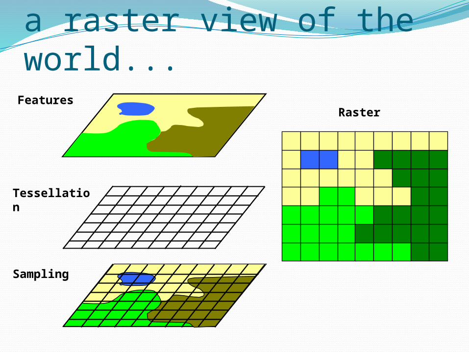
a raster view of the world...
Tessellation
RasterFeatures
Sampling
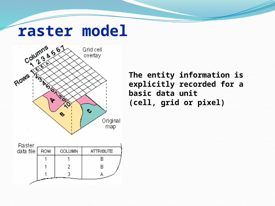
raster model
The entity information is explicitly recorded for a basic data unit (cell, grid or pixel)
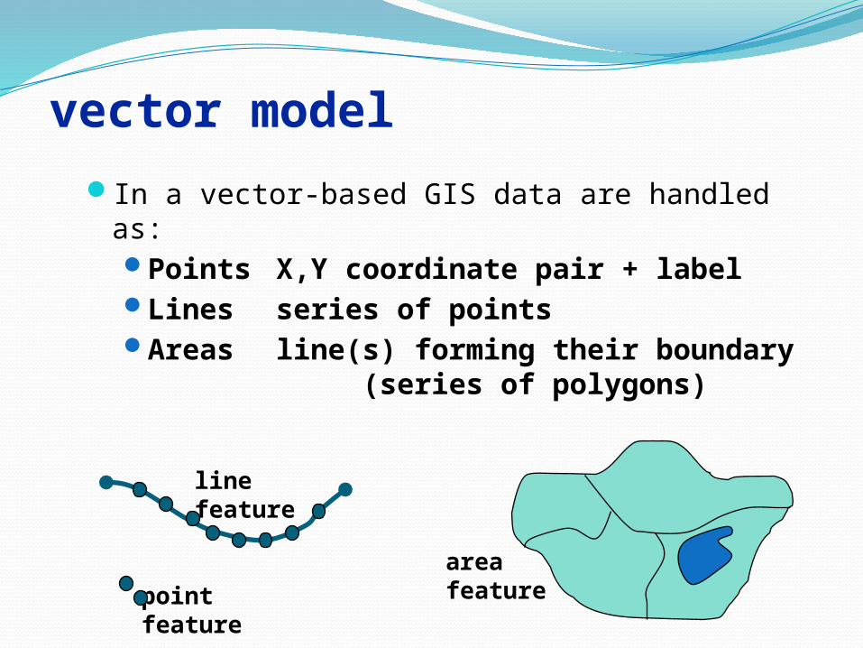
vector modelIn a vector-based GIS data are handled as:
Points X,Y coordinate pair + labelLines series of pointsAreas line(s) forming their
boundary (series of polygons)
line feature
area featurepoint
feature

vector model
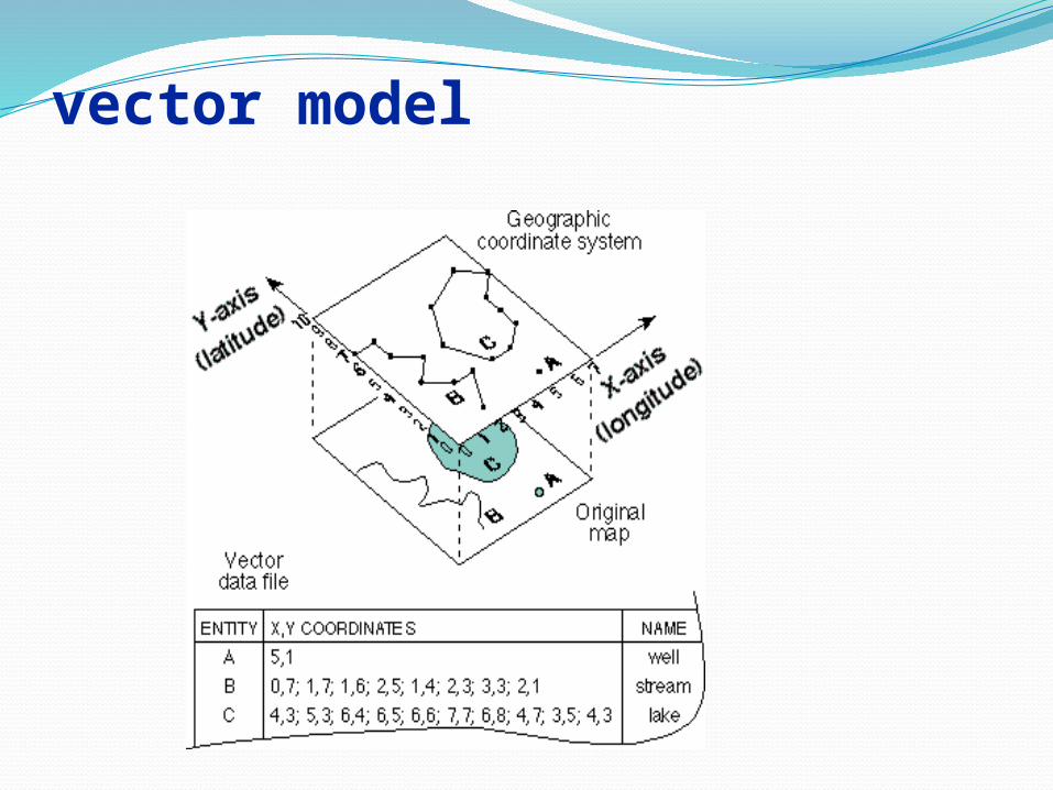
vector model
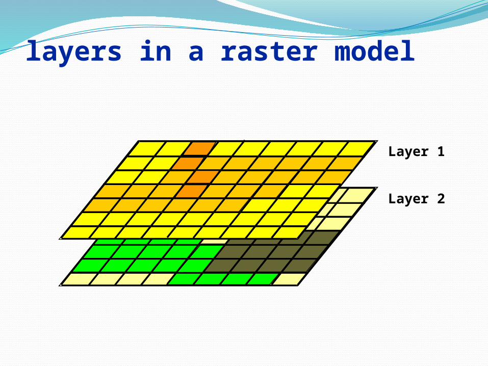
layers in a raster model
Layer 1
Layer 2
Reference: → http://www-
→MapServer
→OpenLayers

THANK YOU !


![Al farabi principles of the beings [hyman]](https://img.pdfslide.us/doc/110x75/579057071a28ab900c9ba9e5/al-farabi-principles-of-the-beings-hyman.jpg)
![[Leo Strauss] How Farabi Read Plato's Laws(BookZZ.org)](https://img.pdfslide.us/doc/110x75/5695d1661a28ab9b0296601e/leo-strauss-how-farabi-read-platos-lawsbookzzorg.jpg)


![Al-Farabi - Summary of Plato's Laws [Tr.mahdi]](https://img.pdfslide.us/doc/110x75/55cf9d2d550346d033ac8dc2/al-farabi-summary-of-platos-laws-trmahdi.jpg)