Embed Size (px)
Citation preview
1
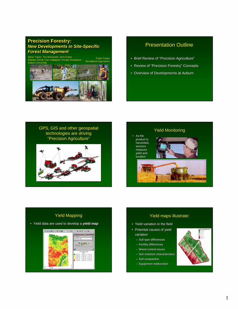
Precision Forestry: New Developments in Site-Specific Forest Management
Precision Forestry: Precision Forestry: New Developments in SiteNew Developments in Site--Specific Specific Forest ManagementForest ManagementSteve Taylor, Tim McDonald, John FultonMathew Smidt, Tom Gallagher, Puneet SrivastavaAuburn University
Steve Taylor, Tim McDonald, John FultonMathew Smidt, Tom Gallagher, Puneet SrivastavaAuburn University
Frank CorleyWoodlands Specialists
Frank CorleyWoodlands Specialists
Presentation Outline Presentation Outline
• Brief Review of “Precision Agriculture”
• Review of “Precision Forestry” Concepts
• Overview of Developments at Auburn
• Brief Review of “Precision Agriculture”
• Review of “Precision Forestry” Concepts
• Overview of Developments at Auburn
GPS, GIS and other geospatial technologies are driving “Precision Agriculture”
GPS, GIS and other geospatial technologies are driving “Precision Agriculture” • As the
product is harvested, sensors measure yield and location
• As the product is harvested, sensors measure yield and location
Yield MonitoringYield Monitoring
• Yield data are used to develop a yield map• Yield data are used to develop a yield map
Yield MappingYield Mapping Yield maps illustrate:Yield maps illustrate:
• Yield variation in the field
• Potential causes of yield variation– Soil type differences
– Fertility differences
– Weed control issues
– Soil moisture characteristics
– Soil compaction
– Equipment malfunction
• Yield variation in the field
• Potential causes of yield variation– Soil type differences
– Fertility differences
– Weed control issues
– Soil moisture characteristics
– Soil compaction
– Equipment malfunction
2
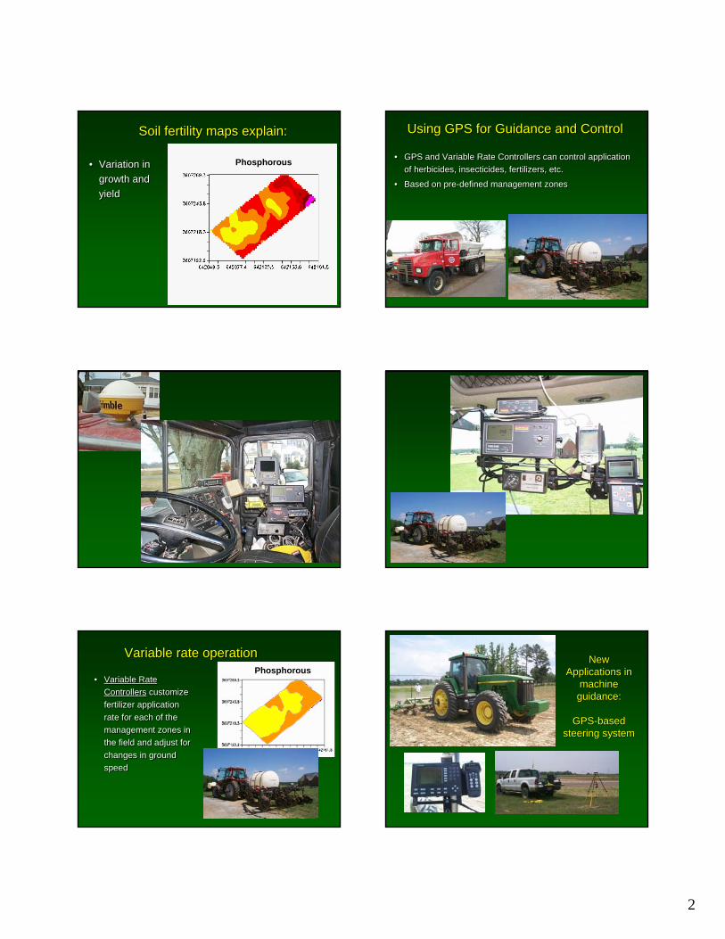
Phosphorous• Variation in growth and yield
• Variation in growth and yield
Soil fertility maps explain:Soil fertility maps explain: Using GPS for Guidance and ControlUsing GPS for Guidance and Control
• GPS and Variable Rate Controllers can control application of herbicides, insecticides, fertilizers, etc.
• Based on pre-defined management zones
• GPS and Variable Rate Controllers can control application of herbicides, insecticides, fertilizers, etc.
• Based on pre-defined management zones
Variable rate operationVariable rate operation
• Variable Rate Controllers customize fertilizer application rate for each of the management zones in the field and adjust for changes in ground speed
• Variable Rate Controllers customize fertilizer application rate for each of the management zones in the field and adjust for changes in ground speed
PhosphorousNew New
Applications in Applications in machine machine guidance:guidance:
GPSGPS--based based steering system steering system
3
GPSGPS--based based steering system steering system for subsequent for subsequent
operations operations based on based on
original map original map created during created during
tillage or tillage or plantingplanting
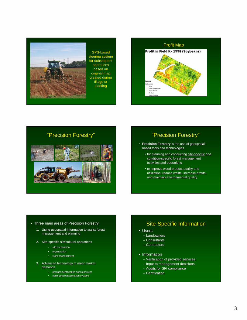
Profit MapProfit Map
““Precision ForestryPrecision Forestry”” ““Precision ForestryPrecision Forestry””• Precision Forestry is the use of geospatial-
based tools and technologies
• for planning and conducting site-specific and condition-specific forest management activities and operations
• to improve wood product quality and utilization, reduce waste, increase profits, and maintain environmental quality
• Precision Forestry is the use of geospatial-based tools and technologies
• for planning and conducting site-specific and condition-specific forest management activities and operations
• to improve wood product quality and utilization, reduce waste, increase profits, and maintain environmental quality
• Three main areas of Precision Forestry:• Three main areas of Precision Forestry:
1. Using geospatial-information to assist forest management and planning
2. Site-specific silvicultural operations • site preparation
• regeneration
• stand management
3. Advanced technology to meet market demands
• product identification during harvest• optimizing transportation systems
1. Using geospatial-information to assist forest management and planning
2. Site-specific silvicultural operations • site preparation
• regeneration
• stand management
3. Advanced technology to meet market demands
• product identification during harvest• optimizing transportation systems
Site-Specific InformationSite-Specific Information• Users
– Landowners– Consultants– Contractors
• Information– Verification of provided services– Input to management decisions– Audits for SFI compliance– Certification
• Users– Landowners– Consultants– Contractors
• Information– Verification of provided services– Input to management decisions– Audits for SFI compliance– Certification
4
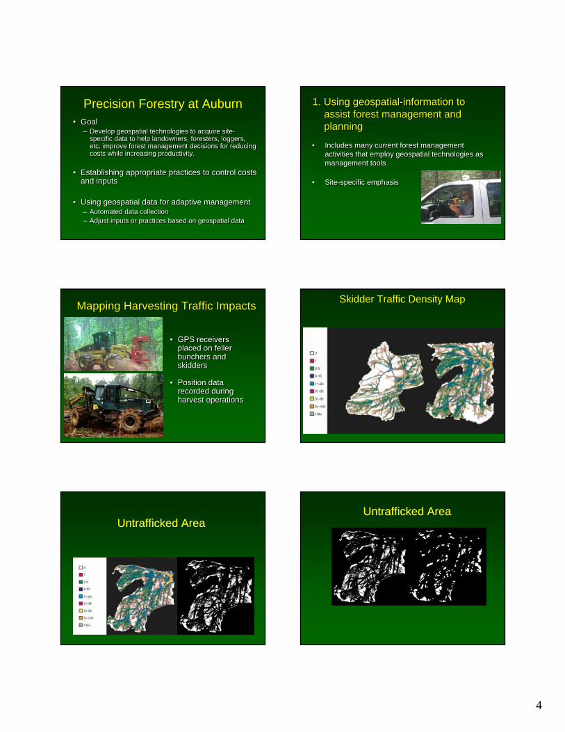
Precision Forestry at Auburn• Goal
– Develop geospatial technologies to acquire site-specific data to help landowners, foresters, loggers, etc. improve forest management decisions for reducing costs while increasing productivity.
• Establishing appropriate practices to control costs and inputs
• Using geospatial data for adaptive management– Automated data collection– Adjust inputs or practices based on geospatial data
• Goal– Develop geospatial technologies to acquire site-
specific data to help landowners, foresters, loggers, etc. improve forest management decisions for reducing costs while increasing productivity.
• Establishing appropriate practices to control costs and inputs
• Using geospatial data for adaptive management– Automated data collection– Adjust inputs or practices based on geospatial data
1. Using geospatial-information to assist forest management and planning
1. Using geospatial-information to assist forest management and planning
• Includes many current forest management activities that employ geospatial technologies as management tools
• Site-specific emphasis
• Includes many current forest management activities that employ geospatial technologies as management tools
• Site-specific emphasis
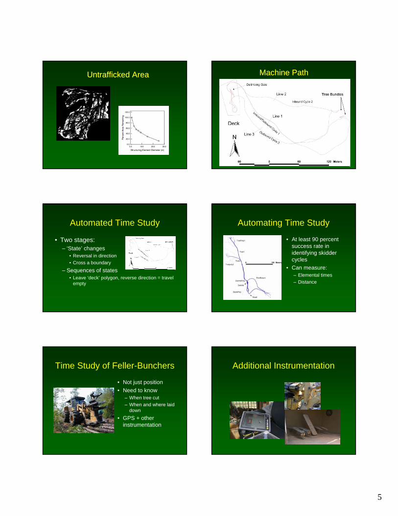
• GPS receivers placed on feller bunchers and skidders
• Position data recorded during harvest operations
• GPS receivers placed on feller bunchers and skidders
• Position data recorded during harvest operations
Mapping Harvesting Traffic ImpactsMapping Harvesting Traffic Impacts Skidder Traffic Density Map
Untrafficked AreaUntrafficked AreaUntrafficked AreaUntrafficked Area
5
Untrafficked AreaUntrafficked Area Machine PathMachine Path
Automated Time Study
• Two stages:– ‘State’ changes
• Reversal in direction• Cross a boundary
– Sequences of states• Leave ‘deck’ polygon, reverse direction = travel
empty
Automating Time Study
• At least 90 percent success rate in identifying skidder cycles
• Can measure:– Elemental times– Distance
Time Study of Feller-Bunchers
• Not just position• Need to know
– When tree cut– When and where laid
down• GPS + other
instrumentation
Additional Instrumentation
6
Time Study Results
• 238 of 240 trees cut detected
• 47 cycles (cut/dump) - 53 detected
010
20
30
40
50
60
Perc
dent
of C
ycle
s
< -2 -1 0 1 > 2
Difference in Number of Trees Per Cycle
2.7Aug 6
1.6Aug 6
1.3Aug 7
1.7Aug 9 (PM)
1.9Aug 9 (AM)
AVG Speed (MPH)
D6
Mapping mechanicalsite preparation operations
Mapping mechanicalsite preparation operations
Mapping mechanical site preparation operations
Commercial GPSCommercial GPS--based mapping based mapping
of site of site preparationpreparation
Productivity Productivity measurement of site measurement of site
preparation operationspreparation operations
#########################################################################################################
###############
####
######
####
####
#####
####
####
####
#####
######
####
####
####
#####
#####
#####
#########
######
######
#######
#######
##################################################################################################################################################
#######################################
#########
#####
################
####
######
#####
#####
#####
#####
######
######
#####
#####
#####
#####
#######
#######
#####
#######
#######
######################################################################################################################################
#####################################
####
####
####
####
#####
####
####
####
####
####
#####
####
##############
######
####
#####
######
#######
#######
#######
######
################
#######################################################################################################################################
###########################################
######
#####
####
####
####
####
####
####
####
######
####
#####
####
#####
######
##########
######
######
#######
######
#######################################################################
####################################################
##############################################################################
################################
#####
####
#####
####
####
######
####
####
####
#####
####
######
####
######
#########
########
######
#####
######
######
###############################################################################################
################################################################################################
#####
####
#####
####
######
#####
#############
#####
####
######
#####
#####
#####
#######
#########
#######
#####
######
######
###################
#######
#########
######
#####
######
####
#####
#####
################
#############################################################################
##########
#################
#####
######
#####
#####
######
#####
#####
######
################
#############################################################################################
#########
###########
#########
########
########
########
#######
########
#########
#######
##############################################################################################################################################################################################################
####
####
####
####
####
######
######
######
######
#####
######
######
#####
######
######
######
######
#####
######
#####
####
######
######
######
####
########
####################################################################################################################################################
####################
######
######
######
######
######
######
######
######
######
#######
#####
#####
######
#####
#####
######
#####
######
###############
########################################################################################################################################
###########
#########################################################################################################################################################################################################################
######
######
######
######
######
######
######
######
######
#######
#####
######
#####
######
######
######
#######
##################
############################################################################################################################################
#####################
######
######
#####
###########
######
######
######
######
######
#####
#####
######
######
######
##############
######
######
############################
##########
############################
#######################################################################################################################
#######################################################
#######
#####
#######
######
#######
######
##########################
#####
#####
######
#####
######
#####
##############
########
#######
###########################################
#############################
################
##########################################################################################################################################
####################################################
###################################################
###########
####################################
####
####
#####
####
####
####
################################
#####################################
###################
###############
####################
####
####
######
######
####
####
####
#######################################
#########################
###############
#######################
###
####
####
####
####
####
##############################
#############################
###############################
################################
###############
#####################
######
######
####
####
##########
#######
###########
####
####
####
###
###
####
####
####
####
#######################
###########
#####################################
###########################
#######################
########
###################
################
###############################
####
###
#####
#####
######
######
####
####
####
###
####
#####
####
######
####
####
#######
####
####
###
####
####
####
######
#################################
##################
#########################################
###########
######################
##################
###############################
####
####
#########
#####
####
###
############
####
####
####
####
####
####
###
####
####
#####
####
###
###
###
####
####
####
############################
########################
########
#############
#########
######
##############
###################
##################
##############
#################
######
####
####
####
####
######
###
####
####
####
###
####
###
####
####
####
####
####
####
####
#
####
####
####
###############################
###########################
################
###################
##########
##########################
####################
################################
#####
#####
#######
############################
#######
################
####
####
####
####
###
####
####
#####
###
###
####
####
####
###
####
##############################
#####
##############################################
#########
####
##################
#################
################################
###################
######
####
############
####
####
####
###
####
###
###
####
####
####
####
###
###
####
###
##########
#####
####
####
##################### ########
#################################################
########
#######
#####################
#################
###########
#########################
##########
####
####
####
###
####
####
####
####
####
###
####
####
####
####
###
####
####
###############################
#############
##################
########################################################################################################################################################################################################################################################################################################################################################################
#######
############
###############
#################
############################
####
#####
###
###
####
###
####
####
####
####
####
####
####
####
###
####
####
####
##############################
############
###########################
###########
###########
#######
#####################
#################################
###
####
####
#####
###
####
###
####
####
####
###
###
####
####
####
####
####
####
#################################
#########################################
######
#######
############
#####
###############
#############################
#####
######
####
#####
####
####
###
####
###
####
####
####
####
#####
####
####
####
################################
##############################
##########
###############
#####
#######
######
#####
#########################
######
######
#######
##########################
#######
######
######
######################################
#######
##########
########
#######
#####
##########
#############
##################
###
###
####
###
####
###
####
####
#########################################################
####
#####
###
###
#####
###
###
######################################################
#####
####
###
###
####
###
############################################################
#####
###
#####
#####
###
####
###################################################
#####
#####
###
####
###
#########################################
######
####
####
###########
######################
###################
##
##
##
#######
PLOW DOWN
PLOW UP
PLOW DOWN
PLOW UP
Location of delimbing area during harvesting operation
Location of delimbing area during harvesting operationLocation of wet
areaLocation of wet area
Productivity measurement of site Productivity measurement of site preparation operationspreparation operations
7
Time
(min)
TimeTime
(min)(min)Percent of TimePercent Percent of Timeof Time
TurningTurningTurning
PlowingPlowingPlowing
Avoiding ObstaclesAvoiding Avoiding ObstaclesObstacles
StoppedStoppedStopped
223223223 61%61%61%
110110110 30%30%30%
202020 5%5%5%
141414 4%4%4%
Time Element
Time Time ElementElement
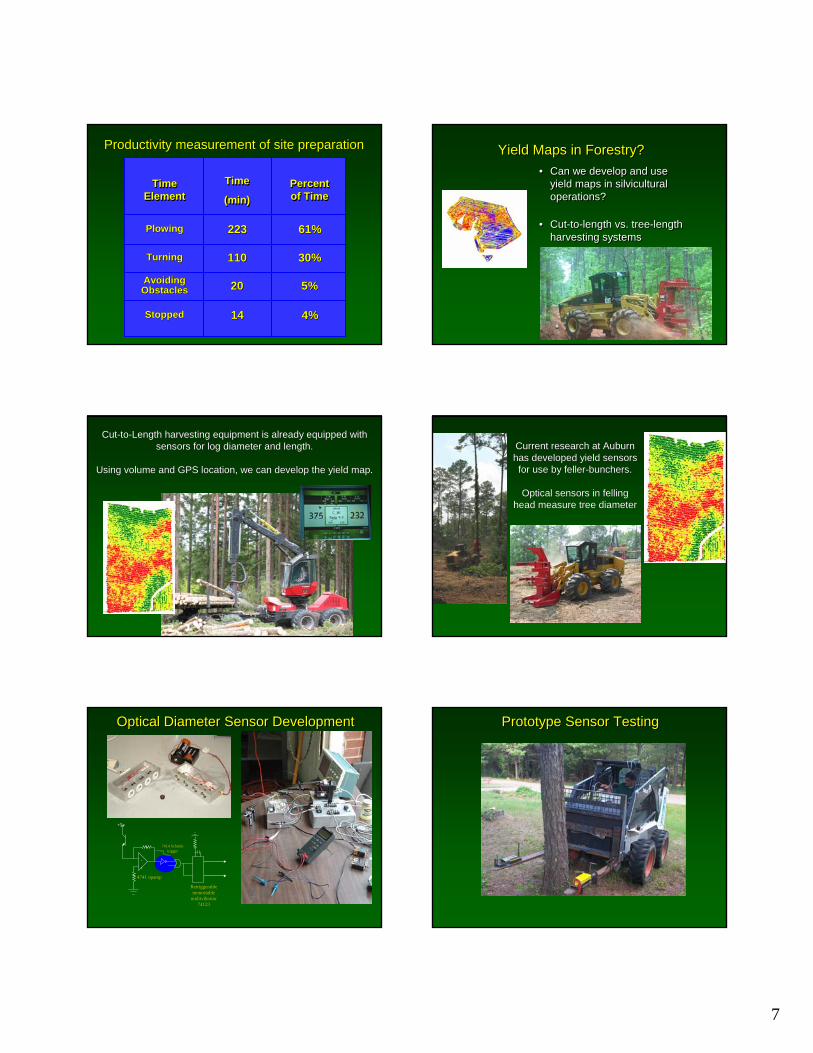
Productivity measurement of site preparationProductivity measurement of site preparation Yield Maps in Forestry?Yield Maps in Forestry?• Can we develop and use
yield maps in silvicultural operations?
• Cut-to-length vs. tree-length harvesting systems
• Can we develop and use yield maps in silvicultural operations?
• Cut-to-length vs. tree-length harvesting systems
Cut-to-Length harvesting equipment is already equipped with sensors for log diameter and length.
Using volume and GPS location, we can develop the yield map.
Cut-to-Length harvesting equipment is already equipped with sensors for log diameter and length.
Using volume and GPS location, we can develop the yield map.
Current research at Auburn has developed yield sensors for use by feller-bunchers.
Optical sensors in felling head measure tree diameter
Current research at Auburn has developed yield sensors for use by feller-bunchers.
Optical sensors in felling head measure tree diameter
+5v
4741 opamp
+
-
7414 Schmitt trigger
Retriggerablemonostable
multivibrator74123
Optical Diameter Sensor DevelopmentOptical Diameter Sensor Development Prototype Sensor TestingPrototype Sensor Testing
8
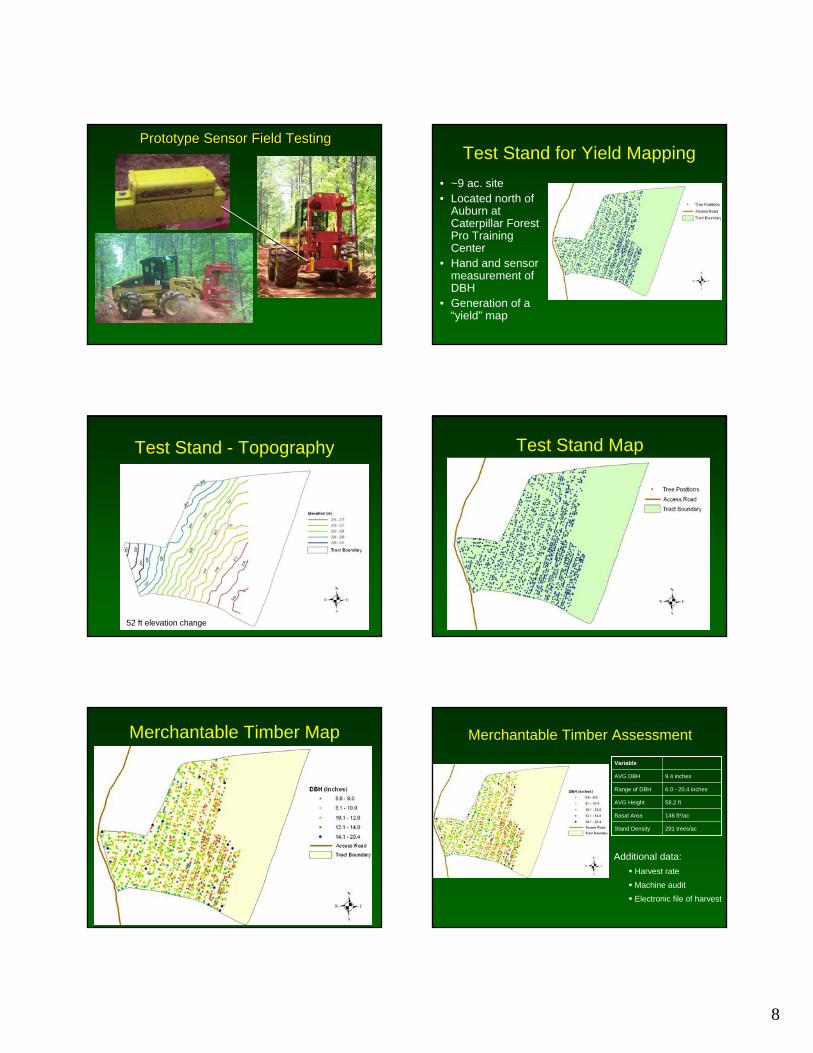
Prototype Sensor Field TestingPrototype Sensor Field TestingTest Stand for Yield Mapping
• ~9 ac. site• Located north of
Auburn at Caterpillar Forest Pro Training Center
• Hand and sensor measurement of DBH
• Generation of a “yield” map
Test Stand - Topography
52 ft elevation change
Test Stand Map
Merchantable Timber Map Merchantable Timber Assessment
58.2 ftAVG Height
146 ft2/acBasal Area
Variable
9.4 inchesAVG DBH
291 trees/acStand Density
6.0 - 20.4 inchesRange of DBH
Additional data:Harvest rate
Machine audit
Electronic file of harvest

9
Value Map $13.74 per treeAVG Value
$19,809Total Value Next Steps in Yield MappingNext Steps in Yield Mapping
• Extensive field testing of optical sensor
• Testing of different sensing techniques
• Refinement of yield mapping methods
• Extension activities to transfer technology to loggers and landowners
• Extensive field testing of optical sensor
• Testing of different sensing techniques
• Refinement of yield mapping methods
• Extension activities to transfer technology to loggers and landowners
2. Site-specific silvicultural operations2. Site-specific silvicultural operationsUsing GPS, GIS, and variable rate controllers to assist in regeneration (site preparation, planting), thinning, harvesting,etc.
Using GPS, GIS, and variable rate controllers to assist in regeneration (site preparation, planting), thinning, harvesting,etc.
• More efficient herbicide and fertilizer application
• Marking tree location for planting and subsequent operations
• “Smart” backpack spraying systems
• “Smart” hand planting systems
• More efficient herbicide and fertilizer application
• Marking tree location for planting and subsequent operations
• “Smart” backpack spraying systems
• “Smart” hand planting systems
Site-specific herbicide applicationSite-specific herbicide application
• Banded spraying and variable-rate technology
• Manual or Automated control
• Banded spraying and variable-rate technology
• Manual or Automated control
Site-specific herbicide applicationSite-specific herbicide application
• Pre-plant:
• Banded spraying
• Variable-rate technology
• Marks location of trees
• Pre-plant:
• Banded spraying
• Variable-rate technology
• Marks location of trees
As-applied map of herbicide applicationAs-applied map of herbicide application
Owner GIS Herbicide Tractor GPS82 79 77
Acres
10
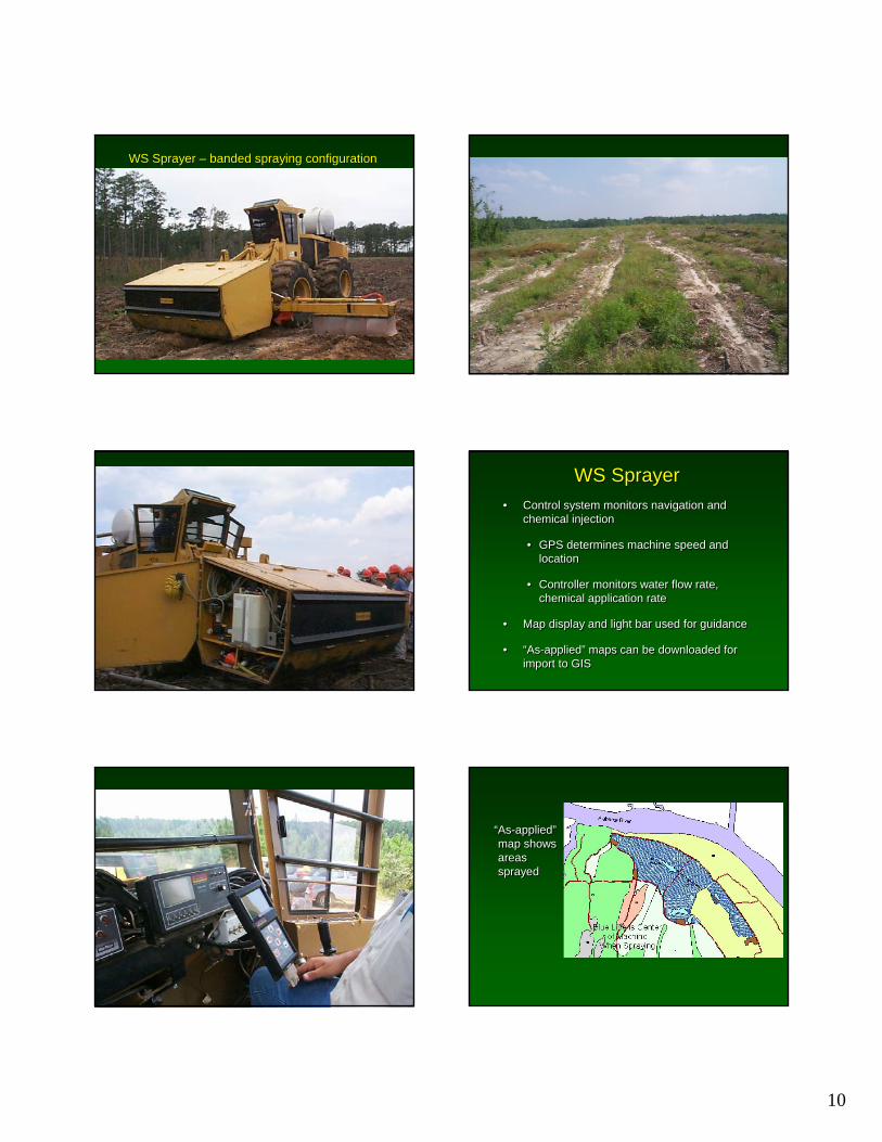
WS Sprayer WS Sprayer –– banded spraying configurationbanded spraying configuration
WS SprayerWS Sprayer• Control system monitors navigation and
chemical injection
• GPS determines machine speed and location
• Controller monitors water flow rate, chemical application rate
• Map display and light bar used for guidance
• “As-applied” maps can be downloaded for import to GIS
• Control system monitors navigation and chemical injection
• GPS determines machine speed and location
• Controller monitors water flow rate, chemical application rate
• Map display and light bar used for guidance
• “As-applied” maps can be downloaded for import to GIS
“As-applied”map shows areas sprayed
“As-applied”map shows areas sprayed
11
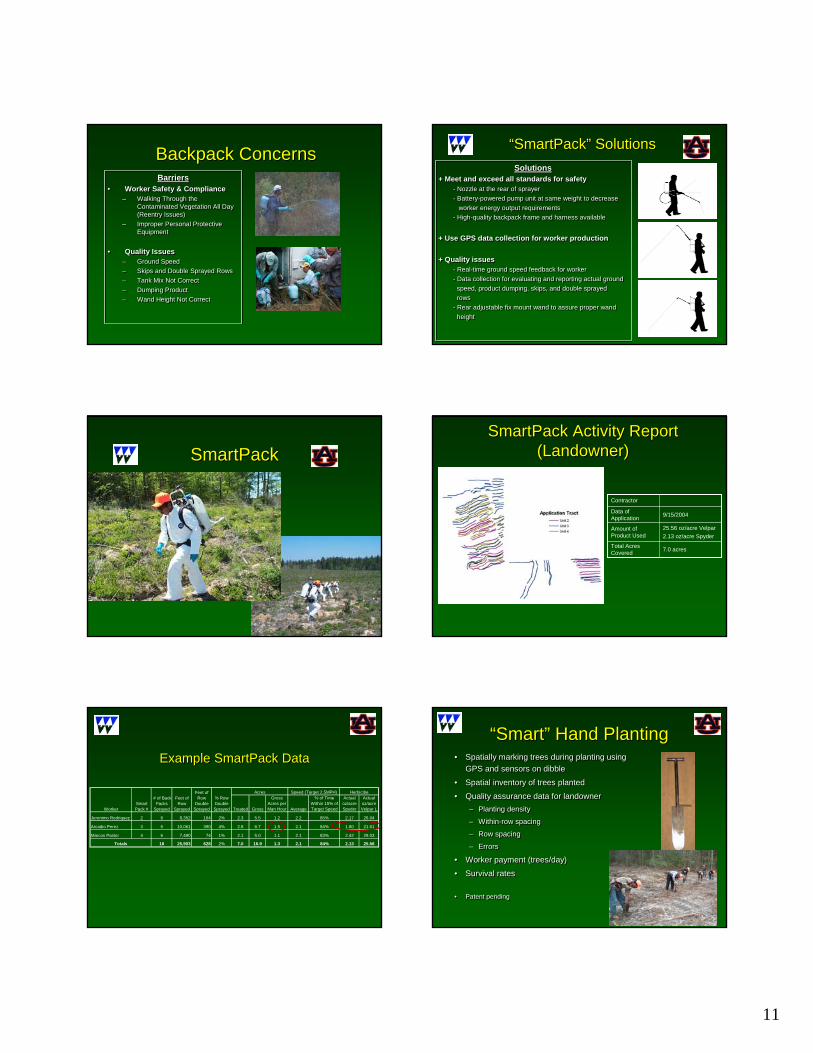
Backpack ConcernsBackpack ConcernsBarriers
• Worker Safety & Compliance– Walking Through the
Contaminated Vegetation All Day (Reentry Issues)
– Improper Personal Protective Equipment
• Quality Issues– Ground Speed– Skips and Double Sprayed Rows– Tank Mix Not Correct– Dumping Product– Wand Height Not Correct
Barriers• Worker Safety & Compliance
– Walking Through the Contaminated Vegetation All Day (Reentry Issues)
– Improper Personal Protective Equipment
• Quality Issues– Ground Speed– Skips and Double Sprayed Rows– Tank Mix Not Correct– Dumping Product– Wand Height Not Correct
Solutions+ Meet and exceed all standards for safety
- Nozzle at the rear of sprayer- Battery-powered pump unit at same weight to decrease
worker energy output requirements- High-quality backpack frame and harness available
+ Use GPS data collection for worker production
+ Quality issues- Real-time ground speed feedback for worker- Data collection for evaluating and reporting actual ground
speed, product dumping, skips, and double sprayedrows
- Rear adjustable fix mount wand to assure proper wandheight
“SmartPack” Solutions“SmartPack” Solutions
SmartPackSmartPack
Contractor
9/15/2004Data of Application
7.0 acresTotal Acres Covered
25.56 oz/acre Velpar2.13 oz/acre Spyder
Amount of Product Used
SmartPack Activity Report (Landowner)
SmartPack Activity Report (Landowner)
Example SmartPack DataExample SmartPack Data
Treated Gross
Gross Acres per Man Hour Average
% of Time Within 15% of Target Speed
Actual oz/acre Spyder
Actual oz/acre Velpar L
Jeronimo Rodriquez 2 6 8,352 164 2% 2.3 5.5 1.2 2.2 85% 2.17 26.04
Arcadio Perez 3 6 10,061 390 4% 2.8 6.7 1.5 2.1 84% 1.80 21.61
Marcos Pastor 4 6 7,490 74 1% 2.1 5.0 1.1 2.1 83% 2.42 29.03
18 25,903 628 2% 7.0 16.9 1.3 2.1 84% 2.13 25.56
WorkerSmart Pack #
# of Back Packs
Sprayed
Totals
HerbicibeSpeed (Target 2.5MPH)Feet of
Row Sprayed
Feet of Row
Double Sprayed
Acres% Row Double Sprayed
“Smart” Hand Planting“Smart” Hand Planting• Spatially marking trees during planting using
GPS and sensors on dibble
• Spatial inventory of trees planted
• Quality assurance data for landowner– Planting density
– Within-row spacing
– Row spacing
– Errors
• Worker payment (trees/day)
• Survival rates
• Patent pending
• Spatially marking trees during planting using GPS and sensors on dibble
• Spatial inventory of trees planted
• Quality assurance data for landowner– Planting density
– Within-row spacing
– Row spacing
– Errors
• Worker payment (trees/day)
• Survival rates
• Patent pending
12
Quality Assurance Data for LandownerQuality Assurance Data for Landowner• Target
– 545 trees/ac– Tree spacing = 6 ft– Row spacing = 12 ft
• Target– 545 trees/ac– Tree spacing = 6 ft– Row spacing = 12 ft
• Actual– 551.7 trees/ac (CV = 12%)– Tree spacing = 6.2 ft (CV = 18%)– Row spacing = 11.3 ft (CV = 24%)
• Actual– 551.7 trees/ac (CV = 12%)– Tree spacing = 6.2 ft (CV = 18%)– Row spacing = 11.3 ft (CV = 24%)
As-Planted and SmartPackApplication Map
As-Planted and SmartPackApplication Map
How do we use yield maps?How do we use yield maps?
• How can we use yield maps in the next rotation?
• Site-specific fertilization
• Site-specific herbicide application
• Site-specific planting density
• How can we use yield maps in the next rotation?
• Site-specific fertilization
• Site-specific herbicide application
• Site-specific planting density
Management philosophies for site-specific silvicultural operations
Management philosophies for site-specific silvicultural operations
• Manage soil fertility to optimize profit
OR
• Manage vegetation to optimize profit
• Manage soil fertility to optimize profit
OR
• Manage vegetation to optimize profit
Phosphorous
Site-specific fertilizationSite-specific fertilization• Yield maps can be combined with soil fertility maps
to develop management zones
• Different rates of fertilizer can be applied at different locations
• Yield maps can be combined with soil fertility maps to develop management zones
• Different rates of fertilizer can be applied at different locations
Phosphorous
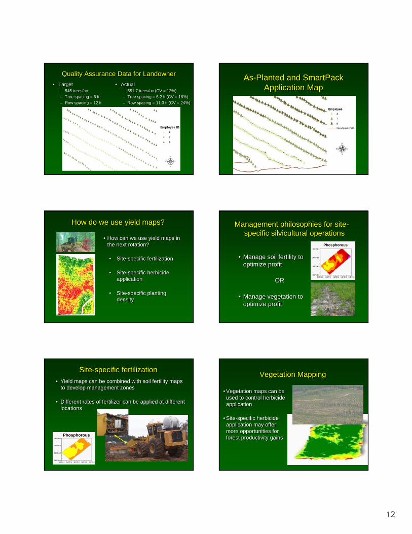
Vegetation MappingVegetation Mapping
• Vegetation maps can be used to control herbicide application
• Site-specific herbicide application may offer more opportunities for forest productivity gains
• Vegetation maps can be used to control herbicide application
• Site-specific herbicide application may offer more opportunities for forest productivity gains
13
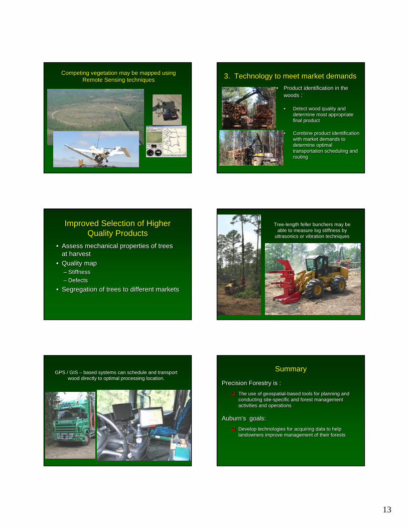
Competing vegetation may be mapped using Remote Sensing techniques
Competing vegetation may be mapped using Remote Sensing techniques 3. Technology to meet market demands3. Technology to meet market demands
• Product identification in the woods :
• Detect wood quality and determine most appropriate final product
• Combine product identification with market demands to determine optimal transportation scheduling and routing
• Product identification in the woods :
• Detect wood quality and determine most appropriate final product
• Combine product identification with market demands to determine optimal transportation scheduling and routing
Improved Selection of Higher Quality Products
Improved Selection of Higher Quality Products
• Assess mechanical properties of trees at harvest
• Quality map– Stiffness– Defects
• Segregation of trees to different markets
• Assess mechanical properties of trees at harvest
• Quality map– Stiffness– Defects
• Segregation of trees to different markets
Tree-length feller bunchers may be able to measure log stiffness by
ultrasonics or vibration techniques
Tree-length feller bunchers may be able to measure log stiffness by
ultrasonics or vibration techniques
GPS / GIS – based systems can schedule and transport wood directly to optimal processing location.
GPS / GIS – based systems can schedule and transport wood directly to optimal processing location.
SummarySummary
Precision Forestry is :The use of geospatial-based tools for planning and conducting site-specific and forest management activities and operations
Auburn’s goals:Develop technologies for acquiring data to help landowners improve management of their forests
Precision Forestry is :The use of geospatial-based tools for planning and conducting site-specific and forest management activities and operations
Auburn’s goals:Develop technologies for acquiring data to help landowners improve management of their forests
14
SummarySummary
Precision Forestry focus at Auburn:GPS-based tracking and monitoring systems developed and tested in forest operations
• Site preparation and harvesting
• Harvesting impacts on soil compaction measured
Basic components of yield mapping techniques have been developed for tree-length harvesting systems
• Optical diameter sensor developed and tested
• Other sensing systems under development
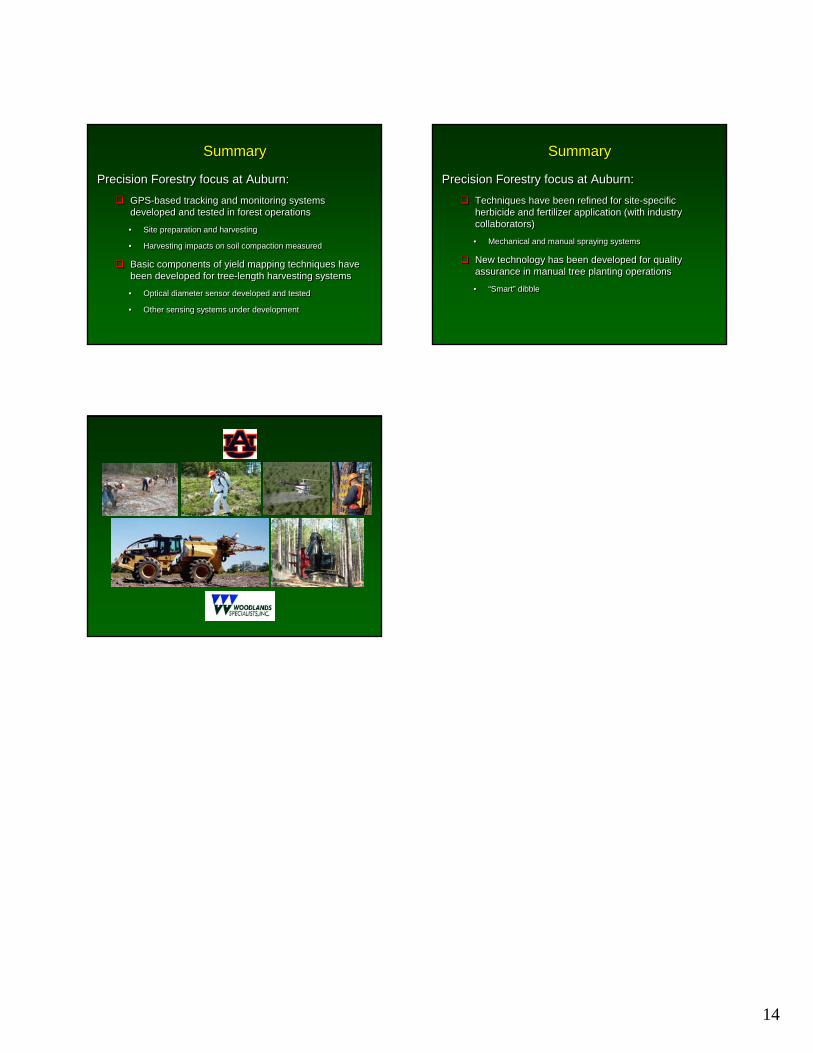
SummarySummary
Precision Forestry focus at Auburn:Techniques have been refined for site-specific herbicide and fertilizer application (with industry collaborators)
• Mechanical and manual spraying systems
New technology has been developed for quality assurance in manual tree planting operations
• “Smart” dibble
Precision Forestry focus at Auburn:Techniques have been refined for site-specific herbicide and fertilizer application (with industry collaborators)
• Mechanical and manual spraying systems
New technology has been developed for quality assurance in manual tree planting operations
• “Smart” dibble