Embed Size (px)
Citation preview
1
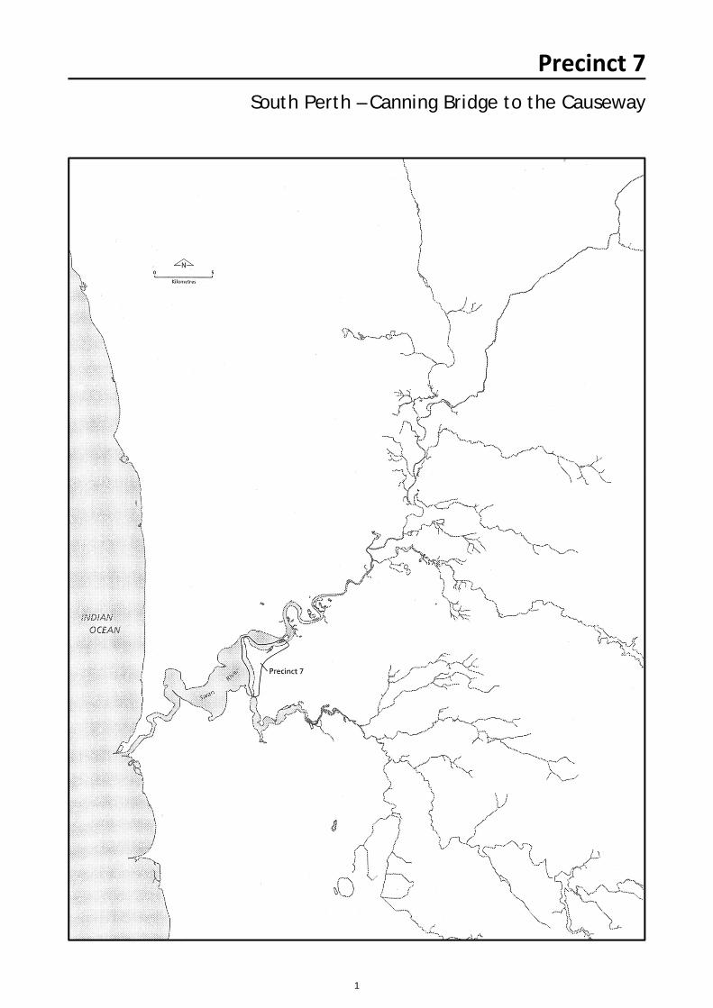
Precinct 7South Perth – Canning Bridge to the Causeway
2
Summary
The precinct is the southern foreshore of Perth Water and the easternside of Melville Water, between the Causeway and Canning Bridge. TheComo section of Melville Water is a long linear north-south orientated sandy beach. The construction of the Kwinana Freeway has reduced theonce wide sandy beaches to narrow beaches with several limestone groinsto reduce sand movement.
The Milyu Reserve is a narrow belt of natural vegetation which is
an important nature reserve for the flora and fauna of the area.
The rest of the Como foreshore is grassed and has other exotic
species present. There is also a heavily used dual use path along
the foreshore.
The Swan River forms a visually enclosed basin at Perth Water.
The southern foreshore has been reclaimed using sediment from
the channel and landfill. This is protected from erosion by the
limestone retaining wall which has been constructed along the
South Perth foreshore except for the small sandy and shelly
beach west of the Coode Street Jetty. The South Perth foreshore
has reticulated lawn and gardens. There are few trees adjacent
to the South Perth Esplanade and there are a number of rose
beds. Sir Mitchell Park has been extensively re-landscaped to
incorporate the original paperbark swamps and the open playing
ground areas. There are several man- made lakes and various
facilities to encourage several recreational pursuits. The area
adjacent to the foreshore reserve is high density housing with
several multistorey townhouses and units dominating the
landscape. The overall appearance of the river landscape in this
precinct is of an ordered and controlled environment. This is due
to the maintained lawn and gardens, the retaining wall separating
the water and land and the neat residential areas.
Perth Water – Perth City Foreshore
3
Resource Information
Biophysical Processes Geological Processes The geological formations of the South Perth Precinct are made
up of Quaternary deposits of partly lithified or unconsolidated
sediments which are related to erosion and deposition processes
during the Pleistocene and Holocene (SRT, 1994).
The major part of the South Perth precinct is made up of the
sandy plains which have peaty pozols in the swampy areas
known as the Bassendean Soil Unit (McArthur and Bettenay,
1974). The South Perth peninsula is made up of the aeolian
deposits of the Karrakatta Soil unit (deep yellow sands over
limestone). The marine deposits of the Vasse unit consisting of
mixed layers of recent estuarine deposits are present along the
southern Perth Water foreshore. The early settlers found the soil
excessively drained deep yellow sands, except for the northern
shore where the land was sandy loam.
Topography South Perth is part of the Bassendean Dune System which
consists of a series of low hills (Balla, 1994). Apart from the
central hill, the land in South Perth is below 15 metres ADH and
was originally subject to frequent flooding. The present day
foreshore topography is between 2 and 4 metres AHD, however
this would have been much lower before reclamation took place.
The foreshore now is a relatively flat platform which is only
broken by the rise of 'Yellow Hill' adjacent to Parker Street.
Hydrological Processes Water features The water foreshore was reclaimed in 1939 at Millars Pool and
again in 1966 which extended the foreshore 50 metres into the
river. Further foreshore changes were made with the
construction of the Narrows Bridge and Kwinana Freeway, which
involved realigning the Melville Water foreshore and removing 60
metres off Point Belches. There are three artificial lakes located
on the eastern side of Sir James Mitchell Park. These receive
drain water which is drained into the river and also used for
reticulating the park. Originally, there were several freshwater
springs in the area, however these have since dried up.
Bathymetry
The river bed is rocky and stable and varies in depth between 0.6
and 1.5 metres. There are two banks of shallow clayey mud flats
which stretch in two north- south orientated bars in the Perth
Water. The South Perth section of the channel originally had a
large shelly fossil bed, which was excavated by the Public Works
Department for reclamation at Coode Street. The section of
Melville Water adjacent to Royal Perth Golf Course has a large
sandy bank which is often exposed in low tide conditions.
There are several navigation channels which range between 1
and 1.5 metres below low water mark. The river foreshore
contains several underground aquifers up to 1000 metres deep
which are refilled by rainwater, although extensive bore
construction has reduced the amount of low salinity water in
these formations.
Below the Causeway the river is estuarine in character. The
physio-chemical composition of the river is dependent on the
high winter rainfall received in the catchment. The water in the
deeper basins, such as Melville Water, is more saline than the
overlying water. In the shallower Perth Water, the stratification is
less pronounced due to the wind driven water agitation.
Hydrological change also varies due to tidal influence which
varies between 0.15 and 1 metre AHD (SRT, 1994).
Flooding In 1862, there was severe flooding of the South Perth river flats
and these floods caused Millars Pool to become filled with
sediment. In 1929, Perth had received an unusual sequence of
high westerly winds and very heavy rains in the hinterlands. The
flood waters inundated all of Mill Point and the South Perth
Esplanade and all the Chinese market gardens adjacent to Mill
Point Road. Flooding has been reduced by reclaiming the low
lying land and retaining the land with limestone walls.
Erosion and accretion The degree of erosion along the South Perth foreshore has been
markedly reduced by the limestone retaining wall which has been
constructed along most of the foreshore. There is little erosion
along the shelly banks of the unwalled foreshore near Coode
Street. At Milyu there is offshore deposition and erosion of fluvial
sediments on the mud banks. Como beach is more dramatically
affected by erosive processes since the construction of the
freeway which has built upon the sediment which would have
been removed and redeposited by wave action.
4
Precinct 7 – South Perth – Canning Bridge to the Causeway
Vegetation Communities Native Vasse Complex The flora of the Vasse Complex would have been the original
vegetation at Point Belches and along a narrow line east of the
Coode Street Jetty (DCE, 1980). It consisted of a mixture of
closed melaleuca scrub to a fringing woodland of flooded gum
(Eucalyptus rudis) and melaleuca species. It would have also
included an open forest of tuart (Eucalyptus gomphocephala),
jarrah (Eucalyptus marginata) and marri (Eucalyptus calophylla)
on the higher land. The wetlands would have originally supported
swamp paperbark (Melaleuca rhaphiophylla), moonah
(Melaleuca preissiana) and saltwater paperbark (Melaleuca
cuticularis), swamp sheoak (Casuarina obesa), Christmas tree
(Nuytsia floribunda), robin redbreast bush (Melaleuca lateritia)
and coojong (Acacia saligna).
Karrakatta Complex A small section of Point Belches originally supported the flora
identified as being the Karrakatta Complex. This complex is
predominantly tuart (Eucalyptus gomphocephala), jarrah
(Eucalyptus marginata) and marri (Eucalyptus calophylla). The
understorey consisted of slender banksia (Banksia attenuata),
firewood banksia (Banksia menziessii) and bull banksia (Banksia
grandis). In addition, sheoak (Allocasuarina fraseriana) and
peppermint (Agonis flexuosa) are found.
Bassendean Complex The indigenous flora of this precinct is classified as being part of
the Bassendean Complex.
The vegetation ranges from woodland of jarrah (Eucalyptus
marginata), sheoak (Allocasuarina fraseriana), and various
banksia species (Banksia species) to sedge lands on the moister
and lower sites.
Sir Charles Fraser, botanist on the 1927 Stirling exploratory
party, described Point Belches as having banksias, eucalypts
and the shrubs consisted of a 'beautiful Isopogon, a species of
Acacia and a Jacksonia with crimson flowers'. Early residents of
South Perth recall that there were abundant swanberries
(Rhadodia baccata), a native berry which was very sweet and
popular with both with locals and goannas. They also recall that
between Mends Street and the Causeway there was a belt of
rivergum (Eucalyptus rudis), salt sheoak (Casuarina obesa),
paperbark (Melaleuca sp), reeds and rushes (Gothard, 1988).
The hinterland was described as undulating with jarrah
(Eucalyptus marginata) and banksia (Banksia sp) (Crowley,
1962).
The man-made lakes have some fringing rushes (Typha and
Baumea). North of Canning Bridge there are several reeds
(Juncus species) and salt sheoak (Casuarina obesa) which are
not in good condition. There are also summer scented wattle
(Acacia rostellifera) and several eucalyptus trees adjacent to
Kwinana Freeway. At Milyu, there are rushes (Juncus kraussii)
and paperbarks (Melaleuca species) but unfortunately several
weed species.
Exotic The foreshore along Sir James Mitchell Park, Point Belches and
Mc Callum park are maintained lawn of couch (*Cynodon
dactylon) and kikuyu (*Pennisetum clandestinum). The man
made lakes have large willows (*Salix babylonica) and cotton
palms (*Washingtonia sp) on the islands which are the result of
incorporating historically planted species into new landscape
plans. Giant reed (*Arundo donax), and pine seedlings
(*Aracuccaria sp) are prominent exotics along the Kwinana
Freeway. Como Beach has flame trees (*Brachychiton
acerifolius), dandelion (*Taraxacum offininale), poplars
(*Condonocarpus continifolis), buffalo (*Stenotaphrum
secundatum) and couch (*Cynodon dactylon). At Milyu Reserve
there is pigface (*Carpobrotus aquilaterus), wild oats (*Avena
fatua) and beaded oats (Avena barbarta), cats tail (*Lagurus
ovatus) and couch (*Cynodon dactylon). North of Canning
Bridge, Geraldton wax (*Chamelacium uncinatum) and pencil
pines (*Cupressus sp) have been planted.
Historical Land use & Resulting Environmental Changes The area was. first sighted by the Dutch explorer Willem de
Vlamingh in 1697. In 1801, the French exploratory party lead by
Francois Heirisson was stranded at the muddy flats now known
as the Causeway and the islands were named 'Iles Heirisson'.
Stirling's exploratory party mapped the Swan and named Point
Belches after Peter Belches, 3rd Lieut. of H.M.S. Success.
The early colony was planned from 1829 and the South Perth
peninsula was identified for suburban extension of Perth. In the
early years there was little need for a suburb of Perth and as a
consequence the area was quite slow to grow due to its
inaccessibility and land which was unsuitable for productive
agriculture. However the rich and risk taking investor William
Peel laid claim to the whole area using his and a number of other
people's entire fortunes. Peel planned to initiate a massive land
settlement the peninsula and it was agreed that the scheme must
be successful before 1 November 1829 after which the land
would be allocated to other settlers. His scheme fell through and
Peel was allocated land near the present day Peel Inlet at
Mandurah.
5
Precinct 7 – South Perth – Canning Bridge to the Causeway
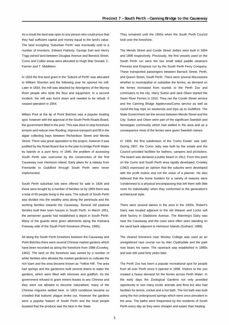
As a result the land was open to any person who could prove that
they had sufficient capital and money equal to the land's value.
The land excepting 'Suburban Perth' was eventually sold to a
number of investors. Edward Flaherty, George Earl and Henry
Trigg owned land between Douglas Avenue and Berwick Street.
Como and Collier areas were allocated to Hugh Mac Donald, C.
Farmer and T. Middleton.
In 1833 the first land grant in the 'Suburb of Perth' was allocated
to William Shenton and the following year he opened his mill.
Later in 1834, the mill was attacked by Aborigines of the Murray
River people who stole the flour and equipment. In a second
incident, the mill was burnt down and needed to be rebuilt. It
ceased operation in 1854.
Millars Pool at the tip of Point Belches was a popular boating
spot, however with the approval of the South Perth Roads Board,
the government filled in the pool. This was done to stop foreshore
erosion and reduce river flooding, improve transport and fill in the
algae collecting bays between Richardson Street and Mends
Street. There was great opposition to the project, however it was
justified by the Road Board due to the plan to bridge Perth Water
by islands or a punt ferry. In 1840, the problem of accessing
South Perth was overcome by the construction of the first
Causeway over Heirisson Island. Early plans for a railway from
Fremantle to Guildford through South Perth were never
implemented.
South Perth suburban lots were offered for sale in 1834 and
these were bought by a number of families so by 1859 there was
a total of 65 people living in the area. The suburb of South Perth
was divided into the wealthy area along the peninsula and the
working families towards the Causeway. Several old pastoral
families built their town houses in South Perth. In March 1851,
the pensioner guards had established a depot in South Perth.
Many of the guards were given allotments along the Kwinana
Freeway side of the South Perth foreshore (Florey, 1995).
All along the South Perth foreshore between the Causeway and
Point Belches there were several Chinese market gardens which
have been recorded as along the foreshore from 1888 (Crowley,
1962). The land on the foreshore was owned by a number of
white families who allowed the market gardeners to cultivate the
rich loam and the area became known as 'Yellow Hill'. The area
had springs and the gardeners built several drains to water the
gardens, which were filled with minnows and goldfish. As the
government refused to grant miners leases to any Chinese and
they were not allowed to become naturalised, many of the
Chinese migrants settled here. In 1903 conditions became so
crowded that bubonic plague broke out. However the gardens
were a popular feature of South Perth and the local people
boasted that the produce was the best in the State.
They remained until the 1950s when the South Perth Council
took over the foreshore.
The Mends Street and Coode Street Jetties were built in 1894
and 1896 respectively. Previously, the first vessels used on the
South Perth run were the two small sided paddle steamers
Princess and Empress run by the South Perth Ferry Company.
These transported passengers between Barrack Street, Perth,
and Queen Street, South Perth. There were several discussions
whether to municipalise or subsidise the ferries, as demand on
the ferries increased from tourists to the Perth Zoo and
commuters to the city. Harry Sutton and Jack Olsen started the
Swan River Ferries in 1910. They ran the Coode Street service
and the Canning Bridge Applecross/Como service as well as
round-the-bay trips on weekends and trips up to Guildford. The
State Government ran the service between Mends Street and the
City. Sutton and Olsen were part of the significant Swedish and
Norwegian community which had settled in the area and as a
consequence most of the ferries were given Swedish names.
In' 1905, the first subdivision of the 'Como Estate' was sold.
During 1907, the Como Jetty was built by the estate and the
Council provided facilities for bathers, campers and picnickers.
The beach was declared a public beach in 1911. From this point
on the Como and South Perth area rapidly developed. Crowley
(1962) expressed an opinion that the suburbs were developed
with the profit motive and not the vision of a planner. He also
believed that the home builders for a variety of reasons were
'condemned to a physical encompassing that left them with little
room for individuality' when they conformed to the generation's
architectural style.
There were several dairies in the area in the 1930s. Robert's
Dairy was located adjacent to the old Weaver and Locks soft
drink factory in Gladstone Avenue. The Manning's Dairy was
near the Causeway and the cows were often seen standing on
the sand bank adjacent to Heirisson Islands (Gothard, 1988).
The cleared foreshore near Wesley College was used as an
unregistered race course run by Alec Clydesdale and the park
now bears his name. The racetrack was established in 1890s
and was still used forty years later.
The Perth Zoo has been a popular recreational spot for people
from all over Perth since it opened in 1898. Visitors to the zoo
created a heavy demand for the ferries across Perth Water. In
the early days the Zoological Gardens not only provided
opportunity to see many exotic animals and flora but also had
facilities for tennis, cricket and a hot bath. The hot bath was built
using the hot underground springs which were once prevalent in
the area. The baths were frequented by the residents of South
Perth every day as they were cheaper and easier than heating
6
Precinct 7 – South Perth – Canning Bridge to the Causeway
hot water for a bath at home. The Richardson family lived
adjacent to the parkland now named after their father. Constable
Richardson was the local policeman and later the gate keeper for
the Perth Zoo. Several of the palms which are present from
Coode Street to Como were planted using seed from the
Zoological Gardens in the 1930s (City of South Perth, 1996).
In 1922 the tram service reached the district and ran until 1952.
The trams served to link the ferry ports to the growing suburbs
and the demand for crossing the river dramatically increased.
From 1901 plans were drawn up for a bridge across the Narrows,
however these plans were abandoned. In 1954 the Hawke
Government made a decision to construct a traffic bridge across
the Narrows water. The plan involved taking 60 metres off the
Point Belches foreshore and reclaiming a significant part of Perth
Water. Maunsell and Partners were the engineers who were
given the requirement that the bridge should be 'of good
appearance worthy of its beautiful setting'. The pre-cast,
pre-stressed, concrete bridge was opened in 1959 as 'The
Narrows Bridge'. The Kwinana Freeway was built on the Melville
Water foreshore which substantially reduced the wide sandy
beach at Como and the remaining swampy beaches at Milyu.
The South Perth and Como areas were dramatically changed by
the freeway. It was decided that it was better to build the freeway
along the foreshore rather than running the freeway through the
suburbs which would cut the suburbs in half and be a more costly
project. The 1960s proved to be a time of dramatic population
boom in the municipality and the first high rise development,
'Darley Heights', was constructed in 1967. This was the first of
many multi storey apartments and subdivided blocks which have
become characteristic of the inner-city suburb of South Perth.
Infilling of the South Perth foreshore has occurred since the
1930s. Most infilling occurred around Pt Belches, Melville Parade
and Coode St Jetty. During the 1950s a section of Perth Water
was excavated by the Public Works Department for reclamation
at Coode Street. Between 1959 and 1969 the foreshore area
adjacent to Swan View Terrace was used as a domestic rubbish
tip. The area reclaimed was 32 hectares and reached to a depth
of approximately 2 and a half metres (Riggert, 1978). This was
levelled and use as a golf practice driving range up until the late
1980s when the land was re-landscaped into artificial lakes and a
general recreational area.
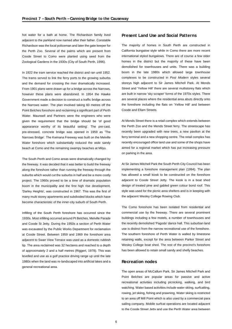
Present Land Use and Social Patterns The majority of homes in South Perth are constructed in
California bungalow style while in Como there are more recent
international styled bungalows. There are of course a few older
homes in the district but the majority of these have been
demolished for townhouses and units. There was a building
boom in the late 1980s which allowed large townhouse
complexes to be constructed in Post Modern styles several
storeys high adjacent to Sir James Mitchell Park. At Mends
Street and 'Yellow Hill' there are several multistorey flats which
are built in narrow 'sky scraper' forms of the 1970s styles. There
are several places where the residential area abuts directly onto
the foreshore including the flats on 'Yellow Hill' and between
Coode and Ellam Streets.
At Mends Street there is a retail complex which extends between
the Perth Zoo and the Mends Street ferry. The streetscape has
recently been upgraded with new trees, a new pavilion at the
ferry terminal and a new shopping centre. The retail complex has
recently encouraged office land use and some of the shops have
aimed for a regional market which has put increasing pressure
on parking in the area.
At Sir James Mitchell Park the South Perth City Council has been
implementing a foreshore management plan (1994). The plan
has allowed a small kiosk to be constructed on the foreshore
adjacent to Coode Street Jetty. The kiosk is in a boat shed
design of treated pine and gabled green colour bond roof. This
style was used for the picnic area shelters and is in keeping with
the adjacent Wesley College Rowing Club.
The Como foreshore has been isolated from residential and
commercial use by the freeway. There are several prominent
buildings including a few motels, a number of townhouses and
the recently demolished 'Pagoda' dance hall. This suburban land
use is distinct from the narrow recreational use of the foreshore.
The southern foreshore of Perth Water is walled by limestone
retaining walls, except for the area between Parker Street and
Wesley College boat shed. The rest of the precinct's foreshore
has been allowed to retain small sandy and shelly beaches.
Recreation nodes The open areas of McCallum Park, Sir James Mitchell Park and
Point Belches are popular areas for passive and active
recreational activities including picnicking, walking, and bird
watching. Water based activities include water skiing, surfcatting,
rowing, jet skiing, fishing and prawning. Water skiing is restricted
to an area off Mill Point which is also used by a commercial para
sailing company. Mobile surfcat operations are located adjacent
to the Coode Street Jetty and use the Perth Water area between
7
8
Precinct 7 – South Perth – Canning Bridge to the Causeway
the ferry channel and up to Hurlingham Road. The Wesley
College rowing shed is located on the Coode St foreshore
adjacent to a boat ramp. A new restaurant has been built at the
Coode Street Jetty. At Como Jetty, the beach is suitable for
swimming and there is a small picnic area adjacent to the jetty.
The area is also a popular fishing spot with local people and a
good prawning spot in summer. Due to the relative inaccessibility
and high noise level the number of beach users is very small
considering with how popular the beach was historically.
Every Australia Day weekend the South Perth Foreshore is an
important viewing point for thousands of people to view the
fireworks show. For many of the locals this is a controversial
activity, as the foreshore is inundated by many people and the
result is an expensive clean up operation every year.
Royal Perth Golf Course was granted its lease along Labouchere
Road in 1907. It is a private course, with the highly manicured
lawns and trees restricted to members only. The adjacent
Richardson Park is used by local sporting clubs throughout the
year.
Other foreshore recreational spots include Milyu Nature
Reserve, McCallum Park and Clydesdale Park.
Public access There is a dual use path all along the foreshore between the
Causeway and the Canning Bridge. There are four pedestrian
overpasses across the Kwinana Freeway to enable access to
Milyu and Como Beaches. The bike paths are heavily used by
cyclists who commute to the city for work. Access is severely
limited by the Kwinana Freeway which discourages visitors to the
area due to the heavy traffic and associated high noise levels
generated so close to the foreshore.
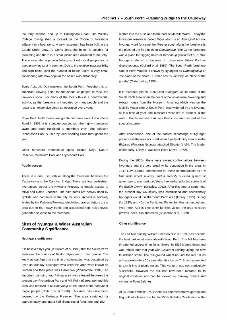
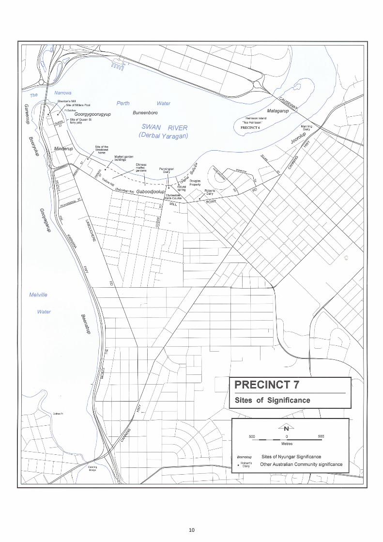
Sites of Nyungar & Wider Australian Community Significance Nyungar significance It is believed by Lyon (in Collard et al, 1996) that the South Perth
area was the country of Beeloo Nyungars or river people. The
key Nyungar figure at the time of colonisation was described by
Lyon as Munday. Nyungars who used this area were known as
Gareen and their place was Gareenup (Vinnicombe, 1989). An
important camping and fishing area was situated between the
present day Richardson Park and Mill Point (Gareenup) and this
area was referred to as Booryulup or the place of the booryul or
magic people (Collard et al, 1996). This area has since been
covered by the Kwinana Freeway. The area stretched for
approximately one and a half kilometres of foreshore and 150
metres into the bushland to the east of Melville Water. Today the
foreshore reserve is called Milyu which is an Aboriginal but not
Nyungar word for samphire. Further south along the foreshore is
the place of the frog holes or Gooyagarup. The Como foreshore
was a place for digging holes or Beenabup (Collard et al, 1996).
Nyungars referred to the area of rushes near Millars Pool as
Goorgygoogup (Collard et al, 1996). The South Perth foreshore
side of Perth Waters is known by Nyungars as Gaboodjoolup or
'the place of the shore'. Further east is Joorolup or 'place of the
jarrahs' (Collard et al, 1996).
It is recorded (Bates, 1992) that Nyungars would camp in the
South Perth area when the beere or banksias were flowering and
extract honey from the blossom. A spring which was on the
Melville Water side of South Perth was widened by the Nyungar
at this time of year and blossoms were left to ferment in the
water. The fermented drink was then consumed as part of this
special occasion.
After colonisation, one of the earliest recordings of Nyungar
presence in the area occurred when a party of thirty men from the
Bidjareb (Pinjarra) Nyungar attacked Shenton's Mill. The leader
of the party, Gcalyut, was later jailed (Joynt, 1972).
During the 1850s, there were violent confrontations between
Nyungars and the very small white population in the area. In
1847 E.W. Landor commented on these confrontations as : 'a
little well- timed severity, and a steadily pursued system of
government, soon reduced them into well-conducted subjects of
the British Crown' (Crowley, 1962). After this time, a camp near
the present day Causeway was established and occasionally
Nyungars would use the South Perth area (Florey, 1995). During
the 1930s and 40s the Parfitt and Pickett families, among others,
lived here. At this time other families visited the area to catch
prawns, bees, fish and crabs (O'Connor et al, 1989).
Other significance
The Old Mill built by William Shenton first in 1833, has become
the landmark most associate with South Perth. The Mill has been
threatened several times in its history. In 1835 it burnt down and
was rebuilt later that year with Governor Stirling laying the new
foundation stone. The mill ground wheat up until the late 1850s
and approximately 30 years after its closure T. Brown attempted
to turn it into a picnic resort. This venture was not particularly
successful. However the mill has now been restored to its
original condition and can be viewed by freeway drivers and
visitors to Point Belches.
At Sir James Mitchell Park there is a commemorative garden and
flag pole which was built for the 150th Birthday Celebration of the
9
Precinct 7 – South Perth – Canning Bridge to the Causeway
State in 1979. The park was only named after Sir James Mitchell
in 1950 when it was decided by the South Perth Road Board to
use the area for sporting groups.
10
11
Landscape Description
Conservation areas The Perth Zoo is vested in the National Parks and Nature
Conservation Authority and listed on the Register of Heritage
Places.
Wetlands The Swan Estuary Marine Park Management Plan has been
prepared by CALM and Department of Environmental Protection
for the Milyu Reserve.
System 6
M60 Aquatic Reserve, South Perth
It was recommended that the tidal flats immediately to the west of
the Kwinana Freeway, South Perth be incorporated into a
management plan. The vegetation consists of sedgeland and
reeds. The area is one of the only three significant wading bird
habitats remaining on the Swan River. These are an important
feeding and resting ground for trans-equatorial migratory birds.
The reserve is now being incorporated to the Swan Estuary
Marine Park and adjacent CALM Reserves Draft Management
Plan (1995).
12
Precinct 7 – South Perth – Canning Bridge to the Causeway
Precinct Description Waterform The southern section of Perth Water is a wide basin which bends
around Point Belches to a gently concave shaped bay. The water
surface is always a pleasing landscape feature in this section of
the river as the enclosed form is subject to prevailing weather
conditions which are reflected in water surface condition. The
water body narrows with a gently convex point adjacent to the
Hurlingham Street, and the river is divided into two by Heirisson
Island. In contrast to the gently curved foreshore at South Perth,
Melville Water has a eastern foreshore which is a straight
north-south orientated beach. The water body is subject to strong
prevailing winds and the viewer is presented with the wide basin
that stretches between Crawley, Kings Park and Applecross.
Natural riparian zone The Como foreshore is a narrow white sandy beach which has
been dramatically reduced in width since the construction of the
freeway. Much of the beach backs onto grassed banks or a small
limestone retaining wall. There is a sandy bank adjacent to the
Royal Perth Golf Course which is often exposed at low tide. This
feature connects to the fringing vegetation at Milyu Reserve.
Along Como the beach is quite steep and narrow compared with
the wide gently sloped beaches shown in photos previous to the
Freeway construction. The only unwalled foreshore at South
Perth is west of the Coode Street Jetty. This is a narrow sandy
beach with large oyster shells a significant part of the sediment
material. The high tide water action has created a small cut into
the shelly bank which is held in place with kikuyu grass.
Landform The South Perth precinct forms a gently undulating plain. The
edge of the central hill fronts onto the South Perth Foreshore, an
area referred to as 'Yellow Hill'. This has a comparatively steep
embankment in contrast with the flat platform like foreshore. This
flat plain is partly the result of many infilling projects along the
river. The foreshore area is saved from a monotonous
morphology by the artificial lakes and tree planting in the area.
Vegetation The foreshore vegetation is predominantly exotic species, but a
few enclaves of native flora exist. The Milyu Reserve has narrow
band of native species including several young Sheoaks which
have dark green wispy forms which rise above the low uniform
height of the bushes. The reeds are also long needle like forms
which extend into the shallow water. Adjacent to this enclave are
four very tall cotton palms which are somewhat out of place and
have no association with any understorey or river feature.
As individuals they are quite impressive, however the adjacent
freeway light poles and overpass detract from their attractive
linear form.
The Como Jetty area has several flame trees which provide the
seasonally bright colours of deciduous plant and several bushes
are planted around the foreshore toilet block. The lawn is well
maintained and reaches down to the high water mark, however
the narrowness of the reserve has limited the planting of more
trees and shrubs.
At the South Perth peninsula there are several formal rose beds
and well maintained lawn to the limestone retaining wall. The
Mends Street jetty has several mature plane trees and small
cotton palms which have been planted in a formal pattern and the
lawn is well maintained. The South Perth foreshore near 'Yellow
Hill' has a few stands of mature paperbarks. These have
substantial amounts of kikuyu grass beneath them which is
unfortunate as the trees themselves are very attractive. The
South Perth City Council has embarked on landscaping the area
with native species and has successfully used the vegetation to
minimise the impact of the car parks and buildings. The dual use
path user also experiences the contrast between walking through
planted native gardens and open grass areas. The man made
lakes have native riparian vegetation, as well as several cotton
palms and flame trees. The plants are spaced in a 'parkland'
manner. Several date palms are present along the Hurlingham
Road foreshore area. These are fine individuals and it would be
of benefit to plant more palms or other tall trees to make a feature
of trees along this point. McCallum Park has several mature
exotic trees and the area has been completely transformed into
parkland.
Riparian land use The Como Sea Scouts are the only remaining club on the Como
foreshore. They have a small clubhouse which is surrounded by
bushes and is fairly inconspicuous. The area once supported the
South of Perth Yacht Club and Como Baths. The Como Jetty has
recently been upgraded and the Council has provided public
toilets, picnic tables and play equipment. However the recreation
node is fairly narrow and only metres away from the freeway, the
two areas separated by a cyclone wire fence. There are several
limestone groynes which have been built to reduce sediment
transport around the South Perth peninsula. The result is the
classic beach build up on one side of the groyne and little
sediment at the other end. These white sandy crescents are a
prominent feature from Kings Park, while to the South Perth
foreshore user the shape of the beach is a less dominant feature.
13
Precinct 7 – South Perth – Canning Bridge to the Causeway
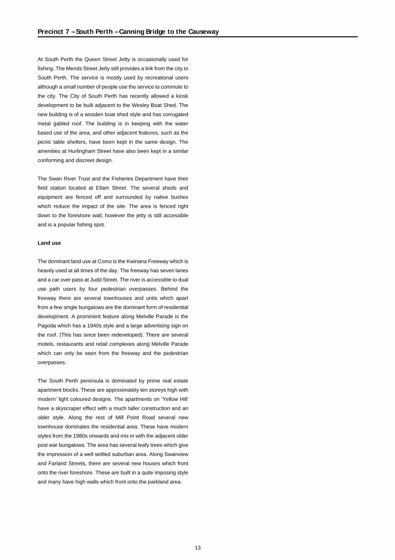
At South Perth the Queen Street Jetty is occasionally used for
fishing. The Mends Street Jetty still provides a link from the city to
South Perth. The service is mostly used by recreational users
although a small number of people use the service to commute to
the city. The City of South Perth has recently allowed a kiosk
development to be built adjacent to the Wesley Boat Shed. The
new building is of a wooden boat shed style and has corrugated
metal gabled roof. The building is in keeping with the water
based use of the area, and other adjacent features, such as the
picnic table shelters, have been kept in the same design. The
amenities at Hurlingham Street have also been kept in a similar
conforming and discreet design.
The Swan River Trust and the Fisheries Department have their
field station located at Ellam Street. The several sheds and
equipment are fenced off and surrounded by native bushes
which reduce the impact of the site. The area is fenced right
down to the foreshore wall; however the jetty is still accessible
and is a popular fishing spot.
Land use The dominant land use at Como is the Kwinana Freeway which is
heavily used at all times of the day. The freeway has seven lanes
and a car over pass at Judd Street. The river is accessible to dual
use path users by four pedestrian overpasses. Behind the
freeway there are several townhouses and units which apart
from a few single bungalows are the dominant form of residential
development. A prominent feature along Melville Parade is the
Pagoda which has a 1940s style and a large advertising sign on
the roof. (This has since been redeveloped). There are several
motels, restaurants and retail complexes along Melville Parade
which can only be seen from the freeway and the pedestrian
overpasses.
The South Perth peninsula is dominated by prime real estate
apartment blocks. These are approximately ten storeys high with
modern' light coloured designs. The apartments on 'Yellow Hill'
have a skyscraper effect with a much taller construction and an
older style. Along the rest of Mill Point Road several new
townhouse dominates the residential area. These have modern
styles from the 1980s onwards and mix in with the adjacent older
post war bungalows. The area has several leafy trees which give
the impression of a well settled suburban area. Along Swanview
and Farland Streets, there are several new houses which front
onto the river foreshore. These are built in a quite imposing style
and many have high walls which front onto the parkland area.
14
Landscape Interpretation
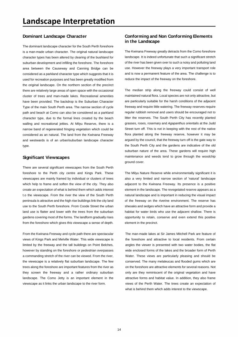
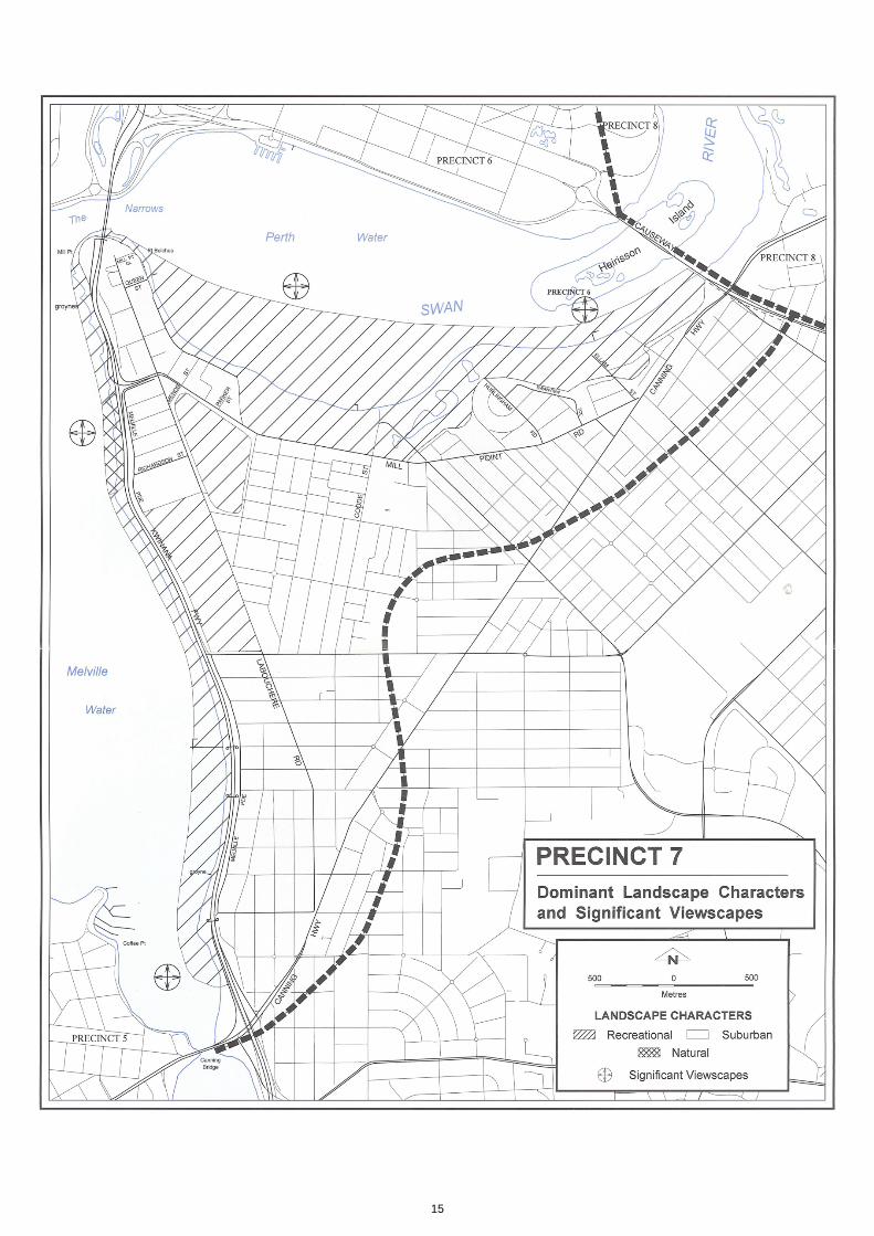
Dominant Landscape Character The dominant landscape character for the South Perth foreshore
is a man-made urban character. The original natural landscape
character types has been altered by clearing of the bushland for
suburban development and infilling the foreshore. The foreshore
area between the Causeway and Canning Bridge can be
considered as a parkland character type which suggests that it is
used for recreation purposes and has been greatly modified from
the original landscape. On the northern section of the precinct
there are relatively large areas of open space with the occasional
cluster of trees and man-made lakes. Recreational amenities
have been provided. The backdrop is the Suburban Character
Type of the main South Perth area. The narrow section of cycle
path and beach at Como can also be considered as a parkland
character type, due to the formal lines created by the beach
walling and recreational jetties. At Milyu Reserve, there is a
narrow band of regenerated fringing vegetation which could be
considered as an natural. The land from the Kwinana Freeway
and westwards is of an urban/suburban landscape character
type.
Significant Viewscapes There are several significant viewscapes from the South Perth
foreshore to the Perth city centre and Kings Park. These
viewscapes are mainly framed by individual or clusters of trees
which help to frame and soften the view of the city. They also
create an expectation of what is behind them which adds interest
t.o the viewscape. From the river the view of the South Perth
peninsula is attractive and the high rise buildings link the city land
use to the South Perth foreshore. From Coode Street the urban
land use is flatter and lower with the trees from the suburban
gardens covering most of the forms. The landform gradually rises
from the foreshore which gives this viewscape a sense of depth.
From the Kwinana Freeway and cycle path there are spectacular
views of Kings Park and Melville Water. This wide viewscape is
limited by the freeway and the tall buildings on Point Belches,
however by standing on the foreshore or pedestrian overpasses
a commanding stretch of the river can be viewed. From the river,
the viewscape is a relatively flat suburban landscape. The few
trees along the foreshore are important features from the river as
they screen the freeway and a rather ordinary suburban
landscape. The Como Jetty is an important element in the
viewscape as it links the urban landscape to the river form.
Conforming and Non Conforming Elements in the Landscape The Kwinana Freeway greatly detracts from the Como foreshore
landscape. It is indeed unfortunate that such a significant stretch
of the river has been given over to such a noisy and polluting land
use. However the freeway plays a very important transport role
and is now a permanent feature of the area. The challenge is to
reduce the impact of the freeway on the foreshore.
The median strip along the freeway could consist of well
maintained natural flora. Local species are not only attractive, but
are particularly suitable for the harsh conditions of the adjacent
freeway and require little watering. The freeway reserves require
regular rubbish removal and users should be encouraged not to
litter the reserves. The South Perth City has recently planted
grasses, roses, rosemary and Agapanthus orientalis at the Judd
Street turn off. This is not in keeping with the rest of the native
flora planted along the freeway reserve, however it may be
argued by the council, that the freeway turn off is the gate way to
the South Perth City and the gardens are indicative of the old
suburban nature of the area. These gardens will require high
maintenance and weeds tend to grow through the woodchip
ground cover.
The Milyu Nature Reserve while environmentally significant it is
also a very limited and narrow section of 'natural' landscape
adjacent to the Kwinana Freeway. Its presence is a positive
element in the landscape. The revegetated reserve appears as a
natural landscape and is important in reducing the visual impact
of the freeway on the riverine environment. The reserve has
sheoaks and sedges which have an attractive form and provide a
habitat for water birds who use the adjacent shallow. There is
opportunity to retain, conserve and even extend this positive
element in the precinct.
The man-made lakes at Sir James Mitchell Park are feature of
the foreshore and attractive to local residents. From certain
angles the viewer is presented with two water bodies, the flat
wide enclosed forms of the lakes and the broader form of Perth
Water. These views are particularly pleasing and should be
conserved. The many melaleucas and flooded gums which are
on the foreshore are attractive elements for several reasons. Not
only are they reminiscent of the original vegetation and have
attractive forms and habitat value. In addition, they also frame
views of the Perth Water. The trees create an expectation of
what is behind them which adds interest to the viewscape.
15
16
Precinct 7 – South Perth – Canning Bridge to the Causeway
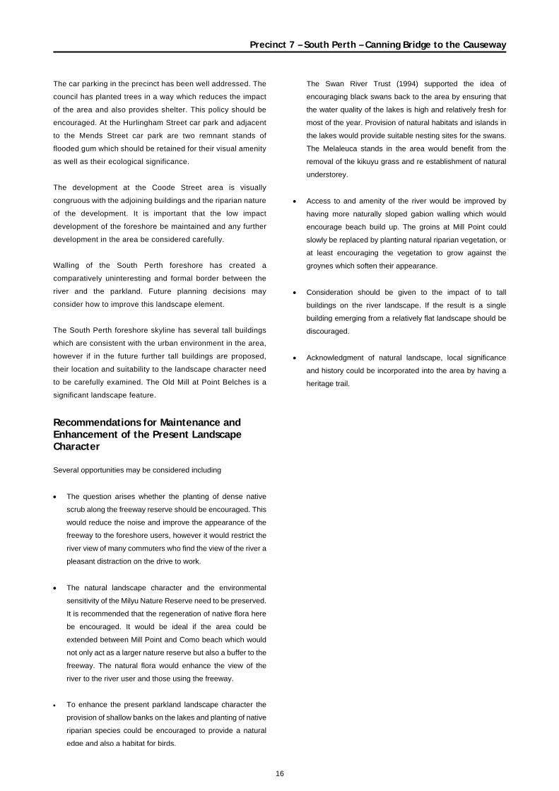
The car parking in the precinct has been well addressed. The
council has planted trees in a way which reduces the impact
of the area and also provides shelter. This policy should be
encouraged. At the Hurlingham Street car park and adjacent
to the Mends Street car park are two remnant stands of
flooded gum which should be retained for their visual amenity
as well as their ecological significance.
The development at the Coode Street area is visually
congruous with the adjoining buildings and the riparian nature
of the development. It is important that the low impact
development of the foreshore be maintained and any further
development in the area be considered carefully.
Walling of the South Perth foreshore has created a
comparatively uninteresting and formal border between the
river and the parkland. Future planning decisions may
consider how to improve this landscape element.
The South Perth foreshore skyline has several tall buildings
which are consistent with the urban environment in the area,
however if in the future further tall buildings are proposed,
their location and suitability to the landscape character need
to be carefully examined. The Old Mill at Point Belches is a
significant landscape feature.
Recommendations for Maintenance and Enhancement of the Present Landscape Character Several opportunities may be considered including
• The question arises whether the planting of dense native
scrub along the freeway reserve should be encouraged. This
would reduce the noise and improve the appearance of the
freeway to the foreshore users, however it would restrict the
river view of many commuters who find the view of the river a
pleasant distraction on the drive to work.
• The natural landscape character and the environmental
sensitivity of the Milyu Nature Reserve need to be preserved.
It is recommended that the regeneration of native flora here
be encouraged. It would be ideal if the area could be
extended between Mill Point and Como beach which would
not only act as a larger nature reserve but also a buffer to the
freeway. The natural flora would enhance the view of the
river to the river user and those using the freeway.
• To enhance the present parkland landscape character the
provision of shallow banks on the lakes and planting of native
riparian species could be encouraged to provide a natural
edge and also a habitat for birds.
The Swan River Trust (1994) supported the idea of
encouraging black swans back to the area by ensuring that
the water quality of the lakes is high and relatively fresh for
most of the year. Provision of natural habitats and islands in
the lakes would provide suitable nesting sites for the swans.
The Melaleuca stands in the area would benefit from the
removal of the kikuyu grass and re establishment of natural
understorey.
• Access to and amenity of the river would be improved by
having more naturally sloped gabion walling which would
encourage beach build up. The groins at Mill Point could
slowly be replaced by planting natural riparian vegetation, or
at least encouraging the vegetation to grow against the
groynes which soften their appearance.
• Consideration should be given to the impact of to tall
buildings on the river landscape. If the result is a single
building emerging from a relatively flat landscape should be
discouraged.
• Acknowledgment of natural landscape, local significance
and history could be incorporated into the area by having a
heritage trail.
17
Precinct Specific ReferencesCity of South Perth. 1996. South Perth Foreshore Draft Plan.
June 1996.
Crowley, F.K. 1962. The History of South Perth. Rigby. Florey, C. 1995. A Social History of South Perth. City of South
Perth.
Gothard, J. 1988. Across Perth Water: Reminiscences ofSouth Perth. Interview with residences of South Perth.
Government of Western Australia. Undated.
Freeway. Pamphlet.
Joynt. S. 1979. South Perth - The Capital's Suburb. A
community service provided by the South Perth City Council to
celebrate Western Australia's 150th Anniversary.
Main Roads Department. 1982. Kwinana Freeway Southern Extension. Official Opening Pamphlet.
Swan River Trust and City of South Perth. 1994. Draft SouthPerth Foreshore Management Plan. Swan River Trust Report
No 21.
18
Precinct 7 – South Perth – Canning Bridge to the Causeway
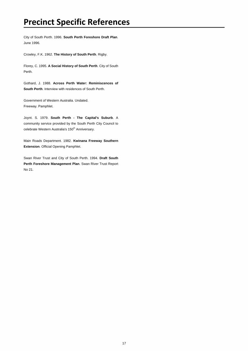
Mill Point from Kings Park, c1932.
Battye Library A4051
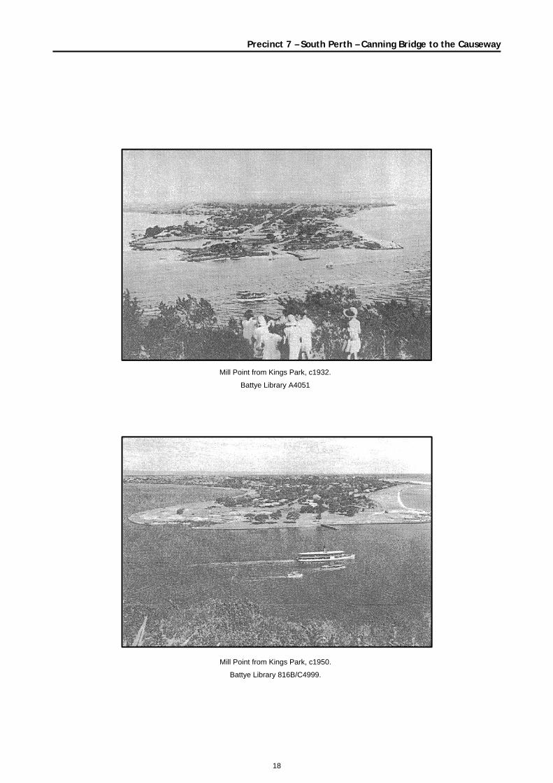
Mill Point from Kings Park, c1950.
Battye Library 816B/C4999.
19
Precinct 7 – South Perth – Canning Bridge to the Causeway
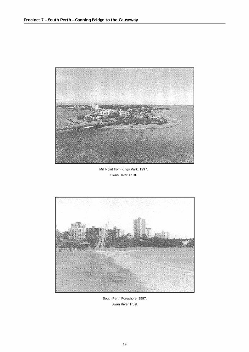
Mill Point from Kings Park, 1997.
Swan River Trust.
South Perth Foreshore, 1997.
Swan River Trust.