Embed Size (px)
Citation preview
Political Geography – Key Terms
• State – people, land, government, & sovereignty.
• Nation-state – politically organized area in which nation and state occupy the same space.
• Microstates – states with very small land areas.
• City-state – sovereign state that compromises a town and the surrounding countryside.
• Colony – territory that is legally tied to a sovereign state rather than being completely independent.
States
• Largest by land area – Russia, China, Canada, the US, Brazil, and Australia.
• Originated in Europe, but can be traced back to the Fertile Crescent.
• FC = arc b/w Persian Gulf and Mediterranean Sea.
• Mesopotamia – (present-day Iraq) centered in valley by Tigris and Euphrates.
• City-states = first to evolve in Mesopotamia.
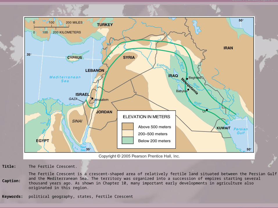
Title: The Fertile Crescent.
Caption:The Fertile Crescent is a crescent-shaped area of relatively fertile land situated between the Persian Gulf and the Mediterranean Sea. The territory was organized into a succession of empires starting several thousand years ago. As shown in Chapter 10, many important early developments in agriculture also originated in this region.
Keywords: political geography, states, Fertile Crescent
Modern State Idea• Peace of Westphalia – refers to the pair of
treaties, the Treaty of Osnabrück and the Treaty of Münster, signed on May 15 and October 24 of 1648 respectively, which ended both the Thirty Years' War and the Eighty Years' War.
• Provided a framework through which Spain, the Dutch United Provinces, France, and the Holy Roman Empire gained regional stability.
• Emerging political state was accompanied by mercantilism, which led to the accumulation of wealth through plunder, colonization, and the protection of home industries and foreign markets.
Colonialism
• Colonialism – the effort by one country to establish settlements and to impose its political, economic, and cultural principles on such territory.
• European states = colonialism• Three reasons for establishing
colonies:– Christianity– Resources– More land = more power
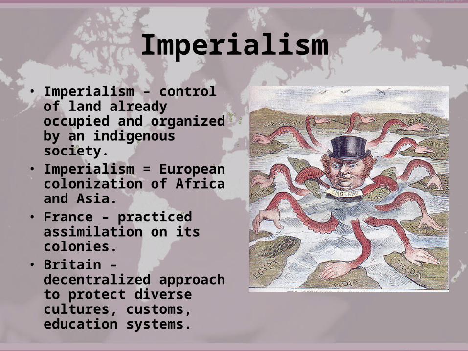
Imperialism• Imperialism – control
of land already occupied and organized by an indigenous society.
• Imperialism = European colonization of Africa and Asia.
• France – practiced assimilation on its colonies.
• Britain – decentralized approach to protect diverse cultures, customs, education systems.
Shapes of States
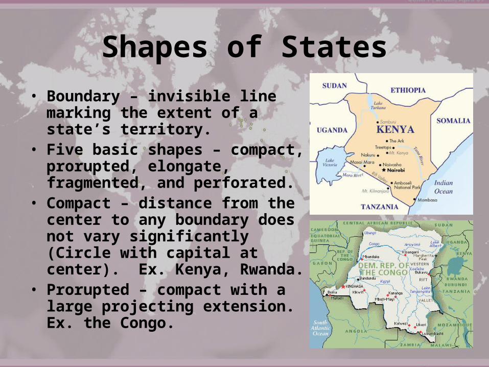
• Boundary – invisible line marking the extent of a state’s territory.
• Five basic shapes – compact, prorupted, elongate, fragmented, and perforated.
• Compact – distance from the center to any boundary does not vary significantly (Circle with capital at center). Ex. Kenya, Rwanda.
• Prorupted – compact with a large projecting extension. Ex. the Congo.
Shapes of States
• Elongated – states with a long and narrow shape. Might suffer from poor internal communications. Ex. Chile and Italy.
• Fragmented – several discontinuous pieces of territory. Two kinds: those with areas separated by water, and those separated by an intervening state.
• Indonesia – encompasses 13,677 islands across 3,000 miles in Indian Ocean.
• Perforated – state that completely surrounds another state. Example: South Africa.
• Lesotho must depend on SA for the import and export of goods.
Landlocked States
• Lacks a direct outlet to the sea because it is completely surrounded by several countries.
• Most common in Africa, where 14 of the continent’s 54 states have no direct ocean access.
• 20th century – European powers built railroads from mines to seaports. These railroads now run through independent states. Created new landlocked countries that have to cooperate with neighboring states that have seaports.

Title: Southern Africa.
Caption:
Burundi, Kenya, Rwanda, and Uganda are examples of compact states. Malawi and Mozambique are elongated states. Namibia and the Democratic Republic of Congo are prorupted states. Angola is a fragmented state. South Africa is a perforated state. The map also shows landlocked African states, which must import and export goods by land-based transportation, primarily rail lines, to reach ocean ports in cooperating neighbor states. Colors show the European colonial rulers in 1914.