Embed Size (px)
Citation preview

Polar Science
Educa t i ona l f i l e p roduced by t he I n t e r na t i ona l Po la r Founda t i on

INTERNAT IONAL POL AR FOUNDAT ION
p /�
THEORETICAL NOTE THE ImPORTANCE OF POLAR REsEARCH 3HIsTORy OF POLAR sCIENCE 3THE DIFFERENT TyPEs OF POLAR sCIENCEs 6
meteorology and the atmospheric sciences 6Glaciology (climatology) 7Geology and geophysics 8Oceanography 9Biology 9space-related science 10
TEACHING NOTEa. Developing a scientific attitude 1�b. Learning about the basics of scientific methodes 1�c. Discovering the unity and diversity of living things, objects, natural or technical phenomena 1�d. Looking at scientific issues for the purpose of teaching youngsters about being good world citizens and sustainable development 1�
PROPOsED ACTIvITIEs 13ExAmPLEs OF TEACHING/LEARNING sEqUENCEs 15
Glaciology and climatology (short sequence) 15Glaciology and climatology (long sequence) 17“Climatology / glaciology” sequence equipment 19
REsOURCEs 30Websites 30Bibliography 30Teaching resources 30
index

INTERNAT IONAL POL AR FOUNDAT ION
p /3
The imporTance of polar research
The sheer immensity of the Polar Regions might seem very different from our familiar world of towns and countryside. But these fro-zen wastelands are essential if our planet is to function properly. For one thing, they lock away vital information for understanding our climate’s recent history and how it is likely to develop in the future. The Polar Regions also fulfil an essential role in the world’s climate machinery, while at the same time being the most sensitive alarm system to climate change.In addition, they represent a highly fantastic and irreplaceable scientific laboratory. Largely spared the effects of direct human influence over the ages, this laboratory is incredibly well endowed, although it can be somewhat fragile.A whole spectrum of scientific disciplines is required if we are to make the most of what the poles can offer us in terms of under-standing the world we live in.
meteorology, oceanography, geophysics and atmospheric sci-ences. Explorers ventured further inland, making some aston-ishing discoveries. New findings about jet-streams prompted the World meteorological Organisation to launch the second
International Polar year (193�-1933). In addition to the many noteworthy scientific advances made, the new polar year saw the building of 114 observation stations in the Arctic and one in the interior of the Antarctic continent.
After a quieter period, polar research enjoyed a strong resur-gence with the International Geophysical year (1957-1958), which included the Third International Polar year. scientists ap-plied the technological advances made during the second World War to a variety of research areas, studying the outer atmosphere, icecaps, and continental drift. Forty-five research bases were set up in Antarctica (including Amundsen-scott, Dumont d’Urville and vostok). It was an occasion for polar science to demonstrate its importance in the understanding the system of the Earth and its history. This boom in polar science led to the signing of the Antarctic Treaty (1959).
hisTory of polar scienceThe history of polar research is linked closely with the history of exploration in the Polar Regions. Given the extreme conditions under which research is con-ducted there – and its cost – the history of polar research has been affected to a large extent by the International Polar years and the various forms of international cooperation that take place during them.
The 19th century was characterised to a significant extent by the search for new lands that could be “colonised”. At the same time, there were increasing numbers of scientific expedi-tions, which included mapping the new regions, discovering more about the flora and fauna, and recording meteorological and astronomical observations.
In the early days, scientific discoveries were mainly related to natural science, based on the observation of animal, botani-cal or geological specimens, or meteorological phenomena. James Clark Ross and William scoresby are two major figures from this period. Between them, they made the essential dis-coveries in the Arctic and Antarctic, discovering fossils, vol-canic rock, the magnetic North Pole, the Ross Ice shelf, mount Erebus (active volcano in Antarctica), and emperor penguins.
The second half of the 19th century saw the advent of the first wave of international cooperation on polar research as part of the First International Polar year (188�-1883). Governments and scientists came to the realisation that studying the Polar Regions could only be possible if they pooled their resources. Research stations were opened in the Arctic and two in the Antarctic. These bases made it possible to conduct planned simultaneous observations in the area of earth sciences (geo-physics) and also to carry out the first study of weather condi-tions in the Antarctic
Research in the Polar Regions intensified from the 1900s on-wards. It was the beginning of more specific research into
FRAM: the first ship designed for polar research
THeOReTiCAL nOTe

INTERNAT IONAL POL AR FOUNDAT ION
p /4
Over the past fifty years, using constantly evolving new technologies, polar science has enabled us to understand the environ-ments of the Arctic and Antarctic, as well as their history and their influence on the Earth’s current climate. most research is now conducted on a cross-national basis.
some key dates • 188� - 83 : First International Polar year• 1897 - 99 First international scientific expedition in Antarctica aboard the Belgica• 1910 - 13 Discovery of the Glossopteris fossil (fern) proving that Antarctica was once part of the Gondwana super-continent First readings taken in the outer atmosphere • 19�5 Beginning of oceanographic research into polar ocean currents • 19�6 - 6� First reports on the ecology of the Arctic • 193� - 33 second International Polar year• 1951 - 5� Discovery of polar depressions• 1957 - 58 International Geophysical year, incorporating the Third International Polar year• 1958 - 60 First theory on the importance of cold water in the circulation of the world’s oceans• 1960 Evidence of mountain ranges under the Antarctic ice • 1964 - 74 Comprehensive outline of the biodiversity of the Arctic tundra • 1966 First deep ice core extracted in Greenland, enabling part of the history of the world’s climate to be retraced • 1971 LANDsAT 1 satellite launched, enabling unexplored areas to be mapped • 1980 Understanding of the Antarctic marine ecosystem (BIOmAss)• 1985 Discovery of a hole in the ozone layer• 1994 - 95 First regional study of the troposphere (FROsT) in Antarctica• �000 - 04 Report on development of the impact of climate change on the Arctic (ACIA)• �004 Extraction of the deepest sedimentary core from the Arctic Ocean, archiving the past 55 million years (ACEx)• �004 Core of Antarctic ice covering almost 900 000 years of climate history (EPICA)• �005 - 06 studies designed to obtain a better understanding of the role of the southern Ocean in climate change (WECCON)• �007 - 08 Fourth International Polar year: understanding a world that is heating up
His to r y o f po la r s c ience
INTERNAT IONAL POL AR FOUNDAT ION
p /5
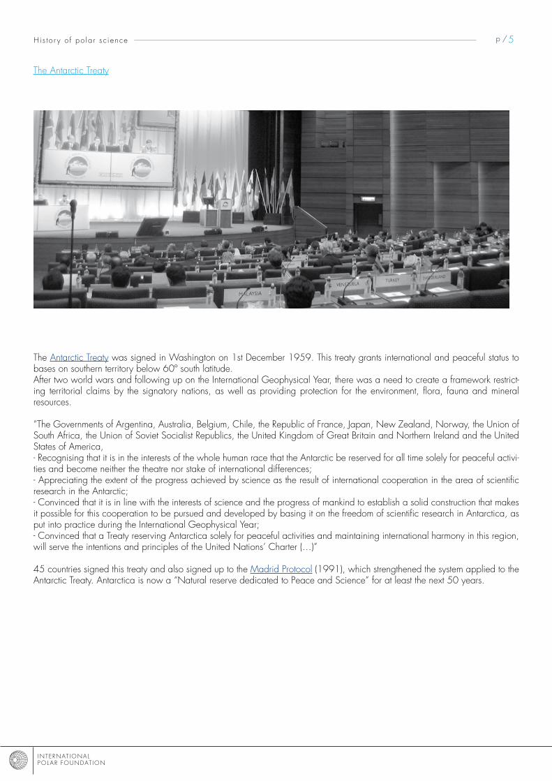
The Antarctic Treaty was signed in Washington on 1st December 1959. This treaty grants international and peaceful status to bases on southern territory below 60º south latitude. After two world wars and following up on the International Geophysical year, there was a need to create a framework restrict-ing territorial claims by the signatory nations, as well as providing protection for the environment, flora, fauna and mineral resources.
“The Governments of Argentina, Australia, Belgium, Chile, the Republic of France, Japan, New Zealand, Norway, the Union of south Africa, the Union of soviet socialist Republics, the United Kingdom of Great Britain and Northern Ireland and the United states of America,- Recognising that it is in the interests of the whole human race that the Antarctic be reserved for all time solely for peaceful activi-ties and become neither the theatre nor stake of international differences;- Appreciating the extent of the progress achieved by science as the result of international cooperation in the area of scientific research in the Antarctic;- Convinced that it is in line with the interests of science and the progress of mankind to establish a solid construction that makes it possible for this cooperation to be pursued and developed by basing it on the freedom of scientific research in Antarctica, as put into practice during the International Geophysical year;- Convinced that a Treaty reserving Antarctica solely for peaceful activities and maintaining international harmony in this region, will serve the intentions and principles of the United Nations’ Charter (…)”
45 countries signed this treaty and also signed up to the madrid Protocol (1991), which strengthened the system applied to the Antarctic Treaty. Antarctica is now a “Natural reserve dedicated to Peace and science” for at least the next 50 years.
The Antarctic Treaty
His to r y o f po la r s c ience

INTERNAT IONAL POL AR FOUNDAT ION
p /6
meteorology and the atmospheric sciencesmeteorology and the atmospheric sciences are areas of science that are involved in trying to understand atmospheric phe-nomena, how they form and how they develop. This means that these sciences study the movement of air masses whilst using chemistry and the principles of physics to understand and describe it all.
The differenT Types of polar sciences Polar science has developed a great deal since it first appeared. Taking all of the various disciplines together, its main aim is to achieve a better understanding of our current and past climate system in such a way that we can predict as accurately as pos-sible the impact that climate change will have on our environment and our way of life.very recently, these confined regions have also be become the location of specific studies for NAsA, EsA (European space Agency) and institutions from other disciplines one would think less likely to be interested in the poles such as medicine, as-tronomy, social science, etc.
meteorologyPut more concisely, meteorology studies all of the phenomena of the troposphere (the lower layer of the atmosphere) and attempts to provide short, medium and long-term weather fore-casts. To do this, meteorology uses specific field data, such as temperature, wind speed, humidity level, rainfall and at-mospheric pressure. meteorology also uses readings taken in the higher levels of the atmosphere, using weather probes, for example. satellites are also used to gain short-term information about meteorological conditions.All of this data collected over a number of years (30 years minimum) enables us to gain a good idea of the climate of a particular region and even current developments in the climate taken for the planet as a whole.
meteorology and the polesThe location of the poles and the extreme conditions that pre-vail there make them places where specific meteorological phenomena can be observed such as extreme temperatures, polar depressions, katabatic winds, etc. The best known and the most dangerous are the katabatic
winds (flash animation: www.educapoles.org). These winds were studied and first understood by F.K. Ball in 1956. These cold, powerful winds only blow in Greenland and Antarctica. They form at the peak of the icecap and move
down towards the coast. Capable of achieving speeds in ex-cess of 300 km/h, katabatic winds represent a danger for Inuits, scientists and explorers alike.Unfortunately, they are difficult to forecast.
Polar depressions are another phenomenon specific to high latitudes. A polar depression is a sort of small cyclone that is created when very cold air at a high altitude comes into contact with a mass of warmer air. This is what happens, for example, when a mass of very cold air over the Arctic Ocean meets an air mass located above the continents.
As this latter mass of air becomes warmer, a temperature gradient is created along with a polar depression. It is a shorter weather event (�4-48 hours) than a cyclone, yet it is very intense and often accompanied by blizzard conditions. Polar depressions are small weather phenomena (100 km in diam-eter), at least on the grand meteorological scale. They are not easy to identify using weather-forecasting instruments and hence can be dangerous for sailors. Our atmospheric meas-uring instruments need to be refined further to enable us to make observations on a smaller scale and forecast these events better.
Polar depression (courtesy: NASA)

INTERNAT IONAL POL AR FOUNDAT ION
p /7
Atmospheric sciencesWe talk about Atmospheric sciences when it comes to re-search on the quality and evolution of the atmosphere. In these days of climate change, we need to understand how the at-mospheric system works, how it evolves, and what impact pol-lutants (CFCs and other greenhouse gases) have on the vari-ous layers of the atmosphere and the underlying environment. As the various parts of the world’s atmospheric circulation are connected, a change in one particular region can affect other regions. This is why we are able to find traces of the eruption of mount Pinatubo in Arctic and Antarctic ice.
The changing hole in the ozone layer since 1979. We can see that it had been progressively increasing in size, although it appears to have stabilised since the Montréal Protocol was adopted.© NASA
Atmospheric sciences and the polesNot only are the poles ideal locations to observe the atmos-phere and its changes, they are also sensitive environments and thus make good early-warning alarms. Atmospheric circulation at the poles can take place in a semi-closed circuit1. This means that the pollutants and other par-ticles borne along on it may stay in it longer and can cause much damage. This was the case during the 1980s which eventually led to the hole in the ozone layer.The layer of ozone in the upper atmosphere (stratosphere) fil-ters out some of the sun’s ultraviolet rays. In 1985, scientists published an article relating the appearance of a hole in this protective layer above the Antarctic. A reduction of almost 50% in the total concentration of ozone was observed during the southern spring across the entire surface of the Antarctic. The same phenomenon was also observed above the Arctic Ocean, although not to the same extent. This means that as the sun’s ultraviolet rays are not filtered out so effectively by the ozone layer, and this has a direct effect on the people living in the more southerly regions of south America. Going out at certain times of the day means a guaranteed sunburn!
This example demonstrates the extent to which understanding phenomena in the atmosphere and the mechanics of atmos-
1 There is, however, a difference in behaviour between the two poles. This difference is directly linked to geography. The Antarctic continent is isolated in the middle of the oceans of the southern Hemisphere. In the Northern Hemisphere, on the other hand, the alternation of continents and oceans, plus areas of high and low atmospheric pres-sure, all contribute towards creating a continuous movement in the air masses in such a way that the North Pole is never totally cut off from other areas. This means that the air from the middle latitudes always reaches the North Pole, whereas this does not happen the Antarctic.
pheric circulation at high latitudes is so important. As the popu-lation living in the Antarctic was only researchers and their teams, there were not enough people to produce a sufficient amount of CFCs to create a hole in the ozone layer immedi-ately above their heads. Thus it had to be CFCs produced at lower latitudes that were responsible for making the hole.
Glaciology (climatology)GlaciologyGlaciology is the science that studies the physical and chemi-cal nature of glaciers, icecaps and icy environments. It also studies all of the phenomena that have to do with ice, such as permafrost, how snow is transformed into névé and then into ice, the interactions between the air and snow, etc. It is a science specific to the Polar Regions and mountainous areas where there are glaciers.
At the current time, a large part of the research into glaciol-ogy is trying to provide a better understanding of the world’s climate system by reconstructing the history of our climate over the past one million years. It does this by using ice archives, by quantifying the reduction in the quantities of ice on Earth, or by making models of the dynamics of the way glaciers and/or pack-ice move.
Glaciology at the polesscientists have begun taking a special interest in the ice that covers the Arctic and southern Oceans, Antarctica and Green-land since the International Geophysical year 1957-58. With evidence of global warming, changes to the thickness of the inlandsis� and the pack-ice is being monitored very closely. The melting of the icecaps is also having a direct impact on sea levels and on the future of the whole world’s coastal regions.
In the Arctic, the extent and thickness of the pack-ice has dimi-nished. The icecap in Greenland is beginning to get smaller, both in terms of thickness and the area it covers. Land that is frozen all year round (permafrost) is beginning to thaw.
Generally speaking, the Antarctic region does not yet appear to be affected by these changes, at least on the Antarctic Pe-ninsula. However in �00�, a piece of the floating icecap broke off into thousands of icebergs in a region that has had
� To understand better the differences between inlandsis, icecaps and pack-ice, see the Flash animation dealing with the description of types of ice.
Variation in the Arctic icecap between 1979 and 2003
The d i f f e ren t t ype s o f po la r s c ience s
INTERNAT IONAL POL AR FOUNDAT ION
p /8The d i f fe ren t t ype s o f po la r s c ience s
one of the fastest rises in temperature the Earth has ever known (�°C in 50 years).Fear that this phenomenon might repeat itself is prompting scientists to find out as much as possible about how glaciers move (speed of flow, possible cycles, etc.) from the way in which the pack-ice or floating part of glaciers can break off.
Glaciology and climatology
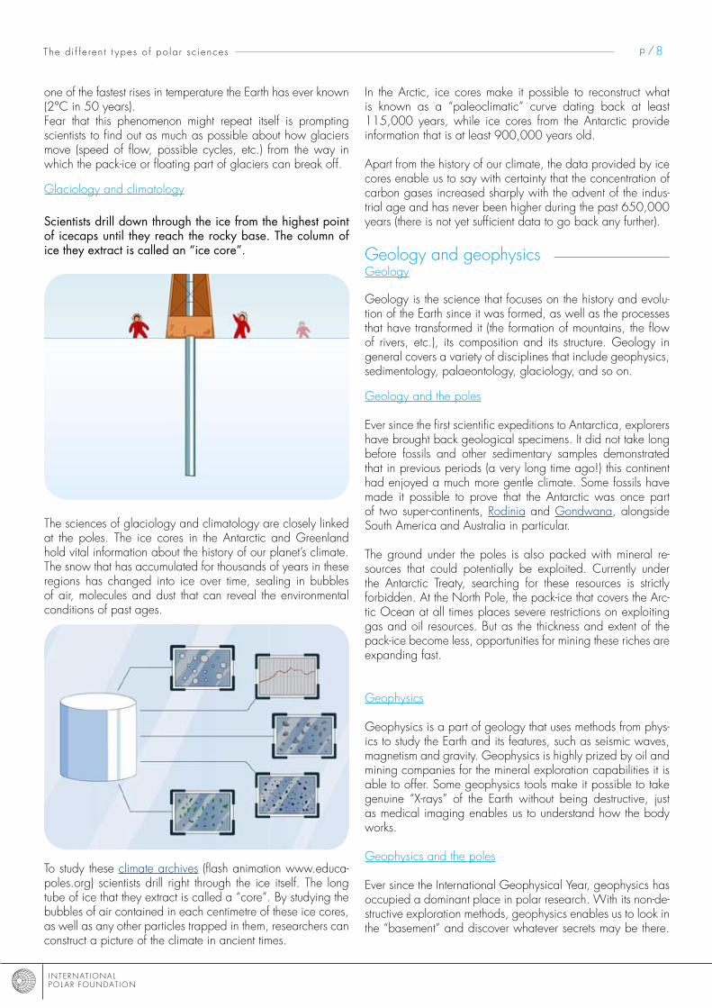
scientists drill down through the ice from the highest point of icecaps until they reach the rocky base. The column of ice they extract is called an “ice core”.
The sciences of glaciology and climatology are closely linked at the poles. The ice cores in the Antarctic and Greenland hold vital information about the history of our planet’s climate. The snow that has accumulated for thousands of years in these regions has changed into ice over time, sealing in bubbles of air, molecules and dust that can reveal the environmental conditions of past ages.
To study these climate archives (flash animation www.educa-poles.org) scientists drill right through the ice itself. The long tube of ice that they extract is called a “core”. By studying the bubbles of air contained in each centimetre of these ice cores, as well as any other particles trapped in them, researchers can construct a picture of the climate in ancient times.
In the Arctic, ice cores make it possible to reconstruct what is known as a “paleoclimatic” curve dating back at least 115,000 years, while ice cores from the Antarctic provide information that is at least 900,000 years old.
Apart from the history of our climate, the data provided by ice cores enable us to say with certainty that the concentration of carbon gases increased sharply with the advent of the indus-trial age and has never been higher during the past 650,000 years (there is not yet sufficient data to go back any further).
Geology and geophysicsGeology
Geology is the science that focuses on the history and evolu-tion of the Earth since it was formed, as well as the processes that have transformed it (the formation of mountains, the flow of rivers, etc.), its composition and its structure. Geology in general covers a variety of disciplines that include geophysics, sedimentology, palaeontology, glaciology, and so on.
Geology and the poles
Ever since the first scientific expeditions to Antarctica, explorers have brought back geological specimens. It did not take long before fossils and other sedimentary samples demonstrated that in previous periods (a very long time ago!) this continent had enjoyed a much more gentle climate. some fossils have made it possible to prove that the Antarctic was once part of two super-continents, Rodinia and Gondwana, alongside south America and Australia in particular.
The ground under the poles is also packed with mineral re-sources that could potentially be exploited. Currently under the Antarctic Treaty, searching for these resources is strictly forbidden. At the North Pole, the pack-ice that covers the Arc-tic Ocean at all times places severe restrictions on exploiting gas and oil resources. But as the thickness and extent of the pack-ice become less, opportunities for mining these riches are expanding fast.
Geophysics
Geophysics is a part of geology that uses methods from phys-ics to study the Earth and its features, such as seismic waves, magnetism and gravity. Geophysics is highly prized by oil and mining companies for the mineral exploration capabilities it is able to offer. some geophysics tools make it possible to take genuine “x-rays” of the Earth without being destructive, just as medical imaging enables us to understand how the body works.
Geophysics and the poles
Ever since the International Geophysical year, geophysics has occupied a dominant place in polar research. With its non-de-structive exploration methods, geophysics enables us to look in the “basement” and discover whatever secrets may be there.

INTERNAT IONAL POL AR FOUNDAT ION
p /9
Polar icecaps (particularly in the Antarctic) cover a topography and geomorphology that is not possible to study from obser-vations made on the ground. For example, geophysics has enabled us to highlight the presence of mountain ranges and lakes underneath the Antarctic icecap.
moreover, the study of geomagnetism (the evolution of the Earth’s magnetic field) makes it possible to measure variations in the magnetic north pole. These variations are monitored at all times and we can say, for example, that the magnetic north pole is currently moving at the rate of 40 km a year.
OceanographyOceanography
Oceanography is the science that studies the oceans and seas. Oceanography is involved in a number of different scientific areas: biology, chemistry, physics, geology, geophysics and meteorology. All of these branches of science are required for an overall understanding of the ocean system.
Oceanography and the poles
The oceanic circulation plays a dominant role in how our cli-mate is constituted and regulated. The huge masses of oceanic water interact with the atmosphere above them through ex-changes of heat, radiation and gases. Water retains heat more easily than air. This means that when a warm current moves, it also heats up the surrounding air. If this air then passes across a continent, it heats up the local climate there. An example of this is the Gulf stream, which warms northern Europe. The future of this current could be determined in the Arctic Ocean in the coming years. some researchers believe that as our planet heats up, this has a direct effect on the salinity of the oceans, which could alter what is known as the thermohaline circulation of the oceans (temperature – salinity). Warm, salty water from the region around the equator flows up to the Arctic Ocean, where it dives into the depths because it is denser than the surrounding water (this water is colder and more salty). An additional influx of fresh water caused by greater rainfall could slow down the Gulf stream, which could disrupt the conveyor belt of the oceans (article at www.educapoles.org).
Global thermohaline circulation (courtesy: earthobservatory.nasa.gov)
In conjunction with the ice drilling programmes that have ena-bled scientists to obtain data about the past 900,000 years, researchers are also interested in the sedimentary matter that is found at the bottom of the polar oceans. sediment preserves information that is much older than ice. By extracting cores of sediment from the Polar Regions, scientists can understand the way environmental conditions have evolved over tens of mil-lions of years. Putting sedimentary data and ice data together enables them to understand better the interaction between ocean and atmosphere over the past hundreds of thousands of years.
BiologyBiology
Biology is the study of living beings. It attempts to understand the structure, functions and levels of organisation of living be-ings. It is also interested in the relationships between each spe-cies and its environment, relationships between species and the evolution of living beings. Additionally biology aims to understand the characteristics of living beings that may be of value to mankind, as well as interactions between living be-ings and their environment, and the subsequent consequences for mankind.
Biology and the Polar Regions
The poles, with their extreme conditions, are teeming with endemic species (species limited to a particular region), the best known of which are the polar bear (Arctic) and the em-peror penguin (Antarctic). species such as these are sensitive to change because they are part of a specific ecosystem that is itself fragile. As a result, biologists are extremely interested in the response of these populations of animals to changes in their environment. How will they adapt? For example, some populations can move to find identical conditions or can change towards a new source of food.The response of some populations to changes in their environ-ment may have direct consequences on man’s environment.
Emperor penguin (Polarstern expedition)
The d i f f e ren t t ype s o f po la r s c ience s

INTERNAT IONAL POL AR FOUNDAT ION
p /10
For example, the European space Agency (EsA) has built Cryosat, a satellite dedicated to the study of polar ice. Follow-ing the failure of the first launch in �005, the EsA will send Cryosat-� into orbit in march �009 to measure changes in the thickness of the pack-ice and the height of the polar icecaps.
space-related science also benefits from the Polar Regions. These virtually uninhabited areas where there is very little at-mospheric pollution are locations for observing space that pro-vide incredible quality and clarity, like a window that opens to the universe. These arid regions are also used by the space agencies as veritable laboratories for testing prototypes before they are sent on missions to other planets.
Elsewhere, these extreme conditions have forced some spe-cies to find some novel solutions for adapting to the conditions around them. By studying their metabolism, physiology and ethology (animal behaviour), researchers are able to highlight useful discoveries for other purposes or branches of science.
Currently, polar researchers are also examining the reac-tion of plankton to variations in its environment. In terms of climate, plant plankton is one of the effective stores of carbon. If biologists can understand and model the behaviour of plankton, this will enable climatologists to predict the future better by in-corporating this new data into their climate-based scenarios.
sciences spatialesFor the past few decades, satellites have become major instru-ments for polar research, as well as for many other areas of science. satellites make it possible to track the movements of many animals at the poles. With the help of small beacons (Argos), researchers can follow the comings and goings of polar bears as they come to terms with the melting pack-ice. They can also find out more about the amazing habits of other marine predators, such as seals and penguins.
satellites are also used intensively by scientists to study chang-es to the climate in Polar Regions. They can now monitor the development of ice and icecaps even in mid-winter when it is dark for several months, as satellites give them a very accurate picture of reductions in the volume and extent of icecaps and pack-ice. Changes to the hole in the ozone layer are also tracked using satellites. Combining data gathered by satellites and readings taken on the ground also open up new fields of research and enables us to understand various interactions bet-ter, such as the interaction between ocean, atmosphere and ice.
The development of phytoplankton (bloom) off the coast of Argentina, as detected by satellite (Wikipedia)
CryoSat © ESA - AOES Medialab
Observations at the poles are not polluted by sources of light originating from humans © NASA
The d i f f e ren t t ype s o f po la r s c ience s

INTERNAT IONAL POL AR FOUNDAT ION
p /11TeACHing nOTe
The teaching objective of this file consists partly of having children discover the diversity of the contribution polar science makes, highlighting in particular the importance of teaching science.
very often children have an incorrect or partial image of science. This stems mainly from the media and society as a whole. This teaching note enables you to fine-tune the preferred direction to be taken in terms of teaching science in schools.
purpose of scienceHuman beings have always tried to understand the world that surrounds them. This attitude of questioning things is one of the distinguishing features of our species. “Homo sapiens are primates capable of asking questions,” states the famous geneticist, Albert Jaccard. Hence the first purpose of science stems from our instinctive desire for knowledge. Pure science describes na-tural objects and phenomena. The term ‘natural phenomena’ means all phenomena that affect the areas of physics, chemistry, astronomy, geology, biology and so on, and which enable us to have a better understanding of the world around us.
Beyond this simple curiosity, human beings very quickly understood that having this knowledge could improve certain aspects of their everyday lives. Applied science, which is the search to make practical use of scientific knowledge, defines the pos-sible applications linked to scientific knowledge. Technology, on the other hand, makes it possible to achieve various appli-cations. This means that science occupies a dominant position – and this is its second purpose – in the evolution of our living conditions, which some people call progress!
At the present time, advances in science and technology make it possible through simulations and modelling to gain an idea of how our planet is evolving and the fragility of the balances involved. Pollution, protecting the environment and climate war-ming are areas where science plays a key role. science not only plays a fundamental role in understanding complex systems, but also in seeking out solutions designed to safeguard a heritage that has taken several million years to build.
Thus teaching science provides us with a unique opportunity to involve pupils in the issues that are fundamental for humankind.
Building a “fund” of scientific knowledgescientific knowledge is knowledge built up from the objective observation of what surrounds us and the thinking that results from those observations.
Teaching science pursues a number of objectives:
a. Developing a scientific attitudeb. Learning about the basics of the scientific methodesc. Discovering the unity and diversity of living things, objects, and natural or technical phenomenad. Looking at scientific issues for the purpose of teaching youngsters about sustainable development and about being good
world citizens.

INTERNAT IONAL POL AR FOUNDAT ION
p /1�
a. Developing a scientific attitude Teaching science at school is first and foremost about stimulating attitudes that are favourable towards scientific activities: Ope-ning up to the world, curiosity, the desire to seek and research, self-confidence, a critical mind, the desire to communicate, a creative imagination, perseverance and precision.
b. learning about the basics of scientific methodesA scientific method is one that makes it possible to answer the questions that we ask ourselves about natural and technical phe-nomena as well as the world of living things.
This questioning is designed to enable us to acquire scientific skills in the follow-up to an investigation conducted by the pupils. The role of the teacher here is essential, because he or she guides the children through the various possible processes:
- Direct experimentation - Observation- Documentary research- Technological achievement- Reporting (survey, interview, visit)
c. Discovering the unity and diversity of living things, objects, natural or technical phenomenaThe investigations carried out by pupils should foster the manner by which they build up scientific concepts. It is known that schoolchildren come to structure their knowledge through exchanges that take place by comparing results, dealing with reference works, debating, assimilating new knowledge acquired in class, and working on special projects (displays, models, written documents, videos, multimedia).
As they discover important concepts (matter, time, space, energy, organisation, regulation, etc.), pupils gradually discover the unity and diversity of living things, objects, and natural or technical phenomena.
d. looking at scientific issues for the purpose of teaching youngsters about sustainable development and about being good world citizensLearning about science at school is also and most importantly understanding lessons in a global and systemic perspective. As a result, every science activity should establish links with previous activities as well as with other disciplines, while enabling the children to come face to face with the various issues at stake with our planet.
Teaching science at school involves identifying themes, concepts, specific processes and transverse abilities.

INTERNAT IONAL POL AR FOUNDAT ION
p /13
proposed acTiviTies
Objectives
To be able to:
- Ask questions, to others and to oneself- Use a scientific approach (observation, experiment, model)- Conduct a study- Analyse data- seek out information- Debate objectively- Develop mathematical tools for comparing and estimating areas- Locate elements on a map
To have understood and remembered:
- The importance of polar science- some of the geographic features of scientific polar bases - The way of life led by scientists working in these regions - The importance of international cooperation - The cross-disciplinary aspect of polar science - People’s perceptions on the poles- The thawing of the Arctic pack-ice
file on “experiments in earth sciences”
- Properties of ice- movement of glaciers- Polar climate and heat radiation- Building a weather station- Earth’s magnetic field
What perception do the people around you have on the poles?
Define a number of questions with the pupils and create a questionnaire on the polar regions. Give the pupils a few days to conduct the questionnaire with people they know. Ask each child to make a summary of their questionnaires and find a way of passing on the answers to their friends. make comparisons between the various responses. make an overall summary for the whole class and discuss it with the children.
Where are the scientific bases located in the arctic and the antarctic?
split the class into two groups. Ask one group to work on the Arctic and the other to work on the Antarctic. Each group then seeks out information in books or on the Internet so that they can locate the scientific bases in the Arctic and Antarctic on a map. Afterwards, each group presents its work to the other group. make comparisons on the number of bases in the North Pole and those in the south Pole, discuss the location of these bases (on the coast, inland) and what they are used for (bases for summer, over-wintering, etc.).
Need some reference maps?- pôle nord 1, pôle nord �- Antarctique

INTERNAT IONAL POL AR FOUNDAT ION
p /14
What sort of life do scientists lead at the poles?
Demander aux élèves d’imaginer le quotidien des scientifiques aux pôles en écrivant un texte narratif d’une page à la première Ask the children to imagine the daily lives of scientists at the poles by writing a one-page narrative text in the first person (“I woke up this morning to see heavy snow falling…”). Read out each child’s story to the class and show the differences (noting them on the blackboard) between their “imaginary” ideas and actual facts.The children then carry out research to round out the reality of the life of scientists at the poles. Get them to write a new, informa-tive story, as though they were journalists who have met a scientist who works at the poles. suggest meeting a local scientist and discuss his/her day-to-day life to see whether researchers at the poles have a particular daily routine.
What do clouds tell us?
Take the children outside to observe the sky. Look at the different types of clouds and the way the various “levels” of the sky fit on top of one another. Ask the children to draw the different clouds and to estimate the amount of cloud cover. Note this estimate in a corner of the drawing.Once you are back in the classroom, come back to the different cloud shapes and what they mean. Give the children a blue sheet and a white sheet. Ask them to use the same amount of white sheet to estimate the cloud cover outside. Get them to cut the sheets up into little clouds, all using this sheet of paper. Then glue these ‘clouds’ on to the blue sheet so that they can gain a real view of what they have observed in the sky.For this activity, see http://www.kidskonnect.com/Clouds/CloudsHome.html
What do the poles teach us about the earth’s geography?
Give the pupils a map of the world showing all the continents. Ask them to look carefully at the different continents and to see whether any of them look similar. Would it be possible to use the continents like pieces of a jigsaw puzzle to make one whole landmass? The children must cut out the continents and try to put the puzzle together to create one single continent. mention that Antarctic research has confirmed the existence of a super-continent called Gondwana (the pupils can then try and reconstitute Gond-wana). show the children a map of Gondwana. Discuss the reasons why some parts cannot be fitted together with the others (collisions between continents and the creation of mountain ranges, etc.).Come back to the map of today’s geography and look at it again. This time, locate the mountain ranges formed where the continents have moved to end up in their current position, etc.
how much of the pack ice has disappeared?
Give your pupils a satellite image of the Arctic at different times (see the United Nations for the Protection of the Environment website One planet many people or the NAsA “Observing the Earth” website. Ask them to observe the differences. Ask the children to think about these differences. Then get the children to estimate the area of pack-ice which has been lost by using the photos (NB: it may help to add a scale on the images). Give them a ruler, paper, scissors, string, tracing paper, etc. Leave it up to the children to select the tools they need to estimate the surface area. Note all the result approximations on the blackboard. Then show the actual area that has disappeared. Think about the differenc-es, first in terms of the method used, then by taking into account the fact that a photo only provides a view in � dimensions.
INTERNAT IONAL POL AR FOUNDAT ION
p /15
examples of Teaching/learning sequencesGlaciology and climatology (short sequence)
Objectives
To be able to:
- Ask oneself and others questions- Confirm data- Use the scientific method- make links between various disciplines
To have understood and retained concepts such as
- Using ice cores to study climate history- The evolution of the climate over time
1. starting point (10 minutes)
show the children a map of Antarctica that shows the location of scientific bases as well as a photo of either drilling an ice core in the Antarctic or of an ice core itself.
2. Thinking (45 - 60 minutes)
General knowledgeWorking in groups of two, the children should define what they think the map and photo represent, noting their thou-ghts on a sheet of paper. Write down all their thoughts on the blackboard. Discuss the ideas raised by the children. Put a system of reasoning in place to help them fine-tune their ideas and come to a general understanding the geogra-phy of Antarctica and the notions of scientific research.Note some of the children’s pertinent arguments on the blackboard, such as:- It’s a map of an island because there is water all around it. It is a cold region because most of the map is white, etc.- you must make a hole to try and find water because you can see that there is no vegetation or water anywhere, etc.Discuss with the children and devise a way to confirm their arguments. An idea for a research project should emerge.
3. Documentary research (15 minutes + 90 minutes / 2 x 45 minutes)
Préparation (15 minutes)As preparation for this part of the sequence (15 minutes), return to the arguments needing confirmation and suggest to the children that they bring in any documentation/information that they may have at home (books, anecdotes from parents, press articles, DvDs, videos).
Research (45 minutes)The aim is to check that the hypotheses made during the thinking process are in fact correct. The children work in twos and look for images, texts and data that make it possible to confirm their arguments. For example, for the argu-ment stating that: - It’s a map of an island because there is ocean all around it. It’s in a cold region because most of the map is white, etc. The children can give the definition of an island, find that island on a map of the Earth and find out some information about the climate in the region.The research is done from the information brought in by the children and/or by the teacher, as well as on the Internet using predefined websites (see Resources).

INTERNAT IONAL POL AR FOUNDAT ION
p /16
Pooling knowledge (45 minutes)The results of the research are presented to the other pupils. They can confirm that it is in fact a map of Antarctica and that an ice core does in fact make it possible to understand how the climate was in the past. The teacher can show the animations to all the children so that they continue with the rest of the learning process using a shared pool of knowledge.
4. Using the scientific method (45 minutes)
Explain to the children that they are going to be given a core of ice and that they are going to have to reconstitute the history of the core. They will then make a poster with the core drawn actual size.Ask the children to think about a way of working that will enable them to tell about the history of this piece of ice through a q&A game. Bring out the following points:- Observe the overall appearance of the ice core (observe the various layers)- measure the length of the core- Observe the contents of the core more accurately (describe the various layers)- Associate the contents with an actual eventWrite notes on the blackboard and have the children try to organise their observations on a sheet.
5. 5. observing / putting into practice (2 x 45 minutes)
Observation (45 minutes)Give the children the material they need for observing the ice core (see example further in the file): descriptive sheet, ruler, coloured pencils, magnifying glass, grey pencil, etc.Ask each child to fill in his/her sheet carefully and accurately so that the information noted can be used again subse-quently.Help the children to make suppositions about the contents of the layers, for example if there is ash, there was a fire not far away.
Putting into practice (45 minutes)Give the children the various texts and images to associate with the various layers of the ice. Each child then re-constructs the climactic history using the ice core based on his/her observations. Each child then redraws the core at actual-size (most importantly the length) on the poster and for each layer glues the image associated with it along with some descriptive text, adding details of the observation (such as “there is ash in the layer”) that led him/her to a particular conclusion.
6. link with scientific research
Watch part of the Canadian science and technology website film about ice cores. Discuss the main points of the video with the children. Come back to certain aspects:- The volcanic dust trapped in the ice, which allows scientists to determine when volcanic events took place- The air bubbles enclosed in the ice, in which CO� and other gas concentrations are measured- The amount of greenhouse gas trapped in the ice is proportionate to average global temperature.Use a graph with the curve showing the variations in the greenhouse gases and ask them to indicate the warm and cold periods.
7. evaluation - assessment
Come back to the images shown at the outset and discuss with the children again to bring out the knowledge they have acquired.

INTERNAT IONAL POL AR FOUNDAT ION
p /17
Glaciology and climatology (long sequence)
Objectives
To be able to:
- Ask oneself and others questions- Confirm data- Use the scientific method- make links between various disciplines
To have understood and retained concepts such as
- Using ice cores to study climate history- The evolution of the climate over time
1. starting point (10 minutes)
show the children a map of Europe and North America at the current time and map of Europe and North America during the last ice age (18000 years ago). Ask them to comment on the differences.
2 . Discussion (30 minutes)
Discuss the differences on the two maps with the children. Note the differences on the blackboard. Try to state with the children what might categorise the differences on the older map. Try to bring out the term ‘ice age’. Define it with the pupils (a colder period of time).
3. Thinking (90 minutes ou 2 x 45 minutes)
Come back to the term ‘ice age’. Ask the children how it is we can know that there have been colder and warmer period of time in the Earth’s history. In groups of two, the children then think about a response, which they note down on a sheet. Note their responses on the blackboard. Discuss the ideas brought up by the children. Try to bring out the term ‘scientific research’, as well as the various disciplines involved.
Discuss the various disciplines with the children and those that best lend themselves to determining variations in the climate in the past. Ask the children to do some research on these to confirm the idea and define the usefulness of the other sciences.
4. specialisation: starting point (10 minutes)
show the children a photo of drilling an ice core in the Antarctic or of an actual ice core.
5. Thinking (45 - 60 minutes)
General knowledgeIn groups of two, have the children define what they think the picture means, making notes on a sheet of paper. Pool these thoughts on the blackboard. Discuss the ideas brought up by the children. Put a reasoning system in place to fine-tune their ideas and arrive at the approximate idea that it is about scientific research in a polar environment.Discuss with the children to find a way of confirming these arguments. The idea of doing research should emerge.

INTERNAT IONAL POL AR FOUNDAT ION
p /18
6. Documentary research (15 minutes + 90 minutes / 2 x 45 minutes) Préparation (15 minutes)
As preparation for this part of the sequence (15 minutes), return to the arguments to be confirmed and suggest to the children that they bring in any documentation/information that they may have at home (books, anecdotes from parents, press articles, DvDs, videos).
Research (45 minutes)
The aim is to check that the proposals made during the thinking process are in fact correct. The children work in twos and look for images, texts and data that make it possible to confirm the arguments. The research is done from the information brought in by the children and/or by the teacher, as well as on the Internet using predefined websites (see Resources).
Pooling knowledge (45 minutes)
The results of the research are presented to the other pupils. They can confirm the fact that it is an ice core from which it possible to reconstitute climates from the past. The teacher can show the animations to all the children so that they continue with the rest of the learning process using a shared pool of knowledge.
7. Using the scientific method (45 minutes)
Explain to the children that they are going to be given a core of ice and that they are going to have to determine the history of the climate using the core. They will then make a poster with the core drawn to actual size.Ask the children to think about a way of working that will enable them to describe the climate’s history using this piece of ice through a q&A game. make sure the students:- Observe the overall appearance of the ice core (observe the various layers)- measure the length of the core- Observe the contents of the core accurately (describe the various layers)- Associate the contents with an actual eventWrite notes on the blackboard and have the children write down all of these observations on their poster.
8. Observation / Putting into practice (2 x 45 minutes)
Observation (45 minutes)Give the children the material they need for studying the ice core (see example further in the file): descriptive sheet, ruler, coloured pencils, magnifying glass, grey pencil, etc.Ask each child to fill in his/her sheet carefully and accurately so that the information noted can be used again subse-quently.Help the children form hypotheses based on the contents of the layers. For example if they find ash in a particular layer, this could mean that there was a fire not far away.
Putting into practice (45 minutes)Give the children the various texts and images to associate with the various layers of the ice. Each child then reconstructs the climactic history using the ice core based on his/her observations. Each child then redraws the core at actual-size (most importantly the length) on the poster and for each layer glues the image associated with it along with some descriptive text, adding details of the observation (such as “there is ash in the layer”) that led him/her to a particular conclusion.

INTERNAT IONAL POL AR FOUNDAT ION
p /19
“Climatology / glaciology” sequence equipment
- A map of the Antarctic, showing the research bases - A current map of Europe and North America- A map of Europe and North America 18,000 years ago- A photo of drilling ice cores in Antarctica- A sheet describing how to “make” an ice core - A sheet describing an ice core- sheets describing the climate - Photos of the Rhône glacier
9. link with scientific research (45 minutes)
Watch part of the Canadian science and technology website film about ice cores. Discuss the main points of the video with the children. Come back to certain aspects:- The volcanic dust trapped in the ice, which allows scientists to determine when volcanic events took place- The air bubbles enclosed in the ice, in which CO� and other gas concentrations are measured- The amount of greenhouse gas trapped in the ice is proportionate to average global temperature.Use a graph with the curve showing the variations in the greenhouse gases and ask them to indicate the warm and cold periods.
10. evaluation - assessment (45 minutes)
Come back to the images shown at the outset and discuss with the children again to bring out the knowledge they have acquired.
11. extension
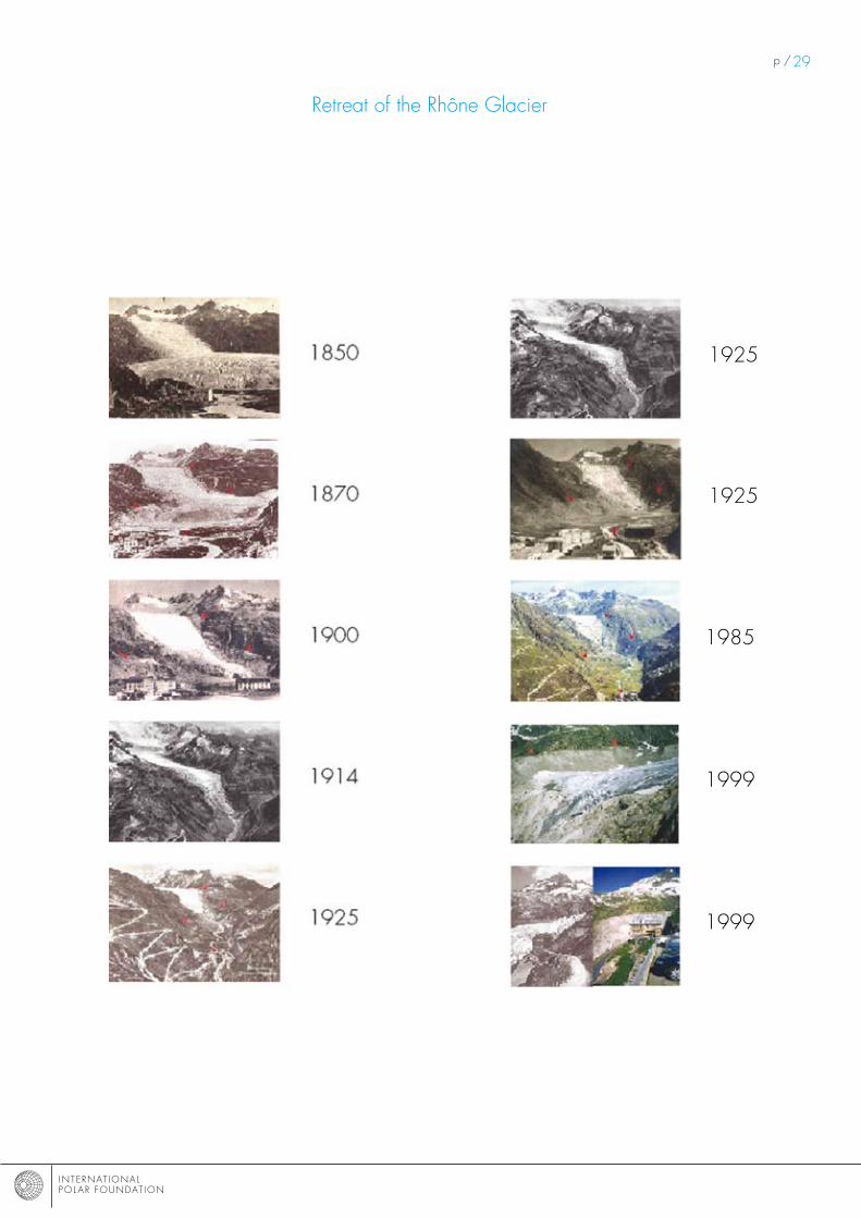
Use images showing how the glaciers are shrinking to provoke thinking about using glaciology in the Alps and about the very recent history of our climate.

INTERNAT IONAL POL AR FOUNDAT ION
p /�0
map of the Antarctic, showing research bases d’hiver / permanente

INTERNAT IONAL POL AR FOUNDAT ION
p /�1maps of Europe and North America current and 18,000 years ago

INTERNAT IONAL POL AR FOUNDAT ION
p /��

INTERNAT IONAL POL AR FOUNDAT ION
p /�3
Drilling an ice core in the Antarctic (Open University of Belgium)

INTERNAT IONAL POL AR FOUNDAT ION
p /�4
making an ice core for the pupils
Equipment required
- A clear, empty 1.5L plastic bottle - some very fine sand or sawdust- Cooking oil- Finely ground plant matter (failing that, some green food colouring)- some ash- Water- measuring beaker- Freezer
methodWash the bottle. Dry it. Fill the bottom of the bottle with water just enough so that the first layer can rest on something flat. Put it in the freezer until the water has completely frozen.1. Put 3 tablespoons of cooking oil into the measuring beaker and then top up with water to �00 ml. Pour the mixture into the bottle. Close the bottle and shake it until small bubbles of the oil have formed in the water. Place the bottle vertically in the freezer until the water has completely frozen.�. Once the first layer has frozen, take the bottle out of the freezer. Place the ground plant matter (or colorant) in the measuring jug and then top up with water to �00 ml. Pour the mixture into the bottle and shake. Put the bottle back in the freezer vertically until the water has completely frozen.3. Once the second layer has frozen, take the bottle out of the freezer. Cover the bottom of the measuring jug with sand and top up with water to �00 ml. Pour the mixture into the bottle and shake. (The sand must be fine enough to be able to be suspended in the water until it freezes. It should not settle to the bottom before the water freezes). Put the bottle back in the freezer vertically until the water has completely frozen. 4. Once the third layer has frozen, take the bottle out of the freezer. Put �00 ml of water in the measuring bea-ker. Pour the water into the bottle. Put back vertically in the freezer until the water has completely frozen. 5. Once the fourth layer has frozen, take the bottle out of the freezer. Cover the bottom of the measuring beaker with ash and top up with water to �00 ml. Pour the mixture into the bottle and shake. Put the bottle back in the freezer vertically until the water has completely frozen.Once the final layer has frozen, the ice core is ready.Indicate the direction of your ice core by drawing an arrow pointing to the top of the ice core. Write ‘bottom’ at the base of the bottle, and ‘top’ at the top.To make the ice core more realistic, cut off the top and bottom of the bottle in order to obtain a cylinder.
WarningThis classroom activity does not correspond exactly to what is done in polar science. The scientists working on ice cores study the air contained in the bubbles trapped in the ice, as well as any tiny microscopic dust. The equipment required for this type of observation cannot be transposed into a classroom and even if it were, it would require the presence of qualified staff. However, this exercise does make it possible for students to link observations of the contents of the ice with variations in climate.
Setting up the activity with the pupilsshow the ice core to the children, explaining that it was taken from a glacier at the edge of the sea and that it is their task to understand the secrets encased in the core so that they can tell the story of what happened in the location where this ice core was taken to the rest of the school. (you can tell them the real story of this ice core at the end of the exercise if it appears necessary).To begin with, the children work in twos to describe the ice core using the pupil sheet. They must not forget to indicate the direction of the core, to measure and to describe each layer. you can then give your pupils a sample of the contents of each layer using a small spoon so that they can add detail to their description. They can use a magnifying glass if there is one in the classroom.Use a map to show where the ice core was taken from and allow the children to speculate on how the contents came to be in the core.Give them the descriptive sheets with the history of the region so that they can put them in chronological order using their description of the core. Then work with them to try and draw a sketch of the climate curve, indicating warmer and colder periods.

INTERNAT IONAL POL AR FOUNDAT ION
p /�5
Explanation of the contents The explanation is given going from the bottom to the top, i.e. in chronological order
1. 18,000 years ago, the Earth experienced an ice age. There were glaciers everywhere. The glacier we are talking about covered a swampy area, picking up particles of water loaded with organic matter in the ice. These are bubbles of oil.
�. 1�,000 years ago, the world’s climate warmed up again, melting the inlandsis. Our glacier lost thic-kness in particular, because it was located close to the south Pole. As the climate became warmer, sea levels rose, as did the number of organisms. In the area where the glacier was located, there were frequent storms in summer. The front end of the glacier was often submerged in seawater and contains seaweed.
3. For several thousand years, the Earth’s climate did not vary sufficiently for the glacier to record these variations. However, from time to time, desert winds reached the south Pole, bringing sand with them.
4. During the Little Ice Age, the weather again turned colder and damper. The glaciers in the Alps advan-ced. Our glacier accumulated snow that turned into pure ice (visually, at least)).
5. The world’s climate warmed up again. In 1991, the eruption of mount Pinatubo produced a reduction in global temperatures ranging from 0.5 to 0.9°C. Winters were colder and there was more snow. The ash from the volcano, carried on the wind, travelled around the Earth and was deposited in many places, including on our glacier.
5
4
3
2
1
colder warmer

INTERNAT IONAL POL AR FOUNDAT ION
p /�6

INTERNAT IONAL POL AR FOUNDAT ION
p /�7
first name :
cut out the articles below following the dotted lines. read them, then match each article with each of the layers in the ice core. Then do the same thing with the dates.
The world’s climate cooled down over several thousand years. The aha glacier close to the antarctic advanced several dozen metres, covering the marshes.
mount pinatubo started erupting in 1991, sending a mus-hroom cloud of smoke 20 km into the upper atmosphere. This cloud travelled around the world three times and cooled down the world’s climate during that year by an average of 0.5ºc.
The earth’s climate has heated up for the past 6000 years. The icecaps have retreated or diminished. sea levels have risen. some glaciers have undergone frequent exposure to the sea. seaweed is often found washed up on tongues of the glacier just above the surface of the water.
During this period, the stability of the climate did not pre-vent fierce wind storms in some of the deserts. The storms were sometimes severe enough for sand to be sucked up in updrafts and carried to far-off places.
The climate has cooled down slightly over the past century or so. The glaciers in the alps have advanced noticeably. in other regions, there has been heavier rainfall, ‘fattening’ the glaciers with pure ice.
The last maximum extent of the ice age – 18,000 years ago.
Warming (beginning of interglacial period) -12,000 years ago.
The little ice age in the 17th century a period of stability (interglacial environment) – 6,000 years ago.
a period of warming in the 20th century

INTERNAT IONAL POL AR FOUNDAT ION
p /�8
first name :
5
4
3
2
1
colder warmer
INTERNAT IONAL POL AR FOUNDAT ION
p /�9
Retreat of the Rhône Glacier
19�5
1999
19�5
1999
1985

INTERNAT IONAL POL AR FOUNDAT ION
p /30resources
Websites
- http://www.educapoles.org: Educapoles, the educational website of the International Polar Foundation provides learning activities about the Polar Regions and climate warming.- http://www.antarctica.ac.uk/: the website of the British Antarctica survey with an educational section- http://www.sciencepoles.org/: the scientific website of the International Polar Foundation (in English) includes the latest news and information about Polar science- http://www.polarcom.gc.ca: the website of the Canadian Polar Commission, with a young audience section that provides links to various websites aimed at children.- http://www.msc.ec.gc.ca/education: Website for Environment Canada, educational section on the Arctic ozone layer.
Bibliography
- Antarctica: the Heart of the World, Coral Tulloch, Echanted Lion books.- The Lost seal, Diane mcknight, moonlight publishing.- Polar research: understanding our planet better, RDT info, European research magazine, special issue, may �005.