Embed Size (px)
Citation preview
Site Plan Application 1454 and 1450 Merivale Road City of Ottawa First Capital Asset Management ULC
February 26, 2014
PLANNING RATIONALE REPORT

2 of 37 _______________________________________________________________
R.G Richards & Associates
4181 Sladeview Crescent, Unit 23, Mississauga, ON, L5L 5R2 Telephone: 905.823.7897 Fax: 905.606.2546 E-mail: [email protected]
TABLE OF CONTENTS
COVER PAGE 1
TABLE OF CONTENTS 2
LIST OF FIGURES 3
1.0 INTRODUCTION ____________________________________________________________ 4 2.0 CONTEXT _________________________________________________________________ 5
3.0 SITE AND SURROUNDINGS __________________________________________________ 6 3.1 Site ____________________________________________________________________ 6 3.2 Surrounding Land Use ____________________________________________________ 8 3.3 Road and Transit Network ________________________________________________ 10
3.3.1 Roads ______________________________________________________________ 10 3.3.2 Transit ______________________________________________________________ 10
4.0 PROPOSED DEVELOPMENT ________________________________________________ 13
5.0 POLICY AND REGULATORY FRAMEWORK ____________________________________ 15 5.1 Provincial Policy Statement (2005) __________________________________________ 15
5.2 City of Ottawa Official Plan, 2007 – In force __________________________________ 15 5.2.1 Section 2.5.1 of the Official Plan - Compatibility and Community Design ___________ 17 5.2.2 Section 4.11 of the Official Plan - Compatibility _______________________________ 18
5.3 2013 City of Ottawa Official Plan – Awaiting Ministerial Approval ________________ 19 5.4 Merivale Road Secondary Plan _____________________________________________ 20
5.4.1 Merivale Road Mixed Use Designation _____________________________________ 23 5.4.2 Transportation Policies _________________________________________________ 23
5.5 Urban Design Guidelines for Development along Arterial Mainstreets ____________ 24 5.5.1 Streetscape __________________________________________________________ 24 5.5.2 Built Form ___________________________________________________________ 24
5.5.3 Pedestrian and Cyclists _________________________________________________ 25 5.5.4 Vehicles and Parking ___________________________________________________ 26
5.5.5 Landscape and Environment _____________________________________________ 26 5.5.6 Signs _______________________________________________________________ 27 5.5.7 Servicing and Utilities __________________________________________________ 28
5.6 Urban Design Guidelines for Drive-Through Facilities __________________________ 28 5.7 Zoning By-Law 2008-250 __________________________________________________ 30
6.0 JUSTIFICATION ___________________________________________________________ 32 6.1 Infill and Redevelopment _________________________________________________ 32 6.2 Land Use, Compatibility & Urban Design ____________________________________ 32
6.3 Density, Height & Massing ________________________________________________ 33 7.0 SUMMARY OF TECHNICAL ANALYSES _______________________________________ 34
7.1 Transportation Impact Study ______________________________________________ 34 7.2 Functional Servicing Report _______________________________________________ 35
7.3 Geotechnical Study ______________________________________________________ 35 8.0 CONCLUSIONS AND RECOMMENDATIONS ____________________________________ 37

3 of 37 _______________________________________________________________
R.G Richards & Associates
4181 Sladeview Crescent, Unit 23, Mississauga, ON, L5L 5R2 Telephone: 905.823.7897 Fax: 905.606.2546 E-mail: [email protected]
LIST OF FIGURES
Figure 1: Context Map ________________________________________________________ 5
Figure 2: Site Location Map ____________________________________________________ 7
Figure 3: Existing Bank of Montreal – 1454 Merivale Road __________________________ 7
Figure 4: Existing One-Storey Commercial Building – 1450 Merivale Road _____________ 8
Figure 5: Shoppers Drug Mart – 1465 Merivale Road _______________________________ 9
Figure 6: Firkin & Knight Pub and Restaurant – 1460 Merivale Road __________________ 9
Figure 7: Schedule E – Urban Road Network _____________________________________ 10
Figure 8: OC Transpo Bus Map _______________________________________________ 11
Figure 9: Schedule D – Rapid Transit Network ___________________________________ 12
Figure 10: Site Plan __________________________________________________________ 14
Figure 11: Official Plan – Schedule B, Urban Policy Plan ___________________________ 16
Figure 12: Schedule 1 – Merivale Road Secondary Plan ____________________________ 21
Figure 13: Zoning Map – Bylaw 2008-250 ________________________________________ 30

4 of 37 _______________________________________________________________
R.G Richards & Associates
4181 Sladeview Crescent, Unit 23, Mississauga, ON, L5L 5R2 Telephone: 905.823.7897 Fax: 905.606.2546 E-mail: [email protected]
1.0 INTRODUCTION
R.G. Richards & Associates (RGR) has been retained as Planning Consultants by First Capital Asset Management ULC to provide land use planning advice and to prepare this Planning Rationale Report in support of a Site Plan Application for 1450 and 1454 Merivale Road in the City of Ottawa, herein referred to as the ‘Site’. This report demonstrates that the proposed development is appropriate for the Site and is consistent with the policies and provisions of the Provincial Policy Statement as well as the City of Ottawa’s planning framework. Furthermore, the proposed development is compatible and fits with the existing fabric surrounding the Site which consists of a number of single storey commercial buildings. The Site is designated as General Urban Area and Arterial Mainstreet within the City of Ottawa Official Plan. Both of these designations permit a broad range of uses, including residential, office, and retail. The Site is zoned Arterial Mainstreet – AM which permits banks as well as commercial and retail uses. The Site is currently occupied by a two storey Bank of Montreal commercial building, a vacant one storey commercial building and related surface parking areas located to the rear and sides of both buildings. Both existing buildings will ultimately be demolished. The Site is located on the north side of Merivale Road approximately mid-way between Baseline Road to the east and Clyde Avenue to the west. The Site is adjacent to the east property line of the existing Loblaws Plaza, known municipally as 1460 Merivale Road. The Site will be integrated with the existing plaza and will share parking and internal roadways. Consent and Minor Variance applications will be submitted concurrently with the Site Plan Application. The Consent application is required as a portion of the proposed Pad A building and several adjacent parking spaces are located on 1460 Merivale Road. The Consent application will sever this parcel (204.1 m²) from 1460 Merivale and be consolidated with 1450/1454 Merivale Road. A Minor Variance application will be submitted to permit a Reciprocal Operating and Easement Agreement for shared vehicular and pedestrian acess, shared underground services, shared parking and shared access for maintenance and construction, between the Site and 1460 Merivale Road. The proposal is for a commercial development containing two one-storey commercial buildings with a total GFA of approximately 789m² (8,499 ft²). One building will accommodate the relocated Bank of Montreal currently occupying 1454 Merivale Road. The new bank building (Pad B) will occupy the east side of the site (1450 Merivale Road) and will be constructed first. After the bank has moved into this new building the old bank will be demolished and the second building constructed (Pad A). RGR has assessed the appropriateness of the proposed redevelopment in the context of the surrounding community and the overarching policy and regulatory framework. In preparing this report, RGR has reviewed the relevant policies of the Provincial Policy Statement, City of Ottawa Official Plan and Urban Design Guidelines, as well as the City of Ottawa Zoning By-law. It is our opinion that the proposal is appropriate as it is compatible with the existing commercial buildings and residential community surrounding the Site and therefore represents good planning. A number of supporting technical studies as prepared by various consultants will address the details of the proposal and are referenced as required and included as part of the application package.

5 of 37 _______________________________________________________________
R.G Richards & Associates
4181 Sladeview Crescent, Unit 23, Mississauga, ON, L5L 5R2 Telephone: 905.823.7897 Fax: 905.606.2546 E-mail: [email protected]
2.0 CONTEXT
The Site is part of the Merivale Road Secondary Plan Area and is located between Clyde Avenue and Baseline Road (see Figure 1). The area surrounding the Merivale Road corridor can be characterized as a stable, low density residential community centred on a successful and popular shopping destination. Although this community has long been established, it is expected that change is likely to occur along Merivale Road through development of vacant commercial parcels, infill projects on underutilized sites and the redevelopment of existing properties. The proposed development will help meet Ottawa’s vision of improving the area as a place to work, shop and live.
Figure 1: Context Map

6 of 37 _______________________________________________________________
R.G Richards & Associates
4181 Sladeview Crescent, Unit 23, Mississauga, ON, L5L 5R2 Telephone: 905.823.7897 Fax: 905.606.2546 E-mail: [email protected]
3.0 SITE AND SURROUNDINGS
3.1 Site
The Site, known municipally as 1450 and 1454 Merivale Road, is approximately 4,065m² (43,750 ft²) in size, and is located on the north side of Merivale Road between Baseline Road and Clyde Avenue (see Figure 2). The Site has a combined frontage of approximately 83 m (272 ft) and a depth of 55 m (182 ft). A small area of land will be severed from the adfjacent 1460 plaza site and consolidated with 1450 and 1454 Merivale Road to allow appropriate development. 1450 and 1454 Merivale Road will be merged in title. With the addition of the severed parcel, the Site will be 4,269.1m² (45,952 ft²) in size. The Site will become an integrated part of an existing shopping centre (Loblaw’s Plaza) located at 1460 Merivale Road, although title in this case will not be merged. All three properties are under the same beneficial ownership. Loblaw’s Plaza, which provides approximately 134,000 ft² of commercial shopping space, is owned by the same parent company as the Site. Tenants in the Loblaw’s Plaza include Loblaws, Royal Bank of Canada, GoodLife Fitness, Dollar Tree, and Starbuck’s, among others. Parking areas and traffic aisles will be redesigned to permit traffic flow between the properties. The Site is currently occupied by a two storey building containing a 3,950 ft² Bank of Montreal (BMO) and a vacant one-storey building (formerly a Harley-Davidson motorcycle dealership) (see Figure 3 and 4). The remainder of Site contains associated parking and minimal landscaping. The Site currently enjoys unrestricted accesses for the BMO building and the former Harley Davidson building both from Merivale Rd. Burris Lane runs south from Merivale Road opposite 1450 Merivale Road and is a signalized “T” intersection. There is no through connection from Burris Lane to the Site.

7 of 37 _______________________________________________________________
R.G Richards & Associates
4181 Sladeview Crescent, Unit 23, Mississauga, ON, L5L 5R2 Telephone: 905.823.7897 Fax: 905.606.2546 E-mail: [email protected]
Figure 2: Site Location Map
Figure 3: Existing Bank of Montreal – 1454 Merivale Road

8 of 37 _______________________________________________________________
R.G Richards & Associates
4181 Sladeview Crescent, Unit 23, Mississauga, ON, L5L 5R2 Telephone: 905.823.7897 Fax: 905.606.2546 E-mail: [email protected]
Figure 4: Existing One-Storey Commercial Building – 1450 Merivale Road
3.2 Surrounding Land Use
In general, the land uses surrounding the Site include a mix of vacant land, office, retail, restaurant and service commercial uses with low density residential further to the north and south. The Site is part of an active shopping area which includes numerous shopping centres fronting on Clyde Ave, Merivale Rd. and Baseline Rd (see Figures 5 and 6). A large automobile dealership is located at Baseline and Merivale and a Federal Government office building is located opposite the site on Merivale Rd. Significant vacant lands exist to the west of the Loblaw’s Plaza. These lands are zoned for Mixed Use development. A medical building is proposed at the north-west corner of Burris Lane and Merivale Road.

9 of 37 _______________________________________________________________
R.G Richards & Associates
4181 Sladeview Crescent, Unit 23, Mississauga, ON, L5L 5R2 Telephone: 905.823.7897 Fax: 905.606.2546 E-mail: [email protected]
Figure 5: Shoppers Drug Mart – 1465 Merivale Road
Figure 6: Firkin & Knight Pub and Restaurant – 1460 Merivale Road

10 of 37 _______________________________________________________________
R.G Richards & Associates
4181 Sladeview Crescent, Unit 23, Mississauga, ON, L5L 5R2 Telephone: 905.823.7897 Fax: 905.606.2546 E-mail: [email protected]
3.3 Road and Transit Network
3.3.1 Roads
Merivale Road, Baseline Road and Clyde Avnue are multi laned arterial roads and are designated as such in the Official Plan (OP) (see Figure 7). Merivale Road extends in a generally north south direction through this part of western Ottawa providing access (via Clyde and Maitland) to Highway 417 (the Queensway) to the north and Hunt Club Road to the south, both major east west roads traversing the city. Baseline Road extends in an east west direction from the Rideau Canal in the east to Highway 416 in the west and is a significant route for cross town traffic.
Figure 7: Schedule E – Urban Road Network
3.3.2 Transit
The Site has access to extensive transportation infrastructure and benefits from the existing bus routes. OC Transpo Bus route 151 (Tunney’s Pasture) and 176 (Barrhaven Centre) travel along Merivale Road and both provide several stops in close proximity to the Site. Four bus stops are located in close proximity to the Site, with one of the stops located directly in front of the Site (see Figure 8). OC Transpo Route 118 (Hurdman) is located to the north of the Site and operates along Baseline Road. The Westgate Station is located northeast of the Site at Carling Avenue and Merivale Road.

11 of 37 _______________________________________________________________
R.G Richards & Associates
4181 Sladeview Crescent, Unit 23, Mississauga, ON, L5L 5R2 Telephone: 905.823.7897 Fax: 905.606.2546 E-mail: [email protected]
Figure 8: OC Transpo Bus Map
Merivale Road is identified as a Transit Priority Corridor by Schedule D – Rapid Transit Network within the City of Ottawa Official Plan (see Figure 9). As part of the Transportation Master Plan the City is dedicated to reducing the need for automobile use and increasing transportation options for residents. Policy 2.3.1(22) of the Plan pertaining to Transit provides that “The City will improve the speed and reliability of transit service by providing transit-priority measures to lessen delays on transit vehicles caused by other traffic and traffic control signals. Transit-priority measures will be implemented for those transit-priority corridors identified on Schedule D and at other opportune locations”. Baseline Road is identified as a Transit Intensive (Bus) Corridor (see Figure 9). This type of corridor is intended to link multiple transit networks and provide all-day, dedicated, continuous and exclusive transit facilities for use by bus.

12 of 37 _______________________________________________________________
R.G Richards & Associates
4181 Sladeview Crescent, Unit 23, Mississauga, ON, L5L 5R2 Telephone: 905.823.7897 Fax: 905.606.2546 E-mail: [email protected]
Figure 9: Schedule D – Rapid Transit Network

13 of 37 _______________________________________________________________
R.G Richards & Associates
4181 Sladeview Crescent, Unit 23, Mississauga, ON, L5L 5R2 Telephone: 905.823.7897 Fax: 905.606.2546 E-mail: [email protected]
4.0 PROPOSED DEVELOPMENT
The proposed development consists of two one-storey commercial/retail buildings with a total GFA of approximately 789m² (8,499 ft ²) (refer to Figure 10). The proposal requires the phased demolition of the two existing buildings and the phased construction of the 2 new buildings. The former Harley Davidson building (1450) will be demolished first and a new BMO building will be constructed in its place. The existing BMO building (1454) will then be demolished and the second retail building constructed on the west side of the Site. The proposed BMO building will be one-storey and will contain approximately 372 m² (4,000 ft²) of GFA. The building will have an associated drive-through lane located on the east side of the building.Cars will enter off of Merivale Road, circle around the bank and drive clockwise along the south and east side of the building. The proposed drive-through will include a stacking lane for 6 or more cars. An Automated Teller Machine (ATM) will be located at the end of the drive-through lane. An asphalt ramp will be constructed for easier access. A tower and canopy are to be constructed at the ATM location and will be built with aluminum composite panels. The tower will have an overall height of approximately 8 m. The second commercial building will also be one-storey and will contain approximately 418m² (4,500 ft²) of GFA. This building will be multi-tenanted. Parking for the proposed development will be provided via surface parking. The surface parking will be accessed by the private driveway proposed off of Merivale Road as well as from the existing shopping centre to the west. In total, 47 parking stalls will be provided with the proposed development. The proposed parking complies with the Zoning By-law. Two (2) handicap parking spaces will be provided near the east entrance to the proposed Pad A. One (1) handicap parking space will be provided near the north entrance of the proposed BMO. The number and location of the proposed handicap parking spaces complies with the Zoning By-law. Two (2) bicycle spaces will be located on the north building wall of Pad A. Two (2) bicycle spaces will be located on the east building wall of the BMO. All bicycle spaces will be located near building entrances. As disclosed in the submitted Site Plan, 1460 Merivale Road will provide 452 parking spaces. This is an increase from the existing 440 parking spaces. In addition, the 47 parking spaces from 1450 and 1454 Merivale Road will be accessible to shoppers and visitiors to 1460 Merivale Road. As part of the proposed development a triangle of land located near the south west corner of the Loblaw’s Plaza lands will be severed and added to the Site (see Figure 10 - proposed Site Plan). A Traffic study has been completed by CastleGlenn Consultants and forms part of this submission. The private driveway will include sufficient stacking capacity to accommodate both cars and delivery trucks leaving the Site. The private driveway will align with Burris Lane to the south and is recommended to be fully signalized. A traffic signal exists at this location although there is no provision for through movements to the Site as currently configured. Appropriate road improvements have been identified by CastleGlenn and an RMA has been submitted. A road widening of approximately 9.5 m is required for the Site, along Merivale Road and has been accounted for on the proposed site plan. A similar road widening was previously taken from 1460 Merivale. It is proposed that existing and replacement pylon signage be permitted to remain within the lands to be dedicated to the city subject to an encroachment agreement. No parking is proposed in the area of the required widening. New pavement markings will identify pedestrian cross walks. A pathway has been included at the north east corner of the site. This pathway will connect with an existing asphalt pathway leading to the property located at 1292 Baseline Road. Bicycle parking per bylaw requirements will be provided on Site. An in-ground garbage system will be installed for use by the tenants of the CRU building. Garbage for the BMO will be stored internally.

14 of 37 _______________________________________________________________
R.G Richards & Associates
4181 Sladeview Crescent, Unit 23, Mississauga, ON, L5L 5R2 Telephone: 905.823.7897 Fax: 905.606.2546 E-mail: [email protected]
Figure 10: Site Plan

15 of 37 _______________________________________________________________
R.G Richards & Associates
4181 Sladeview Crescent, Unit 23, Mississauga, ON, L5L 5R2 Telephone: 905.823.7897 Fax: 905.606.2546 E-mail: [email protected]
5.0 POLICY AND REGULATORY FRAMEWORK
5.1 Provincial Policy Statement (2005)
The 2005 Provincial Policy Statement (PPS) came into effect March 1, 2005 and provides direction on matters of Provincial interest related to land use planning and development. The Planning Act requires all decisions affecting land use planning matters be consistent with the PPS. The Five-Year Review of the PPS commenced on March 1, 2010 and is almost complete. The review of the PPS includes a number of proposed modifications. Outside of minor changes, the following is a list of some of the larger impacting modifications to the PPS:
Supporting active transportation and transit, and providing connectivity within and among transportation modes.
Promoting investment-ready communities and opportunities for economic development.
Encouraging green infrastructure and strengthening stormwater management requirements.
Supporting the adaptive re-use of infrastructure. It is expected that the amending policies will be brought into force and effect by April 30, 2014. Staff at the Ministry of Municipal Affairs and Housings (MMAH) have identified that no exact completion timeline can be provided as large parts of the review have yet to be completed. The policies of the PPS recognize redevelopment, intensification and compact form as tools to achieve efficient development and land use patterns within settlement areas. Through promoting redevelopment and intensification of existing built up areas and supporting compact form in new development, the PPS aims to build strong communities through efficient development and land use patterns. The proposed development supports the policies of the Provincial Policy Statement by providing for infill on an underutilized parcel of land. The development is situated in a prime location with respect to public transit, public service facilities and other essential community facilities and services.
5.2 City of Ottawa Official Plan, 2007 – In force
The City of Ottawa Official Plan was consolidated in 2007 and is the guiding document for managing growth and change over the next 20 years. The Site is designated ‘General Urban Area’ and ‘Arterial Mainstreet’ by Schedule B – Urban Policy Plan of the Official Plan (see Figure 11). Section 3.6.1 of the Official Plan outlines the policies for General Urban Areas within the City. General Urban Areas are designed to permit a full range of residential uses in close proximity to employment, commercial, cultural and institutional uses. Although a broad range of uses are permitted within General Urban Areas, the plan notes that the Zoning By-law will further regulate the location, scale and type of land use. As per the Official Plan, the City recognizes the need to ensure that intensification and infill development as it relates to the existing community character will enhance or build upon established patterns of built form.

16 of 37 _______________________________________________________________
R.G Richards & Associates
4181 Sladeview Crescent, Unit 23, Mississauga, ON, L5L 5R2 Telephone: 905.823.7897 Fax: 905.606.2546 E-mail: [email protected]
General Urban Areas are to include a variety of small locally-oriented convenience and service uses that complement the surrounding residential areas. These locally-oriented convenience and service uses are to be of a size and scale which do not attract large volumes of vehicular traffic and are accessible to pedestrian and cycling patterns. Arterial Mainstreets are designed to facilitate a gradual transition to a more intensive development. Arterial Mainstreets function as mixed-use corridors that provide a range of goods and services to surrounding communities. Arterial Mainstreets are to provide a mix of uses and have the potential to evolve into more pedestrian-friendly places. Arterial Mainstreets permit a broad range of retail and service commercial, offices, residential and institutional uses. These uses can be found within separate buildings or can occur side by side within individual buildings. Drive-through facilities are permitted within Arterial Mainstreets, in accordance to design guidelines. Arterial Mainstreets encourage redevelopment and infill. Redevelopment is also encouraged if the proposed building accentuates the street edge and provides direct pedestrian linkages to the sidewalks.
Figure 11: Official Plan – Schedule B, Urban Policy Plan
The proposed development supports the policies for General Urban Areas, as contained in the Official Plan. The proposal attempts to provide uses which are essential for the everyday needs of the neighbourhood. The proposal adheres to the policies of Arterial Mainstreets as it involves the intensification and redevelopment of an aging site. The buildings are to be brought closer to the road which will add street presence and encourage pedestrian accessibility. The proposal as will be noted below, implements the policies of the Merivale Road Secondary Plan.

17 of 37 _______________________________________________________________
R.G Richards & Associates
4181 Sladeview Crescent, Unit 23, Mississauga, ON, L5L 5R2 Telephone: 905.823.7897 Fax: 905.606.2546 E-mail: [email protected]
5.2.1 Section 2.5.1 of the Official Plan - Compatibility and Community Design
The Official Plan requires that all new development within the General Urban Area take into consideration the policies of Section 2.5.1, Compatibility and Community Design, as well as Section 4.11, Compatibility. Section 2.5.1 identifies that through Compatibility, new development in existing areas must enhance the surrounding fabric whilst not disturbing the established community. New development is to ‘fit well’ with its physical context and ‘work well’ with the functions that surround it. Although essential, new development should not be the same as or similar to its surroundings but rather coexist with existing development. Section 2.5.1 provides Design Objectives which are to be applied to all land use designations and are to influence the built environment. Rather than a checklist, the objectives are described as stimulus to development and not as prescribed policy. The following are among several objectives taken from the list to which the proposal supports:
a) Recognizing every building as being part of a greater whole that contributes to the overall coherency of the urban fabric.
b) Consider streets as public spaces. c) Encourage a continuity of street frontages. Where continuous building facades are not a
dominant feature of the streetscape, the gradual infilling of empty spaces between buildings and between the building and the street edge is promoted to occur over time.
d) Address the relationship between buildings and between buildings and the street e) Connect buildings and spaces through a network of roads, sidewalks, and pathways in ways
that are understandable. These connections should be accessible to all users and incorporate the principles of universal access and where connections lead into a building, the building and its facilities should be designed so that it can be approached, entered, and used by persons with physical or sensory disabilities.
f) Allow the built form to evolve through architectural style and innovation. g) Achieve a more compact urban form over time. h) Provide flexibility for buildings and spaces to adapt to a variety of possible uses in response to
changing social, economic and technological conditions. i) Demonstrate that all practical means of retaining stormwater on site have been considered. j) Maximize opportunities for sustainable transportation modes (walking, cycling, transit facilities
and connections). k) Utilize green building technologies and rating systems such as Leadership in Energy and
Environmental Design (LEED).
The proposed development adheres to the Design objectives above by providing a building form that engages the streetfront of Merivale Road. The proposed buildings provide continuity with the existing plaza. Furthermore, the proposed building form is located adjacent to Merivale Road. By providing a more accessible building facade, the proposed development seeks to begin the process of infill for properties along that stretch of Merivale Road. Much of the adjacent buildings are setback from Merivale Road, by introducing a new building form, the proposed development will promote a more accessible relationship between buildings and the street by which adjacent properties can continue. The proposed size and scale of the buildings fit into the existing surrounding fabric of the shopping centre as well as the surrounding neighbourhood. The proposed buildings re-engineer the access for resident’s visiting the Site as well as the plaza. The proposed development will not have any negative impact on site, as it

18 of 37 _______________________________________________________________
R.G Richards & Associates
4181 Sladeview Crescent, Unit 23, Mississauga, ON, L5L 5R2 Telephone: 905.823.7897 Fax: 905.606.2546 E-mail: [email protected]
updates the parcels in a manner which not only fits with the existing neighbourhood but also furthers the goal of redeveloping parcels along Arterial Mainstreets. The proposed development maximizes the opportunity for alternate transportation modes such as walking and cycling, and provides greater opportunity for intensive bus transit. The Site is steps away from several Bus Stops and is accessible to multiple different routes. A pathway is proposed between the Site and 1292 Baseline Road. This pathway will connect visitors between multiple buildings and provide additional pedestrian access to and from Baseline Road. The proposed development will be built to Leadership in Energy and Environmental Decision (LEED) Silver standard.
5.2.2 Section 4.11 of the Official Plan - Compatibility
The Official Plan includes Section 4.11 – Urban Design and Compatibility which establishes objective criteria that is to be used in evaluating the compatibility of infill development including height, bulk or mass, scale relationship, setback, and the distance between buildings. The following are essential components of the compatibility criteria and highlight the ways in which the proposal adheres to Section 4.11:
Traffic: Part of the proposal includes Road Modifications which will provide more efficient access to the Site and to the existing plaza. The modification, in addition to the proposed full intersection, will operate in a satisfactory level of service by providing sufficient storage space for vehicles entering and leaving the site. Although the amount of generated vehicular traffic is not expected to significantly increase, the Site is located on an arterial road which will assist in minimizing the potential for traffic infiltration.
Vehicular Access: Vehicles will access the Site directly from Merivale Road. The location and orientation of vehicle access and egress to the Site will not create additional noise or impact on the adjacent sites as no new traffic is to be generated from the proposed buildings. The proposed buildings are similar to the existing as they will be generally of the same size and will be providing similar services. The proposed intersection includes a storage length of approximately 70m (ie. about 10 car lengths). This storage length is sufficient and is not anticipated to impact on-site traffic operations for the plaza as a whole as well as from the proposed drive-through.
Parking Requirements: The proposal provides an adequate amount of parking spaces for the commercial uses on-site. The proposed parking will be provided via surface parking which has been designed to assist the flow of traffic to the existing plaza as well as to increase the pedestrian walkability. The proposed parking will also be shared with the adjacent shopping centre. Several bicycle spaces will be provided which will promote the usage of bicycles by visitors and employees.
Outdoor Amenity Area: The proposed development will not create adverse impacts on the surrounding environment. A pathway will be incorporated which will link the Site to 1292 Baseline Road. Landscaping will screen the drive-through for pedestrians and drivers traveling along Merivale Road.
Loading Areas, Service Areas, and Outdoor Storage: The proposal is designed for less intensive uses which do not require space for loading. All product and merchandise are to be delivered to the entrances of each building. Garbage will be contained in an inground garbage system (such as Earth Bins) for Pad A. All garbage for the proposed BMO will be stored inside the building.

19 of 37 _______________________________________________________________
R.G Richards & Associates
4181 Sladeview Crescent, Unit 23, Mississauga, ON, L5L 5R2 Telephone: 905.823.7897 Fax: 905.606.2546 E-mail: [email protected]
Lighting: The proposed lighting for the development will meet City standards. There are no anticipated impacts on surrounding developments or properties.
Noise and Air Quality: There is no impact related to noise or air quality as a result of the proposed development.
Sunlight: There is no impact related to shadowing on surrounding properties.
Microclimate: There is no impact related to wind, snow drifting, and temperature on adjacent properties.
Supporting Neighbourhood Services: The proposed development will maintain and enhance retail commercial services for the community. Policy 4.11 (4) of the OP provides that buildings are to be used to define public spaces, such as streets. The proposed development uses the buildings to define Merivale Road. Pedestrians will be able to access the commercial services directly from Merivale Road.
The proposed development is consistent with the policies and vision of the OP and does not seek to introduce significant change to the make-up and location of the existing use, as is identified in the Merivale Road Secondary Plan. The proposed development intends to improve the area as a place to shop and work by creating a more pleasant environment and maintains the commercial vitality of the area. As previously indicated, the proposed landscaping will assist in screening the drive-through. The landscaping will also define Merivale Road by framing the street edge in a more pedestrian-friendly manner. The new building fabric will also assist in establishing a more pedestrian-friendly environment as the proposed buildings are angled in a way which eliminates gaps in the streetscape as well as by placing parking to the rear and side of the property. The scale and massing of the proposed development fits with the surrounding context of the Merivale Road area and the adjacent shopping centre. The proposed buildings will further define the street edge by reducing the setback. As per the Zoning By-law, the height and size of the buildings is permitted. The massing of the building is appropriate for the surrounding neighbourhood which is largely single storey. The exterior treatment will include materials that further complement the existing area while still being sensitive to adjacent development. The exterior treatment of the proposed BMO has been designed with gray veneer brick. The proposed drive-through is designed with aluminum and concrete panels. The entry features and windows will include a mix of spandrel and vision glazing.
5.3 2013 City of Ottawa Official Plan – Awaiting Ministerial Approval
In Novmber of 2013 City Council was presented the Official Plan Amendment #150 which implemented changes to the various parts of the Official Plan based on a comprehensive 5-year review as required by the Planning Act. City Council adopted the Draft Offcial Plan Amendment on November 26th and December 11th, 2013. The notice of Council’s adopted of OPA #150 was issued on December 19th, 2013. The Official Plan amendment included changes to the policies of the General Urban Area . Additional policies were added which clarify the allowable heights of buildings. The change of policy now requires the maximum
20 of 37 _______________________________________________________________
R.G Richards & Associates
4181 Sladeview Crescent, Unit 23, Mississauga, ON, L5L 5R2 Telephone: 905.823.7897 Fax: 905.606.2546 E-mail: [email protected]
building height in the General Urban Area to be Low-rise (one to four storeys or less). The proposed development is consistent with this change as both buildings are proposed as one-storey. The Official Plan amendment also included additional amending policies to the Mainstreets designation. One of the new polices stipulates, that unless otherwise indicated by a Secondary Plan, buildings with up to 9 storeys are to predominate the area. The provision adds, that subject to the approval of a zoning amendment, a building can be built to a maximum of 12 storeys.Buildings proposing the maximum 12 storeys must be located on a site that is within 400m of walking distance to a Rapid Transit Station, directly abutting an intersection of the Mainstreet with another Mainstreet or a Transit Priority Corridor or located directly abutting a Major Urban Facility. The Official Plan amendment did not include any changes to policies of the Merivale Road Secondary Plan.
5.4 Merivale Road Secondary Plan
As identified in Section 1.1 of the Merivale Road Secondary Plan, the Merivale Road Secondary Plan area is a successful commercial destination which provides a variety of services to the adjacent residential neighbourhoods. As the area is a successful mix of uses, the Secondary Plan identifies that redevelopment should be directed to underutilized parcels within commercial areas. The Site is also located within the Merivale Road Corridor and is subject to those General Policies. As per Schedule 1 of the Merivale Road Secondary Plan, the Site is designated as Merivale Road Mixed Use (see Figure 12).

21 of 37 _______________________________________________________________
R.G Richards & Associates
4181 Sladeview Crescent, Unit 23, Mississauga, ON, L5L 5R2 Telephone: 905.823.7897 Fax: 905.606.2546 E-mail: [email protected]
Figure 12: Schedule 1 – Merivale Road Secondary Plan
Section 2.1 and Section 2.2 provide the goals and objectives for which the Merivale Road Secondary Plan uses to continue or improve on for areas under the jurisdiction of the plan. The following is list of the goals and objectives that are applicable to the proposed development. Goals
Strengthen the visual character of the area;
Maintain and build upon the current economic vitality of the commercial sector in the area;
Allow landowners and businesses to respond to evolving commercial market trends and conditions;
Enhance the relationship between the physical elements of residential uses within and adjacent to the area and the commercial component along Merivale Road.
The Goals of the Merivale Road Secondary Plan are featured as the proposed development will strengthen the visual character of the area by updating the urban form. The visual character will also be strengthened by providing buildings which are more conducive to pedestrian accessibility and which utilize the site more efficiently. By removing the existing accesses to the 1450 and 1454 Merivale Road and by adding an internal road network between properties, the current economic vitality will be improved as visitors can access multiple units more efficiently.

22 of 37 _______________________________________________________________
R.G Richards & Associates
4181 Sladeview Crescent, Unit 23, Mississauga, ON, L5L 5R2 Telephone: 905.823.7897 Fax: 905.606.2546 E-mail: [email protected]
Objectives
Aesthetic Quality - to create a sense of identity and general continuity through the use of design and architectural treatments.
Built Form – to focus on the built form, not the land use structure, as the prominent design consideration. (regulation of the built form, rather than use).
Land Use – to continue the permission for retail and office uses, allowing a natural growth and response to market demand.
Employment – to maintain the commercial vitality of the area thus preserving current employment.
Pedestrian and Cycling Linkages – to improve the physical quality of the pedestrian environment along the Merivale Corridor to improve the pedestrian environment within each developed site and between adjacent sites.
Transportation – to optimize traffic flow along the Merivale Corridor by providing the required turning and ancillary lanes as vacant sites develop, by consolidating site driveways as sites redevelop, by improving vehicular links between adjacent sites and by regular review of traffic control signal timing, phasing and progression.
The proposed development adheres to the objectives as it will create a sense of identity in the Merivale Corridor by providing a site layout which accommodates all users. The proposed buildings will be flexible and adaptable for a variety of uses and will reflect a sensitivity to the shopping centre as well as to the adjacent development. As per market demand, the proposed development will continue retail and office uses by contributing more space. The proposed development will improve the pedestrian environment by providing a safer and more accessible development. The proposed roadway modification will consolidate the two existing accesses which connects the Site to Merivale Road as well as to the existing shopping plaza at 1460 Merivale Road. As per the General Policies (Section 3.1), the following policies are intended to provide a statement which reflects objectives and urban design guidelines.
Merivale Road should allow the evolution of a built form that contributes to creating a distinct mixed use district (3.1.1.2).
The streetscape treatment along Merivale Road should be consistent with an environment that supports and encourages pedestrian activity (3.1.1.3).
Improvements to the quality and quantity of crosswalks in the area will be provided (3.1.1.4).
A convenient, comfortable, attractive, safe and fully connected network of sidewalks should be provided to link retail complexes, transit stops and the public sidewalks along Merivale Road (3.1.2.1).
Common (shared) vehicular routes between sites within large blocks shall be provided to reduce the number of inter-site movement occurring on Merivale Road or other major roads (3.1.4.1).

23 of 37 _______________________________________________________________
R.G Richards & Associates
4181 Sladeview Crescent, Unit 23, Mississauga, ON, L5L 5R2 Telephone: 905.823.7897 Fax: 905.606.2546 E-mail: [email protected]
The proposed development provides parking which will be found to the sides and rear of the buildings. The parking locations will further evolve the built form and provide a building edge which encourages pedestrian access directly from Merivale Road. The roadway modification proposes a full-turn intersection. The full-turn intersection will improve the quality of crosswalk for pedestrians travelling along Merivale Road. The full-turn intersection will also reduce the number of private driveways on Merivale Road. The proposed sidewalk network will connect the existing public sidewalks along Merivale Road to the sidewalks associated with the proposed development. A pathway is to be located on the north east corner of the Site and will connect 1292 Baseline Road to the Site. Painted lines for walkways and the creation of new traffic aisles will link the proposed development with the existing parking aisles and pedestrian sidewalks in the adjacent shopping centre.
5.4.1 Merivale Road Mixed Use Designation
As noted above, the Site is designated as Merivale Road Mixed Use within the Merivale Road Secondary Plan (see Figure 12). The designation permits a broad range of commercial uses, including retail and office uses, entertainment and intensive recreational uses, types of residential uses, community and institutional facilities and services. Commercial uses are permitted in the form of shopping centres as well as groups of or individual freestanding establishments and include the following:
Retail and other commercial uses including:
Department stores;
Food stores;
Restaurants;
Service commercial and personal service uses; and
Retail stores with a GFA of 2,700m² or less.
Financial institutions and services;
Business, professional and medical offices; and
Entertainment and recreational uses.
5.4.2 Transportation Policies
In section 4.1.1, the Merivale Road Secondary Plan seeks to reduce the number of Site driveway connections to Merivale Road. A single driveway is proposed for both proposed buildings wheras two private accesses currently exist. The Site will also be integrated with the adjacent Loblaw’s Plaza site. As identified in the Transportation Impact Statement as prepared by CastleGlenn Consultants, which will be further detailed in Section 7.1 of this report, the proposed access and the addition of the north leg of the Merivale Road and Burris Lane intersection will operate well with minimal impact on through traffic.

24 of 37 _______________________________________________________________
R.G Richards & Associates
4181 Sladeview Crescent, Unit 23, Mississauga, ON, L5L 5R2 Telephone: 905.823.7897 Fax: 905.606.2546 E-mail: [email protected]
5.5 Urban Design Guidelines for Development along Arterial Mainstreets
The Site is designated as Arterial Mainstreet in the Official Plan and is subject to the Urban Design Guidelines for Development along Arterial Mainstreets. The Guidelines were endorsed by Ottawa City Council in May 24, 2006. Arterial Mainstreets were developed after 1945 and are often characterized with larger lots, larger buildings, varied setbacks, lower densities and a more automobile-oriented environment. The guidelines have been created to promote and achieve appropriate development along Arterial Mainstreets. The guidelines are broken up into 7 separate sections which include individual guidelines. The sections are:
Streetscape
Built Form
Pedestrian and Cyclists
Vehicles and Parking
Landscape and Environment
Signs
Servicing and Utilities. The following sets out the policies associated with the 7 sections identified above.
5.5.1 Streetscape
1. Locate new buildings along the public street edge 2. Provide or restore a 2.0m wide unobstructed concrete sidewalk. Locate the sidewalk to match the
approved streetscape design places for the area. In addition, provide a 2.0m to 4.0m wide planted boulevard and a 1.0m to 3.0m landscape area in the right-of-way.
3. Plant trees in the boulevard when it is 4.0m wide. If the boulevard is less than 4.0m wide, plant the trees in the landscape area to ensure healthy tree growth.
4. Use buildings, landscaping and other streetscape elements to create continuous streetscapes. 5. Provide streetscape elements such as trees, decorative paving, benches and bicycle parking between
the building and the curb. These elements should match approved streetscape design plans for the area or where there is no streetscape design plan. They should match and extend the existing context.
6. Set new buildings 0 to 3.0m back from the front property line, and 0 to 3.0m back from the side property line for corner sites, in order to define the street edge and provide space for pedestrian activities and landscaping.
The proposed development adheres to the Streetscape guidelines as the buildings are proposed along the public street-edge, provide a 3.0m wide unobstructed concrete sidewalk along the public street-edge and 2.5m wide unobstructed sidewalks along the east and west sides of the buildings.Trees and shrubs will be placed in a manner which screen the development and add to the streetscape.
5.5.2 Built Form
7. Design new development to be compatible with the general physical character of adjacent neighbourhoods. Protect the positive elements of the existing fabric including significant buildings, existing trees, pedestrian routes, public facilities and pedestrian amenities.
8. Provide significant architectural or landscape features at the corner on corner sites where there is no building, to emphasize the public streets and enhance the streetscape.

25 of 37 _______________________________________________________________
R.G Richards & Associates
4181 Sladeview Crescent, Unit 23, Mississauga, ON, L5L 5R2 Telephone: 905.823.7897 Fax: 905.606.2546 E-mail: [email protected]
9. Design street sections with a ratio of building height to road corridor width of between 1:6 (low), 1:3 (medium) and 1:2 (high).
10. Base new development on an internal circulation pattern that allows logical movement throughout the site that will accommodate, and do not preclude, intensification over time. Design the internal circulation pattern with direct connections to the surrounding streets.
11. Create intensified, mixed-use development, incorporating public amenities such as bus stops and transit shelters, at nodes and gateways by concentrating height and mass at these locations.
12. Design the built form in relation to the adjacent properties to create coherent streetscapes. 13. Ensure that buildings occupy the majority of the lot frontage. If the site is on a corner, situate the
building at the lot line with the entrance at the corner. 14. Create a transition in the scale and density of the built form on the site when located next to lower
density neighbourhoods to mitigate any potential impact. 15. Landscape the area in front of a building wall and use projections, recesses, arcades, awnings, colour
and texture to reduce the visual size of any unglazed walls. 16. Design richly detailed buildings that create visual interest, a sense of identity and a human scale along
the public street. 17. Orient the front façade to face the public street and locate front doors to be visible, and directly
accessible, from the public street. 18. Use clear windows and doors to make pedestrian level façade of walls, facing the streets, highly
transparent. Locate active uses along the street at grade, such as restaurants, specialty in-store boutiques, food concessions, seating areas, offices and lobbies.
The proposed development adheres to the Built Form guidelines as the new development is compatible with the general physical character of the surrounding neighbourhood. The built form has been designed to be complementary with adjacent properties and takes into consideration the predominately single-storey environment in the surrounding areas. The internal circulation pattern of the site is sufficient for the expected number of visitors to the site. The design of the drive-through is not anticipated to impact on-site traffic. The circulation will permit access to both buildings as well as the existing shopping plaza. The proposed full-turn intersection will accommodate intensification over time. The buildings are proposed to be one-storey in height which is a similar height to several adjacent commercial buildings and the surrounding residential area which is characterized as low rise single detached housing. The proposed BMO will be designed with spandrel glazing and vision glazing glass on all four sides of the building. This will provide natural lighting for the interior of the proposed BMO as well as make the building visually appealing.
5.5.3 Pedestrian and Cyclists
19. Connect pedestrian walkways between adjacent properties in order to facilitate circulation between sites.
20. Provide direct, safe, continuous and clearly defined pedestrian access from public sidewalks to building entrances.
21. Provide unobstructed pedestrian walkways that are a minimum of 2.0m wide along any façade with a customer entrance, along any façade adjacent to parking areas, and between the primary entrance and the public sidewalk. Provide additional width where doors swing out and car bumpers can potentially interfere with the walkway. Make all other on-site pedestrian walkways at least 1.5m wide.
22. Provide weather protection at building entrances, close to transit stops and in places with pedestrian amenities.

26 of 37 _______________________________________________________________
R.G Richards & Associates
4181 Sladeview Crescent, Unit 23, Mississauga, ON, L5L 5R2 Telephone: 905.823.7897 Fax: 905.606.2546 E-mail: [email protected]
23. Provide an unobstructed 2.0m wide sidewalk in the public right-of-way, across private access driveways. Ensure little or no change in elevation.
24. Provide site furnishings such as benches, bike racks and shelters, at building entrances and amenity areas. Ensure that these locations do not conflict with pedestrian circulation.
The proposed development adheres to the Pedestrian and Cyclists guidelines as the proposed pedestrian walkways will be connected to the public sidewalks, both buildings walkways and the adjacent shopping centre. A pathway will be included which will connect an existing walkway located at 1292 Baseline Road to the Site in order to facilitate circulation between both properties. Pavement markings will be integrated into the Site which will safely demarcate pedestrian walkways across the entry feature into the Site. Walkways have been designed around each of the buildings; this and the above mentioned features will create a pedestrian realm that is safe and continuous. Two bike racks with 4 rings each will be located on both of the proposed buildings. The two bike racks will secure up to 10 bikes in total. A transit stop is located directly in front of the Site and there is easy access through the site to transit on Basline Road.
5.5.4 Vehicles and Parking
25. Share vehicular access to parking areas between adjacent properties in order to reduce the extent of interruption along the sidewalk and the streetscape.
26. Link access drives and parking lots of adjacent properties in order to allow for the circulation of vehicles between sites.
27. Locate surface parking spaces at the side or rear of buildings. Provide only the minimum number of parking spaces required by the Zoning By-law.
28. Locate parking structures that serve multiple properties in the interior of the block as intensification occurs. Do not front the parking structure onto the mainstreet unless commercial facilities line the edges of the building and face the street.
29. Orient car parking spaces to minimize the number of traffic aisles that pedestrians must cross. 30. Provide a consistent width of landscape and pedestrian areas across the front of the site.
The proposed development adheres to the Vehicle Parking guidelines as the parking areas will be shared between both proposed buildings as well as the shopping centre. The parking will be located at the rear and side of the buildings. The layout of the proposed rows of parking allows for two way traffic. The proposed parking layout allows for efficient flow of traffic between the existing shopping centre and the proposed buildings as the parking lanes generally travel in north/south and east/west directions. All parking spaces are proposed at 90 degree angles. The proposal includes 47 spaces on site, whereas 29 spaces are required by the Zoning By-law for a development of this size. The proposed development will include a variety of trees and shrubs arranged in the traffic aisles and in between the proposed buildings and Merivale Road. A proposed planting bed will be located in the areas in between the trees and shrubs.
5.5.5 Landscape and Environment
31. Use continuous landscaping to reinforce pedestrian walkways within parking areas. 32. Select trees, shrubs and other vegetation considering their tolerance to urban conditions, such as road
salt or heat. Give preference to native species of the region of equal suitability. 33. Plan trees away from the curb next to private property when the boulevard is narrower than 4.0m. 34. Coordinate tree and street-light locations above and below-grade utilities.

27 of 37 _______________________________________________________________
R.G Richards & Associates
4181 Sladeview Crescent, Unit 23, Mississauga, ON, L5L 5R2 Telephone: 905.823.7897 Fax: 905.606.2546 E-mail: [email protected]
35. Provide a minimum 3.0m wide landscape area, which may include a solid wall or fence in addition to planting, at the edge of sites adjacent to residential or institutional properties.
36. Provide a minimum 3.0m wide landscape area along the edge of a site where parking areas, drive lanes or stacking lands are adjacent to public street. Use trees, shrubs and low walls to screen cars from view while allowing eye level visibility into the site.
37. Plant trees, shrubs, and ground cover on any unbuilt portions of the site that are not required to meet minimum parking requirements. This includes any areas reserved for future phases of development.
38. Use green building technologies such as green roofs, drip irrigation, and other Leadership in Energy and Environmental Design (LEED) approaches.
39. Protect and feature heritage, specimen and mature trees on site by minimizing grade changes and preserving permeable surfaces.
40. Landscape areas between the building and the sidewalk with foundation planting, trees, street furniture and walkways to the public sidewalk.
41. Provide a minimum 2.5m wide landscape area along the site’s side and rear yards in order to provide screening and enhance environmental benefits.
42. Plant street trees between 7.0m and 10.0m apart along public streets and internal pedestrian walkways. Plant trees in a 4.0m boulevard, a minimum 2.5m away from the curb of the public street and 1.5m from the public sidewalk. Plant in permeable surfaces with a minimum of 10.0m² of soil area per tree.
The proposed development adheres to the Landscape and Environmental guidelines as all traffic aisles will be designed with planting beds, trees and shrubs. These features will be similar to the landscaping features found on the adjacent shopping plaza and which will provide a sense of continuity within the pedestrian walkways. The planting beds in the traffic aisles will enhance the permeable surfaces and allow for additional groundwater absorption. The types of trees include Red Maple, Sugar Maple, Freeman Maple, Hawthorn, Hackberry, Dogwood, Crabapple, Lilac, White Spruce, Colorado Spruce, Red Pine and White Pine. The types of shrubs include St. Johns Wort, Potentilla. Sumac, Snowberry and Spirea. The proposed development provides the required 3.0 m landscape area along areas adjacent to Merivale Road As previously identified, the proposed buildings and site will be designed to meet or exceed LEED Silver standards. The categories of LEED include Sustainable Sites, Water Efficiency, Energy & Atmosphere, Materials & Resources and Innovation & Design Process. As per each category, a development will receive points for every requirement that is achieved. The final point total will determine the level of LEED certification. The proposed development is expected to achieve more than 33 points which will achieve a LEED Silver certification.
5.5.6 Signs
43. Design buildings to accommodate signs that respect building scale, architectural features, signage uniformity and established streetscape design objectives.
44. Eliminate visual clutter. 45. Design sign illumination to be task oriented and avoid glare/light spillover toward adjacent land uses. 46. Locate and design ground-mounted and wall-mounted signs to complement the character and scale of
the area and promote an active, pedestrian-friendly environment. 47. Allow for retailer identification where there are multiple buildings and uses on a site but avoid allowing
individual corporate image, colour and signs to dominate both the site and public spaces. 48. Restrict temporary and portable signs. Prohibits billboards, revolving signs and roof signs on private
property.

28 of 37 _______________________________________________________________
R.G Richards & Associates
4181 Sladeview Crescent, Unit 23, Mississauga, ON, L5L 5R2 Telephone: 905.823.7897 Fax: 905.606.2546 E-mail: [email protected]
The proposed development adheres to the Signs guidelines as all signage will be designed in uniformity to one another and will avoid glare/light spillover. A pylon sign for each of the sites is in existence and it is intended that these signs be retained or replaced. An encroachment agreement will be required as the signs are located on lands to be dedicated, but not immediately required, for a road widening.
5.5.7 Servicing and Utilities
49. Share service and utility areas between different uses, within a single building or between different buildings, to maximize space efficiencies.
50. Enclose all utility equipment within buildings or screen them from both the Arterial Mainstreet and private properties to the rear. These include utility boxes, garbage and recycling container storage, loading docks and ramps and air conditioner compressors.
51. Design lighting so that there is no glare or light spilling into surrounding uses. 52. Provide lighting that is appropriate to the street character and mainstreet ground floor use with a focus
on pedestrian areas. 53. Design secondary doors (such as emergency exits or service doors) to blend in with the building
façade.
The proposed development will adhere to the Servicing and Utilities guidelines as all utility equipment will be located away from Merivale Road with the exception of the existing electrical transformer. An encroachment agreement will be required as the transformer is located on lands to be dedicated, but not immediately required, for a road widening. The in-ground waste management system proposed for Pad A will be located in the northwest portion of the Site. All garbage and recycling will be located internally for the proposed BMO. The proposed lighting will be appropriate to the street character as well as provide for a safe experience for visitors to the Site. The proposed development adheres to the Urban Design Guidelines for Development along Arterial Mainstreets and will foster a compatible development which promotes a comfortable pedestrian environment and a strong street edge along Merivale Road.
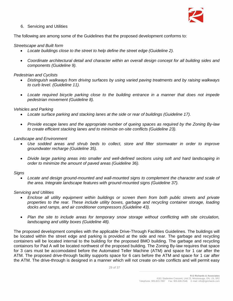
5.6 Urban Design Guidelines for Drive-Through Facilities
The Urban Design Guidelines for Drive-Through Facilities identifies that drive-through facilities are often found in combination with other uses, such as a financial institution. The guidelines are applied during the planning application stage and will be applied to all parts of the City. When the drive-through facility is located in areas identified as Mainstreets, the Mainstreets guidelines will be used in conjunction. The Design guidelines document contains 49 Guidelines and is organized into six general sections, namely:
1. Streetscape and Built Form 2. Pedestrians and Cyclists 3. Vehicles and Parking 4. Landscape and Environment 5. Signs
29 of 37 _______________________________________________________________
R.G Richards & Associates
4181 Sladeview Crescent, Unit 23, Mississauga, ON, L5L 5R2 Telephone: 905.823.7897 Fax: 905.606.2546 E-mail: [email protected]
6. Servicing and Utilities The following are among some of the Guidelines that the proposed development conforms to: Streetscape and Built form
Locate buildings close to the street to help define the street edge (Guideline 2).
Coordinate architectural detail and character within an overall design concept for all building sides and components (Guideline 9).
Pedestrian and Cyclists
Distinguish walkways from driving surfaces by using varied paving treatments and by raising walkways to curb level. (Guideline 11).
Locate required bicycle parking close to the building entrance in a manner that does not impede pedestrian movement (Guideline 8).
Vehicles and Parking
Locate surface parking and stacking lanes at the side or rear of buildings (Guideline 17).
Provide escape lanes and the appropriate number of queing spaces as required by the Zoning By-law to create efficient stacking lanes and to minimize on-site conflicts (Guideline 23).
Landscape and Environment
Use sodded areas and shrub beds to collect, store and filter stormwater in order to improve groundwater recharge (Guideline 35).
Divide large parking areas into smaller and well-defined sections using soft and hard landscaping in order to minimize the amount of paved areas (Guideline 36).
Signs
Locate and design ground-mounted and wall-mounted signs to complement the character and scale of the area. Integrate landscape features with ground-mounted signs (Guideline 37).
Servicing and Utilities
Enclose all utility equipment within buildings or screen them from both public streets and private properties to the rear. These include utility boxes, garbage and recycling container storage, loading docks and ramps, and air conditioner compressors (Guideline 43).
Plan the site to include areas for temporary snow storage without conflicting with site circulation, landscaping and utility boxes (Guideline 48).
The proposed development complies with the applicable Drive-Through Facilities Guidelines. The buildings will be located within the street edge and parking is provided at the side and rear. The garbage and recycling containers will be located internal to the building for the proposed BMO building. The garbage and recycling containors for Pad A will be located northwest of the proposed building. The Zoning By-law requires that space for 3 cars must be accomodated before the Automated Teller Machine (ATM) and space for 1 car after the ATM. The proposed drive-through facility supports space for 6 cars before the ATM and space for 1 car after the ATM. The drive-through is designed in a manner which will not create on-site conflicts and will permit easy

30 of 37 _______________________________________________________________
R.G Richards & Associates
4181 Sladeview Crescent, Unit 23, Mississauga, ON, L5L 5R2 Telephone: 905.823.7897 Fax: 905.606.2546 E-mail: [email protected]
internal circulation for the cars using and not using the drive-through. The Site will include an area to the southeast that will act as snow storage in the winter months and will be landscaped with permeable materials for the remainder of the year.
5.7 Zoning By-Law 2008-250
The City of Ottawa Zoning By-law 2008-250 was consolidated in 2008 in order to harmonize the 36 former zoning by-laws for the City of Ottawa that governed the various municipalities prior to amalgamation. The City of Ottawa zoning by-law regulates development and provides a number of provisions relating to use, lot size, building height, setbacks, built form, parking and loading. AM The Site is zoned Arterial Mainstreet Zone – AM by By-law 2008-250 (see Figure 13). The purpose of the AM – Arterial Mainstreet Zone is to support the Arterial Mainstreet as designated in the Official Plan and accommodate a broad range of uses including retail, service, commercial, offices, residential and institutional. The AM Zone has been established to impose development standards to promote intensification without losing sight of the surrounding existing.
Figure 13: Zoning Map – Bylaw 2008-250
As per Part 3, Section 93, the Site and 1460 Merivale Road shall be considered as one lot for the purposes of applying zoning provisions and regulations. Both properties are zoned Arterial Mainstreet and share a common parking lot. Permitted Uses

31 of 37 _______________________________________________________________
R.G Richards & Associates
4181 Sladeview Crescent, Unit 23, Mississauga, ON, L5L 5R2 Telephone: 905.823.7897 Fax: 905.606.2546 E-mail: [email protected]
The AM Zone contains a number of permitted uses, including banks as well as other commercial and retail uses. The proposed uses on the Site are permitted under the current zoning permissions of the AM Zone. Development Standards The provisions for the AM zone applicable to the Site include no minimum lot area, lot width or landscaped area. The provisions require a minimum 3 metre rear yard setback for properties abutting a street. The provisions also require a maximum building height of 25 metres if the properties are located more than 30 metres from a property line abutting a R1 – R4 zone. The maximum floor space index is 2.0. The proposed development adheres to these Zoning By-law provisions. The Site is located in Area C of Schedule 1 for Zoning By-law 2008-250. The parking rate for a shopping centre use located 600m outside of a rapid transit station and within Area C is 3.6 spaces per 100m² of gross floor area. A minimum of 29 parking spaces is required by the Zoning By-law based on the proposed 789.6 m² of gross floor area. The proposed development provides for a total of 47 parking spaces which will be shared with the existing shopping centre. The Zoning By-law also requires that bicycle spaces be provided at a rate of 1 per 250 m² of gross floor area. The proposed development provides storage racks for up to 10 bicycles and is in compliance with the zoning by-law requirements. Drive-through Facilities are permitted on site and require that the minimum number of queing spaces leading to a bank/bank machine is 3 before/at each machine and 1 space is required after the machine. The proposed development exceeds the Zoning By-law requirement for Drive-Through Facilities.

32 of 37 _______________________________________________________________
R.G Richards & Associates
4181 Sladeview Crescent, Unit 23, Mississauga, ON, L5L 5R2 Telephone: 905.823.7897 Fax: 905.606.2546 E-mail: [email protected]
6.0 JUSTIFICATION
This report has described the Site and surrounding fabric, the proposed development, as well as the relevant provisions and policies of the Provincial Policy Statement, the City of Ottawa Official Plan, the Merivale Road Secondary Plan, applicable Ottawa Urban Design documents, and Zoning By-law 2008-250 as they pertain to the proposal.
6.1 Infill and Redevelopment
The proposed Site development is consistent with the policies found in the Provincial Policy Statement, the City of Ottawa Official Plan and the Merivale Road Secondary Plan all of which support redevelopment on sites well served by municipal infrastructure and public transit. The Official Plan supports infill and redevelopment throughout the Merivale Road area. The Plan supports and recognizes the need for infill projects on underutilized sites while maintaining a successful and popular shopping destination. The Merivale Road Secondary Plan further supports the redevelopment of existing parcels which will improve the relationship between existing and future residential and commercial uses. Rather than develop on a ‘green field’ site, the proposal seeks to redevelop an existing and underutilized parcel. The benefit of this infill development is that it will encourage revitalization as well as contribute to a successful commercial area. By redeveloping the site, the proposed development aligns itself with the goals of both the Secondary Plan and the Official Plan, which are to support infill and redevelopment in areas well serviced by Public Transit. Both existing buildings are dated and built in a manner that is not conducive to an active street front. The existing buildings do not follow the street line and create for awkward sight lines along Merivale Road. The proposal addresses these issues as the buildings are to be angled in a manner which follows Merivale Road. By proposing a building-edge which parallels Merivale Road, the Site instantly improves the streetscape. In addition to being more visually appealing, the proposed development will provide a safer and more accessible shopping destination as the access to both buildings will come from one signalized access, rather than two unsignalized accesses. The proposed development will not require additional servicing, rather, the redevelopment will utilize the existing infrastruscture.
6.2 Land Use, Compatibility & Urban Design
The proposed redevelopment is consistent with the Merivale Road land use permissions in the City of Ottawa Official Plan. The proposal addresses the objectives of the Official Plan which seeks to achieve a broad range of land uses and activities which are to be supported by residential neighbourhoods within the Merivale Road Area. Banks, restaurants, retail and service commercial are all uses permitted within the Official Plan and the Zoning By-law. The proposed commercial development on the Site is in keeping with similar land uses to the east and west of the Site, and the development form is also compatible and consistent with adjacent developments and land uses. Single-storey commercial buildings surround the Site to the north, east and west.

33 of 37 _______________________________________________________________
R.G Richards & Associates
4181 Sladeview Crescent, Unit 23, Mississauga, ON, L5L 5R2 Telephone: 905.823.7897 Fax: 905.606.2546 E-mail: [email protected]
All new development within the City of Ottawa must adhere to Section 2.5.1, Design Objectives and Principles, of the Official Plan. As outlined in Section 5.2.1 of this report, the proposed development adheres to the design criteria listed in Section 2.5.1 of the Official Plan. The proposal provides for an updated use of an underutilized Site which will in turn add to the character of the neighbourhood as well as improve the visual aesthetic of the Merivale Road street front. The exterior treatment of the building and the architectural design will further complement the existing fabric of the area and development adjacent to the Site. The proposed development also adheres to the measures contained in Section 4.11 of the Official Plan pertaining to Urban Design and Compatibility (refer to Section 5.2.2 for detailed analysis). The proposal has been designed to respect urban design policies of the Official Plan by providing features which promote the streetscape and built form, enhance the pedestrian and cyclist realm, provide adequate vehicle and parking area, provide sufficient landscaping features, provide for service areas and mitigate issues such as noise, air and light pollution. The proposal respects the guidelines for both development along Arterial Mainstreets and proposals including Drive-Through Facilities. As submitted with this application, supporting reports and studies as well as the architectural plans provide reassurance that the design requirements have been met and addressed. The proposed development is in keeping with the intent and objectives of the design and compatibility criteria of the Official Plan.
6.3 Density, Height & Massing
The proposed height of the commercial buildings fit with the existing residential developments in the area which includes single-storey detached residential buildings south of the Site. The scale and massing of the proposed development fits with the surrounding context of the Merivale Road area. The proposed height of the buildings is permitted by the current City of Ottawa zoning, and the massing of the buildings is appropriate for the area. As per the Zoning By-law the maximum Floor Space Index (FSI) is 2.0. The FSI for the proposed buildings 0.5 which is well within the maximum requirement.

34 of 37 _______________________________________________________________
R.G Richards & Associates
4181 Sladeview Crescent, Unit 23, Mississauga, ON, L5L 5R2 Telephone: 905.823.7897 Fax: 905.606.2546 E-mail: [email protected]
7.0 SUMMARY OF TECHNICAL ANALYSES
7.1 Transportation Impact Study
A Transportation Impact Study (TIS) was prepared for the proposed development by CastleGlenn Consultants Inc. (CGI) in January 2014. The TIS concludes that the impact of the proposed development upon the surrounding roadway network was determined to be negligible. The following are several of the findings and conclusions yielded from the Transportation Impact Study:
1. The turning movements associated with the new west1 leg of the Merivale Road / Burris Lane intersection (independent of which option is selected for the 1445 Merivale Road lands) would result in the following:
EB movements leaving the site would experience an average delay of 22 seconds assuming a shared EB access;
The NB-LT movement entering the site would experience an average delay of 5 seconds; and
The SB-RT entering the site from Merivale Road would experience an average delay of 6 seconds. This accounts for SB-TH vehicles in front of the SB-RT vehicle in the outer lane blocking the right turn movement while waiting for the light to change.
2. The net effect 5 years after opening up a new west leg of the Merivale Road / Burris Lane intersection
(in 2015) (independent of which option is selected for the 1445 Merivale Road lands) would result in:
WB-LTs from Burris Lane onto Merivale Road experiencing an additional 3 seconds of delay and a very minor increase in the volume to capacity (v/c) ratio of 0.07; and
The SB-RT entering the site from Merivale Road from the shared Th-RT lane would result in only an additional 2 seconds of delay and a very minor increase in the v/c ratio of 0.06.
3. The impact of the proposed development upon the surrounding roadway network was determined to be
negligible with less than 35 vehicles-per-hour (vph) for either the morning or afternoon peak direction of travel demand.
4. This new internal connection between the Loblaws Plaza and the proposed site can be accommodated
by the site configuration and result in acceptable on-site circulation.
5. The drive through storage length was found to be sufficient and is not anticipated to impact on-site traffic operations nor block the new site access.
Roadway Infrastructure Effects:
1. The yellow pavement markings on the centreline of the south leg of the Merivale Road/ Burris Lane intersection should be replaced with a dedicated NB-LT lane with a total length of 55m;
2. The 40m throat length of the new west leg of the intersection as illustrated on the site plan would provide for adequate vehicle storage length on site;
1 Transportation Impact Statement identifies the new leg of the proposed intersection to be a west leg. Due to the awkwardness of the
Merivale Road and Burris Lane intersection, the Planning Rational identifies the proposed intersection improvement as a north leg.

35 of 37 _______________________________________________________________
R.G Richards & Associates
4181 Sladeview Crescent, Unit 23, Mississauga, ON, L5L 5R2 Telephone: 905.823.7897 Fax: 905.606.2546 E-mail: [email protected]
3. A dedicated SB-RT auxiliary lane into the site is not warranted; and
4. It is proposed that the new west leg of the intersection be configured as a shared movement with a 1-
to-2m painted median. 1445 Merivale Road Access Effects:
1. Five options were examined to assess the impacts on intersection performance. It was concluded that the impact upon the Merivale Road / Burris Lane intersection (independent of which option is selected for the 1445 Merivale Road lands) is negligible. Proposed Commercial Development – 1450 & 1454 Merivale Road Page -17- Traffic Impact Assessment January 2014
2. Despite the above, the preferred arrangement that would offer the best traffic operation and circulation
characteristics was determined to be a RI-RO access off of Merivale into the 1445 Merivale Road site in concert with a full-movement intersection on Burris Lane.
The results of the Traffic Study indicate that the City of Ottawa should be encouraged to assemble the appropriate conditions for development approval that would permit the development application to proceed.
7.2 Functional Servicing Report
A Functional Servicing Report was completed for the proposed development by David Schaeffer Engineering Limited. The report provided the following conclusions and recommendations:
The proposed water demand is less than the existing condition, it can be assumed the existing municipal water infrastructure is capable of providing adequate supply for the contemplated development. A pressure test is recommended to determine if pressure control is required;
The contemplated development has a waterwater flow contribution of 0.14L/s, adequate capacity within the adjacent sewers is assumed as it is discharging less than in the existing condition;
Due to a net reduction in imperviousness and peak flow rates from existing to the proposed condition it is not anticipated that further quantity or qualify controls will be necessary.
7.3 Geotechnical Study
A Geotechnical Investigation was completed for the proposed development by Paterson Group Inc. on February 14, 2014. The investigation identified that from a geotechnical perspective, the subject site is suitable for the proposed buildings. The following are the recommendations yielded from the investigation:
Observation of all bearing surfaces prior to the placement of concrete.
Sampling and testing of the concrete and fill materials used.

36 of 37 _______________________________________________________________
R.G Richards & Associates
4181 Sladeview Crescent, Unit 23, Mississauga, ON, L5L 5R2 Telephone: 905.823.7897 Fax: 905.606.2546 E-mail: [email protected]
Periodic observation of the condition of unsupported excavation side slopes in excess of 3 m in height, if applicable.
Observation of all subgrades prior to backfilling
Field density tests to determine the level of compaction achieved.
Sampling and testing of the bituminous concrete including mix design reviews. Upon completion of the above recommendations, the investigation recommends the completion of a follow up report confirming the completion of these works to the standards of a satisfactory program by a geotechnical consultant.

37 of 37 _______________________________________________________________
R.G Richards & Associates
4181 Sladeview Crescent, Unit 23, Mississauga, ON, L5L 5R2 Telephone: 905.823.7897 Fax: 905.606.2546 E-mail: [email protected]
8.0 CONCLUSIONS AND RECOMMENDATIONS
The proposal is consistent with the policy direction established in the Provincial Policy Statement and the City of Ottawa Official Plan. The proposed development complies with the design policies and guidelines contained in the Official Plan, the Merivale Road Secondary Plan, the Urban Design Guidelines for Development along Arterial Mainstreets and the Urban Design Guidelines for Drive-Through Facilities. The proposal is also compliant with the provisions provided for the Site in the City of Ottawa Zoning By-law. The design, height, and massing of the proposed development is compatible with the existing built form context of the surrounding area and existing development adjacent to the Site. The proposed redevelopment contributes to the goals of the Official Plan and Merivale Road Secondary Plan by providing for redevelopment along Merivale Road while maintaining the existing nature of the surrounding neighbourhood. The proposed commercial uses will contribute to the City’s vision of Merivale Road as a successful shopping area. The Site is ideal for intensification given the existing infrastructure, proximity to public transit, and surrounding environment. It is recommended that the City of Ottawa approve the Site Plan Application for 1450 and 1454 Merivale Road.