Embed Size (px)
Citation preview

DEVELOPMENT OF A MAPPING TOOL TO SUPPORT LOCAL LAND-USE PLANNING
PROGRESS UPDATE
Buea, 10th November 2015 Regional delegation conference hall of MINEPAT Buea.
i
SUMMARY
SOMMARY ................................................................................................................................... i
LIST ABBREVIATIONS ................................................................... Error! Bookmark not defined.
I- INTRODUCTION ................................................................................................................... 1
1. Brief reminder of the Project .......................................................................................... 1
2. Objectives of the meeting ............................................................................................... 1
II- PROCESSING OF THE MEETING ........................................................................................... 2
1. The welcoming of the representative of the regional delegate MINEPAT ..................... 2
2. Introduction of participants ............................................. Error! Bookmark not defined.
3. Presentations................................................................................................................... 2
3.1. The legal framework of land use planning in Cameroon ......................................... 2
3.2. Updates of the EFI project progress and its output so far ....................................... 3
3.3. Updates of the biodiversity mapping ...................................................................... 3
3.4. Mapping and Forest Governance ............................................................................ 4
3.5. Update on accessibility mapping ............................................................................. 4
3.6. Introduction to the online Land Use Planner (Economic Analysis Tool) ................. 5
3.7. Update on the status of data for planning land use within their sector and inputs
to the common mapping tool. ............................................................................................ 6
4. Plenary discussions .......................................................................................................... 7
III- CONCLUSION ................................................................................................................... 8
IV- ANNEX ............................................................................................................................. 9
1. Agenda of the meeting ................................................................................................ 9
2. Attendance list ........................................................................................................... 10
ii
Acronyms
UE: Union Europénne
MINEPAT: Ministère de l’Economie de la Planification et de l’Aménagement du territoire
WRI : World Ressources Institute
MINTP : Ministère des Travaux Publiques
PNDP : Programme National de Développement Participatif
MINEPDED : Ministère de l’Environnement et du Développement durable
MINDCAF: Ministère du Domaine, du Cadastre et des Affaires Foncières
CDC: Cameroon Development Corporation
AJESH: Ajemalibu Self Help

1
1 INTRODUCTION
1.1 Brief reminder of the Project
The objective of the project is to design and test a mapping tool to improve the transparency
of spatial planning in Cameroon, in the context of REDD+. The tool will make available
various types of information to those who need it during multi-stakeholder land use
planning at council (and regional) level.
The project is funded by the European Forest Institute (EFI) REDD+ Facility. Funds come from
many donors. A consortium is responsible for the implementation of this project:
• LTS International (Consortium Leader)
• Rainbow Environment Consult – National Partner to implement the
project
• WRI – developing the mapping portal (previously Ecometrica)
• Proforest – providing technical support
The project is supported by the government of Cameroon. A first scoping mission took place
in June 2014. The EU Ambassador wrote to the Minister of MINEPAT on 11th December 2014
requesting official support for project. The Minister MINEPAT responded on 3rd February
2015 giving his support for the project.
The project is initially focused on South West Region and Nguti Council. Rationale for
choosing Nguti was presented in the Project Interim Report No.1 (May 2015).
In April 2015, two launching meeting were held in Buea and Nguti, which were organized to
present the rationale for development of this tool; to understand the stakeholder interests
in land use planning; to share ideas about what types of decisions a mapping tool should be
able to help; to agree what spatial data are needed to make these decisions; and to gain
support of regional and local stakeholders.
1.2 Objectives of the meeting
The objectives of the current meeting were to:
Remind Stakeholders about:
o the interest to plan for the future use of land;
o the legal framework for Land Use Planning in Cameroon;
o the type of decisions a mapping tool should be able to support;
o the type of spatial information needed to support land use decision making;
o the objectives of the EFI Project to support land use decision making in the
context of this land use planning framework;
Update Stakeholders on the preliminary results of field tests completed so far;
Share the draft maps prepared by EFI Project partners for Nguti Council Area;

2
Identify possible land use planning scenarios (options) for how Nguti might use its
land in future and to analyse these options in economic terms.
Compile and verify information that we will use to finalise the work:
o Roads;
o Cost of transport;
o Yields of crops;
o Prices.
Plan the next steps to the end of the EFI Project.
1.3 Process of the meeting
The Agenda for the meeting is outlined in Annex 1. The Buea meeting was attended by
almost forty participants from various ministries, CSO’s and Representatives of council and
traditional authorities. A list of participants is presented in Annex 2 of this report.
A representative of the South West Region’s Governor attended the opening session and
followed the first presentation reminding Cameroon’s land use planning framework which
was made by Professor Soh Fotsing, the representative of MINEPAT from Yaoundé.
The main activities held during the meeting can be presented as follows:
Words of welcome;
Introduction of each participant;
Power point presentations;
Discussions;
Meeting close.
1.4 Welcome by the representative of the Regional Delegate of MINEPAT
Mme Stéphanie Tchouateu, Regional Chief of Service of Economic Affairs and Programming,
representing the Regional Delegate, first of all wished all participants welcome to Buea and
the MINEPAT Delegation. She also reminded participants that this meeting was to present
progress with implementation of the EFI project entitled “Development of a mapping tool to
support local land-use planning”. She then hoped that all the activities would proceed as
planned.
A “tour de table” allowed each participant to introduce him/herself.
2 Presentations
2.1 The legal framework of land use planning in Cameroon
The legal framework of land use planning and sustainable development was presented by
Professor SOH FOTSING Bertin, the head of the Cartography Unit at MINEPAT.

3
He first of all reminded that Cameroon aims to become an emergent country by 2035 as it is
mentioned in the Document de Stratégie pour la Croissance et l’Emploi (DSCE) adopted by
the Government of Cameroon in November 2009. He then reminded participants that the
legal framework is the Orientation Law (n° 2011 /008 of 06 May 2011) on Land Management
and Sustainable Development. This Law aims to:
integrate the management of national space within development policies in
order to give more visibility and method to land allocation;
Balance the distribution of activities, infrastructures, equipment, services, and
populations across the national territory.
Support the implementation of major projects;
Some recommendations were mentioned during the launching meeting of the mapping tool
project in April 2015. It was to:
- Involve all the stakeholders during the project;
- Involve all the administrative to share data.
He finally noted that the Nguti council had been chosen as a pilot area and the results will be
a model for other councils in the country.
2.2 Updates of the EFI project progress and its output so far
The first presentation delivered by James ACWORTH (of LTS International), the EFI Mapping
Project Team Leader was an update on project progress and its output so far in terms of new
map layers generated since the Launch Meetings held in April 2015. This included a brief
reminder of the Project objectives, the government support for the Project, the funders and
the implementers of the project. It also summarised the different programs put in place in
reference to the implementation of the REDD+ project. He also reminded participants why
the concept of a common mapping platform to support transparent decision-making is
important and why it is helpful to make such information publicly accessible via the Internet.
He also reminded participants of the project calendar and where we are in the process.
2.3 Updates of the biodiversity mapping
The second presentation was delivered by Dr Peguy TCHOUTO on behalf of the team of
botanists led by the National Herbarium. He reported on the progress made with mapping
plant biodiversity in the Nguti municipality. The biodiversity mapping was done using a
method called Rapid Botanical Surveys (RBS) to map botanical ‘richness’ of the Nguti
Municipality to identify priority areas for protection (managed for their biodiversity), for
development or community uses.
Dr Tchoutou’s presentation can be downloaded by clicking here. The detailed report from
the Botanical Field Survey is found in Annex XX.
4
2.4 Mapping and Forest Governance
This presentation was done by the coordinator of the project in Cameroon followed by a
presentation of its progress by AJESH representative.
The Mapping and Forest Governance (MFG) Project in Cameroon is part of a regional
programme funded by the British Department for International Development (DfID) that
aims to contribute to poverty reduction, sustainable management and improved governance
of tropical rainforests in the Congo Basin.
The objective of the project is to:
- document forest communities’ land tenure and governance systems through
participatory mapping in at least 36 communities;
- Support local communities and their representatives to defend their rights to lands
and resources, in the context of the projects that are affecting them and of the
relevant legal and political processes, particularly land planning.
2.5 Update on accessibility mapping
This presentation was made by Simone VACCARI of LTS International. It can be downloaded
by clicking here.
He started by defining accessibility for the purposes of this project as “the time and cost of
transportation of agricultural commodities from the farm to the main market”.
The accessibility map helps to support some decisions around land use planning. The main
questions are:
- How long does it take to…?
- What is the best route…?
- How much does it cost…?
- Where is the best location to…?
The approach used to build the accessibility map was to generate a map showing the walking
time to nearest road and then travel time from the point of arrival at roadside in Nguti, along
the road to Douala, using estimates of travel speed based on the current state of repair of
each section of road traversed. We then combined estimates of time to walking to the road
and time to travel by road to Douala.
The cost of transporting an important commodity for rural livelihoods such as Cocoa from
farm to market can be generated from this information. The draft map of time and cost of
transporting cocoa to market is a work in progress - the road network needs to be updated
using the best available road data and better estimates of travel times and costs before the
model is run again to produce a final accessibility map for the whole of South West Region.

5
2.6 Crop Suitability
James Acworth provided updates on two « crop suitability » maps that have been prepared
by project collaborators for the South West Region and beyond:
A map of oil palm suitability has been prepared by IIASA.
A map of cocoa suitability has been prepared by IITA.
These two maps show that there are areas of the South-West Region that are more or less
suited to the two crops. They show that the areas most suitable for Oil Palm are less suited
to Cocoa, and vice versa. While Nguti has suitable soils, and modest altitudes, and enough
annual rainfall, it is of relatively low suitability for Oil Palm due to the long dry season.
Meanwhile, the area is highly suited to Cocoa under current climatic conditions but will
become less suited with projected climate change over the next 35 years.
2.7 Introduction to the online Land Use Planner (Economic Analysis Tool)
The full presentation can be downloaded by clicking here.
Thomas SEMBRES of EFI presented the pros and cons of mapping tools and economic
analysis tools:
Mapping tools can produce maps of current and “optimal” land use for specific
scenarios but land use decisions are also based on socio-economic analysis to
consider possible better alternatives. Some limited economic information can be
integrated into the mapping tool (e.g. transport costs, as provided in the accessibility
map presented above).
Economic tools can compare alternative scenarios with economic, social and
environmental indicators, but does not reconcile these in a limited « production
space ».
He then presented an online interactive tool called the « Land Use Planner »
(http://landuseplanner.org/) that has been developed by EFI to facilitate responsible land-
use planning. The “Land Use Planner” tool can analyse and compare alternative land use
scenarios with economic, social and environmental indicators, but does not reconcile these
in a limited « production space ».
2.8 Mapping Tool Development
An update on the online mapping tool being developed by WRI was presented by M.
Duclaire Mbouna, the national representative of WRI.
The Interactive Forest Atlas is available online here - http://cmr.forest-atlas.org
This online tool will be adapted to support land use planning in Cameroon, using Nguti and
South West Region as a Pilot areas.
6
2.9 Discussion of the potential alternative land use pathways in Nguti
A plenary discussion on potential alternative land use pathways in Nguti was led by the
representatives of LTS.
The different scenarios can be constructed by projecting current trends of e.g. growth in
population, agricultural expansion, conservation efforts, and other dynamics, such as the
impact of new roads on in-migration. The participants were asked to envisage 3 possible
land use scenarios for the Nguti Municipality (which has a total of 205,000 hectares of land)
that could be reached by the year 2050. This exercise involved allocating the total area of
land to one or another purpose, but making sure that it did exceed the 205,000 ha of
available « production space ».
3 Discussion and feedback
The chairman led a plenary discussion and feedback on the various data layers presented above.
3.1 Update on the status of data for planning land use within their sector
and inputs to the common mapping tool.
Representatives of different sectors were invited to comment on the status and availability of data from their respective sectors that could be relevant for planning land use and the potential to provide such data to improve the common mapping tool.
The representative of MINDCAF said that the Land Titles (Titres Fonciers) cannot be
uploaded to the platform because some of such data is considered to be confidential. But he
felt that this problem could soon be solved given that the trend is towards increasing
transparency these days. The Minister (MINDCAF) can authorize release of the land titles
data, based on a formal request from MINEPAT.
The representative of MINEPDED said they are keenly waiting for this tool to take decision
for the management of the environment.
For the MINEPIA, their members need to be trained to produce spatial data of their activities
so that they could share these data for the development of the project
The MINTP is glad to know that the MINTP online road data helped in this project. He wishes
that the data would be updated.
The PSMNR wish that all the work will be validated by the National Cartographic Institute
(INC).
WCS also expressed its willingness to share historical data relating to Banyang Mbo Wildlife
Sanctuary.

7
3.2 Plenary discussions
Participants made a number of questions, contributions and comments during and after the
presentations.
3.2.1 Questions
Representative of Rainforest Foundation: Are there stated and binding rules for land use planning framework in the South West?
After the presentation of the representative of the National Herbarium providing an update on the progress with the mapping biodiversity in Nguti municipality, the representative of Nature Cameroon asked whether the maps he presented are available and if yes, how can they be used? He also appreciated the initiative, but he complains about the communication, which is not really effective between PSMNR and the local communities.
After the presentation of Mapping and Forest Governance and the update on the OpenStreetMap platform, the representative of MINDCAF wanted to know whether his ministry was informed about the different projects mentioned? This raised the point that subordinates in most ministries usually have little or no knowledge about important issues and the fact that there is poor information sharing within and between most ministries.
After the presentations on the next steps, the introduction to the online land use planner and lastly the running land use planning scenarios, some others questions have been asked.
On what basis are conclusions going to be made in reference to the different scenarios?
Has REDD+ been implemented in any African country yet?
What’s the assurance of having a forest in the next 50 years?
3.2.2 Answers, contributions and recommendations
As response for all these preoccupation, it has been said that all the ministries are involved. For example, the MINDCAF could not be involved because he owns the land. He is a member of the validation comity. He is the concern at the first level. The answer given by the representative of MINEPAT Yaoundé was that, legal and binding norms shall be stated and established in the framework but that for now the framework has not yet been established.
For the question regarding the availability of the maps presented and how they can be used, Dr Tchouto responded that, the different maps he presented were not yet official because these maps had not yet been validated by the national institute of cartography (INC) and that the data were just estimates regarding the fact that; there are no maps yet showing what Herakles planted and what CDC owns for example.
The EFI team clarified that all the relevant ministries were informed before the launching of the EFI mapping tool project and were updated about the progress of the project during implementation. The same is true for the Mapping for Governance Project.

8
A recommendation was made for the improvement of the accessibility map by taking into
account the seasonality. Considerations should be done according to the different seasons
and their conditions in Cameroon. This is because the travel time is different whether it is in
the dry or wet season.
4 CONCLUSION As closing remarks, the chiefs and Mayor Representative expressed their satisfaction and
happiness for having been invited to this meeting. They strongly supported the project
concept and hope that the project will be useful for the country.
The Representative of the Regional Delegate of MINEPDED thanked the people for their
contributions. The workshop was interesting, and she hoped that the project would continue
as planned.
Thomas SEMBRES on EFI was really impressed by the interest of the entire participant, by
the quality of the discussions, the data shared. He hope that the pilot Council area of Nguti
will serve as an example for all the country
The representative of MINEPAT said this project is in a framework of land use that will be
launch. He congratulated all the contributions and hope the tool will help solve community
problem.
All participants appreciated the work done by all the contributors.

9
5 ANNEXES
Annex 1. Agenda of the meeting Time AGENDA item Speaker / Moderator
09:00-09.10 Welcome and opening remarks Regional Delegate MINEPAT
09:10-09:20 Introduction of each participant Tour de table
09:20-09:35 Reminder of Cameroon’s land use planning framework (Schéma National, Plan de Zonage National, Schéma Régional, Plan Local) and progress with implementation.
Representative MINEPAT Yaoundé
09.35-09:50 Update on EFI project progress, and outputs so far. James Acworth (LTS)
09.50-10.10
Update on progress with mapping biodiversity in Nguti Municipality.
Representative of the National Herbarium, (or PeguyTchouto)
10.10-10.40
Update on progress with the mapping and forest governance project Nguti (RFUK / FODER / AJESH).
Representative of AJESH
10.40-10.50 Feedback from OpenStreetMap Mapping Party (held on 29th October in Yaoundé)
Participant at the mapping party (to be selected)
10.50-11.00 Update on accessibility mapping Simone Vaccari (LTS)
11:00-11.15 Coffee/tea
11.15-11.30 Update on crop suitability mapping (Oil Palm and possibly Cocoa)
James Acworth (LTS)
11.30-12.00 Update on online mapping tool development + demonstration
WRI representative and/or Simone Vaccari (LTS)
12.00-12.30
Update by all other participants on the status of data for planning land use within their sector and inputs to the common mapping tool.
(MINADER, PNDP, PSMNR, others), Moderator (Tim Fomete, Rainbow)
13.00-14.00 Lunch Break
14.00-14.30 Presentation of potential alternative land use pathways in Nguti (analysis of multiple layers)
James Acworth (LTS) or Tim Fomete (Rainbow)
14.30-15.00 Feedback ondata layers, mapping tool and initial land-use scenarios,from the perspective of stakeholders in SW Region and Nguti Municipality.
Open floor.
Moderator (Tim Fomete, Rainbow)
15.30-15.45
Next steps and preparations for final project Workshop in Yaoundé – December 2015
James Acworth
15.45-16.00 Technical Session: Introduction to the online Land Use Planner (Economic Analysis Tool)
Thomas Sembres, EFI
16.00-17.00 Technical Session: running land use planning scenarios using the online Land Use Planner
Thomas Sembres, EFI
17.00 Closing remarks Regional Delegate MINEPAT

10
Annex 2. Attendance list
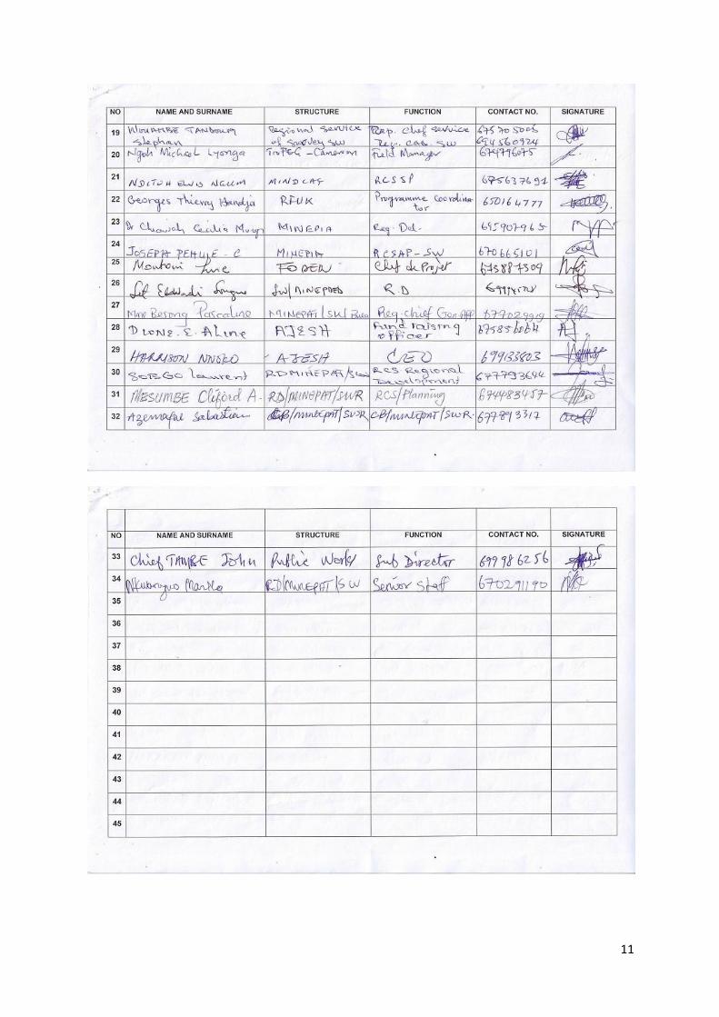
11