Embed Size (px)
Citation preview

PENINSULA PLATEAU
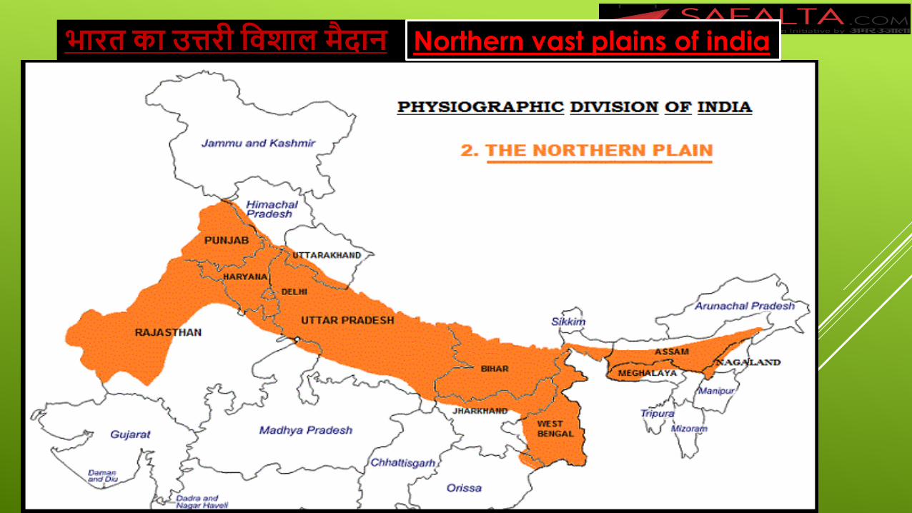
भारत का उत्तरी विशाल मैदान Northern vast plains of india
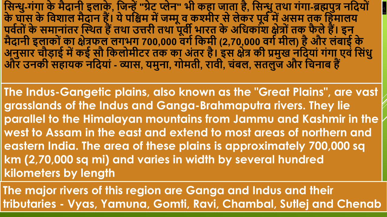
विनु्ध-गंगा के मैदानी इलाके, विन्हें "गे्रट पे्लन" भी कहा िाता है, विनु्ध तथा गंगा-ब्रह्मपुत्र नवदय ं
के घाि के विशाल मैदान हैं। ये पविम में िमू्म ि कश्मीर िे लेकर पूिव में अिम तक वहमालय
पिवत ंके िमानांतर स्थथत हैं तथा उत्तरी तथा पूिी भारत के अविकांश के्षत्र ंतक फैले हैं। इन
मैदानी इलाक ंका के्षत्रफल लगभग 700,000 िगव वकमी (2,70,000 िगव मील) है और लंबाई के
अनुिार चौडाई में कई िौ वकल मीटर तक का अंतर है। इि के्षत्र की प्रमुख नवदयां गंगा एिं विंिु
और उनकी िहायक नवदयां - व्याि, यमुना, ग मती, रािी, चंबल, ितलुि और वचनाब हैं
The Indus-Gangetic plains, also known as the "Great Plains", are vast grasslands of the Indus and Ganga-Brahmaputra rivers. They lie parallel to the Himalayan mountains from Jammu and Kashmir in the west to Assam in the east and extend to most areas of northern and eastern India. The area of these plains is approximately 700,000 sq
km (2,70,000 sq mi) and varies in width by several hundred
kilometers by length
The major rivers of this region are Ganga and Indus and their tributaries - Vyas, Yamuna, Gomti, Ravi, Chambal, Sutlej and Chenab
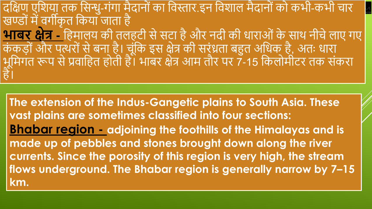
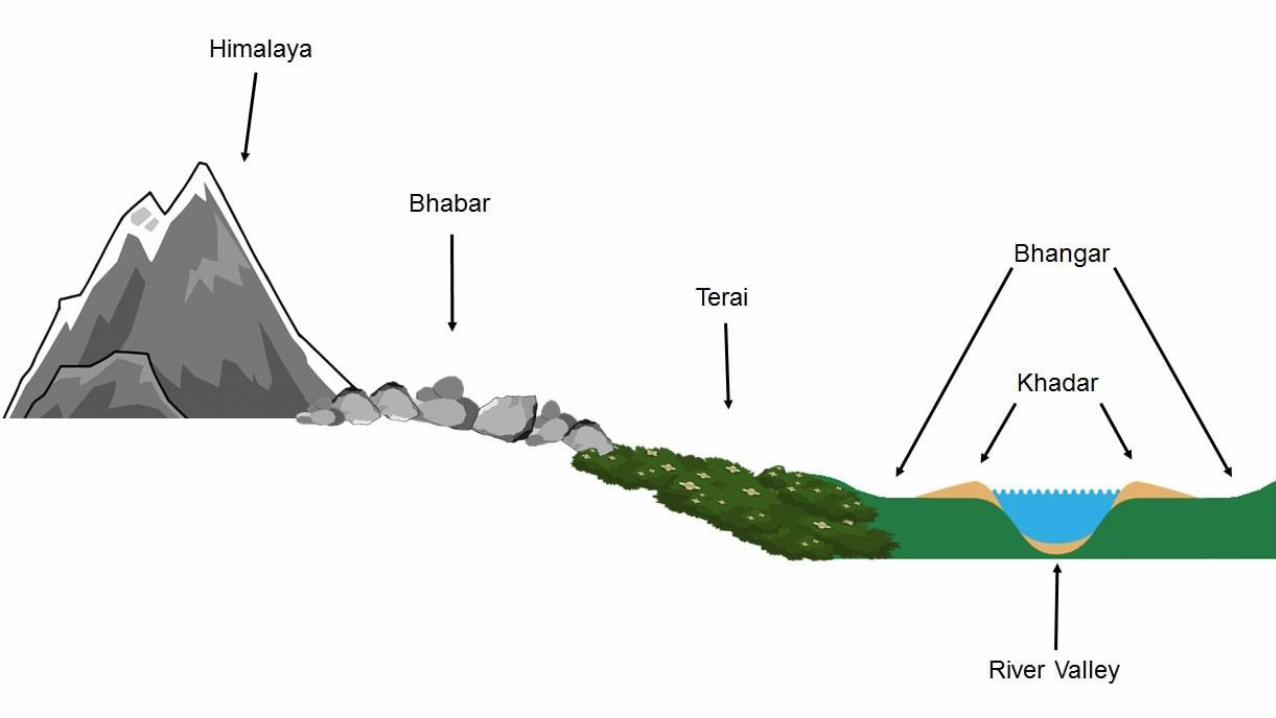
दक्षिण एक्षिया तक क्षिनु्ध-गंगा मैदान ंका क्षिस्तार.इन क्षििाल मैदान ंक कभी-कभी चार
खण् ंमें िगीकृत क्षकया जाता है
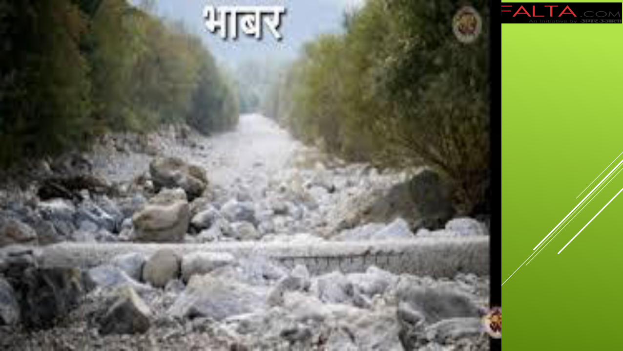
भाबर के्षत्र - क्षहमालय की तलहटी िे िटा है और नदी की धाराओ ंके िाथ नीचे लाए गए
कंकड ंऔर पत्थर ंिे बना है। च ंक्षक इि िेत्र की िरंध्रता बहुत अक्षधक है, अतः धारा
भ क्षमगत रूप िे प्रिाक्षहत ह ती है। भाबर िेत्र आम तौर पर 7-15 क्षकल मीटर तक िंकरा
है।
The extension of the Indus-Gangetic plains to South Asia. These vast plains are sometimes classified into four sections:
Bhabar region - adjoining the foothills of the Himalayas and is
made up of pebbles and stones brought down along the river currents. Since the porosity of this region is very high, the stream flows underground. The Bhabar region is generally narrow by 7–15 km.
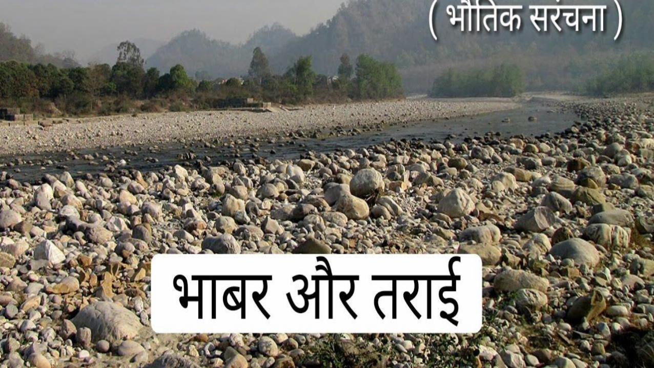
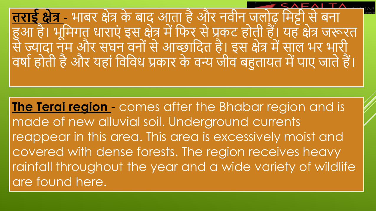
तराई के्षत्र - भाबर िेत्र के बाद आता है और निीन जल ढ़ क्षमट्टी िे बना
हुआ है। भ क्षमगत धाराएं इि िेत्र में क्षिर िे प्रकट ह ती हैं। यह िेत्र जरूरत
िे ज्यादा नम और िघन िन ंिे आच्छाक्षदत है। इि िेत्र में िाल भर भारी
िर्ाा ह ती है और यहां क्षिक्षिध प्रकार के िन्य जीि बहुतायत में पाए जाते हैं।
The Terai region - comes after the Bhabar region and is made of new alluvial soil. Underground currents
reappear in this area. This area is excessively moist and
covered with dense forests. The region receives heavy
rainfall throughout the year and a wide variety of wildlife
are found here.
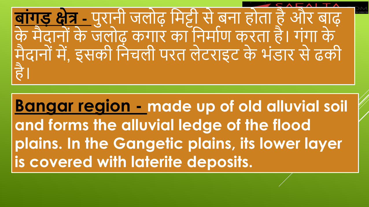
बांगड के्षत्र - पुरानी जल ढ़ क्षमट्टी िे बना ह ता है और बाढ़
के मैदान ंके जल ढ़ कगार का क्षनमााण करता है। गंगा के
मैदान ंमें, इिकी क्षनचली परत लेटराइट के भंडार िे ढकी
है।
Bangar region - made up of old alluvial soil
and forms the alluvial ledge of the flood plains. In the Gangetic plains, its lower layer is covered with laterite deposits.
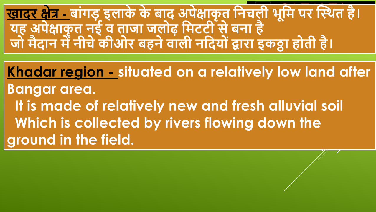
खादर के्षत्र - बांगड इलाके के बाद अपेक्षाकृत वनचली भूवम पर स्थथत है।
यह अपेक्षाकृत नई ि तािा िल ढ़ वमटटी िे बना है
ि मैदान में नीचे कीओर बहने िाली नवदय ंद्वारा इकठ्ठा ह ती है।
Khadar region - situated on a relatively low land after
Bangar area.
It is made of relatively new and fresh alluvial soil
Which is collected by rivers flowing down the
ground in the field.
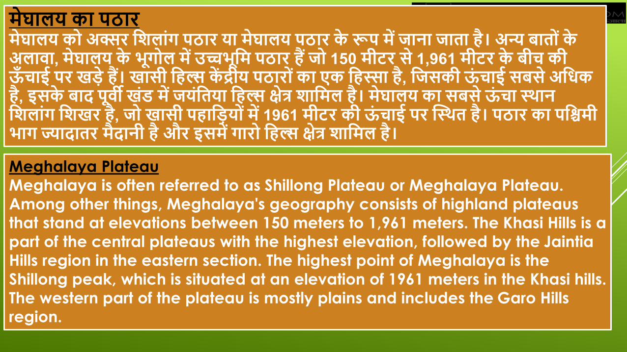
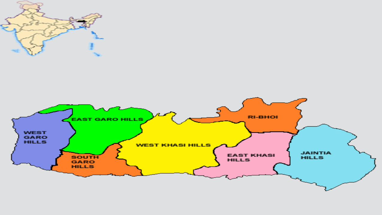
मेघालय का पठार मेघालय क अक्सर वशलांग पठार या मेघालय पठार के रूप में िाना िाता है। अन्य बात ंके
अलािा, मेघालय के भूग ल में उच्चभूवम पठार हैं ि 150 मीटर िे 1,961 मीटर के बीच की
ऊँचाई पर खडे हैं। खािी वहल्स कें द्रीय पठार ंका एक वहस्सा है, वििकी ऊंचाई िबिे अविक
है, इिके बाद पूिी खंड में ियंवतया वहल्स के्षत्र शावमल है। मेघालय का िबिे ऊंचा थथान
वशलांग वशखर है, ि खािी पहावडय ंमें 1961 मीटर की ऊंचाई पर स्थथत है। पठार का पविमी
भाग ज्यादातर मैदानी है और इिमें गार वहल्स के्षत्र शावमल है।
Meghalaya Plateau
Meghalaya is often referred to as Shillong Plateau or Meghalaya Plateau.
Among other things, Meghalaya's geography consists of highland plateaus
that stand at elevations between 150 meters to 1,961 meters. The Khasi Hills is a
part of the central plateaus with the highest elevation, followed by the Jaintia
Hills region in the eastern section. The highest point of Meghalaya is the
Shillong peak, which is situated at an elevation of 1961 meters in the Khasi hills.
The western part of the plateau is mostly plains and includes the Garo Hills
region.
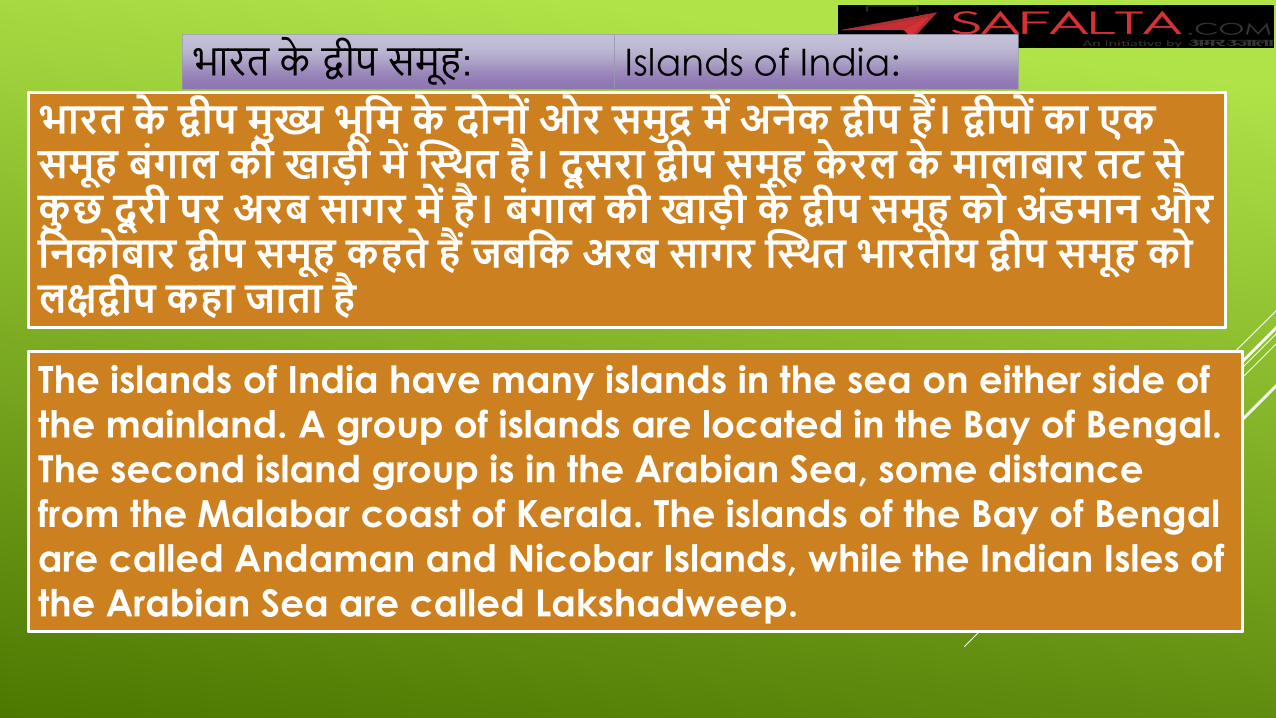
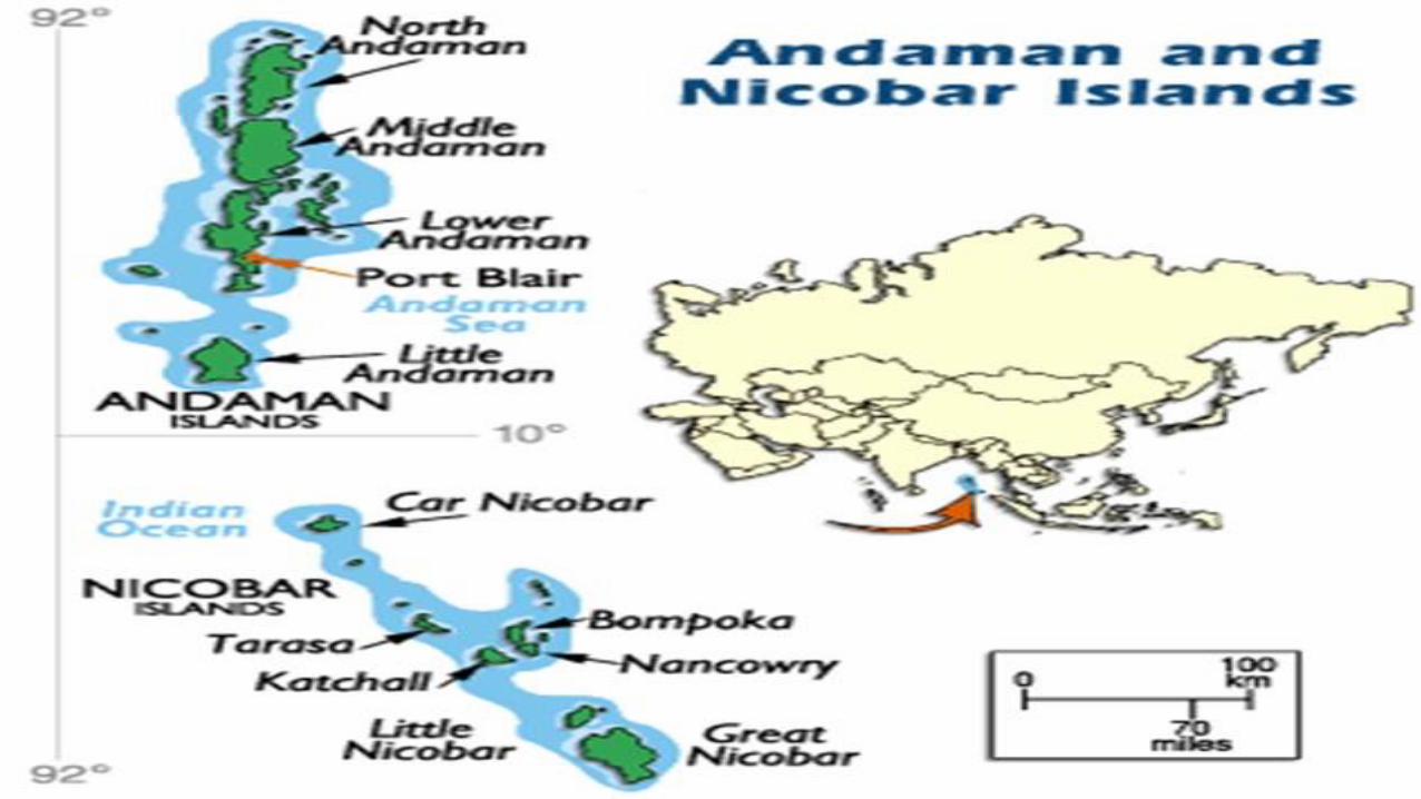
भारत के द्वीप मुख्य भूवम के द न ंओर िमुद्र में अनेक द्वीप हैं। द्वीप ंका एक
िमूह बंगाल की खाडी में स्थथत है। दूिरा द्वीप िमूह केरल के मालाबार तट िे
कुछ दूरी पर अरब िागर में है। बंगाल की खाडी के द्वीप िमूह क अंडमान और
वनक बार द्वीप िमूह कहते हैं िबवक अरब िागर स्थथत भारतीय द्वीप िमूह क
लक्षद्वीप कहा िाता है
भारत के द्वीप िम ह: Islands of India:
The islands of India have many islands in the sea on either side of
the mainland. A group of islands are located in the Bay of Bengal. The second island group is in the Arabian Sea, some distance from the Malabar coast of Kerala. The islands of the Bay of Bengal are called Andaman and Nicobar Islands, while the Indian Isles of the Arabian Sea are called Lakshadweep.
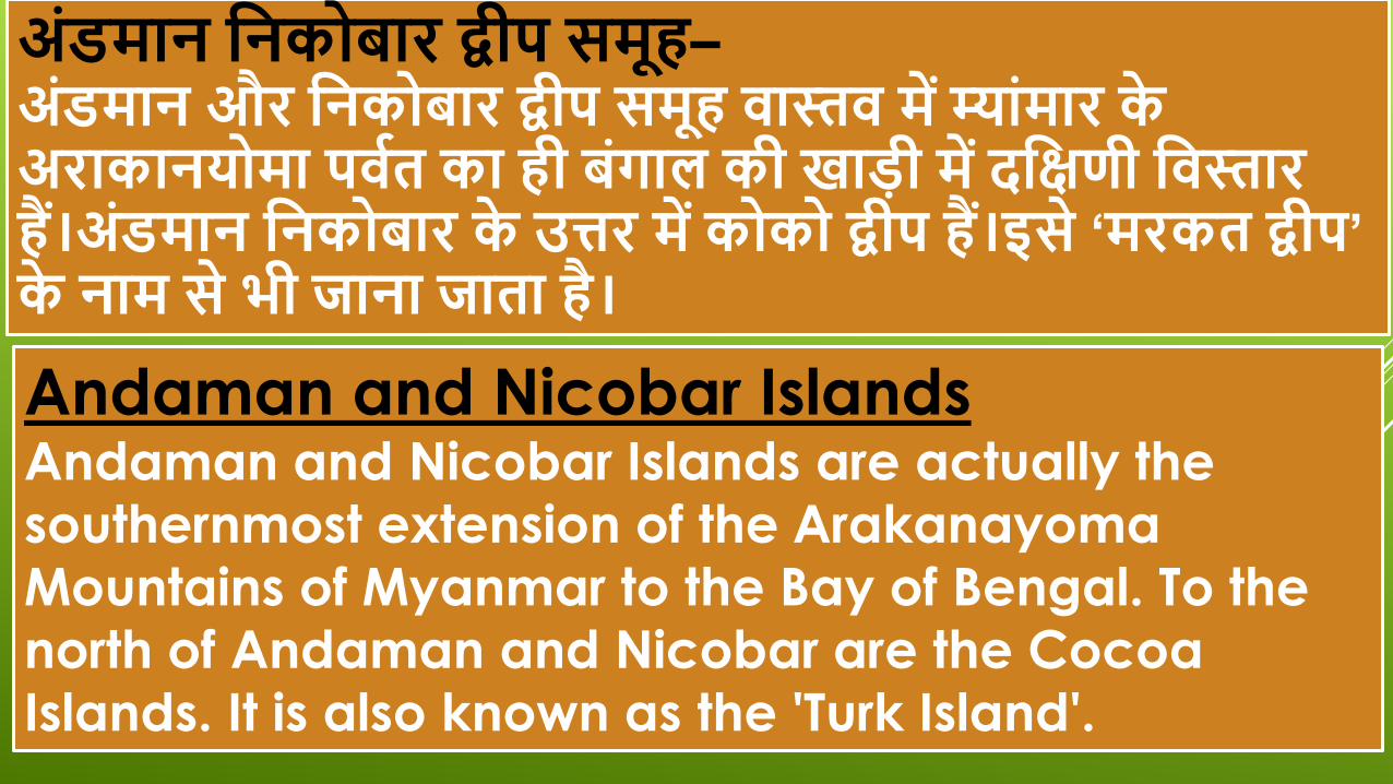
अंडमान वनक बार द्वीप िमूह– अंडमान और वनक बार द्वीप िमूह िास्ति में म्ांमार के
अराकानय मा पिवत का ही बंगाल की खाडी में दवक्षणी विस्तार
हैं।अंडमान वनक बार के उत्तर में क क द्वीप हैं।इिे ‘मरकत द्वीप’
के नाम िे भी िाना िाता है।
Andaman and Nicobar Islands Andaman and Nicobar Islands are actually the
southernmost extension of the Arakanayoma
Mountains of Myanmar to the Bay of Bengal. To the
north of Andaman and Nicobar are the Cocoa
Islands. It is also known as the 'Turk Island'.
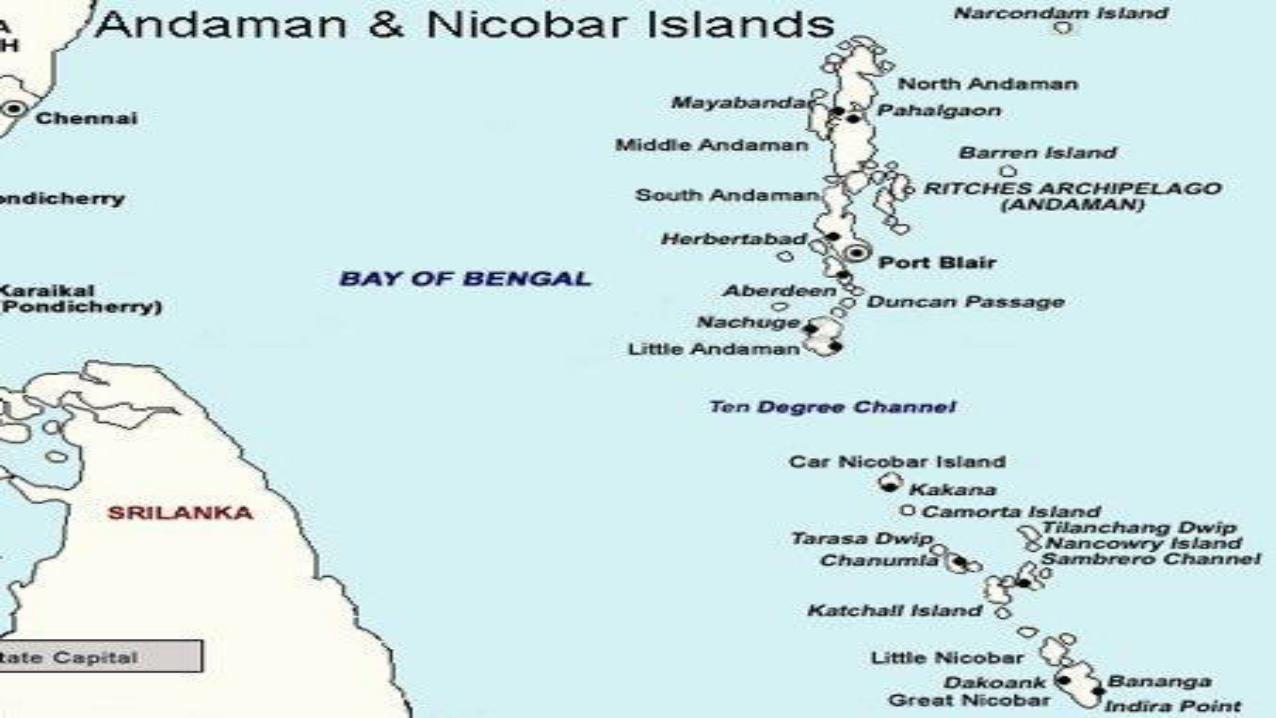
उत्तरी द्वीप ंक अंडमान के नाम िे िाना िाता है
िबवक दवक्षणी द्वीप ंक वनकबार के नाम िे िाना िाता है।
अंडमान के िबिे उत्तर में ‘उत्तरी अंडमान द्वीप’ हैं।
The northern islands are known as Andaman while
the southern islands are known as Nikbar.
North of Andaman is the 'North Andaman Islands'.
उत्तरी अंडमान के दवक्षण में मध्य अंडमान द्वीप हैं और मध्य अंडमान के दवक्षण में दवक्षणी
अंडमान हैं।
और दवक्षणी अंडमान के दवक्षण में वलवटल अंडमान द्वीप है। इन द्वीप ंक उत्तर िे दवक्षण वदखा में
ऐिे देख िकते है–
उत्तरी अंडमान
मध्य अंडमान
दवक्षणी अंडमान
वलवटल अंडमान
To the south of North Andaman are the Middle Andaman Islands and to the south of Middle Andaman are the South Andaman. And to the south of South Andaman is Little Andaman Island. You
can see these islands from north to south like this - North Andaman Middle Andaman South Andaman Little Andaman
The highest peak of the Andaman-Nicobar Islands is 'Sandal Peak' in North Andaman.
'Middle Andaman' is the largest island of Andaman and Nicobar. The South Andaman Islands are the capital and Port Blair itself. The northernmost island in the Nicobar archipelago is Carnicobar.
अंडमान-वनक बार द्वीप िमूह की िबिे ऊंची च टी ‘िैंडल पीक’ उत्तरी
अंडमान में हैं।
‘मध्य अंडमान’ अंडमान वनक बार का िबिे बडा द्वीप है।
‘दवक्षणी अंडमान’ द्वीप ओर ही राििानी ‘प टव बे्लयर’ हैं।
िही ँवनक बार द्वीपिमूह का िबिे उत्तरी द्वीप ‘कारवनक बार है।
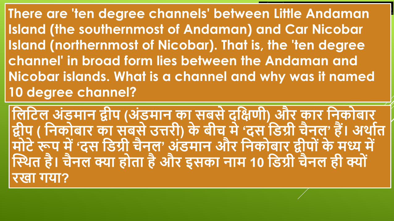
वलवटल अंडमान द्वीप (अंडमान का िबिे दवक्षणी) और कार वनक बार
द्वीप ( वनक बार का िबिे उत्तरी) के बीच मे ‘दि वडग्री चैनल’ हैं। अथावत
म टे रूप में ‘दि वडग्री चैनल’ अंडमान और वनक बार द्वीप ंके मध्य में
स्थथत है। चैनल क्या ह ता है और इिका नाम 10 वडग्री चैनल ही क्य ं
रखा गया?
There are 'ten degree channels' between Little Andaman
Island (the southernmost of Andaman) and Car Nicobar
Island (northernmost of Nicobar). That is, the 'ten degree
channel' in broad form lies between the Andaman and
Nicobar islands. What is a channel and why was it named
10 degree channel?
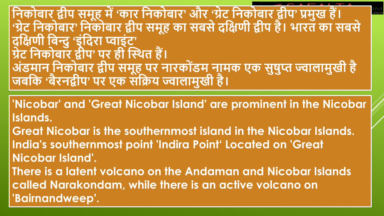
वनक बार द्वीप िमूह में ‘कार वनक बार’ और ‘गे्रट वनक बार द्वीप’ प्रमुख हैं।
‘गे्रट वनक बार’ वनक बार द्वीप िमूह का िबिे दवक्षणी द्वीप है। भारत का िबिे
दवक्षणी वबन्दु ‘इंवदरा प्वाइंट’
गे्रट वनक बार द्वीप’ पर ही स्थथत हैं।
अंडमान वनक बार द्वीप िमूह पर नारक डंम नामक एक िुषुप्त ज्वालामुखी है
िबवक ‘बैरनद्वीप’ पर एक िविय ज्वालामुखी है।
'Nicobar' and 'Great Nicobar Island' are prominent in the Nicobar Islands.
Great Nicobar is the southernmost island in the Nicobar Islands. India's southernmost point 'Indira Point‘ Located on 'Great Nicobar Island'. There is a latent volcano on the Andaman and Nicobar Islands called Narakondam, while there is an active volcano on 'Bairnandweep'.
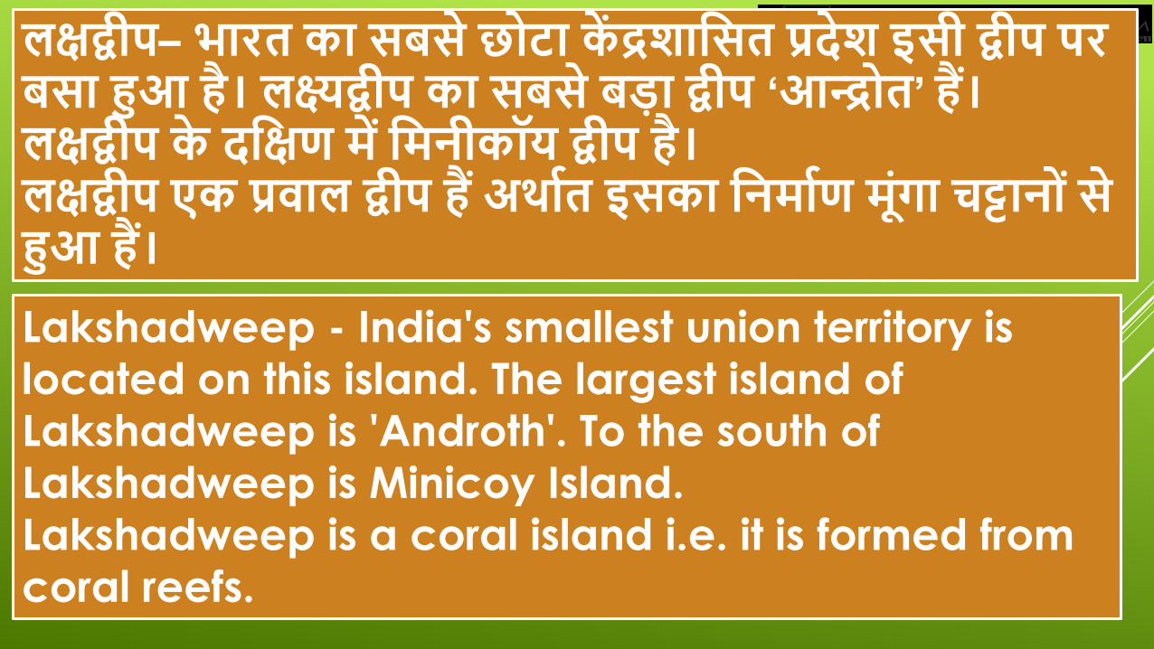
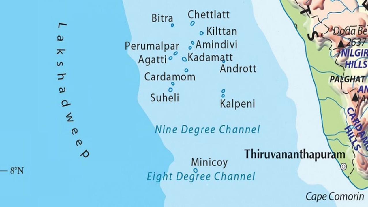
लक्षद्वीप– भारत का िबिे छ टा कें द्रशावित प्रदेश इिी द्वीप पर
बिा हुआ है। लक्ष्यद्वीप का िबिे बडा द्वीप ‘आन्द्र त’ हैं।
लक्षद्वीप के दवक्षण में वमनीकॉय द्वीप है।
लक्षद्वीप एक प्रिाल द्वीप हैं अथावत इिका वनमावण मंूगा चट्टान ंिे
हुआ हैं।
Lakshadweep - India's smallest union territory is
located on this island. The largest island of
Lakshadweep is 'Androth'. To the south of
Lakshadweep is Minicoy Island.
Lakshadweep is a coral island i.e. it is formed from
coral reefs.
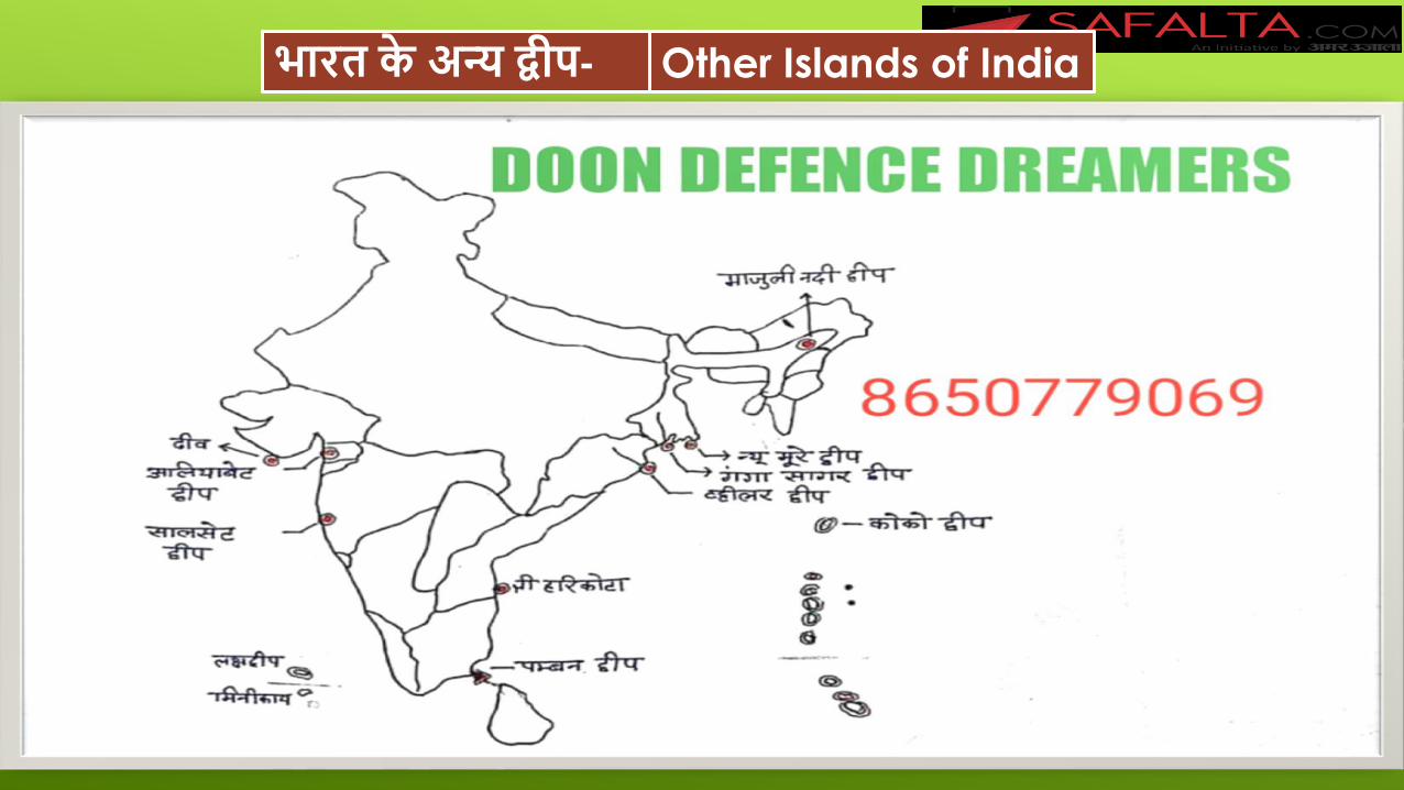
भारत के अन्य द्वीप- Other Islands of India
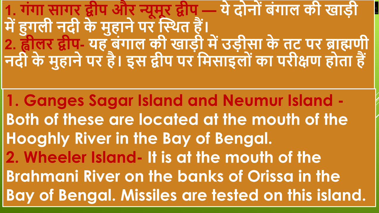
1. गंगा िागर द्वीप और नू्यमूर द्वीप — ये द न ंबंगाल की खाडी
में हुगली नदी के मुहाने पर स्थथत हैं।
2. ह्वीलर द्वीप- यह बंगाल की खाडी में उडीिा के तट पर ब्राह्मणी
नदी के मुहाने पर है। इि द्वीप पर वमिाइल ंका परीक्षण ह ता हैं
1. Ganges Sagar Island and Neumur Island -
Both of these are located at the mouth of the Hooghly River in the Bay of Bengal.
2. Wheeler Island- It is at the mouth of the Brahmani River on the banks of Orissa in the Bay of Bengal. Missiles are tested on this island.
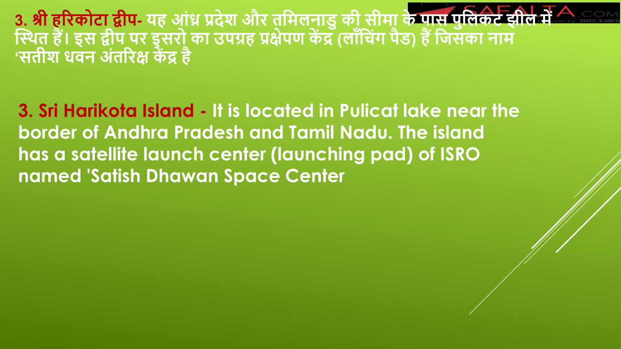
3. श्री हररक टा द्वीप- यह आंध्र प्रदेश और तवमलनाडु की िीमा के पाि पुवलकट झील में
स्थथत हैं। इि द्वीप पर इिर का उपग्रह प्रके्षपण कें द्र (लॉंवचंग पैड) हैं वििका नाम
‘ितीश ििन अंतररक्ष कें द्र है
3. Sri Harikota Island - It is located in Pulicat lake near the border of Andhra Pradesh and Tamil Nadu. The island has a satellite launch center (launching pad) of ISRO named 'Satish Dhawan Space Center
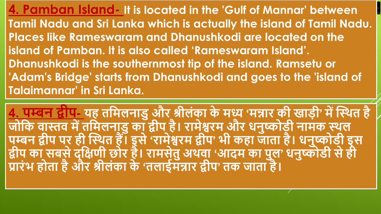
4. पम्बन द्वीप- यह तवमलनाडु और श्रीलंका के मध्य ‘मन्नार की खाडी’ में स्थथत है
ि वक िास्ति में तवमलनाडु का द्वीप है। रामेश्वरम और िनुष्क डी नामक थथल
पम्बन द्वीप पर ही स्थथत हैं। इिे ‘रामेश्वरम द्वीप’ भी कहा िाता है। िनुष्क डी इि
द्वीप का िबिे दवक्षणी छ र है। रामिेतु अथिा ‘आदम का पुल’ िनुष्क डी िे ही
प्रारंभ ह ता है और श्रीलंका के ‘तलाईमन्नार द्वीप’ तक िाता है।
4. Pamban Island- It is located in the 'Gulf of Mannar' between
Tamil Nadu and Sri Lanka which is actually the island of Tamil Nadu.
Places like Rameswaram and Dhanushkodi are located on the island of Pamban. It is also called ‘Rameswaram Island’. Dhanushkodi is the southernmost tip of the island. Ramsetu or
'Adam's Bridge' starts from Dhanushkodi and goes to the 'island of Talaimannar' in Sri Lanka.
िनुष्क डी िे लेकर तलाईमन्नार तक मन्नार की खाडी में
डूबी हुई द्वीप ंकी िंृखला ही ‘रामिेतु’ कहलाती है। यानी
पम्बन द्वीप, रामेश्वरम, िनुष्क डी और रामिेतु ये िभी
मन्नार की खाडी में ही स्थथत हैं।
The chain of islands submerged in the Gulf of
Mannar from Dhanushkodi to Talaimannar is
called 'Ram Setu'. That is, Pamban Island, Rameswaram, Dhanushkodi and Ramsetu are
all situated in the Gulf of Mannar.
5. अवलयाबेट द्वीप- यह गुिरात के दवक्षण में खम्भात की खाडी में नमवदा
नदी के मुहाने पर है। इि द्वीप में पेटर वलयम का भंडार हैं।
6. एलीफैं टा द्वीप- यह मुम्बई के पाि अरबिागर में है।
7. क क द्वीप- यह बंगाल की खाडी में अंडमान द्वीप ंके उत्तर में स्थथत
म्ांमार का एक द्वीप है वििपर चीन अपने िैन्यबेि का वनमावण कर रहा
है।
5. Aliabet Island- It is at the mouth of the Narmada River in
the Gulf of Khambhat in the south of Gujarat. The island has
a stock of petroleum.
6. Elephanta Island - It is in Arbasagar near Mumbai.
7. Kokodwip - It is an island in Myanmar, north of the
Andaman islands in the Bay of Bengal, on which China is
building its military base.
प्रिाल िीि और प्रिाल वभवत्त
यह द िेंटी मीटर का एक िमुद्री िीि है ि चूने पर वनिावह करता है। प्रिाल िीि तट
के पाि वछंछले िमुद्र में कर ड ंकी िंख्या में कॉल नी बना के रहते हैं। इनका
विकाि उष्णकवटबंि िागर ंमें वछंछले िमुद्र ंमें ही ह ता है िहां िूयव का प्रकाश
पहंुचता है। प्रिाल कैस्शशयम काबोनेट के ख ल में रहते हैं और िब एक प्रिाल की
मृतु्य ह िाती है त उिके ऊपर दूिरा प्रिाल अपने ख ल का वनमावण करता है।
Coral fauna and coral reefs
It is a sea centimeter of two centimeters which subsists on
lime. The coral fauna resides in a small number of colonies
in the shallow sea near the coast. They develop only in
shallow seas in the tropical seas where sunlight reaches. The
coral resides in the calcium carbonate shell and when one
coral dies, another coral forms its shell over it.
इि प्रकार िब प्रिाल कर ड ंकी िंख्या में एक के ऊपर एक विकाि करते हुए
िागर ितह तक आ िाते हैं त िमुद्र में विशाल चट्टाननुमा ‘प्रिाल वभवत्तय ’ं या
‘प्रिाल द्वीप ंका वनमावण ह िाता है
उदाहरण के वलए लक्षद्वीप, वमवनकॉय द्वीप और उिके दवक्षण में मालदीप द्वीप ंका
वनमावण मँूगा अथिा प्रिाल चट्टान ंिही हुआ है।
इिी प्रकार आस्ट्रेवलया के पूिी तट के िाथ िाथ हिार ंवकमी फैले ‘गे्रट बैररयर
रीफ’ (महान प्रिाल वभवत्त) का वनमावण भी मँूगा चट्टान ंिे ही हुआ है।
In this way, when coral reefs grow to one hundred in number and
reach the ocean surface, then huge rock-like 'coral reefs' or 'coral islands' are formed in the sea. For example, the coral or coral reefs of Lakshadweep, Minicoy Island and the Maldeep islands to its south have been formed. Similarly, along the east coast of Australia, the Great Barrier Reef (great coral reef) spread thousands of kilometers has also been formed from coral reefs.
प्रिालवभवत्तय ंका महत्त्व-
प्रिाल जीि के ख ल अथाात म ंगा चट्टान लाल, गुलाबी, ििेद, हरे रंग के ह ते
हैं। इिके आि पाि बहुत िारी मछक्षलयां ह ती हैं क् कं्षक प्रिाल क्षभक्षियां
मछक्षलय ंऔर अन्य िमुद्री जीि ंके क्षलए ‘निारी’ का काम करती है जहां इन
जीि ंका प्रारंक्षभक क्षिकाि ह ता है और प्रिालक्षभक्षिय ंमें ही िमुद्री जीि ंक
भ जन िुरिा और आिाि प्राप्त ह ता है
Importance of benefits- The shell of coral fauna means coral reefs are red, pink,
white, green. There are many fishes around it because the
coral reefs serve as 'nurseries' for fishes and other marine
organisms where these organisms grow early and in the reefs
the sea creatures get food security and habitat.
ये िमुद्री ग ताख र ंके
क्षलए आकर्ाण के कें द्र
ह ते हैं।
‘प्रिाल क्षभक्षिय ’ं क
‘महािगार ंका िर्ाािन’
भी कहते हैं क् कं्षक ये
िमुद्री जैिक्षिक्षिधता के
भण्ार ह ते हैं।
These are hotspots for
sea divers.
The coral reefs are
also called the
'rainforest of the
generals' as they are
the storehouse of
marine biodiversity.