Embed Size (px)
Citation preview
8/3/2019 Pedra Branca Batu Putih
http://slidepdf.com/reader/full/pedra-branca-batu-putih 1/15
Pedra Branca, SingaporeFrom Wikipedia, the free encyclopedia
For other places with the same name, see Pedra Branca (disambiguation).
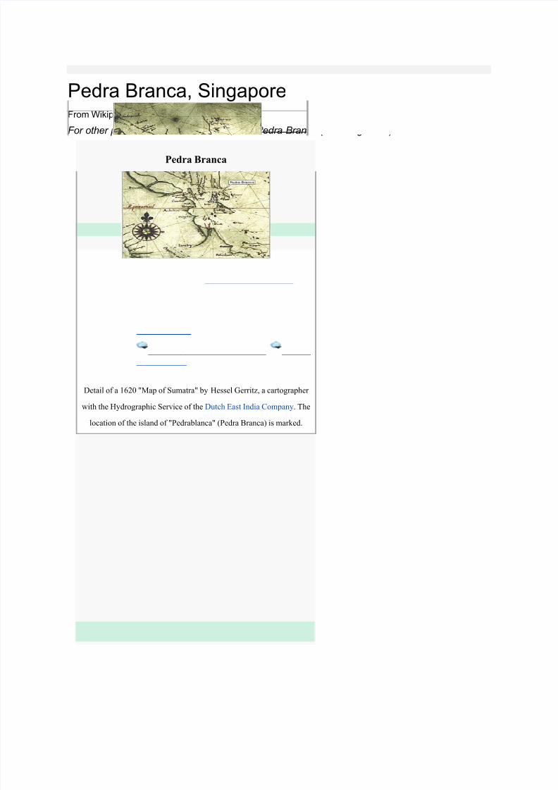
Pedra Branca
Detail of a 1620 "Map of Sumatra" by Hessel Gerritz, a cartographer
with the Hydrographic Service of the Dutch East India Company. The
location of the island of "Pedrablanca" (Pedra Branca) is marked.
Geography
Location South China Sea
Coordinates 1°19′48″N 104°24′27″ECoordinates : 1°19′48″
N 104°24′27″E
Area 8,560 m2 (92,140 sq ft)
Length 137 m (449 ft)
Width 60 m (200 ft) (average)
Country
Singapore
8/3/2019 Pedra Branca Batu Putih
http://slidepdf.com/reader/full/pedra-branca-batu-putih 2/15
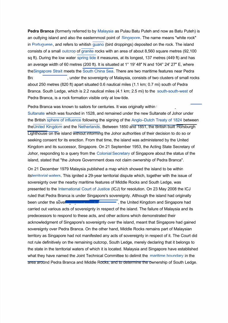
Pedra Branca (formerly referred to by Malaysia as Pulau Batu Puteh and now as Batu Puteh) is
an outlying island and also the easternmost point of Singapore. The name means "white rock"
in Portuguese, and refers to whitish guano (bird droppings) deposited on the rock. The island
consists of a small outcrop of granite rocks with an area of about 8,560 square metres (92,100
sq ft). During the low water spring tide it measures, at its longest, 137 metres (449 ft) and has
an average width of 60 metres (200 ft). It is situated at 1° 19′ 48″ N and 104° 24′ 27″ E, where
theSingapore Strait meets the South China Sea. There are two maritime features near Pedra
Branca. Middle Rocks, under the sovereignty of Malaysia, consists of two clusters of small rocks
about 250 metres (820 ft) apart situated 0.6 nautical miles (1.1 km; 0.7 mi) south of Pedra
Branca. South Ledge, which is 2.2 nautical miles (4.1 km; 2.5 mi) to the south-south-west of
Pedra Branca, is a rock formation visible only at low-tide.
Pedra Branca was known to sailors for centuries. It was originally within the territory of the Johor
Sultanate which was founded in 1528, and remained under the new Sultanate of Johor under
the British sphere of influence following the signing of the Anglo–Dutch Treaty of 1824 between
theUnited Kingdom and the Netherlands. Between 1850 and 1851, the British built Horsburgh
Lighthouse on the island without informing the Johor authorities of their decision to do so or
seeking consent for its erection. From that time, the island was administered by the United
Kingdom and its successor, Singapore. On 21 September 1953, the Acting State Secretary of
Johor, responding to a query from the Colonial Secretary of Singapore about the status of the
island, stated that "the Johore Government does not claim ownership of Pedra Branca".
On 21 December 1979 Malaysia published a map which showed the island to be withinitsterritorial waters. This ignited a 29-year territorial dispute which, together with the issue of
sovereignty over the nearby maritime features of Middle Rocks and South Ledge, was
presented to the International Court of Justice (ICJ) for resolution. On 23 May 2008 the ICJ
ruled that Pedra Branca is under Singapore's sovereignty. Although the island had originally
been under the sovereignty of the Johor Sultanate, the United Kingdom and Singapore had
carried out various acts of sovereignty in respect of the island. The failure of Malaysia and its
predecessors to respond to these acts, and other actions which demonstrated their
acknowledgment of Singapore's sovereignty over the island, meant that Singapore had gained
sovereignty over Pedra Branca. On the other hand, Middle Rocks remains part of Malaysian
territory as Singapore had not manifested any acts of sovereignty in respect of it. The Court did
not rule definitively on the remaining outcrop, South Ledge, merely declaring that it belongs to
the state in the territorial waters of which it is located. Malaysia and Singapore have established
what they have named the Joint Technical Committee to delimit the maritime boundary in the
area around Pedra Branca and Middle Rocks, and to determine the ownership of South Ledge.
8/3/2019 Pedra Branca Batu Putih
http://slidepdf.com/reader/full/pedra-branca-batu-putih 3/15
Contents
[hide]
• 1 Name
• 2 Physical attributes
• 3 History
○ 3.1 Up to the 1840s
○ 3.2 1840s to 1851: Construction of Horsburgh
Lighthouse
○ 3.3 1852 to the 1970s
• 4 Present
•5 Territorial dispute
○ 5.1 International Court of Justice case
○ 5.2 Reactions to ICJ decision
○ 5.3 Resolution of outstanding issues
• 6 See also
• 7 Notes
• 8 References
• 9 Further reading
○ 9.1 Articles
○ 9.2 Books
○ 9.3 News reports
• 10 External links
○ 10.1 Images
[edit]Name
Pedra Branca means "white rock" in Portuguese, and refers to whitish guano (bird droppings)
deposited on the rock by the black- naped tern, which used the island as a nesting ground.
[1] This name is used by both the English-language and Malay-language press in Singapore.
[2] Malaysia formerly referred to the island as Pulau Batu Puteh, which means "white rock island"
in Malay, but the Government of Malaysiasubsequently decided to drop the
8/3/2019 Pedra Branca Batu Putih
http://slidepdf.com/reader/full/pedra-branca-batu-putih 4/15
word Pulau ("Island"). In August 2008 Foreign Minister Rais Yatim said Malaysia considered
that the maritime feature did not meet internationally recognised criteria for an island, that is,
land inhabited by humans that had economic activity.[3]
The island is known in Mandarin as Baijiao (Chinese:白礁; pinyin: báijiāo),[1] which means
"white reef ".[4] The Tamil name is பட்ர பரங்க, a transliteration of Pedra Branca.
[edit]Physical attributes
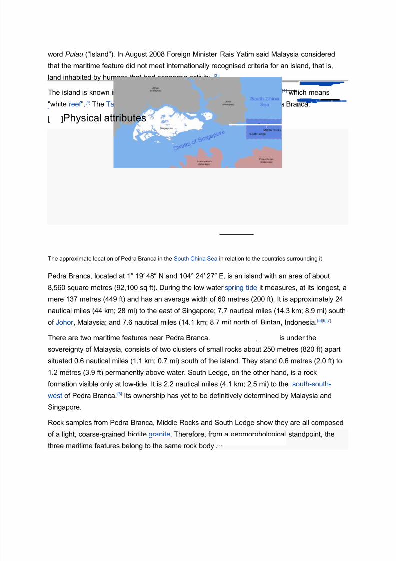
The approximate location of Pedra Branca in the South China Sea in relation to the countries surrounding it
Pedra Branca, located at 1° 19′ 48″ N and 104° 24′ 27″ E, is an island with an area of about
8,560 square metres (92,100 sq ft). During the low water spring tide it measures, at its longest, a
mere 137 metres (449 ft) and has an average width of 60 metres (200 ft). It is approximately 24
nautical miles (44 km; 28 mi) to the east of Singapore; 7.7 nautical miles (14.3 km; 8.9 mi) south
of Johor , Malaysia; and 7.6 nautical miles (14.1 km; 8.7 mi) north of Bintan, Indonesia.[5][6][7]
There are two maritime features near Pedra Branca. Middle Rocks, which is under the
sovereignty of Malaysia, consists of two clusters of small rocks about 250 metres (820 ft) apart
situated 0.6 nautical miles (1.1 km; 0.7 mi) south of the island. They stand 0.6 metres (2.0 ft) to
1.2 metres (3.9 ft) permanently above water. South Ledge, on the other hand, is a rock
formation visible only at low-tide. It is 2.2 nautical miles (4.1 km; 2.5 mi) to the south-south-
west of Pedra Branca.[8] Its ownership has yet to be definitively determined by Malaysia and
Singapore.
Rock samples from Pedra Branca, Middle Rocks and South Ledge show they are all composed
of a light, coarse-grained biotite granite. Therefore, from a geomorphological standpoint, the
three maritime features belong to the same rock body.[9]
8/3/2019 Pedra Branca Batu Putih
http://slidepdf.com/reader/full/pedra-branca-batu-putih 5/15
[edit]History
[edit]Up to the 1840s
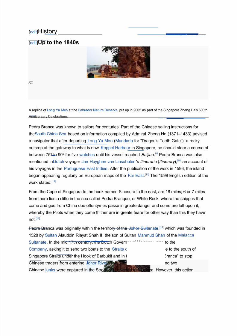
A replica of Long Ya Men at the Labrador Nature Reserve, put up in 2005 as part of the Singapore Zheng He's 600th
Anniversary Celebrations
Pedra Branca was known to sailors for centuries. Part of the Chinese sailing instructions for
theSouth China Sea based on information compiled by Admiral Zheng He (1371–1433) advised
a navigator that after departing Long Ya Men (Mandarin for "Dragon's Teeth Gate"), a rocky
outcrop at the gateway to what is now Keppel Harbour in Singapore, he should steer a course of
between 75º to 90º for five watches until his vessel reached Baijiao.[1] Pedra Branca was also
mentioned inDutch voyager Jan Huyghen van Linschoten's Itinerario (Itinerary ),[10] an account of
his voyages in the Portuguese East Indies. After the publication of the work in 1596, the island
began appearing regularly on European maps of the Far East.[11]
The 1598 English edition of thework stated:[12]
From the Cape of Singapura to the hook named Sinosura to the east, are 18 miles; 6 or 7 miles
from there lies a cliffe in the sea called Pedra Branque, or White Rock, where the shippes that
come and goe from China doe oftentymes passe in greate danger and some are left upon it,
whereby the Pilots when they come thither are in greate feare for other way than this they have
not.[11]
Pedra Branca was originally within the territory of the Johor Sultanate,[13] which was founded in
1528 by Sultan Alauddin Riayat Shah II, the son of Sultan Mahmud Shah of the MalaccaSultanate. In the mid 17th century, the Dutch Governor of Malacca wrote to the Dutch East India
Company, asking it to send two boats to the Straits of Singapore to "cruise to the south of
Singapore Straits under the Hook of Barbukit and in the vicinity of Pedra Branca" to stop
Chinese traders from entering Johor River . The plan was put into force, and two
Chinese junks were captured in the Straits and diverted to Malacca. However, this action
8/3/2019 Pedra Branca Batu Putih
http://slidepdf.com/reader/full/pedra-branca-batu-putih 6/15
provoked a protest from the Sultan of Johor , which showed that the Sultan regarded the junks'
seizure as an infringement of his sovereignty in the area. Three letters written in 1824 to
the Government of Indiaby the British Resident in Singapore, John Crawfurd, also confirm it was
his understanding that all the islands in the region of the Straits of Singapore came under the
Johor Sultanate.[14]
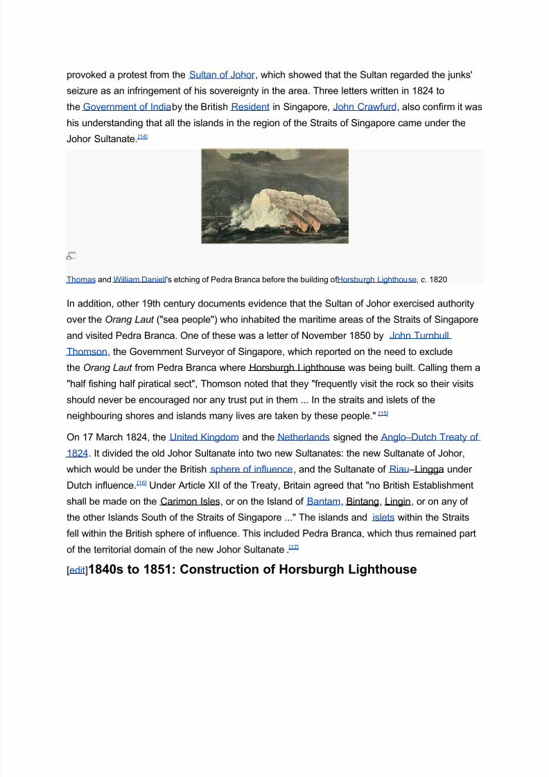
Thomas and William Daniell 's etching of Pedra Branca before the building of Horsburgh Lighthouse, c. 1820
In addition, other 19th century documents evidence that the Sultan of Johor exercised authority
over the Orang Laut ("sea people") who inhabited the maritime areas of the Straits of Singapore
and visited Pedra Branca. One of these was a letter of November 1850 by John Turnbull
Thomson, the Government Surveyor of Singapore, which reported on the need to exclude
the Orang Laut from Pedra Branca where Horsburgh Lighthouse was being built. Calling them a
"half fishing half piratical sect", Thomson noted that they "frequently visit the rock so their visits
should never be encouraged nor any trust put in them ... In the straits and islets of the
neighbouring shores and islands many lives are taken by these people."[15]
On 17 March 1824, the United Kingdom and the Netherlands signed the Anglo–Dutch Treaty of
1824. It divided the old Johor Sultanate into two new Sultanates: the new Sultanate of Johor,
which would be under the British sphere of influence, and the Sultanate of Riau –Lingga under
Dutch influence.[16] Under Article XII of the Treaty, Britain agreed that "no British Establishment
shall be made on the Carimon Isles, or on the Island of Bantam, Bintang, Lingin, or on any of
the other Islands South of the Straits of Singapore ..." The islands and islets within the Straits
fell within the British sphere of influence. This included Pedra Branca, which thus remained part
of the territorial domain of the new Johor Sultanate.[17]
[edit]1840s to 1851: Construction of Horsburgh Lighthouse
8/3/2019 Pedra Branca Batu Putih
http://slidepdf.com/reader/full/pedra-branca-batu-putih 7/15
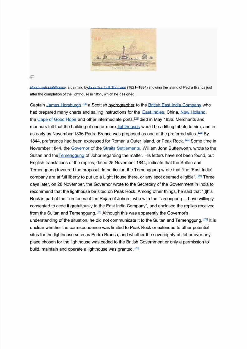
Horsburgh Lighthouse, a painting byJohn Turnbull Thomson (1821–1884) showing the island of Pedra Branca just
after the completion of the lighthouse in 1851, which he designed.
Captain James Horsburgh,[18] a Scottish hydrographer to the British East India Company who
had prepared many charts and sailing instructions for the East Indies, China, New Holland,
the Cape of Good Hope and other intermediate ports,[19] died in May 1836. Merchants and
mariners felt that the building of one or more lighthouses would be a fitting tribute to him, and in
as early as November 1836 Pedra Branca was proposed as one of the preferred sites.[20] By
1844, preference had been expressed for Romania Outer Island, or Peak Rock.[21] Some time in
November 1844, the Governor of the Straits Settlements, William John Butterworth, wrote to the
Sultan and theTemenggung of Johor regarding the matter. His letters have not been found, but
English translations of the replies, dated 25 November 1844, indicate that the Sultan and
Temenggung favoured the proposal. In particular, the Temenggung wrote that "the [East India]
company are at full liberty to put up a Light House there, or any spot deemed eligible".[21] Three
days later, on 28 November, the Governor wrote to the Secretary of the Government in India to
recommend that the lighthouse be sited on Peak Rock. Among other things, he said that "[t]his
Rock is part of the Territories of the Rajah of Johore, who with the Tamongong ... have willingly
consented to cede it gratuitously to the East India Company", and enclosed the replies received
from the Sultan and Temenggung.[21] Although this was apparently the Governor's
understanding of the situation, he did not communicate it to the Sultan and Temenggung.[22] It is
unclear whether the correspondence was limited to Peak Rock or extended to other potential
sites for the lighthouse such as Pedra Branca, and whether the sovereignty of Johor over any
place chosen for the lighthouse was ceded to the British Government or only a permission to
build, maintain and operate a lighthouse was granted.[23]
8/3/2019 Pedra Branca Batu Putih
http://slidepdf.com/reader/full/pedra-branca-batu-putih 8/15
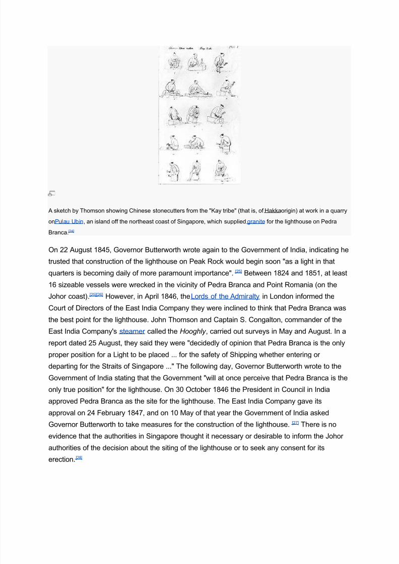
A sketch by Thomson showing Chinese stonecutters from the "Kay tribe" (that is, of Hakkaorigin) at work in a quarry
onPulau Ubin, an island off the northeast coast of Singapore, which supplied granite for the lighthouse on Pedra
Branca.[24]
On 22 August 1845, Governor Butterworth wrote again to the Government of India, indicating he
trusted that construction of the lighthouse on Peak Rock would begin soon "as a light in that
quarters is becoming daily of more paramount importance". [25] Between 1824 and 1851, at least
16 sizeable vessels were wrecked in the vicinity of Pedra Branca and Point Romania (on the
Johor coast).[25][26] However, in April 1846, theLords of the Admiralty in London informed the
Court of Directors of the East India Company they were inclined to think that Pedra Branca was
the best point for the lighthouse. John Thomson and Captain S. Congalton, commander of the
East India Company's steamer called the Hooghly , carried out surveys in May and August. In a
report dated 25 August, they said they were "decidedly of opinion that Pedra Branca is the only
proper position for a Light to be placed ... for the safety of Shipping whether entering or
departing for the Straits of Singapore ..." The following day, Governor Butterworth wrote to the
Government of India stating that the Government "will at once perceive that Pedra Branca is the
only true position" for the lighthouse. On 30 October 1846 the President in Council in India
approved Pedra Branca as the site for the lighthouse. The East India Company gave its
approval on 24 February 1847, and on 10 May of that year the Government of India asked
Governor Butterworth to take measures for the construction of the lighthouse. [27] There is no
evidence that the authorities in Singapore thought it necessary or desirable to inform the Johor
authorities of the decision about the siting of the lighthouse or to seek any consent for its
erection.[28]
8/3/2019 Pedra Branca Batu Putih
http://slidepdf.com/reader/full/pedra-branca-batu-putih 9/15
Although the private subscribers wishing to commemorate Horsburgh had raised a sum which,
withcompound interest , came up to more than 7,400 Spanish dollars when it was paid over to
the Singapore authorities,[29] there was still a shortfall of funds for the building works. Thus, the
Government of India, in agreement with the East India Company, authorized Governor
Butterworth to prepare a law imposing a dutyon vessels entering Singapore and asked him to
take immediate measures to begin constructing the lighthouse. [30] The Light Dues Act 1852 was
duly enacted by the Governor-General of India in Council on 30 January 1852.[31] Thomson,
appointed by the Governor as architect for the project, took charge of planning and supervising
the construction of Horsburgh Lighthouse.[30] Construction work began in late March or early
April 1850.[32] OnQueen Victoria's birthday, 24 May 1850, the foundation stone was laid at a
ceremony conducted by members of the newly-founded Masonic Lodge Zetland in the East No.
749 and attended by the Governor, the commander of the Singapore garrison, a rear
admiral and several foreignconsuls.
[33]
The construction of the lighthouse then continued till 21October, and resumed after the monsoon in April 1851. Up to 50 workmen were involved,
including Chinese carpenters and stonemasons and their Malay assistants, Indian quarrymen
and convict labourers, a cook and his assistant, and six lascars to defend the island from attack
by pirates. The pirates of the South China Sea were notorious – during the construction of
Horsburgh Lighthouse nine Chinese labourers were killed in pirate raids.[24] Building materials
and supplies were brought by the Hooghly , supported by two gunboats and two lighters. Unless
he was required elsewhere, Thomson stayed on the island to supervise the works. [34] The
ceremonial first lighting of the lamp was arranged for 27 September 1851, again attended by the
Governor,Masons of the Zetland Lodge, foreign dignitaries, senior residents of Singapore and
other notables; the Singapore Free Press reported: "A simultaneous rising [of the guests from
the dinner table] announced that the process of illumination had commenced. Three hearty
cheers welcomed the light, the meteor -like brilliancy of which will probably serve to guide the
midnight path of the mariner for a thousand years to come."[35] On 15 October the lighthouse
was permanently turned on, and Thomson finally departed Pedra Branca for Singapore on
theHooghly on 18 November 1851.[36]
[edit]1852 to the 1970s
The Light Dues Acts of 1852 and 1854 (India) declared that Horsburgh Lighthouse and
its appurtenances were the property of and vested in the East India Company. In 1867, the
Straits Settlements, of which Singapore was a part, became a Crown Colony, and by the Straits
Settlements Light-Houses Ordinance 1912, the lighthouse was vested in Singapore.[37] After
1912, the duties levied on ships passing through the Singapore Strait were abolished; instead,
the costs of the lighthouse were shared by the neighbouring states.[38]
8/3/2019 Pedra Branca Batu Putih
http://slidepdf.com/reader/full/pedra-branca-batu-putih 10/15
In 1946, following World War II, Singapore became a separate Crown Colony. The other Straits
Settlements, Malacca and Penang, joined theMalay states (including Johor) to form the Malayan
Union. The latter became the Federation of Malaya in 1948, and the Federation of Malaysia in
1957 when it gained independence from Britain. On 17 June 1953, the Colonial Secretary of
Singapore wrote to the British Adviser to the Sultan of Johor to clarify the status of Pedra
Branca. He noted that the rock was outside the limits ceded by Sultan Hussein Shah and the
Temenggung with the island of Singapore under the Treaty of Friendship and Alliance of 2
August 1824 they had entered into with the East India Company.[39] However, the Colonial
Government had been maintaining the lighthouse built on it, and "[t]his by international usage
no doubt confers some rights and obligations on the Colony". He therefore asked if "there is any
document showing a lease or grant of the rock or whether it has been ceded by the Government
of the State of Johore or in any other way disposed of" .[40] The Acting State Secretary of Johor
replied on 21 September that "the Johore Government does not claim ownership of PedraBranca".[41] This correspondence indicated that as of 1953 Johor understood it did not have
sovereignty over Pedra Branca, which had therefore vested in the United Kingdom.[42]
The Colony of Singapore became a self-governing state in 1959, and left the British Empire to
join the Federation of Malaysia in 1963. Two years later, in 1965, Singapore became a fully
independent republic. In 1959, in an official publication regarding meteorological information
collected on Pedra Branca, Malaya listed Horsburgh Lighthouse as a "Singapore" station
together with the Sultan Shoal and Raffles Lighthouses. The lighthouse on Pedra Branca was
described in the same way in a joint Malaysian and Singaporean publication in 1966, the year
after Singapore left the Federation. In 1967, when the two countries began reporting
meteorological information separately, Malaysia ceased referring to Horsburgh Lighthouse.[43] In
maps published by the Malayan and Malaysian Surveyor General and Director of General
Mapping in 1962, 1965, 1970, 1974 and 1975, the island was indicated with the word
"(SINGAPORE)" or "(SINGAPURA)" under it. The same designation was used for an island that
was unquestionably under Singapore's sovereignty. On the other hand, the designation was not
used for Pulau Pisang, an island under Malaysian sovereignty on which Singapore operated a
lighthouse.[44]
Singapore replaced the original kerosene-fired lamp of Horsburgh Lighthouse with automated
navigational lights in the 1970s.[35] In 1972, 1973, 1974 and 1978, the Port of Singapore
Authority (PSA) considered the feasibility of carrying out reclamation of about 5,000 square
metres (54,000 sq ft) of land around Pedra Branca, but did not go ahead with the project.[45] On
30 May 1977, with the permission of the PSA, the Republic of Singapore Navy installed a
military rebroadcast station which it shared with the Republic of Singapore Air Force.
8/3/2019 Pedra Branca Batu Putih
http://slidepdf.com/reader/full/pedra-branca-batu-putih 11/15
8/3/2019 Pedra Branca Batu Putih
http://slidepdf.com/reader/full/pedra-branca-batu-putih 12/15
[edit]Territorial dispute
Main article: Pedra Branca dispute
[edit]International Court of Justice case
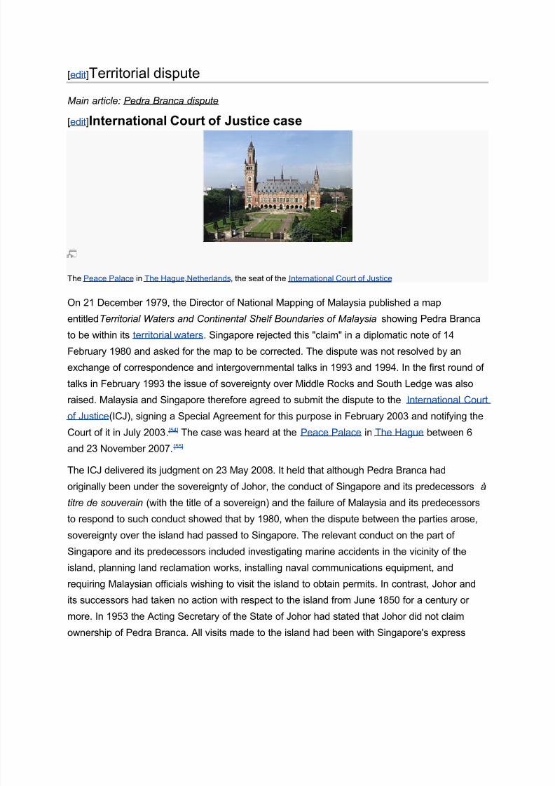
The Peace Palace in The Hague,Netherlands, the seat of the International Court of Justice
On 21 December 1979, the Director of National Mapping of Malaysia published a map
entitledTerritorial Waters and Continental Shelf Boundaries of Malaysia showing Pedra Branca
to be within its territorial waters. Singapore rejected this "claim" in a diplomatic note of 14
February 1980 and asked for the map to be corrected. The dispute was not resolved by an
exchange of correspondence and intergovernmental talks in 1993 and 1994. In the first round of
talks in February 1993 the issue of sovereignty over Middle Rocks and South Ledge was also
raised. Malaysia and Singapore therefore agreed to submit the dispute to the International Court
of Justice(ICJ), signing a Special Agreement for this purpose in February 2003 and notifying the
Court of it in July 2003.[54] The case was heard at the Peace Palace in The Hague between 6
and 23 November 2007.[55]
The ICJ delivered its judgment on 23 May 2008. It held that although Pedra Branca had
originally been under the sovereignty of Johor, the conduct of Singapore and its predecessors à
titre de souverain (with the title of a sovereign) and the failure of Malaysia and its predecessors
to respond to such conduct showed that by 1980, when the dispute between the parties arose,
sovereignty over the island had passed to Singapore. The relevant conduct on the part of
Singapore and its predecessors included investigating marine accidents in the vicinity of the
island, planning land reclamation works, installing naval communications equipment, and
requiring Malaysian officials wishing to visit the island to obtain permits. In contrast, Johor and
its successors had taken no action with respect to the island from June 1850 for a century or
more. In 1953 the Acting Secretary of the State of Johor had stated that Johor did not claim
ownership of Pedra Branca. All visits made to the island had been with Singapore's express
8/3/2019 Pedra Branca Batu Putih
http://slidepdf.com/reader/full/pedra-branca-batu-putih 13/15
permission, and maps published by Malaysia in the 1960s and 1970s indicated that it
recognized Singapore's sovereignty over Pedra Branca. [56][57]
Like Pedra Branca, the Sultan of Johor held the original ancient title to Middle Rocks. As
Singapore had not exercised any rights as a sovereign over Middle Rocks, the ICJ determined
that Malaysia retained sovereignty over this maritime feature. [58] As for South Ledge, the ICJ
noted that it fell within the apparently overlapping territorial waters of mainland Malaysia, Pedra
Branca and Middle Rocks. As the Court had not been mandated to draw the line
of delimitation with respect to the territorial waters of Malaysia and Singapore in the area in
question, it simply held that sovereignty over South Ledge belonged to the state which owned
the territorial waters in which it is located.[59]
[edit]Reactions to ICJ decision
Although both Malaysia and Singapore had agreed to respect and accept the ICJ's decision,
[60] Malaysian Foreign Minister Rais Yatim later said his country had renewed its search for the
letters written by Governor Butterworth to the Sultan and Temenggung of Johor seeking
permission to build Horsburgh Lighthouse on Pedra Branca. He noted that the rules of the ICJ
allowed a case to be reviewed within ten years if new evidence was adduced.[61] In response,
Singapore's Law Minister K. Shanmugam said that the city-state would wait to see what new
evidence the Malaysian government could come up with.[62]
A week after the delivery of the ICJ's judgment, the Foreign Ministry of Malaysia asked the
Malaysian media to cease using the Malay wordPulau ("Island") for Pedra Branca and to refer to
it as "Batu Puteh" or "Pedra Branca".[63] On 21 July 2008, in response to questions from
Singapore Members of Parliament about Pedra Branca, the Senior Minister of State for Foreign
Affairs Balaji Sadasivan stated that the maritime territory around the island included a territorial
sea of up to 12 nautical miles (22 km; 14 mi) and an Exclusive Economic Zone. This was
condemned by Malaysia's Foreign Minister Rais Yatim as "against the spirit of Asean and the
legal structure" as the claim was "unacceptable and unreasonable and contradicts the principles
of international law".[64] In response, a Singapore Ministry of Foreign Affairs spokesman said that
Singapore first stated its claim to a territorial sea and Exclusive Economic Zone on 15
September 1980, and reiterated this claim on 23 May 2008 following the ICJ's judgment. Both
statements had made clear that if the limits of Singapore's territorial sea or Exclusive Economic
Zone overlapped with the claims of neighbouring countries, Singapore would negotiate with
those countries to arrive at agreed delimitations in accordance with international law.[65] In
August 2008, Rais said Malaysia took the view that Singapore was not entitled to claim an
Exclusive Economic Zone around Pedra Branca as it considered that the maritime feature did
8/3/2019 Pedra Branca Batu Putih
http://slidepdf.com/reader/full/pedra-branca-batu-putih 14/15
not meet internationally recognised criteria for an island, that is, land inhabited by humans that
had economic activity.[3]
At the National Day Awards in August 2008, Singapore announced that awards would be
conferred on a number of people and organizations for their special contributions towards the
Pedra Branca case. Chief Justice Chan Sek Keong; Tommy Koh, Ambassador-at-Large; and
Justice Chao Hick Tin, then Attorney-General of Singapore, who appeared as counsel and
advocates for Singapore, would respectively be awarded the Darjah Utama Temasek (Order of
Temasek) (Second Class), the Darjah Utama Nila Utama (Order of Nila Utama) (First Class),
and the Darjah Utama Bakti Cemerlang (Distinguished Service Order). The Pingat Jasa
Gemilang (Meritorius Service Medal) would be conferred on Sivakant Tiwari s/o Thakurprasad
Tiwari, Special Consultant to the International Affairs Division of the Attorney-General's
Chambers. Twenty-two people from the Attorney-General's Chambers, Maritime and Port
Authority of Singapore, Ministry of Defence, Ministry of Foreign Affairs, National Archives of
Singapore, National Library Board, National University of Singapore and Supreme Court of
Singaporewould receive the Pingat Pentadbiran Awam (Public Administration Medal),
the Pingat Kepujian (Commendation Medal) and the Pingat Berkebolehan (Efficiency Medal).
The President's Certificate of Commendation would be issued to the Coastal Command
(COSCOM),Republic of Singapore Navy; the Police Coast Guard, Singapore Police Force; the
Centre for Heritage Services, Ministry of Defence; the National Archives of Singapore; and the
Hydrographic Department, Maritime and Port Authority of Singapore.[66] The awards were
presented on 17 November 2008.[67]
[edit]Resolution of outstanding issues
Malaysia and Singapore have established what they have named the Joint Technical
Committee to delimit the maritime boundary in the area around Pedra Branca and Middle
Rocks, and to determine the ownership of South Ledge.[68] Following a meeting on 3 June 2008,
the Committee agreed that a technical sub-committee would be established to oversee the
conduct of joint survey works to prepare the way for talks on maritime issues in and around the
area. If any incident occurred in and around the waters of Pedra Branca, Middle Rocks and
South Ledge, either side would provide humanitarian assistance to the vessels involved. Finally,
both Malaysian and Singaporean fishermen could continue traditional fishing activities in those
waters.[69] In September 2008, the Joint Technical Committee reported that its Sub-Committee
on Joint Survey Works was finalizing technical preparations for a hydrographic survey that
would provide data for future delimitation discussions. A Sub-Committee on Maritime and
Airspace Management and Fisheries had also been formed, and after a meeting on 20 August

8/3/2019 Pedra Branca Batu Putih
http://slidepdf.com/reader/full/pedra-branca-batu-putih 15/15
2008 it decided that traditional fishing activities by both countries should continue in waters
beyond 0.5 nautical miles (0.9 km; 0.6 mi) off Pedra Branca, Middle Rocks and South Ledge.[70]
[edit]See also