Embed Size (px)
Citation preview
Part XXV North County Metropolitan
Subregional Plan San Diego County General Plan
Adopted January 3, 1979
GPA 78-03 Amended
December 19, 1990 GPA 01-01
Revised July 1, 2009

This page is intentionally left blank

NORTH COUNTY METROPOLITAN PLAN
TABLE OF CONTENTS
PAGE
CHAPTER 1. INTRODUCTION.................................................................................... 12
CHAPTER 2. GOALS................................................................................................... 23
1. Accommodate Village Development in Appropriate Areas .......................... 23
2. Encourage Logical City Annexations ........................................................... 23
3. Promote Agriculture in Non-Urban areas..................................................... 23
4. Protect Environmental Resources ............................................................... 34
CHAPTER 3. POLICIES............................................................................................... 45
LAND USE ........................................................................................................... 45
1. Increase City-County Planning Cooperation......................................... 4
2. Designate Current Urban Development Areas ..................................... 4
3. Designate Future Urban Development Areas - Escondido Area .......... 4
4. Accommodate Future Urban Development - Island Areas ................... 5
[j1] GOVERNMENT STRUCTURES .......................................................................... 56
5. Support City Annexation Incentive Program....................................... 56
6. Identify Potential Commercial Locations............................................. 56
7. Study Amendment of County Road and Sign Standards.................... 76
8. Support Sewer Service Extension - Martyn Creek.............................. 67
9. Merge Buena Sanitation District ......................................................... 67
10. Limit New Subdivisions Exceeding One Du/Acre - Escondido............ 78
AGRICULTURE.................................................................................................... 78
11. Promote Agriculture - Outside City Spheres....................................... 78
12. Promote Interim Agriculture - Future Urban Development
Areas .................................................................................................. 8
[j2] 13. Recognize Avocational Agriculture ..................................................... 89
14. Assist Cities in Preparing Agricultural Plans..................................... 810
MOBILEHOMES................................................................................................. 109
15. Encourage Mobilehome Park Development ..................................... 109
16. Identify Prospective Mobilehome Park Areas ................................... 109
SEWER SERVICE ............................................................................................. 110
17. Improve Sewer Service Within the Urban Area ................................ 110
SCENIC HIGHWAYS ......................................................................................... 110
18. Assign Scenic Highway Priorities ................................................10 [j3]

NORTH COUNTY METROPOLITAN PLAN
TABLE OF CONTENTS
PAGE
CONSERVATION............................................................................................... 121
19. Designate Resource Conservation Areas......................................... 121
RECREATION.................................................................................................... 121
20. Direct County Resources Toward Parkland Acquisition and Development ........................................................................... 121
21. Pursue Joint Funding Sources for Regional Park Development .................................................................................. 121
22. Prioritize Local Parks........................................................................ 132
IMPLEMENTATION ........................................................................................... 132
23. Adopt General Plan Categories........................................................ 132
CHAPTER 4. RUBEL SPECIFIC PLANNING AREA.................................................. 143
CHAPTER 5. CHAMPAGNE BOULEVARD SPECIFIC PLAN AREA......................... 154
CHAPTER 6. HIDDEN MEADOWS COUNTRY TOWNVILLAGE[j4] ........................ 176
CHAPTER 7. MEADOW VIEW RANCH SPECIFIC PLAN AREA ................................ 17
CHAPTER 8. HARMONY GROVE VILLAGE SPECIFIC PLAN AREA......................... 23
[j5]APPENDICES
Appendix A - Resource Conservation Areas (RCAs) for North County Metro..................................................................................A-1
Appendix B - I-15 Corridor Subregional Plan.......................................................B-1

1
POLICY CODE EXPLANATION
The responsibility for carrying out the policies of this community/subregional plan does not lie solely with the Department of Planning and Land Use (DPLU). The cooperation of private property owners, developers, decision-makers and numerous other entities, both public and private, is necessary to make these policies successful. A code within brackets [ ] has been placed at the end of each policy within the Plan Text to identify which county department or sub-departmental section of the Department of Planning and Land Use is responsible for taking the lead in carrying out the policy. In addition, there is a code identified as "GEN", which indicates those policies that are of a general concern to all persons or groups that might be involved in development or plan implementation. This approach will assist in providing detailed information regarding policies easier to locate, and aid staff in overseeing the progress of the plan. CODE GEN POLICY OF GENERAL APPLICATION DPW DEPARTMENT OF PUBLIC WORKS DPR DEPARTMENT OF PARKS AND RECREATION DHS DEPARTMENT OF HEALTH AND HUMAN SERVICES DA DEPARTMENT OF AGRICULTURE HCD DEPARTMENT OF HOUSING AND COMMUNITY DEVELOPMENT DPLU DEPARTMENT OF PLANNING AND LAND USE C - Code Enforcement PP - Project Planning AP - Advanced Planning B - Building Division

2
CHAPTER 1 INTRODUCTION The North County Metropolitan Plan consists of this text and the Land Use Plan Map. The Plan is intended to promote orderly development, protect environmental and man-made resources, and implement the County's objectives for growth management and the structure of government for the Subregion. The Land Use Plan Map provides a basis for the specific zoning regulation of unincorporated land within the Subregion. The text provides planning goals and related policies for implementing the Plan through a variety of specific governmental action programs. This Subregional Plan supplements all existing Elements of the San Diego County General Plan - 1990, with specific emphasis on the planning needs of the North County Metropolitan Sub Subregion area shown on figure 1 below. This Plan was prepared by County staff in cooperation with numerous involved citizens, citizen groups, businesses and governmental agencies. In particular this Plan reflects--to the maximum possible extent--consistency with general plans of each of the six incorporated cities of the Subregion.
Figure 1: North County Metropolitan Subregion

3
CHAPTER 2 GOALS 1. ACCOMMODATE URBAN DEVELOPMENT IN APPROPRIATE AREAS Because the North County Metropolitan Subregion A. is developing rapidly with an average annual growth rate since 1970 of 8.3
percent compared to the Countywide average of 2.9 percent; and[J6] B. contains large areas of developable land with many basic urban services
available or located nearby. ACCOMMODATE A POPULATION OF 430,800 PERSONS IN THE SUBREGION
(INCLUDES CITIES) BY 1995, IF ESSENTIAL SERVICES SUCH AS WATER, SEWER, FIRE PROTECTION AND SCHOOLS CAN BE MADE AVAILABLE.[J7]
2. ENCOURAGE LOGICAL CITY ANNEXATIONS Because A. the Subregion includes five incorporated cities which are appropriate
governmental agencies to efficiently serve a projected 1995 population of 412,200 persons projected to reside within these cities; and[J8]
BA. "spheres of influence" boundaries for all five cities have been adopted to
facilitate rational city annexations in the future. ENCOURAGE THE ANNEXATION OF UNINCORPORATED LAND WITHIN
EACH CITY'S ADOPTED SPHERE OF INFLUENCE. 3. PROMOTE AGRICULTURE IN NON-URBAN AREAS Because A. nearly 30 percenta large portion of the unincorporated territory of the
Subregion is in some form of valuable agricultural production; and B. agriculture provides economic benefits to County residents. PROMOTE AGRICULTURE BY PROTECTING ESTATESEMI-RURAL AND
RURAL AREAS FROM URBANIZATION AND INCOMPATIBLE DEVELOPMENT.

4
4. PROTECT ENVIRONMENTAL RESOURCES Because A. the Subregion includes scenic rugged terrain which is not suitable for
urbanization; and B. resource conservation areas have been identified to help protect valuable
resources throughout the Subregion. PROTECT NATURAL AND ECONOMIC RESOURCES BY DESIGNATING
APPROPRIATE LANDS AS RURAL, SEMI-RURALESTATE, AND ENVIRONMENTALLY CONSTRAINED AREAS.
5
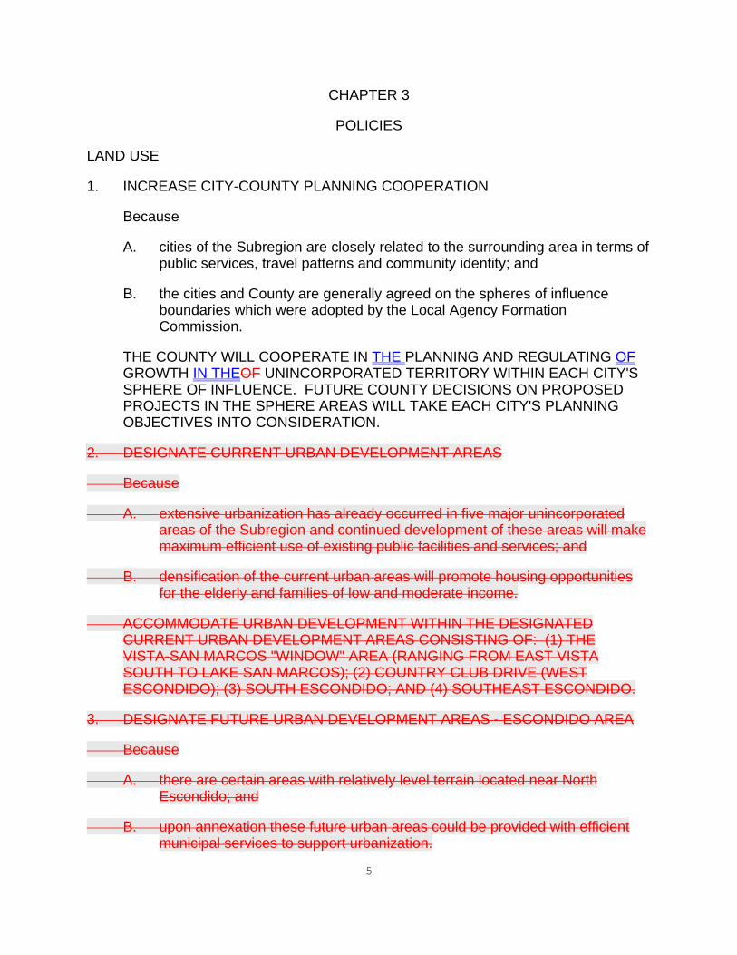
CHAPTER 3 POLICIES LAND USE 1. INCREASE CITY-COUNTY PLANNING COOPERATION Because A. cities of the Subregion are closely related to the surrounding area in terms of
public services, travel patterns and community identity; and B. the cities and County are generally agreed on the spheres of influence
boundaries which were adopted by the Local Agency Formation Commission.
THE COUNTY WILL COOPERATE IN THE PLANNING AND REGULATING OF
GROWTH IN THEOF UNINCORPORATED TERRITORY WITHIN EACH CITY'S SPHERE OF INFLUENCE. FUTURE COUNTY DECISIONS ON PROPOSED PROJECTS IN THE SPHERE AREAS WILL TAKE EACH CITY'S PLANNING OBJECTIVES INTO CONSIDERATION.
2. DESIGNATE CURRENT URBAN DEVELOPMENT AREAS Because A. extensive urbanization has already occurred in five major unincorporated
areas of the Subregion and continued development of these areas will make maximum efficient use of existing public facilities and services; and
B. densification of the current urban areas will promote housing opportunities
for the elderly and families of low and moderate income. ACCOMMODATE URBAN DEVELOPMENT WITHIN THE DESIGNATED
CURRENT URBAN DEVELOPMENT AREAS CONSISTING OF: (1) THE VISTA-SAN MARCOS "WINDOW" AREA (RANGING FROM EAST VISTA SOUTH TO LAKE SAN MARCOS); (2) COUNTRY CLUB DRIVE (WEST ESCONDIDO); (3) SOUTH ESCONDIDO; AND (4) SOUTHEAST ESCONDIDO.
3. DESIGNATE FUTURE URBAN DEVELOPMENT AREAS - ESCONDIDO AREA Because A. there are certain areas with relatively level terrain located near North
Escondido; and B. upon annexation these future urban areas could be provided with efficient
municipal services to support urbanization.

6
ACCOMMODATE FUTURE URBAN DEVELOPMENT ALONG THE NORTHERN FRINGE OF ESCONDIDO BY DESIGNATING SELECTED AREAS AS FUTURE URBAN DEVELOPMENT AREAS. FUTURE URBAN DEVELOPMENT AREAS WILL BE PERMITTED TO DEVELOP AT LOW DENSITIES (TEN ACRE MINIMUM PARCEL SIZE OR LARGER) UNTIL INFILLING HAS OCCURRED IN ADJACENT AREAS AND SERVICES CAN BE PROVIDED AT LEVELS NECESSARY FOR URBAN DENSITIES.
4. ACCOMMODATE FUTURE URBAN DEVELOPMENT - ISLAND AREAS Because A. the Subregion includes numerous municipal "islands" with terrain appropriate
to urbanization; B. the Future Urban Development Area (FUDA) category will limit subdivision of
the islands to ten acre minimum and thereby encourage annexation and provision of city services and facilities; and
C. lands covered by FUDA's may continue to be used for agriculture and other
permitted uses until annexed to a city and developed in accordance with the city general plan.
ACCOMMODATE FUTURE URBAN DEVELOPMENT IN THE MUNICIPAL
ISLANDS BY DESIGNATING THEM AS FUTURE URBAN DEVELOPMENT AREAS.[RC9]
GOVERNMENT STRUCTURES 52. SUPPORT CITY ANNEXATION INCENTIVE PROGRAMS Because A. the cities and County are generally agreed that territory within the city
spheres of influence should eventually be annexed; and B. pre-annexation improvement plans, which identify city services available to
neighborhoods upon annexation, will encourage public support for annexation.
SUPPORT CITY ANNEXATION INCENTIVE PROGRAMS FOR EACH CITY
WITHIN THE SUBREGION. ASSIST THE CITIES IN PREPARING PRE-ANNEXATION IMPROVEMENT PLANS TO IDENTIFY CITY SERVICES AND FACILITIES THAT WOULD BE INCENTIVES TO PUBLIC SUPPORT FOR ANNEXATION.
63. IDENTIFY POTENTIAL COMMERCIAL LOCATIONS Because A. identification of the potential commercial use of these sites if annexed to a
city will serve as an incentive for the property owner to seek annexation in order to realize a more intense use of the property;

7
B. these sites should only be developed when sewer service is made available; and
C. the relevant city generally concurs that these locations are potentially as
described below. THE FOLLOWING ARE IDENTIFIED AS POTENTIAL LOCATIONS FOR
COMMERCIAL USES IF ANNEXED TO THE CITY: A. SAN PASQUAL VALLEY ROAD AT BEAR VALLEY PARKWAY -
NEIGHBORHOOD SERVING COMMERCIAL USES. B. GAMBLE LAND (CITRICADO PARKWAY) AT FELICITA ROAD -
NEIGHBORHOOD SERVING COMMERCIAL USES. PENDING ANNEXATION, THE COUNTY WILL PERMIT REASONABLE
RESIDENTIAL USE OF THESE POTENTIAL COMMERCIAL SITES. 74. STUDY AMENDMENT OF COUNTY ROAD AND SIGN STANDARDS Because each city is more likely to annex territory within its sphere if roads and
signage are developed consistent with the city's own standards. CONDUCT COUNTY STUDIES ON THE FEASIBILITY OF AMENDING COUNTY
ROAD STANDARDS TO MAKE THEM CONSISTENT WITH EACH CITY'S STANDARDS. CONDUCT A STUDY ON THE FEASIBILITY OF AMENDING COUNTY ORDINANCES RELATING TO REGULATION ON SIGNS WITHIN THE UNINCORPORATED AREA OF EACH CITY'S SPHERE OF INFLUENCE.[RC10]
85. SUPPORT SEWER SERVICE EXTENSION - MARTYN CREEK Because A. the southeastern area within the Escondido sphere of influence is
experiencing septic tank failures; and B. the prospect of sewer service will create an incentive to annex. ENCOURAGE AND SUPPORT THE CITY OF ESCONDIDO IN CONDUCTING A
FEASIBILITY STUDY FOR THE EXTENSION OF SEWER SERVICE DOWN MARTYN CREEK.
96. MERGE BUENA SANITATION DISTRICT Because A. the Buena Sanitation District service area is within the sphere of influence of
the City of Vista and the City of San Marcos; B. merging the Buena Sanitation District into the Vista Sanitation District and/or
San Marcos County Water District will improve operating efficiencies;

8
C. such merginger would benefit the City of Vista within their sphere of
influence by improving local control over sewer service; and D. any merger would be subject to agreement by all affected parties and
subject to applicable reorganization requirements. THE COUNTY WILL WORK WITH THE RESIDENTS OF THE BUENA
SANITATION DISTRICT AND WILL SUPPORT THE CITY OF VISTA AND THE SAN MARCOS COUNTY WATER DISTRICT IN DETERMINING THE FEASIBILITY OF MERGING THE BUENA SANITATION DISTRICT INTO THE VISTA SANITATION DISTRICT AND/OR THE SAN MARCOS COUNTY WATER DISTRICT.
107. LIMIT NEW SUBDIVISIONS EXCEEDING ONE DU/ACRE, OTHER THAN
WHERE THE LAND USE MAP SHOWS A HIGHER DENSITY - ESCONDIDO Because A. there is a great amount of unincorporated land within the adopted city
sphere of influence which is appropriate for urbanization if annexed to the city;
B. a one acre minimum lot size requirement would create an incentive for
landowners to annex to the city in order to realize higher densities; C. a one acre minimum policy will minimize the creation of new public service
demands; and D. exceptions to a one acre requirement can be considered on a case-by-case
basis if sewer service is available or if the vicinity of a proposed project is already fully subdivided or developed.
PROHIBIT NEW MAJOR AND MINOR SUBDIVISIONS WITHIN THE ADOPTED
ESCONDIDO CITY SPHERES OF INFLUENCE IF THE DENSITY SHOWN ON THE FINAL SUBDIVISION OR PARCEL MAP IS GREATER THAN ONE DWELLING UNIT PER GROSS ACRE, UNLESS: (1) CONSISTENT WITH THE GENERAL PLAN LAND USE MAPTHE PLANNING COMMISSION AND BOARD OF SUPERVISORS ADOPTS A FINDING THAT A PARTICULAR AREA QUALIFIES AS FULLY SUBDIVIDED OR FULLY DEVELOPED PURSUANT TO POLICY 3.5 OF THE LAND USE ELEMENT OF [J11]THE GENERAL PLAN; OR (2) THE PROPOSED PROJECT HAS SEWERS AVAILABLE AND CAN OBTAIN SEWER LATERAL CONNECTIONS TO AN EXISTING SEWER MAIN, IN WHICH CASE THIS POLICY SHALL NOT APPLY TO THE PROPERTY.
AGRICULTURE 118. PROMOTE AGRICULTURE - OUTSIDE CITY SPHERES Because A. agriculture is an important commercial activity in the North County
Metropolitan Subregion and valuable commercial crops are being raised on

9
about 25,000 acres which is about 30 percent of the total area of the Subregion;
B. row crops and nursery production are common to the maritime area climate
while orchards are scattered throughout the eastern portion of the Subregion. Since 1970, orchard production in the Subregion has increased about 35 percent and row crop production about 61 percent;[J12]
C. certain areas have viable commercial agriculture and soil; climatic and other
conditions are favorable for continuing success; and D. low density land use plan designations can be applied to protect agriculture
in these outlying and undeveloped locations. DESIGNATE THE TWIN OAKS VALLEY (PORTION OUTSIDE SAN MARCOS
SPHERE) AND THE HARMONY GROVE AREA (PORTION OUTSIDE ESCONDIDO SPHERE[RC13]) AS INTENSIVE AGRICULTURESEMI-RURAL AND RURAL LANDS REGIONAL CATEGORIES. DESIGNATE REMOTE AREAS (PRIMARILY EAST AND NORTHEAST OF ESCONDIDO) AS MULTIPLE RURAL USE. THESE DESIGNATIONS WILL LIMIT THE INTRUSION OF INCOMPATIBLE LAND USES FROM EXISTING AGRICULTURAL LANDS.
12. PROMOTE INTERIM AGRICULTURE - FUTURE URBAN DEVELOPMENT
AREAS Because the Future Urban Development Area category will serve to protect
existing agriculture from development until essential urban services are made available by the appropriate city.
APPLY THE FUTURE URBAN DEVELOPMENT AREA CATEGORY TO
APPROPRIATE AREAS AS AN INTERIM MEANS OF PROTECTING EXISTING AGRICULTURE.
[J14] 139. RECOGNIZE AVOCATIONAL AGRICULTURE Because A. avocational agriculture, primarily orchard crops on small parcels, is found
throughout the Subregion and is especially common at the urban fringe around the cities of Escondido, San Marcos and Vista; and
B. while the use of such land is primarily residential, avocational agriculture is
recognized to be of benefit to both the economy and the environment. RECOGNIZE THAT AVOCATIONAL AGRICULTURE IS A COMPATIBLE
SECONDARY USE OF LAND THROUGHOUT THE SUBREGION. 1410. ASSIST CITIES IN PREPARING AGRICULTURAL PLANS Because
A. the Knox-Nisbet Act (Government Code Sections 54774 and 54796)

10
requires Local Agency Formation Commissions to determine whether agricultural preserves or prime agricultural land would be adversely affected if a proposed annexation were approved; and
B. the County has completed extensive work to inventory and analyze
agricultural resources in the Subregion and this information can be made available to cities of the Subregion.
ASSIST CITIES OF THE SUBREGION IN PREPARING AGRICULTURAL PLANS
FOR THE UNINCORPORATED AREAS WITHIN THEIR SPHERE OF INFLUENCE.
MOBILEHOMES 1511. ENCOURAGE MOBILEHOME PARK DEVELOPMENT Because A. County government recognizes the growing importance of mobilehomes as
the means of providing affordable housing to a larger segment of the public; and
B. the amount of land which is both appropriate and available in the Subregion
for mobilehome development has been decreasing steadily due to competition from larger-lot, more expensive residential development.
ENCOURAGE MOBILEHOME PARK DEVELOPMENT AS A MEANS TO
PROMOTE ALTERNATIVE TYPES OF HOUSING AS WELL AS TO EXPAND HOUSING OPPORTUNITIES FOR LOW AND MODERATE INCOME HOUSEHOLDS.
1612. IDENTIFY PROSPECTIVE MOBILEHOME PARK AREAS Because there are many possible locations throughout the Subregion where
mobilehome parks could be appropriate and where public services would be available.
ACCOMMODATE MOBILEHOMES AT APPROPRIATE LOCATIONS WITHIN
THE SUBREGION WHERE PUBLIC SERVICES ARE NOW AVAILABLE OR CAN BE MADE AVAILABLE CONCURRENT WITH EACH DEVELOPMENT PROJECT. POSSIBLE LOCATIONS INCLUDE (BUT ARE NOT LIMITED TO):
A. NORTHEAST ESCONDIDO, ALONG VALLEY PARKWAY (ANNEXATION
REQUIRED FOR SEWER CONNECTION); B. BUENA AND WEST SAN MARCOS AREA; C. UNINCORPORATED ISLANDS, SOUTH OF VISTA AND WITHIN ITS
SPHERE OF INFLUENCE (ASSUMES ANNEXATION);

11
D. VISTA/SAN MARCOS WINDOW AREA; AND E. SOUTH CARLSBAD ISLANDS (ASSUMES ANNEXATION). SEWER SERVICE 1713. IMPROVE SEWER SERVICE WITHIN THE URBAN AREA Because A. many areas throughout the Subregion have experienced septic tank failures
and the problem is especially critical in the fringe areas around Escondido and Vista where the cumulative impact of residential development is causing this problem to worsen over time; and
B. need for sewer service will expand greatly as growth continues, particularly
within the County Water Authority (CWA) boundarydesignated Current Urban Development Areas.
WHEREVER FEASIBLE, PROVIDE SEWER SERVICE INSIDE THE CURRENT
URBAN DEVELOPMENT AREACWA BOUNDARY AND TO EXISTING DEVELOPED AREAS OUTSIDE THE CURRENT URBAN DEVELOPMENT AREACWA BOUNDARY WHERE HIGH RATES OF SEPTIC TANK FAILURES HAVE BEEN EXPERIENCED.
SCENIC HIGHWAYS 18. ASSIGN SCENIC HIGHWAY PRIORITIES Because the objective of a Scenic Highway Program is to protect and enhance the
County's scenic, historic, and recreational resources within a network of scenic highway corridors.
ASSIGN THE FOLLOWING PRIORITIES TO SCENIC HIGHWAY CORRIDORS
WITHIN THE SUBREGION:
A. FIRST AND HIGHEST PRIORITY: EL CAMINO REAL (S11), FROM MANCHESTER AVENUE NORTH TO STATE ROUTE 76 EXCLUDING THE PORTION WITHIN THE CITIES OF CARLSBAD AND OCEANSIDE; STATE ROUTE 76, FROM EL CAMINO REAL EAST TO INTERSTATE 15 EXCLUDING THE PORTION WITHIN CITY OF OCEANSIDE;
B. SECOND PRIORITY: NORTH SANTA FE AVENUE AND OSBORNE STREET, FROM THE OCEANSIDE CITY LIMITS EAST TO VISTA WAY; STATE ROUTE 78, FROM VIA RANCHO PARKWAY TO STATE ROUTE 79, EXCLUDING THE PORTION WITHIN THE CITY OF SAN
12
DIEGO; AND
C. THIRD PRIORITY: VISTA WAY; ORANSBY STREET; OLD CASTLE ROAD; LILAC ROAD; TWIN OAKS VALLEY ROAD; DEL DIOS HIGHWAY AND VIA RANCHO PARKWAY; BEAR VALLEY ROAD AND STATE ROUTE 78, FROM VALLEY CENTER ROAD TO VIA RANCHO PARKWAY.[RC15]
CONSERVATION 1914. DESIGNATE RESOURCE CONSERVATION AREAS Because A. it is County policy to protect and manage environmental resources in order
to maintain them for future needs; and B. An initial inventory of valuable resources has been completed (refer to
Appendix). THE RESOURCE CONSERVATION AREA (RCA) DESIGNATION IS APPLIED
TO PROTECT SENSITIVE BIOLOGICAL, ARCHAEOLOGICAL, AESTHETIC, MINERAL AND WATER RESOURCES. PROJECTS REQUIRING ENVIRONMENTAL ANALYSIS UNDER THE CALIFORNIA ENVIRONMENTAL QUALITY ACT (CEQA) THAT OCCUR WITHIN RESOURCE CONSERVATION AREAS SHOULD BE CAREFULLY ANALYZED TO ASSESS THEIR IMPACT ON THE RESOURCE CONSERVATION AREA.
RECREATION 2015. DIRECT COUNTY RESOURCES TOWARD PARKLAND ACQUISITION
AND DEVELOPMENT Because A. priority to acquisition and development protects good park locations from
alternative development; and B. acquisition and development by the County facilitates annexation of the park
by the city which is the appropriate entity to manage a recreation program for that locality.
DIRECT COUNTY RESOURCES TOWARD PARK LAND ACQUISITION AND
DEVELOPMENT; PARK SITES WITHIN AN ADOPTED CITY SPHERE OF INFLUENCE SHOULD BE ANNEXED AND SUBSEQUENTLY OPERATED AND MAINTAINED BY THE CITY. WHEN FEASIBLE, CITY ANNEXATION, OPERATION AND MAINTENANCE SHOULD BE A REQUIREMENT OF CITY-COUNTY JOINT POWERS PARK AGREEMENTS.
2116. PURSUE JOINT FUNDING SOURCES FOR REGIONAL PARK

13
DEVELOPMENT Because A. the main problem with the regional park program has been the lack of funds
available for acquisition and construction; and B. it is most important that the County continue cooperating with cities of the
Subregion as well as with other agencies, to seek regionwide funding sources for implementing the regional parks program.
THE COUNTY SHALL PARTICIPATE WITH THE CITIES OF THE
SUBREGION IN PLANNING AND SEEKING FUNDS FOR THE ACQUISITION AND DEVELOPMENT OF GUAJOME, HEDIONDA AND BUENA VISTA REGIONAL PARKS.
2217. PRIORITIZE LOCAL PARKS Because A. there is a critical need for acquisition and development of local parks; and B. the Recreation Element of the County General Plan projects a need for
5,000 additional local park acres by 1990 to satisfy the rapidly growing demand within the city and County areas of this Subregion.[J16]
THE FOLLOWING ARE HIGH PRIORITY LOCAL PARK SITES TO BE
DEVELOPED BY JOINT POWERS AGREEMENT WITH THE APPROPRIATE CITY: SAN MARCOS PARK; IRIS STREET/EL NORTE (ESCONDIDO); MONTE VISTA SITE (SAN MARCOS); JESMOND DENE COMMUNITY PARK (NORTH ESCONDIDO); AND FELICITA PARK (ESCONDIDO).
IMPLEMENTATION 2318. ADOPT GENERAL PLAN CATEGORIES Because A. the North County Metropolitan Subregional Plan, as part of the County
General Plan, must conform to the County General Plan; and B. the Land Use Element contains a full description of the land use
designations which will be used to implement each of the County's community and subregional plans.
THE LAND USE DESIGNATIONS CONTAINED IN THE LAND USE ELEMENT

14
ARE HEREBY ADOPTED BY REFERENCE AND WILL BE USED TO IMPLEMENT THIS SUBREGIONAL PLAN.

15
CHAPTER 4 RUBEL SPECIFIC PLANNING AREA (SPA .23) The Rubel SPA consists of approximately 655 acres located east of I-15 and south of Mountain Meadow Road. The site is wholly contained with County Agricultural Preserve #12. The project shall be developed according to the following criteria: 1. Overall density shall not exceed .23 dwelling units per acre. 2. Lots are to be a minimum of one acre in size. 3. Large portions of the site which are generally in excess of 25 percent slope,
particularly the southeastern portion of the site, shall be preserved in permanent open space and/or agriculture.
4. The Specific Plan for this site shall be prepared and processed under Board of
Supervisors Policy I-59, Large Scale Project Review.[J17] 54. Concurrent with submitting any draft Specific Plan for this property, the owner
shall apply to the County to remove the property from Agricultural Preserve #12 and apply to cancel any existing land conservation contract as it applies to the property.

16
CHAPTER 5
CHAMPAGNE BOULEVARD SPECIFIC PLAN AREA (O.O DWELLING UNIT PER ACRE)
DESCRIPTION The Champagne Boulevard Specific Plan Area contains approximately 140 acres of mostly undeveloped land, located on both sides of Champagne Boulevard, between Lawrence Welk Country Club Village and the Circle R Resort (Subareas 200, 201, 202, 203, 206C, General Plan Amendment 88-01, Item 5). OBJECTIVES The objective of this SPA is to accommodate visitor-serving commercial uses, similar in nature and complimentary to those found in the Lawrence Welk Country Club Village and the Circle R Resort development. It is specifically intended that no residences be allowed, other than those already existing; that slopes in excess of 25 percent be left in their natural state; that all development be phased with the availability of adequate public services and facilities; and that sensitive environmental resources, including American Indian sites, be preserved. IMPLEMENTATION Development shall be in accordance with all County goals, objectives and policies, including the County General Plan. and Board of Supervisors Policy I-59 (Large Scale Project Review).[J18] The following steps will be required, as a minimum, to implement this SPA: 1. A Work Program for the required Specific Plan describing the tasks to be
performed, by whom, by when, and at what cost, shall be prepared by the affected property owners, planning groups and the County of San Diego.
2. A Work Program shall include, but not be limited to, the following items: a. Slope analysis, to identify terrain in excess of 25 percent and plans for
preserving such areas in their natural state; b. Environmental Impact Report to identify, where necessary, sensitive
environmental resources, archaeological and historical sites, high groundwater areas, and appropriate mitigating measures;
c. Infrastructure analysis to determine available and needed public services

17
and facilities; d. A feasibility study to determine the cost of establishing and operating a
sanitation district to provide sewer service within and adjacent to this Specific Plan Area shall be conducted. This feasibility study shall include preliminary engineering analysis of the costs of establishing and operating such a district;
e. Phasing plan, to determine timing of development, ensuring that it not
precede adequate infrastructure support; f. Landscape plan, to be coordinated with the Scenic Preservation Guidelines
adopted for the I-15 Corridor, through the I-15 Corridor Design Review Board; and
g. Financing plan describing how all infrastructure provisions, as well as
environmental mitigation and open space acquisitions/preservations, are to be financed.
3. The cost of preparing the required Specific Plan and its studies shall be borne by
the affected property owners. One method for meeting this cost would be through the establishment of a County Service Area (CSA), although other methods may also be acceptable.
18
CHAPTER 6 HIDDEN MEADOWS COUNTRY TOWNVILLAGE The intention of the Hidden Meadows Country Town Village Regional Land Use CategoryBoundary is to permit continued development of the community at the densities designated by the Land Use Element. It is specifically intended that the Country TownVillage Regional CategoryBoundary not be used as a rationale for amending the Land Use Element to accommodate higher densities or major changes in land use type which would lead to development in excess of 1,600 units in the project area. Residential, and Neighborhood or Office Commercial Land Use Designations will be the only land use designations considered in this Country Town Village. CHAPTER 7 MEADOW VIEW RANCH SPECIFIC PLAN AREA (.31 DWELLING UNITS PER ACRE) DESCRIPTION OF THE SITE The Meadow View Ranch Specific Plan Area (SPA) contains approximately 257 acres and is situated east of Mountain Meadow Road and north of Cerveza Drive in the northeast corner of the North County Metropolitan Subregional Planning area. Primary access is provided by Mountain Meadow Road. The land form of the site is varied, consisting of fragmented but predominantly 0 to 25 percent slope in the southern portion, an extension of the Hidden Meadows area topography, with steeper slope gradients of 25 to 50 percent in the north central portion. A major tributary of Moosa Creek flows through the center of the property and supports the Oak riparian woodland located through and along this tributary. Outcroppings of rock are scattered throughout the site. The site is undeveloped, with the exception of the westerly most twenty acres, which contain an avocado grove and single-family residence. DESCRIPTION OF THE PROJECT The project proposes to amend the existing General Plan for the 257 acres from (18) Multiple Rural Use to (21) Specific Plan Area. The theoretical maximum number of dwelling units for the Specific Plan Area is a combination of (17) Estate Residential and (18) Multiple Rural Use Land Use Designation based on slope criteria. Overall density will not exceed 0.31 dwelling unit per acre (one dwelling unit per 3.21 acres), with a clustering of parcel sizes no smaller than one acre in size. The maximum theoretical density is based upon a slope analysis factored by a 2-4-20 formula. This results in a yield of 83 lots for dwelling units; however, the Specific Plan will request only 80.[J19] The Meadow View Ranch SPA is intended to be a gated community consisting of 80 estate-size custom home sites with recreational facilities that include tennis courts, an equestrian center for the boarding of horses, and an internal trail system becoming part of the County Regional Trail System

19
Custom home lots will be created by taking advantage of the natural terrain, maintaining the semi-rural character of the area. Similarly, roads will be located and built to require a minimum amount of grading and disturbance. Clustering is proposed to preserve the environmentally significant areas and unique visual features of the site and to facilitate the creation of an equestrian and hiking grail system to be offered as part of the County Regional Trail System. OBJECTIVES The objective of the Meadow View Ranch Specific Plan is to create custom home sites, an equestrian center, riding and biking trails and tennis courts that will successfully integrate with the environmentally significant areas of the site, reflect the semi-rural setting of the Hidden Meadows community. The clustering of custom home lots will permit a minimum of 50% of the site to be placed in public open space outside private lot lines, and allow the project to be designed to incorporate and blend with the natural features of the site and the surrounding community. IMPLEMENTATION Development of the Specific Plan shall be in accordance with the North County Metropolitan Subregion's goals and policies; all County goals, objectives and policies, including the County General Plan; the Board of Supervisor's Policy I-59 (Large Scale Project Review), the Resource Protection Ordinance and the Hillside Development policies. GENERAL POLICIES 1. A Major Use Permit for a planned development will be required to implement this
project. 2. Development within the Meadow View Ranch SPA shall be limited to residential
and recreational uses. Commercial uses are permitted only in relation to the equestrian center which shall be operated under a private commercial lease, and open for membership to residents and the general public. Industrial and commercial agricultural uses are prohibited.
3. Project design shall conform to the community character of the most immediate
residential community. 4. Any area devoted to non-residential uses, including tenn/equestrian center and
environmental/open space areas, shall be included when calculating overall density of the SPA.
5. Primary gated entry shall be provided from Mountain Meadow Road. Secondary
gated entry shall be provided from Cerveza Drive. 6. All goals, objectives and policies of the North County Metropolitan Subregional
Plan shall apply.

20
7. The Specific Plan shall include a phasing plan that describes the timing, location
and phasing of the proposed development. 8. The visual impact of all development shall be minimized through the use of siting
and landscaping. RESIDENTIAL DEVELOPMENT POLICIES 1. The theoretical maximum number of dwelling units shall be computed as a
combination of (17) Estate Residential and (18) Multiple Rural Use Land Use Designation density factors:
a. Where the average slope of the project area does not exceed 25%: 0.5
dwelling per gross acre; b. Where the average slope of the project area is greater than 25% and does
not exceed 50%: 0.25 dwelling units per gross acre; c. Where the average slope of the project area shall not exceed 0.31 dwelling
units per gross acre. 2. The overall residential density shall not exceed 0.31 dwelling units per acre (one
unit per 3.21 acres). The minimum clustered lot size shall be no smaller than 1.0 acre of land.
3. Design of the Specific Plan shall be such that landscaping, building locations and
other improvements blend in with surrounding areas. RECREATION POLICIES 1. A riding and hiking trail system shall be prepared as part of the Specific Plan. The
trail system shall permit a link with any adopted regional trail system immediately adjacent to the site. The Department of Public Works shall ensure that the applicant install appropriate trail marker signs, and, if necessary, barriers to prevent the intrusion of motorized vehicles on the trail.
2. On-site equestrian trials shall meet County Regional Parks/Public Works
Department standards and on-site initial trail improvements shall be made by the developer prior to making these facilities available for public use.
3. Recreation facilities will be created in accord with County Resource Protection
Ordinance policies. OPEN SPACE POLICIES 1. A minimum of 50% of the gross acreage shall be dedicated to the County as an

21
open space easement. This public open space will be outside private lot lines. CONSERVATION POLICIES 1. Development within the SPA shall be coordinated and compatible with the existing
terrain through the following measures: a. Split level lots and cantilevering shall be encouraged to minimize pad
grading and encroachment into steep slopes. b. The architecture of homes and the recreational facilities and the color and
texture of building materials shall blend with the natural environment. c. Large rock outcroppings shall be retained, wherever possible, and
incorporated into the design and landscaping of individual home sites. d. Lot development shall be designed to minimize grading thereby integrating
residential uses into the existing topography. e. Manufactured slopes adjacent to native vegetation shall be revegetated with
plant species which reflect the composition of the native vegetation. f. A landscaping implementation proposal shall be submitted. It shall provide
financial and visual guarantees that all manufactured areas within the SPA shall be landscaped and provided with either adequate irrigation or fire-retardant and drought-resistant species, where possible.
2. Woodland habitat, including riparian oak woodland and mature oak clusters of
significant size and number located outside of the riparian habitat, shall be preserved through the following measures:
a. Riparian woodland habitat, except those areas necessary for roadways,
areas isolated by improvements, and trail crossings, shall be preserved in an open space easement which shall include a 50-foot maximum biological buffer and a fuel management program in accordance with policies and standards of the Fire Marshall. If no alternative location is feasible, leach fields may be located in the biological buffer area.
b. Road and horse trail crossings in the riparian woodland habitat shall be
located so as to minimize impacts to the habitat. Trials shall be located outside the woodland habitat except for unavoidable crossings.
c. A conceptual riparian revegetation plan shall be prepared which requires the
replacement of riparian woodland habitat lost at a ration of three acres (new) for each acre lost. Oak habitat outside of the riparian habitat shall be re

22
placed at a ration of one (new) tree for each one over six inches in diameter lost; individual oak trees six inches in diameter or larger which are impacted shall be replaced at a ratio of ten (new) one-gallon or liner-size trees for each existing tree lost.
3. Additional conservation measures shall include the following: a. Manufactured slopes and crib walls shall not exceed 30 feet in height. b. Major drainage coursed shall be placed in open space easements. These
easements shall exclude any roads, driveways, building pads and/or septic systems for which no suitable alternate location exists.
c. To reduce water consumption: (1) Landscape plans shall include drought-resistant native vegetation. (2) Each residence shall incorporate low-flow plumbing devices. d. Where residential lots, roadways, driveways or the recreational facilities
encroach into a landslide area, geotechnical design criteria shall be incorporated to ensure public safety.
FACILITIES POLICIES 1. Individual subsurface (septic) disposal systems or on-site pressurized waste water
systems shall serve the custom home lots for waste water disposal. Waste water from the recreation facilities will also be treated in the same manner.
2. The size and location of septic leach fields shall be implemented in accordance
with Resource Protection Ordinance and County Health Department policies and standards. House pad areas between 4,000 and 6,000 square feet shall be located on portions of the lot in accordance with the Resource Protection Ordinance and Hillside Development policies.
3. Water will be provided by the Valley Center Water District. 4. Pursuant to Government Code Section 65451: The Specific Plan Text shall include a financing plan outlining capital
improvements necessary to implement the proposed project. This financing plan shall include an outline of the mechanisms to be employed to build new facilities, to connect to existing facilities and to fund the needed on-site and off-site improvements. A map showing the location of the public facilities currently serving the Specific Plan Area is required, along with an assessment of the adequacy of those facilities. The types of facilities to be addressed in the financing plan shall

23
include: the transportation network; sewage, water and drainage systems; fire protection and emergency medical facilities; other essential facilities (e.g. law enforcement, library, animal control facilities) which may be required due to the unique characteristics of the Specific Plan Area.
The financing plan shall include detailed information on the size and scope of all
needed capital improvements, the estimated costs of such improvements and the financing mechanisms to be used to fund the improvements. Supplemental information on ongoing operational expense estimates may be required by the Department of Planning and Land Use in certain circumstances.
CIRCULATION POLICIES 1. All roads within this project shall conform to County standards for private roads,
and such roads shall not include curbs, gutters, sidewalks and bike lanes. 2. All interior roadways shall be curvilinear and follow existing topography. 3. Improve Mountain Meadow Road from Meadow Glen Way to Rolling Rock road by
widening to accommodate a center turn lane.[J20]CHAPTER 8
HARMONY GROVE VILLAGE SPECIFIC PLAN AREA The Harmony Grove Village Specific Plan Area is comprised of approximately 468-acres located both north and south of the intersection of Harmony Grove Road and Country Club Drive in the community east of the City of Escondido known as Harmony Grove. It is, primarily, a residential village that provides a range of for-sale housing to accommodate broad market needs. It contains a maximum of 742 detached residential units, resulting in an average gross density of 1.6 dwelling units per acre. Residential lots range in size from under 5,000 square feet to over two acres. Harmony Grove Village includes a pedestrian-oriented mixed –use core that combines commercial, residential, live/work, recreational and public uses. Community amenities include parks, open space, a multi-use trail system and equestrian facilities. Development within Harmony Grove Village will be governed by the adopted Harmony Grove Village Specific Plan.[RC21]

APPENDIX A

1
RESOURCE CONSERVATION AREAS
Figure 2 identifies lands requiring special attention in order to conserve resources in a manner best satisfying public and private objectives. The appropriate implementation actions will vary depending upon the conservation objectives of each resource but may include: public acquisition, establishment of open space easements, application of special land use controls such as cluster zoning, large lot zoning, scenic or natural resource preservation overlay zones, or by incorporating special design considerations into subdivision maps or special use permits. Resource conservation areas shall include but are not limited to groundwater problem areas, coastal wetlands, native wildlife habitats, construction quality sand areas, littoral sand areas, astronomical dark sky areas, unique geological formations, and significant archaeological and historical sites. Within Resource Conservation Areas, County departments and other public agencies shall give careful consideration and special environmental analysis to all projects which they intend to carry out, propose, or approve, and shall select those conservation actions most appropriate to the project and consistent with the intent of this overlay designation. The Conservation and Open Space Section (3) of the Community Plan includes a Resource Conservation Element Area Map and reference to Resource Conservation Areas (RCAs) by number. This appendix identifies those areas, and provides discussion of those resources to be conserved in each of the numbered areas. CRITERIA The following criteria were used in selecting resources worthy of conservation: -- Areas necessary for the protection of wildlife and representative stands of native
vegetation. -- Areas containing rare and/or endangered plants. -- Wildlife habitats which are: a. in large blocks, if possible; b. wide, rather than long and narrow to minimize adverse effects along their
margins; and c. in contact with other wild areas and floodplains to provide migration
corridors. -- Areas containing mineral resources. Conservation measures should ensure future
availability. -- Areas which provide the scenic mountainous backdrop to development within the community.
A- Figure 2: resource Conservation Areas

2
19. Rancho Guejito
This is the most important resource area in the planning area and extends outside of the plan boundaries. Resources in this area include extensive riparian woodland in the San Luis Rey River Valley, large growth mixed chaparral and oak woodlands on north facing slopes and a small area of coniferous trees in the eastern portion. The southernmost population of the Pacific Madrone tree grows on Rodriquez Mountain. This tree is normally associated with northern California.
20. Gopher Canyon
This area was delineated to include the scenic Oak woodlands along Gopher Canyon.
22. San Marcos Mountains
The north end of this area extends into Bonsall. These mountains are especially significant because they have rare and endangered plant species such as Cleveland sage (Salvia clevelandii), tetracoccus dioicus and southern mountain misery (Chamaebatia australis). These mountains are also valuable as visual landmarks of great scenic beauty.
23. Merriam Mountains
Resources in this area are similar to the San Marcos Mountains including the same species of rare plants plus comarostaphylos diversifolia.
25. Moosa Canyon
This area contains a large canyon with oak and riparian woodlands. A small waterfall is present in a portion of the canyon. The area is an important wildlife habitat because of the continuous nature of the woodlands and includes some chaparral covered slopes on the canyon sides for wildlife habitat.
27. Valley Center Ridge
This scenic, steep, high ridge also contains a diversity of oak woodlands and large growth chaparral.
28. Jesmond Dene Oaks
This area is specifically included because of the scenic value of the oaks and contribution to the character of the Jesmond Dene area.
3
29. Mount Whitney Double Peak
This major geographic feature contains rare and endangered plants including the Wart stem ceanothus (Ceanothus verrucosus) and Monardella hypoleuca.
30. Bottle Peak/Lake Wohlford
This geographic feature harbors the California Huckelberry (Vaccinium ovatum), a remnant of the Pleistocene vegetation. The north slopes of the mountain are covered with large, old growth Mixed chaparral and Oak woodlands. Lake Wohlford contains aquatic habitats and the upstream areas support Riparian vegetation.
31. Escondido Oaks
32. Orosco Ridge/Clevenger Canyon
Clevenger Canyon is regionally significant for the Riparian woodland along highway 78 and that extends east in Santa Ysabel Creek. Orosco Ridge is an unspoiled area with extensive Oak woodland along Boden Canyon.
36. San Dieguito River/Lake Hodges
The portion of this RCA in the North County Metropolitan Subregion encloses Lake Hodges. It consists of the natural areas that remain around Lake Hodges and its aquatic and semi-aquatic habitats. This RCA extends down into the San Dieguito River gorge.

APPENDIX B

I-15 CORRIDOR SUBREGIONAL PLAN TABLE OF CONTENTS PAGE INTRODUCTION........................................................................................................B-15 GOALS AND POLICIES.............................................................................................B-26 A. Scenic Preservation .................................................................................B-26 B. Land Use ..................................................................................................B-26 C. Public Services and Facilities ...................................................................B-37 D. Circulation ................................................................................................B-37 E. Conservation ............................................................................................B-48 F. Coordination .............................................................................................B-48 G. Implementation.........................................................................................B-59 ATTACHMENTS 1. SCENIC PRESERVATION GUIDELINES .......................................................B-160 2. INTERSTATE 15/HIGHWAY 76/INTERCHANGE MASTER SPECIFIC PLANB-189

B-1
INTRODUCTION The I-15 Corridor Plan consists of this text and the Land Use Plan Map. The Plan is intended to promote orderly development, protect environmental and man-made resources and implement the County's objectives for growth management and the structure of government for the Subregion. The I-15 Corridor extends approximately 20 miles from the Escondido city limits to the Riverside County line. It contains the ½ acre to 2 mile "viewshed" area on either side of the freeway, which is what generally can be seen while driving along the Corridor. It encompasses some 12,600 acres and passes through five different plan areas: North County Metropolitan, Bonsall, Valley Center, Fallbrook, and Rainbow. This I-15 Corridor Plan does not replace the aforementioned plans for areas located within the Corridor, but is instead implemented through amendments to these area plans, as appropriate. The Land Use Plan Map provides a basis for the specific zoning regulations of unincorporated land within the Subregion. The text provides planning goals and related policies for implementing the Plan through a variety of regulatory measures. The Vicinity Map on the following page shows the general area of the I-15 Corridor.

B-2
GOALS AND POLICIES A. SCENIC PRESERVATION GOAL: PRESERVE TO THE EXTENT POSSIBLE, THE SCENIC ATTRIBUTES
OF THE I-15 CORRIDOR. POLICIES: 1. Establish Scenic Preservation Guidelines for all development activity within
the I-15 Corridor (Staff, Board of Supervisors - Attachment 1). 2. Apply a "B" Special Area Designator to the zones of all properties within the
Corridor, which will require the preparation of a Site Plan for any development permit, in accordance with the Scenic Preservation Guidelines (Board of Supervisors).
3. Establish a Design Review Board with representatives from the affected
communities and with appropriate professional expertise, to review all required Site Plans in accordance with the Scenic Preservation Guidelines, to coordinate with the respective community planning groups, and to advise County staff (Planning Group, Board of Supervisors).
4. Prepare more detailed design guidelines for Specific Plan Areas and other
areas warranting such treatment along the I-15 Corridor (Design Review Board).
5. Review periodically the Scenic Preservation Guidelines and the organization
and function of the Design Review Board and modify as needed (Design Review Board, Planning Group, Staff, Board of Supervisors).
B. LAND USE GOAL: PROVIDE A LAND USE PATTERN SENSITIVE TO THE
OPPORTUNITIES AND CONSTRAINTS OF THE I-15 CORRIDOR. POLICIES: 1. Adopt the regional categories and land use designations contained in the
County General Plan to implement this Corridor Plan (Board of Supervisors). 2. Plan the Corridor from a regional perspective, but concurrently solicit and
incorporate, to the extent possible, recommendations from the affected planning groups (Staff, Planning Groups, Board of Supervisors).

B-3
3. Concentrate development where it can be best accommodated, e.g., the more level portions of the plan area, thereby diffusing development pressures from the majority of the Corridor (Staff, Planning Group, Board of Supervisors).
4. Phase development according to available public services and facilities
(Staff, Board of Supervisors). 5. Prepare an overall Master Specific Plan for the Highway 76/I-15 interchange
area in accordance with the conditions contained in Attachment 2 (Property Owners).
C. PUBLIC SERVICES AND FACILITIES GOAL: PROVIDE ADEQUATE AND EQUITABLY FINANCED PUBLIC
SERVICES AND FACILITIES. POLICIES: 1. Coordinate development proposals with agencies responsible for providing
public services and facilities (Property Owners, Staff). 2. Require annexations and construction of facilities as stipulated by the
provider agencies prior to any development (Staff, Board of Supervisors). 3. Phase and size public services and facilities in a manner conducive to the
restrictive land use pattern recommended in this Plan, e.g., adequate to serve the areas designated for more intensive development, but limited so as not to encourage or support development where it is not intended (Provider Agencies).
4. Prepare a public facilities plan for the Highway 76/I-15 interchange Specific
Plan Area, prior to any development in that area, to include needed services and facilities, provider agencies, current and proposed capacities, required annexations, and financing methods (Property Owners).
D. CIRCULATION GOAL: PROVIDE A CIRCULATION NETWORK CAPABLE OF HANDLING
CORRIDOR AND SUBREGIONAL TRAFFIC, INCLUDING PUBLIC AND NON-MOTORIZED MODES OF TRAVEL.
POLICIES: 1. Participate in location and financing studies leading to the construction of
State Route 76 as a freeway (Property Owners, Staff).

B-4
2. Conduct additional traffic analysis before any development within the Highway 76/I-15 interchange Specific Plan Area (Property Owners).
3. Amend the Circulation Element and condition development applications as
appropriate, following required traffic studies (Staff, Board of Supervisors). 4. Provide a bicycle and pedestrian network (Property Owners, Planning
Groups, Staff, Board of Supervisors). 5. Promote expansion of mass transit system (Staff, Board of Supervisors). 6. Develop an incentive program for use of carpools and mass transit system,
especially to employment centers, such as proposed as the Highway 76/I-15 interchange area (Developers, Staff).
7. Design local roads with emphasis on scenic beauty by following natural
contours and avoiding inappropriate grading to the extent possible (Developers, Staff).
E. CONSERVATION GOAL: PROTECT THE ENVIRONMENTAL RESOURCES ALONG THE I-15
CORRIDOR INCLUDING, BUT NOT LIMITED TO THOSE CONTAINED WITHIN "RESOURCE CONSERVATION AREAS".
POLICIES: 1. Keep the watercourse of the San Luis Rey River natural and place as much
as possible of the floodplain in open space easements (Developers, Staff, Board of Supervisors).
2. Require a river plan of all development proposals within or adjacent to the
San Luis Rey River floodplain, addressing the preservation of natural resources and measures to protect against potential hazards (Staff, Board of Supervisors).
3. Identify all environmental resources threatened by development and prepare
measures to mitigate or alternatives to avoid such adverse impacts (Developers, Planning Groups, Staff).
F. COORDINATION GOAL: COORDINATE PLANNING AND DEVELOPMENT PROPOSALS WITH
ADJACENT JURISDICTIONS, PLANNING GROUPS, AND PRIVATE INTERESTS.
POLICIES:

B-5
1. Consult with the appropriate planning group before submitting any development proposals (Developers).
2. Request recommendations from from any affected planning groups before
finalizing recommendations on any development proposal (Staff). 3. Request comments on development proposals from other affected planning
groups along the I-15 Corridor (Developers, Staff). 4. Coordinate all planning and development proposals with CalTrans, adjacent
cities, and appropriate private interests, such as adjacent property owners (Developers, Staff, Board of Supervisors).
G. IMPLEMENTATION GOAL: IMPLEMENT THE DEVELOPMENT AND CONSERVATION CONCEPTS
CONTAINED IN THE I-15 CORRIDOR PLAN AS APPROPRIATE. POLICIES: 1. Amend the maps and text of the North County Metropolitan Subregional
Plan, and the Bonsall, Valley Center, Fallbrook, and Rainbow Community Plans to incorporate the plan concepts contained in the I-15 Corridor Plan, and any subsequent changes that may occur (Staff, Board of Supervisors).
2. Adopt the Scenic Preservation Guidelines (Attachment 1) and add them as
an amendment to the texts of the aforementioned subregional and community plans.

B-6
APPENDIX B Attachment 1 SCENIC PRESERVATION GUIDELINES I-15 CORRIDOR STUDY AREA CITIZEN'S COMMITTEE

B-7
I-15 CORRIDOR SCENIC PRESERVATION GUIDELINES TABLE OF CONTENTS PAGE APPLICATION .....................................................................................................B-81310 EXEMPTION ..........................................................................................................B-8130 MAP .....................................................................................................................B-10411 OBJECTIVE .............................................................................................................B-115 STANDARDS .....................................................................................................B-111512 I. Site Design ...........................................................................................B-1152 A. Site Planning Standards ..............................................................B-1152 B. Parking and Circulation Design Standards ..................................B-1263 C. Site Lighting Standards ...............................................................B-1374 D. Landscape Design Standards .....................................................B-1347 E. Public Utilities and Safety Standards...........................................B-1485 F. Development Standards for Steep Topography and Natural Features..........................................................B-1486 II. Architectural Design ...........................................................................B-15196 IMPLEMENTATION ...........................................................................................B-162018 PERIODIC REVIEW...........................................................................................B-172118

B-8
APPLICATION The Scenic Preservation Guidelines contained in this manual apply to the unincorporated portion of the I-15 Corridor extending from the northern Escondido city limits to the Riverside County line (see Vicinity Map next page). Property affected are more specifically identified by a "B" Design Review Area Special Designator applied to their zones. The "B" Designator requires the preparation of a Site Plan for any type of development permit, including building permits for single-family dwellings, in accordance with these Guidelines and as further described in Section 5750 through 5799 of the County Zoning Ordinance. Such Site Plans are to be reviewed in part by a Design Review Board established especially for this purpose. More detailed design criteria shall be developed for Specific Plan Areas and other areas along the I-15 Corridor where it is deemed appropriate. Such additional criteria are to be prepared by the Design Review Board, the affected planning groups, and Department of Planning and Land Use staff jointly. EXEMPTIONS These Guidelines do not apply to alterations to the interior of structures which are not visible from the outside (Section 5756 of the County Zoning Ordinance) nor to minor exterior alterations, reconstruction for the purpose of maintenance, and construction or expansion of accessory structures (Section 5757).

B-9
This page is intentionally left blank

B-10

B-11
OBJECTIVE The purpose of the following scenic and planning quality guidelines is to: 1) protect and enhance scenic resources within the I-15 Corridor planning area while accommodating coordinated planned development which harmonizes with the natural environment; 2) establish standards to regulate the visual quality and the environmental integrity of the entire Corridor; and 3) encourage scenic preservation and development practices compatible with the goals and policies of the five community and subregional planning areas encompassed by the I-15 Corridor area, when appropriate. STANDARDS These standards address man-made and natural features which affect the scenic quality of the I-15 Corridor area. I. SITE DESIGN A. Site Planning Standards 1. Individual projects shall reinforce the character of the sites, the
attributes of adjacent projects and preserve the viewsheds, natural topographic features, and natural watercourses.
2. Individual projects shall relate on-site open space and pedestrian
areas with those of other projects, both visually and in terms of providing for continuous paths of travel.
3. Building setbacks shall be coordinated between adjacent lots so as to
capitalize on usable site area between buildings. 4. Building orientation shall take maximum advantage of existing views
and, create view corridors. 5. Ridgeline projects can be highly sensitive and are generally
discouraged. a. Ridgeline projects shall maintain a low profile appearance
and the natural physical character of the ridgeline shall be substantially maintained.
b. Ridgeline projects shall be limited to one story. c. Ridgelines that have been graded or disturbed shall be
supplemented with a sufficient amount of trees, shrubs and
B-12
ground cover to minimize visual impacts resulting from such disturbances.
6. A combination of earth berm and/or wall techniques shall be provided
to buffer noise. B. Parking and Circulation Design Standards 1. Use of public right-of-way for service loading/unloading shall be
avoided. Adequate on-site service and delivery areas, including provisions for circulation, shall be provided. Service areas shall be separated from building entrances and public access areas when possible. Storage and loading areas shall not be located in the front yard.
2. Project entries shall provide for safe and efficient circulation. a. Project entries and the transition from major circulation routes
into the project interior shall be accomplished through the use of landforms, open space, landscape plantings and architectural elements (i.e., wall, signs).
b. The number of driveway entrances into parking areas from public
streets shall be minimized. Use of common easements for parking and circulation systems integrated between properties shall be encouraged.
c. Safety lighting shall be provided at all street intersections and on
project drives, entries, walkways and parking areas. 3. Parking areas or structures shall be designed as integral components
of the overall design of specific projects. Parking areas shall be bermed or screened from street views where possible.
4. Development of bikeways shall be encouraged. 5. Separation of pedestrian and bikeway/automobile traffic throughout the
project shall be provided where feasible. 6. Definition of pedestrian paths and crossings shall be developed
through the use of differing paving material or painting/coloring techniques.
7. Complete access for emergency (police, fire and ambulance) services
to structures shall be provided as required.

B-13
C. Site Lighting Standards 1. Site lighting shall minimize emission of light rays into both the night sky
and neighborhood properties, especially as it pertains to the Mt. Palomar Observatory.
a. Site lighting shall be limited to that necessary for security, safety
and identification and shall be integrated with project landscape design.
b. Excessive building or site lighting for decorative purposes shall
be discouraged. 2. Site lighting plans that conflict with the character of the community
shall be discouraged. D. Landscape Design Standards 1. Visual screening for portions of development projects shall be provided
to include satellite dishes, parking and service areas located in viewshed areas.
2. Project boundary landscaping shall complement adjacent landforms
and plant materials. 3. Landscape plans shall utilize native and drought-tolerant plants where
possible, per the plant list provided by County staff. 4. Trees and plantings adjacent to pedestrian paths and within parking
areas shall be selected to enhance the human scale. a. Tree canopies shall be encouraged to soften the visual impact of
vehicular circulation and parking areas and relieve them from heat build-up. Trees shall be placed away from entrances to buildings, parking lots and street intersections for visibility and safety where possible.
b. Low-scale plantings shall be located adjacent to driveway
entrances and street corners where possible and shall not obscure drive visibility.
c. Parking areas shall be visually screened with peripheral
landscaping wherever feasible. Exposed vehicular use areas shall include a minimum of ten percent of the paved areas in landscaping, dispersed throughout the parking area.

B-14
5. Common open spaces and recreational areas shall be linked by
pedestrian pathways to individual lots. 6. A "greenbelt" shall be provided in viewshed areas for accommodation
of bikeways and/or footpaths. 7. Landscape materials that aid in preventing the rapid spread of brush
fires shall be provided. 8. Earth berms shall be rounded and natural in character where possible,
designed to obscure undesirable views. 9. Major strands of native trees shall be preserved. E. Public Utilities and Safety Standards 1. New development projects shall be phased with the provision of
adequate fire protection services. 2. Fire prevention and suppression in the design of all new projects shall
be encouraged. 3. Utilities shall be placed underground (electrical, telephone, cable, etc.)
where practical. 4. The alignment of utility infrastructure shall be correlated with the
topography, to minimize disruption of natural features within the viewshed areas.
5. Transformers and related utility components shall be placed in vaults
or be screened with retaining walls and/or plantings and located to avoid conflict with pedestrian paths.
F. Development Standards for Steep Topography and Natural Features 1. Extensive grading of slope areas within viewsheds will be minimized. a. Revegetation and erosion control shall be provided in all newly
graded areas. b. Grading during the wet seasons (November to March) shall be
discouraged. 2. Hillside development shall be integrated with existing topography and
landforms. Areas of steep topography, tree stands, hillside agricultural

B-15
activity and rock outcroppings shall be respected and preserved. 3. Variety in the development of hillsides shall be encouraged through the
use of appropriate site preparation techniques, grading techniques, and in the configuration, size and placement of lots.
4. The arrangement of building sites to optimize and retain significant
viewsheds shall be encouraged. 5. The protection and preservation of the public use of on-site vista points
shall be encouraged. 6. The visual quality shall be maximized and the erosion potential shall be
minimized by planting native and naturalized plants, especially in disturbed areas adjacent to upgraded hillsides and watercourses.
7. Natural watercourses shall be protected and existing watershed and
groundwater resources shall be conserved. 8. Any grading above 25 percent slope will blend with the surrounding
area and be landscaped appropriately to look natural. II. ARCHITECTURAL DESIGN A. Building forms, materials and colors shall complement adjacent topography,
landscape and buildings in the area. 1. Architectural harmony with the surrounding community shall be
achieved through the use of natural appearing materials and complementary styles.
2. Colors for primary building forms shall be coordinated with landscaping
materials. Earthtones and muted pastels are preferred for large areas, with primary colors limited to accent points and trim.
3. Building materials used shall convey a sense of permanence and
quality. 4. Where a site is visible from higher elevations, roof forms shall be
considered integral design elements, with consideration given to colors and pattern of roofing materials.
5. The use of mirrored glass, which can cause the sun to glare into
drivers' eyes and, therefore, a potential safety hazard, shall be prohibited on buildings visible from I-15.
B. Building forms shall be of appropriate scale, provide visual interest, avoid

B-16
block-like configurations and, where feasible, be integrated into the existing topography.
1. The use of special detail treatments in roof forms, windows and entries
shall be encouraged. 2. Roof-mounted satellite dishes, solar systems, ventilation ducts and
other mechanical equipment shall be integrated into the architectural design, and be screened where visible from adjacent properties or high elevations.
3. Building forms shall be scaled to step up and away from primary
circulation routes and from each other; parallel and continuous building facades and paved surfaces shall be avoided where possible.
C. Signage shall not adversely impact the environmental and visual quality of
the area. 1. All signs shall be limited to the minimum size and height necessary to
adequately identify a business location. 2. All signs shall be kept as low to the ground as possible. 3. Signs shall be used for identification, not advertisement. 4. Signage design shall be carefully integrated with the site and building
design concepts to create a unified appearance for the total development.
a. Signs shall be part of a comprehensive graphic program for each
project. 5. Signs shall be predominately natural materials, non-moving, externally
illuminated. 6. Off-premise signs shall be prohibited except for temporary real estate
directional, community identification and directional signs, as specified in Section 6207 of the County Zoning Ordinance.
IMPLEMENTATION A Design Review Board shall be established by the Board of Supervisors, pursuant to Ordinance 396.10 (New Series) of the County Administrative Code, to review required Site Plans for conformance to these Scenic Preservation Guidelines, and to advise County staff accordingly. This Board shall have representation for each of the affected plan areas, preferably with expertise in design, architecture, landscape architecture, and land use planning. Each Design Review Board member shall report to the respective
B-17
planning group any Site Plans deemed of sufficient interest or importance to warrant planning group consideration. The Design Review Board members shall report to the respective planning group any Site Plans other than single-family dwellings. PERIODIC REVIEW These Scenic Preservation Guidelines and review procedures shall be subject to periodic evaluations. Any proposed changes shall be reviewed by the Design Review Board, the affected planning groups, and County staff before being presented to the Planning Commission and the Board of Supervisors.

B-18
APPENDIX B Attachment 2 INTERSTATE 15/HIGHWAY 76/INTERCHANGE MASTER SPECIFIC PLAN GENERAL DESCRIPTION The Interstate 15/Highway 76 Master Specific Plan Area (MSPA) contains approximately 1,178 acres of land located within the four quadrants of the I-15/SR 76 interchange area. Because of its location at the intersection of an interstate highway and a major state highway, it is anticipated that this area will become a logical node of future development. The principal land use components of the proposed plan include the adopted Campus Park/Hewlett-Packard Industrial/Research Park Specific Plan, a possible modification of the "Pappas" ownership in that Specific Plan to convert approximately 100 acres of mobilehome park to an industrial/research park use (with a similar type of development as proposed on the Hewlett-Packard Park ownership) or to retain it for residential uses. Also proposed are residential areas to meet some of the anticipated housing needs of the community and the industrial park, supporting neighborhood commercial areas, parks, trails and open space. The overall residential density of the proposed plan would be .81 dwelling unit per acre, based on the total acreage within the Master Specific Plan Area, with a maximum of 956 dwelling units. Considering only the areas designated for residential uses (and deleting the 270 lots on 98 acres from Tentative Map 4249-1; see below), the resulting density would be 1.73 dwelling units per acre. No "clustering" of residential uses would be allowed beyond that already authorized in approved maps, permits, or Specific Plans. Additional housing to support anticipated industrial and commercial employment needs would come from the surrounding Fallbrook community and Rancho California to the north in Riverside County. A minimum parcel size of 15,000 square feet would be permitted, on land with less than 15 percent slope only. Preliminary analysis of the MSPA indicates that the areas does not presently have the necessary service, utility and road infrastructure to support the entire proposed plan; therefore, a final land use plan should not be adopted until further studies are carried out to identify the detailed needs of the plan area and the appropriate methods to support those needs. These studies should consider the local as well as regional consequences of the proposed uses. The studies may indicate a need to modify the target land uses. These studies will be carried out by County staff and/or consultants but funded by the land owners within the Master Specific Plan Area. Provisional zoning with a 20 acre minimum lot size will be applied as a holding zone until final zoning and the Master Specific Plan (with component Specific Plans) are adopted by the Board of Supervisors. The Master Specific Plan process is suggested because: 1) it appears to be a logical vehicle for an integrated planning approach where all the necessary facilities and services are not currently available; and 2) the Specific Plan process is defined in state law and is often used for planning of large blocks of land where control beyond the

B-19
General Plan level is appropriate.

B-20
IMPLEMENTATION Additional studies need to be conducted for the properties within the Master Specific Plan Area before the recommended land use designations are finalized by the Board of Supervisors. These studies include the following (detailed further on pages 3-5): 1) traffic analysis; 2) facilities financing plan; 3) market analysis; 4) San Luis Rey River Plan; 5) detailed dark sky policy implementation procedures; 6) more detailed design guidelines developed in conformance with the I-15 Corridor Scenic Preservation Guidelines; and 7) a park and open space/trails plan. These studies will analyze the proposed plan and determine the necessary infrastructure to support the suggested planned development. In addition, the studies will determine how and when the needed services, utilities and roads can be built, and establish a financing and phasing plan to construct these improvements as needed. The studies may indicate that some of the land uses suggested here have unacceptable impacts on the infrastructure and environment and may recommend that this proposed plan be modified. These modifications would be considered by the Planning Commission and Board of Supervisors in adopting the final Master Specific Plan and its component Specific Plans. INTERIM ZONING The Master Specific Plan Area is recommended to be zoned as a Holding Area Use Regulation (S90) until the necessary supporting technical studies are carried out and the Master Specific Plan Area and its implementing zones are adopted by the Board of Supervisors after later public hearings. The County Zoning Ordinance, Section 2900, states that "...this zone [S90] is intended to prevent isolated or premature land uses from occurring on lands for which adequate public services and utilities are unavailable or for which the determination of the appropriate zoning regulations is precluded by contemplated or adopted planning proposals or by a lack of economic, demographic, geographic, or other date. It is intended that the Holding Area Use Regulations will be replaced by other use regulations when the aforementioned conditions no longer exist. The uses permitted are those which are community services, interim uses, or uses which, with appropriate development designators, will not prematurely commit the land to a particular use or intensity of development." Until the Master Specific Plan is adopted by the Board of Supervisors, and the land contained therein appropriately zoned to implement the Master Specific Plan land uses, only the land uses allowed in the S90 Use Regulation as defined by Sections 2900-2908 in The Zoning Ordinance shall be allowed, with a minimum lot size of 20 acres. The entire Master Specific Plan Area shall have a Special Study Area Regional Category. Development shall also be in accordance with all County goals, objectives and policies, including the County General Plan and Board of Supervisors Policy I-59 (Large Scale Project Review). Eexcept for the pipeline provisions contained in the County General Plan, County Zoning Ordinance (Section 1019), and the Subdivision Ordinance (Section 81.102.13.1), all properties within the proposed Master Specific Plan Area

B-21
must comply with the conditions contained herein, unless those uses or rights are already vested. It is anticipated that the detailed studies required to produce the Master Specific Plan will further define the appropriate land uses within the project area, describe and schedule the infrastructure elements and specify the detailed measures needed to support and/or mitigate the potential adverse effects of these uses. Any further implementation beyond the S90 Holding zone towards the target land uses and suggested residential densities will depend on the completion of the Master Specific Plan. Until its adoption and subsequent rezoning by the Board of Supervisors, no change in land use beyond the 20 acre minimum lot size will be allowed. NECESSARY SUPPORTING STUDIES A. River Plan The Master Specific Plan Area is bisected by the San Luis Rey River which
contains valuable riparian vegetation and sand resources, but which also poses potential flood threats to man-made improvements within the river. A comprehensive river plan shall be prepared which defines the boundaries of the river and the floodplain. It shall address the preservation of natural resources and identifies measures to protect the River's resources and existing or needed improvements against potential hazards. This planning study shall be integrated to the fullest extent feasible with the Least Bell's Vireo Comprehensive Species Management Plan and Habitat Conservation Plan for the San Luis Rey River, currently being developed by the San Diego Association of Governments (SANDAG). To the extent possible, the floodplain shall be preserved as permanent open space and the watercourse shall be kept natural except for on-going legally permitted uses. No alteration to the floodway or floodplain should be allowed if it is found to have adverse downstream impacts.
B. Traffic Study A model-based detailed subarea traffic analysis must be completed and approved
for the entire Master Specific Plan Area, concentrating on the type and timing for improvements in the State Route 76 and the Interstate 15 interchange area. This study shall determine the ultimate traffic impact on the affected road network and the needed amendments to the Circulation Element. Such amendments shall be completed and development plans conditioned accordingly as part of the Master Specific Plan implementation.
C. Facilities Financing Plan A facilities financing plan acceptable to the Department of Planning and Land Use
shall be required as part of the preparation of the Master Specific Plan. The plan shall investigate the needed public services and facilities, current and proposed capacities, required annexations, financing methods proposed and appropriate

B-22
phasing of these improvements. Development agreements, if necessary or appropriate, shall be an integral part of this facilities plan.
D. Phasing Plan A phasing plan shall be prepared timing all proposed developments to the
stipulations of the facilities financing plan. E. Market Analysis As part of the Master Specific Plan, a market analysis shall be required for each of
the development plans, showing the type, size, period and rate of development that can be expected to occur as justification for each project. This analysis shall evaluate the fiscal impact of each proposed project and the combined Master Specific Plan on the County government and the service agencies.
F. Dark Sky Policy Due to this area's proximity to the Palomar Observatory, the proposed Master
Specific Plan shall develop implementation guidelines in conformance with the Astronomical Dark Sky Policy as contained in the Conservation Element of the County General Plan. The implementingImplementation of Specific Plans shall be conditioned to require restrictions on lighting design and placement, operating hours for exterior lights, mitigation through landscaping and other measures deemed appropriate at the time the Specific Plans are reviewed.
G. Design Guidelines All development proposals within the Master Specific Plan Area shall conform to
the I-15 Corridor Scenic Preservation Guidelines. In addition, more detailed design guidelines shall be prepared for this Master Specific Plan Area by the Design Review Board established for the I-15 Corridor Area. This design study should specifically address the appropriate lot sizes, design standards, and potential mitigation measures to areas within the Master Specific Plan Area.
H. Park/Open Space A park/open space and trails study will be requested in conjunction with the other
required studies to establish an integrated park, open space, and trails plan for the Master Specific Plan Area. The San Luis Rey River should serve as a primary focus for this plan.
PROPOSED LAND USES Recommended County General Plan Regional Category Special Study Area (SSA): This category is being applied on an interim basis because development should be restricted pending completion of the detailed studies being

B-23
required for the Master Specific Plan Area.

B-24
Recommended Master Specific Plan Land Uses (Permitted only after necessary studies, environmental review and confirmation by adoption of a Master Specific Plan by the Board of Supervisors. It is anticipated that each ownership would be implemented by individual Specific Plans): 1. Hewlett-Packard "Campus Park": (Areas B and C of Specific Plan 83-01) consists
of 327 acres, of which 83 acres are designated industrial research park and associated parking and 10.5 acres for neighborhood commercial. Areas B and C of this adopted Specific Plan are not proposed for any change except that the plan should only be implemented after the required future studies are carried out.
2. Pappas/Campus Park: 100 acres (Areas A and D of Specific Plan 83-01) is
recommended to be studied for two separate uses including the present mobilehome park and variable residential use designations on the approved Specific Plan and industrial, with specific uses and intensity to be determined through the Master Specific Plan. This location currently has a high ambient noise level, which is expected to increase with increased traffic and development of the Hewlett-Packard site, and other areas along the I-15 Corridor.
3. Robert Pankey Property: 92 acres, designated (21) Specific Plan Area (2.75),
potentially allowing as many as 253 dwelling units pending review under the required studies.
4. Edgar Pankey Property: 90 acres designated (21) Specific Plan Area (2.75),
potentially allowing as many as 157 dwelling units (assuming approximately 33 acres are in the floodplain and will not be developed).
5. Lake Rancho Viejo: (Specific Plan 81-02), 469 acres currently designated for 816
mobilehome/manufactured units, open space and agriculture. Within Lake Rancho Viejo, Phase I of Tentative Map 4249 (P81-023) has been approved as a Final Map for 270 dwelling units on 98.8 acres, and is considered vested. The Master Specific Plan should consider no change in the total number of dwelling units for the remainder of Lake Rancho Viejo (370 acres). In addition, in order to conserve the valuable riparian associated resources west of Interstate 15 on the Lake Rancho Viejo property, it is recommended that the floodplain and immediate uplands be reserved as permanent open space. The resultant project, excluding the 98.8 acre vested Phase I of Tentative Map 4249 for 270 dwelling units, would allow 546 dwelling units on the remaining 370 acres, with a gross residential density of 1.48 dwelling units per acre. For this ownership, a provisional zone is being applied which would allow the approved map to guide the development. If any substantial changes are proposed, or changes which require a new map or permits, the Master Specific Plan controls will apply. If this occurs, traffic and other impacts of a project which may be proposed within an amendment to the Specific Plan or a Rezone should be examined in the facilities study and any necessary future California Environmental Quality Act (CEQA) review.

B-25
6. Jenkins Property: 57 acres is proposed for (21) Specific Plan Area (RV), with the ultimate land use proposed as a recreational vehicle (RV) park. The Master Specific Plan shall particularly address the potential realignment of SR 76. The proposed RV park, if permitted, shall be located completely outside the unaltered floodway. In addition, any development of this property shall be contingent upon adequate mitigation of any hazard associated with the San Diego Aqueduct blow-off valve located on-site, as well as conform to the proposed river plan and other studies required as part of the Master Specific Plan.
7. North American Resorts Property: 37 acres, proposed as (24) Impact Sensitive
(allowing 1 dwelling unit for 4, 8 and 20 acres). No density assumption has been made because this property is located entirely within the floodplain. The development of this property is dependent on the River Plan Element of the proposed Master Specific Plan.
8. Jones Property: 34 acres, proposed as (21) Specific Plan Area (0). Pending the
completion of the Master Specific Plan, it is recommended that this property be developed as follows:
Approximately three to four acres of the most level area (portion of Parcels 1 and
2) would be developed as General Commercial (freeway-oriented). The balance of the property (Parcels 3 and 4, portion of Parcels 1 and 2) would be
designated Open Space in order to provide permanent buffers to surrounding existing uses.
ELE-TXT\NCMETRO\NCMETRO-2000