Embed Size (px)
Citation preview
145
Part 5. Extratropical Cyclones
Extratropical Synoptic Scale Disturbances
Cyclone – rotates in the same sense as the earth’s rotation (counterclockwise
in Northern Hemisphere, clockwise in Southern Hemisphere).
Extratropical Cyclones are poleward of 25° (Tropics).
Air Masses and Fronts
In the classical Norwegian concept, cyclones are born along a front between warm and cold air masses. Normally, the temperature and humidity of the air near the surface change only slowly over great distances of 1,000 miles (1,600 km) or more, leading to the concept of broad, relatively uniform air masses. Temperature and moisture are their main distinguishing features. Basically, we differentiate between warm (topical) and cold (polar) air masses and between humid (maritime) and dry (continental) air masses. Combining these, the four principal air masses according to geographic origin are:
Continental polar Maritime polar Continental tropical Maritime tropical Classification of air masses has been carried much farther than presented in this simple scheme, but with little advantage in most circumstances.
Frequently two air masses, especially tropical and polar, develop a sharp boundary or interface, where the temperature difference between them becomes concentrated. Such boundaries were named fronts by the Norwegians.
146
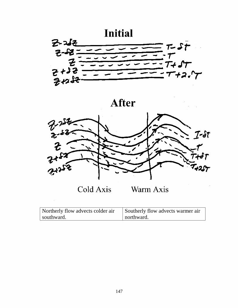
Extratropical cyclones form by baroclinic instability – where north/south temperature gradient becomes so strong that an infintitely small perturbation amplifies into a synoptic-scale wave disturbance.
• Assume that this perturbation exists in a uniform zonal flow u.
• Assume wavelike perturbation moves at speed c=u.
• Assume N/S velocity associated with perturbations will distort T
patterns.
147
Northerly flow advects colder air southward.
Southerly flow advects warmer air northward.
148
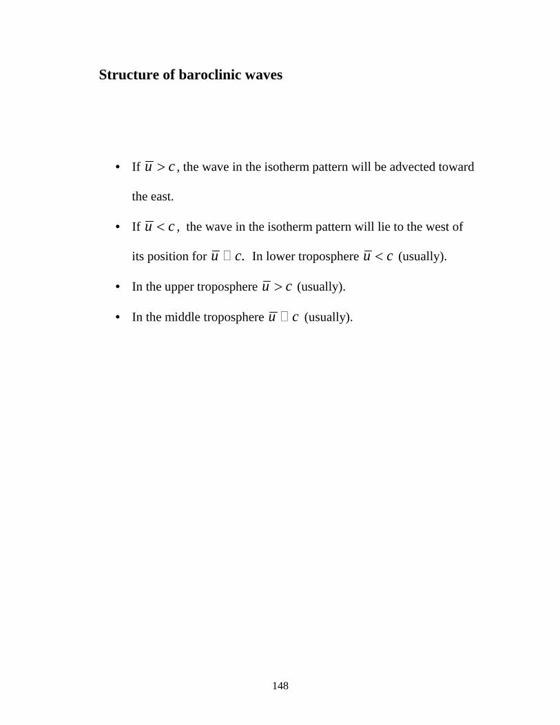
Structure of baroclinic waves
• If u c> , the wave in the isotherm pattern will be advected toward
the east.
• If u c< , the wave in the isotherm pattern will lie to the west of
its position for .u c! In lower troposphere u c< (usually).
• In the upper troposphere u c> (usually).
• In the middle troposphere u c! (usually).
149
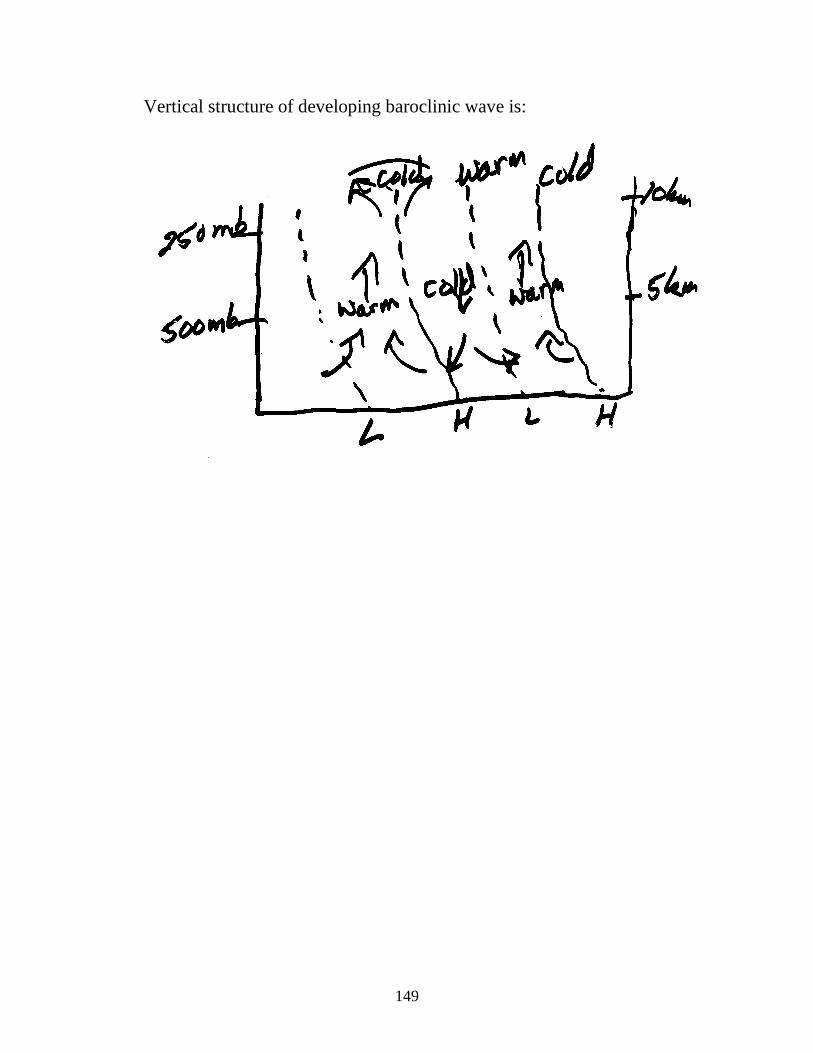
Vertical structure of developing baroclinic wave is:
150
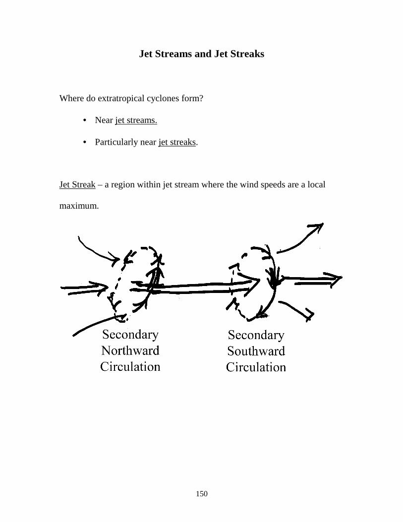
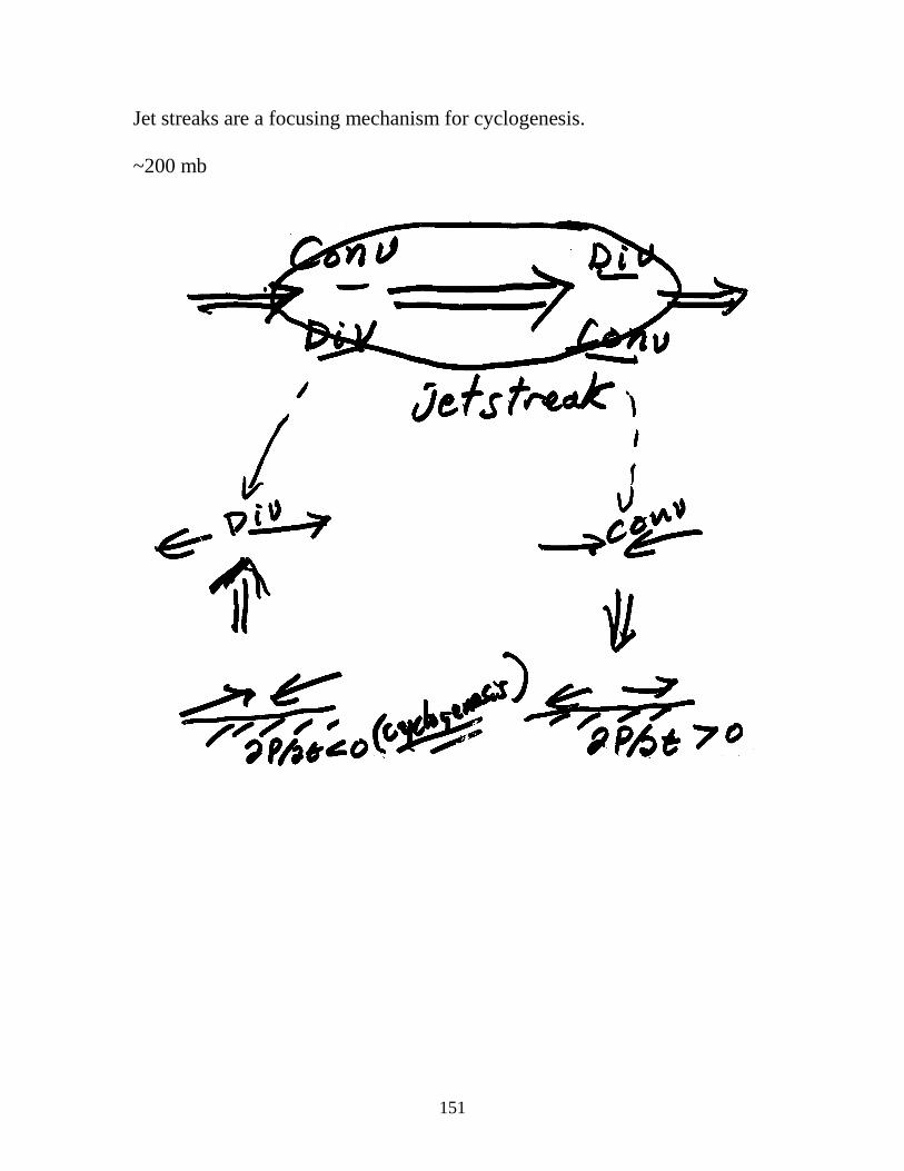
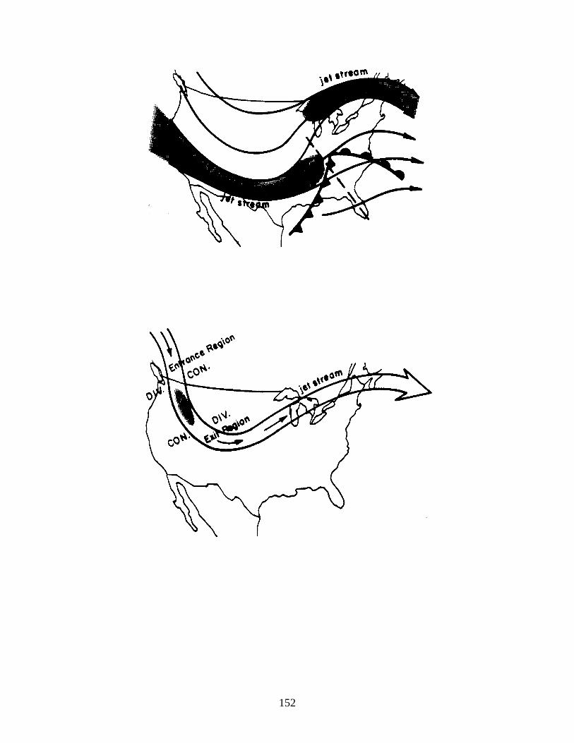
Jet Streams and Jet Streaks
Where do extratropical cyclones form?
• Near jet streams.
• Particularly near jet streaks.
Jet Streak – a region within jet stream where the wind speeds are a local
maximum.
151
Jet streaks are a focusing mechanism for cyclogenesis.
~200 mb
152
153
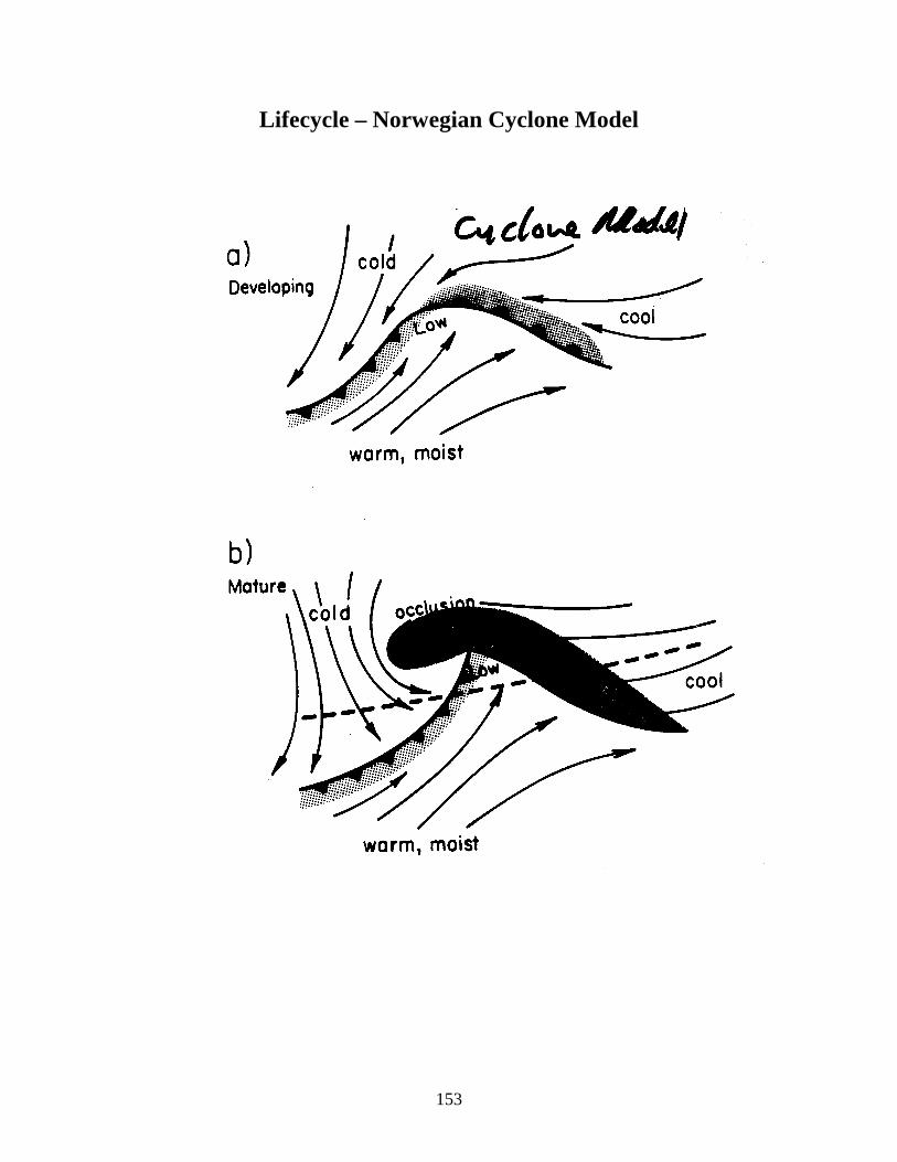
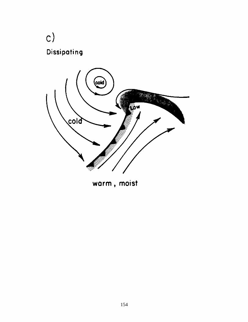
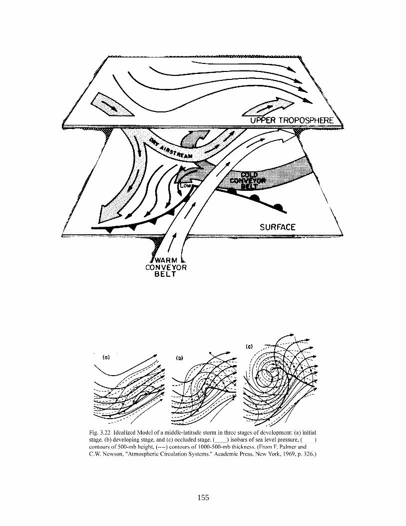
Lifecycle – Norwegian Cyclone Model
154
155
156
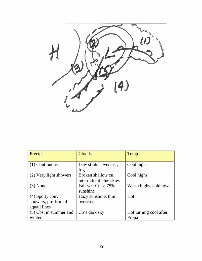
Precip. Clouds Temp.
(1) Continuous Low stratus overcast, fog
Cool highs
(2) Very light showers Broken shallow cu, intermittent blue skies
Cool highs
(3) None Fair wx. Cu. > 75% sunshine
Warm highs, cold lows
(4) Spotty conv. showers, pre-frontal squall lines
Hazy sunshine, thin overcast
Hot
(5) Cbs. in summer and winter
Cb’s dark sky Hot turning cool after Fropa
157
158
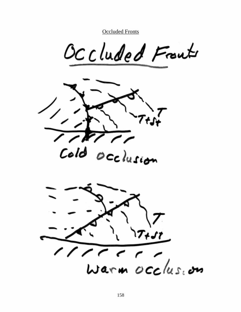
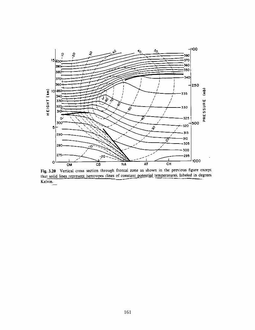
Occluded Fronts
159
• The common notion is that such fronts form when the cold front
catches up with part of the warm front during cyclogenesis.
• However there are few examples of cold fronts overtaking warm
fronts to form occlusions.
• It appears most occluded fronts are new fronts which form as surface
lows separate from the junctions of their respective warm and cold
fronts and deepen further back into cold air.
160
161
162
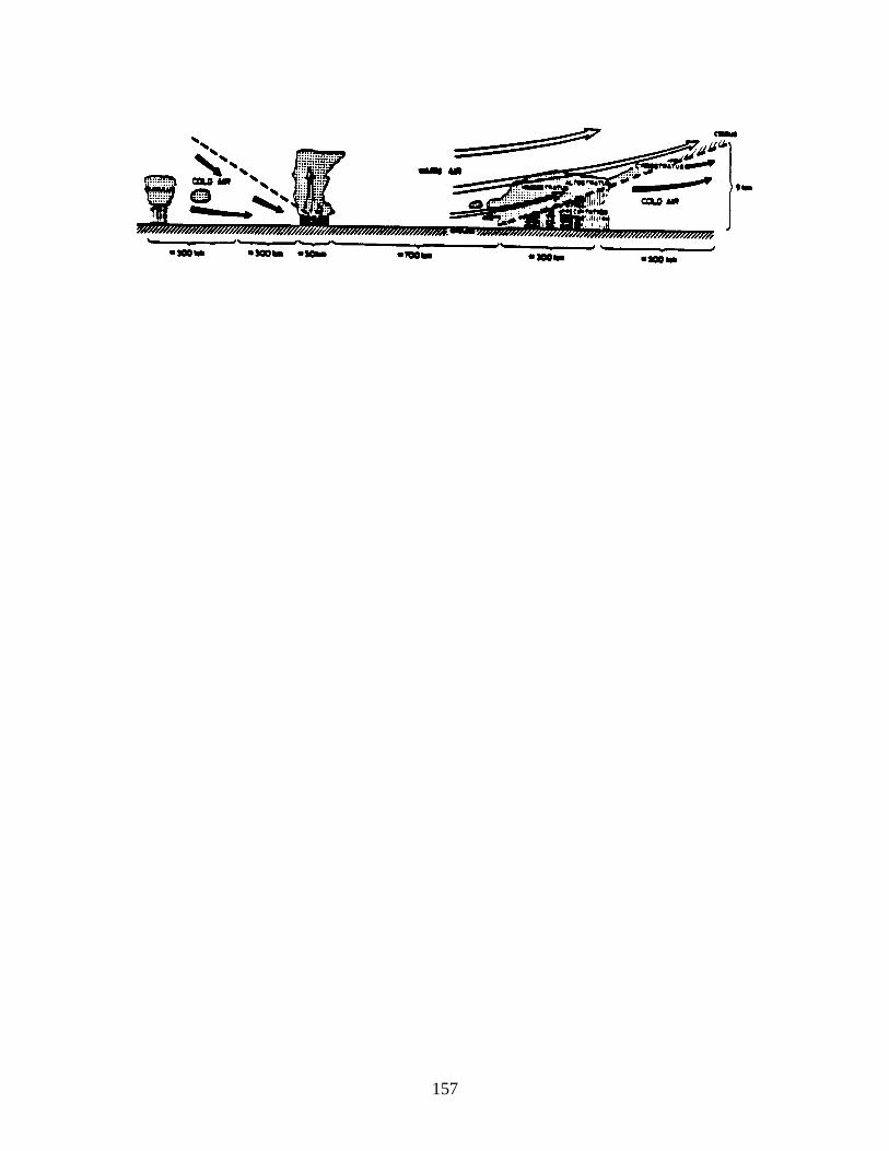
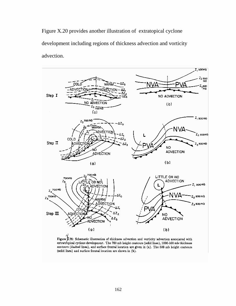
Figure X.20 provides another illustration of extratopical cyclone
development including regions of thickness advection and vorticity
advection.
163
The conditions associated with the development of extratropical storms is
as follows:
• Favorable conditions:
o The existence of a thickness gradient in the lower
troposphere (i.e, a front); particulary when it is
anticyclonically curved;
o The presence of an upper-level trough with cold advection to
its rear and warm advection ahead; and
o Release of latent heat near the center of the surface low by
deep cumulonimbus and stratiform precipitation.
• Unfavorable conditions:
o A weakening thickness gradient as a result of low-level
divergent flow; and
o The absence of an upper-level trough or a trough with cold
advection ahead ot it, and warm advection behind resulting
in a trough which will decrease in intensity with time.
Extratropical cyclones are different from hurricanes and tropical storms
because their energy is primarily from the juxtaposition of cold and warm air
masses (i.e., a horizontal thickness gradient). Tropical cyclones, in contrast,
derive their energy though heating around the central core as a result of deep
164
cumulonimbus. In addition, the wind field of extratropical cyclones,
although spread over a large area, has weaker maximum speeds since the
pressure gradient is not as strong as found in mature, well-developed
hurricanes. Oceanic extratropical cyclones are less of a danger to shipping
than hurricanes because the seas are not as chaotic since the wind direction
does not vary through 360° around a small center as it does for the tropical
storm.
165
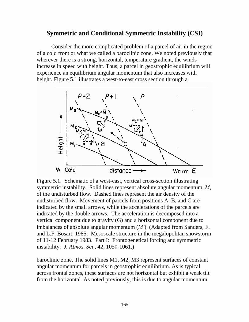
Symmetric and Conditional Symmetric Instability (CSI)
Consider the more complicated problem of a parcel of air in the region of a cold front or what we called a baroclinic zone. We noted previously that wherever there is a strong, horizontal, temperature gradient, the winds increase in speed with height. Thus, a parcel in geostrophic equilibrium will experience an equilibrium angular momentum that also increases with height. Figure 5.1 illustrates a west-to-east cross section through a
Figure 5.1. Schematic of a west-east, vertical cross-section illustrating symmetric instability. Solid lines represent absolute angular momentum, M, of the undisturbed flow. Dashed lines represent the air density of the undisturbed flow. Movement of parcels from positions A, B, and C are indicated by the small arrows, while the accelerations of the parcels are indicated by the double arrows. The acceleration is decomposed into a vertical component due to gravity (G) and a horizontal component due to imbalances of absolute angular momentum (M′). (Adapted from Sanders, F. and L.F. Bosart, 1985: Mesoscale structure in the megalopolitan snowstorm of 11-12 February 1983. Part I: Frontogenetical forcing and symmetric instability. J. Atmos. Sci., 42, 1050-1061.) baroclinic zone. The solid lines M1, M2, M3 represent surfaces of constant angular momentum for parcels in geostrophic equilibrium. As is typical across frontal zones, these surfaces are not horizontal but exhibit a weak tilt from the horizontal. As noted previously, this is due to angular momentum
166
decreasing with latitude and increasing with height. Quite evident in the figure is the tendency for the equilibrium absolute angular momentum to increase with height. Also shown are surfaces of constant air density which are not horizontal across a frontal zone. Colder, more dense air lies to the west. Nonetheless, the tendency for air density to decrease with height is also evident in the figure. The vertical variation in density in the figure corresponds to a stable, environmental temperature-lapse rate. Let us consider the vertical, horizontal, and slantwise displacements of parcels A, B, and C, respectively. Displacing A upward in a stably stratified environment results in the density of A being greater than its environment, causing a downward acceleration. The upward-displaced parcel, A, will also carry its angular momentum, MA, to higher levels and find itself in a region where the environmental geostrophically balanced angular momentum M is greater. This imbalance will create an acceleration of A toward lower absolute angular momentum in the environment or to the west (left). Because M decreases in magnitude toward the west, the westward acceleration rapidly decreases as the parcel moves in that direction. The dominant acceleration is, therefore, downward due to the stable stratification. Parcel A, thus, experiences a net restoring force bringing it back to its original position.
Let us now consider the westward displacement of parcel B. Because parcel B conserves its absolute angular momentum as it is displaced westward, it will find itself with excess angular momentum relative to its environment. This will create a horizontal acceleration toward larger environmental angular momentum, or to the right. Parcel B will also become less dense than its environment, resulting in a net acceleration that is upward and to the right. Because the environmental stratification is stable, the upward acceleration will not continue and parcel B will experience a net restoring force to its initial position. Thus, in the environment depicted in Figure 5.1 a parcel displaced either vertically or horizontally will experience a restoring force that will return the parcel to its original position. The environment is stable to either vertical or horizontal displacements. Consider now the slantwise displacement of parcel C along the path shown in Figure 5.1, which has a slope that is between the slopes of the environmental angular momentum and density surfaces. In this case, while carrying its lesser angular momentum to higher levels, it will experience a
167
deficit in angular momentum relative to its environment and therefore accelerate toward lower environmental angular momentum or to the left. Likewise, as parcel C ascends, it will become less dense than its environment and therefore experience an acceleration that is upward. The parcel undergoing slantwise displacement will therefore experience a net acceleration in the direction of its displacement. An environment in which the slope of the environmental angular momentum surfaces is shallower than that of the surfaces of environmental density is said to be unstable to slantwise motion or symmetrically unstable.
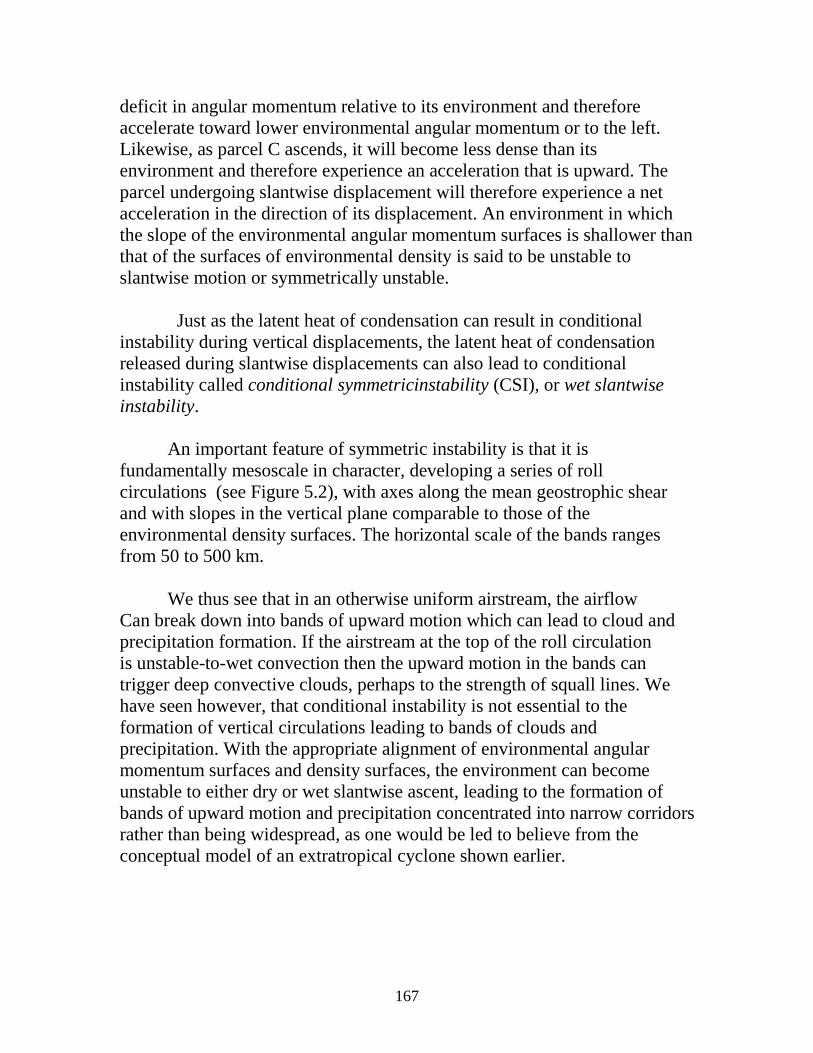
Just as the latent heat of condensation can result in conditional instability during vertical displacements, the latent heat of condensation released during slantwise displacements can also lead to conditional instability called conditional symmetricinstability (CSI), or wet slantwise instability. An important feature of symmetric instability is that it is fundamentally mesoscale in character, developing a series of roll circulations (see Figure 5.2), with axes along the mean geostrophic shear and with slopes in the vertical plane comparable to those of the environmental density surfaces. The horizontal scale of the bands ranges from 50 to 500 km.
We thus see that in an otherwise uniform airstream, the airflow Can break down into bands of upward motion which can lead to cloud and precipitation formation. If the airstream at the top of the roll circulation is unstable-to-wet convection then the upward motion in the bands can trigger deep convective clouds, perhaps to the strength of squall lines. We have seen however, that conditional instability is not essential to the formation of vertical circulations leading to bands of clouds and precipitation. With the appropriate alignment of environmental angular momentum surfaces and density surfaces, the environment can become unstable to either dry or wet slantwise ascent, leading to the formation of bands of upward motion and precipitation concentrated into narrow corridors rather than being widespread, as one would be led to believe from the conceptual model of an extratropical cyclone shown earlier.
168
Figure 5.2. Schematic of the circulation resulting from conditional symmetric instability. The dashed lines show positions of environmental density surfaces. The roll circulation exhibits a long axis in the north-south direction in the case illustrated.
169
Rapidly Deepening Coastal Cyclones
Or “bombs”
Characterized by (surface) pressure falls of ~24 mb in 24 hr or more.
Associated severe weather hurricane force winds, high seas, intense cb’s,
heavy precip. – (snow)
(Noreaster)
170
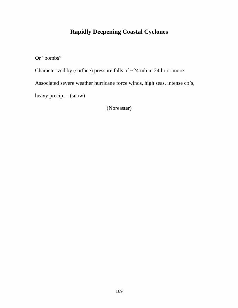
President’s Day Storm
171
President’s Day Storm:
P-deepened from 1020 mb to 996 mb in 24 hr.
From DC to NY snow amounts in excess of 60 cm (~2 ft.).
Such a storm can receive as much as half its energy from the fluxes of
sensible and latent heat from the ocean (Gulf stream). The other half from
baroclinicity.
172
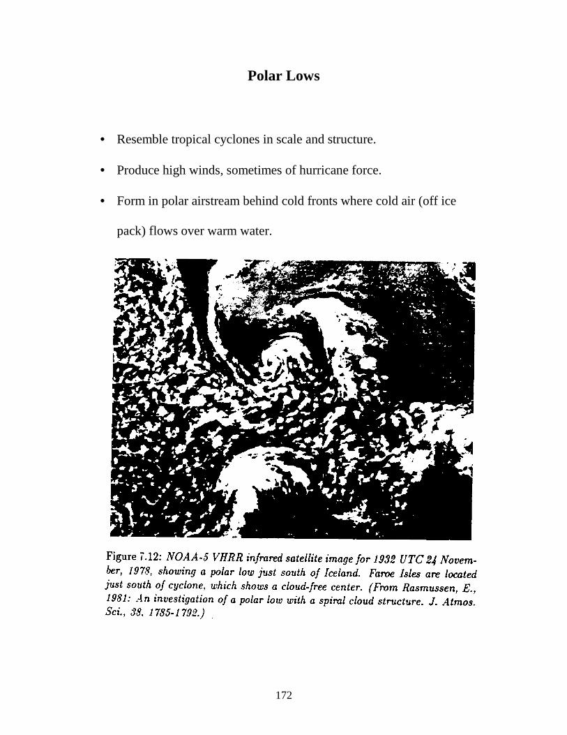
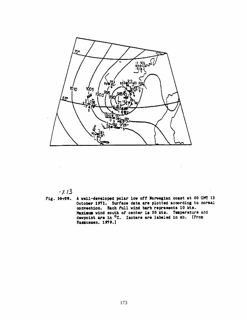
Polar Lows
• Resemble tropical cyclones in scale and structure.
• Produce high winds, sometimes of hurricane force.
• Form in polar airstream behind cold fronts where cold air (off ice
pack) flows over warm water.
173
174
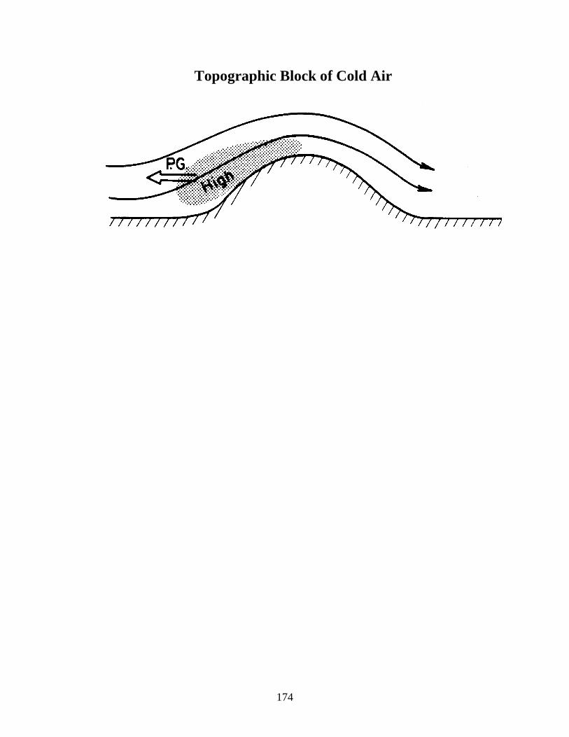
Topographic Block of Cold Air
175
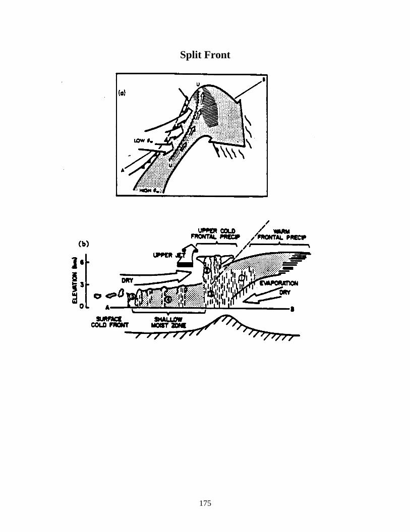
Split Front
176
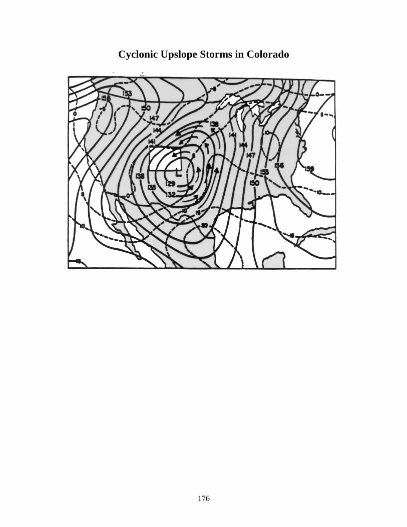
Cyclonic Upslope Storms in Colorado
177
178
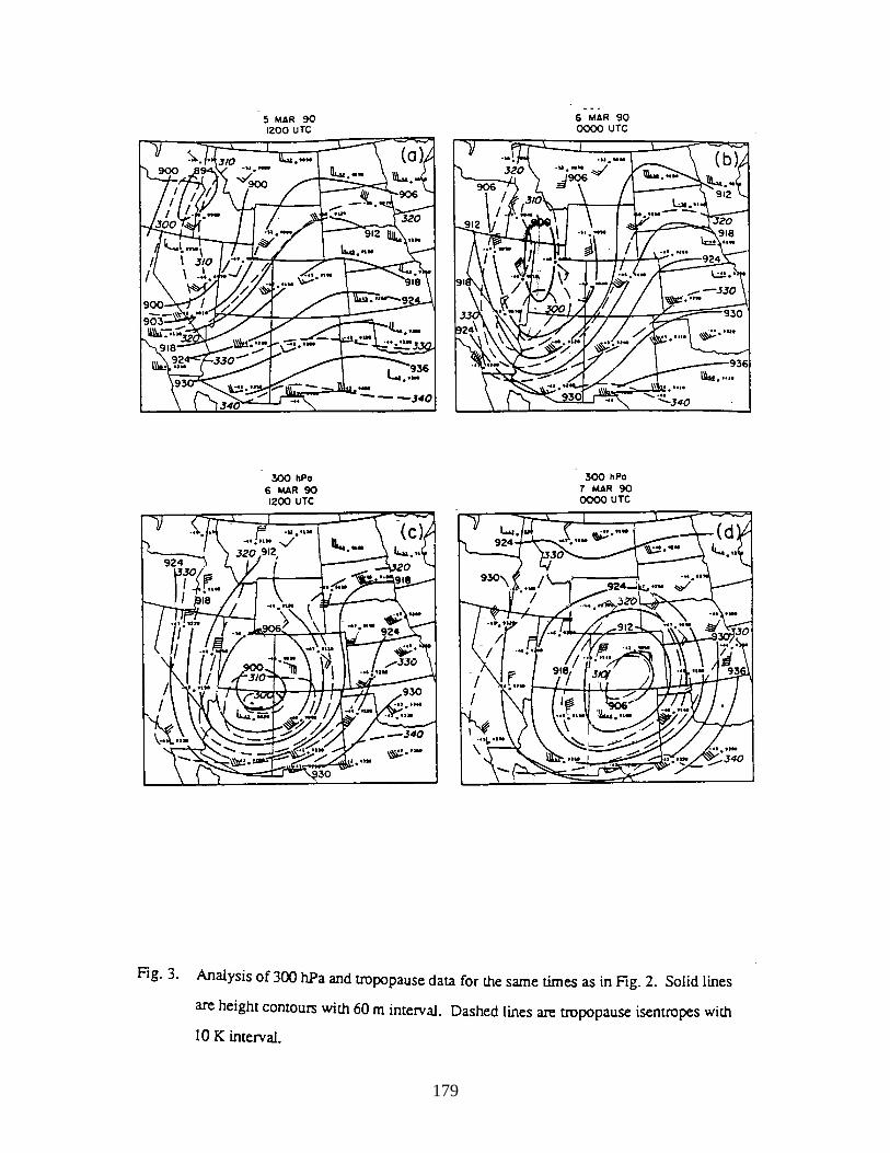
179
180
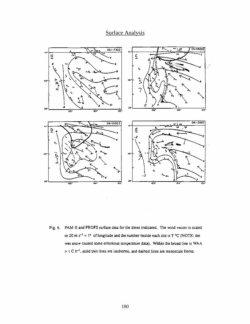
Surface Analysis
181
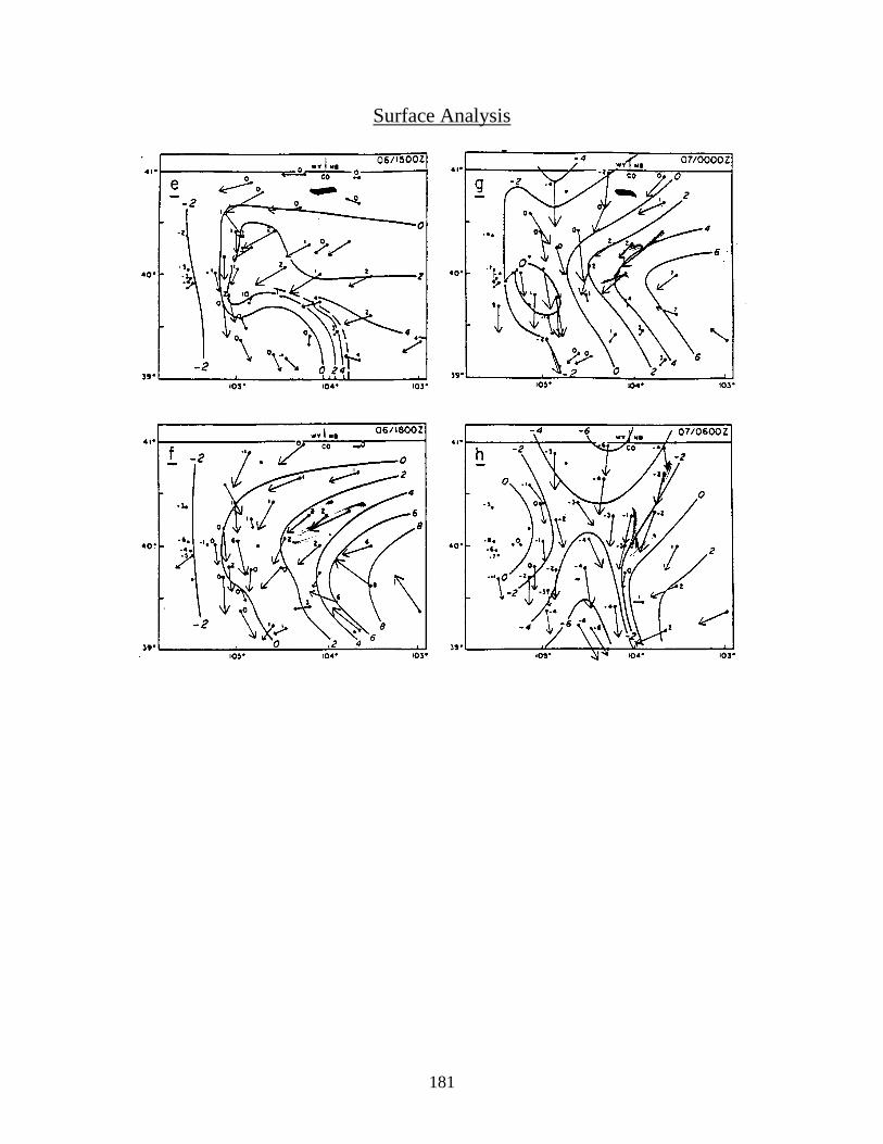
Surface Analysis
182
183
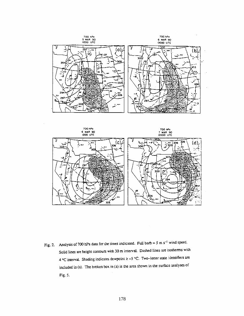
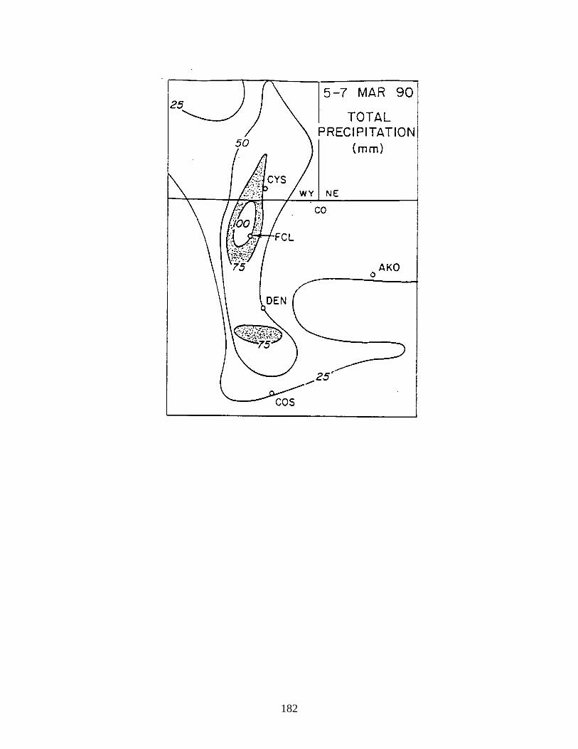
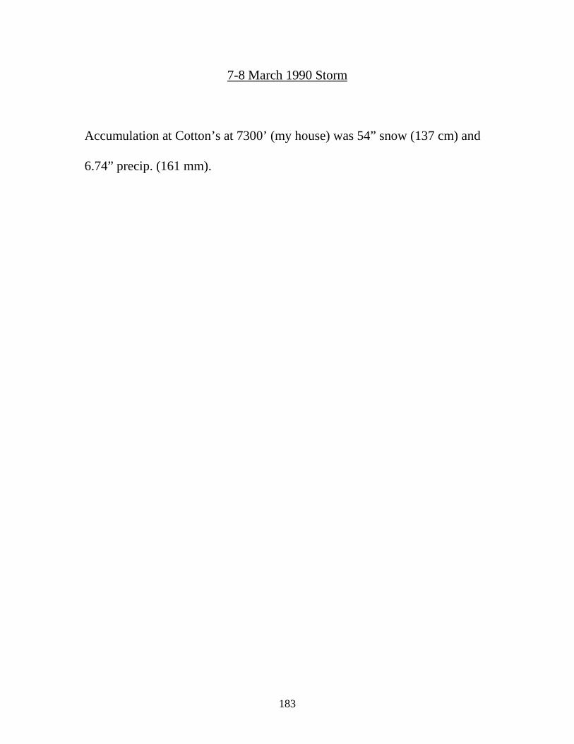
7-8 March 1990 Storm
Accumulation at Cotton’s at 7300’ (my house) was 54” snow (137 cm) and
6.74” precip. (161 mm).
184
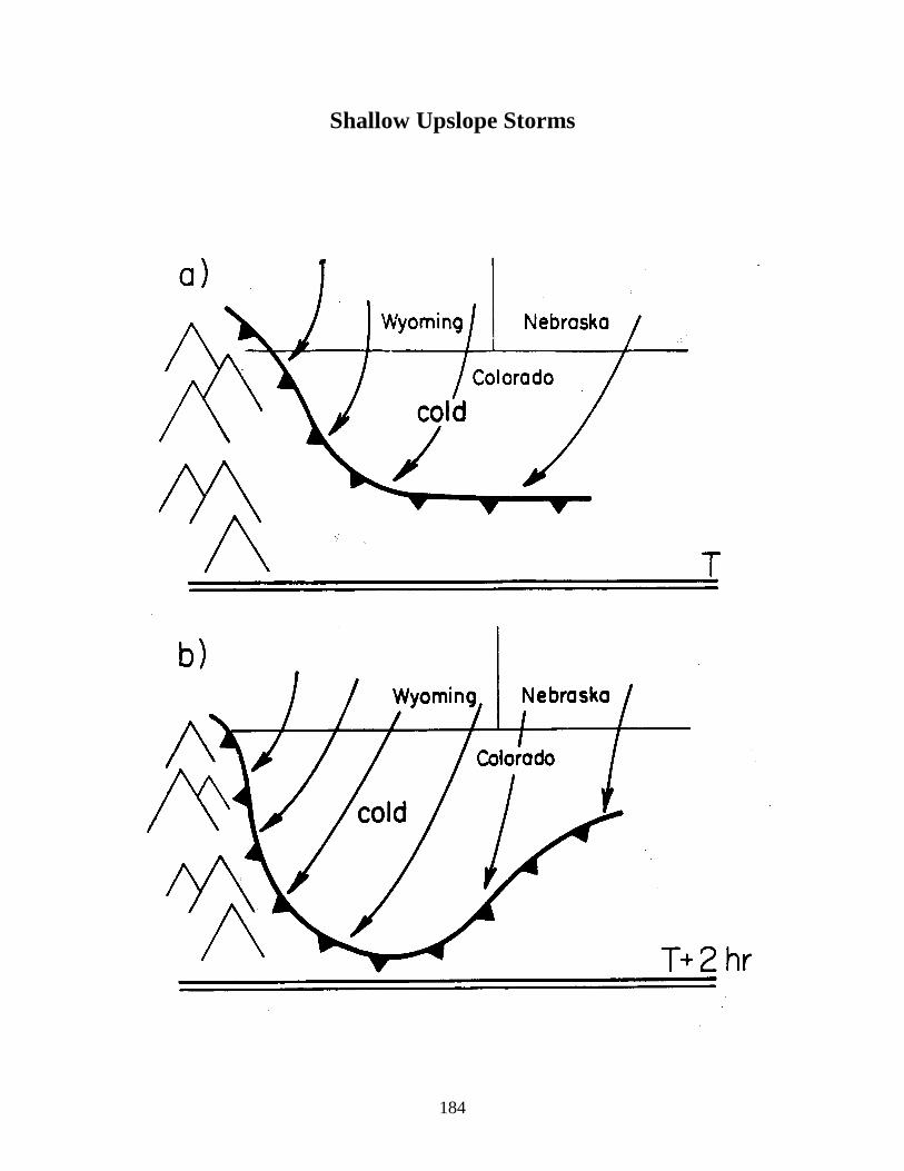
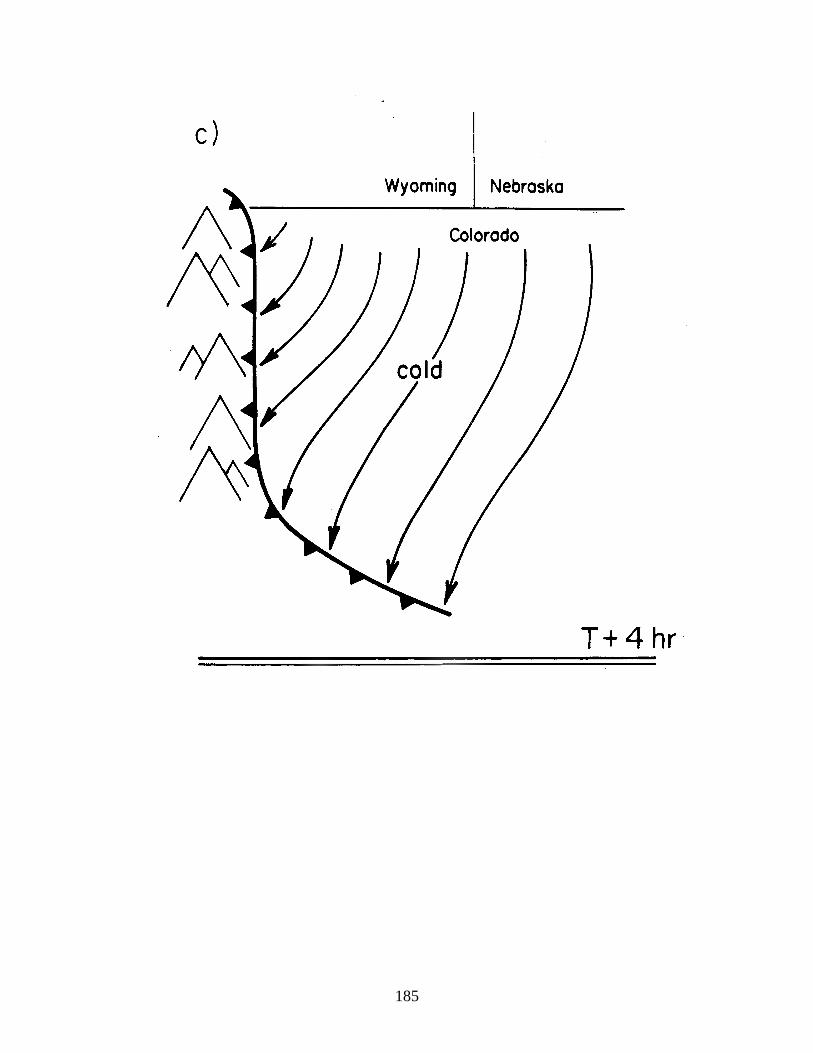
Shallow Upslope Storms
185
186
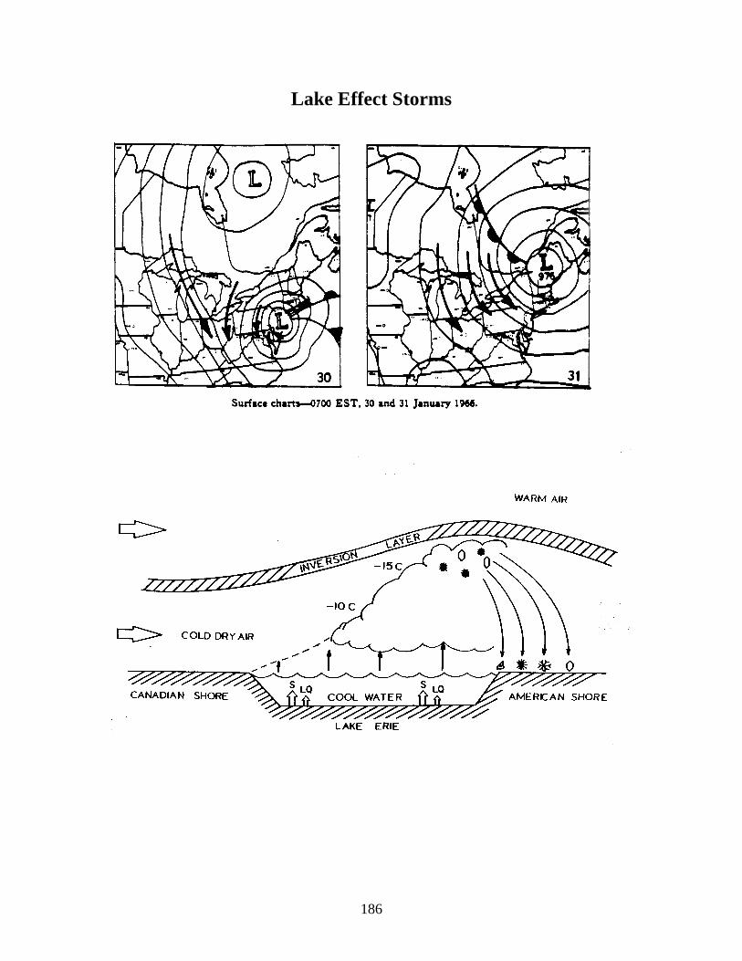
Lake Effect Storms
187
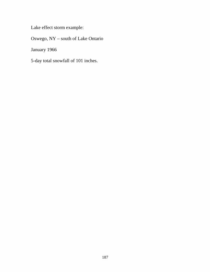
Lake effect storm example:
Oswego, NY – south of Lake Ontario
January 1966
5-day total snowfall of 101 inches.