Embed Size (px)
Citation preview
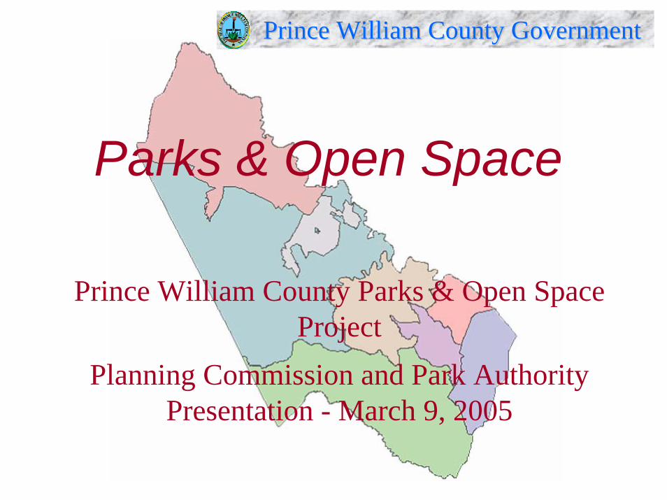
Prince William County GovernmentPrince William County Government
Parks & Open Space
Prince William County Parks & Open Space Project
Planning Commission and Park Authority Presentation - March 9, 2005
1Date: 3/9/2005
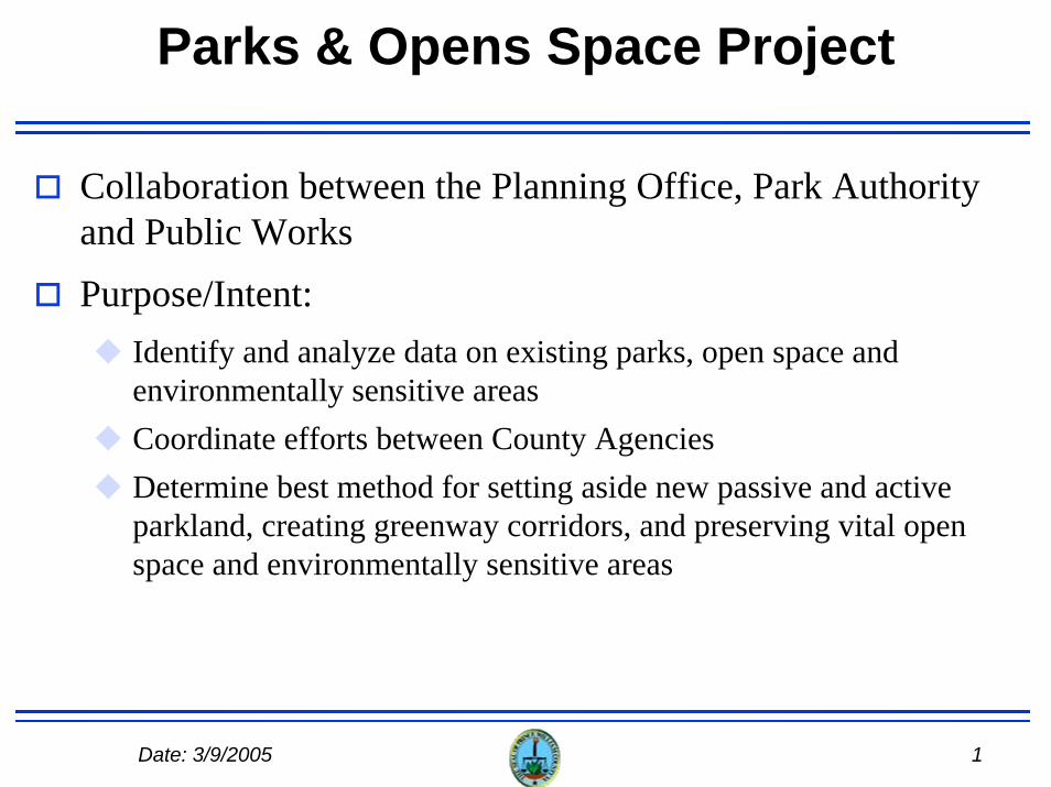
Parks & Opens Space Project
Collaboration between the Planning Office, Park Authority and Public WorksPurpose/Intent:
Identify and analyze data on existing parks, open space and environmentally sensitive areasCoordinate efforts between County AgenciesDetermine best method for setting aside new passive and active parkland, creating greenway corridors, and preserving vital openspace and environmentally sensitive areas
2Date: 3/9/2005
Basis for Parks & Open Space Project County Comprehensive Plan
Parks and Open Space ChapterCreate and maintain an inventory of existing private sector and other jurisdictional parkland and facilities for use in future park analysis.
Environment ChapterTo protect the biological diversity, processes, and functions of natural habitats, identify a network of preservation corridors or large woodland areas to be incorporated into an overall habitat protection network.Investigate the benefits of establishing a private conservancy fund for the purpose of purchasing privately held lands for preservation purposes and seeking perpetual conservation easements to preserve open space.
Long Range Land Use ChapterCreate a new Public Facilities Map.
3Date: 3/9/2005
Basis for Parks & Open Space Project Park Authority Comprehensive Plan
Establish long-range acquisition and development priorities.Develop a Parks and Open Space Master Plan for the County that identifies areas suitable for recreational development, open space preservation, and/or historic/cultural preservation, and identify means for acquiring such areas.Coordinate with the County Planning Office to establish policies for protecting the County’s open space (ie. green infrastructure) and establish guidelines as to the management of such spaces.
Consider developing a per capita standard for open space and/or passive park acreage.Identify possible funding sources for property acquisition.
4Date: 3/9/2005
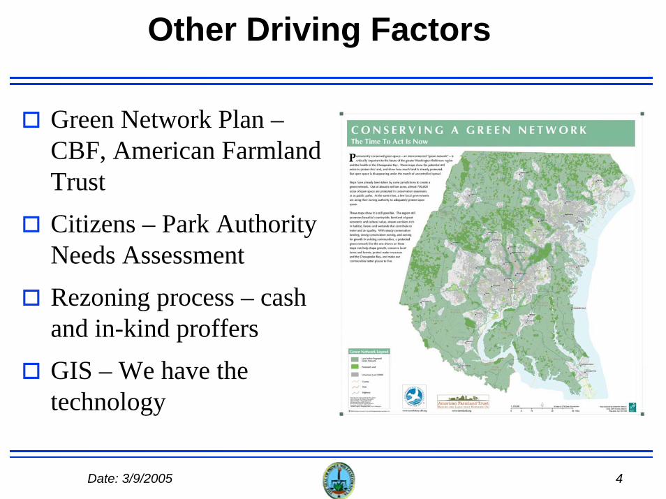
Other Driving Factors
Green Network Plan –CBF, American Farmland TrustCitizens – Park Authority Needs AssessmentRezoning process – cash and in-kind proffersGIS – We have the technology

5Date: 3/9/2005
Project Phases
Phase 1: Data Collection & AnalysisSeptember 2004 – April 2005Outputs:
Preliminary reportProposed Parks and Open Space map (revised)Proposed Long-Range Land Use Map (revised)
Phase 2: Citizen ParticipationSeries of Public Forums throughout CountyInformational websiteApril – June (2005)Output: Citizen Input Report
6Date: 3/9/2005
Project Phases, cont.
Phase 3: Commission & Board participationJoint (and/or separate) work sessions with Planning Commission and Park Authority BoardWork sessions with BOCSJune - July (2005)
Phase 4: Final project reportAugust – December 2005Outputs:
Project report Revised Parks & Open Space Map and Long-Range Land Use Map for BOCS adoption Proposed amendments - Parks & Open Space Chapter of the Comprehensive Plan for BOCS adoptionRevised Park Authority Comprehensive Plan for Park Authority Board adoption
7Date: 3/9/2005
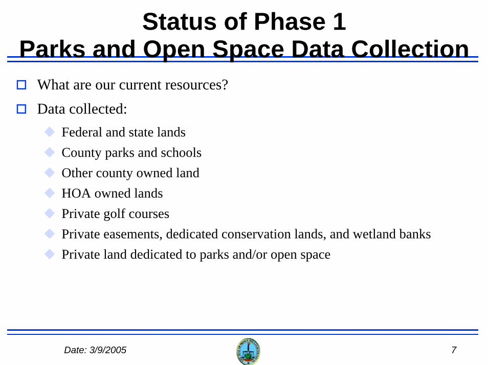
Status of Phase 1Parks and Open Space Data Collection
What are our current resources?Data collected:
Federal and state landsCounty parks and schoolsOther county owned landHOA owned lands Private golf coursesPrivate easements, dedicated conservation lands, and wetland banksPrivate land dedicated to parks and/or open space
8Date: 3/9/2005
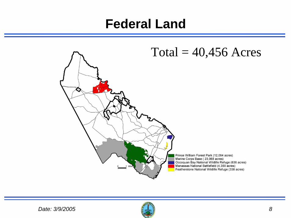
Federal Land
Total = 40,456 Acres
9Date: 3/9/2005
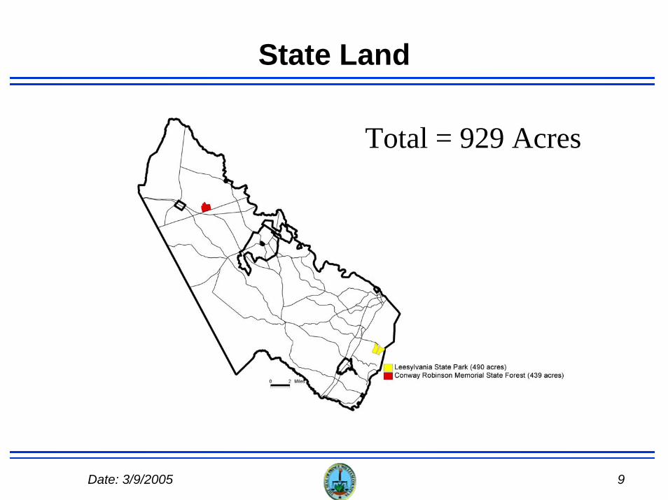
State Land
Total = 929 Acres
10Date: 3/9/2005
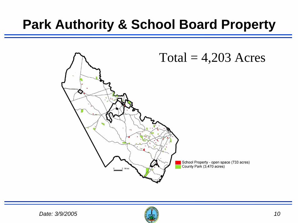
Park Authority & School Board Property
Total = 4,203 Acres
11Date: 3/9/2005
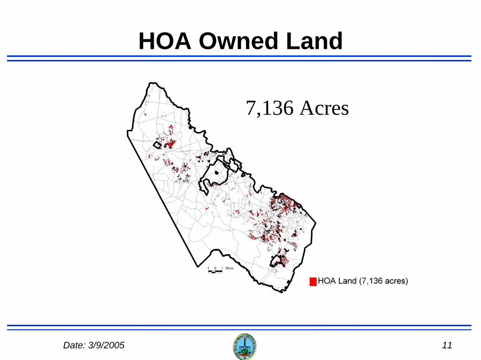
HOA Owned Land
7,136 Acres

12Date: 3/9/2005
Golf Courses
4,078 Acres
13Date: 3/9/2005
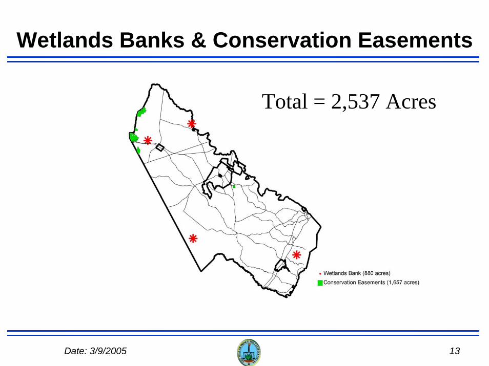
Wetlands Banks & Conservation Easements
Total = 2,537 Acres
14Date: 3/9/2005
Status of Phase 1 –Data Analysis – Green Infrastructure
Where do we want to go?Status of data analysis
Open SpaceEnvironmentally-sensitive landsCultural resources
“Green Infrastructure Map”

15Date: 3/9/2005
Environmental Resources
16Date: 3/9/2005
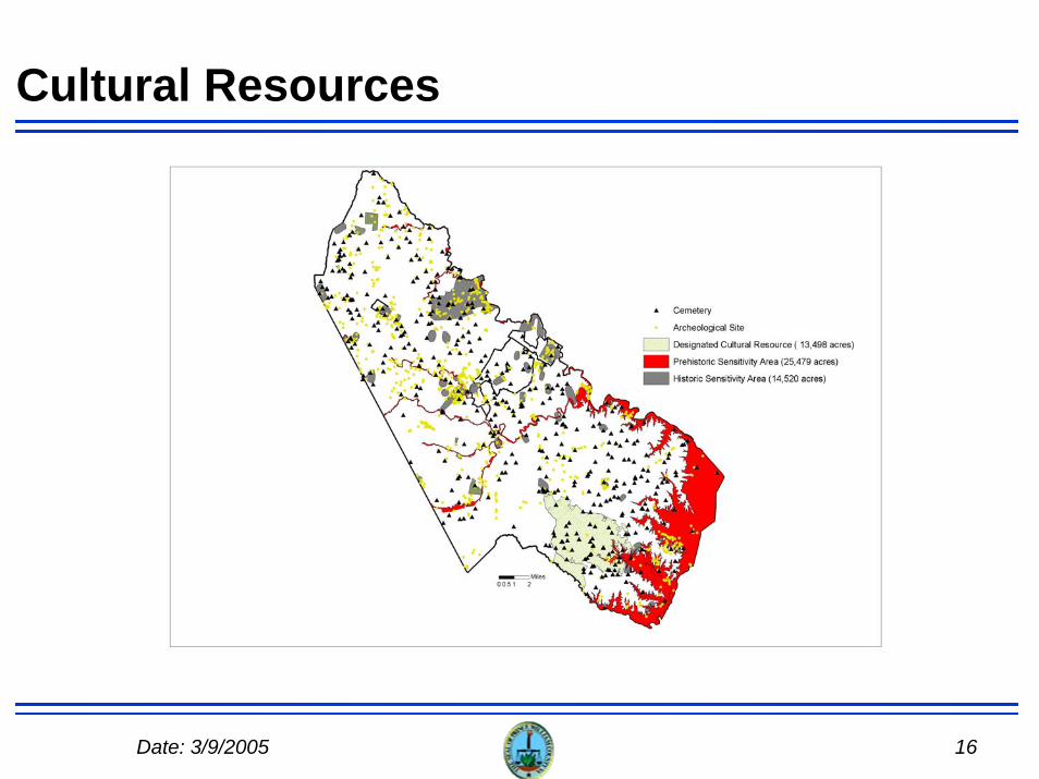
Cultural Resources
17Date: 3/9/2005
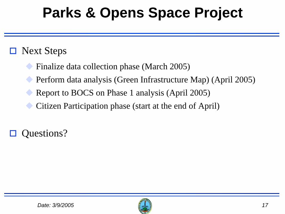
Parks & Opens Space Project
Next StepsFinalize data collection phase (March 2005)Perform data analysis (Green Infrastructure Map) (April 2005)Report to BOCS on Phase 1 analysis (April 2005)Citizen Participation phase (start at the end of April)
Questions?