Embed Size (px)
Citation preview
U.S. Department of the InteriorU.S. Geological Survey
Susan TrapaneseChief of National Water Information SystemApril 17, 2007
Overview of National Water Information System (NWIS)
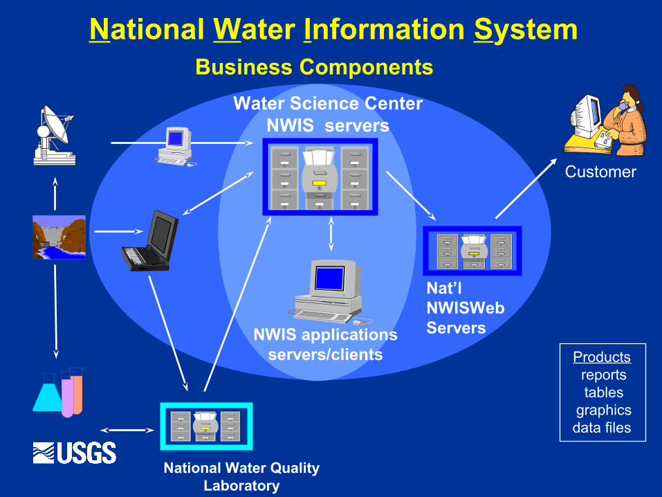
Nat’l NWISWeb Servers
National Water Quality Laboratory
Water Science Center NWIS servers
Customer
NWIS applicationsservers/clients
National Water Information System Business Components
Products reports tables
graphicsdata files

AK
HI
WA
MT
OR
CA
ID
NVUT
WY
CO
AZ NM
TX
OK
KS
NE
SD
ND
LA
MN
IA
MO
AR
MS AL
TN
KY
WI
IL IN
MI
OH
VA
NC
SC
GA
FL
PR
PA
NY
NJ
MD/DE
New England (MA, CT, RI, VT, NH, ME)
WV
NWIS Water Science Center Installations
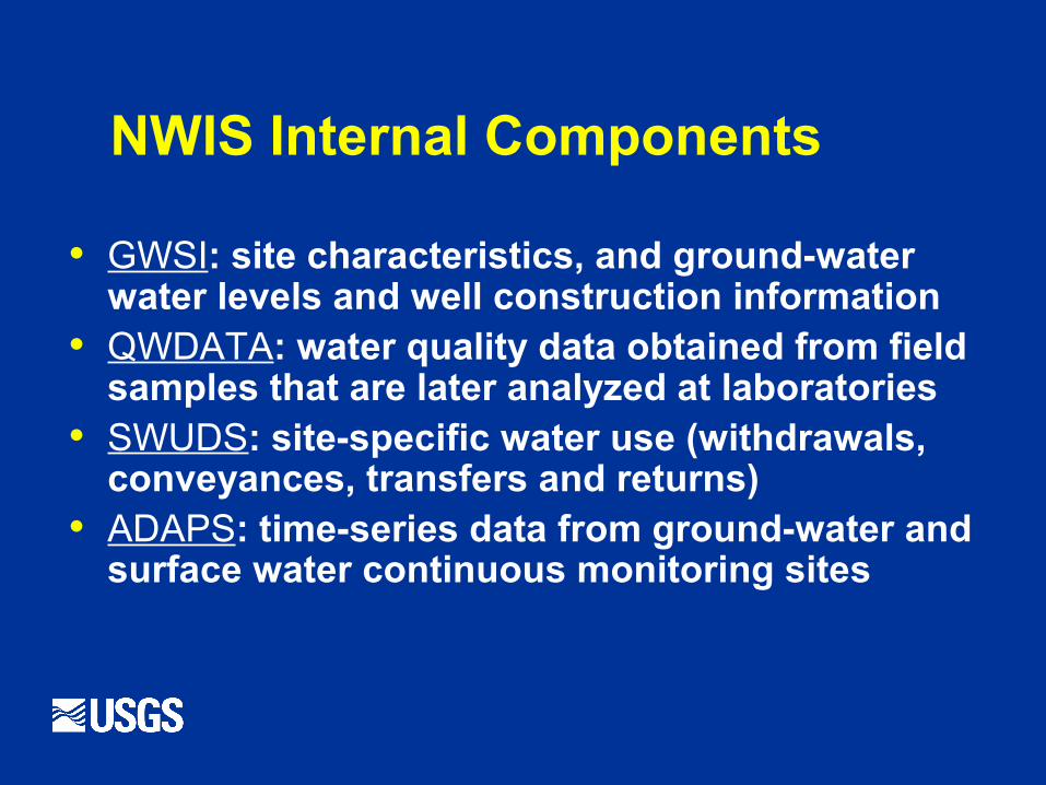
NWIS Internal Components
• GWSI: site characteristics, and ground-water water levels and well construction information
• QWDATA: water quality data obtained from field samples that are later analyzed at laboratories
• SWUDS: site-specific water use (withdrawals, conveyances, transfers and returns)
• ADAPS: time-series data from ground-water and surface water continuous monitoring sites
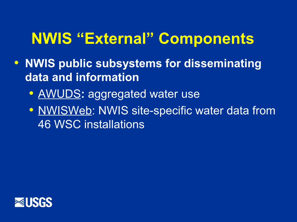
NWIS “External” Components
• NWIS public subsystems for disseminating data and information
• AWUDS: aggregated water use
• NWISWeb: NWIS site-specific water data from 46 WSC installations
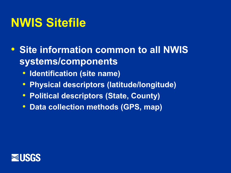
NWIS Sitefile
• Site information common to all NWIS systems/components• Identification (site name)
• Physical descriptors (latitude/longitude)
• Political descriptors (State, County)
• Data collection methods (GPS, map)
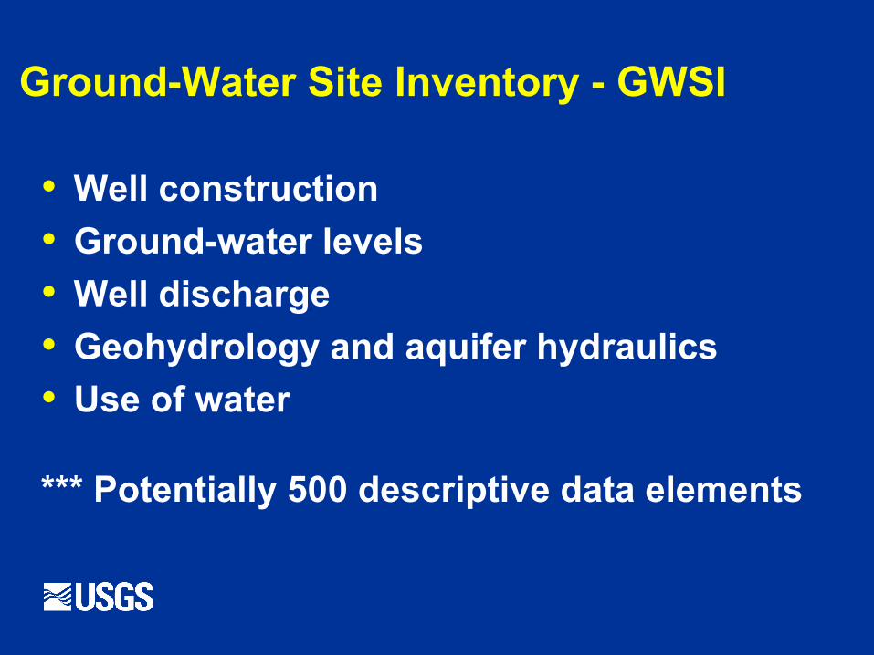
Ground-Water Site Inventory - GWSI
• Well construction
• Ground-water levels
• Well discharge
• Geohydrology and aquifer hydraulics
• Use of water
*** Potentially 500 descriptive data elements
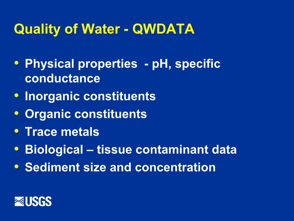
Quality of Water - QWDATA
• Physical properties - pH, specific conductance
• Inorganic constituents
• Organic constituents
• Trace metals
• Biological – tissue contaminant data
• Sediment size and concentration
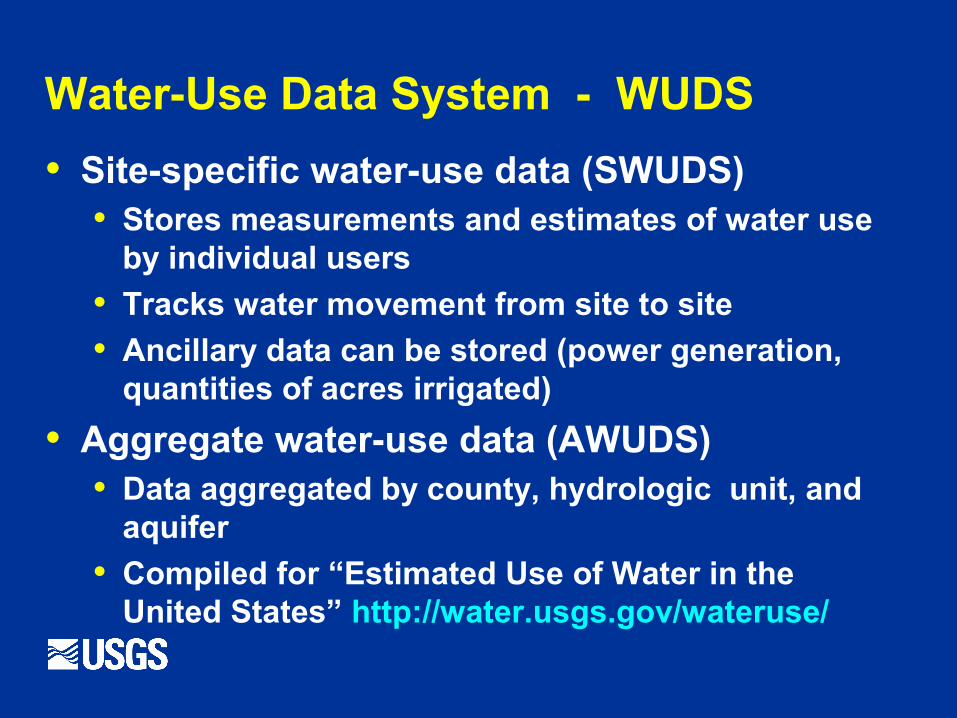
Water-Use Data System - WUDS
• Site-specific water-use data (SWUDS)• Stores measurements and estimates of water use
by individual users
• Tracks water movement from site to site
• Ancillary data can be stored (power generation, quantities of acres irrigated)
• Aggregate water-use data (AWUDS)• Data aggregated by county, hydrologic unit, and
aquifer
• Compiled for “Estimated Use of Water in the United States” http://water.usgs.gov/wateruse/
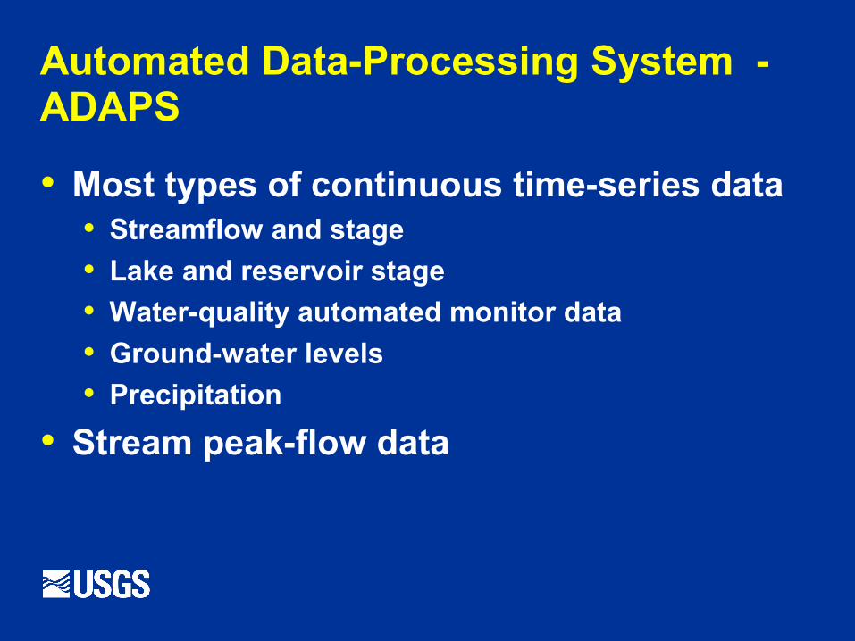
Automated Data-Processing System - ADAPS
• Most types of continuous time-series data • Streamflow and stage
• Lake and reservoir stage
• Water-quality automated monitor data
• Ground-water levels
• Precipitation
• Stream peak-flow data
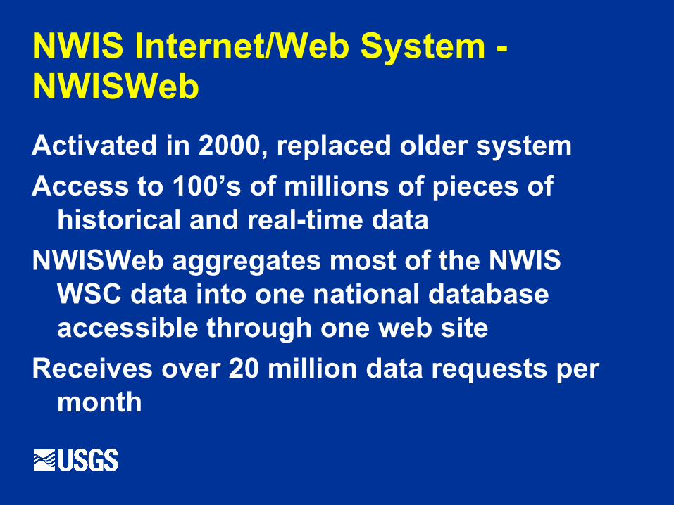
NWIS Internet/Web System - NWISWeb
Activated in 2000, replaced older system
Access to 100’s of millions of pieces of historical and real-time data
NWISWeb aggregates most of the NWIS WSC data into one national database accessible through one web site
Receives over 20 million data requests per month
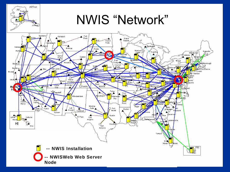
-- NWIS Installation
-- NWISWeb Web Server Node Draft-10/12/2004
NWIS “Network”
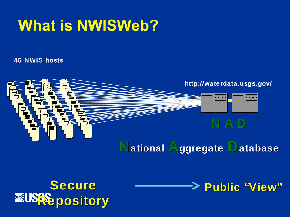
NN AA DD
NNationalational AAggregateggregate DDatabaseatabase
http://waterdata.usgs.gov/
Secure Secure RepositoryRepository
Public “View”Public “View”
46 NWIS hosts
What is NWISWeb?
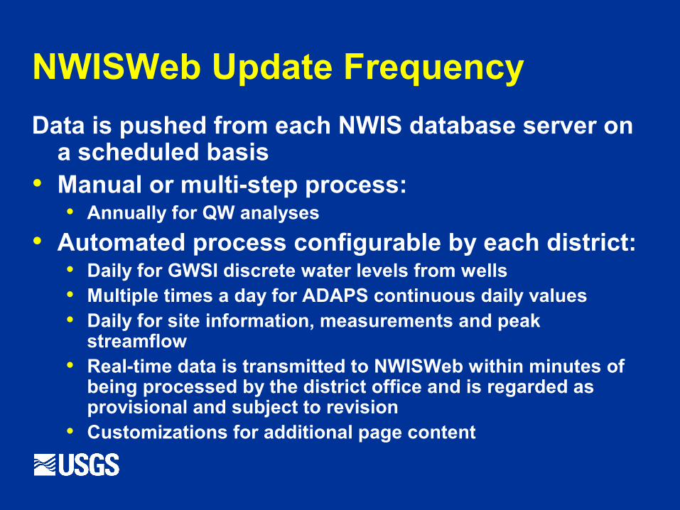
NWISWeb Update Frequency
Data is pushed from each NWIS database server on a scheduled basis
• Manual or multi-step process:• Annually for QW analyses
• Automated process configurable by each district:• Daily for GWSI discrete water levels from wells• Multiple times a day for ADAPS continuous daily values • Daily for site information, measurements and peak
streamflow• Real-time data is transmitted to NWISWeb within minutes of
being processed by the district office and is regarded as provisional and subject to revision
• Customizations for additional page content
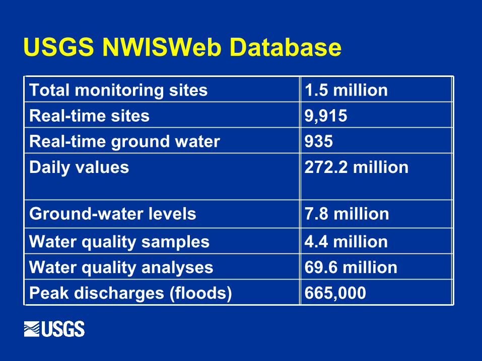
USGS NWISWeb Database
935Real-time ground water
665,000Peak discharges (floods)
69.6 millionWater quality analyses
4.4 millionWater quality samples
7.8 millionGround-water levels
272.2 millionDaily values
9,915Real-time sites
1.5 millionTotal monitoring sites
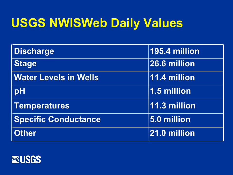
USGS NWISWeb Daily Values
11.4 millionWater Levels in Wells
21.0 millionOther
5.0 millionSpecific Conductance
11.3 millionTemperatures
1.5 millionpH
26.6 millionStage
195.4 millionDischarge
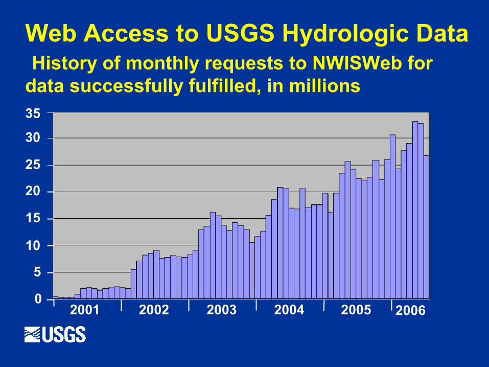
Web Access to USGS Hydrologic Data History of monthly requests to NWISWeb for data successfully fulfilled, in millions35
30
25
20
15
10
5
02001 2002 2003 2004 2005 2006
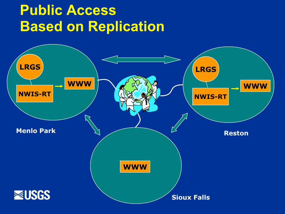
Public AccessBased on Replication
NWIS-RT
LRGS
WWW
LRGS
WWW
WWW
NWIS-RT
Menlo Park
Sioux Falls
Reston
NWIS-RT
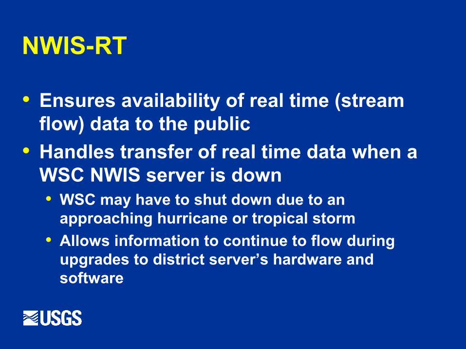
• Ensures availability of real time (stream flow) data to the public
• Handles transfer of real time data when a WSC NWIS server is down• WSC may have to shut down due to an
approaching hurricane or tropical storm
• Allows information to continue to flow during upgrades to district server’s hardware and software
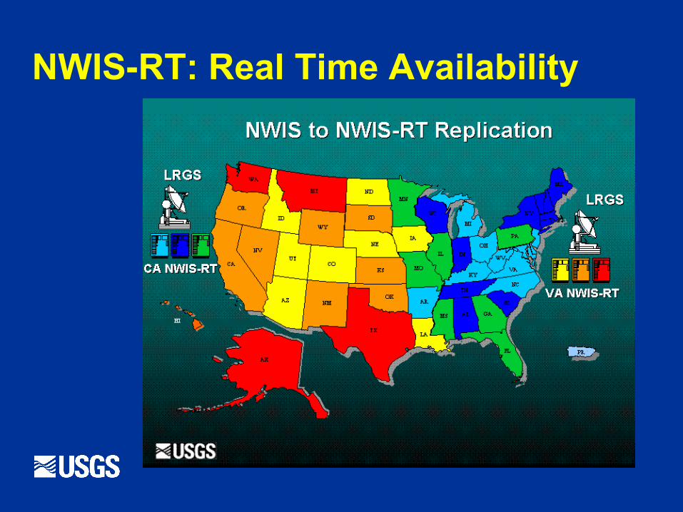
NWIS-RT: Real Time Availability
NWIS Water Data Not in NWISWeb
• Well completion and production information
• Water-use information (aggregate water- use available at http://water.usgs.gov/watuse/)
Useful Links to NWIS
• NWIS data via web http://waterdata.usgs.gov/nwis/
• List of water quality parameters available from NWIS via NWISWeb http://waterdata.usgs.gov/nwis/help?parameters_help
• NWISWeb Fact Sheet http://pubs.usgs.gov/fs/fs-128-02/