Embed Size (px)
Citation preview

Overcoming GNSS Vulnerability by Applying Inertial Data Integration in Multi-Sensor Systems for High Accuracy Navigation, Pointing, and Timing SolutionsEngineers from Geodetics select KVH for versatile high-performance inertial sensors
KVH Industries, Inc. • World Headquarters • 50 Enterprise Center • Middletown, RI • 02842 • USAkvh.com
White Paper

©2015 KVH Industries, Inc.kvh.com
2
Engineers from Geodetics select KVH for versatile high-performance inertial sensors
Executive Summary
Global Navigation Satellite Systems (GNSS) are at the core of most high accuracy navigation, pointing and timing solutions despite the well-established vulnerabilities associated with satellite-based navigation. The need to overcome GNSS blockages from terrain, urban environments, and jamming has led to the development of multi-sensor navigation systems using data from both GNSS and inertial sensors. The only form of precise navigation that does not rely on external references, inertial navigation relies instead on knowing initial position, velocity, and attitude and measuring attitude rates and accelerations to determine position. This makes it, in essence, unjammable. Inertial navigation enhances GNSS performance by maintaining the navigation data during the loss of satellite signals and allowing a rapid reacquisition of the GNSS signals when they are once again available.
This paper examines how the combination of a high-performance inertial measurement unit (IMU) from KVH fully integrated with GNSS results in an extremely precise GNSS-aided system developed by Geodetics. This approach overcomes the various GNSS vulnerabilities using both GNSS and high-performance fiber optic gyro (FOG)-based IMUs from KVH Industries, Inc. The result is a series of reliable and cost-effective high-performance multi-sensor navigation solutions.
Challenge
GNSS signals can be blocked or reflected by buildings, terrain and other structures, or even intentionally jammed or spoofed with readily available and affordable jamming technology. To compensate for these vulnerabilities, engineers are looking toward multi-sensor solutions, recognizing that no single navigation technology is robust enough or reliable enough to accomplish precision navigation on its own at an affordable cost. A multi-sensor navigation system relies on integration algorithms to obtain the best overall position solution from a group of subsystems and components, including inertial measurement sensors along with GNSS positioning.
An IMU by itself cannot provide an absolute position. It consists of three orthogonally mounted rate gyros integrated with three accelerometers that measure angular rates and linear accelerations, respectively. Velocity is calculated by software, adding all the velocity changes (accelerations) to an initial velocity reading. Position is calculated by adding all the position changes (velocities) to an initial position via an algorithm. These mathematical calculations integrate the IMU data into the navigation solution. When integrating IMUs into high-performance navigation or positioning systems, configuration flexibility is also a major consideration. Configuration flexibility means the systems can be easily designed to utilize a wide range of sensors, and thereby address many different application areas.
KVH’s 1750 IMU provides flexibility
of integration for multiple
configurations in multi-sensor
navigation solutions
What is an IMU Inertial measurement units
(IMUs) typically contain three orthogonally mounted rate-gyroscopes and three
orthogonally mounted accelerometers, measuring angular velocity and linear acceleration respectively.
By processing signals from these sensors it is possible
to track the position and orientation of a device
or platform.

©2015 KVH Industries, Inc.kvh.com
3
Engineers from Geodetics select KVH for versatile high-performance inertial sensors
Geodetics, Inc., a leader in the development of real-time, high-precision position and navigation solutions, required a resource for high-performance IMUs with flexible integration options for its series of high-performance, high-accuracy navigation systems. In addition to configuration flexibility, Geodetics also required inertial sensors that were designated as commercial off-the-shelf (COTS) and offered high performance without export restrictions.
Geodetics’ Choice for IMUs
Geodetics’ team evaluated numerous commercially available IMU technologies before choosing the premium performance 1775 IMU, the high-performance 1750 IMU, and the high-accuracy 1725 IMU from KVH Industries, Inc. Their primary choice is the 1750 IMU, a versatile, compact, commercially available inertial sensor system incorporating the world’s smallest precision FOG – the KVH DSP-1750 FOG – along with very low noise, highly accurate MEMS accelerometers. The 1750 IMU delivers excellent bias stability and repeatability while also being extremely resistant to shock and vibration. In addition to providing highly accurate 6-degrees-of-freedom (6 DoF) angular rate and acceleration data, the 1750 IMU performs with extreme stability in demanding environments, including thermal ambient conditions.
Another attribute of the 1750 IMU vital to Geodetics’ engineers was integration flexibility. The 1750 IMU measures the derivatives of the variables to be controlled (position, velocity, and attitude), and that data is integrated with the navigation system through the use of an algorithm. Geodetics developed its own suite of Extended Kalman filter algorithms to integrate the data from the KVH IMU with its various navigation systems.
The 1750 IMU offers RS-422 asynchronous communications with user programmable data output rates from 1 to 1000 Hz. The unique adaptability of KVH inertial sensors meant that Geodetics could precisely tailor the output of the IMU to create the designed message output from both the 1750 IMUs’ gyros and accelerometers. Adjustable baud and data rates of the 1750 IMU allowed Geodetics to achieve maximum performance based on the intended application by minimizing the communication latency so that the IMU delivers accurate data at the fastest possible rate.
Inertial data is used to enhance GNSS data in a number of navigation solutions including relative navigation, position, navigation and timing, and hybrid navigation. Fiber optic gyro-based IMUs by KVH offer the configuration flexibility, integration flexibility, and user selectable data inputs and outputs that make these IMUs ideal for a number of Geodetics’ inertial-aided navigation solutions.
Quotable“Based on (Geodetics’)…
desire to address the needs of the commercial
marketplace without export restrictions and without
sacrificing performance, we chose the KVH family
of IMUs.”
Dr. Jeffrey Fayman, Vice President of Planning
and Development at Geodetics, Inc.
KVH’s 1725, 1750, and 1775 IMUs
KVH’s family of IMUs offer a range
of performance options designed to
support an array of applications
©2015 KVH Industries, Inc.kvh.com
4
Engineers from Geodetics select KVH for versatile high-performance inertial sensors
Inertial Navigation
Inertial navigation is a self-contained navigation technique in which measurements provided by an IMU’s accelerometers and gyroscopes are used to track the position and orientation of an object relative to a known starting point, orientation, and velocity. The IMU carries key navigation data during the loss of GPS satellite signals and then enables fast re-acquisition of the signals when they are once again available.
The Geo-iNAV® Advanced navigation system by Geodetics is a fully integrated GPS-aided inertial navigation system that uses IMUs from KVH to offer a highly accurate navigation solution for both commercial and military applications. The Geo-iNav Advanced system provides navigation, position and orientation with accuracy to the centimeter level.
By offering its Geo-iNAV Advanced with a range of KVH IMUs, engineers and designers are able to further refine the level of performance required from the inertial navigation system. Geodetics chooses from KVH’s portfolio of IMUs for the performance features required including ranges in bandwidth, magnetometers, user selectable baud rates, and a range of data rates from 1 to 5000 Hz.
Relative Navigation
Relative navigation provides precise relative position, orientation, velocity and attitude between moving platforms such as manned or unmanned air and ground vehicles. Relative navigation is used to accomplish mid-air refueling of planes, autonomous UAV landing, and “sense and avoid” navigation. It is also used to enable a group of unmanned vehicles to operate in a swarm.
Geodetics’ Geo-RelNAV® system is a relative GPS/INS navigation system used for applications such as autonomous aerial refueling, autonomous landing systems, and
collision avoidance. Like other Geodetics navigation systems, the Geo-RelNAV is offered with the KVH 1750 IMU providing inertial navigation data to be integrated with its software via Geodetics’ proprietary algorithm. The system is offered in various configurations designed to meet a wide range of requirements for both commercial and military applications.
In Geo-RelNAV, the relative position, distance, azimuth and elevation of the line-of-sight vector from the secondary to the primary platform are provided by a GPS-based system in which raw observations from the GPS of the secondary platform are transmitted to the primary through a data link. The primary platform uses this data to determine its relative distance to the secondary. The accuracy enhancement of a GPS-based relative navigation system is achieved by using the carrier phase GPS and fixing relative ambiguities. This line-of-sight
KVH’s 1750 IMU integrates with
Geodetics’ Geo-iNAV Advanced to
offer a highly accurate navigation
solution for both commercial and
military applications.
Geodetics’ Geo-RelNAV is used for such applications as
autonomous aerial refueling
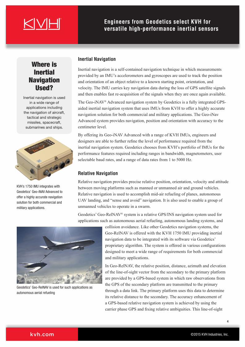
Where is Inertial
Navigation Used?
Inertial navigation is used in a wide range of
applications including the navigation of aircraft,
tactical and strategic missiles, spacecraft,
submarines and ships.

©2015 KVH Industries, Inc.kvh.com
5
Engineers from Geodetics select KVH for versatile high-performance inertial sensors
relative position observation is used in a Relative Extended Kalman Filter (R-EKF) in association with transmitted data from the KVH 1750 IMU to provide relative navigation data.
Positioning, Navigation, and Timing
Inertial data is also used in Positioning, Navigation, and Timing (PNT) solutions to deliver time, position and attitude during the temporary loss of GNSS signals. Position updates from satellites are not always available, or they are potentially incorrect (e.g., unintentional jamming of weak GNSS signals or signal reflections leading to erroneous positions). The integrity and availability of position updates benefit from inertial navigation technology, which is independent of external signals.
Geodetics’ Geo-PNT® system offers precise navigation data and an accurate time reference by combining a GPS master clock with the KVH 1750 IMU to deliver time, position, and attitude under all circumstances, including temporary loss of GPS, which is typical in dynamic applications. The multi-sensor system minimizes size, weight, and power needs due to the integration of positioning and timing that in other systems require two independent subsystems.
Hybrid Navigation
Hybrid navigation combines multiple navigation technologies to provide accurate orientation, pointing, and positioning information. Hybrid navigation is used for orientation data on slow moving or stationary platforms such as aerostats, as well as in camera stabilization, antenna pointing, and weapons pointing.
The Geo-hNAV™ combines the precision inertial technology of KVH’s 1750 IMU with Geodetics’ Geo-iNAV inertial navigation and Geo-Pointer™ heading systems. Precise heading is derived using two antennas rigidly mounted on the platform with some separation. This heading information is used as a constraint by the system and the remaining orientation parameters are obtained from the 1750 IMU.
A UAV with Geo-PNT, which combines a
GPS master clock with the KVH 1750 IMU,
shown here being used in an unmanned
application
Geo-hNAV application for stationary or slow moving platforms

©2015 KVH Industries, Inc.kvh.com
6
Engineers from Geodetics select KVH for versatile high-performance inertial sensors
Conclusion
GNSS continues to be the key source of accurate navigation and positioning data for the foreseeable future regardless of its shortcomings in terms of interference vulnerability and signal jamming. As developments continue on anti-jamming technologies that can detect and counter GNSS jammers, improvements continue to be made to existing systems such as dead reckoning algorithms, inertial sensing, nuclear magnetic resonance gyros, and multiple GNSS constellations, to name a few.
Advancements also continue to be made in multi-sensor navigation and positioning technologies by innovative and agile companies such as Geodetics, Inc., that focus on solutions that are robust, reliable, cost-effective, and fully integrated. Just as engineers and designers carry on work toward the development of next generation navigation solutions, KVH continues pushing the boundaries of its fiber optic sensor technology to provide high-performance components necessary for cutting edge navigation solutions. KVH remains one of the only fiber optic gyro manufacturers in the world to control the entire manufacturing process from drawing its own proprietary polarization-maintaining optical fiber to packaging its gyros in higher level systems for inertial measurement, inertial navigation and attitude, heading and reference systems. This level of vertical integration gives the company total control over the quality of its products, including extensive in-house testing and continuous quality improvements in manufacturing. KVH is in a unique position to partner with innovative companies such as Geodetics to help support the next generation in navigation and positioning solutions.
About Geodetics, Inc.
Geodetics, Inc. is a leader in high accuracy, real-time positioning and navigation solutions. The company was founded in 1999, and is privately held with headquarters in San Diego, CA. Geodetics develops and markets real-time positioning and navigation solutions for military and civilian applications requiring the highest levels of precision.
To learn more, visit http://www.geodetics.com
Talk to an expertPlease contact: Jeff Fayman Vice President Planning and Development Geodetics, Inc. Tel: +1 858-729-0872 Email: [email protected]
KVH’s level of vertical integration includes
drawing its own optical fiber, which
enables accuracy equal to or better than
costly ring laser gyros.

©2015 KVH Industries, Inc.kvh.com
7
KVH high-performance fiber optic gyros provide precision pointing in interstellar space
About KVH Industries, Inc.
KVH Industries is a premier manufacturer of high-performance sensors and integrated inertial systems for defense and commercial guidance and stabilization applications, having sold more than 18,000 TACNAV® systems and 80,000 fiber optic gyros. KVH is based in Middletown, RI, with research, development, and manufacturing operations in Middletown, RI, and Tinley Park, IL. The company’s global presence includes offices in Belgium, Brazil, Cyprus, Denmark, Hong Kong, Japan, the Netherlands, Norway, Singapore, and the United Kingdom.
To learn more, visit www.kvh.com/fog
Talk to an expert
In the Americas, please contact: Sean McCormack Director - FOG/OEM Sales Guidance & Stabilization Group Direct Tel: +1 401-845-2413 Email: [email protected]
Turkey, Middle East, Africa, and Asia-PacChristine Marion Business Area Manager - International Guidance & Stabilization Group Direct Tel: +1 401-845-8126 Email: [email protected]
In Europe, please contact:
Jeya Sithamparanathan European Business Development Manager - FOG/OEM Guidance & Stabilization Group Direct Tel: +47 33 03 05 33 Email: [email protected]
See Jay Napoli, VP of FOG Sales, discuss
“How to Choose the Right Fiber Optic
Gyro” as seen on KVH’s YouTube channel
https://youtu.be/cBdpuYN3usI

©2015 KVH Industries, Inc.kvh.com
8
KVH high-performance fiber optic gyros provide precision pointing in interstellar space
KVH®, TACNAV®, and E•Core® are registered trademarks of KVH Industries, Inc.
KVH fiber optic gyros and digital signal processing technology are covered by one or more patents; details available at www.kvh.com/patents
All other trademarks are the property of their respective companies.
©2015 KVH Industries, Inc. All rights reserved. No part of this publication may be reproduced, stored in a retrieval system, or transmitted in any form or by any means, electronic, mechanical, photocopying, recording, or otherwise, without prior written permission.