Embed Size (px)
Citation preview
National Park ServiceU.S. Department of the Interior
MISSOURI NATIONAL RECREATIONAL RIVERNEBRASKA, SOUTH DAKOTA
Dear Friends of the Missouri National Recreational River:
What comes to mind when you think about the Missouri National Recreational River?
Do you think of a vast midwestern escape where one can experience solitude in nature and enjoy incredible wide open scenery of the river and its surrounding bluffs? A family friendly destination that provides second-to-none opportunities for fishing, boating, and picnicking? A rare example of a natural, large river system that is home to an abundance and diversity of plants, fish, birds, and other animals? A waterway with an incredible cultural history that tells the many stories of its inhabitants, from native people to European settlers? A “living laboratory” where people of all ages can learn about river dynamics, ecology, plants and animals, history, and other cultures?
The Missouri National Recreational River is all of this, and much more. To help us protect this river system for the benefit and enjoyment of future generations, we have contemplated this very question to determine what makes it outstandingly remarkable.
Knowledgeable people from many agencies and organizations in the region contributed valuable information, insight, and perspective to help answer this question, including representatives from the
National Park Service, U.S. Fish and Wildlife Service, U.S. Army Corps of Engineers, U.S. Geological Survey, various state agencies from Nebraska and South Dakota, academic institutions, and other river partners.
Based on this hard work and thoughtful input, we are pleased to present to you the outstandingly remarkable values of the Missouri National Recreational River. The value statements that follow have been developed to provide a strong foundation for the future management and protection of this nationally significant river system—to help us focus our daily attention on the river’s most important aspects.
We urge you to read these statements and to share your thoughts with us about what makes the Missouri and its designated tributaries outstandingly remarkable to you. Thank you for sharing your passion for the Missouri National Recreational River by helping to shape its future.
Best regards,
Steve MietzSuperintendentMissouri National Recreational RiverNational Park Service
OUTSTANDINGLY REMARKABLE VALUES
Outstandingly RemaRkable Values2 • Missouri NatioNal recreatioNal river
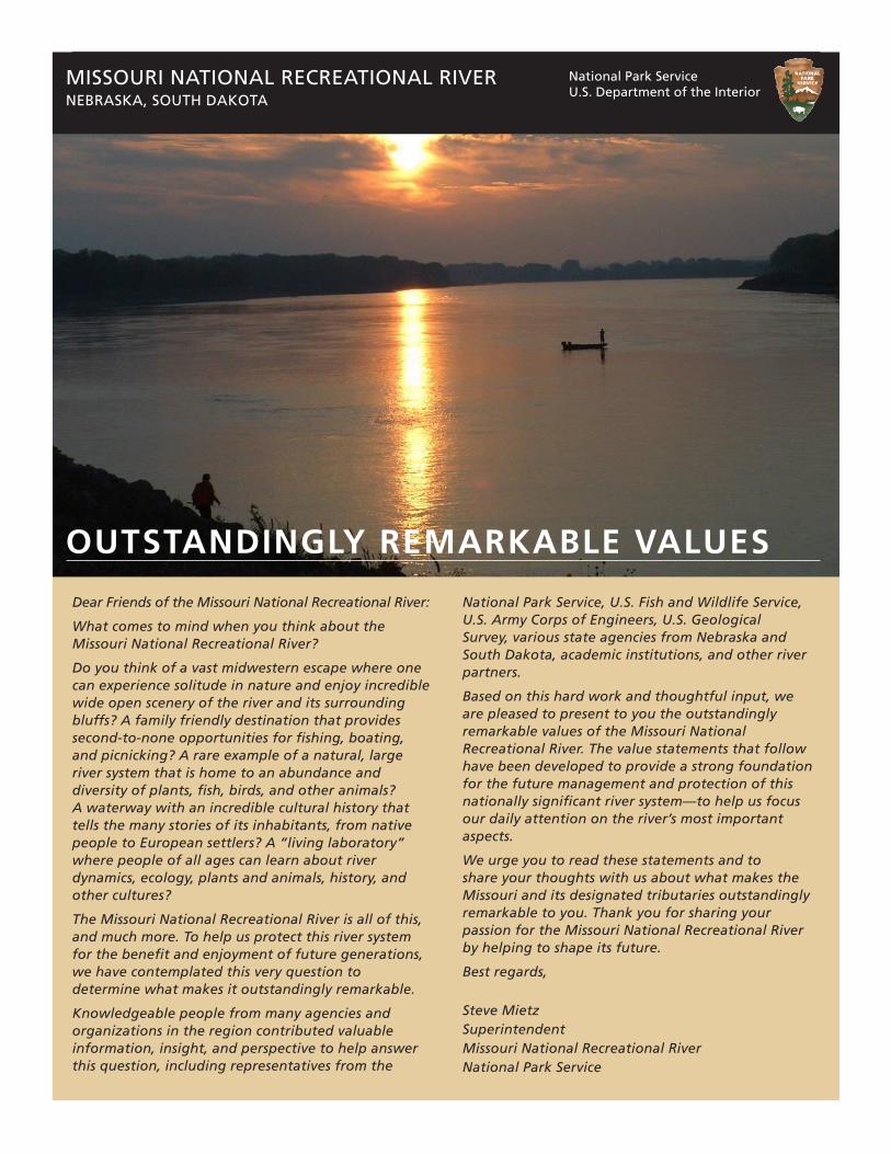
Front cover photo: Fall sunrise near Yankton, South Dakota Photo credit: Linda Gordon Rokosz
3 • Missouri NatioNal recreatioNal riverOutstandingly RemaRkable Values
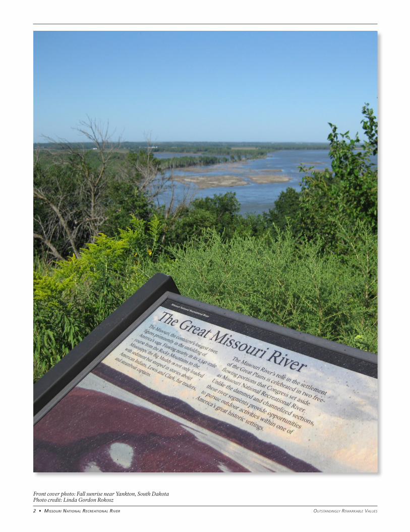
THE WILD AND SCENIC R IVERS ACT AND THE MISSOURI NATIONAL RECREATIONAL RIVERIn 1968, Congress passed the Wild and Scenic Rivers Act. The act “declared to be the policy of the United States that certain selected rivers of the Nation, which with their immediate environments, possess outstandingly remarkable scenic, recreational, geologic, fish and wildlife, historic, cultural, or other similar values, shall be preserved in free-flowing condition, and that they and their immediate environments shall be protected for the benefit and enjoyment of present and future generations.”
Under the Wild and Scenic Rivers Act, designated rivers are classified as wild, scenic, or recreational. The labels primarily relate to the degree of development along the river, not the proposed uses. And, regardless of the classification, each designated river in the national system is to be managed in a way that protects and enhances the values that prompted its designation. According to the act, the three classifications are defined as follows:
• “Wild” river areas – Those rivers or sections of rivers that are free of impoundments and generally inaccessible except by trail, with watersheds or shorelines essentially primitive and waters unpolluted. These represent vestiges of primitive America.
• “Scenic” river areas – Those rivers or sections of rivers that are free of impoundments, with shorelines or watersheds still largely primitive and shorelines largely undeveloped, but accessible in places by roads.
• “Recreational” river areas – Those rivers or sections of rivers that are readily accessible by road or railroad, that may have some shoreline development, and that may have undergone some impoundment or diversion in the past.
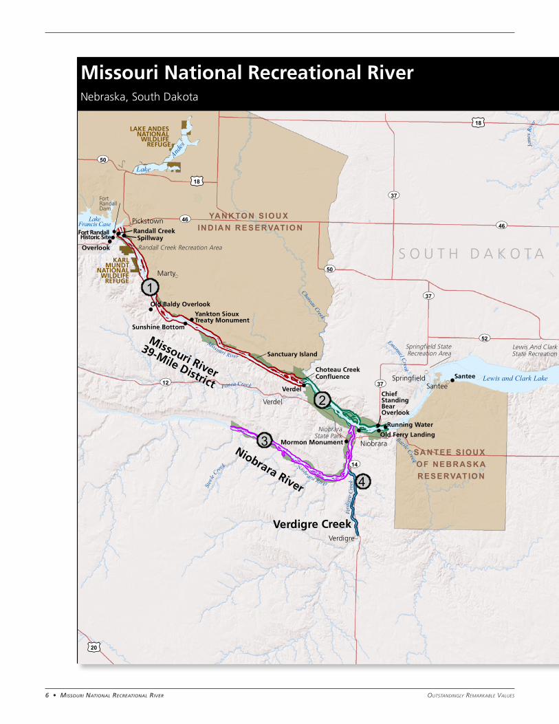
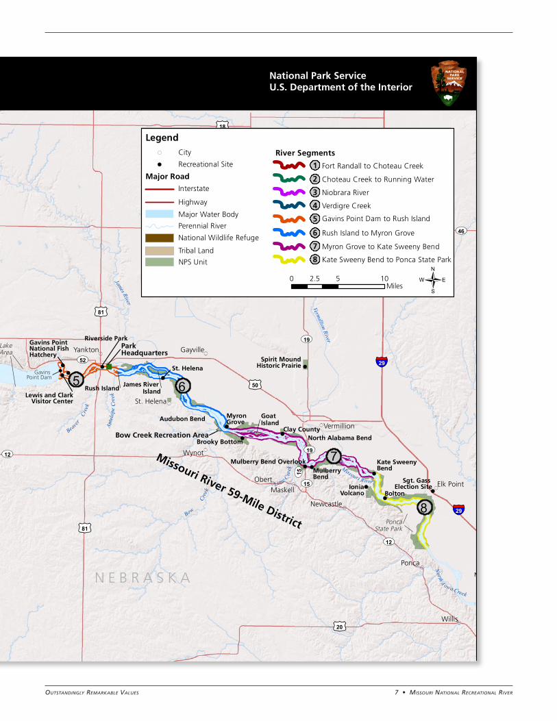
In 1978 and 1991, Congress used the Wild and Scenic Rivers Act to designate portions of the Missouri River, and two of its tributaries in Nebraska, as components of the national wild and scenic river system. In the designation legislation, Congress directed these reaches to be administered as a “recreational river” by the Department of Interior. Despite being designated separately, the two components are managed by the National Park Service as the Missouri National Recreational River. As stated in the 1978 and 1991 legislative acts, the designations include:
1978 designation:
• Missouri River – “The segment from Gavins Point Dam, South Dakota, fifty-nine miles downstream to Ponca State Park, Nebraska”
1991 designation:
• Missouri River – “The 39 mile segment from the headwaters of Lewis and Clark Lake to the Ft. Randall Dam”
• Niobrara River and Verdigre Creek – “The 25-mile segment [of the Niobrara River] from the western boundary of Knox County to its confluence with the Missouri River, including that segment of the Verdigre Creek from the north municipal boundary of Verdigre, Nebraska, to its confluence with the Niobrara”
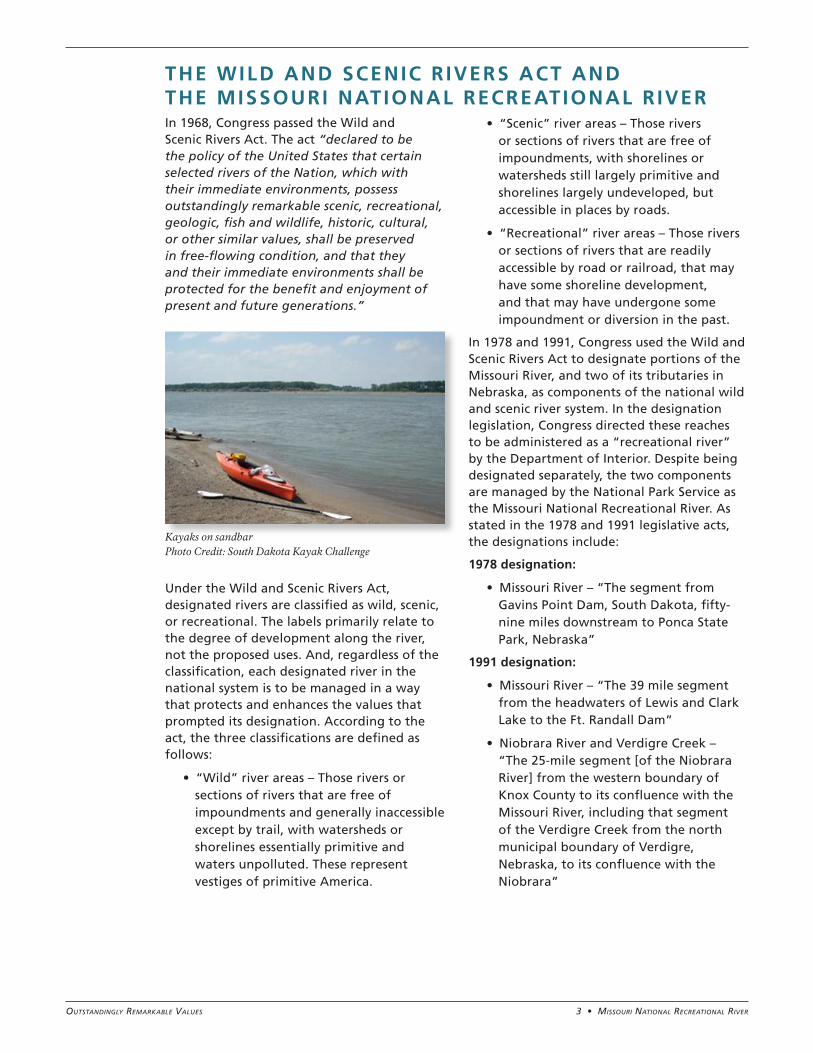
Kayaks on sandbar Photo Credit: South Dakota Kayak Challenge
4 • Missouri NatioNal recreatioNal river Outstandingly RemaRkable Values
OUTSTANDINGLY REMARKABLE VALUESOutstandingly remarkable values (ORVs) are defined by the Wild and Scenic Rivers Act as the characteristics that make a river worthy of special protection. Thus, the foundation for wild and scenic river management is a clearly defined set of ORVs. The Interagency Wild and Scenic Rivers Coordinating Council has issued criteria for identifying and defining these values. The criteria guidance states that:
Based on these criteria and a careful analysis of the designated reaches of the Missouri and Niobrara rivers, and Verdigre Creek, the National Park Service has determined that several ORVs are present on the Missouri National Recreational River.
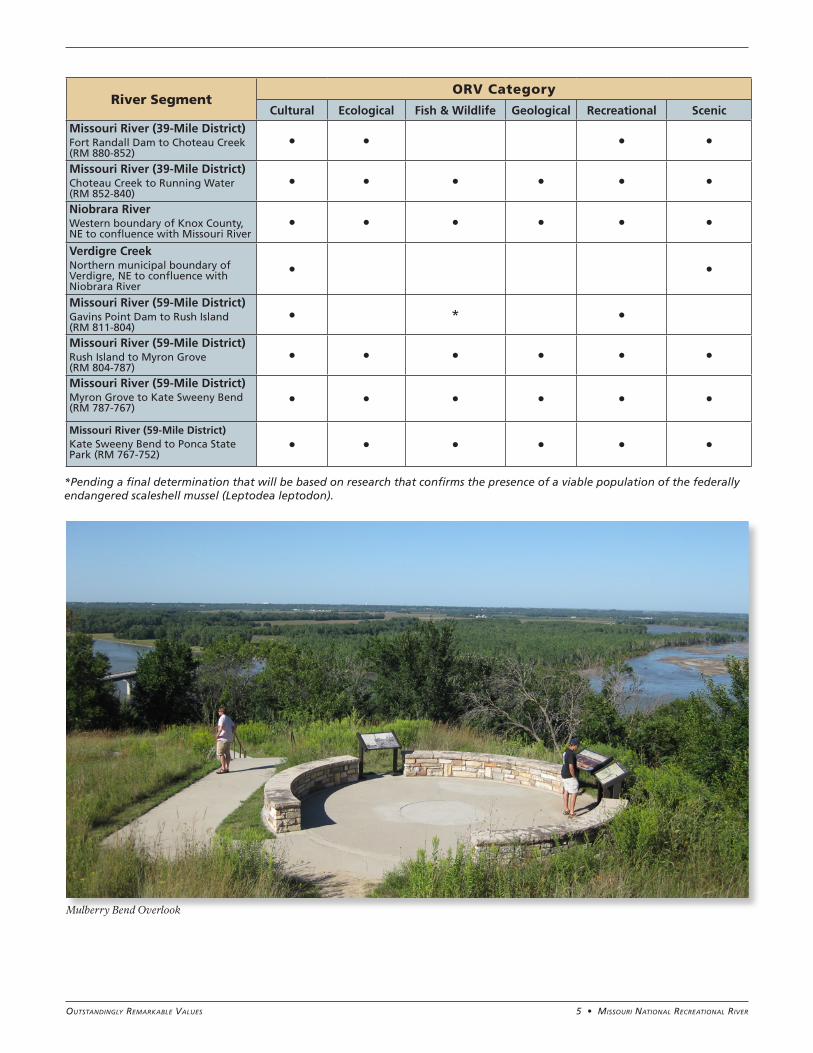
The analysis concluded that the Missouri National Recreational River contains the following ORVs: cultural, ecological, fish and wildlife, geological, recreational, and scenic. A set of broad statements has been developed that articulates each ORV for the entire Missouri National Recreational River. An evaluation process for each ORV was then used to determine which river segments
contain the different ORVs. The results of this evaluation were used to develop segment-specific ORV descriptions for individual river segments, providing further evidence and support for the broad ORV statements. All of these broad statements and segment-specific descriptions are included in the document. The following matrix summarizes the evaluation results and provides organization to the ORV
statements and segment-specific descriptions that follow. It indicates which segments of the Missouri National Recreational River possess the above-mentioned ORVs.
In addition to ORVs, the free-flowing condition and water quality of the Missouri National Recreational River are also integral to its designated status. Because free-flowing condition and water quality support the integrity of the ORVs and are key components of future management, they are included as part of this ORV statement.
• An ORV must be river related or dependent. This means that a value must
○ be located in the river or on its immediate shorelands (generally within 0.25 mile on either side of the river)
○ contribute substantially to the functioning of the river ecosystem
○ owe its location or existence to the presence of the river
• An ORV must be rare, unique, or exemplary at a comparative regional or national scale. Such a value would be one that is a conspicuous example from among a number of similar values that are themselves uncommon or extraordinary.
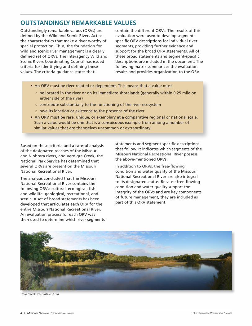
Bow Creek Recreation Area
5 • Missouri NatioNal recreatioNal riverOutstandingly RemaRkable Values
River SegmentORV Category
Cultural Ecological Fish & Wildlife Geological Recreational Scenic
Missouri River (39-Mile District)Fort Randall Dam to Choteau Creek (RM 880-852)
• • • •
Missouri River (39-Mile District)Choteau Creek to Running Water (RM 852-840)
• • • • • •
Niobrara RiverWestern boundary of Knox County, NE to confluence with Missouri River
• • • • • •
Verdigre CreekNorthern municipal boundary of Verdigre, NE to confluence with Niobrara River
• •
Missouri River (59-Mile District)Gavins Point Dam to Rush Island (RM 811-804)
• * •
Missouri River (59-Mile District)Rush Island to Myron Grove (RM 804-787)
• • • • • •
Missouri River (59-Mile District)Myron Grove to Kate Sweeny Bend (RM 787-767)
• • • • • •
Missouri River (59-Mile District)Kate Sweeny Bend to Ponca State Park (RM 767-752)
• • • • • •
*Pending a final determination that will be based on research that confirms the presence of a viable population of the federally endangered scaleshell mussel (Leptodea leptodon).
Mulberry Bend Overlook
6 • Missouri NatioNal recreatioNal river Outstandingly RemaRkable Values
!(
!(!(
!(!(
!(
!(
!(
!(
!(
!(
!(
!(
!(
!(
!(
!(!(
!(!( !(
!(
!(
!(
!(!(
!(
!(
!(
Lewis and Clark Lake
S O U T H D A K O T A
N E B R A S K A
£¤18
§̈¦29
£¤18
£¤20
§̈¦29
SAN TEE S IOUX OF NEBRASKARESERVAT IO N
LakeFrancis Case
LakeAnd
es
James River Island
Goat Island
Gavins Point Dam
Fort Randall Dam
Fort Randall Historic Site
Randall CreekSpillway
Yankton SiouxTreaty Monument
Chief Standing Bear Overlook
Gavins Point National Fish Hatchery
Lewis and ClarkVisitor Center
WynotMulberry Bend Overlook
Missouri River
Running Water
UV46
UV12 UV37
UV19
UV12
Sanctuary Island
Rush Island
2
3
4
5 6
8
1
7 Kate SweenyBend
Choteau Creek Confluence
Bow
Cree
k
Lime Cre
ek
Ponca Creek
")
ParkHeadquarters
Emanuel Creek
Bazile Creek
Beaver Cr
eek
Ante
l ope
Cree
k
North A owa Creek
Bow Creek Recreation Area
Stee
le Cree
k
Audubon Bend
North Alabama Bend
PoncaState Park
Lewis And Clark LakeState Recreation Area
Springfield StateRecreation Area
NiobraraState Park
Randall Creek Recreation Area
£¤18
£¤20
£¤81
£¤81
£¤50
YANK TO N S IOU X IND IA N RESERVATIO N
LAKE ANDES NATIONAL
WILDLIFE REFUGE
KARLMUNDT
NATIONALWILDLIFE
REFUGE
Santee
Verdel
Bolton
Overlook
St. Helena
MyronGrove
Clay County
IoniaVolcano
Brooky Bottom
MulberryBend
Riverside Park
Sunshine Bottom
Mormon MonumentOld Ferry Landing
Old Baldy Overlook
Sgt. Gass Election Site
Spirit MoundHistoric Prairie
Marty
Ponca
Obert
Willis
Verdel
Santee
Yankton
Maskell
Gayville
Verdigre
Niobrara
Pickstown
Elk Point
Newcastle
Vermillion
St. Helena
Springfield
North Sioux City
Niobrara River
Missouri River 59-Mile District
Missouri River
39-Mile District
Verdigre Creek
Missouri River
Niobrara River
Verd
igre
Cre
ek
UV50
UV15
UV37
UV50
UV46
UV52
UV52
UV37
UV46
UV14
UV19
UV12
Jame
s Rive
r
Vermillion
River
Vermillion River
James River
Choteau Creek
UV15
National Park ServiceU.S. Department of the Interior
Missouri National Recreational RiverNebraska, South Dakota
Produced by DSC Planning Division May 2012
Legend( City
!( Recreational Site
Major Road
Interstate
Highway
Major Water Body
National Wildlife Refuge
Tribal Land
River Segments
Fort Randall to Choteau Creek
Perennial River
Choteau Creek to Running Water
Niobrara River
Verdigre Creek
Gavins Point Dam to Rush Island
Rush Island to Myron Grove
Myron Grove to Kate Sweeny Bend
Kate Sweeny Bend to Ponca State Park
1
2
3
4
5
6
7
8
0 5 102.5Miles /
NPS Unit
7 • Missouri NatioNal recreatioNal riverOutstandingly RemaRkable Values
!(
!(!(
!(!(
!(
!(
!(
!(
!(
!(
!(
!(
!(
!(
!(
!(!(
!(!( !(
!(
!(
!(
!(!(
!(
!(
!(
Lewis and Clark Lake
S O U T H D A K O T A
N E B R A S K A
£¤18
§̈¦29
£¤18
£¤20
§̈¦29
SAN TEE S IOUX OF NEBRASKARESERVAT IO N
LakeFrancis Case
Lake
Andes
James River Island
Goat Island
Gavins Point Dam
Fort Randall Dam
Fort Randall Historic Site
Randall CreekSpillway
Yankton SiouxTreaty Monument
Chief Standing Bear Overlook
Gavins Point National Fish Hatchery
Lewis and ClarkVisitor Center
WynotMulberry Bend Overlook
Missouri River
Running Water
UV46
UV12 UV37
UV19
UV12
Sanctuary Island
Rush Island
2
3
4
5 6
8
1
7 Kate SweenyBend
Choteau Creek Confluence
Bow
Cree
k
Lime Cre
ek
Ponca Creek
")
ParkHeadquarters
Emanuel Creek
Bazile Creek
Beaver Cr
eek
Ante
l ope
Cree
kNorth A owa Creek
Bow Creek Recreation Area
Stee
le Cree
k
Audubon Bend
North Alabama Bend
PoncaState Park
Lewis And Clark LakeState Recreation Area
Springfield StateRecreation Area
NiobraraState Park
Randall Creek Recreation Area
£¤18
£¤20
£¤81
£¤81
£¤50
YANK TO N S IOU X IND IA N RESERVATIO N
LAKE ANDES NATIONAL
WILDLIFE REFUGE
KARLMUNDT
NATIONALWILDLIFE
REFUGE
Santee
Verdel
Bolton
Overlook
St. Helena
MyronGrove
Clay County
IoniaVolcano
Brooky Bottom
MulberryBend
Riverside Park
Sunshine Bottom
Mormon MonumentOld Ferry Landing
Old Baldy Overlook
Sgt. Gass Election Site
Spirit MoundHistoric Prairie
Marty
Ponca
Obert
Willis
Verdel
Santee
Yankton
Maskell
Gayville
Verdigre
Niobrara
Pickstown
Elk Point
Newcastle
Vermillion
St. Helena
Springfield
North Sioux City
Niobrara River
Missouri River 59-Mile District
Missouri River
39-Mile District
Verdigre Creek
Missouri River
Niobrara River
Verd
igre
Cre
ek
UV50
UV15
UV37
UV50
UV46
UV52
UV52
UV37
UV46
UV14
UV19
UV12
Jame
s Rive
r
Vermillion
River
Vermillion River
James River
Choteau Creek
UV15
National Park ServiceU.S. Department of the Interior
Missouri National Recreational RiverNebraska, South Dakota
Produced by DSC Planning Division May 2012
Legend( City
!( Recreational Site
Major Road
Interstate
Highway
Major Water Body
National Wildlife Refuge
Tribal Land
River Segments
Fort Randall to Choteau Creek
Perennial River
Choteau Creek to Running Water
Niobrara River
Verdigre Creek
Gavins Point Dam to Rush Island
Rush Island to Myron Grove
Myron Grove to Kate Sweeny Bend
Kate Sweeny Bend to Ponca State Park
1
2
3
4
5
6
7
8
0 5 102.5Miles /
NPS Unit
8 • Missouri NatioNal recreatioNal river Outstandingly RemaRkable Values
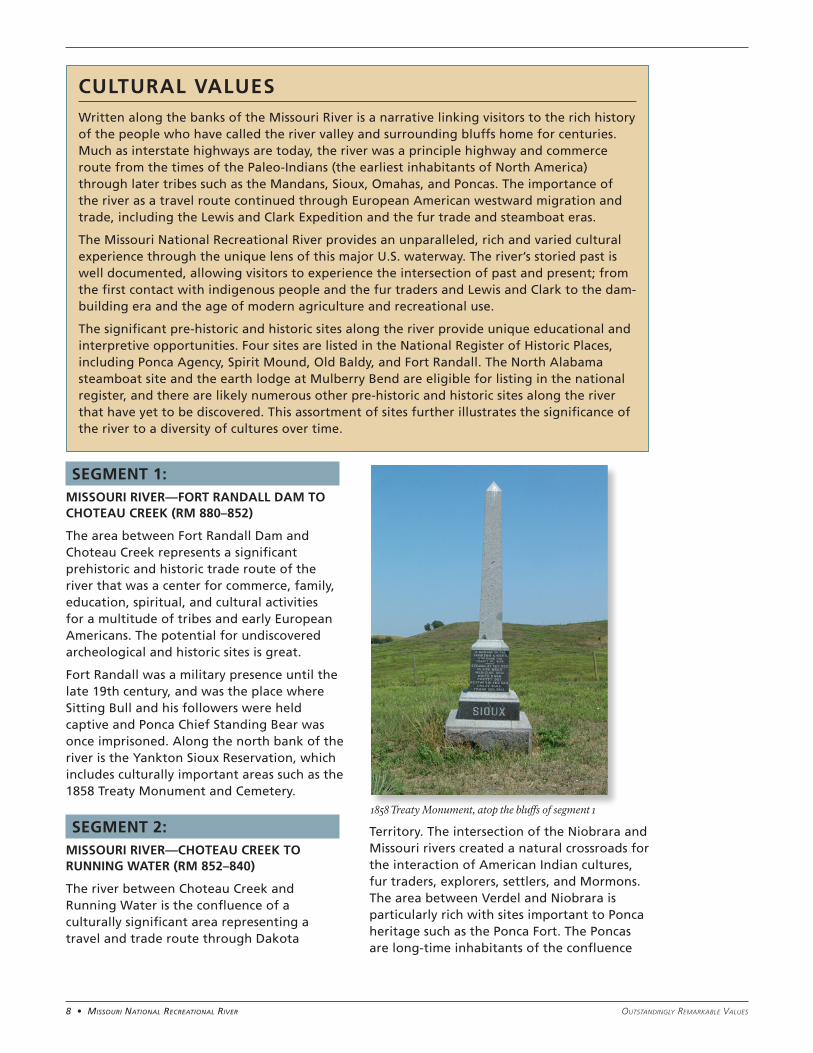
SEGMENT 1: MISSOURI RIVER—FORT RANDALL DAM TO CHOTEAU CREEK (RM 880–852)
The area between Fort Randall Dam and Choteau Creek represents a significant prehistoric and historic trade route of the river that was a center for commerce, family, education, spiritual, and cultural activities for a multitude of tribes and early European Americans. The potential for undiscovered archeological and historic sites is great.
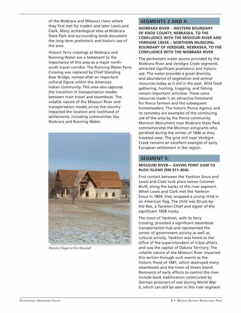
Fort Randall was a military presence until the late 19th century, and was the place where Sitting Bull and his followers were held captive and Ponca Chief Standing Bear was once imprisoned. Along the north bank of the river is the Yankton Sioux Reservation, which includes culturally important areas such as the 1858 Treaty Monument and Cemetery.
SEGMENT 2: MISSOURI RIVER—CHOTEAU CREEK TO RUNNING WATER (RM 852–840)
The river between Choteau Creek and Running Water is the confluence of a culturally significant area representing a travel and trade route through Dakota
Territory. The intersection of the Niobrara and Missouri rivers created a natural crossroads for the interaction of American Indian cultures, fur traders, explorers, settlers, and Mormons. The area between Verdel and Niobrara is particularly rich with sites important to Ponca heritage such as the Ponca Fort. The Poncas are long-time inhabitants of the confluence
CULTURAL VALUESWritten along the banks of the Missouri River is a narrative linking visitors to the rich history of the people who have called the river valley and surrounding bluffs home for centuries. Much as interstate highways are today, the river was a principle highway and commerce route from the times of the Paleo-Indians (the earliest inhabitants of North America) through later tribes such as the Mandans, Sioux, Omahas, and Poncas. The importance of the river as a travel route continued through European American westward migration and trade, including the Lewis and Clark Expedition and the fur trade and steamboat eras.
The Missouri National Recreational River provides an unparalleled, rich and varied cultural experience through the unique lens of this major U.S. waterway. The river’s storied past is well documented, allowing visitors to experience the intersection of past and present; from the first contact with indigenous people and the fur traders and Lewis and Clark to the dam-building era and the age of modern agriculture and recreational use.
The significant pre-historic and historic sites along the river provide unique educational and interpretive opportunities. Four sites are listed in the National Register of Historic Places, including Ponca Agency, Spirit Mound, Old Baldy, and Fort Randall. The North Alabama steamboat site and the earth lodge at Mulberry Bend are eligible for listing in the national register, and there are likely numerous other pre-historic and historic sites along the river that have yet to be discovered. This assortment of sites further illustrates the significance of the river to a diversity of cultures over time.
1858 Treaty Monument, atop the bluffs of segment 1
9 • Missouri NatioNal recreatioNal riverOutstandingly RemaRkable Values
of the Niobrara and Missouri rivers where they first met fur traders and later Lewis and Clark. Many archeological sites at Niobrara State Park and surrounding lands document the long-term prehistoric and historic use of the area.
Historic ferry crossings at Niobrara and Running Water are a testament to the importance of this area as a major north-south travel corridor. The Running Water Ferry Crossing was replaced by Chief Standing Bear Bridge, named after an important cultural figure within the American Indian community. This area also captures the transition in transportation modes between train travel and steamboat. The volatile nature of the Missouri River and transportation modes across the country impacted the location and livelihood of settlements, including communities like Niobrara and Running Water.
SEGMENTS 3 AND 4: NIOBRARA RIVER – WESTERN BOUNDARY OF KNOX COUNTY, NEBRASKA, TO THE CONFLUENCE WITH THE MISSOURI RIVER AND VERDIGRE CREEK – NORTHERN MUNICIPAL BOUNDARY OF VERDIGRE, NEBRASKA, TO THE CONFLUENCE WITH THE NIOBRARA RIVER
The permanent water source provided by the Niobrara River and Verdigre Creek segments attracted significant prehistoric and historic use. The water provides a great diversity and abundance of vegetation and animal resources today as it did in the past. Wild food gathering, hunting, trapping, and fishing remain important activities. These same resources made it an attractive homeland for Ponca farmers and the subsequent homesteaders. The historic Ponca Agency and its cemetery are examples of the continuing use of the area by the Ponca community. Mormon Monument near Niobrara State Park commemorates the Mormon emigrants who perished during the winter of 1846 as they traveled west. The grist mill near Verdigre Creek remains an excellent example of early European settlement in the region.
SEGMENT 5: MISSOURI RIVER— GAVINS POINT DAM TO RUSH ISLAND (RM 811–804).
First contact between the Yankton Sioux and Lewis and Clark took place below Calumet Bluff, along the banks of this river segment. When Lewis and Clark met the Yankton Sioux in 1804, they wrapped a young child in an American flag. The child was Struck-by-the Ree, a Yankton Chief and signer of the significant 1858 treaty.
The town of Yankton, with its ferry crossing, provided a significant steamboat transportation hub and represented the center of government activity as well as cultural activity. Yankton was home to the office of the superintendent of tribal affairs and was the capital of Dakota Territory. The volatile nature of the Missouri River impacted this section through such events as the historic flood of 1881, which destroyed many steamboats and the town of Green Island. Remnants of early efforts to control the river include bank stabilization constructed by German prisoners of war during World War II, which can still be seen in this river segment
Historic Chapel at Fort Randall
10 • Missouri NatioNal recreatioNal river Outstandingly RemaRkable Values
today in the form of wooden pilings. The area continues to be culturally active through celebrations such as Riverboat Days.
SEGMENT 6: MISSOURI RIVER—RUSH ISLAND TO MYRON GROVE (RM 804–787)
The area between Rush Island and Myron Grove holds evidence of the homeland of the Omahas through known, and yet undiscovered, archeological sites. Lewis and Clark documented the presence of an abandoned Omaha village at Bow Creek. Pierre Dorian, a translator for Lewis and Clark, stayed in the area and established the first trading post along the Missouri River at the confluence of the James River. Due to significant steamboat travel, the contribution of this segment of the river to this nation’s westward expansion is well documented—steamboat wrecks remain for discovery and exploration. The historic district of St. Helena represents rural America and the importance of the river in transportation and the establishment of communities along its path.
SEGMENT 7: MISSOURI RIVER—MYRON GROVE TO KATE SWEENY BEND (RM 787–767)
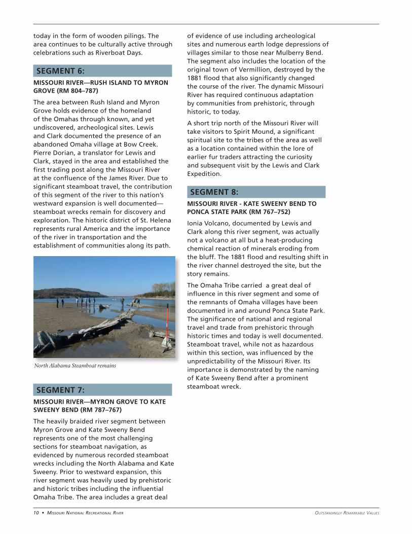
The heavily braided river segment between Myron Grove and Kate Sweeny Bend represents one of the most challenging sections for steamboat navigation, as evidenced by numerous recorded steamboat wrecks including the North Alabama and Kate Sweeny. Prior to westward expansion, this river segment was heavily used by prehistoric and historic tribes including the influential Omaha Tribe. The area includes a great deal
of evidence of use including archeological sites and numerous earth lodge depressions of villages similar to those near Mulberry Bend. The segment also includes the location of the original town of Vermillion, destroyed by the 1881 flood that also significantly changed the course of the river. The dynamic Missouri River has required continuous adaptation by communities from prehistoric, through historic, to today.
A short trip north of the Missouri River will take visitors to Spirit Mound, a significant spiritual site to the tribes of the area as well as a location contained within the lore of earlier fur traders attracting the curiosity and subsequent visit by the Lewis and Clark Expedition.
SEGMENT 8: MISSOURI RIVER - KATE SWEENY BEND TO PONCA STATE PARK (RM 767–752)
Ionia Volcano, documented by Lewis and Clark along this river segment, was actually not a volcano at all but a heat-producing chemical reaction of minerals eroding from the bluff. The 1881 flood and resulting shift in the river channel destroyed the site, but the story remains.
The Omaha Tribe carried a great deal of influence in this river segment and some of the remnants of Omaha villages have been documented in and around Ponca State Park. The significance of national and regional travel and trade from prehistoric through historic times and today is well documented. Steamboat travel, while not as hazardous within this section, was influenced by the unpredictability of the Missouri River. Its importance is demonstrated by the naming of Kate Sweeny Bend after a prominent steamboat wreck.
North Alabama Steamboat remains
11 • Missouri NatioNal recreatioNal riverOutstandingly RemaRkable Values
SEGMENT 1: MISSOURI RIVER - FORT RANDALL DAM TO CHOTEAU CREEK (RM 880–852)
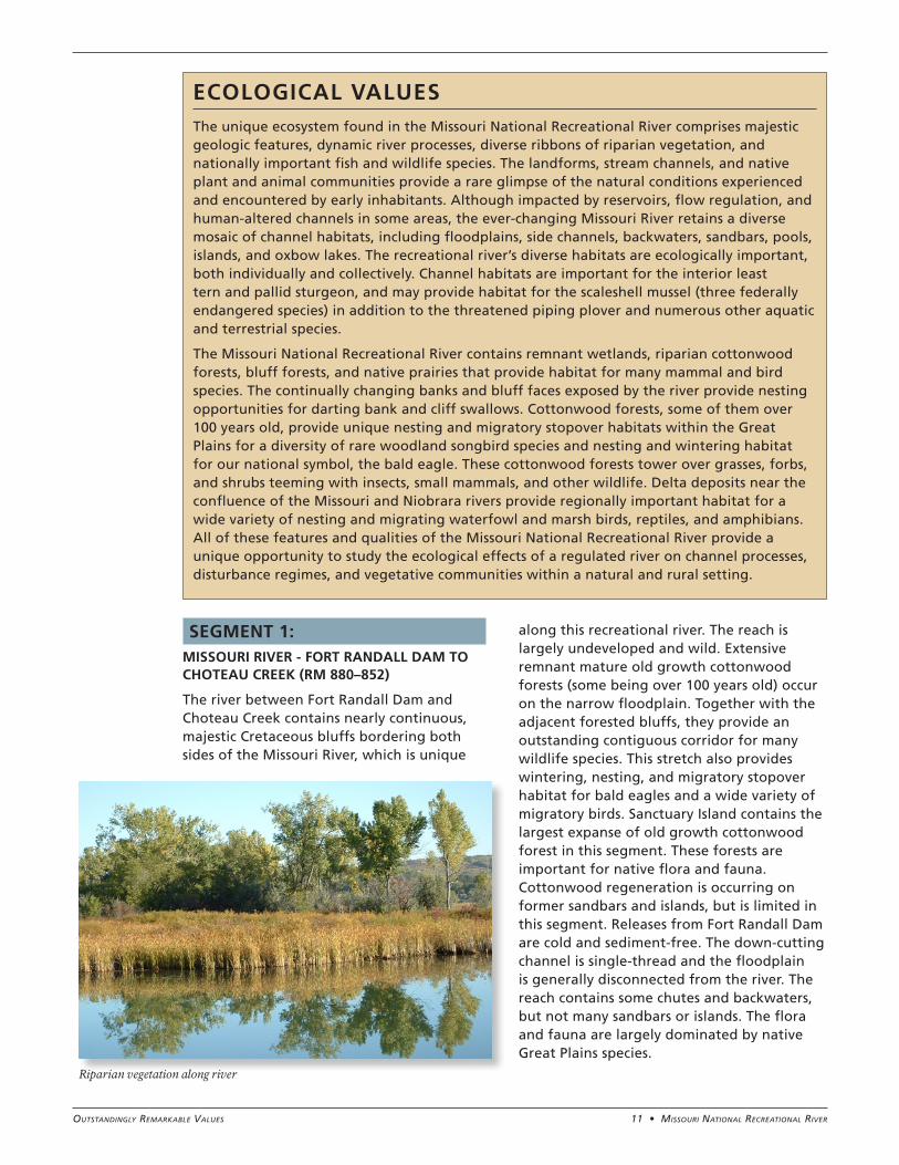
The river between Fort Randall Dam and Choteau Creek contains nearly continuous, majestic Cretaceous bluffs bordering both sides of the Missouri River, which is unique
along this recreational river. The reach is largely undeveloped and wild. Extensive remnant mature old growth cottonwood forests (some being over 100 years old) occur on the narrow floodplain. Together with the adjacent forested bluffs, they provide an outstanding contiguous corridor for many wildlife species. This stretch also provides wintering, nesting, and migratory stopover habitat for bald eagles and a wide variety of migratory birds. Sanctuary Island contains the largest expanse of old growth cottonwood forest in this segment. These forests are important for native flora and fauna. Cottonwood regeneration is occurring on former sandbars and islands, but is limited in this segment. Releases from Fort Randall Dam are cold and sediment-free. The down-cutting channel is single-thread and the floodplain is generally disconnected from the river. The reach contains some chutes and backwaters, but not many sandbars or islands. The flora and fauna are largely dominated by native Great Plains species.
ECOLOGICAL VALUESThe unique ecosystem found in the Missouri National Recreational River comprises majestic geologic features, dynamic river processes, diverse ribbons of riparian vegetation, and nationally important fish and wildlife species. The landforms, stream channels, and native plant and animal communities provide a rare glimpse of the natural conditions experienced and encountered by early inhabitants. Although impacted by reservoirs, flow regulation, and human-altered channels in some areas, the ever-changing Missouri River retains a diverse mosaic of channel habitats, including floodplains, side channels, backwaters, sandbars, pools, islands, and oxbow lakes. The recreational river’s diverse habitats are ecologically important, both individually and collectively. Channel habitats are important for the interior least tern and pallid sturgeon, and may provide habitat for the scaleshell mussel (three federally endangered species) in addition to the threatened piping plover and numerous other aquatic and terrestrial species.
The Missouri National Recreational River contains remnant wetlands, riparian cottonwood forests, bluff forests, and native prairies that provide habitat for many mammal and bird species. The continually changing banks and bluff faces exposed by the river provide nesting opportunities for darting bank and cliff swallows. Cottonwood forests, some of them over 100 years old, provide unique nesting and migratory stopover habitats within the Great Plains for a diversity of rare woodland songbird species and nesting and wintering habitat for our national symbol, the bald eagle. These cottonwood forests tower over grasses, forbs, and shrubs teeming with insects, small mammals, and other wildlife. Delta deposits near the confluence of the Missouri and Niobrara rivers provide regionally important habitat for a wide variety of nesting and migrating waterfowl and marsh birds, reptiles, and amphibians. All of these features and qualities of the Missouri National Recreational River provide a unique opportunity to study the ecological effects of a regulated river on channel processes, disturbance regimes, and vegetative communities within a natural and rural setting.
Riparian vegetation along river
12 • Missouri NatioNal recreatioNal river Outstandingly RemaRkable Values
SEGMENT 2: MISSOURI RIVER - CHOTEAU CREEK TO RUNNING WATER (RM 852–840)
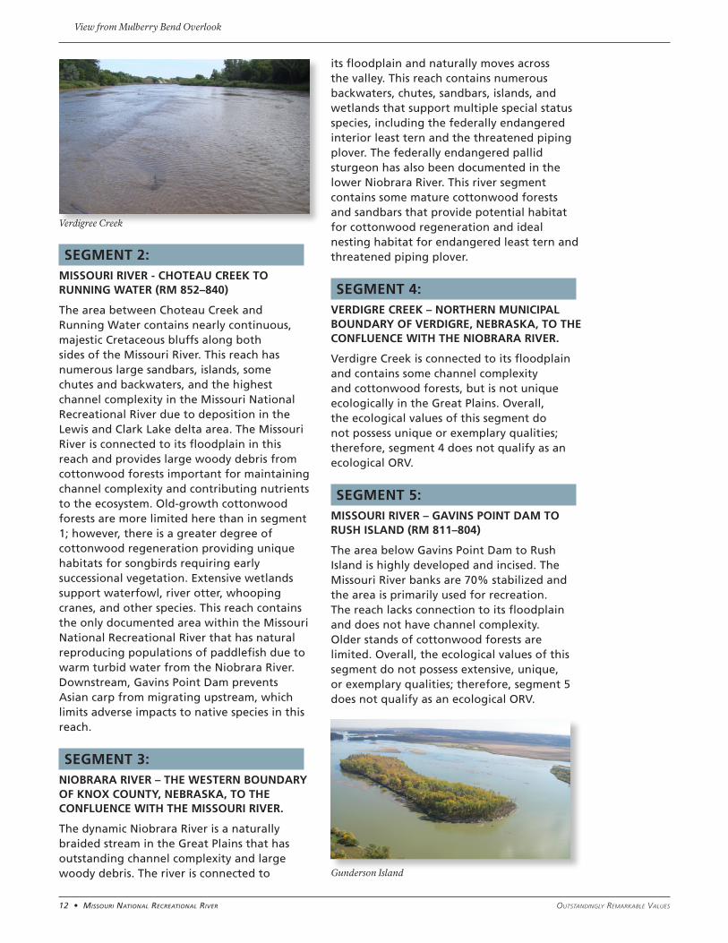
The area between Choteau Creek and Running Water contains nearly continuous, majestic Cretaceous bluffs along both sides of the Missouri River. This reach has numerous large sandbars, islands, some chutes and backwaters, and the highest channel complexity in the Missouri National Recreational River due to deposition in the Lewis and Clark Lake delta area. The Missouri River is connected to its floodplain in this reach and provides large woody debris from cottonwood forests important for maintaining channel complexity and contributing nutrients to the ecosystem. Old-growth cottonwood forests are more limited here than in segment 1; however, there is a greater degree of cottonwood regeneration providing unique habitats for songbirds requiring early successional vegetation. Extensive wetlands support waterfowl, river otter, whooping cranes, and other species. This reach contains the only documented area within the Missouri National Recreational River that has natural reproducing populations of paddlefish due to warm turbid water from the Niobrara River. Downstream, Gavins Point Dam prevents Asian carp from migrating upstream, which limits adverse impacts to native species in this reach.
SEGMENT 3: NIOBRARA RIVER – THE WESTERN BOUNDARY OF KNOX COUNTY, NEBRASKA, TO THE CONFLUENCE WITH THE MISSOURI RIVER.
The dynamic Niobrara River is a naturally braided stream in the Great Plains that has outstanding channel complexity and large woody debris. The river is connected to
its floodplain and naturally moves across the valley. This reach contains numerous backwaters, chutes, sandbars, islands, and wetlands that support multiple special status species, including the federally endangered interior least tern and the threatened piping plover. The federally endangered pallid sturgeon has also been documented in the lower Niobrara River. This river segment contains some mature cottonwood forests and sandbars that provide potential habitat for cottonwood regeneration and ideal nesting habitat for endangered least tern and threatened piping plover.
SEGMENT 4: VERDIGRE CREEK – NORTHERN MUNICIPAL BOUNDARY OF VERDIGRE, NEBRASKA, TO THE CONFLUENCE WITH THE NIOBRARA RIVER.
Verdigre Creek is connected to its floodplain and contains some channel complexity and cottonwood forests, but is not unique ecologically in the Great Plains. Overall, the ecological values of this segment do not possess unique or exemplary qualities; therefore, segment 4 does not qualify as an ecological ORV.
SEGMENT 5: MISSOURI RIVER – GAVINS POINT DAM TO RUSH ISLAND (RM 811–804)
The area below Gavins Point Dam to Rush Island is highly developed and incised. The Missouri River banks are 70% stabilized and the area is primarily used for recreation. The reach lacks connection to its floodplain and does not have channel complexity. Older stands of cottonwood forests are limited. Overall, the ecological values of this segment do not possess extensive, unique, or exemplary qualities; therefore, segment 5 does not qualify as an ecological ORV.
Gunderson Island
Verdigree Creek
View from Mulberry Bend Overlook
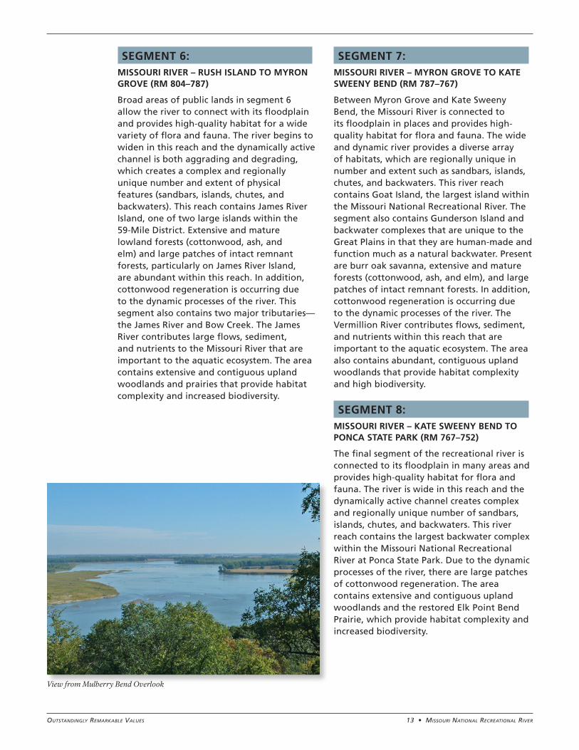
13 • Missouri NatioNal recreatioNal riverOutstandingly RemaRkable Values
SEGMENT 6: MISSOURI RIVER – RUSH ISLAND TO MYRON GROVE (RM 804–787)
Broad areas of public lands in segment 6 allow the river to connect with its floodplain and provides high-quality habitat for a wide variety of flora and fauna. The river begins to widen in this reach and the dynamically active channel is both aggrading and degrading, which creates a complex and regionally unique number and extent of physical features (sandbars, islands, chutes, and backwaters). This reach contains James River Island, one of two large islands within the 59-Mile District. Extensive and mature lowland forests (cottonwood, ash, and elm) and large patches of intact remnant forests, particularly on James River Island, are abundant within this reach. In addition, cottonwood regeneration is occurring due to the dynamic processes of the river. This segment also contains two major tributaries—the James River and Bow Creek. The James River contributes large flows, sediment, and nutrients to the Missouri River that are important to the aquatic ecosystem. The area contains extensive and contiguous upland woodlands and prairies that provide habitat complexity and increased biodiversity.
SEGMENT 7: MISSOURI RIVER – MYRON GROVE TO KATE SWEENY BEND (RM 787–767)
Between Myron Grove and Kate Sweeny Bend, the Missouri River is connected to its floodplain in places and provides high-quality habitat for flora and fauna. The wide and dynamic river provides a diverse array of habitats, which are regionally unique in number and extent such as sandbars, islands, chutes, and backwaters. This river reach contains Goat Island, the largest island within the Missouri National Recreational River. The segment also contains Gunderson Island and backwater complexes that are unique to the Great Plains in that they are human-made and function much as a natural backwater. Present are burr oak savanna, extensive and mature forests (cottonwood, ash, and elm), and large patches of intact remnant forests. In addition, cottonwood regeneration is occurring due to the dynamic processes of the river. The Vermillion River contributes flows, sediment, and nutrients within this reach that are important to the aquatic ecosystem. The area also contains abundant, contiguous upland woodlands that provide habitat complexity and high biodiversity.
SEGMENT 8: MISSOURI RIVER – KATE SWEENY BEND TO PONCA STATE PARK (RM 767–752)
The final segment of the recreational river is connected to its floodplain in many areas and provides high-quality habitat for flora and fauna. The river is wide in this reach and the dynamically active channel creates complex and regionally unique number of sandbars, islands, chutes, and backwaters. This river reach contains the largest backwater complex within the Missouri National Recreational River at Ponca State Park. Due to the dynamic processes of the river, there are large patches of cottonwood regeneration. The area contains extensive and contiguous upland woodlands and the restored Elk Point Bend Prairie, which provide habitat complexity and increased biodiversity.
View from Mulberry Bend Overlook
14 • Missouri NatioNal recreatioNal river Outstandingly RemaRkable Values
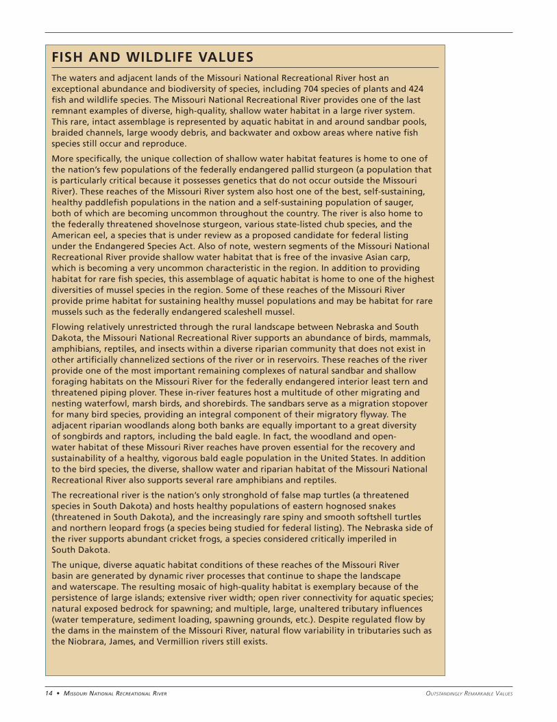
FISH AND WILDLIFE VALUESThe waters and adjacent lands of the Missouri National Recreational River host an exceptional abundance and biodiversity of species, including 704 species of plants and 424 fish and wildlife species. The Missouri National Recreational River provides one of the last remnant examples of diverse, high-quality, shallow water habitat in a large river system. This rare, intact assemblage is represented by aquatic habitat in and around sandbar pools, braided channels, large woody debris, and backwater and oxbow areas where native fish species still occur and reproduce.
More specifically, the unique collection of shallow water habitat features is home to one of the nation’s few populations of the federally endangered pallid sturgeon (a population that is particularly critical because it possesses genetics that do not occur outside the Missouri River). These reaches of the Missouri River system also host one of the best, self-sustaining, healthy paddlefish populations in the nation and a self-sustaining population of sauger, both of which are becoming uncommon throughout the country. The river is also home to the federally threatened shovelnose sturgeon, various state-listed chub species, and the American eel, a species that is under review as a proposed candidate for federal listing under the Endangered Species Act. Also of note, western segments of the Missouri National Recreational River provide shallow water habitat that is free of the invasive Asian carp, which is becoming a very uncommon characteristic in the region. In addition to providing habitat for rare fish species, this assemblage of aquatic habitat is home to one of the highest diversities of mussel species in the region. Some of these reaches of the Missouri River provide prime habitat for sustaining healthy mussel populations and may be habitat for rare mussels such as the federally endangered scaleshell mussel.
Flowing relatively unrestricted through the rural landscape between Nebraska and South Dakota, the Missouri National Recreational River supports an abundance of birds, mammals, amphibians, reptiles, and insects within a diverse riparian community that does not exist in other artificially channelized sections of the river or in reservoirs. These reaches of the river provide one of the most important remaining complexes of natural sandbar and shallow foraging habitats on the Missouri River for the federally endangered interior least tern and threatened piping plover. These in-river features host a multitude of other migrating and nesting waterfowl, marsh birds, and shorebirds. The sandbars serve as a migration stopover for many bird species, providing an integral component of their migratory flyway. The adjacent riparian woodlands along both banks are equally important to a great diversity of songbirds and raptors, including the bald eagle. In fact, the woodland and open-water habitat of these Missouri River reaches have proven essential for the recovery and sustainability of a healthy, vigorous bald eagle population in the United States. In addition to the bird species, the diverse, shallow water and riparian habitat of the Missouri National Recreational River also supports several rare amphibians and reptiles.
The recreational river is the nation’s only stronghold of false map turtles (a threatened species in South Dakota) and hosts healthy populations of eastern hognosed snakes (threatened in South Dakota), and the increasingly rare spiny and smooth softshell turtles and northern leopard frogs (a species being studied for federal listing). The Nebraska side of the river supports abundant cricket frogs, a species considered critically imperiled in South Dakota.
The unique, diverse aquatic habitat conditions of these reaches of the Missouri River basin are generated by dynamic river processes that continue to shape the landscape and waterscape. The resulting mosaic of high-quality habitat is exemplary because of the persistence of large islands; extensive river width; open river connectivity for aquatic species; natural exposed bedrock for spawning; and multiple, large, unaltered tributary influences (water temperature, sediment loading, spawning grounds, etc.). Despite regulated flow by the dams in the mainstem of the Missouri River, natural flow variability in tributaries such as the Niobrara, James, and Vermillion rivers still exists.
15 • Missouri NatioNal recreatioNal riverOutstandingly RemaRkable Values
SEGMENT 1: MISSOURI RIVER – FORT RANDALL DAM TO CHOTEAU CREEK (RM 880–852)
The aquatic habitat in this river segment is notably affected by the daily hydropower peaking discharges of clear, cold water from Fort Randall Dam, which has reduced the abundance and diversity of macroinvertebrate and fish species relative to downstream reaches. Despite these impacts, several native fish species, including endangered pallid sturgeon, persist in this stretch of the river. Although interior least terns and piping plovers nest in some areas along this segment, it is not extensively used by these birds. And, despite the presence of Karl Mundt National Wildlife Refuge downstream of Fort Randall Dam, bald eagle habitat and use along the river is not rare, unique, or exemplary when compared to the remainder of the Missouri National Recreational River or the Missouri River basin. Overall, the fish and wildlife values of this segment do not possess unique or exemplary qualities relative to the region; therefore, this segment does not qualify as a fish and wildlife ORV.
SEGMENT 2: MISSOURI RIVER – CHOTEAU CREEK TO RUNNING WATER (RM 852–840)
Fish and aquatic resources are particularly unique and exemplary between Choteau Creek and Running Water. The effects of hydropower peaking flows from Fort Randall Dam become diminished in this section due to the distance from the dam. The segment receives flows from several free-flowing tributaries, including the Niobrara River, that contribute sediment and nutrients supporting a diverse macroinvertebrate community and over 45 native fish species. The Niobrara delta
with its extensive backwater complexes and secondary channels supports a particularly high diversity of aquatic species. In addition, the reach supports a high abundance of the federally endangered pallid sturgeon and self-sustaining populations of paddlefish and sauger. Paddlefish spawning habitat in this area is considered to be some of the best in the nation. This river reach provides regionally rare habitat for many naturally reproducing native fish species.
The federally endangered interior least tern and federally threatened piping plover nest on sandbars throughout this reach of the river. The sandbars and marshlands, including the Niobrara River delta, are an important stopover site for a high diversity of migrating shorebirds, marsh birds, and waterfowl. A large number of bald eagles also nest and forage along the cottonwood forest of this segment. In addition to avian habitat, a wide variety of snakes and amphibians forage in the area. All five turtle species in the 39-Mile District of the Missouri River corridor are found in this segment, including the false map turtle, a threatened species in the state of South Dakota.
SEGMENT 3: NIOBRARA RIVER – WESTERN BOUNDARY OF KNOX COUNTY, NEBRASKA, TO THE CONFLUENCE WITH THE MISSOURI RIVER
Natural flows, water temperatures, and sediment transport in the Niobrara River sustain an intact native fish community of 37 species within a dynamic braided channel. Unimpaired, natural river conditions are scarce throughout the region. Large river species such as the federally endangered pallid sturgeon, federally threatened shovelnose sturgeon, and blue suckers, have also been found in the lower Niobrara River. In addition, the natural tributary flows from the Niobrara River into the Missouri River are integral and essential in sustaining the natural production of paddlefish and saugers in the adjacent reach of the Missouri River.
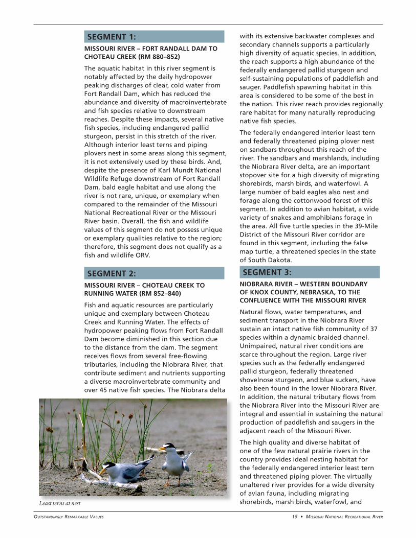
The high quality and diverse habitat of one of the few natural prairie rivers in the country provides ideal nesting habitat for the federally endangered interior least tern and threatened piping plover. The virtually unaltered river provides for a wide diversity of avian fauna, including migrating shorebirds, marsh birds, waterfowl, and Least terns at nest
16 • Missouri NatioNal recreatioNal river Outstandingly RemaRkable Values
songbirds. Bald eagles nest in the riparian forests and forage along the adjacent reaches of the Niobrara. In addition, the Niobrara River segment provides important habitat for the false map turtle, a threatened species in the state of South Dakota.
SEGMENT 4: VERDIGRE CREEK – NORTHERN MUNICIPAL BOUNDARY OF VERDIGRE, NEBRASKA, TO THE CONFLUENCE WITH THE NIOBRARA RIVER
Although Verdigre Creek represents a relatively unaltered prairie stream that supports an intact native fish community consisting of 26 species, including the plains topminnow (a Nebraska state-listed species), this segment is not considered to be a regionally unique stream for fish. However, connectivity with the Niobrara River could allow seasonal use by the piping plover, interior least tern, and pallid sturgeon in lower reaches of Verdigre Creek. Overall, the fish and wildlife values of this segment do not possess unique or exemplary qualities relative to the region; therefore, the Verdigre Creek segment does not qualify as a fish and wildlife ORV.
SEGMENT 5: MISSOURI RIVER – GAVINS POINT DAM TO RUSH ISLAND (RM 811–804)
The artificially modified channel features below Gavins Point Dam and the clear water released from the dam provide suitable habitat conditions that sustain a high diversity and abundance of mussels. Leading experts in the study of shellfish believe this segment likely supports a viable and rare population of scaleshell mussels, a federally endangered species. However, additional research is needed to confirm whether a viable population of scaleshell mussels exists in this segment. This river segment is also an important bald eagle wintering area and possesses high-quality riparian woodland habitat for bald eagle nesting. These sandbars serve as important stopover sites for migratory birds. An abundance of smooth softshell turtles winter below Gavins Point Dam.
Given the best available information on mussel populations and habitat provided during the ORV workshop, it was determined
that segment 5 could possess rare, unique, and exemplary biological values that qualify it as a fish and wildlife ORV. However, this was a conditional ORV determination. The final ORV determination is pending and will be dependent on the confirmation of whether a viable population of scaleshell mussels is present in this river segment.
SEGMENT 6: MISSOURI RIVER – RUSH ISLAND TO MYRON GROVE (RM 804–787)
The aquatic habitat diversity between Rush Island and Myron Grove supports an intact native fish community, including the federally endangered pallid sturgeon and a regionally significant, self-sustaining paddlefish population. The high-quality sturgeon habitat in this segment is supported by the higher turbidity, nutrients, and habitat diversity provided by the inflow of the James River tributary. The abundance of backwater complexes, oxbow habitat, chutes, secondary channels, and pool habitat provide for a particularly high diversity and abundance of aquatic species. For example, this segment contains the highest diversity of mussel species in the Missouri National Recreational River, largely due to the confluence with the James River and the diverse shallow water habitat conditions. This habitat is also heavily used by the false map turtle, a threatened species in South Dakota. James River Island complex supports a large nesting colony of smooth softshell turtles.
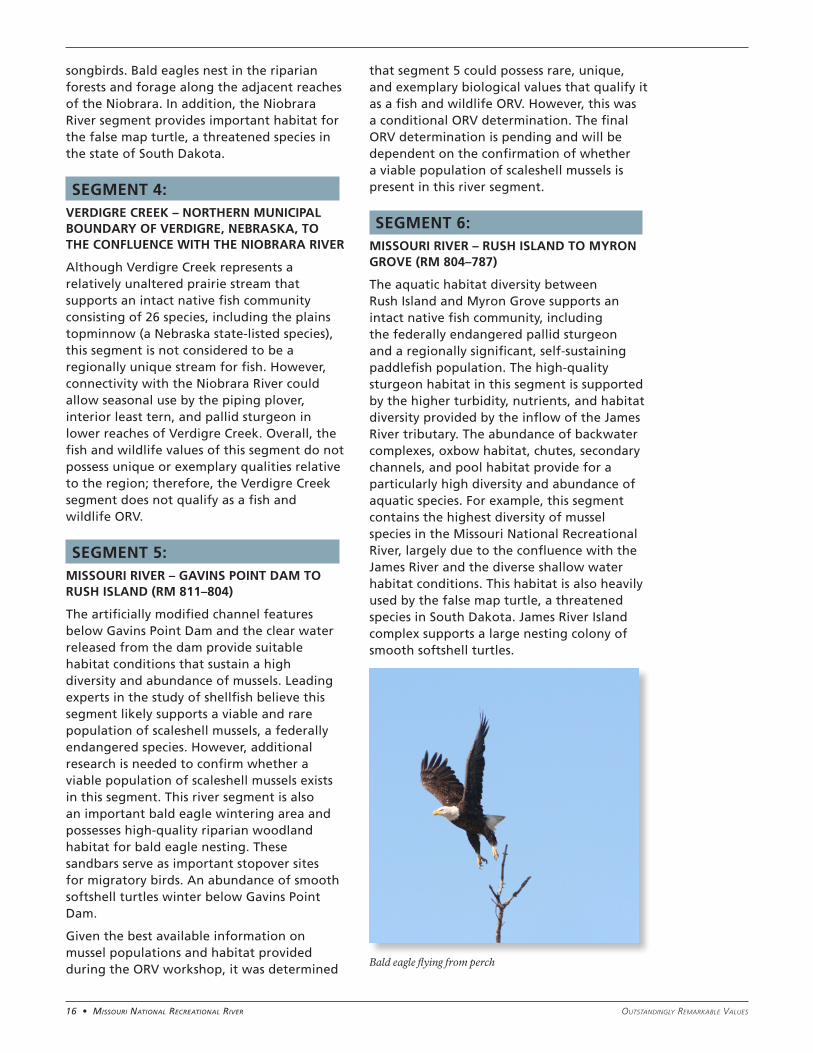
Bald eagle flying from perch
17 • Missouri NatioNal recreatioNal riverOutstandingly RemaRkable Values
This river segment is also known to support a notably high diversity of bird species. The wide river, abundance of natural sandbars, and limited shoreline development of this segment historically has some of the highest concentrations of nesting interior least terns (federally endangered) and piping plovers (federally threatened) on the entire Missouri River. The sandbars provide important resting areas for migrating shorebirds, marsh birds, and waterfowl. In addition, numerous bald eagles nest in the cottonwood forests of this segment and forage in the adjacent open waters.
SEGMENT 7: MISSOURI RIVER – MYRON GROVE TO KATE SWEENY BEND (RM 787–767)
The river between Myron Grove and Kate Sweeny Bend supports an intact native fish community, including the federally endangered pallid sturgeon and the sicklefin chub and sturgeon chub (listed as endangered and threatened species, respectively, in South Dakota). This segment also supports a regionally significant, self-sustaining paddlefish population. The high-quality sturgeon habitat results from the higher turbidity, nutrients, and habitat diversity that is provided by inflows from the James and Vermillion rivers.
The prevalent natural sandbars, wide river conditions, and diverse shallow water habitat of this segment support a high diversity of bird species. The natural sandbars serve as important nesting sites for the federally endangered interior least tern and threatened piping plover (particularly downstream of Goat Island) and provide safe migration stopover areas for many species of marsh birds, waterfowl, and shorebirds. A large number of bald eagles also nest and forage in the adjacent cottonwood forests. The upper portion of this segment is home to a high diversity of mussels and provides habitat for eastern hognose snakes, a threatened species in South Dakota. Similar to the James River Island complex, Goat Island is a large nesting area for smooth softshell turtles and false map turtles, a threatened species in South Dakota.
SEGMENT 8: MISSOURI RIVER – KATE SWEENY BEND TO PONCA STATE PARK (RM 767–752)
The reach of the Missouri River between Kate Sweeny Bend and Ponca State Park supports an intact native fish community that includes the federally endangered pallid sturgeon and the sicklefin chub and sturgeon chub (listed as endangered and threatened, respectively, in South Dakota). The segment’s abundance of backwater complexes, oxbow habitat, secondary channels, and pool habitat provide a particularly high diversity of aquatic species. The higher turbidity, nutrient levels, and habitat diversity that result from the James River and Vermillion River tributaries are integral to the high-quality sturgeon habitat. Segment 8 also supports a regionally significant, self-sustaining paddlefish population.
The natural sandbars throughout this river segment provide the first upriver opportunity for nesting sites encountered by the federally endangered interior least terns and threatened piping plovers as they migrate north along the lower Missouri River in spring. These natural sandbars and other high-quality habitat conditions of this segment are known to support a notably high diversity of bird species. Many species and large numbers of shorebirds, waterfowl, and marsh birds use the sandbars as important stopover sites during migration, and bald eagles use the riparian cottonwood forests in this segment for nesting and foraging. This area contains a population of eastern hognose snakes, a threatened species in South Dakota.
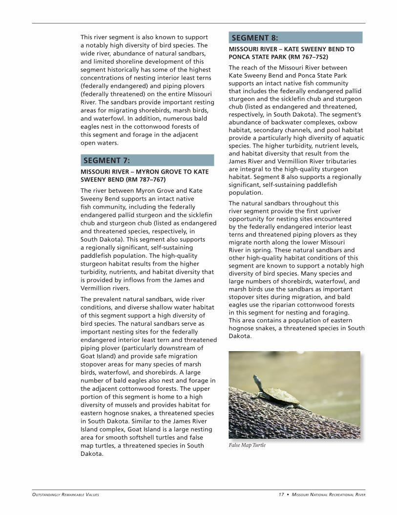
False Map Turtle
18 • Missouri NatioNal recreatioNal river Outstandingly RemaRkable Values
SEGMENT 1: MISSOURI RIVER – FORT RANDALL DAM TO CHOTEAU CREEK (RM 880–852)
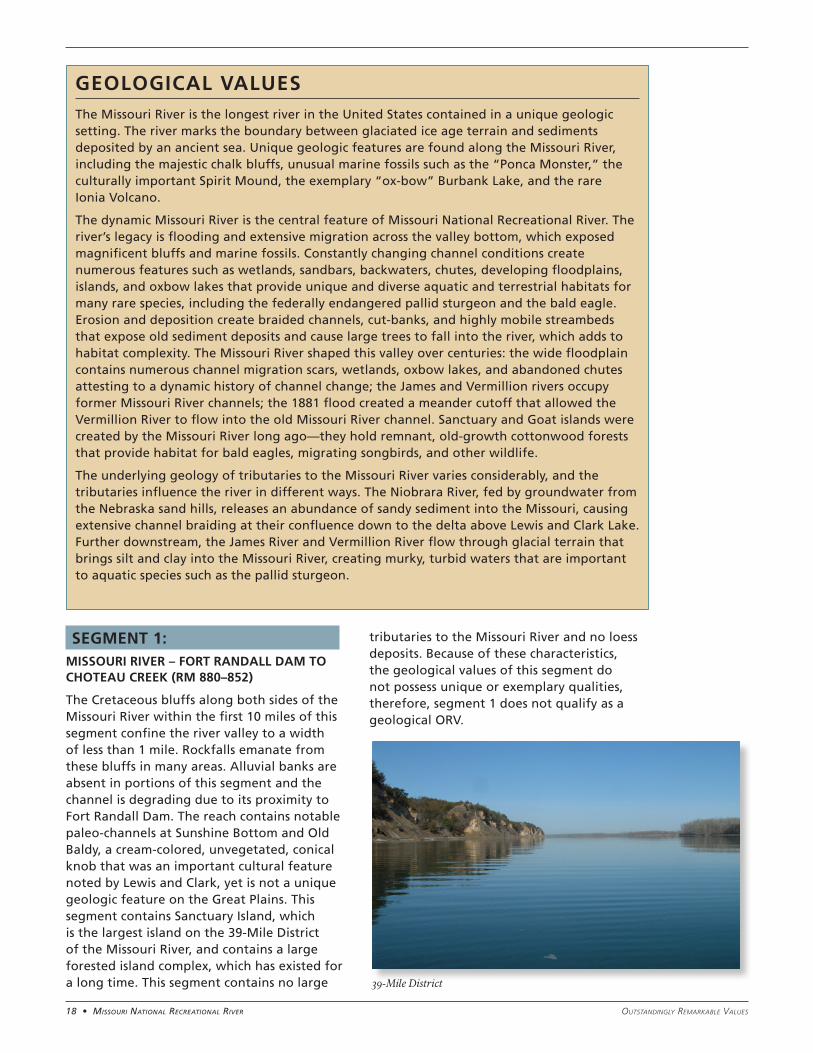
The Cretaceous bluffs along both sides of the Missouri River within the first 10 miles of this segment confine the river valley to a width of less than 1 mile. Rockfalls emanate from these bluffs in many areas. Alluvial banks are absent in portions of this segment and the channel is degrading due to its proximity to Fort Randall Dam. The reach contains notable paleo-channels at Sunshine Bottom and Old Baldy, a cream-colored, unvegetated, conical knob that was an important cultural feature noted by Lewis and Clark, yet is not a unique geologic feature on the Great Plains. This segment contains Sanctuary Island, which is the largest island on the 39-Mile District of the Missouri River, and contains a large forested island complex, which has existed for a long time. This segment contains no large
tributaries to the Missouri River and no loess deposits. Because of these characteristics, the geological values of this segment do not possess unique or exemplary qualities, therefore, segment 1 does not qualify as a geological ORV.
GEOLOGICAL VALUESThe Missouri River is the longest river in the United States contained in a unique geologic setting. The river marks the boundary between glaciated ice age terrain and sediments deposited by an ancient sea. Unique geologic features are found along the Missouri River, including the majestic chalk bluffs, unusual marine fossils such as the “Ponca Monster,” the culturally important Spirit Mound, the exemplary “ox-bow” Burbank Lake, and the rare Ionia Volcano.
The dynamic Missouri River is the central feature of Missouri National Recreational River. The river’s legacy is flooding and extensive migration across the valley bottom, which exposed magnificent bluffs and marine fossils. Constantly changing channel conditions create numerous features such as wetlands, sandbars, backwaters, chutes, developing floodplains, islands, and oxbow lakes that provide unique and diverse aquatic and terrestrial habitats for many rare species, including the federally endangered pallid sturgeon and the bald eagle. Erosion and deposition create braided channels, cut-banks, and highly mobile streambeds that expose old sediment deposits and cause large trees to fall into the river, which adds to habitat complexity. The Missouri River shaped this valley over centuries: the wide floodplain contains numerous channel migration scars, wetlands, oxbow lakes, and abandoned chutes attesting to a dynamic history of channel change; the James and Vermillion rivers occupy former Missouri River channels; the 1881 flood created a meander cutoff that allowed the Vermillion River to flow into the old Missouri River channel. Sanctuary and Goat islands were created by the Missouri River long ago—they hold remnant, old-growth cottonwood forests that provide habitat for bald eagles, migrating songbirds, and other wildlife.
The underlying geology of tributaries to the Missouri River varies considerably, and the tributaries influence the river in different ways. The Niobrara River, fed by groundwater from the Nebraska sand hills, releases an abundance of sandy sediment into the Missouri, causing extensive channel braiding at their confluence down to the delta above Lewis and Clark Lake. Further downstream, the James River and Vermillion River flow through glacial terrain that brings silt and clay into the Missouri River, creating murky, turbid waters that are important to aquatic species such as the pallid sturgeon.
39-Mile District
19 • Missouri NatioNal recreatioNal riverOutstandingly RemaRkable Values
SEGMENT 2: MISSOURI RIVER – CHOTEAU CREEK TO RUNNING WATER (RM 852–840)
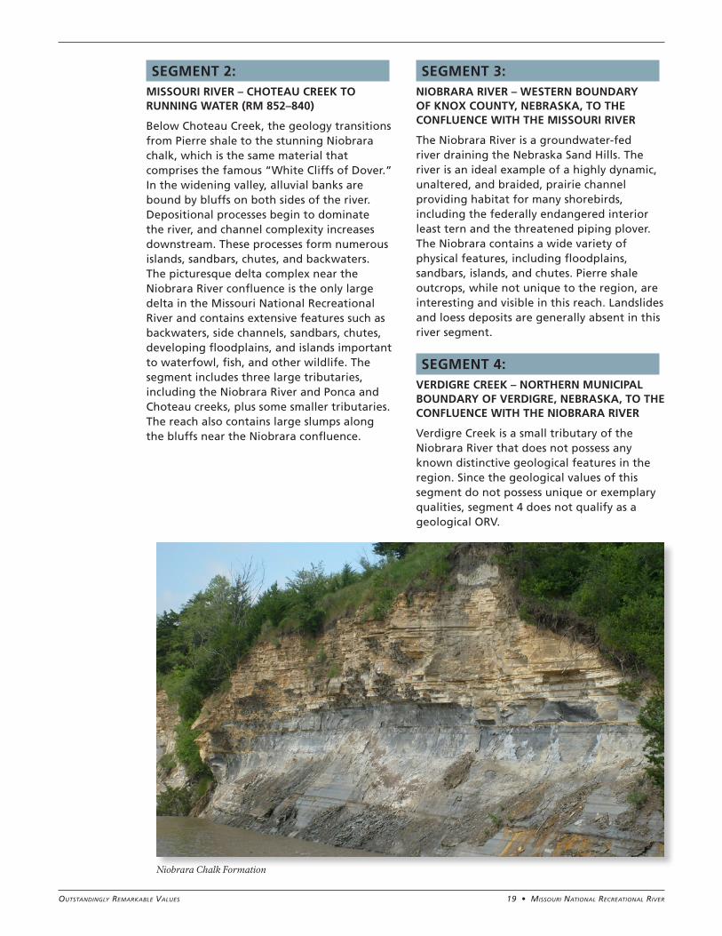
Below Choteau Creek, the geology transitions from Pierre shale to the stunning Niobrara chalk, which is the same material that comprises the famous “White Cliffs of Dover.” In the widening valley, alluvial banks are bound by bluffs on both sides of the river. Depositional processes begin to dominate the river, and channel complexity increases downstream. These processes form numerous islands, sandbars, chutes, and backwaters. The picturesque delta complex near the Niobrara River confluence is the only large delta in the Missouri National Recreational River and contains extensive features such as backwaters, side channels, sandbars, chutes, developing floodplains, and islands important to waterfowl, fish, and other wildlife. The segment includes three large tributaries, including the Niobrara River and Ponca and Choteau creeks, plus some smaller tributaries. The reach also contains large slumps along the bluffs near the Niobrara confluence.
SEGMENT 3: NIOBRARA RIVER – WESTERN BOUNDARY OF KNOX COUNTY, NEBRASKA, TO THE CONFLUENCE WITH THE MISSOURI RIVER
The Niobrara River is a groundwater-fed river draining the Nebraska Sand Hills. The river is an ideal example of a highly dynamic, unaltered, and braided, prairie channel providing habitat for many shorebirds, including the federally endangered interior least tern and the threatened piping plover. The Niobrara contains a wide variety of physical features, including floodplains, sandbars, islands, and chutes. Pierre shale outcrops, while not unique to the region, are interesting and visible in this reach. Landslides and loess deposits are generally absent in this river segment.
SEGMENT 4: VERDIGRE CREEK – NORTHERN MUNICIPAL BOUNDARY OF VERDIGRE, NEBRASKA, TO THE CONFLUENCE WITH THE NIOBRARA RIVER
Verdigre Creek is a small tributary of the Niobrara River that does not possess any known distinctive geological features in the region. Since the geological values of this segment do not possess unique or exemplary qualities, segment 4 does not qualify as a geological ORV.
Niobrara Chalk Formation
20 • Missouri NatioNal recreatioNal river Outstandingly RemaRkable Values
SEGMENT 5: MISSOURI RIVER – GAVINS POINT DAM TO RUSH ISLAND (RM 811–804)
This segment of the Missouri River is highly stabilized and developed. The river is degrading and channel complexity is largely absent due to reservoir releases from Gavins Point Dam. The reach does contain unique gravel beds below the dam. Calumet Bluff and Lake Yankton are in this segment. Overall, the geological values of this river segment do not possess unique or exemplary qualities; therefore, segment 5 does not qualify as a geological ORV.
SEGMENT 6: MISSOURI RIVER – RUSH ISLAND TO MYRON GROVE (RM 804–787)
The geology of this reach is characterized by dramatic and exemplary outcrops of Cretaceous bluffs and alluvial floodplains and banks. The Missouri River begins to widen in this reach and the robustly active channel is aggrading and degrading. These dynamics create a complex and regionally unique number and extent of physical features, including developing floodplains, sandbars, islands, chutes, and paleo-channels. This reach contains James River Island, one of two large islands in the 59-Mile District that contain mature cottonwood forests. Two major tributaries—the James River and Bow Creek—deliver two different types of sediments to the Missouri River in this segment. The lower 4-mile reach of the James River occupies a former channel of the Missouri River.
SEGMENT 7: MISSOURI RIVER – MYRON GROVE TO KATE SWEENY BEND (RM 787–767)
The geology of this segment is characterized by dramatic and exemplary Cretaceous bluffs and alluvial floodplains and banks. The channel is active, creating a complex and regionally unique amount of features, including developing floodplains, sandbars, islands, chutes, and paleo-channels. The alluvial floodplain in this reach contains the channel that was abandoned as a result of the historic 1881 flood. This river reach contains Goat Island, one of two large islands in the 59-Mile District that contain mature
cottonwood forests. In addition, this segment contains a number of smaller forested islands, including Gunderson Island and Ryan’s Island. The Vermillion River, which flows through a portion of the pre-1881 Missouri channel, is a major tributary to the Missouri River in this segment. The reach also contains exemplary features including the regionally unique “ox-bow” Burbank Lake, Gunderson backwater, and the rare Spirit Mound and Ionia Volcano. Locally remarkable loess deposits mantle the southern bluffs to a thickness of up to 50 feet.
SEGMENT 8: MISSOURI RIVER – KATE SWEENY BEND TO PONCA STATE PARK (RM 767–752)
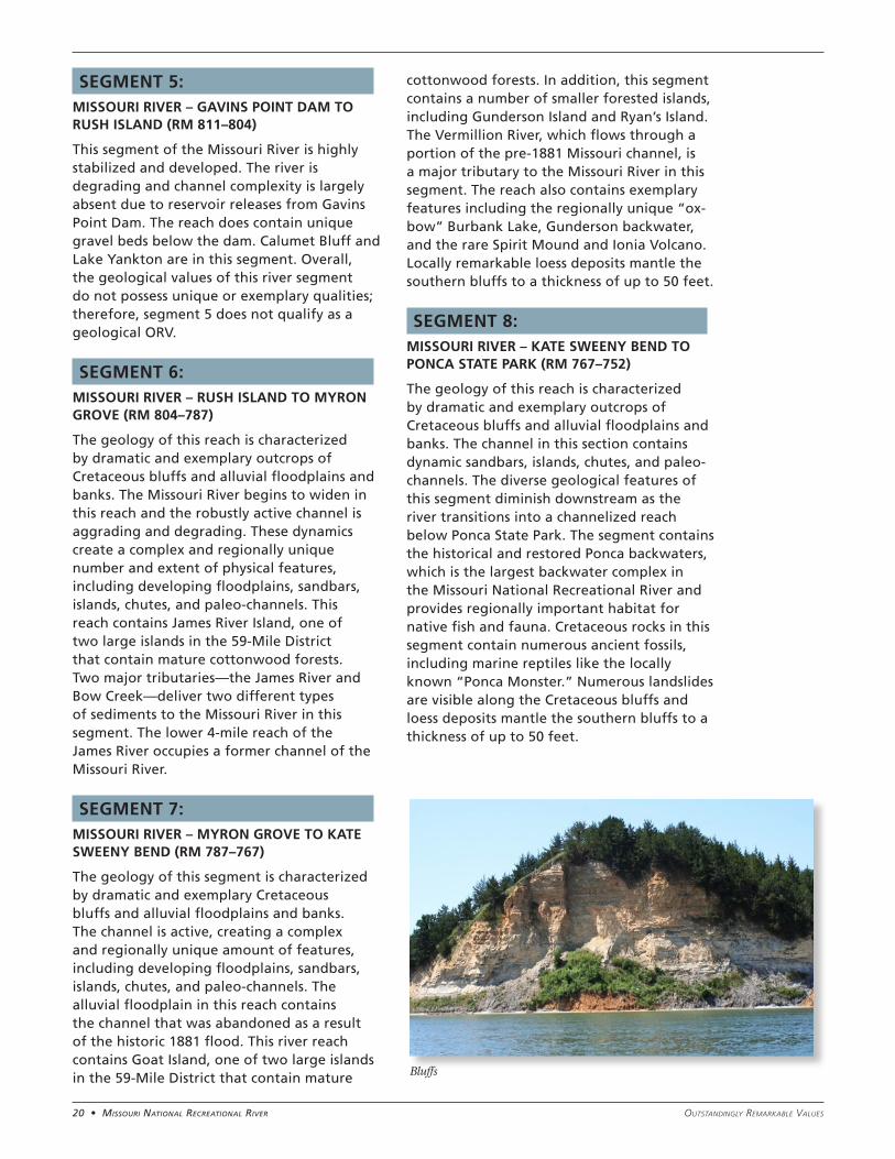
The geology of this reach is characterized by dramatic and exemplary outcrops of Cretaceous bluffs and alluvial floodplains and banks. The channel in this section contains dynamic sandbars, islands, chutes, and paleo-channels. The diverse geological features of this segment diminish downstream as the river transitions into a channelized reach below Ponca State Park. The segment contains the historical and restored Ponca backwaters, which is the largest backwater complex in the Missouri National Recreational River and provides regionally important habitat for native fish and fauna. Cretaceous rocks in this segment contain numerous ancient fossils, including marine reptiles like the locally known “Ponca Monster.” Numerous landslides are visible along the Cretaceous bluffs and loess deposits mantle the southern bluffs to a thickness of up to 50 feet.
Bluffs
21 • Missouri NatioNal recreatioNal riverOutstandingly RemaRkable Values
SEGMENT 1: MISSOURI RIVER – FORT RANDALL DAM TO CHOTEAU CREEK (RM 880–852)
This isolated stretch of the 39-mile segment provides excellent opportunities to hunt and catch a variety of fish species in a natural river setting. Outstanding bird watching, especially bald eagles, is possible within the narrow valley. Limited development and low use levels provide opportunities for solitude while enjoying the sights and sounds of nature. A visit to historic Fort Randall can take visitors back in time to frontier life.
SEGMENT 2: MISSOURI RIVER – CHOTEAU CREEK TO RUNNING WATER (RM 852–840)
Niobrara State Park, situated at the confluence of the Missouri and Niobrara rivers, provides a wide variety of opportunities and experiences, including interpretation of both natural and cultural resources. Expansive public lands provide a high probability of solitude while hiking and camping in the midst of breathtaking scenery.
SEGMENT 3: NIOBRARA RIVER – WESTERN BOUNDARY OF KNOX COUNTY, NEBRASKA, TO THE CONFLUENCE WITH THE MISSOURI RIVER
The Niobrara River is a more approachable opportunity for less experienced paddlers, providing shallower and calmer conditions than on the Missouri River. Paddling this segment of the Niobrara River offers visitors the chance to immerse themselves in the lovely pastoral and wild scenery. It also affords the visitor the chance to access sandbars for fishing and wildlife watching without the need for a boat.
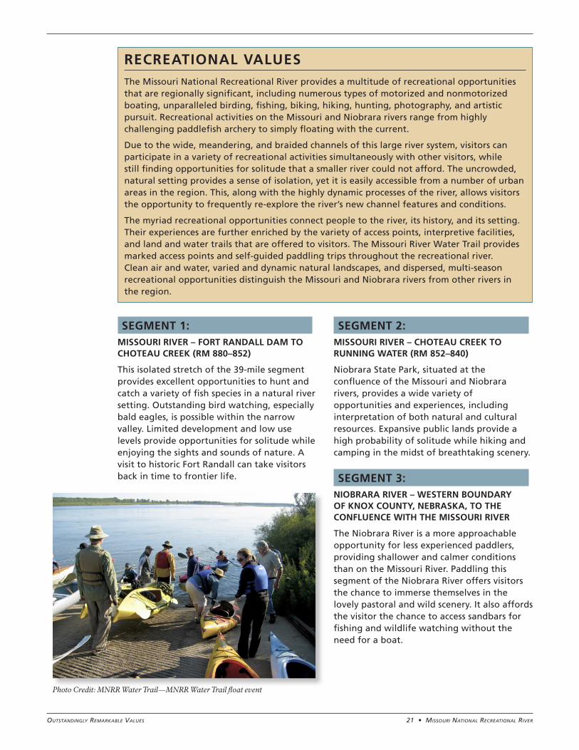
RECREATIONAL VALUESThe Missouri National Recreational River provides a multitude of recreational opportunities that are regionally significant, including numerous types of motorized and nonmotorized boating, unparalleled birding, fishing, biking, hiking, hunting, photography, and artistic pursuit. Recreational activities on the Missouri and Niobrara rivers range from highly challenging paddlefish archery to simply floating with the current.
Due to the wide, meandering, and braided channels of this large river system, visitors can participate in a variety of recreational activities simultaneously with other visitors, while still finding opportunities for solitude that a smaller river could not afford. The uncrowded, natural setting provides a sense of isolation, yet it is easily accessible from a number of urban areas in the region. This, along with the highly dynamic processes of the river, allows visitors the opportunity to frequently re-explore the river’s new channel features and conditions.
The myriad recreational opportunities connect people to the river, its history, and its setting. Their experiences are further enriched by the variety of access points, interpretive facilities, and land and water trails that are offered to visitors. The Missouri River Water Trail provides marked access points and self-guided paddling trips throughout the recreational river. Clean air and water, varied and dynamic natural landscapes, and dispersed, multi-season recreational opportunities distinguish the Missouri and Niobrara rivers from other rivers in the region.
Photo Credit: MNRR Water Trail—MNRR Water Trail float event

22 • Missouri NatioNal recreatioNal river Outstandingly RemaRkable Values
SEGMENT 4: VERDIGRE CREEK – NORTHERN MUNICIPAL BOUNDARY OF VERDIGRE, NEBRASKA, TO THE CONFLUENCE WITH THE NIOBRARA RIVER
Verdigre Creek provides limited seasonal opportunities for canoeing, fishing, and wading; however, it was determined that this segment does not contain rare, unique, or exemplary recreational experiences in the region. Therefore, Verdigre Creek does not contain outstandingly remarkable recreational values.
SEGMENT 5: MISSOURI RIVER – GAVINS POINT DAM TO RUSH ISLAND (RM 811–804)
Contrasting the more secluded sections of the Missouri National Recreational River, Gavins Point Dam to Rush Island provides an opportunity for access to developed types of recreational activities such as paved hiking and biking paths, interpretive centers, and tours of the dam. Easy accessibility, multiple boat ramps, and city and county parks provide opportunities for individuals with limited mobility to enjoy the river. Paddlefish angling is considered excellent in this river segment.
SEGMENT 6: MISSOURI RIVER – RUSH ISLAND TO MYRON GROVE (RM 804–787)
Between Rush Island and Myron Grove visitors have a high potential to experience solitude. Numerous access points along this stretch of the river provide excellent opportunities for both motorized and nonmotorized boating. Vast expanses of public lands are accessible along most of this reach, both from the
water and via roads. All public lands in the reach offer a full range of hunting and fishing opportunities as well as access to wildlife viewing and artistic pursuits. Distance between access points provides for an ideal day of paddling along the Missouri National Recreational River Water Trail.
SEGMENT 7: MISSOURI RIVER – MYRON GROVE TO KATE SWEENY BEND (RM 787–767)
Close proximity to Vermillion and Interstate 29 links this stretch of river to major urban areas in the region and provides easy access to the river. This recreational hub includes Goat Island with its unique opportunities for primitive hiking and camping, Gunderson Backwater with its superlative angling and calm waters, and Mulberry Bend Overlook with its iconic river view. The multitude of sandbars and the widening river provides hunting, fishing, and wildlife viewing opportunities and the freedom to stretch out and enjoy the river.
SEGMENT 8: MISSOURI RIVER – KATE SWEENY BEND TO PONCA STATE PARK (RM 767–752)
Capped by Ponca State Park, the Missouri National Recreational River concludes with excellent opportunities for both primitive and developed camping along the river, a river-focused education and interpretation center, and backwater fishing and luxurious mini-lodges. Once a year the Missouri River Outdoor Expo showcases the numerous recreational opportunities and experiences one can find along the recreational river, which draws 40,000 people in one weekend. Outside of Ponca State Park, this reach provides ample opportunities for solitude, boating, fishing, wildlife viewing, and artistic pursuits due to limited development and long expanses of wild scenery.
NPS Park Ranger
Boats waiting at Riverside Park (Yankton, SD) to transport volunteer river clean-up crews
23 • Missouri NatioNal recreatioNal riverOutstandingly RemaRkable Values
SEGMENT 1: MISSOURI RIVER – FORT RANDALL DAM TO CHOTEAU CREEK (RM 880–852)
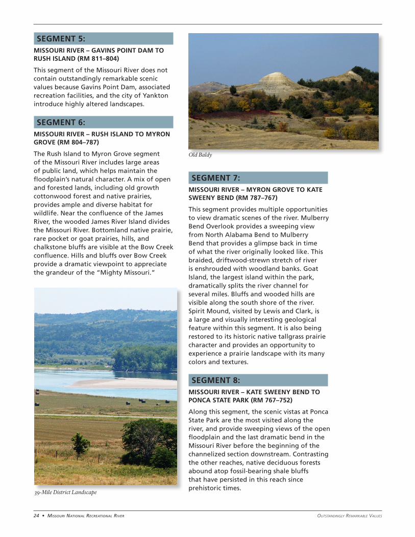
The upper reach of the 39-mile segment sits at the transition of the northern Plains and eastern prairies; the narrowness of this valley section provides an intimate connection to the surrounding grass-covered hills and bottomland forests. Nestled between the chalkrock bluffs facing the river, one can gaze at the brilliance of the prairie skies. Artists and visitors alike continue to be inspired by starry night skies and soaring birds, such as bald eagles, sandhill cranes, and other large flocking birds, reminiscent of the environment seen by the earliest inhabitants. Scenic vistas along this stretch include views of Fort Randall and Old Baldy.
SEGMENTS 2 AND 3: MISSOURI RIVER – CHOTEAU CREEK TO RUNNING WATER (RM 852–840) AND NIOBRARA RIVER – WESTERN BOUNDARY OF KNOX COUNTY, NEBRASKA, TO THE CONFLUENCE WITH THE MISSOURI RIVER.
Downstream of Choteau Creek, the landscape transitions from impressive chalkrock bluffs to more open, rolling hills. The river breaks into extensive braided channels and shallows that provide habitat for high concentrations of nesting and migratory birds. Scenic vistas from Niobrara State Park and Chief Standing Bear Bridge Overlook provide sweeping views
where the sediment-laden, shallow waters of the Niobrara intertwine with the Missouri River. The pleasant rural landscape along these segments allows visitors to imagine the past unfolding on the grass-covered hills under starry night skies.
SEGMENT 4: VERDIGRE CREEK – NORTHERN MUNICIPAL BOUNDARY OF VERDIGRE, NEBRASKA, TO THE CONFLUENCE WITH THE NIOBRARA RIVER.
This exemplary, undeveloped rural landscape with few scattered farms along Verdigre Creek allows for dark night skies that provide excellent opportunities for star gazing. The undulating hills and vast open grasslands along this small meandering stream are evocative of simpler times and the original western landscape.
SCENIC VALUESThe Missouri River is the artery of America’s heartland, coursing its way through the scenic landscapes of the Great Plains to the Eastern Deciduous Forest. The Missouri National Recreational River is a 100-mile stretch that represents a vestige of the untamed west. The recreational river provides a unique perspective on one of the greatest waterways in America through a contrast of natural textures and colors, rural farmsteads, meandering channels, shifting sandbars, and sheer chalkstone bluffs.
To this day, visitors can experience one of the largest rivers in our country where the natural sounds of water and wildlife still dominate. The river provides visitors with unique opportunities to gaze upon the starry heavens or perhaps witness the power of a thunderous storm as it sweeps across the prairie.
The variety of scenery along the Missouri River evokes the stories of our past. As described in the journals of the Lewis and Clark Expedition, the river retains a semblance of the original western landscape, which has long inspired generations of artists. Spirit Mound, Old Baldy, and Fort Randall are a few of the scenic features that not only provide visual contrast to the rolling, grass-covered hills, farmlands, and woodlands, but bring to mind the powerful influence of the Missouri River on the rich history of the area.
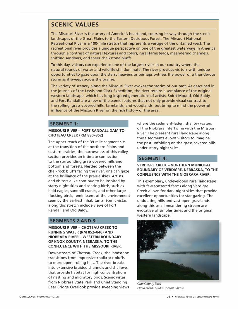
Clay County Park Photo credit: Linda Gordon Rokosz
24 • Missouri NatioNal recreatioNal river Outstandingly RemaRkable Values
SEGMENT 5: MISSOURI RIVER – GAVINS POINT DAM TO RUSH ISLAND (RM 811–804)
This segment of the Missouri River does not contain outstandingly remarkable scenic values because Gavins Point Dam, associated recreation facilities, and the city of Yankton introduce highly altered landscapes.
SEGMENT 6: MISSOURI RIVER – RUSH ISLAND TO MYRON GROVE (RM 804–787)
The Rush Island to Myron Grove segment of the Missouri River includes large areas of public land, which helps maintain the floodplain’s natural character. A mix of open and forested lands, including old growth cottonwood forest and native prairies, provides ample and diverse habitat for wildlife. Near the confluence of the James River, the wooded James River Island divides the Missouri River. Bottomland native prairie, rare pocket or goat prairies, hills, and chalkstone bluffs are visible at the Bow Creek confluence. Hills and bluffs over Bow Creek provide a dramatic viewpoint to appreciate the grandeur of the “Mighty Missouri.”
SEGMENT 7: MISSOURI RIVER – MYRON GROVE TO KATE SWEENY BEND (RM 787–767)
This segment provides multiple opportunities to view dramatic scenes of the river. Mulberry Bend Overlook provides a sweeping view from North Alabama Bend to Mulberry Bend that provides a glimpse back in time of what the river originally looked like. This braided, driftwood-strewn stretch of river is enshrouded with woodland banks. Goat Island, the largest island within the park, dramatically splits the river channel for several miles. Bluffs and wooded hills are visible along the south shore of the river. Spirit Mound, visited by Lewis and Clark, is a large and visually interesting geological feature within this segment. It is also being restored to its historic native tallgrass prairie character and provides an opportunity to experience a prairie landscape with its many colors and textures.
SEGMENT 8: MISSOURI RIVER – KATE SWEENY BEND TO PONCA STATE PARK (RM 767–752)
Along this segment, the scenic vistas at Ponca State Park are the most visited along the river, and provide sweeping views of the open floodplain and the last dramatic bend in the Missouri River before the beginning of the channelized section downstream. Contrasting the other reaches, native deciduous forests abound atop fossil-bearing shale bluffs that have persisted in this reach since prehistoric times.
Old Baldy
39-Mile District Landscape
25 • Missouri NatioNal recreatioNal riverOutstandingly RemaRkable Values
FREE-FLOWING CONDITIONDefinition of free-flowing according to the Wild and Scenic Rivers Act: “…existing or flowing in a natural condition without impoundment, diversion, straightening, rip-rapping or other modification of the waterway.”
Upstream of the Missouri National Recreational River, the Missouri River originates in the Rocky Mountains and carries stream flow from drainages in Canada, Montana, Wyoming, North Dakota, South Dakota, and Nebraska. These drainages provide a snowmelt-dominated flow regime to the Missouri National Recreational River.
The large dams constructed on the Missouri River under the Pick-Sloan Plan, a component of the Flood Control Act of 1944, attempt to minimize flooding and provide other
benefits such as power generation, support for downstream navigation, recreation, fish and wildlife, water supply, water quality, and irrigation. However, the flood control function of these dams was tested during the 2011 runoff season when reservoir levels reached into the exclusive flood-control zone and dam releases were the highest since their construction in the 1950s. The 2011 record flow through the Missouri National Recreational River has produced dramatic changes to the river channel. The net positive or negative effects on the aquatic ecosystem and riparian communities, and the persistence of those effects, are not yet known.
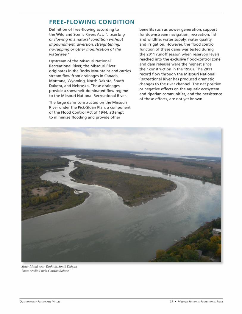
Sister Island near Yankton, South Dakota Photo credit: Linda Gordon Rokosz
26 • Missouri NatioNal recreatioNal river Outstandingly RemaRkable Values
IMPEDIMENTS TO FREE-FLOWING CONDITION
A substantial number of impoundments occur in the Missouri River basin above Fort Randall Dam, including four U.S. Army Corps of Engineers mainstem dams, two Bureau of Reclamation mainstem dams, and seven Pacific Power and Light mainstem dams. There are at least 70 dams (and diversions) on larger tributaries to the Missouri River. Additionally, there are many dams on small tributary drainages that create ponds for livestock watering and other uses.
Because of the presence of dams and reservoirs, the river’s flow, sediment, temperature, and nutrient regimes are highly altered from their natural condition. Generally speaking, flow regulation of the Missouri River results in:
• reductions in high flows
• increased low flows
• shorter low flow periods
• more short-term fluctuations in flow levels
In 2006, due to concerns expressed by wildlife agencies regarding the impact of flow regulation on pallid sturgeon, interior least tern, and piping plover, the U.S. Army Corps of Engineers modified its criteria for releases from Gavins Point Dam to incorporate a spring flood “pulse.” Although modest in scale, this flow revision represents the first step toward establishing a more natural flow regime. Despite highly regulated flows from the various dams on the Missouri River, flow variability that mimics natural conditions as much as possible can yield many ecological benefits, even if the flow variability is artificially created via dam releases.
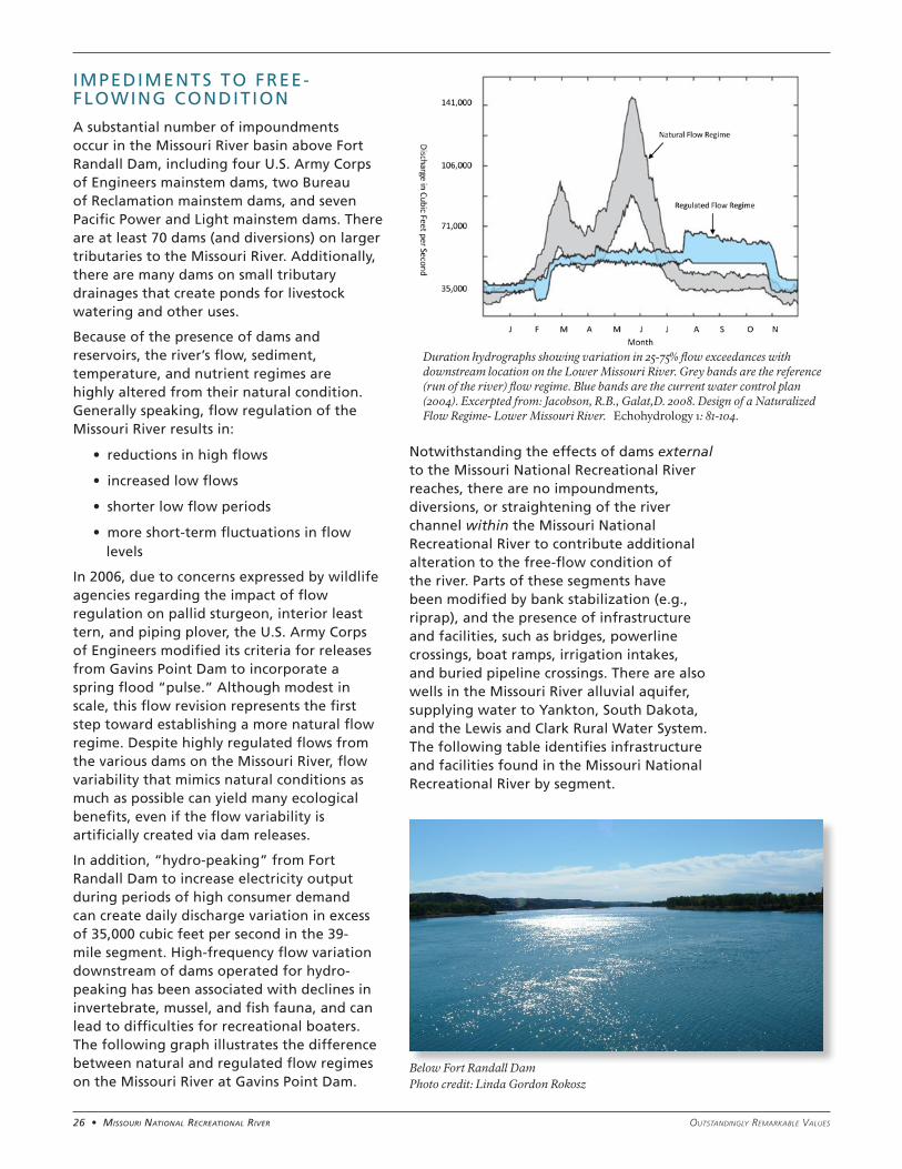
In addition, “hydro-peaking” from Fort Randall Dam to increase electricity output during periods of high consumer demand can create daily discharge variation in excess of 35,000 cubic feet per second in the 39-mile segment. High-frequency flow variation downstream of dams operated for hydro-peaking has been associated with declines in invertebrate, mussel, and fish fauna, and can lead to difficulties for recreational boaters. The following graph illustrates the difference between natural and regulated flow regimes on the Missouri River at Gavins Point Dam.
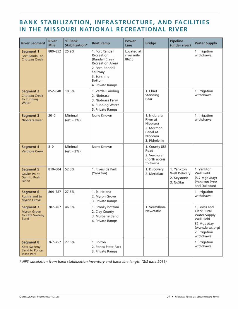
Notwithstanding the effects of dams external to the Missouri National Recreational River reaches, there are no impoundments, diversions, or straightening of the river channel within the Missouri National Recreational River to contribute additional alteration to the free-flow condition of the river. Parts of these segments have been modified by bank stabilization (e.g., riprap), and the presence of infrastructure and facilities, such as bridges, powerline crossings, boat ramps, irrigation intakes, and buried pipeline crossings. There are also wells in the Missouri River alluvial aquifer, supplying water to Yankton, South Dakota, and the Lewis and Clark Rural Water System. The following table identifies infrastructure and facilities found in the Missouri National Recreational River by segment.
Below Fort Randall Dam Photo credit: Linda Gordon Rokosz
Duration hydrographs showing variation in 25-75% flow exceedances with downstream location on the Lower Missouri River. Grey bands are the reference (run of the river) flow regime. Blue bands are the current water control plan (2004). Excerpted from: Jacobson, R.B., Galat,D. 2008. Design of a Naturalized Flow Regime- Lower Missouri River. Echohydrology 1: 81-104.
27 • Missouri NatioNal recreatioNal riverOutstandingly RemaRkable Values
* NPS calculation from bank stabilization inventory and bank line length (GIS data 2011)
River SegmentRiver Mile
% Bank Stabilization*
Boat RampPower Line
BridgePipeline (under river)
Water Supply
Segment 1Fort Randall to Choteau Creek
880–852 25.9% 1. Fort Randall Recreation (Randall Creek Recreation Area)2. Fort. Randall Spillway3. Sunshine Bottom4. Private Ramps
Located at river mile 862.5
1. Irrigation withdrawal
Segment 2Choteau Creek to Running Water
852–840 18.6% 1. Verdel Landing2. Niobrara3. Niobrara Ferry4. Running Water5. Private Ramps
1. Chief Standing Bear
1. Irrigation withdrawal
Segment 3Niobrara River
20–0 Minimal(est. <2%)
None Known 1. Niobrara River at Niobrara2. Mormon Canal at Niobrara3. Pishelville
1. Irrigation withdrawal
Segment 4Verdigre Creek
8–0 Minimal(est. <2%)
None Known 1. County 885 Road2. Verdigre (north access to town)
Segment 5Gavins Point Dam to Rush Island
810–804 52.8% 1. Riverside Park (Yankton)
1. Discovery 2. Meridian
1. Yankton Well Delivery2. Keystone3. NuStar
1. Yankton Well Field(5.7 Mgal/day) (Yankton Press and Dakotan)
Segment 6Rush Island to Myron Grove
804–787 27.5% 1. St. Helena2. Myron Grove3. Private Ramps
1. Irrigation withdrawal
Segment 7Myron Grove to Kate Sweeny Bend
787–767 46.3% 1. Brooky bottom2. Clay County3. Mulberry Bend4. Private Ramps
1. Vermillion-Newcastle
1. Lewis and Clark Rural Water Supply Well Field32 Mgal/day (www.lcrws.org)2. Irrigation withdrawal
Segment 8Kate Sweeny Bend to Ponca State Park
767–752 27.6% 1. Bolton2. Ponca State Park3. Private Ramps
1. Irrigation withdrawal
BANK STABIL IZATION, INFRASTRUCTURE, AND FACIL IT IES IN THE MISSOURI NATIONAL RECREATIONAL RIVER
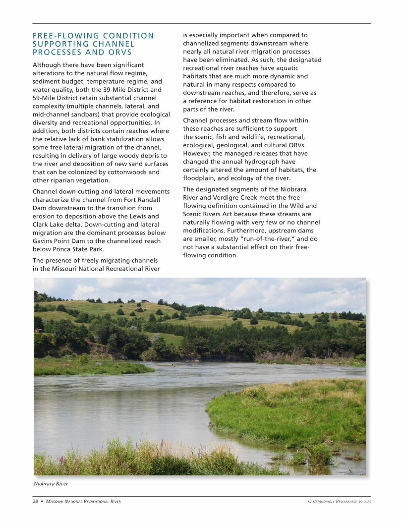
28 • Missouri NatioNal recreatioNal river Outstandingly RemaRkable Values
FREE-FLOWING CONDITION SUPPORTING CHANNEL PROCESSES AND ORVS
Although there have been significant alterations to the natural flow regime, sediment budget, temperature regime, and water quality, both the 39-Mile District and 59-Mile District retain substantial channel complexity (multiple channels, lateral, and mid-channel sandbars) that provide ecological diversity and recreational opportunities. In addition, both districts contain reaches where the relative lack of bank stabilization allows some free lateral migration of the channel, resulting in delivery of large woody debris to the river and deposition of new sand surfaces that can be colonized by cottonwoods and other riparian vegetation.
Channel down-cutting and lateral movements characterize the channel from Fort Randall Dam downstream to the transition from erosion to deposition above the Lewis and Clark Lake delta. Down-cutting and lateral migration are the dominant processes below Gavins Point Dam to the channelized reach below Ponca State Park.
The presence of freely migrating channels in the Missouri National Recreational River
is especially important when compared to channelized segments downstream where nearly all natural river migration processes have been eliminated. As such, the designated recreational river reaches have aquatic habitats that are much more dynamic and natural in many respects compared to downstream reaches, and therefore, serve as a reference for habitat restoration in other parts of the river.
Channel processes and stream flow within these reaches are sufficient to support the scenic, fish and wildlife, recreational, ecological, geological, and cultural ORVs. However, the managed releases that have changed the annual hydrograph have certainly altered the amount of habitats, the floodplain, and ecology of the river.
The designated segments of the Niobrara River and Verdigre Creek meet the free-flowing definition contained in the Wild and Scenic Rivers Act because these streams are naturally flowing with very few or no channel modifications. Furthermore, upstream dams are smaller, mostly “run-of-the-river,” and do not have a substantial effect on their free-flowing condition.
Niobrara River
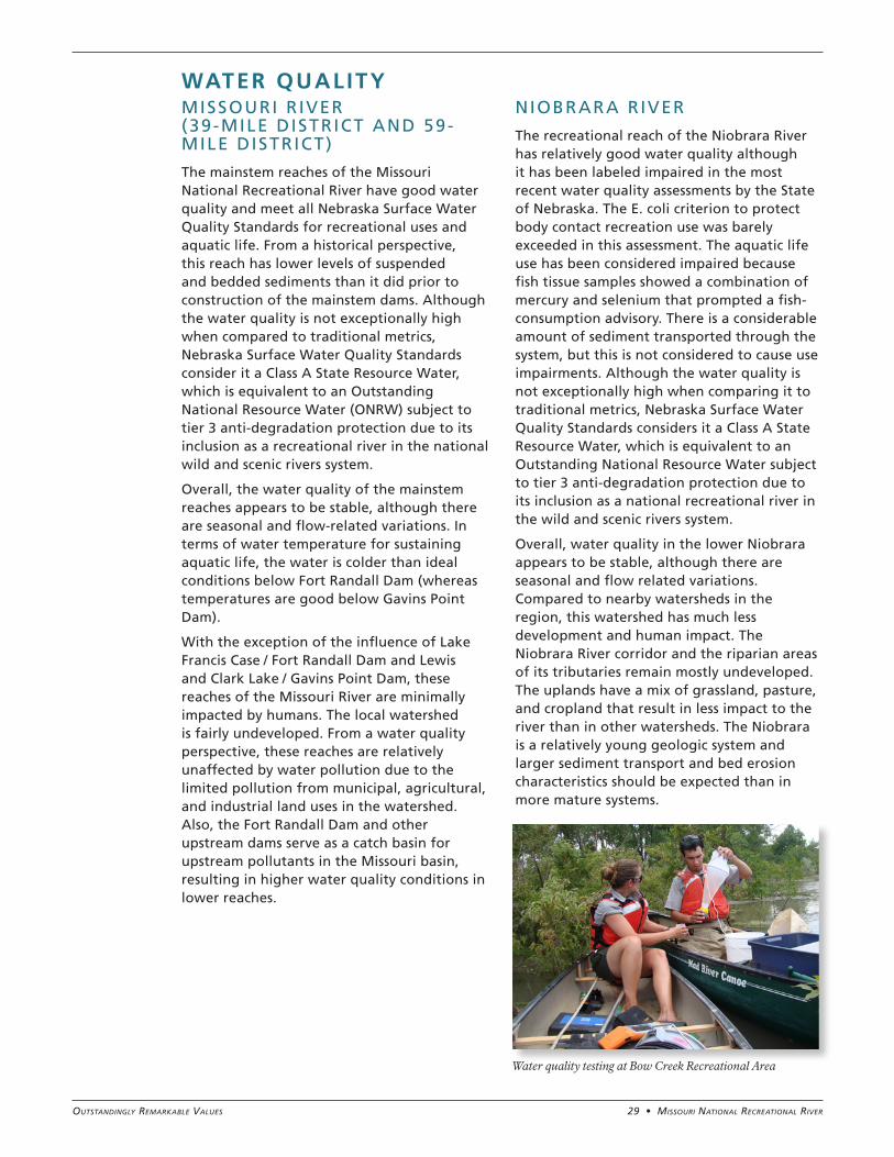
29 • Missouri NatioNal recreatioNal riverOutstandingly RemaRkable Values
WATER QUALITYMISSOURI R IVER (39-MILE DISTRICT AND 59-MILE DISTRICT)
The mainstem reaches of the Missouri National Recreational River have good water quality and meet all Nebraska Surface Water Quality Standards for recreational uses and aquatic life. From a historical perspective, this reach has lower levels of suspended and bedded sediments than it did prior to construction of the mainstem dams. Although the water quality is not exceptionally high when compared to traditional metrics, Nebraska Surface Water Quality Standards consider it a Class A State Resource Water, which is equivalent to an Outstanding National Resource Water (ONRW) subject to tier 3 anti-degradation protection due to its inclusion as a recreational river in the national wild and scenic rivers system.
Overall, the water quality of the mainstem reaches appears to be stable, although there are seasonal and flow-related variations. In terms of water temperature for sustaining aquatic life, the water is colder than ideal conditions below Fort Randall Dam (whereas temperatures are good below Gavins Point Dam).
With the exception of the influence of Lake Francis Case / Fort Randall Dam and Lewis and Clark Lake / Gavins Point Dam, these reaches of the Missouri River are minimally impacted by humans. The local watershed is fairly undeveloped. From a water quality perspective, these reaches are relatively unaffected by water pollution due to the limited pollution from municipal, agricultural, and industrial land uses in the watershed. Also, the Fort Randall Dam and other upstream dams serve as a catch basin for upstream pollutants in the Missouri basin, resulting in higher water quality conditions in lower reaches.
N IOBRARA RIVER
The recreational reach of the Niobrara River has relatively good water quality although it has been labeled impaired in the most recent water quality assessments by the State of Nebraska. The E. coli criterion to protect body contact recreation use was barely exceeded in this assessment. The aquatic life use has been considered impaired because fish tissue samples showed a combination of mercury and selenium that prompted a fish-consumption advisory. There is a considerable amount of sediment transported through the system, but this is not considered to cause use impairments. Although the water quality is not exceptionally high when comparing it to traditional metrics, Nebraska Surface Water Quality Standards considers it a Class A State Resource Water, which is equivalent to an Outstanding National Resource Water subject to tier 3 anti-degradation protection due to its inclusion as a national recreational river in the wild and scenic rivers system.
Overall, water quality in the lower Niobrara appears to be stable, although there are seasonal and flow related variations. Compared to nearby watersheds in the region, this watershed has much less development and human impact. The Niobrara River corridor and the riparian areas of its tributaries remain mostly undeveloped. The uplands have a mix of grassland, pasture, and cropland that result in less impact to the river than in other watersheds. The Niobrara is a relatively young geologic system and larger sediment transport and bed erosion characteristics should be expected than in more mature systems.
Water quality testing at Bow Creek Recreational Area
30 • Missouri NatioNal recreatioNal river Outstandingly RemaRkable Values
VERDIGRE CREEK
The designated reach of Verdigre Creek has relatively good water quality although it has been labeled impaired in recent Nebraska water quality assessments. The aquatic life use is considered to be fully supported, but the E. coli criterion to protect body contact recreational use is consistently exceeded. Other water quality parameters indicate very good water quality. Nebraska Surface Water Quality Standards considers Verdigre Creek a Class A State Resource Water, which is equivalent to an Outstanding National Resource Water subject to tier 3 anti-degradation protection due to its inclusion as a national recreational river in the wild and scenic rivers system.
Overall, water quality appears to be stable, although there are seasonal and flow-related variations. Relative to other watersheds in the region, the immediate watershed has much less development and human impact. The Verdigre Creek corridor below the Village of Verdigre remains mostly undeveloped. The uplands have a mix of grassland, pasture, and cropland that result in less impact to the river than in other watersheds. However, the watershed above Verdigre is extensive and has considerably more cropland although there still is a mix of grassland and pasture. Given these upstream agricultural uses, nitrate levels are relatively high in Verdigre Creek.
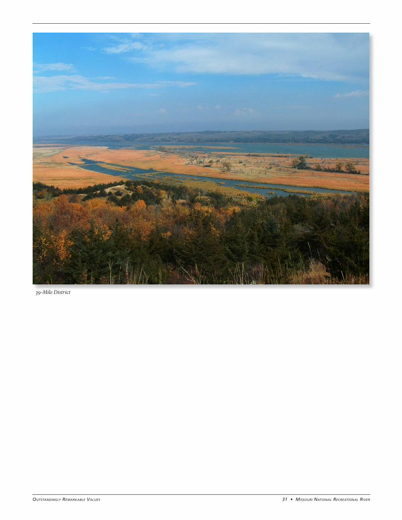
31 • Missouri NatioNal recreatioNal riverOutstandingly RemaRkable Values
39-Mile District
MISSOURI NATIONAL RECREATIONAL RIVERN E B R A S K A , S O U T H D A K O T A
N A T I O N A L P A R K S E R V I C E
U . S . D E P A R T M E N T O F T H E I N T E R I O R