Embed Size (px)
Citation preview
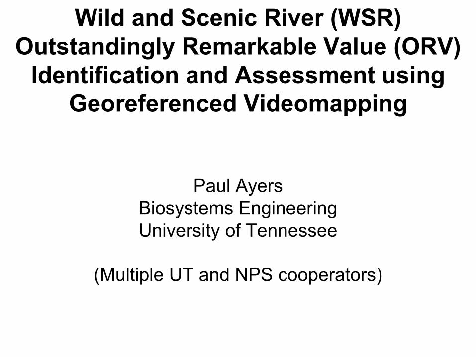
Wild and Scenic River (WSR) Outstandingly Remarkable Value (ORV)
Identification and Assessment using Georeferenced Videomapping
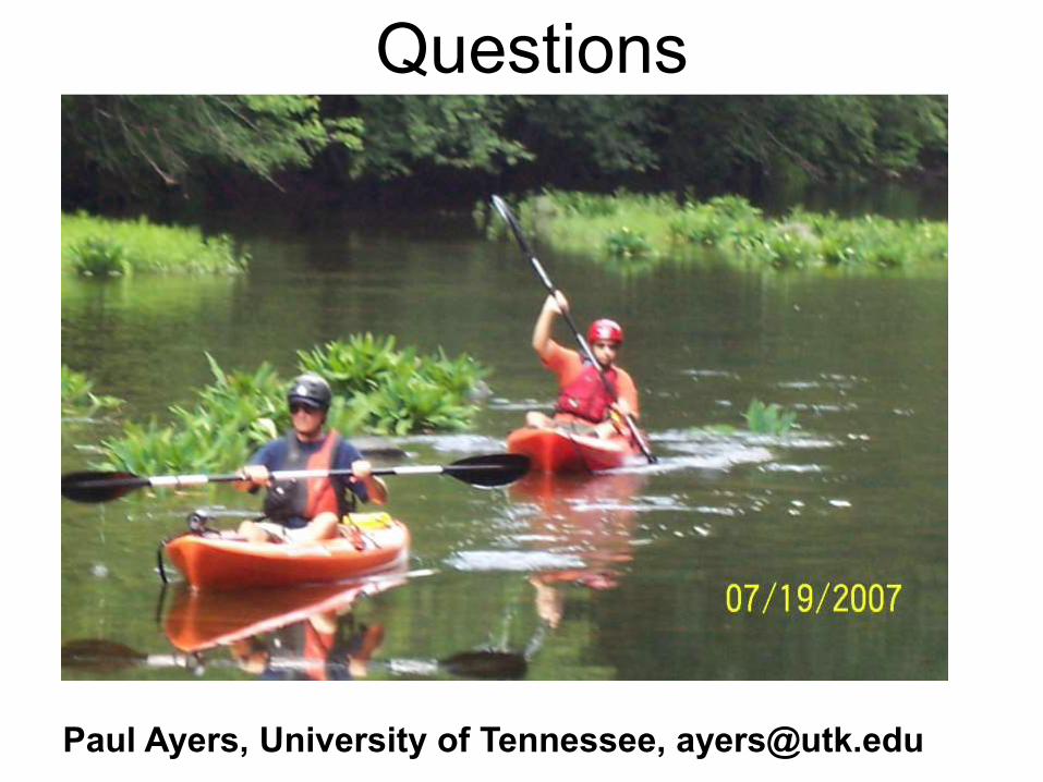
Paul Ayers Biosystems Engineering University of Tennessee
(Multiple UT and NPS cooperators)
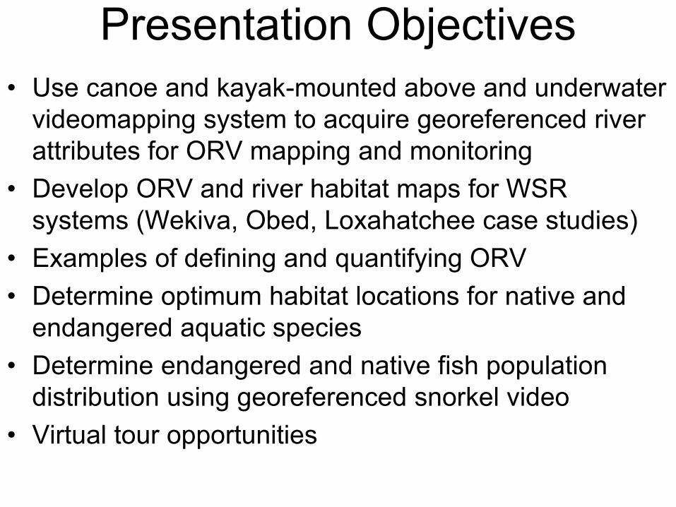
Presentation Objectives • Use canoe and kayak-mounted above and underwater
videomapping system to acquire georeferenced river attributes for ORV mapping and monitoring
• Develop ORV and river habitat maps for WSR systems (Wekiva, Obed, Loxahatchee case studies)
• Examples of defining and quantifying ORV • Determine optimum habitat locations for native and
endangered aquatic species • Determine endangered and native fish population
distribution using georeferenced snorkel video • Virtual tour opportunities
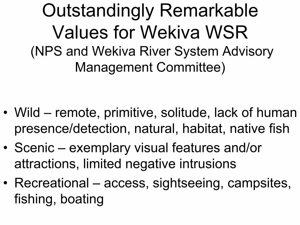
Outstandingly Remarkable Values for Wekiva WSR
(NPS and Wekiva River System Advisory Management Committee)
• Wild – remote, primitive, solitude, lack of human
presence/detection, natural, habitat, native fish • Scenic – exemplary visual features and/or
attractions, limited negative intrusions • Recreational – access, sightseeing, campsites,
fishing, boating
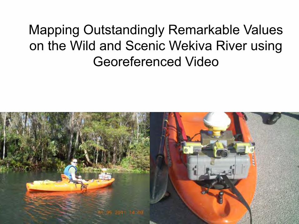
Mapping Outstandingly Remarkable Values on the Wild and Scenic Wekiva River using
Georeferenced Video
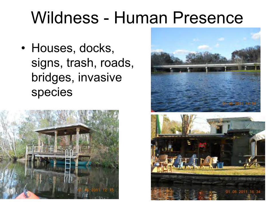
Wildness - Human Presence
• Houses, docks, signs, trash, roads, bridges, invasive species
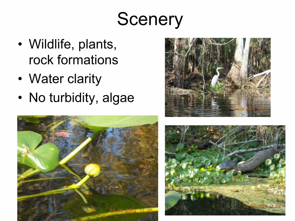
Scenery • Wildlife, plants,
rock formations • Water clarity • No turbidity, algae
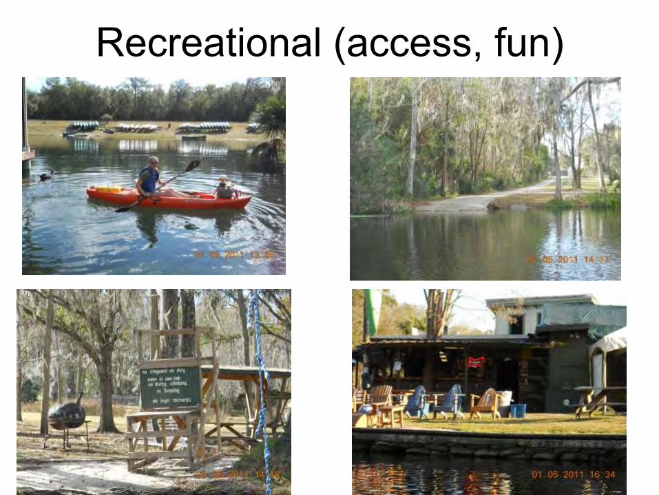
Recreational (access, fun)
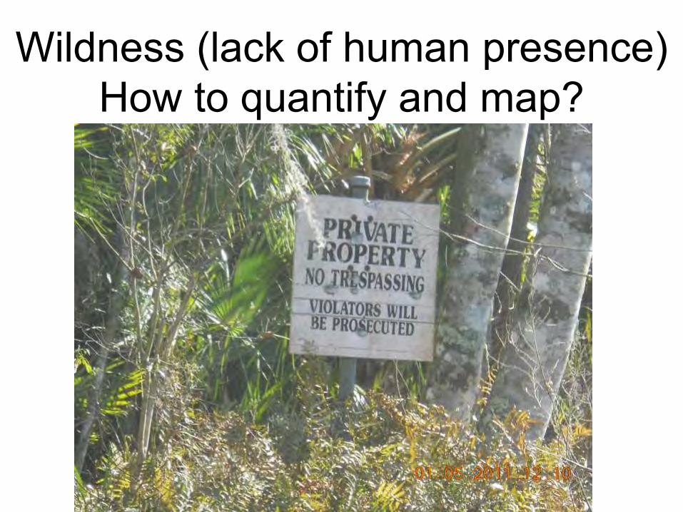
Wildness (lack of human presence) How to quantify and map?
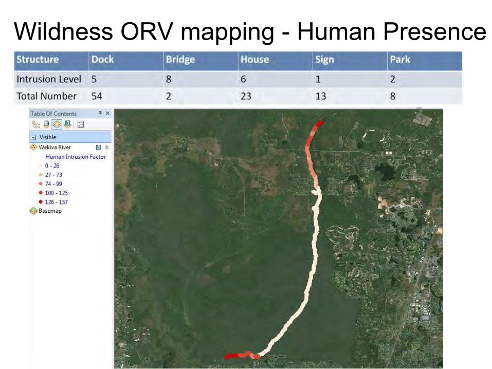
Wildness ORV mapping - Human Presence
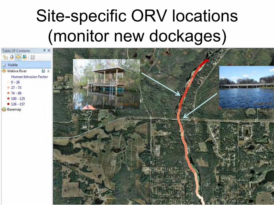
Site-specific ORV locations (monitor new dockages)
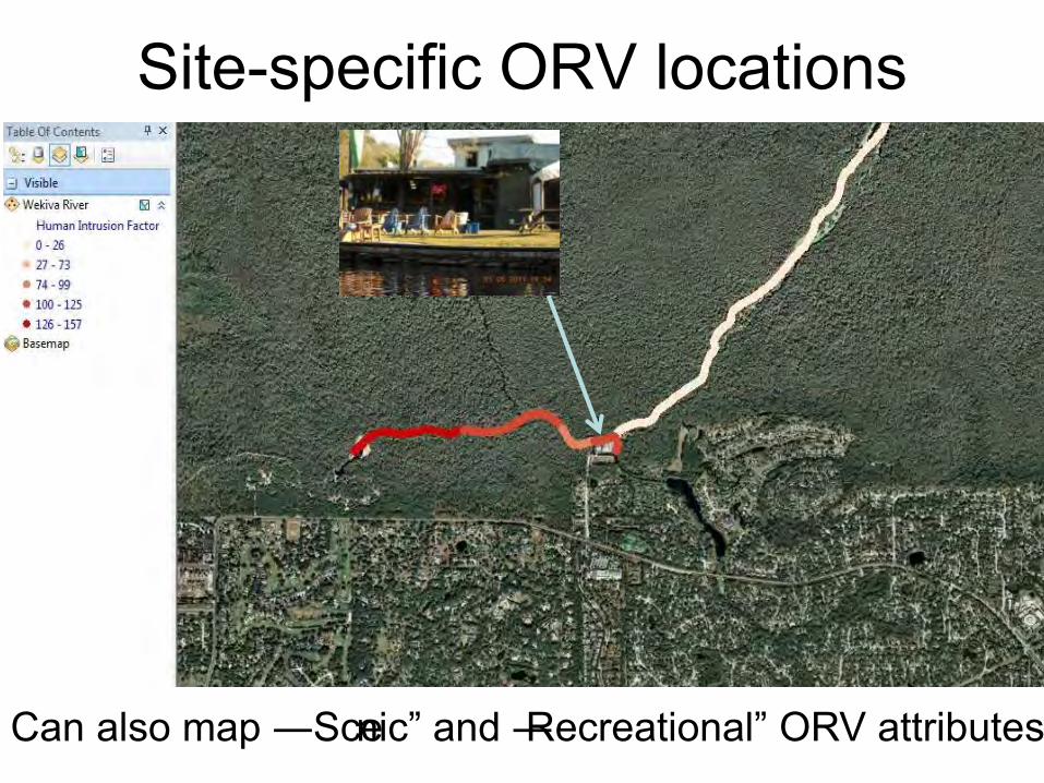
Site-specific ORV locations
Can also map ―Scenic‖ and ―Recreational‖ ORV attributes
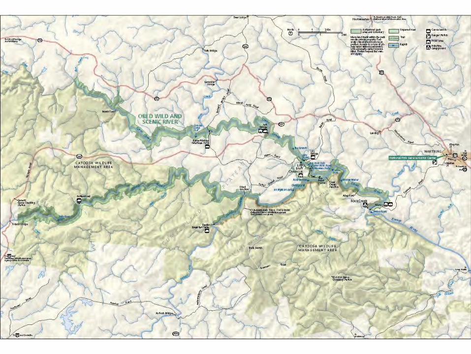
Obed Wild and Scenic River (NPS)
• 45 miles (43 mile Wild) • Concerned about rare and endangered fish and
mussel species • Develop landscape-scale river habitat maps for
rare and endangered aquatic species
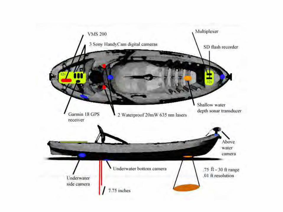
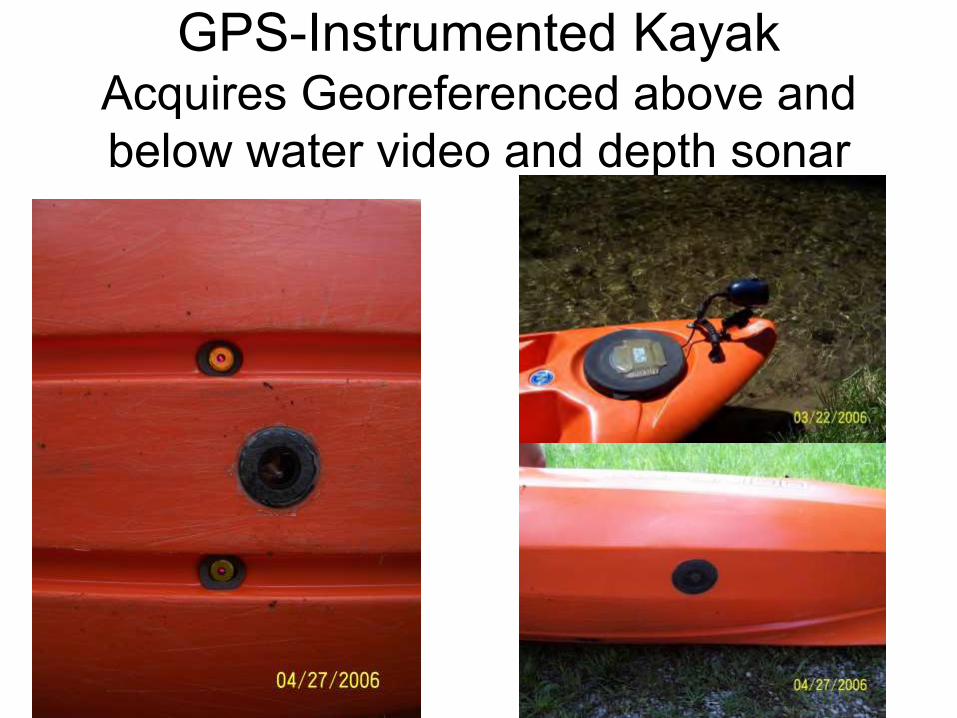
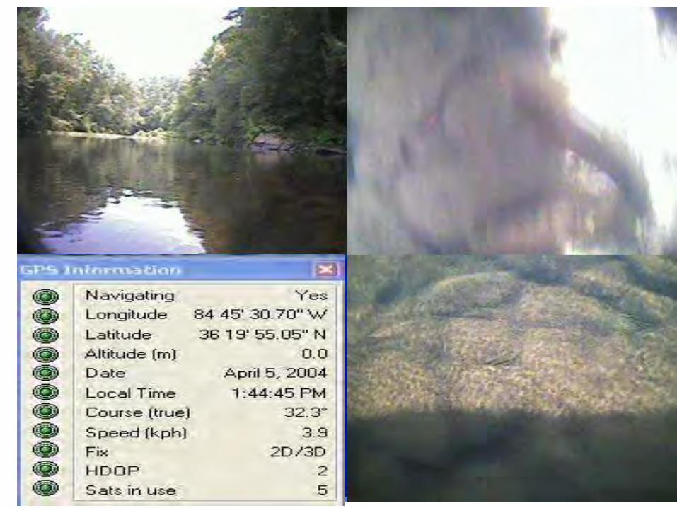
GPS-Instrumented Kayak Acquires Georeferenced above and below water video and depth sonar
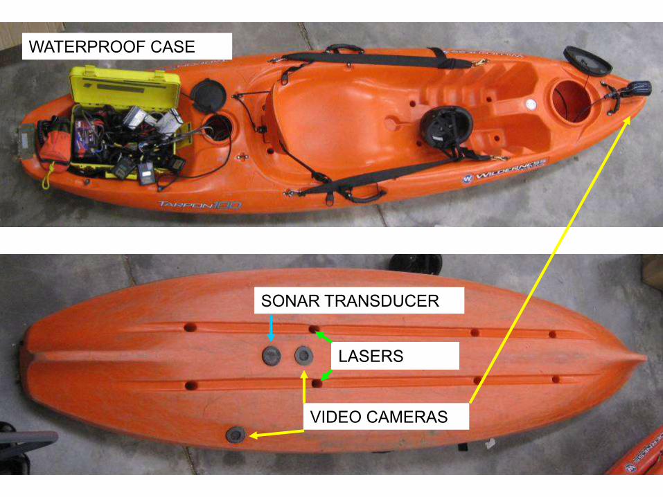
VIDEO CAMERAS
LASERS
SONAR TRANSDUCER
WATERPROOF CASE
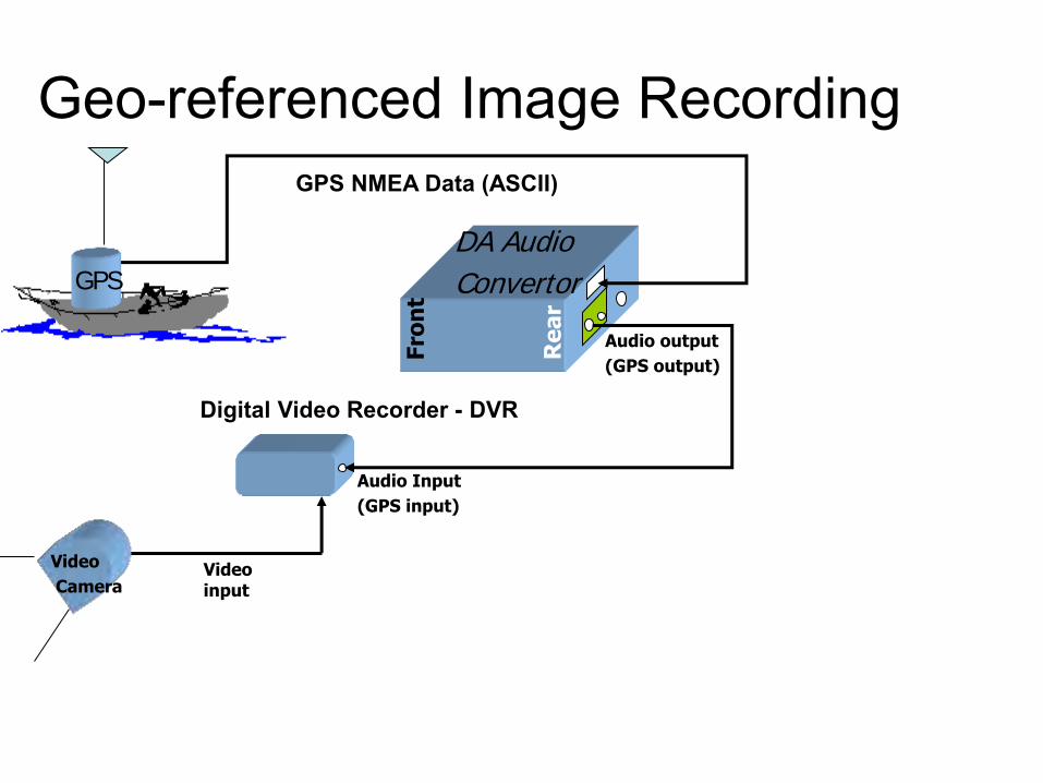
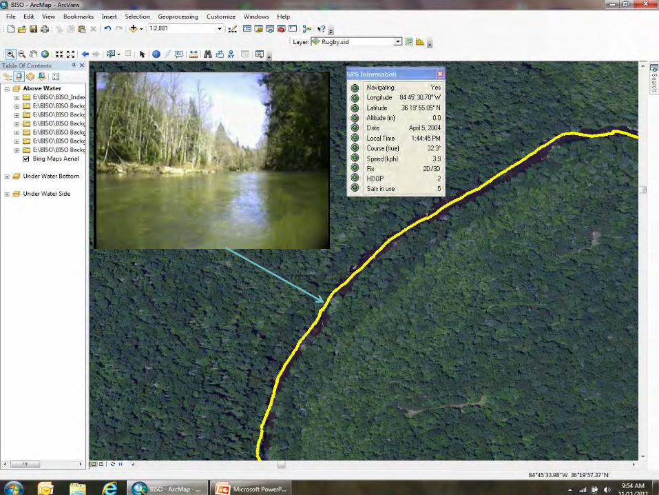
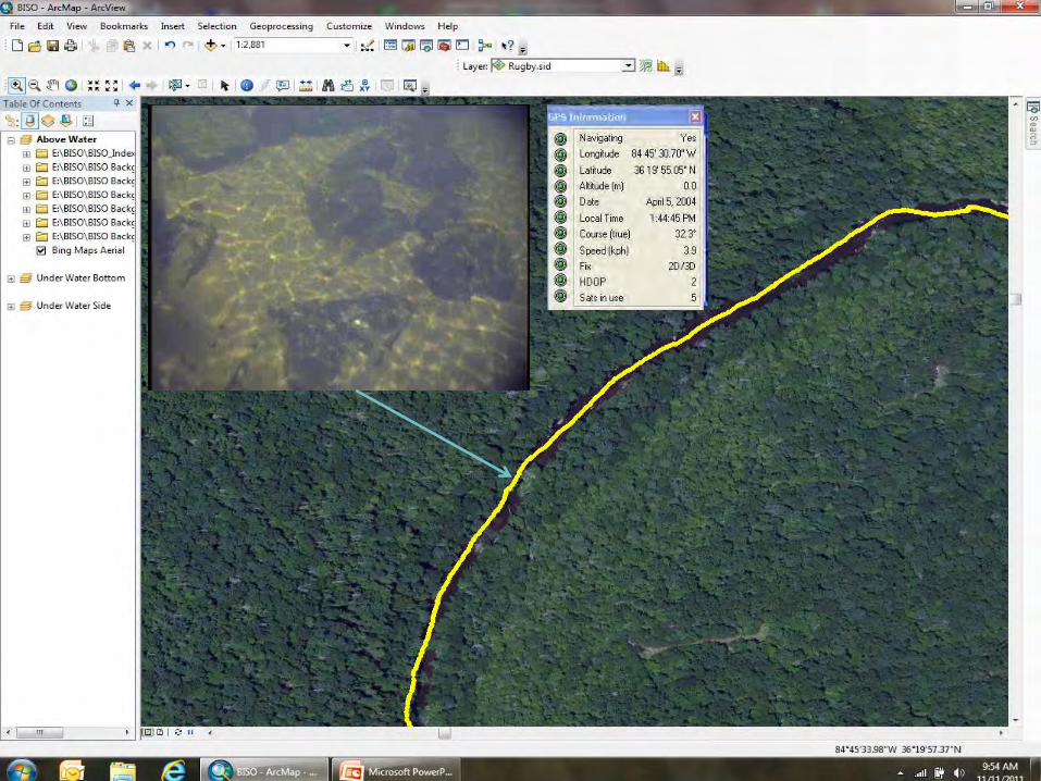
Geo-referenced Image Recording
DA Audio
Convertor
Audio output
(GPS output)
Audio Input
(GPS input)
Re
ar
Fro
nt
GPS
Video input
Video
Camera
Digital Video Recorder - DVR
GPS NMEA Data (ASCII)
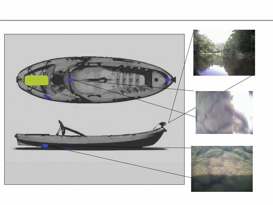
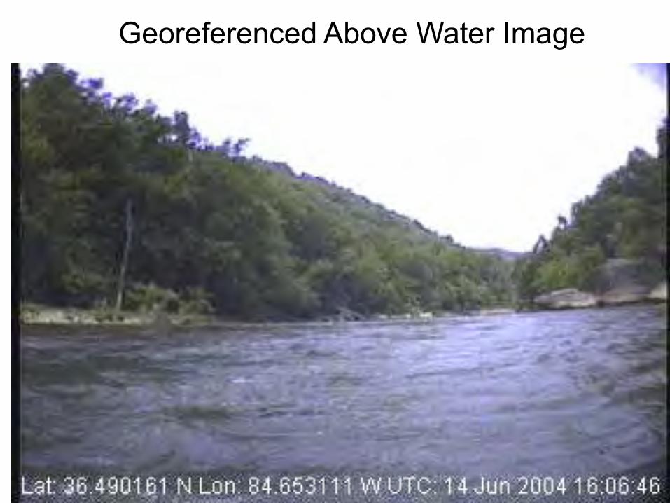
Georeferenced Above Water Image
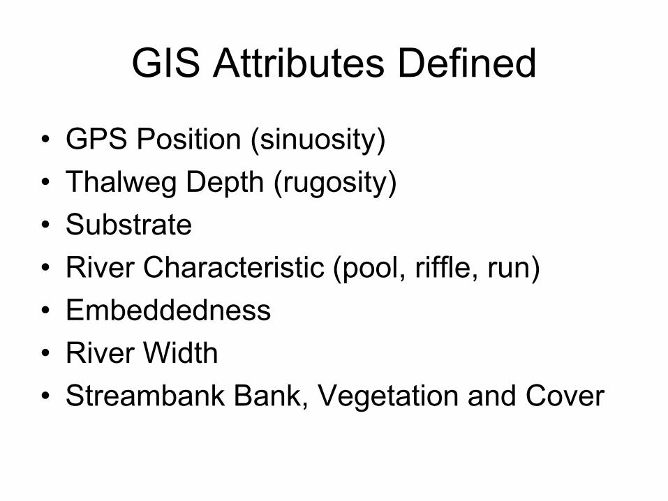
GIS Attributes Defined
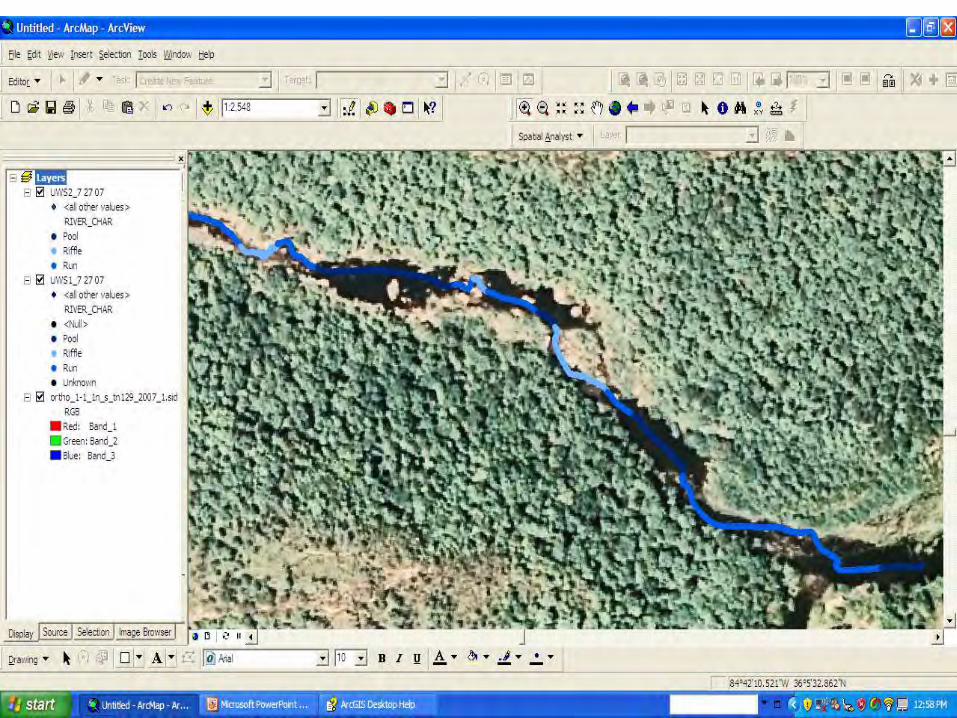
• GPS Position (sinuosity) • Thalweg Depth (rugosity) • Substrate • River Characteristic (pool, riffle, run) • Embeddedness • River Width • Streambank Bank, Vegetation and Cover
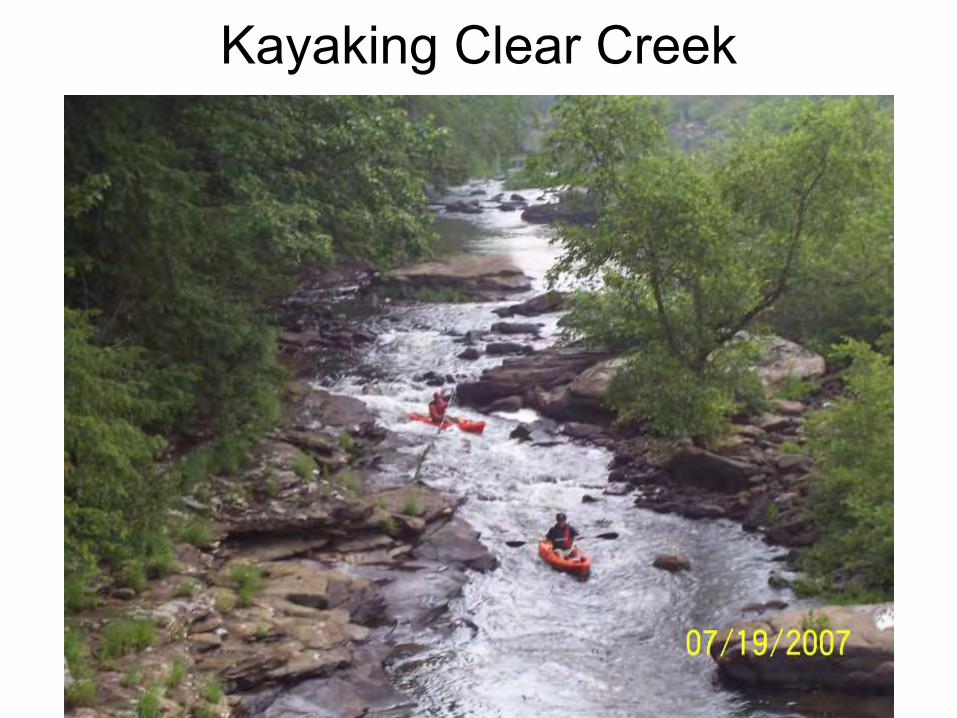
Kayaking Clear Creek
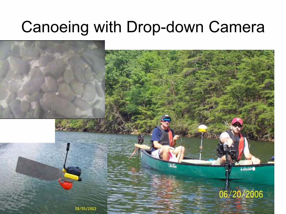
Canoeing with Drop-down Camera
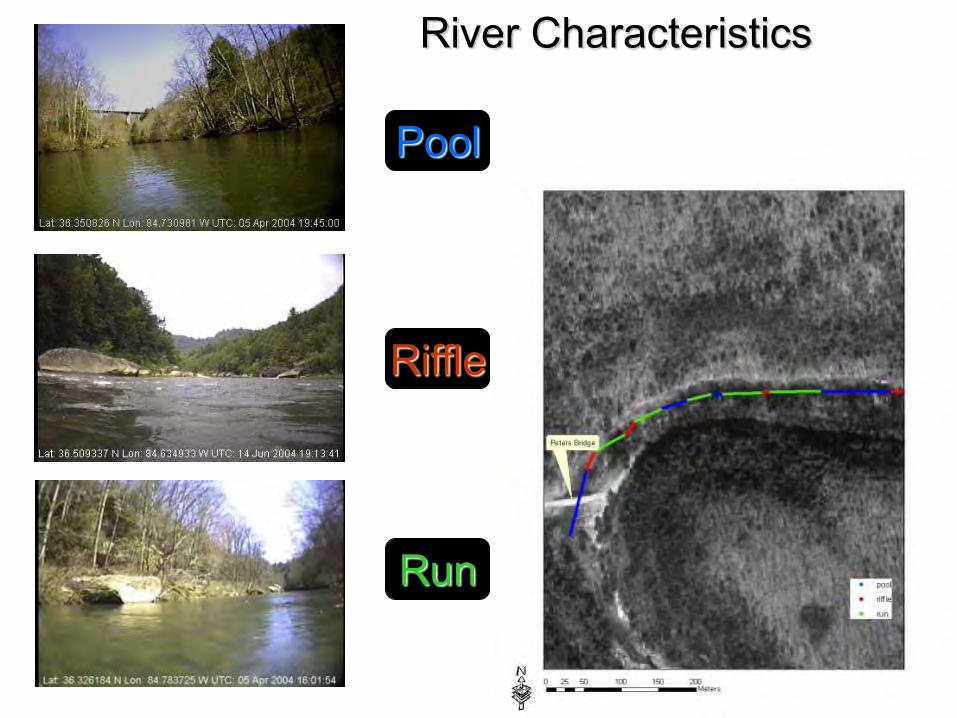
Riffle
Run
Pool
River Characteristics
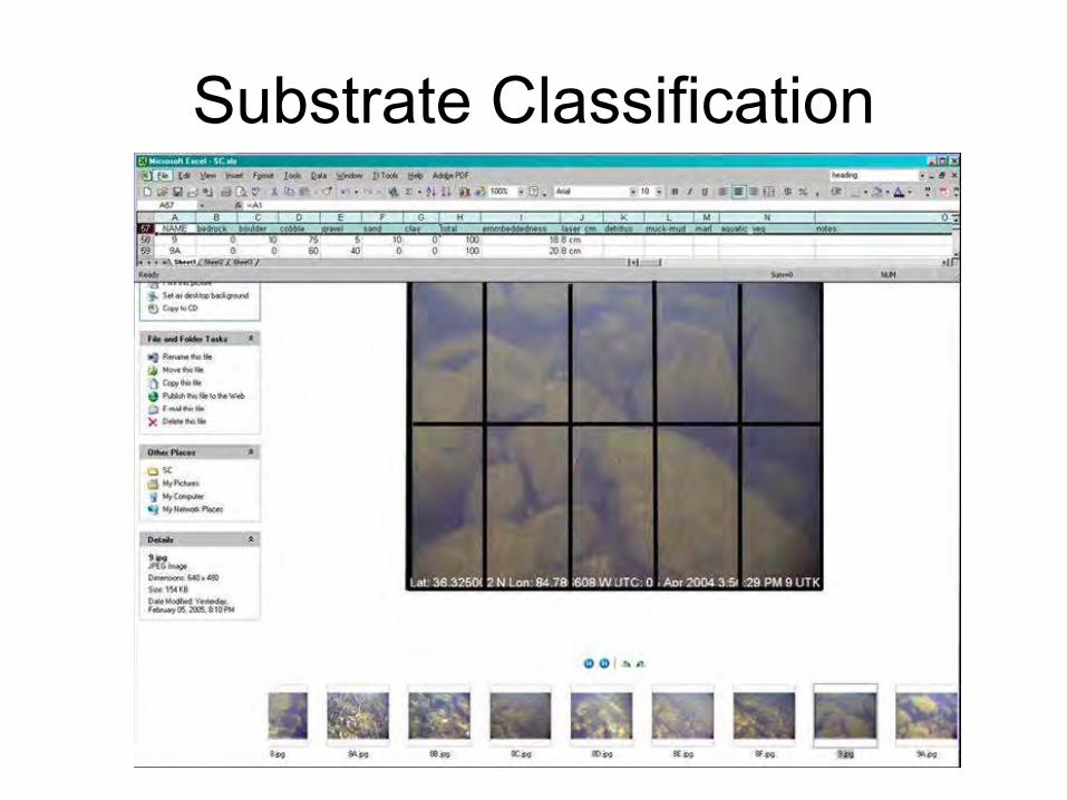
Substrate Classification
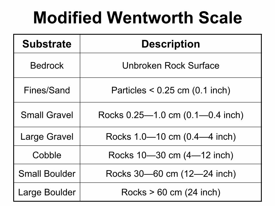
Modified Wentworth Scale Substrate Description
Bedrock Unbroken Rock Surface
Fines/Sand Particles < 0.25 cm (0.1 inch)
Small Gravel Rocks 0.25—1.0 cm (0.1—0.4 inch)
Large Gravel Rocks 1.0—10 cm (0.4—4 inch)
Cobble Rocks 10—30 cm (4—12 inch)
Small Boulder Rocks 30—60 cm (12—24 inch)
Large Boulder Rocks > 60 cm (24 inch)
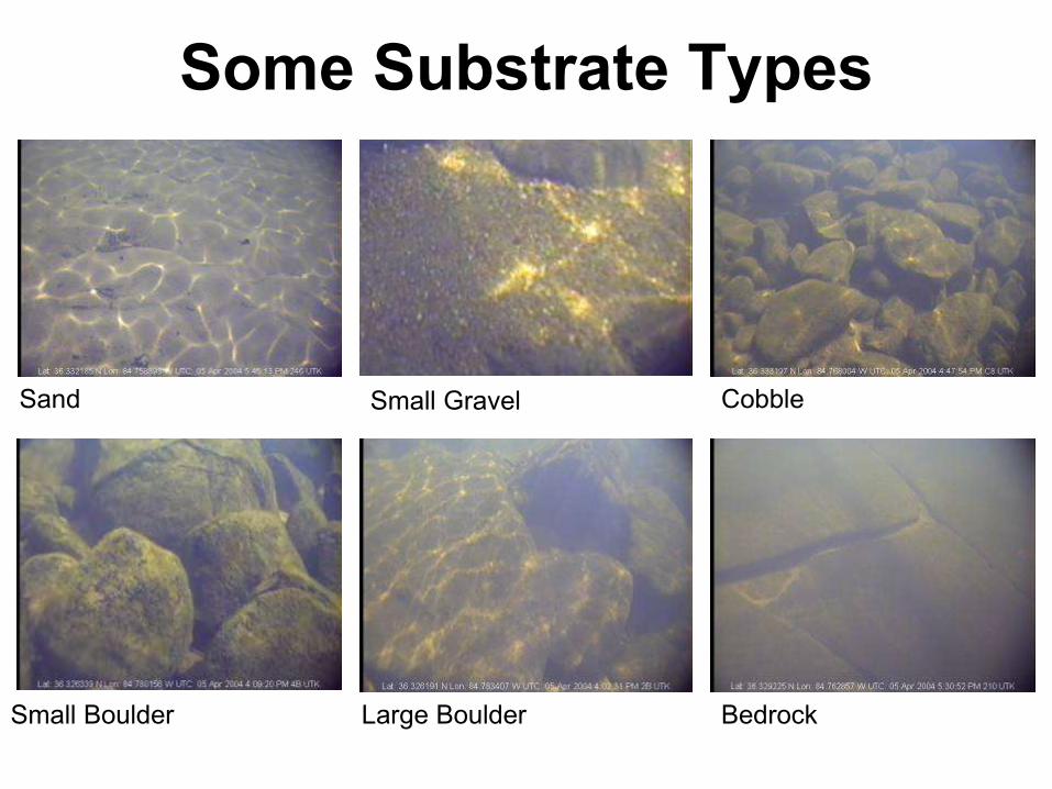
Sand Small Gravel Cobble
Small Boulder Large Boulder Bedrock
Some Substrate Types
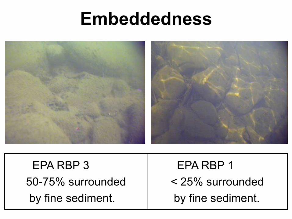
Embeddedness
EPA RBP 3 50-75% surrounded by fine sediment.
EPA RBP 1 < 25% surrounded by fine sediment.
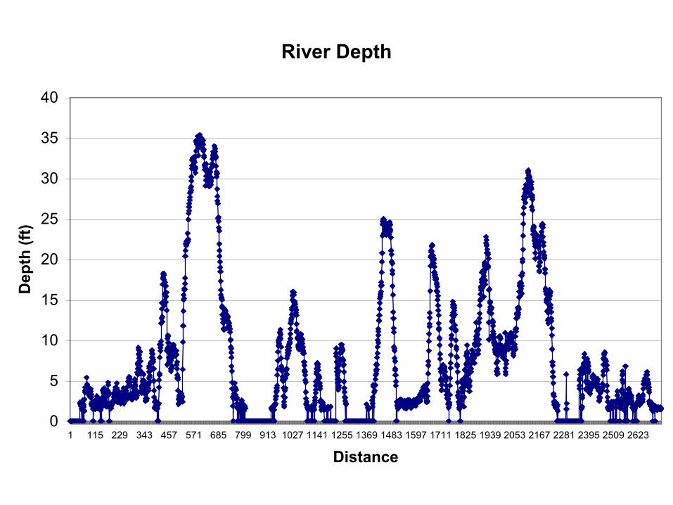
River Depth
0
5
10
15
20
25
30
35
40
1 115 229 343 457 571 685 799 913 1027 1141 1255 1369 1483 1597 1711 1825 1939 2053 2167 2281 2395 2509 2623
Distance
Dep
th (f
t)
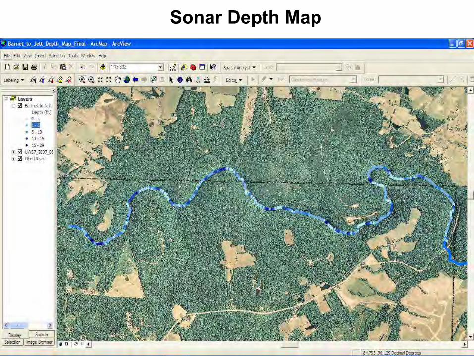
Sonar Depth Map
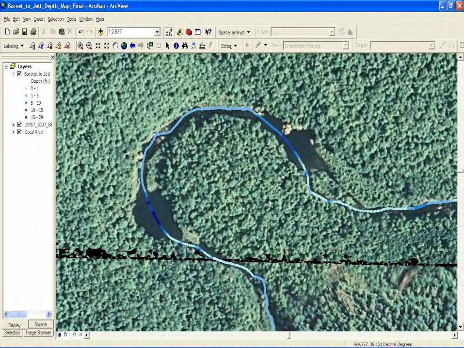
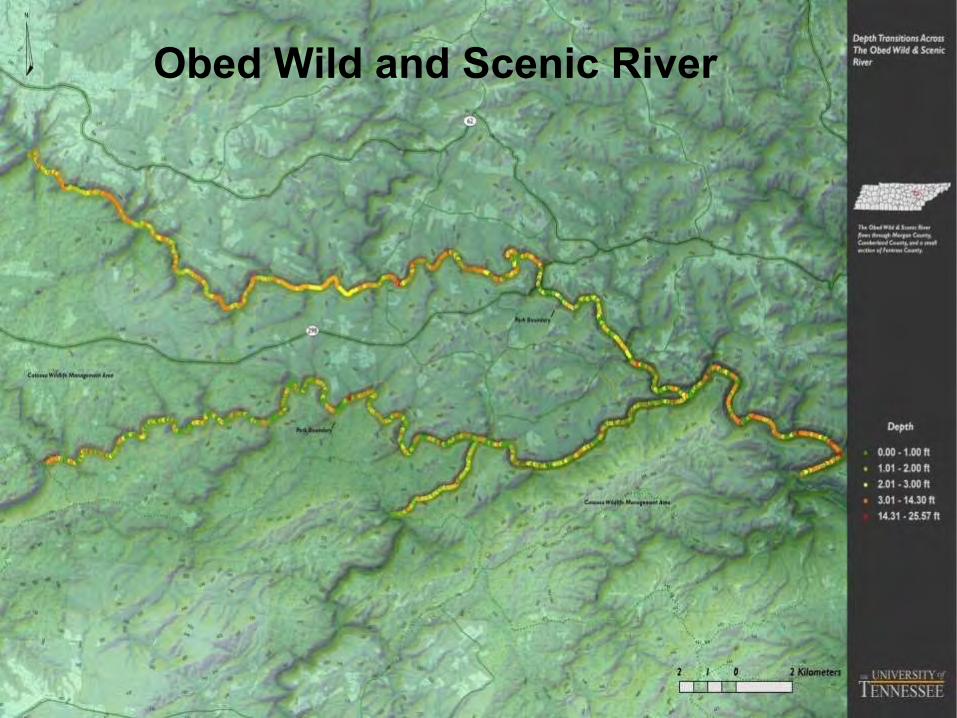
Obed Wild and Scenic River
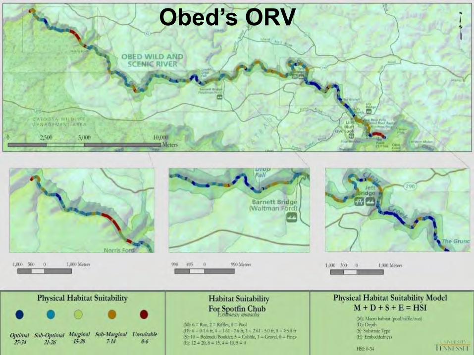
Obed’s ORV
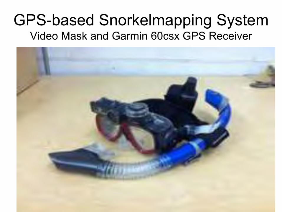
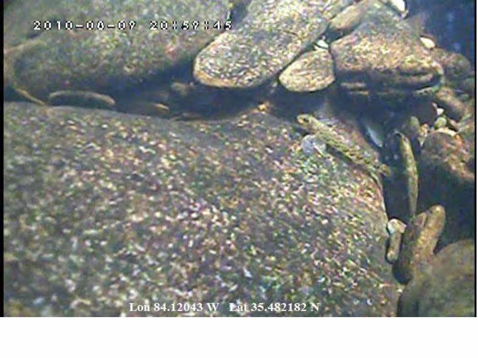
GPS-based Snorkelmapping System Video Mask and Garmin 60csx GPS Receiver
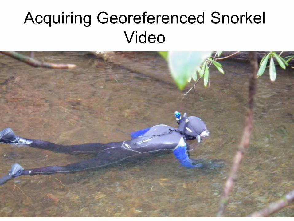
Acquiring Georeferenced Snorkel Video
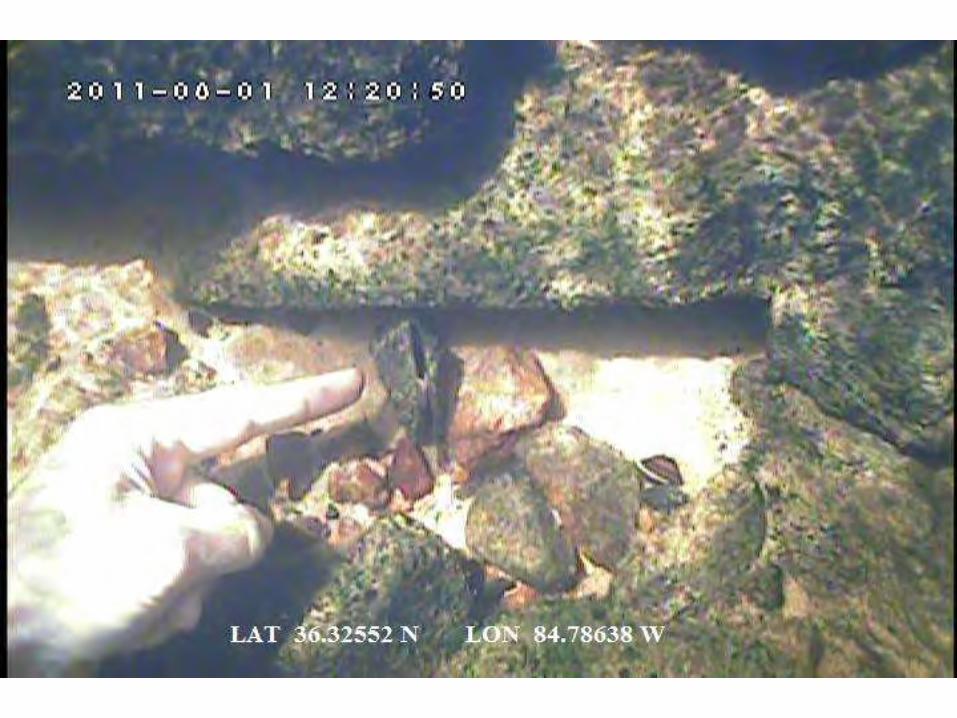
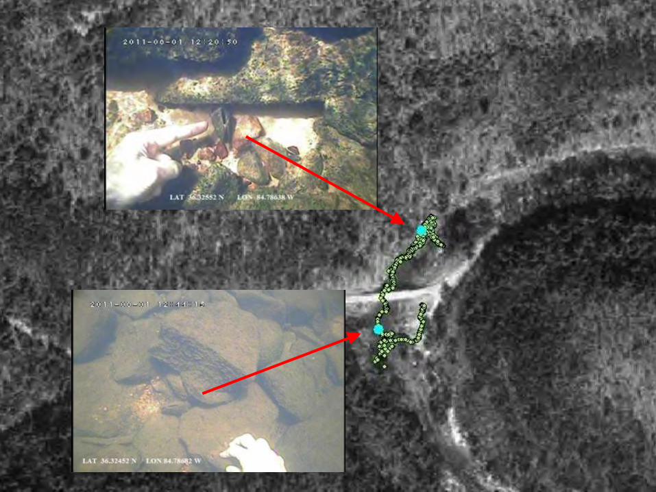
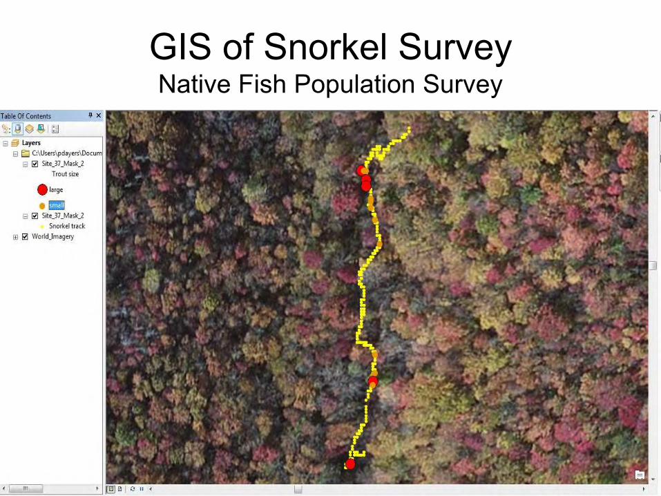
GIS of Snorkel Survey Native Fish Population Survey
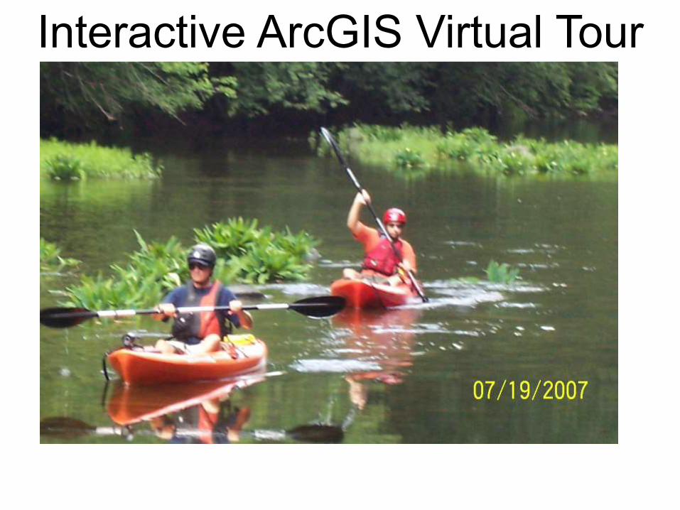
Interactive ArcGIS Virtual Tour
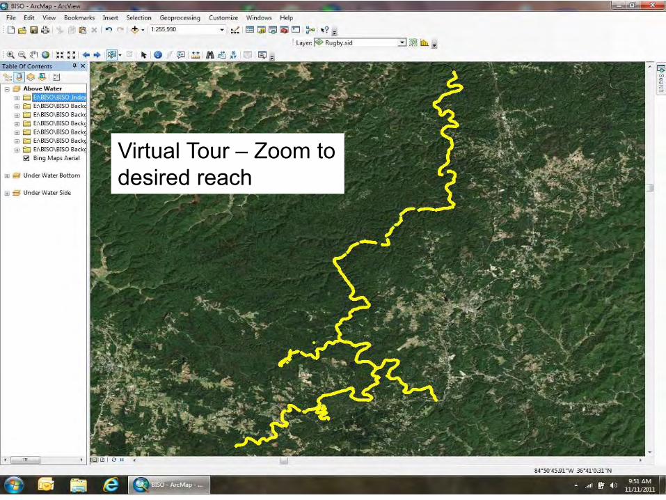
Virtual Tour – Zoom to desired reach
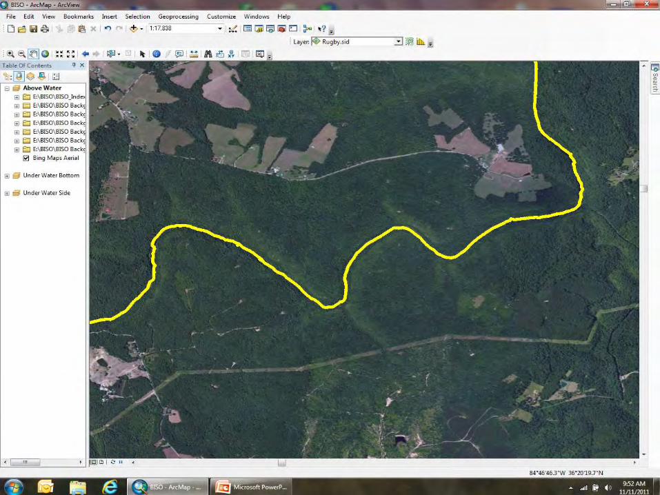
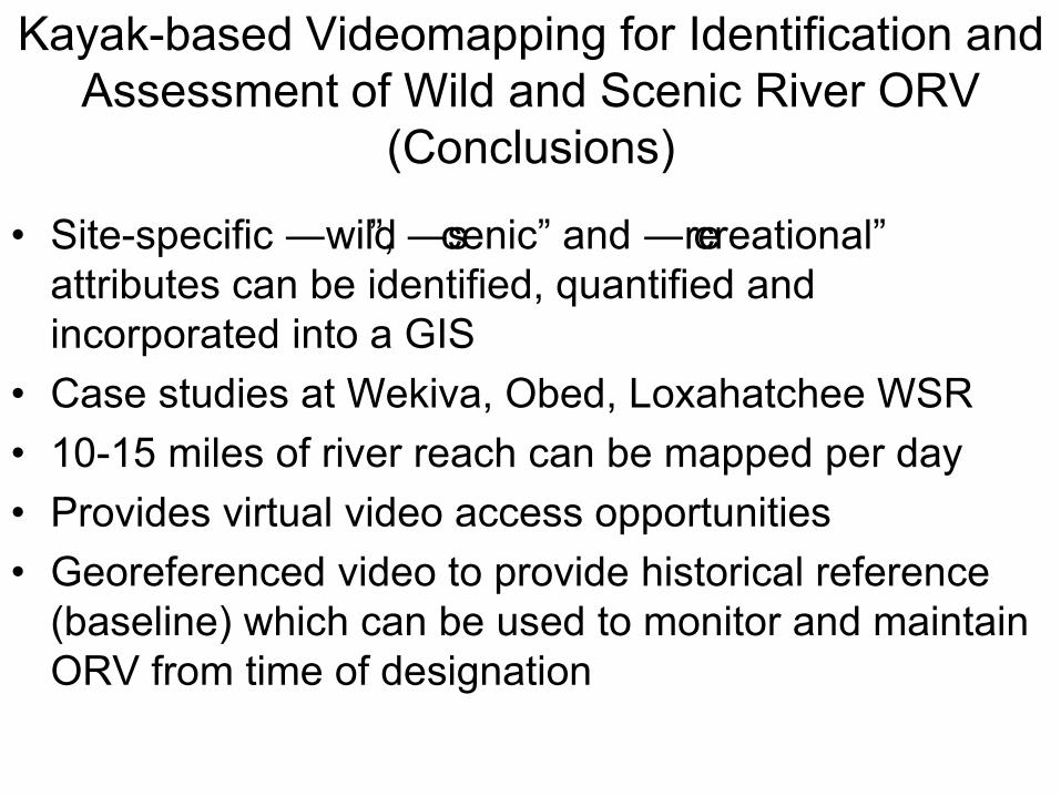
Kayak-based Videomapping for Identification and Assessment of Wild and Scenic River ORV
(Conclusions) • Site-specific ―wild‖, ―scenic‖ and ―recreational‖
attributes can be identified, quantified and incorporated into a GIS
• Case studies at Wekiva, Obed, Loxahatchee WSR • 10-15 miles of river reach can be mapped per day • Provides virtual video access opportunities • Georeferenced video to provide historical reference
(baseline) which can be used to monitor and maintain ORV from time of designation