Embed Size (px)
Citation preview
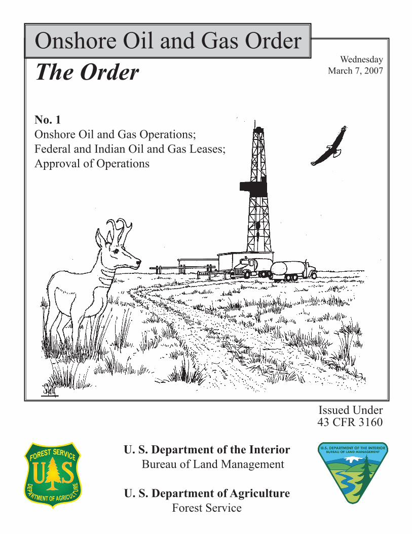
Onshore Oil and Gas Order
No. 1Onshore Oil and Gas Operations;Federal and Indian Oil and Gas Leases;Approval of Operations
Wednesday March 7, 2007
Issued Under43 CFR 3160
U. S. Department of the Interior Bureau of Land Management
U. S. Department of AgricultureForest Service
The Order


10330 Federal Register / Vol. 72, No. 44 / Wednesday, March 7, 2007 / Rules and Regulations
Authorization needed for support facilities, conducted before the approval of the APD or Surface Use Plan of Operations and construction activities.
Private Surface Owner means a non- Federal or non-state owner of the surface estate and includes any Indian owner of surface estate not held in trust by the United States.
Reclamation means returning disturbed land as near to its predisturbed condition as is reasonably practical.
Split Estate means lands where the surface is owned by an entity or person other than the owner of the Federal or Indian oil and gas.
Surface Managing Agency means any Federal or state agency having jurisdiction over the surface overlying Federal or Indian oil and gas.
Variance means an approved alternative to a provision or standard of an Order or Notice to Lessee.
III. Application for Permit To Drill (APD)
An Application for Permit to Drill or Reenter, on Form 3160–3, is required for each proposed well, and for reentry of existing wells (including disposal and service wells), to develop an onshore lease for Federal or Indian oil and gas.
A. Where To File
The operator must file an APD or any other required documents in the BLM Field Office having jurisdiction over the lands described in the application. As an alternative to filing in a local BLM office, an operator may file an APD using the BLM’s electronic commerce application for oil and gas permitting and reporting. Contact the local BLM Field Office for details before using the electronic commerce application.
B. Early Notification
The operator may wish to contact the BLM and any applicable Surface Managing Agency, as well as all private surface owners, to request an initial planning conference as soon as the operator has identified a potential area of development. Early notification is voluntary and would precede the Notice of Staking option or filing of an APD. It allows the involved Surface Managing Agency or private surface owner to apprise the prospective operator of any unusual conditions on the lease area. Early notification also provides both the Surface Managing Agency or private surface owner and the prospective operator with the earliest possible identification of seasonal restrictions and determination of potential areas of conflict. The prospective operator should have a map of the proposed
project available for Surface Managing Agency review to determine if a cultural or biological inventory or other information may be required. Inventories are not the responsibility of the operator.
C. Notice of Staking Option Before filing an APD or Master
Development Plan, the operator may file a Notice of Staking with the BLM. The purpose of the Notice of Staking is to provide the operator with an opportunity to gather information to better address site-specific resource concerns while preparing the APD package. This may expedite approval of the APD. Attachment I, Sample Format for Notice of Staking, provides the information required for the Notice of Staking option.
For Federal lands managed by other Surface Managing Agencies, the BLM will provide a copy of the Notice of Staking to the appropriate Surface Managing Agency office. In Alaska, when a subsistence stipulation is part of the lease, the operator must also send a copy of the Notice of Staking to the appropriate Borough and/or Native Regional or Village Corporation.
Within 10 days of receiving the Notice of Staking, the BLM or the FS will review it for required information and schedule a date for the onsite inspection. The onsite inspection will be conducted as soon as weather and other conditions permit. The operator must stake the proposed drill pad and ancillary facilities, and flag new or reconstructed access routes, before the onsite inspection. The staking must include a center stake for the proposed well, two reference stakes, and a flagged access road centerline. Staking activities are considered casual use unless the particular activity is likely to cause more than negligible disturbance or damage. Off-road vehicular use for the purposes of staking is casual use unless, in a particular case, it is likely to cause more than negligible disturbance or damage, or otherwise prohibited.
On non-NFS lands, the BLM will invite the Surface Managing Agency and private surface owner, if applicable, to participate in the onsite inspection. If the surface is privately owned, the operator must furnish to the BLM the name, address, and telephone number of the surface owner if known. All parties who attend the onsite inspection will jointly develop a list of resource concerns that the operator must address in the APD. The operator will be provided a list of these concerns either during the onsite inspection or within 7 days of the onsite inspection. Surface owner concerns will be considered to
the extent practical within the law. Failure to submit an APD within 60 days of the onsite inspection will result in the Notice of Staking being returned to the operator.
D. Components of a Complete APD Package
Operators are encouraged to consider and incorporate Best Management Practices into their APDs because Best Management Practices can result in reduced processing times and reduced number of Conditions of Approval. An APD package must include the following information that will be reviewed by technical specialists of the appropriate agencies to determine the technical adequacy of the package:
1. A Completed Form 3160–3; And
2. Well Plat
Operators must include in the APD package a well plat and geospatial database prepared by a registered surveyor depicting the proposed location of the well and identifying the points of control and datum used to establish the section lines or metes and bounds. The purpose of this plat is to ensure that operations are within the boundaries of the lease or agreement and that the depiction of these operations is accurately recorded both as to location (latitude and longitude) and in relation to the surrounding lease or agreement boundaries (public land survey corner and boundary ties). The registered surveyor should coordinate with the cadastral survey division of the appropriate BLM State Office, particularly where the lands have not been surveyed under the Public Land Survey System.
The plat and geospatial database must describe the location of operations in:
• Geographical coordinates referenced to the National Spatial Reference System, North American Datum 1983 or latest edition; and
• In feet and direction from the nearest two adjacent section lines, or, if not within the Rectangular Survey System, the nearest two adjacent property lines, generated from the BLM’s current Geographic Coordinate Data Base.
The surveyor who prepared the plat must sign it, certifying that the location has been staked on the ground as shown on the plat.
a. Surveying and staking are necessary casual uses, typically involving negligible surface disturbance. The operator is responsible for making access arrangements with the appropriate Surface Managing Agency (other than the BLM and the FS) or
VerDate Aug<31>2005 18:43 Mar 06, 2007 Jkt 211001 PO 00000 Frm 00024 Fmt 4701 Sfmt 4700 E:\FR\FM\07MRR2.SGM 07MRR2yche
rry
on P
RO
D1P
C64
with
RU
LES
2
10331 Federal Register / Vol. 72, No. 44 / Wednesday, March 7, 2007 / Rules and Regulations
private surface owner. On tribal or allotted lands, the operator must contact the appropriate office of the BIA to make access arrangements with the Indian surface owners. In the event that not all of the Indian owners consent or may be located, but a majority of those who can be located consent, or the owners of interests are so numerous that it would be impracticable to obtain their consent and the BIA finds that the issuance of the APD will cause no substantive injury to the land or any owner thereof, the BIA may approve access. Typical off-road vehicular use, when conducted in conjunction with these activities, is a necessary action for obtaining a permit and may be done without advance approval from the Surface Managing Agency, except for:
• Lands administered by the Department of Defense;
• Other lands used for military purposes;
• Indian lands; or • Where more than negligible surface
disturbance is likely to occur or is otherwise prohibited.
b. No entry on split estate lands for surveying and staking should occur without the operator first making a good faith effort to notify the surface owner. Also, operators are encouraged to notify the BLM or the FS, as appropriate, before entering private lands to stake for Federal mineral estate locations.
3. Drilling Plan
With each copy of Form 3160–3, the operator must submit to the BLM either a Drilling Plan or reference a previously submitted field-wide drilling plan (a drilling plan that can be used for all the wells in a field, any differences for specific wells will be described in the APD specific to that well). The Drilling Plans must be in sufficient detail to permit a complete appraisal of the technical adequacy of, and environmental effects associated with, the proposed project. The Drilling Plan must adhere to the provisions and standards of Onshore Oil and Gas Order Number 2 (see 53 FR 46790) (Order 2) and, if applicable, Onshore Oil and Gas Order Number 6 (see 55 FR 48958) (Order 6), and must include the following information:
a. Names and estimated tops of all geologic groups, formations, members, or zones.
b. Estimated depth and thickness of formations, members, or zones potentially containing usable water, oil, gas, or prospectively valuable deposits of other minerals that the operator expects to encounter, and the operator’s plans for protecting such resources.
c. The operator’s minimum specifications for blowout prevention equipment and diverter systems to be used, including size, pressure rating, configuration, and the testing procedure and frequency. Blowout prevention equipment must meet the minimum standards outlined in Order 2.
d. The operator’s proposed casing program, including size, grade, weight, type of thread and coupling, the setting depth of each string, and its condition. The operator must include the minimum design criteria, including casing loading assumptions and corresponding safety factors for burst, collapse, and tensions (body yield and joint strength). The operator must also include the lengths and setting depth of each casing when a tapered casing string is proposed. The hole size for each well bore section of hole drilled must be included. Special casing designs such as the use of coiled tubing or expandable casing may necessitate additional information.
e. The estimated amount and type(s) of cement expected to be used in the setting of each casing string. If stage cementing will be used, provide the setting depth of the stage tool(s) and amount and type of cement, including additives, to be used for each stage. Provide the yield of each cement slurry and the expected top of cement, with excess, for each cemented string or stage.
f. Type and characteristics of the proposed circulating medium or mediums proposed for the drilling of each well bore section, the quantities and types of mud and weighting material to be maintained, and the monitoring equipment to be used on the circulating system. The operator must submit the following information when air or gas drilling is proposed:
• Length, size, and location of the blooie line, including the gas ignition and dust suppression systems;
• Location and capacity of the compressor equipment, including safety devices, describe the distance from the well bore, and location within the drill site; and
• Anticipated amounts, types, and other characteristics as defined in this section, of the stand by mud or kill fluid and associated circulating equipment.
g. The testing, logging, and coring procedures proposed, including drill stem testing procedures, equipment, and safety measures.
h. The expected bottom-hole pressure and any anticipated abnormal pressures, temperatures, or potential hazards that the operator expects to encounter, such as lost circulation and hydrogen sulfide (see Order 6 for information on
hydrogen sulfide operations). A description of the operator’s plans for mitigating such hazards must be included.
i. Any other facets of the proposed operation that the operator would like the BLM to consider in reviewing the application. Examples include, but are not limited to:
• For directional wells, proposed directional design, plan view, and vertical section in true vertical and measured depths;
• Horizontal drilling; and • Coil tubing operations.
4. Surface Use Plan of Operations
The Surface Use Plan of Operations must:
• Describe the access road(s) and drill pad, the construction methods that the operator plans to use, and the proposed means for containment and disposal of all waste materials;
• Provide for safe operations, adequate protection of surface resources, groundwater, and other environmental components;
• Include adequate measures for stabilization and reclamation of disturbed lands;
• Describe any Best Management Practices the operator plans to use; and
• Where the surface is privately owned, include a certification of Surface Access Agreement or an adequate bond, as described in Section VI. of this Order.
All maps that are included in the Surface Use Plan of Operations must be of a scale no smaller than 1:24,000, unless otherwise stated below. Geospatial vector and raster data must include appropriate attributes and metadata. Georeferenced raster images must be from the same source as hardcopy plats and maps submitted in the APD package. All proposed on-lease surface disturbance must be surveyed and staked as described below in items a through l, including:
• The well location; • Two 200-foot (61-meter) directional
reference stakes; • The exterior pad dimensions; • The reserve pit; • Cuts and fills; • Outer limits of the area to be
disturbed (catch points); and • Any off-location facilities. Proposed new roads require
centerline flagging with stakes clearly visible from one to the next. In rugged terrain, cut and fill staking and/or slopestaking of proposed new access roads and locations for ancillary facilities that may be necessary, as determined by the BLM or the FS.
The onsite inspection will not occur until the required surveying and staking
VerDate Aug<31>2005 18:43 Mar 06, 2007 Jkt 211001 PO 00000 Frm 00025 Fmt 4701 Sfmt 4700 E:\FR\FM\07MRR2.SGM 07MRR2yche
rry
on P
RO
D1P
C64
with
RU
LES
2

10332 Federal Register / Vol. 72, No. 44 / Wednesday, March 7, 2007 / Rules and Regulations
is complete, and any new access road(s) have been flagged, unless a variance is first granted under Section X. of this Order.
Information required by the Surface Use Plan of Operations may be shown on the same map if it is appropriately labeled or on separate diagrams or maps and must include the following:
a. Existing Roads: The operator must submit a legible map such as a highway or county road, United States Geological Survey (USGS) topographic, Alaska Borough, or other such map that shows the proposed well site and access route to the proposed well in relation to a town, village, or other locatable public access point.
1. The operator must improve or maintain existing roads in a condition the same as or better than before operations began. The operator must provide any plans for improvement and/ or maintenance of existing roads. The information provided by the operator for construction and use of roads will be used by the BLM for any Right-of-Way application, as described in Section V. of this Order. The operator may use existing terrain and two-track trails, where appropriate, to assure environmental protection. The operator should consider using Best Management Practices in improving or maintaining existing roads.
2. The operator may use existing roads under the jurisdiction of the FS for access if they meet the transportation objectives of the FS. When access involves the use of existing roads, the FS may require that the operator contribute to road maintenance. This is usually authorized by a Road Use Permit or a joint road use agreement. The FS will charge the operator a pro rata share of the costs of road maintenance and improvement, based upon the anticipated use of the road.
b. New or Reconstructed Access Roads: The operator must identify on a map all permanent and temporary access roads that it plans to construct or reconstruct in connection with the drilling of the proposed well. Locations of all existing and proposed road structures (culverts, bridges, low water crossings, etc.) must be shown. The proposed route to the proposed drill site must be shown, including distances from the point where the access route exits established roads. All permanent and temporary access roads must be located and designed to meet the applicable standards of the appropriate Surface Managing Agency, and be consistent with the needs of the operator. The operator should consider using Best Management Practices in designing and constructing roads.
The operator must design roads based upon the class or type of road, the safety requirements, traffic characteristics, environmental conditions, and the vehicles the road is expected to carry. The operator must describe for all road construction or reconstruction:
• Road width; • Maximum grade; • Crown design; • Turnouts; • Drainage and ditch design; • On-site and off-site erosion control; • Revegetation of disturbed areas; • Location and size of culverts and/or
bridges; • Fence cuts and/or cattleguards; • Major cuts and fills; • Source and storage of topsoil; and • Type of surfacing materials, if any,
that will be used. c. Location of Existing Wells: The
operator must include a map and may include a geospatial database that includes all known wells, regardless of the well status (producing, abandoned, etc.), within a one-mile radius of the proposed location.
d. Location of Existing and/or Proposed Production Facilities: The operator must include a map or diagram of facilities planned either on or off the well pad that shows, to the extent known or anticipated, the location of all production facilities and lines likely to be installed if the well is successfully completed for production.
The map or diagram and optional geospatial database must show and differentiate between proposed and existing flow lines, overhead and buried power lines, and water lines. If facilities will be located on the well pad, the information should be consistent with the layout provided in item i. of this section.
The operator must show the dimensions of the facility layouts for all new construction. This information may be used by the BLM or the FS for Right- of-Way or Special Use Authorization application information, as specified in Section V. of this Order.
If the operator has not developed information regarding production facilities, it may defer submission of that information until a production well is completed, in which case the operator will follow the procedures in Section VIII. of this Order. However, for purposes of NEPA analysis, the BLM or the FS will need a reasonable estimate of the facilities to be employed.
e. Location and Types of Water Supply: Information concerning water supply, such as rivers, creeks, springs, lakes, ponds, and wells, may be shown by quarter-quarter section on a map or plat, or may be described in writing.
The operator must identify the source, access route, and transportation method for all water anticipated for use in drilling the proposed well. The operator must describe any newly constructed or reconstructed access roads crossing Federal or Indian lands that are needed to haul the water as provided in item b. of this section. The operator must indicate if it plans to drill a water supply well on the lease and, if so, the operator must describe the location, construction details, and expected production requirements, including a description of how water will be transported and procedures for well abandonment.
f. Construction Materials: The operator must state the character and intended use of all construction materials, such as sand, gravel, stone, and soil material. The proposed source must be shown on a quarter-quarter section of a map or plat or in a written description.
g. Methods for Handling Waste: The Surface Use Plan of Operations must contain a written description of the methods and locations proposed for safe containment and disposal of each type of waste material (e.g., cuttings, garbage, salts, chemicals, sewage, etc.) that results from drilling the proposed well. The narrative must include plans for the eventual disposal of drilling fluids and any produced oil or water recovered during testing operations. The operator must describe plans for the construction and lining, if necessary, of the reserve pit.
h. Ancillary Facilities: The operator must identify on a map the location and construction methods and materials for all anticipated ancillary facilities such as camps, airstrips, and staging areas. The operator must stake on the ground the approximate center of proposed camps and the centerline of airstrips. If the ancillary facilities are located off- lease, depending on Surface Managing Agency policy, the BLM or the FS may require the operator to obtain an additional authorization, such as a Right-of-Way or Special Use Authorization.
i. Well Site Layout: A diagram of the well site layout must have an arrow indicating the north direction. Diagrams with cuts and fills must be surveyed, designed, drawn, digitized, and certified by licensed professional surveyors or engineers. The operator must submit a plat of a scale of not less than 1 inch = 50 feet showing the location and orientation of:
• The proposed drill pad; • Reserve pit/blooie line/flare pit
location;
VerDate Aug<31>2005 18:43 Mar 06, 2007 Jkt 211001 PO 00000 Frm 00026 Fmt 4701 Sfmt 4700 E:\FR\FM\07MRR2.SGM 07MRR2yche
rry
on P
RO
D1P
C64
with
RU
LES
2
10333 Federal Register / Vol. 72, No. 44 / Wednesday, March 7, 2007 / Rules and Regulations
• Access road entry points and their approximate location with respect to topographic features and with cross section diagrams of the drill pad; and
• The reserve pit showing all cuts and fills and the relation to topography.
The plat must also include the approximate proposed location and orientation of the:
• Drilling rig; • Dikes and ditches to be constructed;
and • Topsoil and/or spoil material
stockpiles. j. Plans for Surface Reclamation: The
operator must submit a plan for the surface reclamation or stabilization of all disturbed areas. This plan must address interim (during production) reclamation for the area of the well pad not needed for production, as well as final abandonment of the well location. Such plans must include, as appropriate:
• Configuration of the reshaped topography;
• Drainage systems; • Segregation of spoil materials
(stockpiles); • Surface disturbances; • Backfill requirements; • Proposals for pit/sump closures; • Redistribution of topsoil; • Soil treatments; • Seeding or other steps to reestablish
vegetation; • Weed control; and • Practices necessary to reclaim all
disturbed areas, including any access roads and pipelines.
The operator may amend this reclamation plan at the time of abandonment. Further details for reclamation are contained in Section XII. of this Order.
k. Surface Ownership: The operator must indicate (in a narrative) the surface ownership at the well location, and of all lands crossed by roads that the operator plans to construct or upgrade, including, if known, the name of the agency or owner, phone number, and address. The operator must certify that they have provided a copy of the Surface Use Plan of Operations required in this section to the private surface owner of the well site location, if applicable, or that they made a good faith effort if unable to provide the document to the surface owner.
l. Other Information: The operator must include other information required by applicable orders and notices (43 CFR 3162.3–1(d)(4)). When an integrated pest management program is needed for weed or insect control, the operator must coordinate plans with state or local management agencies and include the pest management program
in the Surface Use Plan of Operations. The BLM also encourages the operator to submit any additional information that may be helpful in processing the application.
5. Bonding
a. Most bonding needs for oil and gas operations on Federal leases are discussed in 43 CFR subpart 3104. The operator must obtain a bond in its own name as principal, or a bond in the name of the lessee or sublessee. If the operator uses the lessee or sublessee’s bond, the operator must furnish a rider (consent of surety and principal) that includes the operator under the coverage of the bond. The operator must specify on the APD, Form 3160–3, the type of bond and bond number under which the operations will be conducted.
For Indian oil and gas, the appropriate provisions at 25 CFR Subchapter I, govern bonding.
Under the regulations at 43 CFR 3104.5 and 36 CFR 228.109, the BLM or the FS may require additional bond coverage for specific APDs. Other factors that the BLM or the FS may consider include:
• History of previous violations; • Location and depth of wells; • The total number of wells involved; • The age and production capability
of the field; and • Unique environmental issues. These bonds may be in addition to
any statewide, nationwide, or separate lease bond already applicable to the lease. In determining the bond amount, the BLM may consider impacts of activities on both Federal and non- Federal lands required to develop the lease that impact lands, waters, and other resources off the lease.
Separate bonds may be required for associated Rights-of-Way and/or Special Use Authorizations that authorize activities not covered by the approved APD.
b. On Federal leases, operators may request a phased release of an individual lease bond. The BLM will grant this reduction after reclamation of some portion of the lease only if the operator:
• Has satisfied the terms and conditions in the plan for surface reclamation for that particular operation; and
• No longer has any down-hole liability.
c. If appropriate, the BLM may reduce the bond in the amount requested by the operator or appropriate Surface Managing Agency. The FS also may reduce bonds it requires (but not the BLM-required bonds). The BLM and the FS will base the amount of the bond
reduction on a calculation of the sum that is sufficient to cover the remaining operations (including royalty payments) and abandonment (including reclamation) as authorized by the Surface Use Plan of Operations.
6. Operator Certification
The operator must include its name, address, and telephone number, and the same information for its field representative, in the APD package. The following certification must carry the operator’s original signature or meet the BLM standards for electronic commerce:
I hereby certify that I, or someone under my direct supervision, have inspected the drill site and access route proposed herein; that I am familiar with the conditions which currently exist; that I have full knowledge of state and Federal laws applicable to this operation; that the statements made in this APD package are, to the best of my knowledge, true and correct; and that the work associated with the operations proposed herein will be performed in conformity with this APD package and the terms and conditions under which it is approved. I also certify that I, or the company I represent, am responsible for the operations conducted under this application. These statements are subject to the provisions of 18 U.S.C. 1001 for the filing of false statements. Executed this ll day oflllll, 20ll. Name lllllllllllllll
Position Title llllllllllll
Address llllllllllllll
Telephone lllllllllllll
Field representative (if not above signa-tory) llllllllllllllll
Address (if different from above) lll
Telephone (if different from above) ll
E-mail (optional) llllllllll
Agents not directly employed by the operator must submit a letter from the operator authorizing that agent to act or file this application on their behalf.
7. Onsite Inspection
The onsite inspection must be conducted before the APD will be considered complete.
E. APD Posting and Processing
1. Posting
The BLM and the Federal Surface Managing Agency, if other than the BLM, must provide at least 30 days public notice before the BLM may approve an APD or Master Development Plan on a Federal oil and gas lease. Posting is not required for an APD for an Indian oil and gas lease or agreement.
VerDate Aug<31>2005 18:43 Mar 06, 2007 Jkt 211001 PO 00000 Frm 00027 Fmt 4701 Sfmt 4700 E:\FR\FM\07MRR2.SGM 07MRR2yche
rry
on P
RO
D1P
C64
with
RU
LES
2

10334 Federal Register / Vol. 72, No. 44 / Wednesday, March 7, 2007 / Rules and Regulations
The BLM will post the APD or Notice of Staking in an area of the BLM Field Office having jurisdiction that is readily accessible to the public and, when possible, electronically on the internet. If the surface is managed by a Federal agency other than the BLM, that agency also is required to post the notice for at least 30 days. This would include the BIA where the surface is held in trust but the mineral estate is federally owned. The posting is for informational purposes only and is not an appealable decision. The purpose of the posting is to give any interested party notification that a Federal approval of mineral operations has been requested. The BLM or the FS will not post confidential information.
Reposting of the proposal may be necessary if the posted location of the proposed well is:
a. Moved to a different quarter-quarter section;
b. Moved more than 660 feet for lands that are not covered by a Public Land Survey; or
c. If the BLM or the FS determine that the move is substantial.
2. Processing The timeframes established in this
subsection apply to both individual APDs and to the multiple APDs included in Master Development Plans and to leases of Indian minerals as well as leases of Federal minerals.
If there is enough information to begin processing the application, the BLM (and the FS if applicable) will process it up to the point that missing information or uncorrected deficiencies render further processing impractical or impossible.
a. Within 10 days of receiving an application, the BLM (in consultation with the FS if the application concerns NFS lands) will notify the operator as to whether or not the application is complete. The BLM will request additional information and correction of any material submitted, if necessary, in the 10-day notification. If an onsite inspection has not been performed, the applicant will be notified that the application is not complete. Within 10 days of receiving the application, the BLM, in coordination with the operator and Surface Managing Agency, including the private surface owner in the case of split estate minerals, will schedule a date for the onsite inspection (unless the onsite inspection has already been conducted as part of a Notice of Staking). The onsite inspection will be held as soon as practicable based on participants’ schedules and weather conditions. The operator will be notified at the onsite inspection of any
additional deficiencies that are discovered during the inspection. The operator has 45 days after receiving notice from the BLM to provide any additional information necessary to complete the APD, or the APD may be returned to the operator.
b. Within 30 days after the operator has submitted a complete application, including incorporating any changes that resulted from the onsite inspection, the BLM will:
1. Approve the application, subject to reasonable Conditions of Approval, if the appropriate requirements of the NEPA, National Historic Preservation Act, Endangered Species Act, and other applicable law have been met and, if on NFS lands, the FS has approved the Surface Use Plan of Operations;
2. Notify the operator that it is deferring action on the permit; or
3. Deny the permit if it cannot be approved and the BLM cannot identify any actions that the operator could take that would enable the BLM to issue the permit or the FS to approve the Surface Use Plan of Operations, if applicable.
c. The notice of deferral in paragraph (b)(2) of this section must specify:
1. Any action the operator could take that would enable the BLM (in consultation with the FS if applicable) to issue a final decision on the application. The FS will notify the applicant of any action the applicant could take that would enable the FS to issue a final decision on the Surface Use Plan of Operations on NFS lands. Actions may include, but are not limited to, assistance with:
(A) Data gathering; and (B) Preparing analyses and
documents. 2. If applicable, a list of actions that
the BLM or the FS need to take before making a final decision on the application, including appropriate analysis under NEPA or other applicable law and a schedule for completing these actions.
d. The operator has 2 years from the date of the notice under paragraph (c)(1) of this section to take the action specified in the notice. If the appropriate analyses required by NEPA, National Historic Preservation Act, Endangered Species Act, and other applicable laws have been completed, the BLM (and the FS if applicable), will make a decision on the permit and the Surface Use Plan of Operations within 10 days of receiving a report from the operator addressing all of the issues or actions specified in the notice under paragraph (c)(1) of this section and certifying that all required actions have been taken. If the operator has not completed the actions specified in the
notice within 2 years from the operator’s receipt of the paragraph (c)(1) notice, the BLM will deny the permit.
e. For APDs on NFS lands, the decision to approve a Surface Use Plan of Operations or Master Development Plan may be subject to FS appeal procedures. The BLM cannot approve an APD until the appeal of the Surface Use Plan of Operations is resolved.
F. Approval of APDs
a.1. The BLM has the lead responsibility for completing the environmental review process, except in the case of NFS lands.
2. The BLM cannot approve an APD or Master Development Plan until the requirements of certain other laws and regulations including NEPA, the National Historic Preservation Act, and the Endangered Species Act have been met. The BLM must document that the needed reviews have been adequately conducted. In some cases, operators conduct these reviews, but the BLM remains responsible for their scope and content and makes its own evaluation of the environmental issues, as required by 40 CFR 1506.5(b).
3. The approved APD will contain Conditions of Approval that reflect necessary mitigation measures. In accordance with 43 CFR 3101.1–2 and 36 CFR 228.107, the BLM or the FS may require reasonable mitigation measures to ensure that the proposed operations minimize adverse impacts to other resources, uses, and users, consistent with granted lease rights. The BLM will incorporate any mitigation requirements, including Best Management Practices, identified through the APD review and appropriate NEPA and related analyses, as Conditions of Approval to the APD.
4. The BLM will establish the terms and Conditions of Approval for any associated Right-of-Way when the application is approved.
b. For NFS lands, the FS will establish the terms and Conditions of Approval for both the Surface Use Plan of Operations and any associated Surface Use Authorization. On NFS lands the FS has principal responsibility for compliance with NEPA, the National Historic Preservation Act, and the Endangered Species Act, but the BLM should be a cooperating or co-lead agency for this purpose and adopt the analysis as the basis for its decision.
After the FS notifies the BLM it has approved a Surface Use Plan of Operations on NFS lands, the BLM must approve the APD before the operator may begin any surface-disturbing activity.
VerDate Aug<31>2005 18:43 Mar 06, 2007 Jkt 211001 PO 00000 Frm 00028 Fmt 4701 Sfmt 4700 E:\FR\FM\07MRR2.SGM 07MRR2yche
rry
on P
RO
D1P
C64
with
RU
LES
2

10335 Federal Register / Vol. 72, No. 44 / Wednesday, March 7, 2007 / Rules and Regulations
c. On Indian lands, BIA has responsibility for approving Rights-of- Way.
d. In the case of Indian lands, the BLM may be a cooperating or co-lead agency for NEPA compliance or may adopt the NEPA analysis prepared by the BIA (516 DM 3).
G. Valid Period of Approved APD
1. An APD approval is valid for 2 years from the date that it is approved, or until lease expiration, whichever occurs first. If the operator submits a written request before the expiration of the original approval, the BLM, in coordination with the FS, as appropriate may extend the APD’s validity for up to 2 additional years.
2. The operator is responsible for reclaiming any surface disturbance that resulted from its actions, even if a well was not drilled.
H. Master Development Plans
An operator may elect to submit a Master Development Plan addressing two or more APDs that share a common drilling plan, Surface Use Plan of Operations, and plans for future development and production. Submitting a Master Development Plan facilitates early planning, orderly development, and the cumulative effects analysis for all the APDs expected to be drilled by an operator in a developing field. Approval of a Master Development Plan serves as approval of all of the the APDs submitted with the Plan. Processing of a Master Development Plan follows the procedures in Section III.E.2. of this Order. After the Master Development Plan is approved, subsequent APDs can reference the Master Development Plan and be approved using the NEPA analysis for the Master Development Plan, absent substantial deviation from the Master Development Plan previously analyzed or significant new information relevant to environmental effects. Therefore, an approved Master Development Plan results in timelier processing of subsequent APDs. Each subsequent proposed well must have a survey plat and an APD (Form 3160–3) that references the Master Development Plan and any specific variations for that well.
IV. General Operating Requirements
Operator Responsibilities
In the APD package, the operator must describe or show, as set forth in this Order, the procedures, equipment, and materials to be used in the proposed operations. The operator must conduct operations to minimize adverse effects
to surface and subsurface resources, prevent unnecessary surface disturbance, and conform with currently available technology and practice. While appropriate compliance with certain statutes, such as NEPA, the National Historic Preservation Act, and the Endangered Species Act, are Federal responsibilities, the operator may choose to conduct inventories and provide documentation to assist the BLM or the Surface Managing Agency to meet these requirements. The inventories and other work may require entering the lease and adjacent lands before approval of the APD. As in Staking and Surveying, the operator should make a good faith effort to contact the Surface Managing Agency or surface owner before entry upon the lands for these purposes.
The operator can not commence either drilling operations or preliminary construction activities before the BLM’s approval of the APD. A copy of the approved APD and any Conditions of Approval must be available for review at the drill site. Operators are responsible for their contractor and subcontractor’s compliance with the requirements of the approved APD and/or Surface Use Plan of Operations. Drilling without approval or causing surface disturbance without approval is a violation of 43 CFR 3162.3–1(c) and is subject to a monetary assessment under 43 CFR 3163.1(b)(2).
The operator must comply with the provisions of the approved APD and applicable laws, regulations, Orders, and Notices to Lessees, including, but not limited to, those that address the issues described below.
a. Cultural and Historic Resources. If historic or archaeological materials are uncovered during construction, the operator must immediately stop work that might further disturb such materials, contact the BLM and if appropriate, the FS or other Surface Managing Agency. The BLM or the FS will inform the operator within 7 days after the operator contacted the BLM as to whether the materials appear eligible for listing on the National Register of Historic Places.
If the operator decides to relocate operations to avoid further costs to mitigate the site, the operator remains responsible for recording the location of any historic or archaeological resource that are discovered as a result of the operator’s actions. The operator also is responsible for stabilizing the exposed cultural material if the operator created an unstable condition that must be addressed immediately. The BLM, the FS, or other appropriate Surface Managing Agency, will assume responsibility for evaluation and
determination of significance related to the historic or archaeological site.
If the operator does not relocate operations, the operator is responsible for mitigation and stabilization costs and the BLM, the FS, or appropriate Surface Managing Agency will provide technical and procedural guidelines for conducting mitigation. The operator may resume construction operations when the BLM or the FS verifies that the operator has completed the required mitigation.
Relocation of activities may subject the proposal to additional environmental review. Therefore, if the presence of such sites is suspected, the operator may want to submit alternate locations for advance approval before starting construction.
b. Endangered Species Act. To comply with the Endangered Species Act, as amended (16 U.S.C. 1531 et seq.), and its implementing regulations, the operator must conduct all operations such that all operations avoid a ‘‘take’’ of listed or proposed threatened or endangered species and their critical habitats.
c. Surface Protection. Except as otherwise provided in an approved Surface Use Plan of Operations, the operator must not conduct operations in areas subject to mass soil movement, riparian areas, floodplains, lakeshores, and/or wetlands. The operator also must take measures to minimize or prevent erosion and sediment production. Such measures may include, but are not limited to:
• Avoiding steep slopes and excessive land clearing when siting structures, facilities, and other improvements; and
• Temporarily suspending operations when frozen ground, thawing, or other weather-related conditions would cause otherwise avoidable or excessive impacts.
d. Safety Measures. The operator must maintain structures, facilities, improvements, and equipment in a safe condition in accordance with the approved APD. The operator must also take appropriate measures as specified in Orders and Notices to Lessees to protect the public from any hazardous conditions resulting from operations.
In the event of an emergency, the operator may take immediate action without prior Surface Managing Agency approval to safeguard life or to prevent significant environmental degradation. The BLM or the FS must receive notification of the emergency situation and the remedial action taken by the operator as soon as possible, but not later than 24 hours after the emergency occurred. If the emergency only affected
VerDate Aug<31>2005 18:43 Mar 06, 2007 Jkt 211001 PO 00000 Frm 00029 Fmt 4701 Sfmt 4700 E:\FR\FM\07MRR2.SGM 07MRR2yche
rry
on P
RO
D1P
C64
with
RU
LES
2

10336 Federal Register / Vol. 72, No. 44 / Wednesday, March 7, 2007 / Rules and Regulations
drilling operations and had no surface impacts, only the BLM must be notified. If the emergency involved surface resources on other Surface Managing Agency lands, the operator should also notify the Surface Managing Agency and private surface owner within 24 hours. Upon conclusion of the emergency, the BLM or the FS, where appropriate, will review the incident and take appropriate action.
e. Completion Reports. Within 30 days after the well completion, the lessee or operator must submit to the BLM two copies of a completed Form 3160–4, Well Completion or Recompletion Report and Log. Well logs may be submitted to the BLM in an electronic format such as ‘‘.LAS’’ format. Surface and bottom-hole locations must be in latitude and longitude.
V. Rights-of-Way and Special Use Authorizations
The BLM or the FS will notify the operator of any additional Rights-of- Way, Special Use Authorizations, licenses, or other permits that are needed for roads and support facilities for drilling or off-lease access, as appropriate. This notification will normally occur at the time the operator submits the APD or Notice of Staking package, or Sundry Notice, or during the onsite inspection.
The BLM or the FS, as appropriate, will approve or accept on-lease activities that are associated with actions proposed in the APD or Sundry Notice and that will occur on the lease as part of the APD or Sundry Notice. These actions do not require a Right-of- Way or Special Use Authorization. For pipeline Rights-of-Way crossing lands under the jurisdiction of two or more Federal Surface Managing Agencies, except lands in the National Park Service or Indian lands, applications should be submitted to the BLM. Refer to 43 CFR parts 2800 and 2880 for guidance on BLM Rights-of-Way and 36 CFR part 251 for guidance on FS Special Use Authorizations.
A. Rights-of-Way (BLM) For BLM lands, the APD package may
serve as the supporting document for the Right-of-Way application in lieu of a Right-of-Way plan of development. Any additional information specified in 43 CFR parts 2800 and 2880 will be required in order to process the Right- of-Way.
The BLM will notify the operator within 10 days of receipt of a Notice of Staking, APD, or other notification if any parts of the project require a Right- of-Way. If a Right-of-Way is needed, the
information required from the operator to approve the Right-of-Way may be submitted by the operator with the APD package if the Notice of Staking option has been used.
B. Special Use Authorizations (FS) (36 CFR 251 Subpart B)
When a Special Use Authorization is required, the Surface Use Plan of Operations may serve as the application for the Special Use Authorization if the facility for which a Special Use Authorization is required is adequately described (see 36 CFR 251.54(d)(ii)). Conditions regulating the authorized use may be imposed to protect the public interest, to ensure compatibility with other NFS lands programs and activities consistent with the Forest Land and Resources Management Plan. A Special Use Authorization, when related to an APD, will include terms and conditions (36 CFR 251.56) and may require a specific reclamation plan or incorporate applicable parts of the Surface Use Plan of Operations by reference.
VI. Operating on Lands With Non- Federal Surface and Federal Oil and Gas
The operator must submit the name, address, and phone number of the surface owner, if known, in its APD. The BLM will invite the surface owner to the onsite inspection to assure that their concerns are considered. As provided in the oil and gas lease, the BLM may request that the applicant conduct surveys or otherwise provide information needed for the BLM’s National Historic Preservation Act consultation with the State Historic Preservation Officer or Indian tribe or its Endangered Species Act consultation with the relevant fisheries agency. The Federal mineral lessee has the right to enter the property for this purpose, since it is a necessary prerequisite to development of the dominant mineral estate. Nevertheless, the lessee or operator should seek to reach agreement with the surface owner about the time and method by which any survey would be conducted.
Likewise, in the case of actual oil and gas operations, the operator must make a good faith effort to notify the private surface owner before entry and make a good faith effort to obtain a Surface Access Agreement from the surface owner. This section also applies to lands with Indian trust surface and Federal minerals. In these cases, the operator must make a good faith effort to obtain surface access agreement with the tribe in the case of tribally owned surface, otherwise with the majority of
the Indian surface owners who can be located with the assistance and concurrence of the BIA. The Surface Access Agreement may include terms or conditions of use, be a waiver, or an agreement for compensation. The operator must certify to the BLM that: (1) It made a good faith effort to notify the surface owner before entry; and (2) That an agreement with the surface owner has been reached or that a good faith effort to reach an agreement failed. If no agreement was reached with the surface owner, the operator must submit an adequate bond (minimum of $1,000) to the BLM for the benefit of the surface owner sufficient to: (1) Pay for loss or damages; or (2) As otherwise required by the specific statutory authority under which the surface was patented and the terms of the lease.
Surface owners have the right to appeal the sufficiency of the bond. Before the approval of the APD, the BLM will make a good faith effort to contact the surface owner to assure that they understand their rights to appeal.
The BLM must comply with NEPA, the National Historic Preservation Act, the Endangered Species Act, and related Federal statutes when authorizing lease operations on split estate lands where the surface is not federally owned and the oil and gas is Federal. For split estate lands within FS administrative boundaries, the BLM has the lead responsibility, unless there is a local BLM/FS agreement that gives the FS this responsibility.
The operator must make a good faith effort to provide a copy of their Surface Use Plan of Operations to the surface owner. After the APD is approved the operator must make a good faith effort to provide a copy of the Conditions of Approval to the surface owner. The APD approval is not contingent upon delivery of a copy of the Conditions of Approval to the surface owner.
VII. Leases for Indian Oil and Gas
A. Approval of Operations
The BLM will process APDs, Master Development Plans, and Sundry Notices on Indian tribal and allotted oil and gas leases, and Indian Mineral Development Act mineral agreements in a manner similar to Federal leases. For processing such applications, the BLM considers the BIA to be the Surface Managing Agency. Operators are responsible for obtaining any special use or access permits from appropriate BIA and, where applicable, tribal offices. The BLM is not required to post for public inspection APDs for minerals subject to Indian oil and gas leases or agreements.
VerDate Aug<31>2005 18:43 Mar 06, 2007 Jkt 211001 PO 00000 Frm 00030 Fmt 4701 Sfmt 4700 E:\FR\FM\07MRR2.SGM 07MRR2yche
rry
on P
RO
D1P
C64
with
RU
LES
2
10337 Federal Register / Vol. 72, No. 44 / Wednesday, March 7, 2007 / Rules and Regulations
B. Surface Use
Where the wellsite and/or access road is proposed on Indian lands with a different beneficial owner than the minerals, the operator is responsible for entering into a surface use agreement with the Indian tribe or the individual Indian surface owner, subject to BIA approval. This agreement must specify the requirements for protection of surface resources, mitigation, and reclamation of disturbed areas. The BIA, the Indian surface owner, and the BLM, pursuant to 25 CFR 211.4, 212.4 and 225.4, will develop the Conditions of Approval. If the operator is unable to obtain a surface access agreement, it may provide a bond for the benefit of the surface owner(s) (see Section VI. of the Order).
VIII. Subsequent Operations and Sundry Notices
Subsequent operations must follow 43 CFR part 3160, applicable lease stipulations, and APD Conditions of Approval. The operator must file the Sundry Notice in the BLM Field Office having jurisdiction over the lands described in the notice or the operator may file it using the BLM’s electronic commerce system.
A. Surface Disturbing Operations
Lessees and operators must submit for BLM or FS approval a request on Form 3160–5 before:
• Undertaking any subsequent new construction outside the approved area of operations; or
• Reconstructing or altering existing facilities including, but not limited to, roads, emergency pits, firewalls, flowlines, or other production facilities on any lease that will result in additional surface disturbance.
If, at the time the original APD was filed, the lessee or operator elected to defer submitting information under Section III.E.3.d. (Location of Existing and/or Proposed Facilities) of this Order, the lessee or operator must supply this information before construction and installation of the facilities. The BLM, in consultation with any other involved Surface Managing Agency, may require a field inspection before approving the proposal. The lessee or operator may not begin construction until the BLM approves the proposed plan in writing.
The operator must certify on Form 3160–5 that they have made a good faith effort to provide a copy of any proposal involving new surface disturbance to the private surface owner in the case of split estate.
B. Emergency Repairs Lessees or operators may undertake
emergency repairs without prior approval if they promptly notify the BLM. Lessees or operators must submit sufficient information to the BLM or the FS to permit a proper evaluation of any:
• Resulting surface disturbing activities; or
• Planned accommodations necessary to mitigate potential adverse environmental effects.
IX. Well Conversions
A. Conversion to an Injection Well When subsequent operations will
result in a well being converted to a Class II injection well (i.e., for disposal of produced water, oil and gas production enhancement, or underground storage of hydrocarbons), the operator must file with the appropriate BLM office a Sundry Notice, Notice of Intent to Convert to Injection on Form 3160–5. The BLM and the Surface Managing Agency, if applicable, will review the information to ensure its technical and administrative adequacy. Following the review, the BLM, in consultation with the Surface Managing Agency, where applicable, will decide upon the approval or disapproval of the application based upon relevant laws and regulations and the circumstances (e.g., the well used for lease or non-lease operations, surface ownership, and protection of subsurface mineral ownership). The BLM will determine if a Right-of-Way or Special Use Authorization and additional bonding are necessary and notify the operator.
B. Conversion to a Water Supply Well In cases where the Surface Managing
Agency or private surface owner desires to acquire an oil and gas well and convert it to a water supply well or acquire a water supply well that was drilled by the operator to support lease operations, the Surface Managing Agency or private surface owner must inform the appropriate BLM office of its intent before the approval of the APD in the case of a dry hole and no later than the time a Notice of Intent to Abandon is submitted for a depleted production well. The operator must abandon the well according to BLM instructions, and must complete the surface cleanup and reclamation, in conjunction with the approved APD, Surface Use Plan of Operations, or Notice of Intent to Abandon, if the BLM or the FS require it. The Surface Managing Agency or private surface owner must reach agreement with the operator as to the satisfactory completion of reclamation operations before the BLM will approve
any abandonment or reclamation. The BLM approval of the partial abandonment under this section, completion of any required reclamation operations, and the signed release agreement will relieve the operator of further obligation for the well. If the Surface Managing Agency or private surface owner acquires the well for water use purposes, the party acquiring the well assumes liability for the well.
X. Variances
The operator may make a written request to the agency with jurisdiction to request a variance from this Order. A request for a variance must explain the reason the variance is needed and demonstrate how the operator will satisfy the intent of the Order. The operator may include the request in the APD package. A variance from the requirements of this Order does not constitute a variance to provisions of other regulations, laws, or orders. When the BLM is the decision maker on a request for a variance, the decision whether to grant or deny the variance request is entirely within the BLM’s discretion. The decision on a variance request is not subject to administrative appeals either to the State Director or pursuant to 43 CFR part 4.
XI. Waivers, Exceptions, or Modifications
An operator may also request that the BLM waive (permanently remove), except (case-by-case exemption) or modify (permanently change) a lease stipulation for a Federal lease. In the case of Federal leases, a request to waive, except, or modify a stipulation should also include information demonstrating that the factors leading to its inclusion in the lease have changed sufficiently to make the protection provided by the stipulation no longer justified or that the proposed operation would not cause unacceptable impacts.
When the waiver, exception, or modification is substantial, the proposed waiver, exception, or modification is subject to public review for 30 days. Prior to such public review, the BLM, and when applicable the FS, will post it in their local Field Office and, when possible, electronically on the internet. When the request is included in the Notice of Staking or APD, the request will be included as part of the application posting under Section III.C. of this Order. Prior to granting a waiver, exception, or modification, the BLM will obtain the concurrence or approval of the FS or Federal Surface Managing Agency. Decisions on such waivers, exceptions,
VerDate Aug<31>2005 18:43 Mar 06, 2007 Jkt 211001 PO 00000 Frm 00031 Fmt 4701 Sfmt 4700 E:\FR\FM\07MRR2.SGM 07MRR2yche
rry
on P
RO
D1P
C64
with
RU
LES
2

10338 Federal Register / Vol. 72, No. 44 / Wednesday, March 7, 2007 / Rules and Regulations
or modifications are subject to appeal pursuant to 43 CFR part 4.
After drilling has commenced, the BLM and the FS may consider verbal requests for waivers, exceptions, or modifications. However, the operator must submit a written notice within 7 days after the verbal request. The BLM and the FS will confirm in writing any verbal approval. Decisions on waivers, exceptions, or modifications submitted after drilling has commenced are final for the Department of the Interior and not subject to administrative review by the State Director or appeal pursuant to 43 CFR part 4.
XII. Abandonment In accordance with the requirements
of 43 CFR 3162.3–4, before starting abandonment operations the operator must submit a Notice of Intent to Abandon on Sundry Notices and Reports on Wells, Form 3160–5. If the operator proposes to modify the plans for surface reclamation approved at the APD stage, the operator must attach these modifications to the Notice of Intent to Abandon.
A. Plugging The operator must obtain BLM
approval for the plugging of the well by submitting a Notice of Intent to Abandon. In the case of dry holes, drilling failures, and in emergency situations, verbal approval for plugging may be obtained from the BLM, with the Notice of Intent to Abandon promptly submitted as written documentation. Within 30 days following completion of well plugging, the operator must file with the BLM a Subsequent Report of Plug and Abandon, using Sundry Notices and Reports on Wells, Form 3160–5. For depleted production wells, the operator must submit a Notice of Intent to Abandon and obtain the BLM’s approval before plugging.
B. Reclamation Plans for surface reclamation are a
part of the Surface Use Plan of Operations, as specified in Section III.D.4.j., and must be designed to return the disturbed area to productive use and to meet the objectives of the land and resource management plan. If the operator proposes to modify the plans for surface reclamation approved at the APD stage, the operator must attach these modifications to the Subsequent Report of Plug and Abandon using Sundry Notices and Reports on Wells, Form 3160–5.
For wells not having an approved plan for surface reclamation, operators must submit to the BLM a proposal describing the procedures to be
followed for complete abandonment, including a map showing the disturbed area and roads to be reclaimed. The BLM will forward the request to the FS or other Surface Managing Agency. If applicable, the private surface owner will be notified and their views will be carefully considered.
Earthwork for interim and final reclamation must be completed within 6 months of well completion or well plugging (weather permitting). All pads, pits, and roads must be reclaimed to a satisfactorily revegetated, safe, and stable condition, unless an agreement is made with the landowner or Surface Managing Agency to keep the road or pad in place. Pits containing fluid must not be breached (cut) and pit fluids must be removed or solidified before backfilling. Pits may be allowed to air dry subject to BLM or FS approval, but the use of chemicals to aid in fluid evaporation, stabilization, or solidification must have prior BLM or FS approval. Seeding or other activities to reestablish vegetation must be completed within the time period approved by the BLM or the FS.
Upon completion of reclamation operations, the lessee or operator must notify the BLM or the FS using Form 3160–5, Final Abandonment Notice, when the location is ready for inspection. Final abandonment will not be approved until the surface reclamation work required in the Surface Use Plan of Operations or Subsequent Report of Plug and Abandon has been completed to the satisfaction of the BLM or the FS and Surface Managing Agency, if appropriate.
XIII. Appeal Procedures Complete information concerning the
review and appeal processes for BLM actions is contained in 43 CFR part 4 and subpart 3165. Incorporation of a FS approved Surface Use Plan of Operations into the approval of an APD or a Master Development Plan is not subject to protest to the BLM or appeal to the Interior Board of Land Appeals.
The FS’s decisions approving use of NFS lands may be subject to agency appeal procedures, in accordance with 36 CFR parts 215 or 251.
Decisions governing Surface Use Plan of Operations and Special Use Authorization approvals on NFS lands that involve analysis, documentation, and other requirements of the NEPA may be subject to agency appeal procedures, under 36 CFR part 215.
The FS’s regulations at 36 CFR part 251 govern appeals by an operator of written FS decisions related to Conditions of Approval or administration of Surface Use Plans of
Operations or Special Use Authorizations to occupy and use NFS lands.
The operator may appeal decisions of the BIA under 25 CFR part 2.
Attachment I—Sample Format for Notice of Staking
Attachment I Sample Format for Notice of Staking
(Not to be used in place of Application for Permit to Drill or Reenter Form 3160–3)
1. Oil Well Gas Well Other (Specify) 2. Name, Address, and Telephone of
Operator 3. Name and Telephone of Specific
Contact Person 4. Surface Location of Well Attach: (a) Sketch showing road entry onto
pad, pad dimensions, and reserve pit (b) Topographical or other acceptable
map (e.g., a USGS 71⁄2″ Quadrangle) showing location, access road, and lease boundaries
5. Lease Number 6. If Indian, Allottee or Tribe Name 7. Unit Agreement Name 8. Well Name and Number 9. American Petroleum Institute (API)
Well Number (if available) 10. Field Name or Wildcat 11. Section, Township, Range,
Meridian; or Block and Survey; or Area 12. County, Parish, or Borough 13. State 14. Name and Depth of Formation
Objective(s) 15. Estimated Well Depth 16. For directional or horizontal
wells, anticipated bottom-hole location. 17. Additional Information (as
appropriate; include surface owner’s name, address and, if known, telephone).
18. Signed lllllTitlelllll
Date
Note: When the Bureau of Land Management or the Forest Service, as appropriate, receives this Notice, the agency will schedule the date of the onsite inspection. You must stake the location and flag the access road before the onsite inspection. Operators should consider the following before the onsite inspection and incorporate these considerations into the Notice of Staking Option, as appropriate:
(a) H2S Potential; (b) Cultural Resources (Archeology);
and (c) Federal Right-of-Way or Special
Use Permit. [FR Doc. 07–934 Filed 3–6–07; 8:45 am] BILLING CODES 3410–11–P; 4310–84–P
VerDate Aug<31>2005 18:43 Mar 06, 2007 Jkt 211001 PO 00000 Frm 00032 Fmt 4701 Sfmt 4700 E:\FR\FM\07MRR2.SGM 07MRR2yche
rry
on P
RO
D1P
C64
with
RU
LES
2