Embed Size (px)
Citation preview
OFFICE OF COASTAL MANAGEMENTOFFICE OF COASTAL MANAGEMENT
Karl MorganJUNE 2013
Karl MorganJUNE 2013
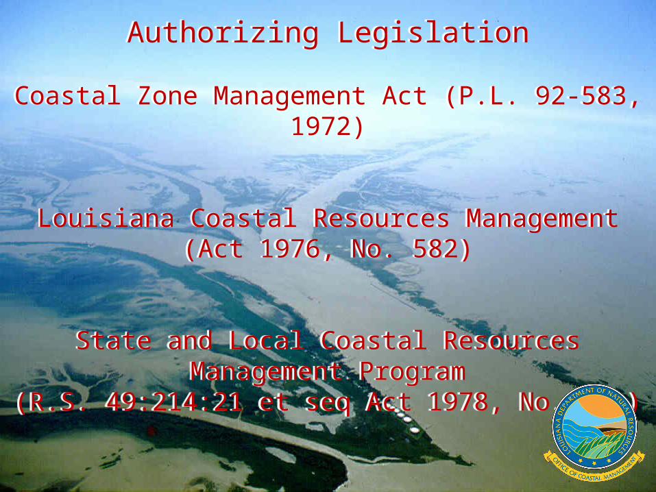
Authorizing Legislation
Coastal Zone Management Act (P.L. 92-583, 1972)
Louisiana Coastal Resources Management(Act 1976, No. 582)
State and Local Coastal Resources Management Program
(R.S. 49:214:21 et seq Act 1978, No. 361)
Authorizing Legislation
Coastal Zone Management Act (P.L. 92-583, 1972)
Louisiana Coastal Resources Management(Act 1976, No. 582)
State and Local Coastal Resources Management Program
(R.S. 49:214:21 et seq Act 1978, No. 361)
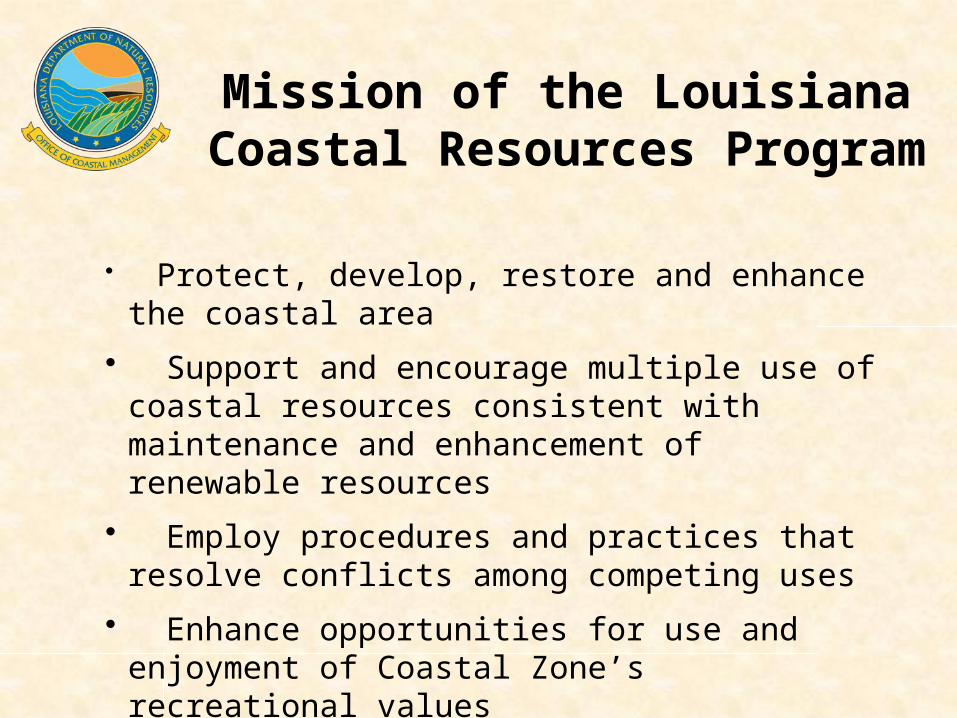
Mission of the Louisiana Coastal Resources Program
• Protect, develop, restore and enhance the coastal area
• Support and encourage multiple use of coastal resources consistent with maintenance and enhancement of renewable resources
• Employ procedures and practices that resolve conflicts among competing uses
• Enhance opportunities for use and enjoyment of Coastal Zone’s recreational values
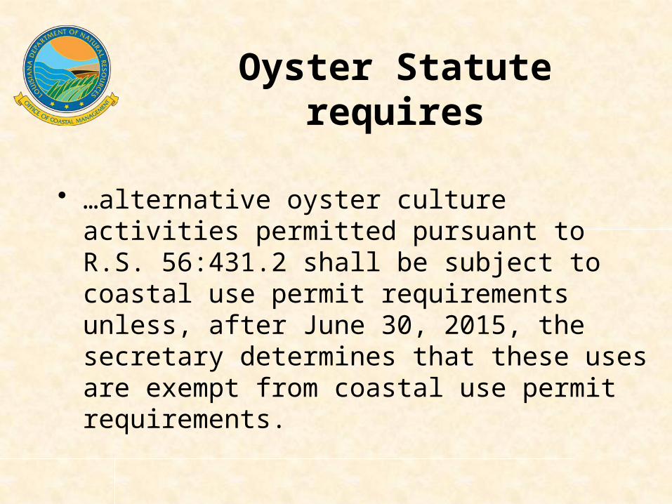
• …alternative oyster culture activities permitted pursuant to R.S. 56:431.2 shall be subject to coastal use permit requirements unless, after June 30, 2015, the secretary determines that these uses are exempt from coastal use permit requirements.
Oyster Statute requires
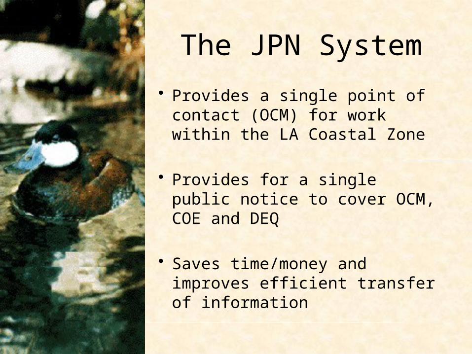
The JPN System
• Provides a single point of contact (OCM) for work within the LA Coastal Zone
• Provides for a single public notice to cover OCM, COE and DEQ
• Saves time/money and improves efficient transfer of information

Interagency Coordination
Comments are solicited from the following agencies:
LDWF DEQ CRT USACE
DHH NOAA FisheriesOCPR EPA
DOTD USFWSLevee BoardsLocal Parishes
State Land Office
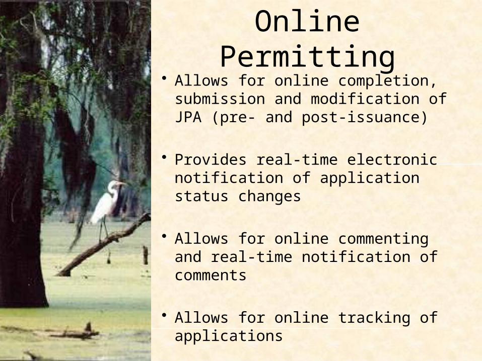
Online Permitting• Allows for online completion,
submission and modification of JPA (pre- and post-issuance)
• Provides real-time electronic notification of application status changes
• Allows for online commenting and real-time notification of comments
• Allows for online tracking of applications

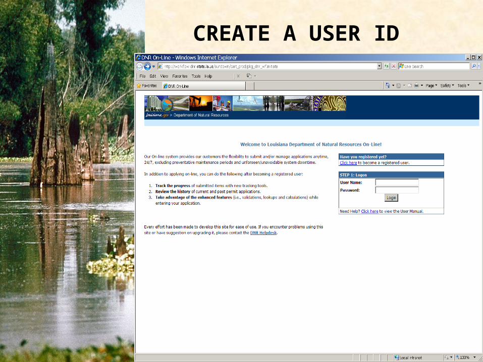
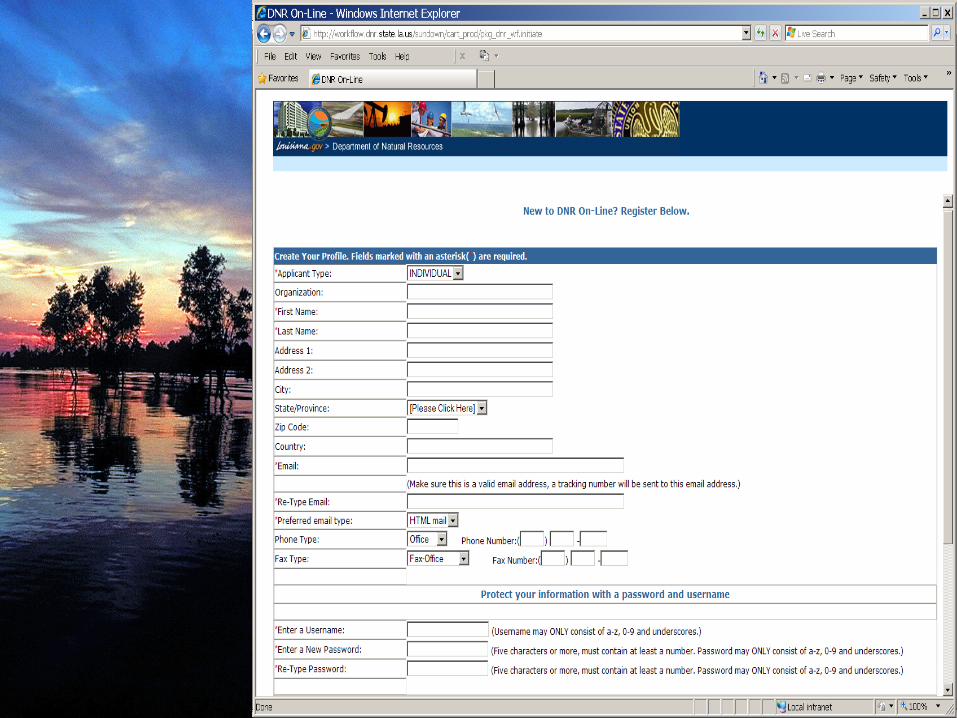
CREATE A USER ID
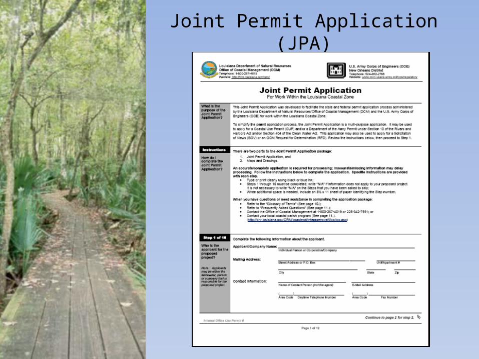
Joint Permit Application (JPA)

All uses and activities shall be planned, sited, designed, constructed, operated, and maintained to avoid to the maximum extent practicable significant.
5. Destruction or adverse alterations of streams, wetland, tidal passes, inshore waters and waterbottoms, beaches, dunes, barrier islands, and other natural biologically valuable areas or protective coastal features.
6. Adverse disruption of existing social patterns.10. Adverse effects of cumulative impacts.13. Discharges of pathogens or toxic substances into coastal waters.14. Adverse alteration or destruction of archaeological, historical, or other
cultural resources.16. Adverse alteration or destruction of unique or valuable habitats,
critical habitat for endangered species, important wildlife or fishery breeding or nursery areas, designated wildlife management or sanctuary areas, or forestlands.
Considerations
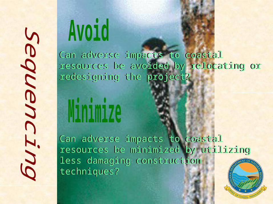
Can adverse impacts to coastal resources be avoided by relocating or redesigning the project?
Can adverse impacts to coastal resources be avoided by relocating or redesigning the project?
Can adverse impacts to coastal resources be minimized by utilizing less damaging construction techniques?
Can adverse impacts to coastal resources be minimized by utilizing less damaging construction techniques?
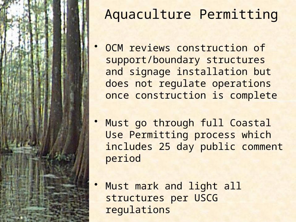
Aquaculture Permitting
• OCM reviews construction of support/boundary structures and signage installation but does not regulate operations once construction is complete
• Must go through full Coastal Use Permitting process which includes 25 day public comment period
• Must mark and light all structures per USCG regulations
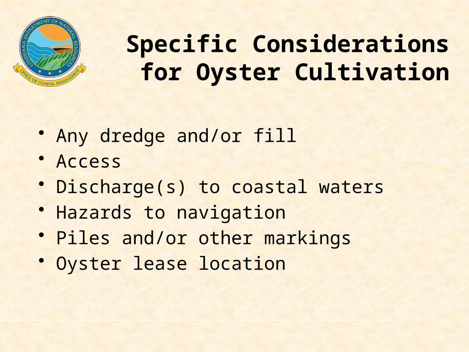
• Any dredge and/or fill• Access• Discharge(s) to coastal waters• Hazards to navigation• Piles and/or other markings• Oyster lease location
Specific Considerations for Oyster Cultivation
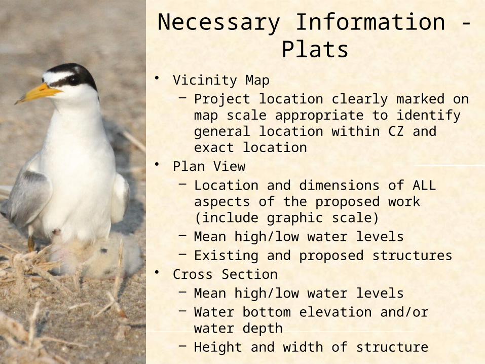
Necessary Information - Plats
• Vicinity Map– Project location clearly marked on map
scale appropriate to identify general location within CZ and exact location
• Plan View– Location and dimensions of ALL aspects
of the proposed work (include graphic scale)
– Mean high/low water levels– Existing and proposed structures
• Cross Section– Mean high/low water levels– Water bottom elevation and/or water
depth– Height and width of structure
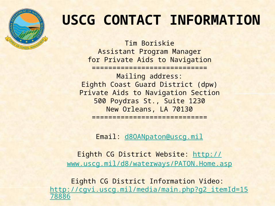
Tim BoriskieAssistant Program Managerfor Private Aids to Navigation
============================Mailing address:
Eighth Coast Guard District (dpw)Private Aids to Navigation Section
500 Poydras St., Suite 1230New Orleans, LA 70130
============================
Email: [email protected]
Eighth CG District Website: http://www.uscg.mil/d8/waterways/PATON.Home.asp
Eighth CG District Information Video: http://cgvi.uscg.mil/media/main.php?g2_itemId=1578886
USCG CONTACT INFORMATION
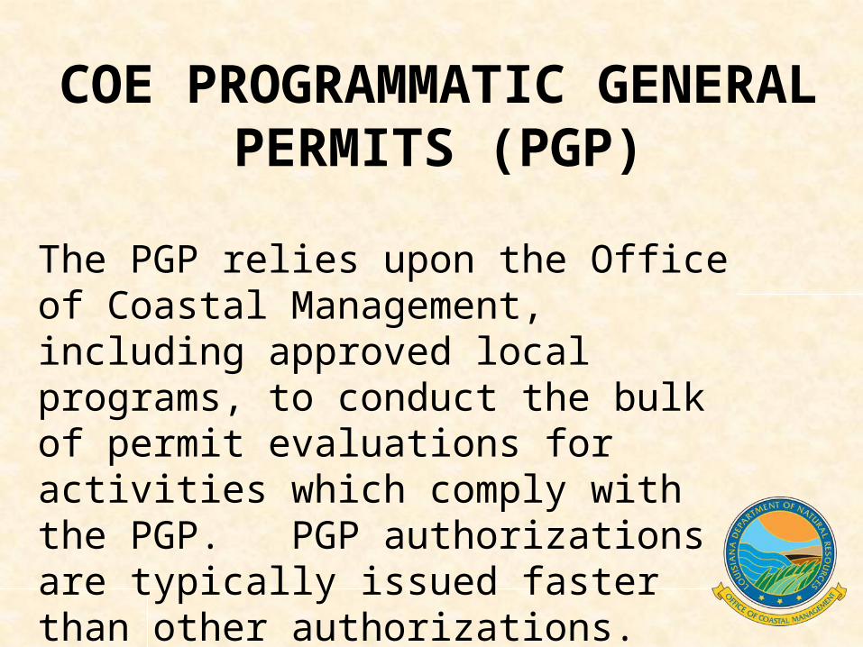
The PGP relies upon the Office of Coastal Management, including approved local programs, to conduct the bulk of permit evaluations for activities which comply with the PGP. PGP authorizations are typically issued faster than other authorizations.
COE PROGRAMMATIC GENERAL PERMITS (PGP)
Questions?Questions?
1-800-267-40191-800-267-4019
1-225-342-64701-225-342-6470