Embed Size (px)
Citation preview
News from
NOAA in the North Atlantic Summer 2012
1N
AR
T New
sletterSu
mm
er 2012
NOAA’s North Atlantic region includes all or part of twelve states and the District of Columbia. The quarterly North Atlantic Regional Team (NART) newsletter highlights recent NOAA collaborative activity in our region.
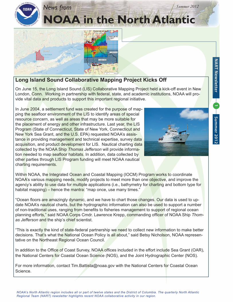
Long Island Sound Collaborative Mapping Project Kicks OffOn June 15, the Long Island Sound (LIS) Collaborative Mapping Project held a kick-off event in New London, Conn. Working in partnership with federal, state, and academic institutions, NOAA will pro-vide vital data and products to support this important regional initiative.
In June 2004, a settlement fund was created for the purpose of map-ping the seafl oor environment of the LIS to identify areas of special resource concern, as well as areas that may be more suitable for the placement of energy and other infrastructure. Last year, the LIS Program (State of Connecticut, State of New York, Connecticut and New York Sea Grant, and the U.S. EPA) requested NOAA’s assis-tance in providing management and technical expertise, survey data acquisition, and product development for LIS. Nautical charting data collected by the NOAA Ship Thomas Jefferson will provide informa-tion needed to map seafl oor habitats. In addition, data collected by other parties through LIS Program funding will meet NOAA nautical charting requirements.
Within NOAA, the Integrated Ocean and Coastal Mapping (IOCM) Program works to coordinate NOAA’s various mapping needs, modify projects to meet more than one objective, and improve the agency’s ability to use data for multiple applications (i.e., bathymetry for charting and bottom type for habitat mapping) – hence the mantra: “map once, use many times.”
“Ocean fl oors are amazingly dynamic, and we have to chart those changes. Our data is used to up-date NOAA’s nautical charts, but the hydrographic information can also be used to support a number of non-traditional uses, ranging from benefi ts to fi sheries management to support of regional ocean planning efforts,” said NOAA Corps Cmdr. Lawrence Krepp, commanding offi cer of NOAA Ship Thom-as Jefferson and the ship’s chief scientist.
“This is exactly the kind of state-federal partnership we need to collect new information to make better decisions. That’s what the National Ocean Policy is all about,” said Betsy Nicholson, NOAA represen-tative on the Northeast Regional Ocean Council.
In addition to the Offi ce of Coast Survey, NOAA offi ces included in the effort include Sea Grant (OAR), the National Centers for Coastal Ocean Science (NOS), and the Joint Hydrographic Center (NOS).
For more information, contact [email protected] with the National Centers for Coastal Ocean Science.
2N
AR
T New
sletterSu
mm
er 2012
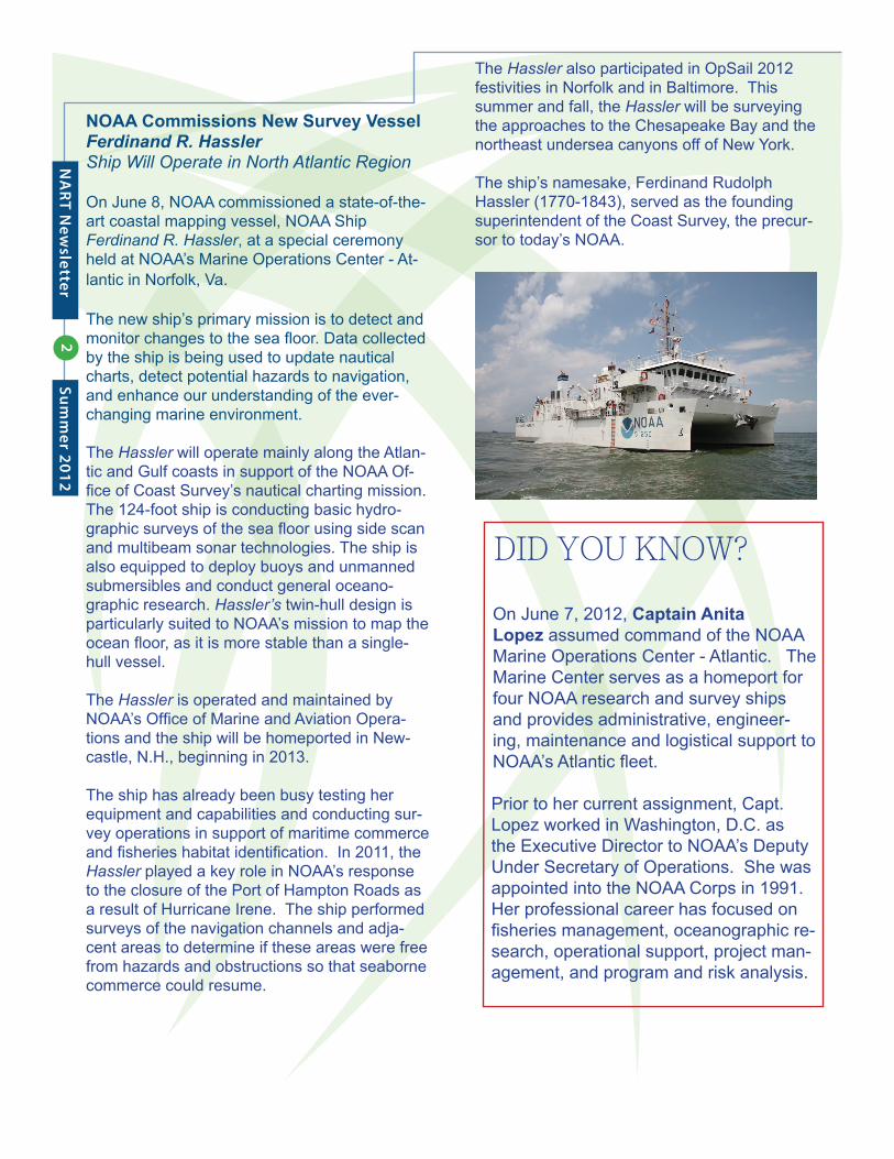
NOAA Commissions New Survey Vessel Ferdinand R. HasslerShip Will Operate in North Atlantic Region
On June 8, NOAA commissioned a state-of-the-art coastal mapping vessel, NOAA Ship Ferdinand R. Hassler, at a special ceremony held at NOAA’s Marine Operations Center - At-lantic in Norfolk, Va.
The new ship’s primary mission is to detect and monitor changes to the sea fl oor. Data collected by the ship is being used to update nautical charts, detect potential hazards to navigation, and enhance our understanding of the ever-changing marine environment.
The Hassler will operate mainly along the Atlan-tic and Gulf coasts in support of the NOAA Of-fi ce of Coast Survey’s nautical charting mission. The 124-foot ship is conducting basic hydro-graphic surveys of the sea fl oor using side scan and multibeam sonar technologies. The ship is also equipped to deploy buoys and unmanned submersibles and conduct general oceano-graphic research. Hassler’s twin-hull design is particularly suited to NOAA’s mission to map the ocean fl oor, as it is more stable than a single-hull vessel.
The Hassler is operated and maintained by NOAA’s Offi ce of Marine and Aviation Opera-tions and the ship will be homeported in New-castle, N.H., beginning in 2013.
The ship has already been busy testing her equipment and capabilities and conducting sur-vey operations in support of maritime commerce and fi sheries habitat identifi cation. In 2011, the Hassler played a key role in NOAA’s response to the closure of the Port of Hampton Roads as a result of Hurricane Irene. The ship performed surveys of the navigation channels and adja-cent areas to determine if these areas were free from hazards and obstructions so that seaborne commerce could resume.
DID YOU KNOW?
On June 7, 2012, Captain Anita Lopez assumed command of the NOAA Marine Operations Center - Atlantic. The Marine Center serves as a homeport for four NOAA research and survey ships and provides administrative, engineer-ing, maintenance and logistical support to NOAA’s Atlantic fl eet.
Prior to her current assignment, Capt. Lopez worked in Washington, D.C. as the Executive Director to NOAA’s Deputy Under Secretary of Operations. She was appointed into the NOAA Corps in 1991. Her professional career has focused on fi sheries management, oceanographic re-search, operational support, project man-agement, and program and risk analysis.
The Hassler also participated in OpSail 2012 festivities in Norfolk and in Baltimore. This summer and fall, the Hassler will be surveying the approaches to the Chesapeake Bay and the northeast undersea canyons off of New York.
The ship’s namesake, Ferdinand Rudolph Hassler (1770-1843), served as the founding superintendent of the Coast Survey, the precur-sor to today’s NOAA.
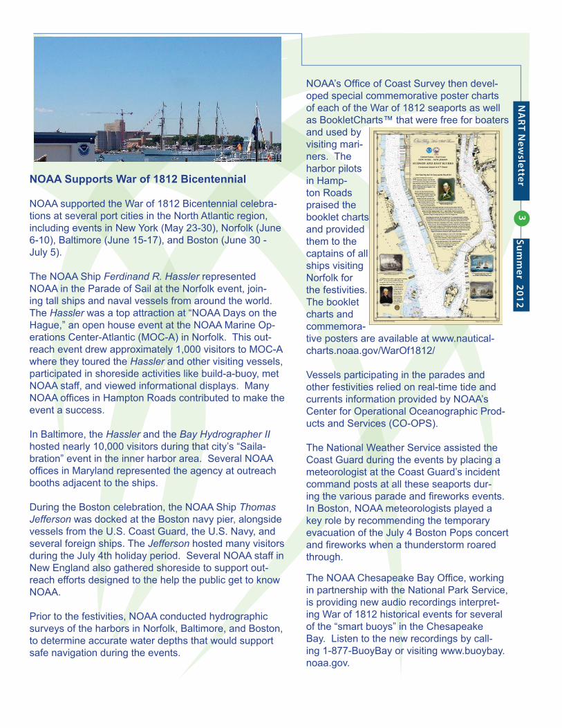
NOAA Supports War of 1812 Bicentennial
NOAA supported the War of 1812 Bicentennial celebra-tions at several port cities in the North Atlantic region, including events in New York (May 23-30), Norfolk (June 6-10), Baltimore (June 15-17), and Boston (June 30 - July 5).
The NOAA Ship Ferdinand R. Hassler represented NOAA in the Parade of Sail at the Norfolk event, join-ing tall ships and naval vessels from around the world. The Hassler was a top attraction at “NOAA Days on the Hague,” an open house event at the NOAA Marine Op-erations Center-Atlantic (MOC-A) in Norfolk. This out-reach event drew approximately 1,000 visitors to MOC-A where they toured the Hassler and other visiting vessels, participated in shoreside activities like build-a-buoy, met NOAA staff, and viewed informational displays. Many NOAA offi ces in Hampton Roads contributed to make the event a success.
In Baltimore, the Hassler and the Bay Hydrographer II hosted nearly 10,000 visitors during that city’s “Saila-bration” event in the inner harbor area. Several NOAA offi ces in Maryland represented the agency at outreach booths adjacent to the ships.
During the Boston celebration, the NOAA Ship Thomas Jefferson was docked at the Boston navy pier, alongside vessels from the U.S. Coast Guard, the U.S. Navy, and several foreign ships. The Jefferson hosted many visitors during the July 4th holiday period. Several NOAA staff in New England also gathered shoreside to support out-reach efforts designed to the help the public get to know NOAA.
Prior to the festivities, NOAA conducted hydrographic surveys of the harbors in Norfolk, Baltimore, and Boston, to determine accurate water depths that would support safe navigation during the events.
NOAA’s Offi ce of Coast Survey then devel-oped special commemorative poster charts of each of the War of 1812 seaports as well as BookletCharts™ that were free for boaters and used by visiting mari-ners. The harbor pilots in Hamp-ton Roads praised the booklet charts and provided them to the captains of all ships visiting Norfolk for the festivities. The booklet charts and commemora-tive posters are available at www.nautical-charts.noaa.gov/WarOf1812/
Vessels participating in the parades and other festivities relied on real-time tide and currents information provided by NOAA’s Center for Operational Oceanographic Prod-ucts and Services (CO-OPS).
The National Weather Service assisted the Coast Guard during the events by placing a meteorologist at the Coast Guard’s incident command posts at all these seaports dur-ing the various parade and fi reworks events. In Boston, NOAA meteorologists played a key role by recommending the temporary evacuation of the July 4 Boston Pops concert and fi reworks when a thunderstorm roared through.
The NOAA Chesapeake Bay Offi ce, working in partnership with the National Park Service, is providing new audio recordings interpret-ing War of 1812 historical events for several of the “smart buoys” in the Chesapeake Bay. Listen to the new recordings by call-ing 1-877-BuoyBay or visiting www.buoybay.noaa.gov.
3N
AR
T New
sletter Su
mm
er 2012
4N
AR
T New
sletterSu
mm
er 2012
NART MemberErica Rule is the Communications and Outreach Coordinator for NOAA’s Atlan-tic Oceanographic and Meteorological Laboratory in Miami, Fla. Erica works with scientists from across this interdisciplinary NOAA Research labo-ratory to highlight and communicate AOML’s scientifi c accomplish-ments and research programs to a wide range of audiences including formal and informal education organizations, members of the media and Congress, and NOAA and other federal partners.
As the NART’s most southern NOAA partner, Erica looks for opportunities to connect aspects of AOML’s broad re-search portfolio to other NOAA entities in the north Atlantic, including hurricane, ocean, and coastal observations and modeling. In this capacity, she has had the opportunity to work alongside many of AOML’s scientists in the fi eld, including cruises on the NOAA ship Ronald Brown and fl ights into hurricanes on NOAA’s P-3 Orion hurricane hunter aircraft.
Originally from the Mid-Atlantic, Erica has an undergraduate degree in Biology from the University of Mary Washington and a master’s degree in Marine Affairs and Policy from the University of Miami’s Rosenstiel School for Marine and Atmo-spheric Science. She lives in Miami with her husband and two children.
NOAA People in the North Atlantic Region
NOAA Places in the North Atlantic Region
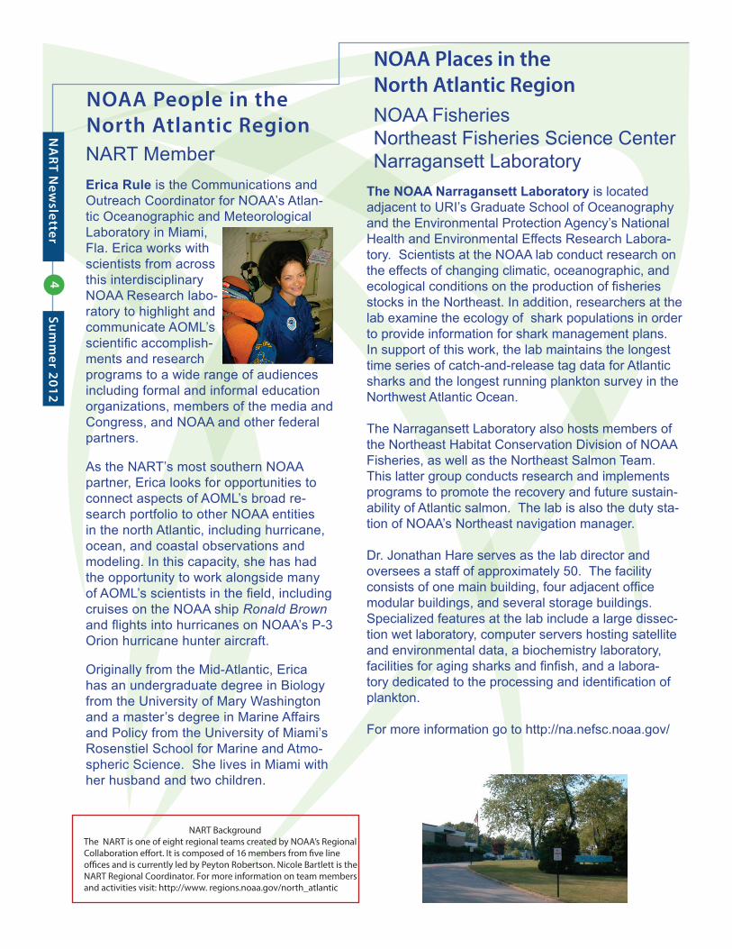
The NOAA Narragansett Laboratory is located adjacent to URI’s Graduate School of Oceanography and the Environmental Protection Agency’s National Health and Environmental Effects Research Labora-tory. Scientists at the NOAA lab conduct research on the effects of changing climatic, oceanographic, and ecological conditions on the production of fi sheries stocks in the Northeast. In addition, researchers at the lab examine the ecology of shark populations in order to provide information for shark management plans. In support of this work, the lab maintains the longest time series of catch-and-release tag data for Atlantic sharks and the longest running plankton survey in the Northwest Atlantic Ocean.
The Narragansett Laboratory also hosts members of the Northeast Habitat Conservation Division of NOAA Fisheries, as well as the Northeast Salmon Team. This latter group conducts research and implements programs to promote the recovery and future sustain-ability of Atlantic salmon. The lab is also the duty sta-tion of NOAA’s Northeast navigation manager.
Dr. Jonathan Hare serves as the lab director and oversees a staff of approximately 50. The facility consists of one main building, four adjacent offi ce modular buildings, and several storage buildings. Specialized features at the lab include a large dissec-tion wet laboratory, computer servers hosting satellite and environmental data, a biochemistry laboratory, facilities for aging sharks and fi nfi sh, and a labora-tory dedicated to the processing and identifi cation of plankton. For more information go to http://na.nefsc.noaa.gov/
NOAA Fisheries Northeast Fisheries Science CenterNarragansett Laboratory
NART BackgroundThe NART is one of eight regional teams created by NOAA’s Regional Collaboration e� ort. It is composed of 16 members from � ve line o� ces and is currently led by Peyton Robertson. Nicole Bartlett is the NART Regional Coordinator. For more information on team members and activities visit: http://www. regions.noaa.gov/north_atlantic