Embed Size (px)
Citation preview
New Paradigms Offering New Earth Observation Opportunities
Mihai Datcu, Gottfried Schwarz
Institut für Methodik der Fernerkundung bzw. Deutsches Fernerkundungsdatenzentrum
Folie 2
2
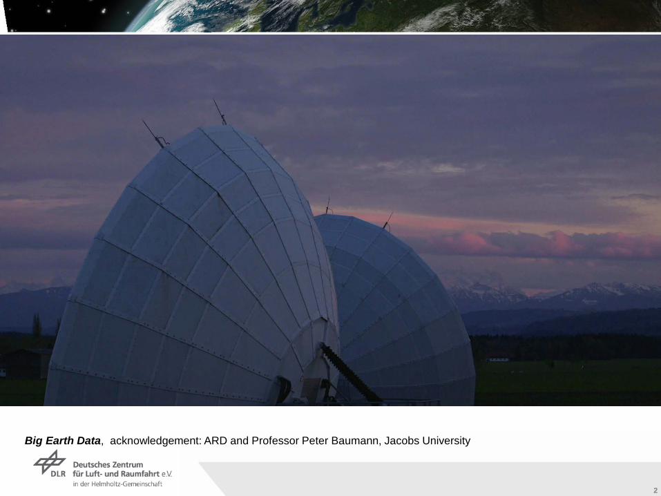
Big Earth Data, acknowledgement: ARD and Professor Peter Baumann, Jacobs University
Institut für Methodik der Fernerkundung bzw. Deutsches Fernerkundungsdatenzentrum
Folie 3
33
Institut für Methodik der Fernerkundung bzw. Deutsches Fernerkundungsdatenzentrum
Folie 4
4
4
Institut für Methodik der Fernerkundung bzw. Deutsches Fernerkundungsdatenzentrum
Folie 5
5
5
Institut für Methodik der Fernerkundung bzw. Deutsches Fernerkundungsdatenzentrum
Folie 6
6
6
Institut für Methodik der Fernerkundung bzw. Deutsches Fernerkundungsdatenzentrum
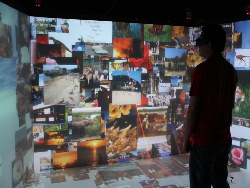
Folie 7
7
7
Institut für Methodik der Fernerkundung bzw. Deutsches Fernerkundungsdatenzentrum
Folie 8
8
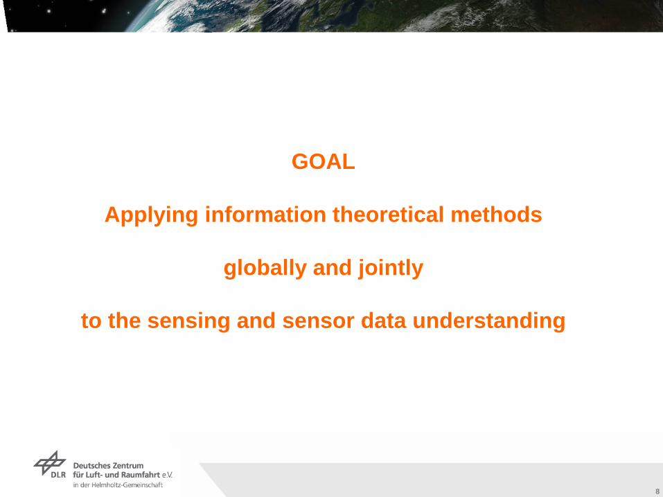
GOAL
Applying information theoretical methods
globally and jointly
to the sensing and sensor data understanding
Institut für Methodik der Fernerkundung bzw. Deutsches Fernerkundungsdatenzentrum
Folie 9
9
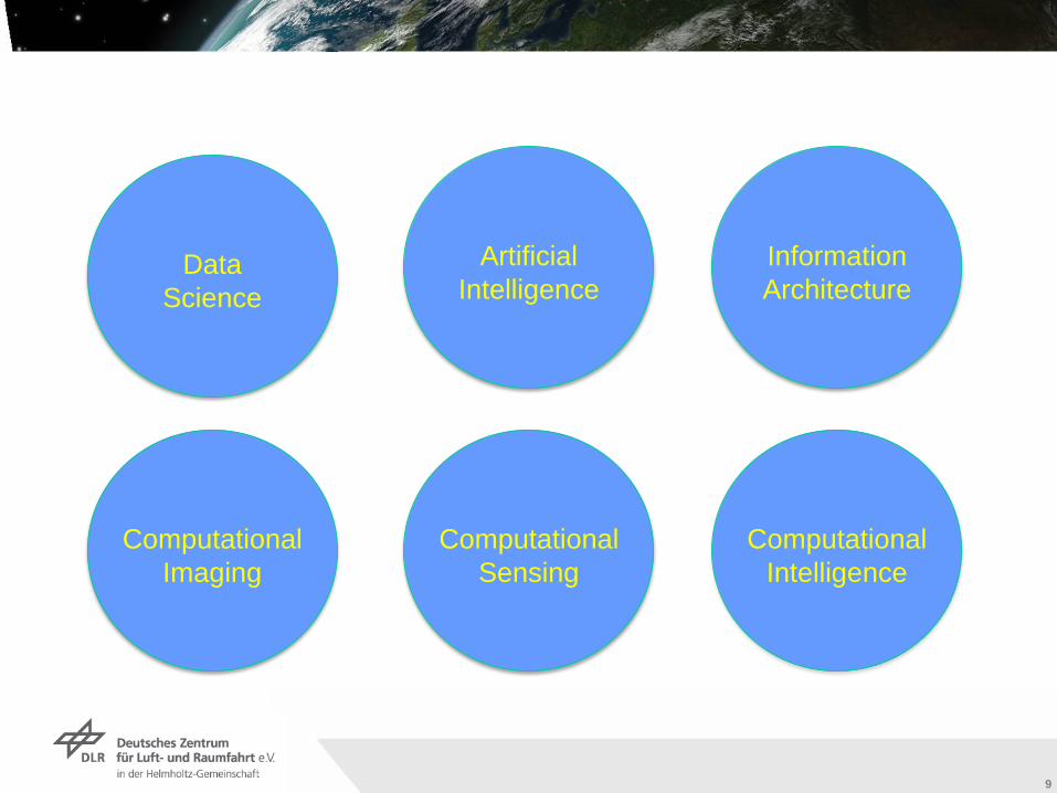
Computational Imaging
Computational Sensing
Computational Intelligence
DataScience
Artificial Intelligence
Information Architecture
Institut für Methodik der Fernerkundung bzw. Deutsches Fernerkundungsdatenzentrum
Folie 10
10
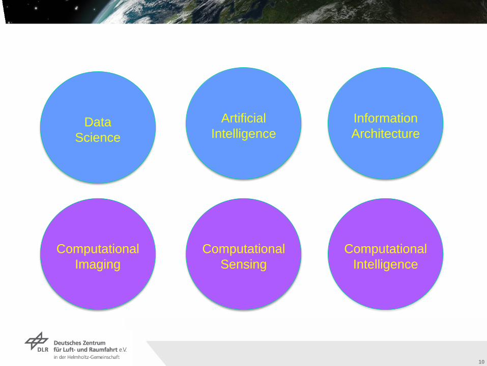
Computational Imaging
Computational Sensing
Computational Intelligence
DataScience
Artificial Intelligence
Information Architecture
Institut für Methodik der Fernerkundung bzw. Deutsches Fernerkundungsdatenzentrum
Folie 11
11
Institut für Methodik der Fernerkundung bzw. Deutsches Fernerkundungsdatenzentrum
Folie 12
12
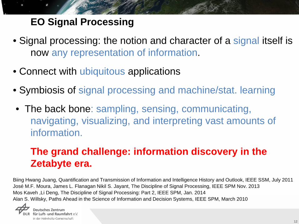
EO Signal Processing
• Signal processing: the notion and character of a signal itself is now any representation of information.
• Connect with ubiquitous applications
• Symbiosis of signal processing and machine/stat. learning
• The back bone: sampling, sensing, communicating, navigating, visualizing, and interpreting vast amounts of information.
The grand challenge: information discovery in the Zetabyte era.
Biing Hwang Juang, Quantification and Transmission of Information and Intelligence History and Outlook, IEEE SSM, July 2011José M.F. Moura, James L. Flanagan Nikil S. Jayant, The Discipline of Signal Processing, IEEE SPM Nov. 2013 Mos Kaveh ,Li Deng, The Discipline of Signal Processing: Part 2, IEEE SPM, Jan. 2014Alan S. Willsky, Paths Ahead in the Science of Information and Decision Systems, IEEE SPM, March 2010
Institut für Methodik der Fernerkundung bzw. Deutsches Fernerkundungsdatenzentrum
Folie 13
13
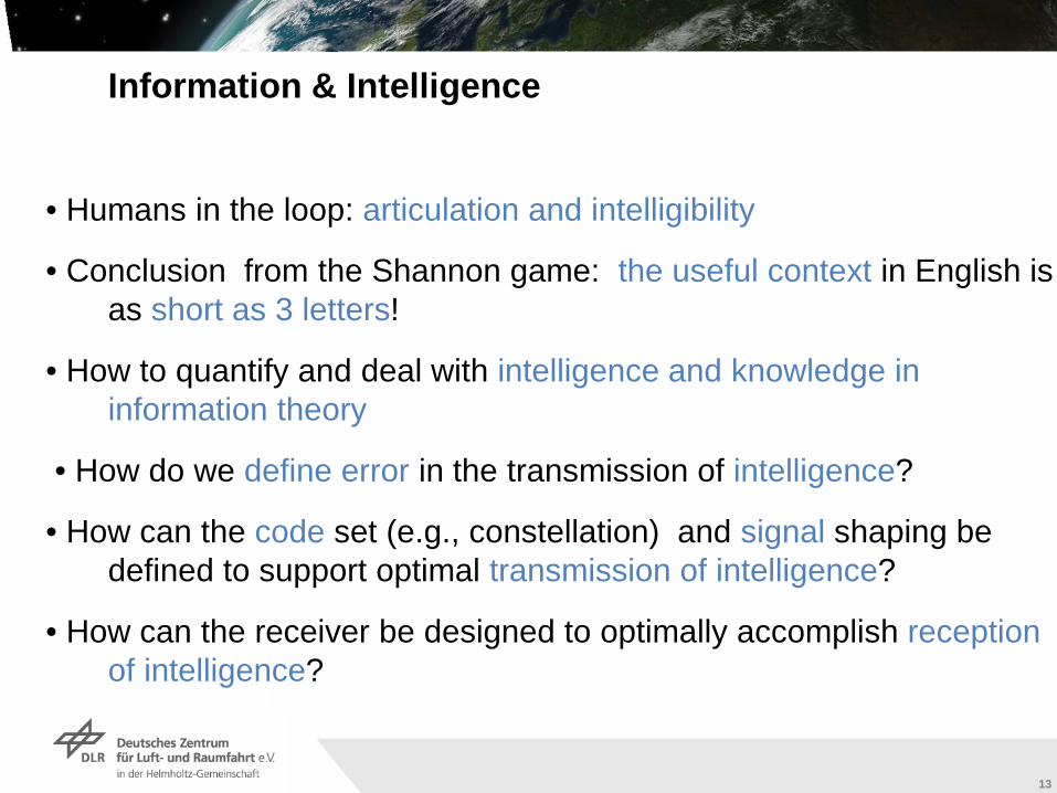
Information & Intelligence
• Humans in the loop: articulation and intelligibility
• Conclusion from the Shannon game: the useful context in English is as short as 3 letters!
• How to quantify and deal with intelligence and knowledge in information theory
• How do we define error in the transmission of intelligence?
• How can the code set (e.g., constellation) and signal shaping be defined to support optimal transmission of intelligence?
• How can the receiver be designed to optimally accomplish reception of intelligence?
Institut für Methodik der Fernerkundung bzw. Deutsches Fernerkundungsdatenzentrum
Folie 14
14
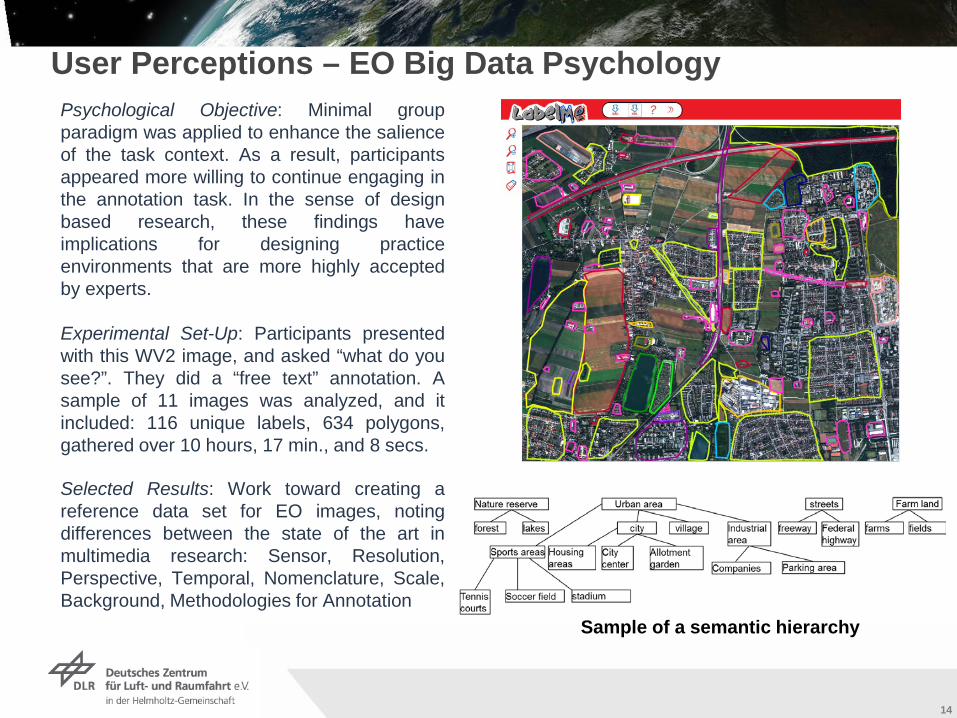
Psychological Objective: Minimal groupparadigm was applied to enhance the salienceof the task context. As a result, participantsappeared more willing to continue engaging inthe annotation task. In the sense of designbased research, these findings haveimplications for designing practiceenvironments that are more highly acceptedby experts.
Experimental Set-Up: Participants presentedwith this WV2 image, and asked “what do yousee?”. They did a “free text” annotation. Asample of 11 images was analyzed, and itincluded: 116 unique labels, 634 polygons,gathered over 10 hours, 17 min., and 8 secs.
Selected Results: Work toward creating areference data set for EO images, notingdifferences between the state of the art inmultimedia research: Sensor, Resolution,Perspective, Temporal, Nomenclature, Scale,Background, Methodologies for Annotation
User Perceptions – EO Big Data Psychology
Sample of a semantic hierarchy
Institut für Methodik der Fernerkundung bzw. Deutsches Fernerkundungsdatenzentrum
Folie 15
15
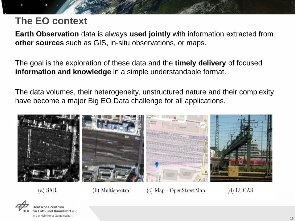
The EO contextEarth Observation data is always used jointly with information extracted from other sources such as GIS, in-situ observations, or maps.
The goal is the exploration of these data and the timely delivery of focused information and knowledge in a simple understandable format.
The data volumes, their heterogeneity, unstructured nature and their complexity have become a major Big EO Data challenge for all applications.
Institut für Methodik der Fernerkundung bzw. Deutsches Fernerkundungsdatenzentrum
Folie 16
16
1630.01.2013
Munich Aerospace Winter School 2013
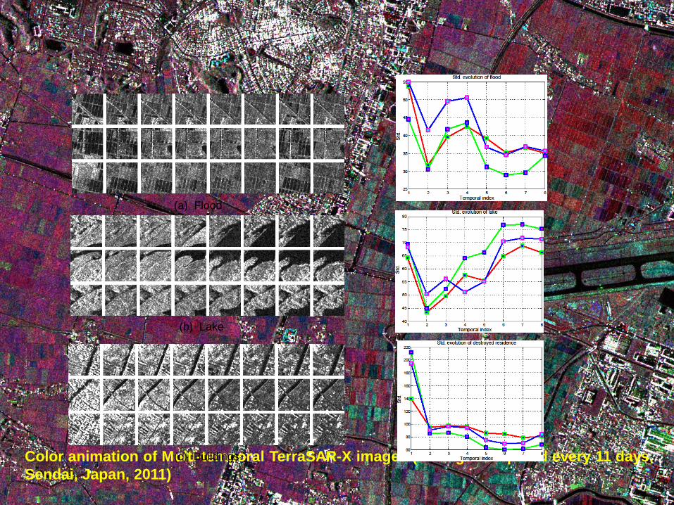
Color animation of Multi-temporal TerraSAR-X images (8 images acquired every 11 days, Sendai, Japan, 2011)
(a) Flood
(b) Lake
(c) Buildings
Institut für Methodik der Fernerkundung bzw. Deutsches Fernerkundungsdatenzentrum
Folie 17
17
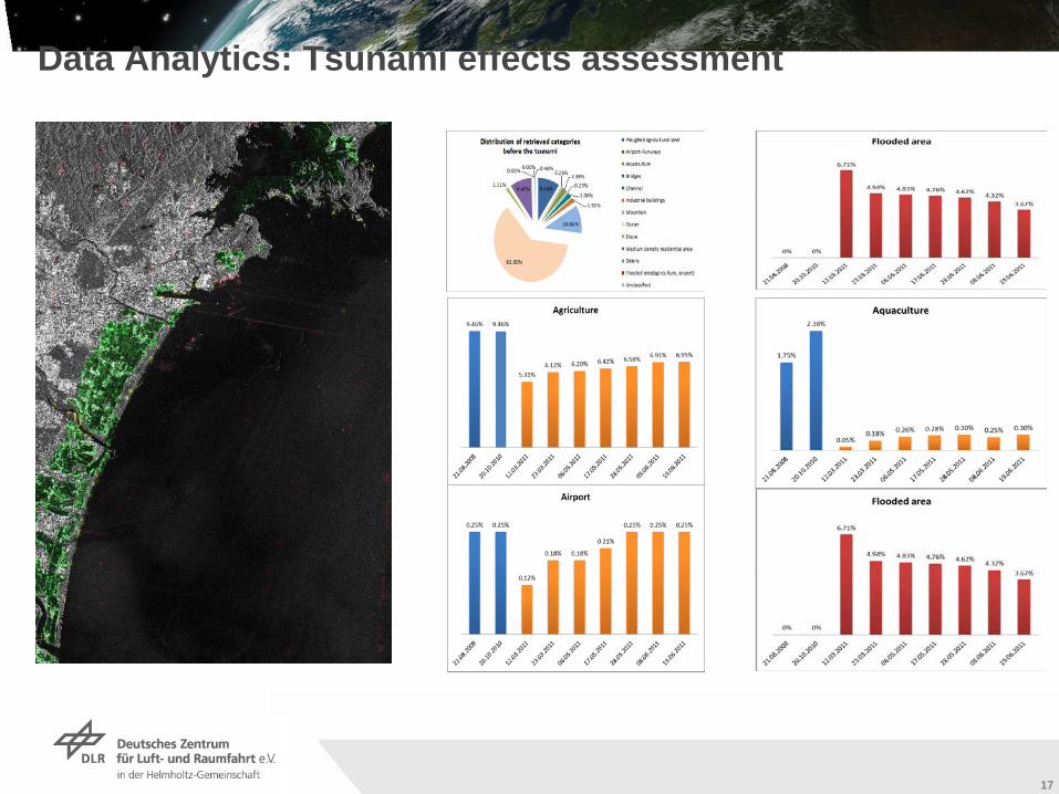
Data Analytics: Tsunami effects assessment
Institut für Methodik der Fernerkundung bzw. Deutsches Fernerkundungsdatenzentrum
Folie 18
18
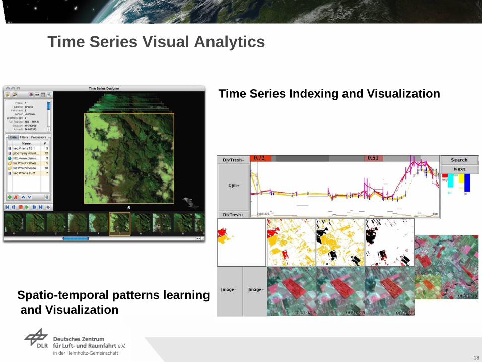
Time Series Visual Analytics
Time Series Indexing and Visualization
Spatio-temporal patterns learningand Visualization
Institut für Methodik der Fernerkundung bzw. Deutsches Fernerkundungsdatenzentrum
Folie 19
19
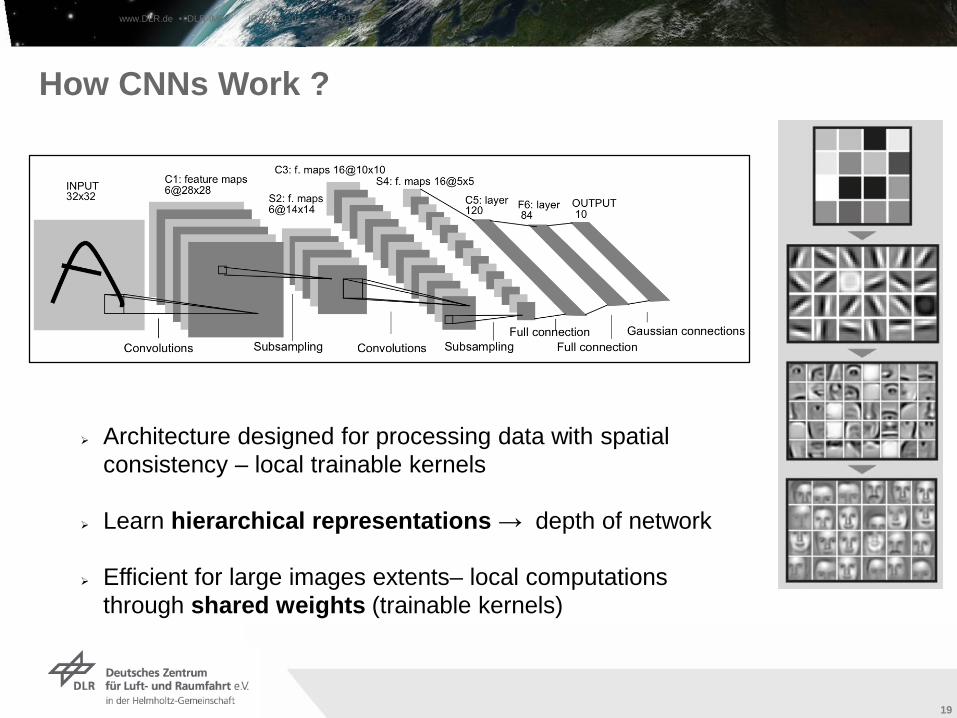
Architecture designed for processing data with spatial consistency – local trainable kernels
Learn hierarchical representations → depth of network
Efficient for large images extents– local computations through shared weights (trainable kernels)
How CNNs Work ?
www.DLR.de • DLR-IMF IGARSS 2017 – July 2017
Institut für Methodik der Fernerkundung bzw. Deutsches Fernerkundungsdatenzentrum
Folie 20
20
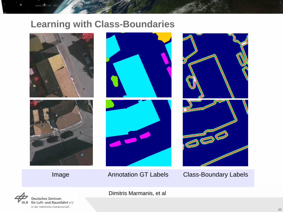
Learning with Class-Boundaries
Image Annotation GT Labels Class-Boundary Labels
www.DLR.de • DLR-IMF IGARSS 2017 – July 2017
Dimitris Marmanis, et al
Institut für Methodik der Fernerkundung bzw. Deutsches Fernerkundungsdatenzentrum
Folie 21
21
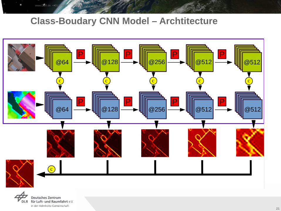
Class-Boudary CNN Model – Archtitecture
www.DLR.de • DLR-IMF IGARSS 2017 – July 2017
Institut für Methodik der Fernerkundung bzw. Deutsches Fernerkundungsdatenzentrum
Folie 22
22
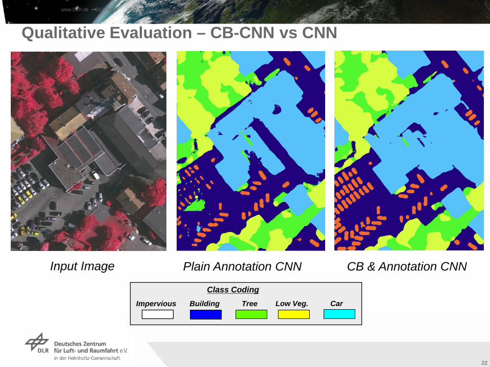
Qualitative Evaluation – CB-CNN vs CNN
Input Image Plain Annotation CNN
Class CodingImpervious Building Tree Low Veg. Car
CB & Annotation CNN
www.DLR.de • DLR-IMF IGARSS 2017 – July 2017
Institut für Methodik der Fernerkundung bzw. Deutsches Fernerkundungsdatenzentrum
Folie 23
23
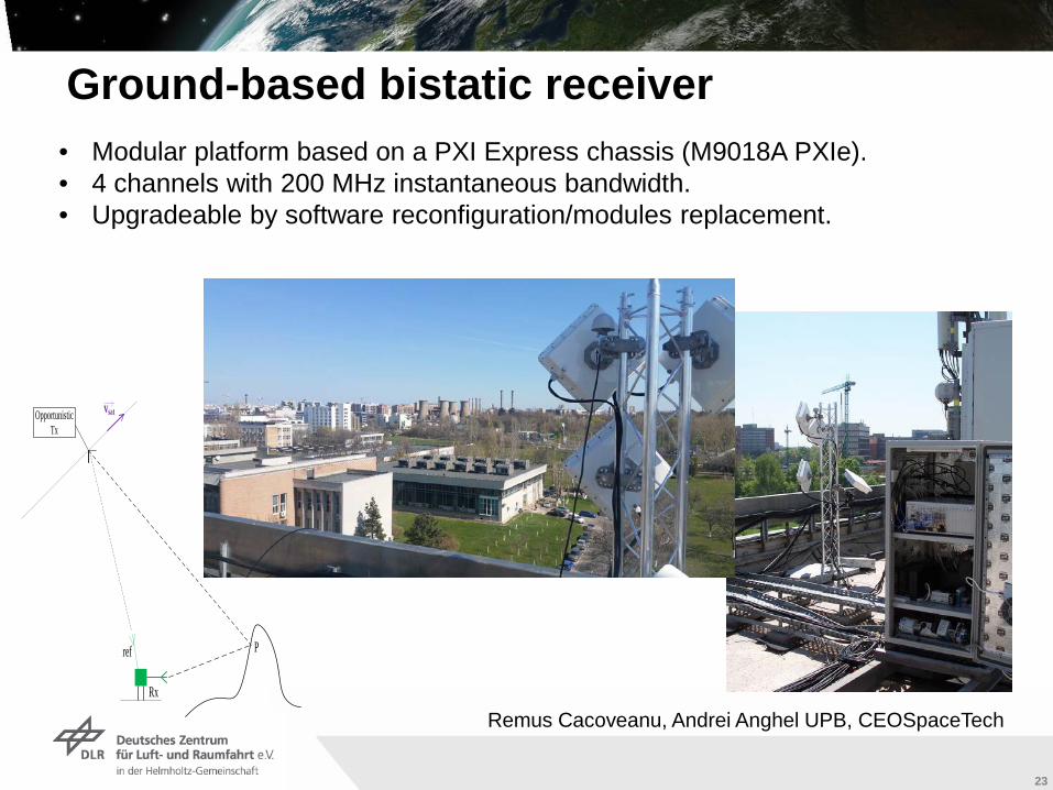
• Modular platform based on a PXI Express chassis (M9018A PXIe).• 4 channels with 200 MHz instantaneous bandwidth.• Upgradeable by software reconfiguration/modules replacement.
Ground-based bistatic receiver
Opportunistic Tx
P
Rx
ref
vsat
Remus Cacoveanu, Andrei Anghel UPB, CEOSpaceTech
Institut für Methodik der Fernerkundung bzw. Deutsches Fernerkundungsdatenzentrum
Folie 24
2424
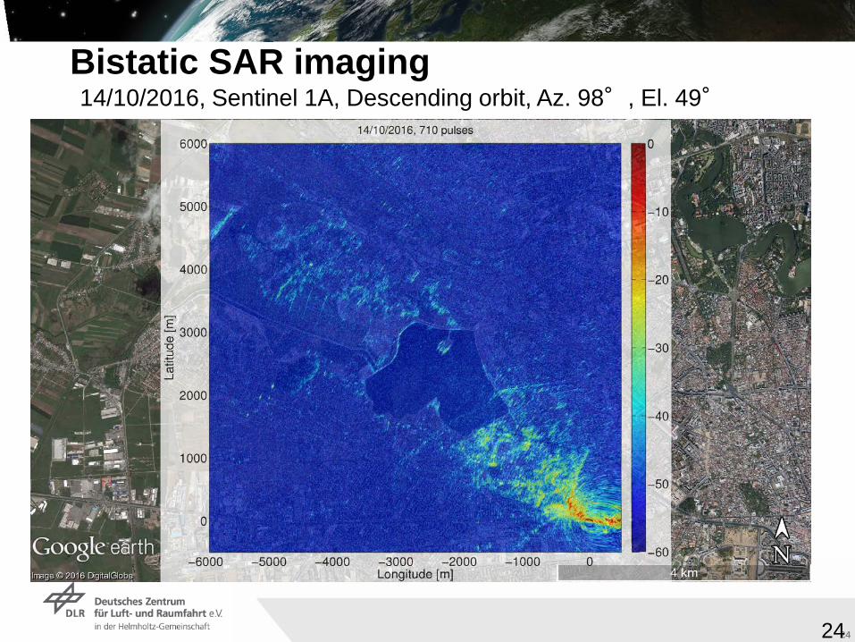
14/10/2016, Sentinel 1A, Descending orbit, Az. 98°, El. 49°
Bistatic SAR imaging
Institut für Methodik der Fernerkundung bzw. Deutsches Fernerkundungsdatenzentrum
Folie 25
25
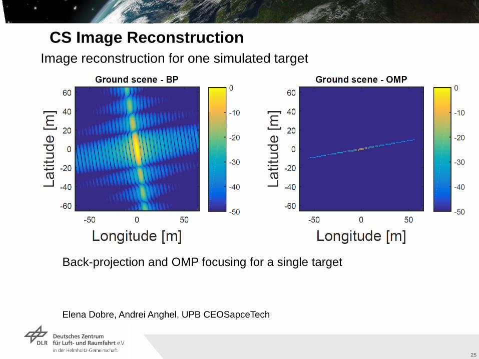
CS Image ReconstructionImage reconstruction for one simulated target
Back-projection and OMP focusing for a single target
Elena Dobre, Andrei Anghel, UPB CEOSapceTech
Institut für Methodik der Fernerkundung bzw. Deutsches Fernerkundungsdatenzentrum
Folie 26
26
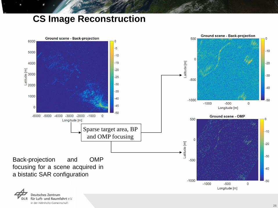
CS Image Reconstruction
Sparse target area, BP and OMP focusing
Back-projection and OMPfocusing for a scene acquired ina bistatic SAR configuration
Institut für Methodik der Fernerkundung bzw. Deutsches Fernerkundungsdatenzentrum
Folie 27
27
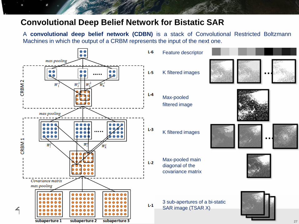
Convolutional Deep Belief Network for Bistatic SAR A convolutional deep belief network (CDBN) is a stack of Convolutional Restricted BoltzmannMachines in which the output of a CRBM represents the input of the next one.
3 sub-apertures of a bi-static SAR image (TSAR X)
Max-pooled main diagonal of the covariance matrix
K filtered images …
Max-pooled filtered image
…K filtered images
Feature descriptor
Institut für Methodik der Fernerkundung bzw. Deutsches Fernerkundungsdatenzentrum
Folie 28
28
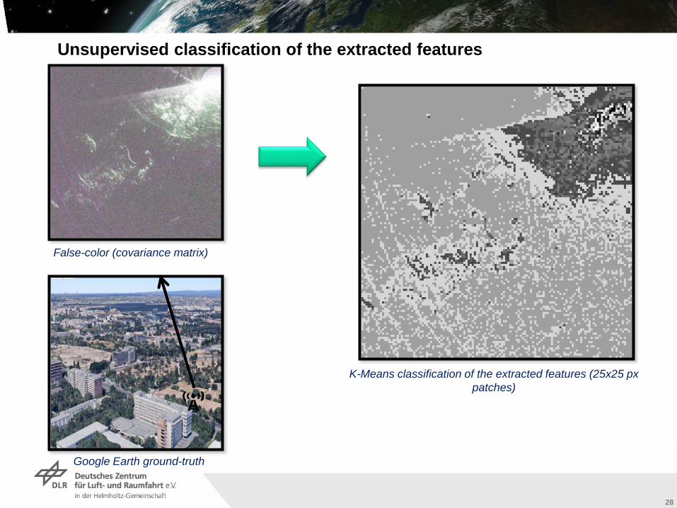
Unsupervised classification of the extracted features
False-color (covariance matrix)
Google Earth ground-truth
K-Means classification of the extracted features (25x25 px patches)

Institut für Methodik der Fernerkundung bzw. Deutsches Fernerkundungsdatenzentrum
Folie 29
29
GOAL
Applying information theoretical methods
globally and jointly
to the sensing and sensor data understanding