Embed Size (px)
Citation preview
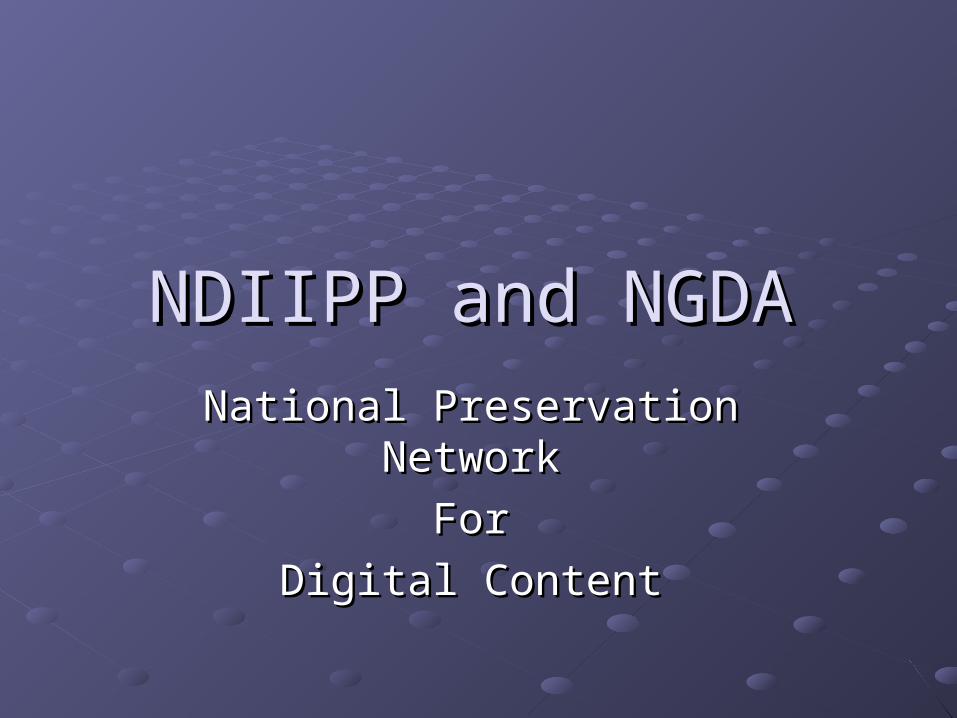
NDIIPP and NGDANDIIPP and NGDA
National Preservation NetworkNational Preservation Network
ForFor
Digital ContentDigital Content
OIT-UCSB 09/25/2006
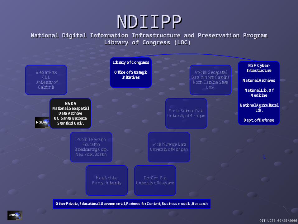
NDIIPPNDIIPPNational Digital Information Infrastructure and Preservation ProgramNational Digital Information Infrastructure and Preservation Program
Library of Congress (LOC)Library of Congress (LOC)
Library of Congress
Office of Strategic Initiatives
Dot Com EraUniversity of Maryland
Public TelevisionEducation
Broadcasting Corp.New York, Boston
MetaArchiveEmory University
NGDA National Geospatial
Data ArchiveUC Santa Barbara
Stanford Univ.
Web at RiskCDL
University of California
Social Science Data University of Michigan
Social Science Data University of Michigan
At-Risk Geospatial Data in North CarolinaNorth Carolina State
Univ.
NSF Cyber-Infrastructure
National Archives
National Lib. Of Medicine
National Agricultural Lib.
Dept. of Defense
Other Private, Educational, Governmental, Partners for Content, Business models, Research
OIT-UCSB 09/25/2006
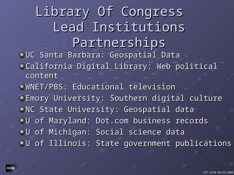
Library Of Congress Library Of Congress Lead Institutions PartnershipsLead Institutions Partnerships
UC Santa Barbara: UC Santa Barbara: Geospatial DataGeospatial Data
California Digital Library: Web political contentCalifornia Digital Library: Web political content
WNET/PBS: Educational televisionWNET/PBS: Educational television
Emory University: Southern digital cultureEmory University: Southern digital culture
NC State University: NC State University: Geospatial dataGeospatial data
U of Maryland: Dot.com business recordsU of Maryland: Dot.com business records
U of Michigan: Social science dataU of Michigan: Social science data
U of Illinois: State government publications U of Illinois: State government publications
OIT-UCSB 09/25/2006
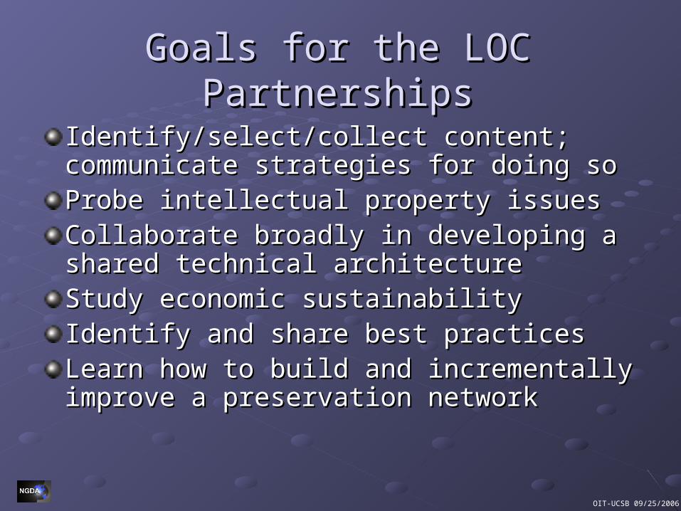
Goals for the LOC PartnershipsGoals for the LOC Partnerships
Identify/select/collect content; communicate Identify/select/collect content; communicate strategies for doing sostrategies for doing soProbe intellectual property issuesProbe intellectual property issuesCollaborate broadly in developing a shared Collaborate broadly in developing a shared technical architecturetechnical architectureStudy economic sustainabilityStudy economic sustainabilityIdentify and share best practicesIdentify and share best practicesLearn how to build and incrementally improve Learn how to build and incrementally improve a preservation networka preservation network
OIT-UCSB 09/25/2006
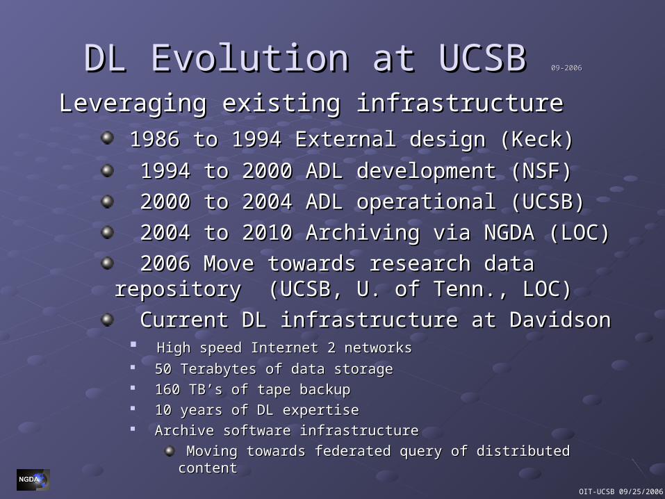
DL Evolution at UCSBDL Evolution at UCSB 09-200609-2006
Leveraging existing infrastructureLeveraging existing infrastructure
1986 to 1994 External design (Keck)1986 to 1994 External design (Keck)
1994 to 2000 ADL development (NSF)1994 to 2000 ADL development (NSF)
2000 to 2004 ADL operational (UCSB) 2000 to 2004 ADL operational (UCSB)
2004 to 2010 Archiving via NGDA (LOC)2004 to 2010 Archiving via NGDA (LOC)
2006 Move towards research data repository 2006 Move towards research data repository (UCSB, U. of Tenn., LOC)(UCSB, U. of Tenn., LOC)
Current DL infrastructure at DavidsonCurrent DL infrastructure at Davidson High speed Internet 2 networks High speed Internet 2 networks 50 Terabytes of data storage50 Terabytes of data storage 160 TB’s of tape backup160 TB’s of tape backup 10 years of DL expertise10 years of DL expertise Archive software infrastructureArchive software infrastructure
Moving towards federated query of distributed contentMoving towards federated query of distributed content
OIT-UCSB 09/25/2006
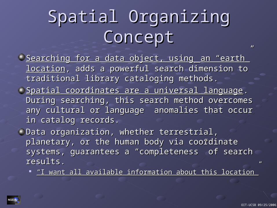
Spatial Organizing ConceptSpatial Organizing Concept
Searching for a data object, usingSearching for a data object, using an “earth” locationan “earth” location, , adds a powerful search dimension to traditional library adds a powerful search dimension to traditional library cataloging methods.cataloging methods.
Spatial coordinates are a universal languageSpatial coordinates are a universal language. During . During searching, this search method overcomes any cultural or searching, this search method overcomes any cultural or language anomalies that occur in catalog records.language anomalies that occur in catalog records.
Data organization, whether terrestrial, planetary, or the Data organization, whether terrestrial, planetary, or the human body via coordinate systems, guarantees a human body via coordinate systems, guarantees a “completeness” of search results.“completeness” of search results.
““I want all available information about this location”I want all available information about this location”
OIT-UCSB 09/25/2006
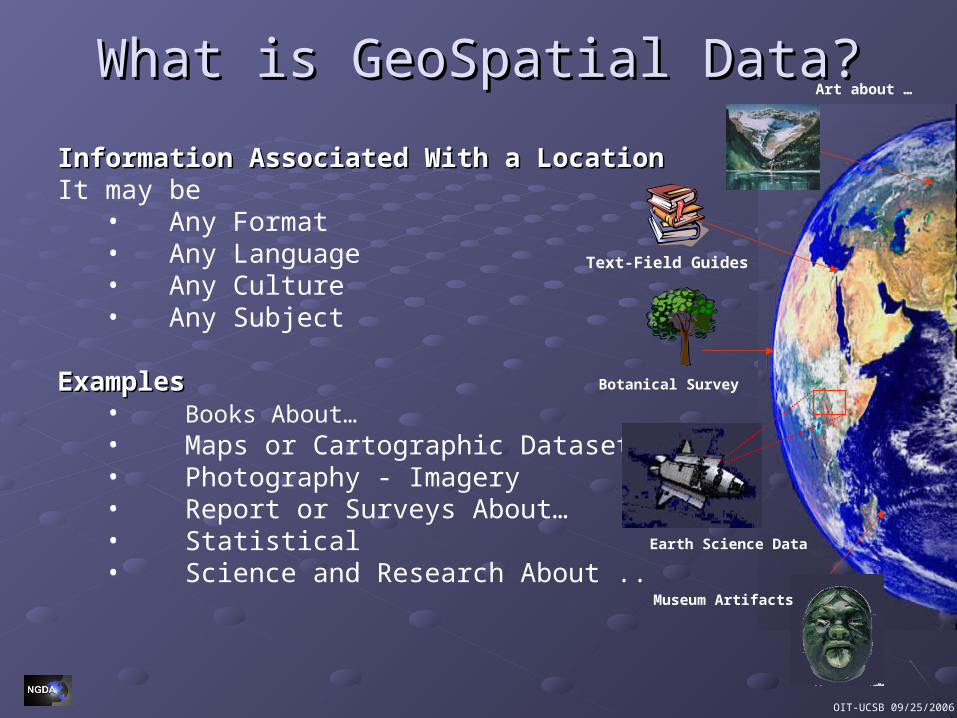
What is GeoSpatial Data?What is GeoSpatial Data?
Information Associated With a LocationInformation Associated With a LocationIt may be
• Any Format• Any Language• Any Culture• Any Subject
ExamplesExamples• Books About…• Maps or Cartographic Datasets• Photography - Imagery• Report or Surveys About…• Statistical • Science and Research About ..
Text-Field Guides
Botanical Survey
Art about …
Earth Science Data
Museum Artifacts
OIT-UCSB 09/25/2006
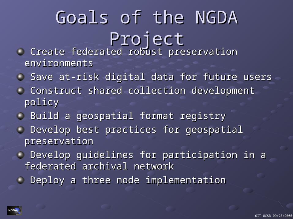
Goals of the NGDA ProjectGoals of the NGDA Project Create federated robust preservation environmentsCreate federated robust preservation environments
Save at-risk digital data for future usersSave at-risk digital data for future users
Construct shared collection development policy Construct shared collection development policy
Build a geospatial format registryBuild a geospatial format registry
Develop best practices for geospatial preservation Develop best practices for geospatial preservation
Develop guidelines for participation in a federated Develop guidelines for participation in a federated archival networkarchival network
Deploy a three node implementation Deploy a three node implementation
OIT-UCSB 09/25/2006
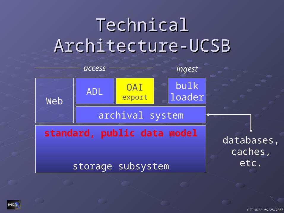
Technical Architecture-UCSBTechnical Architecture-UCSB
storage subsystem
standard, public data model
archival system
ADL OAIexport
bulkloader
databases,caches,
etc.
Web
access ingest
OIT-UCSB 09/25/2006
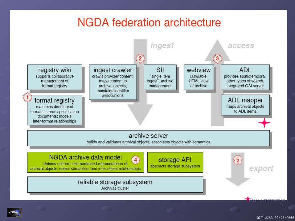
Under Construction
OIT-UCSB 09/25/2006
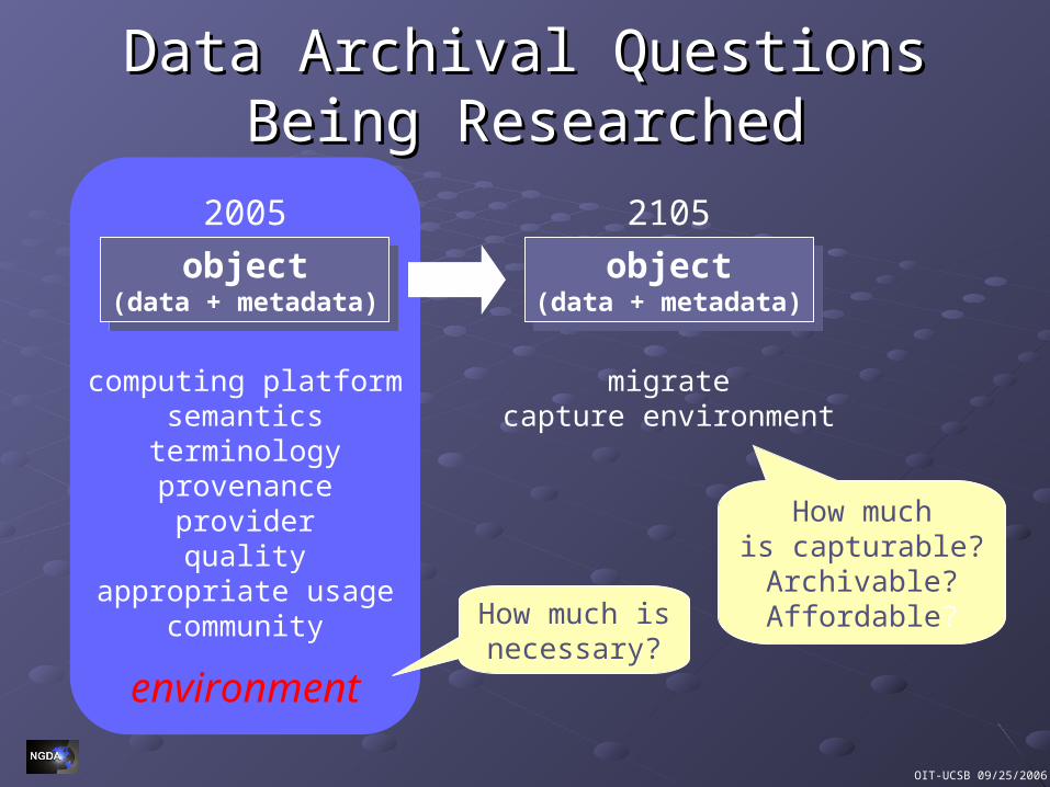
computing platformsemantics
terminologyprovenance
providerquality
appropriate usagecommunity
environment
Data Archival Questions Being Data Archival Questions Being ResearchedResearched
object(data + metadata)
object(data + metadata)
2005
migratecapture environment
object(data + metadata)
object(data + metadata)
2105
How much isnecessary?
How muchis capturable?Archivable?Affordable?
OIT-UCSB 09/25/2006
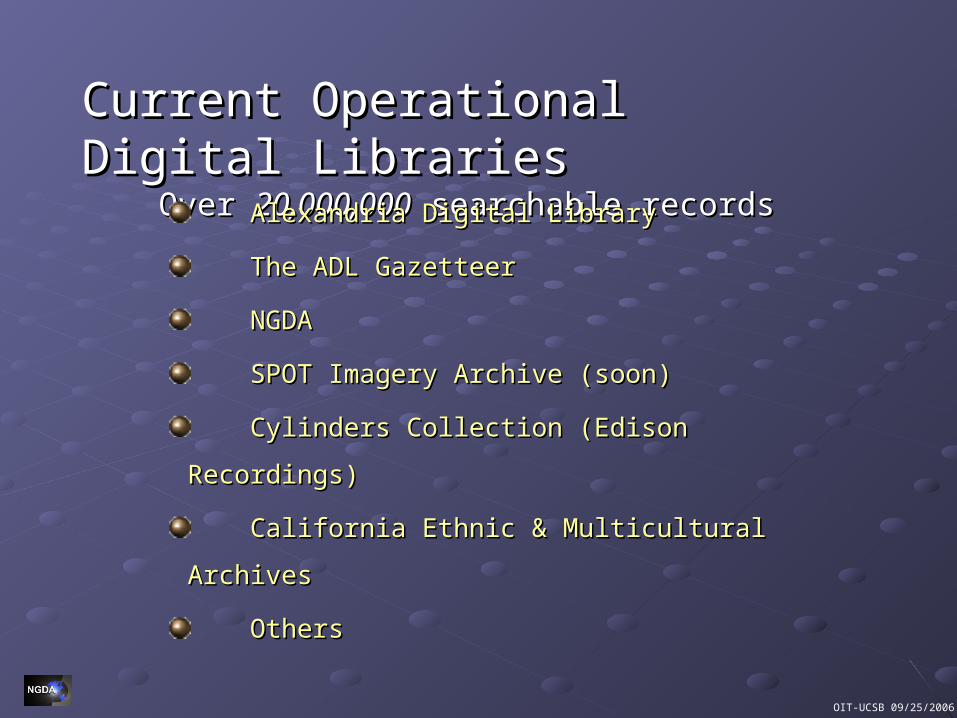
Current Operational Digital LibrariesCurrent Operational Digital LibrariesOver Over 20,000,00020,000,000 searchable records searchable records
Alexandria Digital LibraryAlexandria Digital Library
The ADL GazetteerThe ADL Gazetteer
NGDANGDA
SPOT Imagery Archive (soon)SPOT Imagery Archive (soon)
Cylinders Collection (Edison Recordings)Cylinders Collection (Edison Recordings)
California Ethnic & Multicultural ArchivesCalifornia Ethnic & Multicultural Archives
OthersOthers
OIT-UCSB 09/25/2006
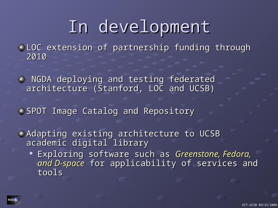
In developmentIn developmentLOC extension of partnership funding through 2010LOC extension of partnership funding through 2010
NGDA deploying and testing federated architecture NGDA deploying and testing federated architecture (Stanford, LOC and UCSB)(Stanford, LOC and UCSB)
SPOT Image Catalog and Repository SPOT Image Catalog and Repository
Adapting existing architecture to UCSB academic digital Adapting existing architecture to UCSB academic digital librarylibrary Exploring software such as Exploring software such as Greenstone, Fedora, and Greenstone, Fedora, and
D-spaceD-space for applicability of services and tools for applicability of services and tools
OIT-UCSB 09/25/2006
Description of NGDA’s Description of NGDA’s Web Data Browser Web Data Browser (Beta)(Beta)
OIT-UCSB 09/25/2006
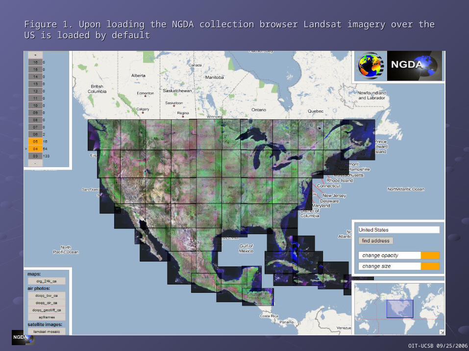
Figure 1. Upon loading the NGDA collection browser Landsat imagery over the US is loaded by Figure 1. Upon loading the NGDA collection browser Landsat imagery over the US is loaded by defaultdefault

OIT-UCSB 09/25/2006
Figure 2. After switching to the DRG historical map collection, a orange "cluster button" indicates that Figure 2. After switching to the DRG historical map collection, a orange "cluster button" indicates that there are a number of maps of California available to view at a higher zoom level. Pressing the cluster there are a number of maps of California available to view at a higher zoom level. Pressing the cluster button recenters the map and redisplays the atlas at higher resolution.button recenters the map and redisplays the atlas at higher resolution.
OIT-UCSB 09/25/2006
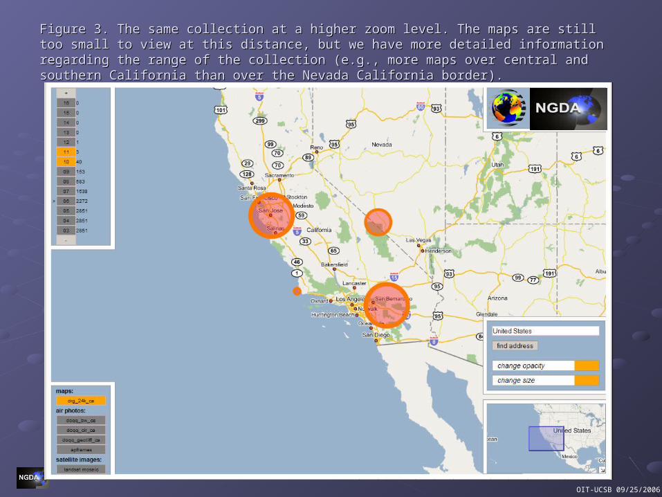
Figure 3. The same collection at a higher zoom level. The maps are still too small to view at this Figure 3. The same collection at a higher zoom level. The maps are still too small to view at this distance, but we have more detailed information regarding the range of the collection (e.g., more distance, but we have more detailed information regarding the range of the collection (e.g., more maps over central and southern California than over the Nevada California border).maps over central and southern California than over the Nevada California border).
OIT-UCSB 09/25/2006
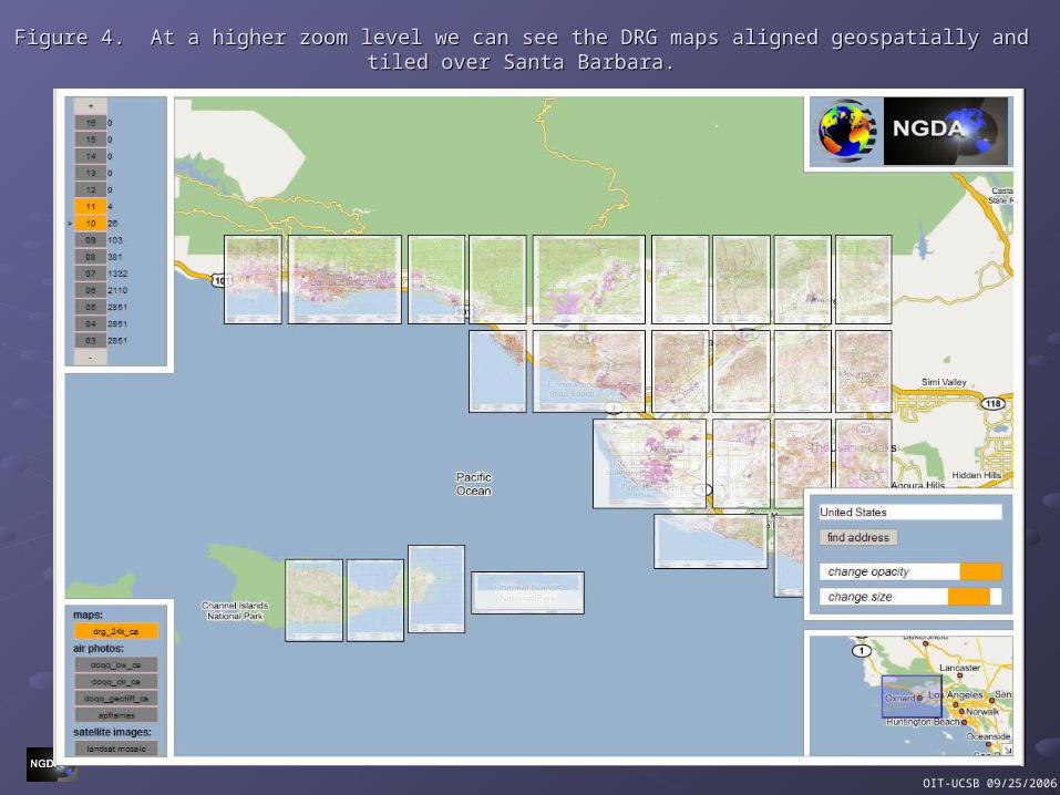
Figure 4. At a higher zoom level we can see the DRG maps aligned geospatially and tiled over Santa Barbara.Figure 4. At a higher zoom level we can see the DRG maps aligned geospatially and tiled over Santa Barbara.
OIT-UCSB 09/25/2006
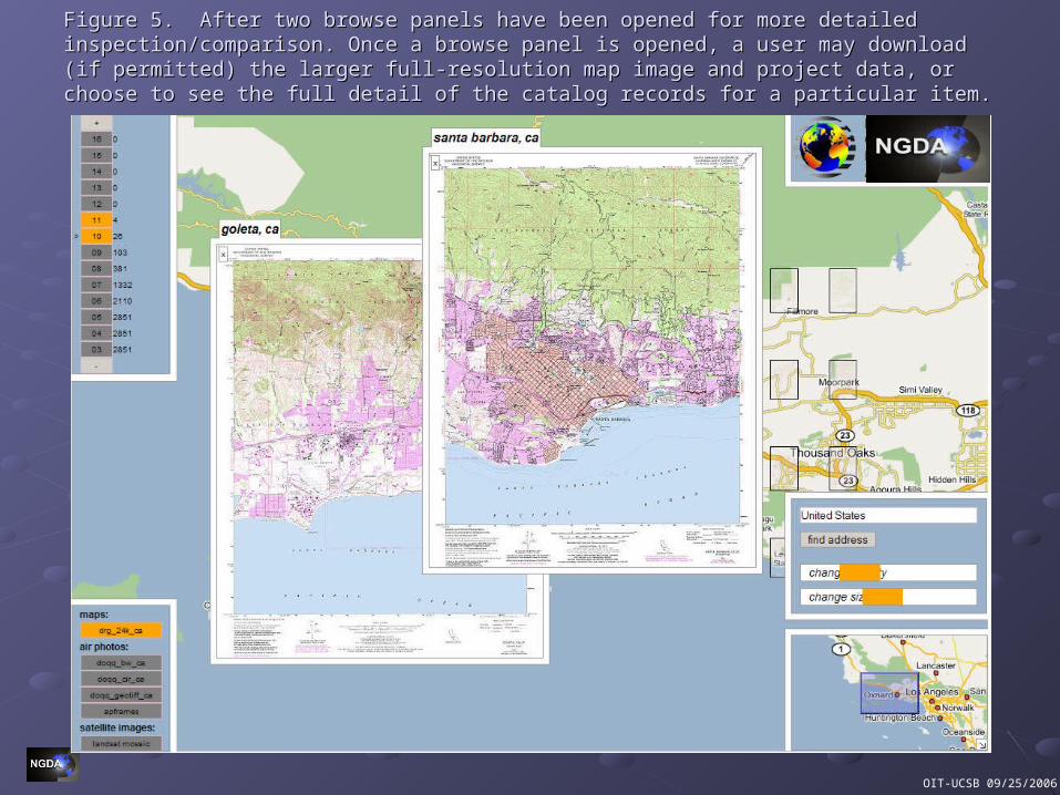
Figure 5. After two browse panels have been opened for more detailed inspection/comparison. Once Figure 5. After two browse panels have been opened for more detailed inspection/comparison. Once a browse panel is opened, a user may download (if permitted) the larger full-resolution map image a browse panel is opened, a user may download (if permitted) the larger full-resolution map image and project data, or choose to see the full detail of the catalog records for a particular item.and project data, or choose to see the full detail of the catalog records for a particular item.
OIT-UCSB 09/25/2006
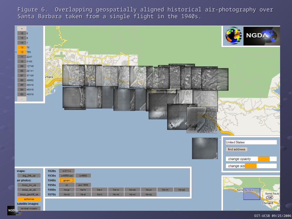
Figure 6. Overlapping geospatially aligned historical air-photography over Santa Barbara taken from Figure 6. Overlapping geospatially aligned historical air-photography over Santa Barbara taken from a single flight in the 1940s.a single flight in the 1940s.
OIT-UCSB 09/25/2006
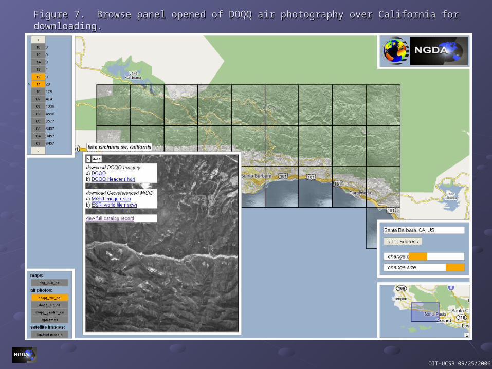
Figure 7. Browse panel opened of DOQQ air photography over California for downloading.Figure 7. Browse panel opened of DOQQ air photography over California for downloading.

OIT-UCSB 09/25/2006
Figure 8. Multiple browse panels opened of Landsat imagery over the Middle East.Figure 8. Multiple browse panels opened of Landsat imagery over the Middle East.
OIT-UCSB 09/25/2006
Thanks for your attention.Thanks for your attention.
httphttp://www.ngda.org://www.ngda.orghttp://www.digitalpreservation.gov/http://www.digitalpreservation.gov/
Questions?Questions?