Embed Size (px)
Citation preview

National Spatial Data Infrastructure in Brazil
40th session of the United Nations Statistical Commission
Lunch Time Seminar
New York, Feb 25th, 2009
Introduction
Spatial Data Infrastructure – SDI
SDI in other countries
National Commission of Cartography (CONCAR)
Presidential Decree
IBGE Actions in Preparing Geospatial Data for NSDI
Final remarks
Contents
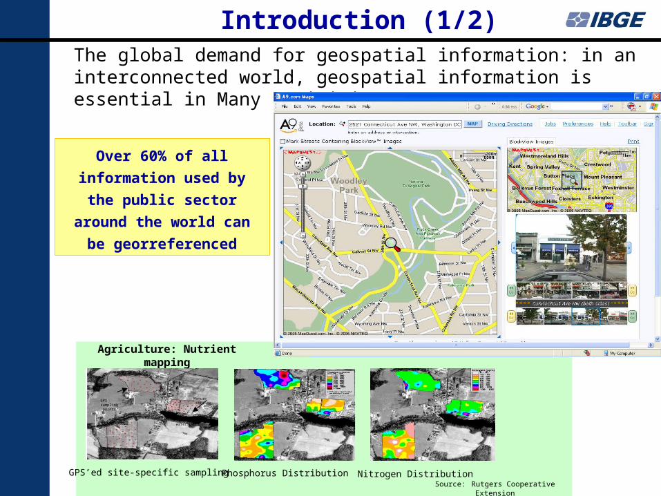
The global demand for geospatial information: in an interconnected world, geospatial information is essential in Many activities
Agriculture: Nutrient mapping
Phosphorus Distribution Nitrogen DistributionGPS’ed site-specific sampling
watershed
Manure storage
GPSsampling points
Source: Rutgers Cooperative Extension
Over 60% of all information
used by the public sector
around the world can be
georreferenced
Introduction (1/2)
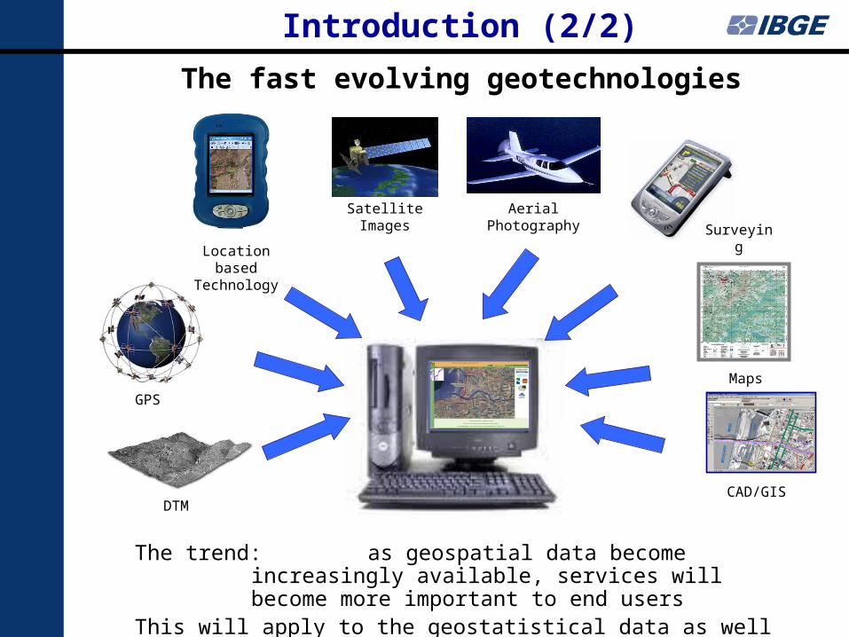
The fast evolving geotechnologies
GPS
Location based Technology
Maps
Satellite Images Aerial Photography
DTMCAD/GIS
Surveying
The trend: as geospatial data become increasingly available, services will become more important to end users
This will apply to the geostatistical data as well
Introduction (2/2)
Brazilian Statistical Office
Example of Georreferenced Statistical data
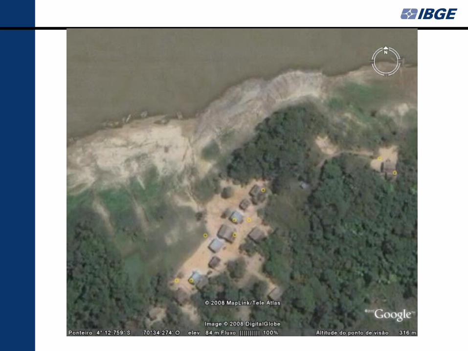
Censuses 2007
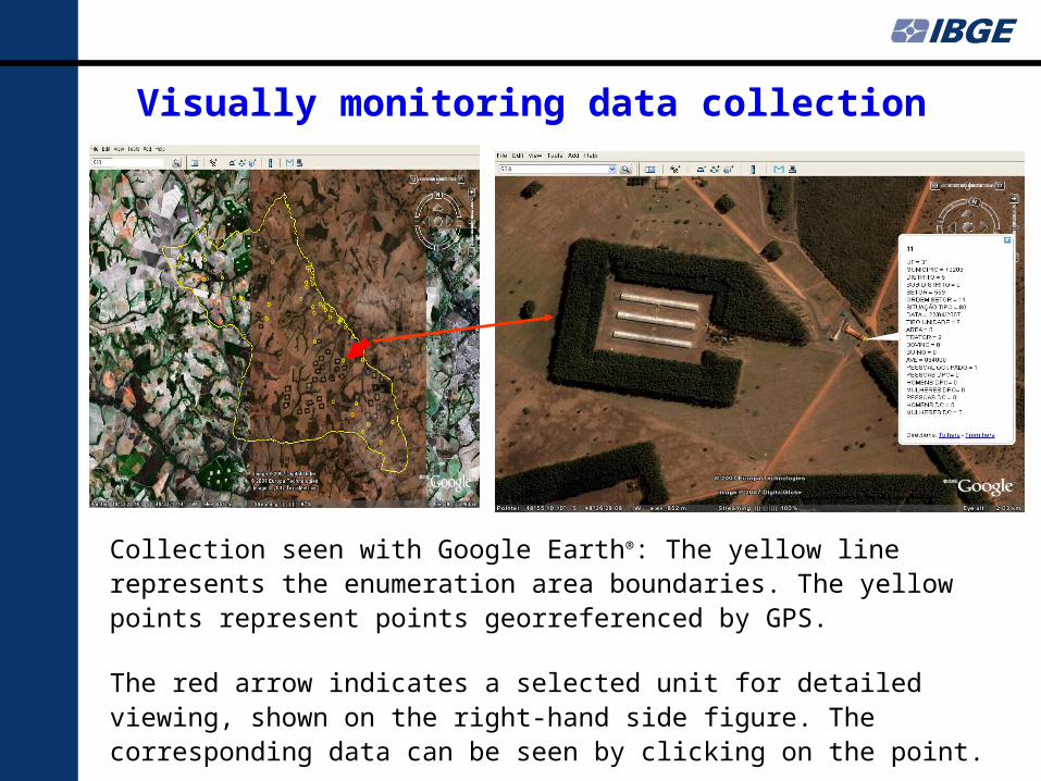
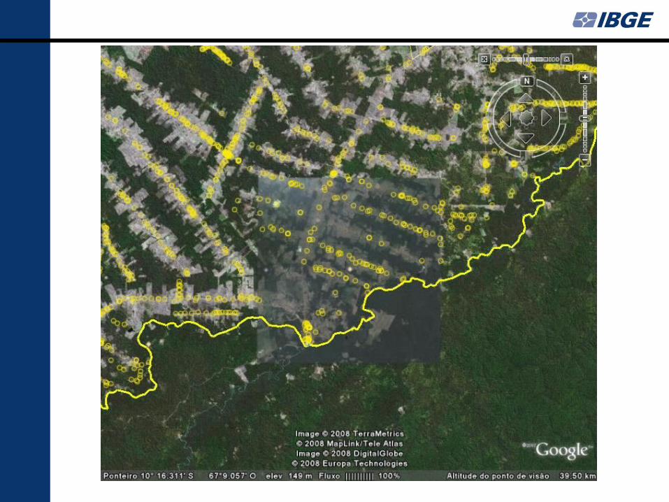
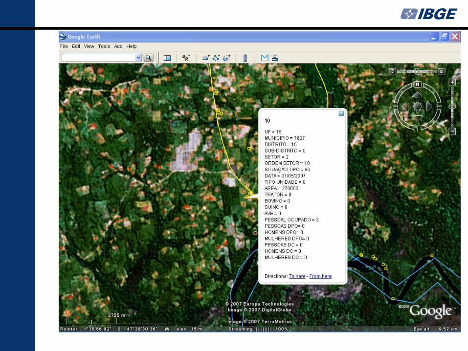
Collection seen with Google Earth®: The yellow line represents the enumeration area boundaries. The yellow points represent points georreferenced by GPS.
The red arrow indicates a selected unit for detailed viewing, shown on the right-hand side figure. The corresponding data can be seen by clicking on the point.
Visually monitoring data collection
National Statistical Offices
What do we need to produce
Georreferenced Statistical data?
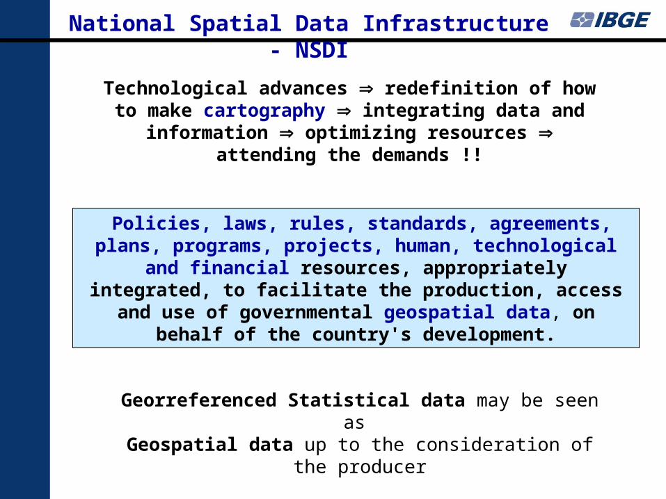
National Spatial Data Infrastructure - NSDI
Policies, laws, rules, standards, agreements, plans, programs, projects, human, technological and financial resources,
appropriately integrated, to facilitate the production, access and use of governmental geospatial data, on behalf of the
country's development.
Technological advances redefinition of how to make cartography integrating data and information optimizing resources attending the demands !!
Georreferenced Statistical data may be seen as Geospatial data up to the consideration of the producer
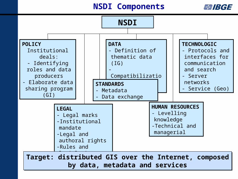
NSDI Components
NSDI
POLICYInstitutional deals:
- Identifying roles and data producers
- Elaborate data sharing program (GI)
DATA- Definition of thematic data (IG)
- Compatibilization - Dissemination
TECHNOLOGIC- Protocols and interfaces for communication and search
- Server networks- Service (Geo)
LEGAL- Legal marks- Institutional mandate-Legal and authoral rights
-Rules and legislation
STANDARDS- Metadata- Data exchange
HUMAN RESOURCES
- Levelling knowledge
-Technical and managerial
Target: distributed GIS over the Internet, composed by data, metadata and services
Target: distributed GIS over the Internet, composed by data, metadata and services
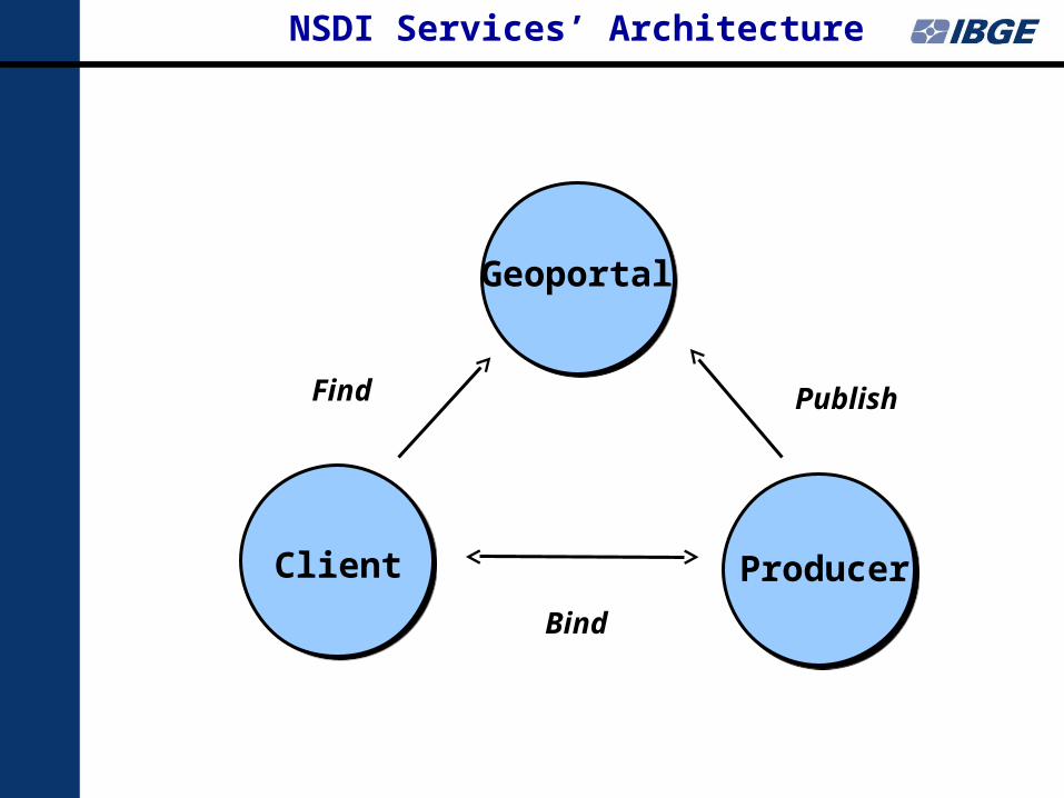
NSDI Services’ Architecture
Client Producer
Geoportal
Find Publish
Bind
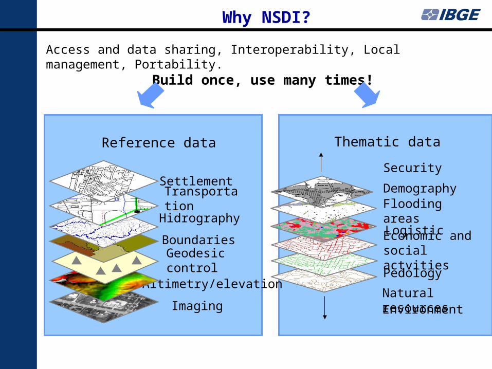
Why NSDI?
Imaging
Altimetry/elevation
Geodesic control
Boundaries
Hidrography
Transportation
Settlement
Pedology
Economic and social actvities
Logistic
Flooding areas
Demography
Security
Access and data sharing, Interoperability, Local management, Portability. Build once, use many times!
Reference data Thematic data
Natural resourcesEnvironment
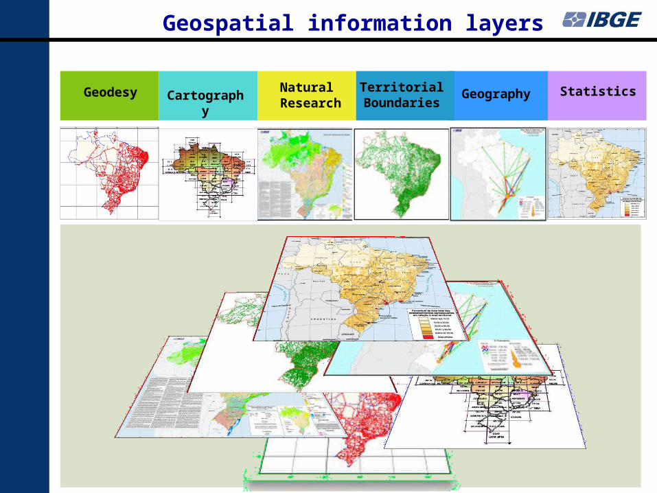
Geodesy Natural Research
CartographyTerritorial Boundaries
Geography Statistics
Geospatial information layers
National Spatial Infrastructure
Some Countries experiences
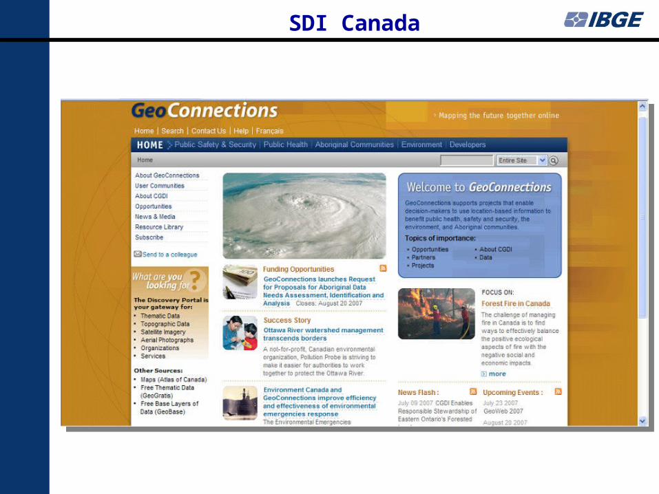
SDI Canada
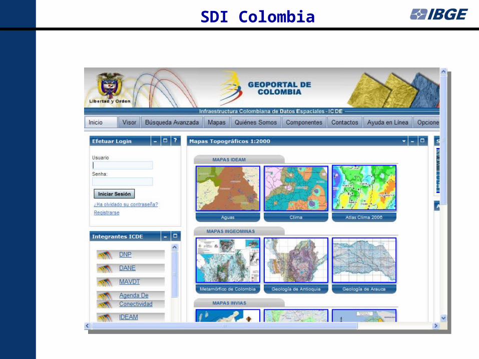
SDI Colombia
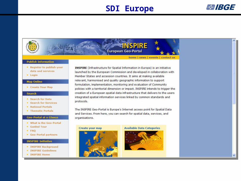
SDI Europe
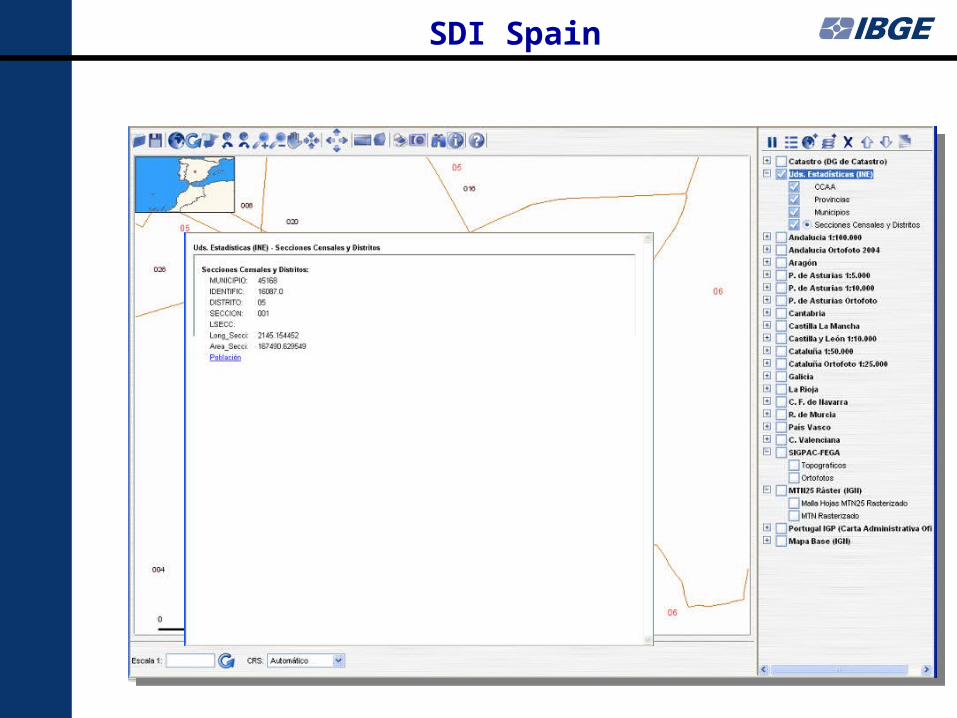
SDI Spain
Important aspects of NSDI, among others
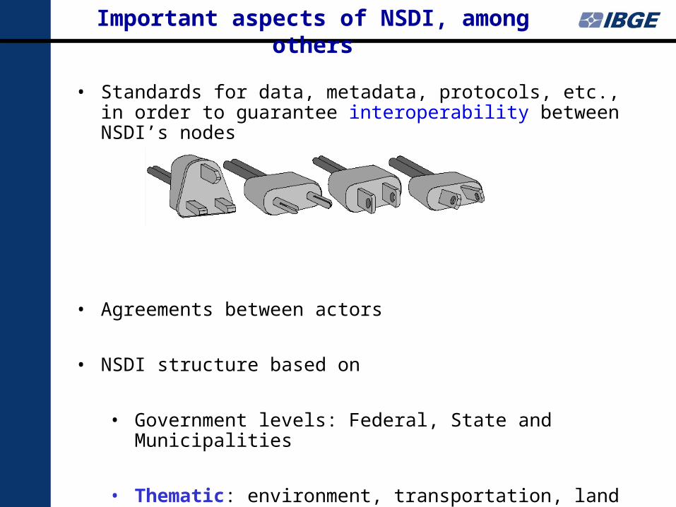
• Standards for data, metadata, protocols, etc., in order to guarantee interoperability between NSDI’s nodes
• Agreements between actors
• NSDI structure based on
• Government levels: Federal, State and Municipalities
• Thematic: environment, transportation, land security, water, foods, education (schools and students), wealth (hospital and health center), etc.
Brazil
Actions for building NSDI
National Register of Addresses
IBGE is preparing the National Register of Addresses for the 2010 Census, by using the Geospatial Information technology, to:
Build a Georreferenced Address File
Produce Georreferenced Statistical data
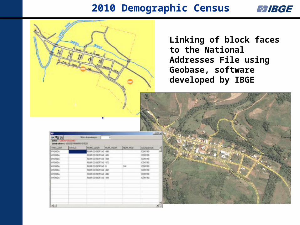
2010 Demographic Census
Urban map
Linking of block faces to the National Addresses File using Geobase, software developed by IBGE
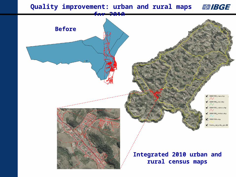
Quality improvement: urban and rural maps for 2010
Integrated 2010 urban and rural census maps
Before
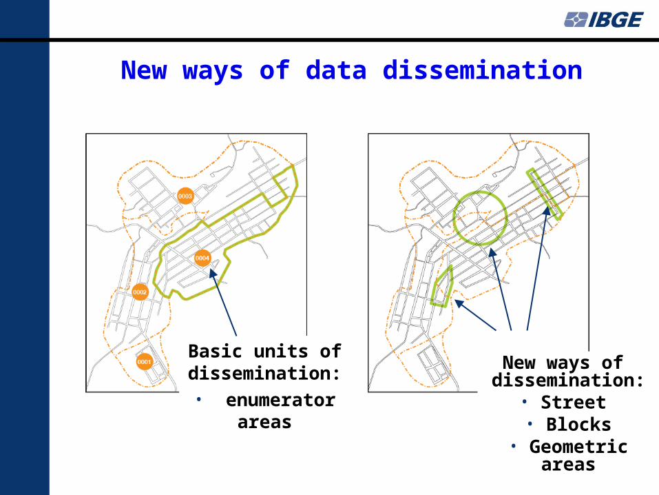
New ways of data dissemination
Basic units of dissemination:• enumerator
areas
New ways of dissemination:
• Street • Blocks
• Geometric areas
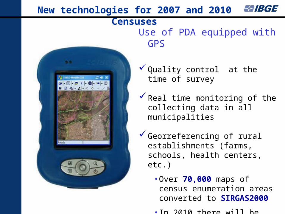
New technologies for 2007 and 2010 Censuses
Use of PDA equipped with GPS
Quality control at the time of survey
Real time monitoring of the collecting data in all municipalities
Georreferencing of rural establishments (farms, schools, health centers, etc.)
• Over 70,000 maps of census enumeration areas converted to SIRGAS2000
• In 2010 there will be over 280,000 census enumeration areas
IBGE actions for building NSDI
IBGE is preparing the geospatial data to contribute to NSDI
Update and converting to NCD/MND of continuous digital geospatial data
Compose a catalogue of satellite imagery with resolution between 2.5 and 100 m of the entire country
IBGE exclusively distributes ALOS satellite images for non-commercial users in Brazil
Note: The census maps that will be prepared to the Census 2010, with intensive use of satellite imagery,
will be a rich collection for the construction of SDI
Note: The census maps that will be prepared to the Census 2010, with intensive use of satellite imagery,
will be a rich collection for the construction of SDI
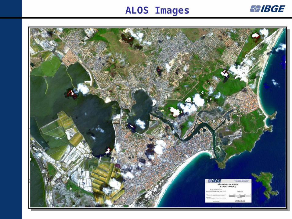
ALOS Images
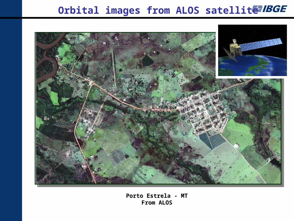
Porto Estrela - MTFrom ALOS
Orbital images from ALOS satellite
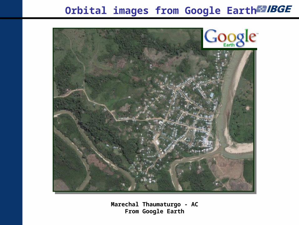
Marechal Thaumaturgo - ACFrom Google Earth
Orbital images from Google Earth
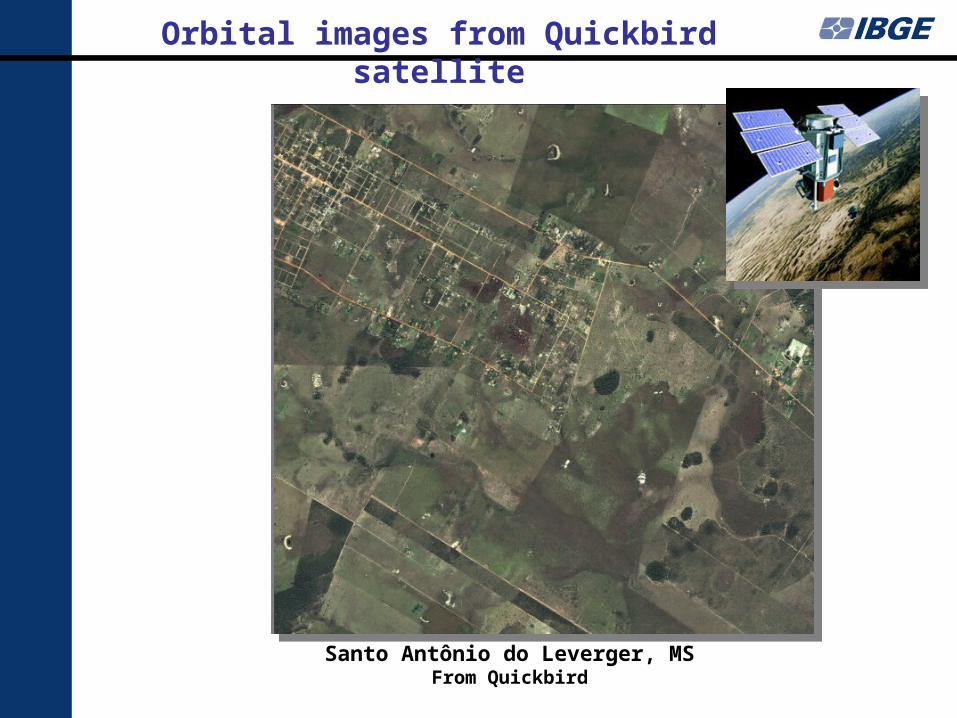
Santo Antônio do Leverger, MSFrom Quickbird
Orbital images from Quickbird satellite
Inserir imagem quickbird
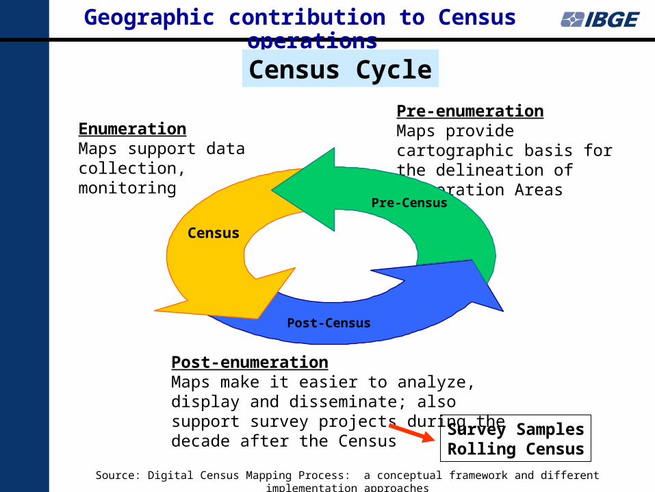
Source: Digital Census Mapping Process: a conceptual framework and different implementation approaches
Post-enumerationMaps make it easier to analyze, display and disseminate; also support survey projects during the decade after the Census
Post-Census
EnumerationMaps support data collection, monitoring
Census
Geographic contribution to Census operations
Pre-enumerationMaps provide cartographic basis for the delineation of Enumeration Areas
Pre-Census
Census Cycle
Survey SamplesRolling Census
• Integrating statistical data into NSDI opens new horizons, based on the possibility of correlating this data with all other data layers, like the ones related to natural resources, environment, education, health, etc.
• The new web based technologies allow NSO to produce Census Mapping in a full digital way, integrating maps, enumeration areas boundaries, graphic and text files, and addresses register
• The current availability of low cost high resolution orbital and aerial imagery can help updating the Census Maps
• The NSOs efforts need to comply with NSDI, which is achievable by following the SDI National Authority Standards – many of which should adhere to the Open Geospatial Consortium standards; by doing this, all geospatial information generated in Census Mapping can be made available through the NSDI
Final Remarks