Embed Size (px)
Citation preview
Discovery MeetingNashua Watershed
April 27, 2016 – Leominster, Massachusetts
2
Introductions Risk MAP Project Team Community partners and officials State partners and officials Other Federal Agencies partner representatives Associations Others
3
Why are we here?
Risk Mapping, Assessment and Planning (RiskMAP): What is different? FY2016 - FY2020? Mitigation Planning - Status update 4-Meeting Format
Discovery meeting today
Study approach – Watershed based
Best Available Data
Community data available?
4
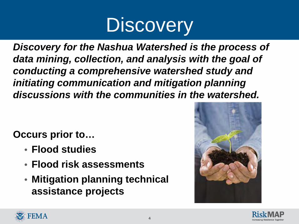
DiscoveryDiscovery for the Nashua Watershed is the process of data mining, collection, and analysis with the goal of conducting a comprehensive watershed study and initiating communication and mitigation planning discussions with the communities in the watershed.
Occurs prior to…• Flood studies• Flood risk assessments• Mitigation planning technical
assistance projects
5
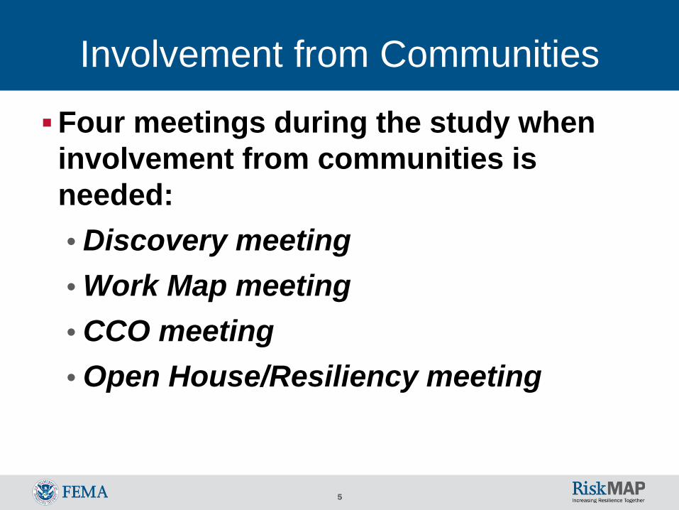
Involvement from Communities
Four meetings during the study when involvement from communities is needed:• Discovery meeting• Work Map meeting• CCO meeting• Open House/Resiliency meeting
6
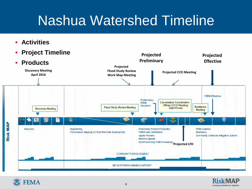
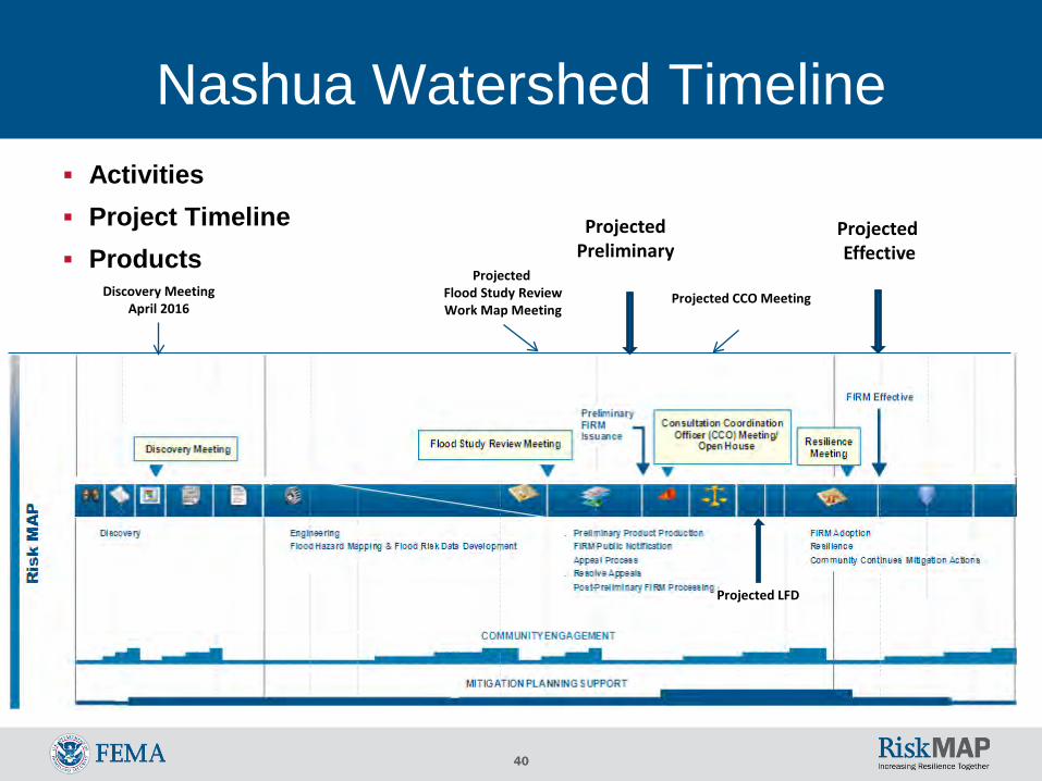
Nashua Watershed Timeline Activities Project Timeline Products
Projected Preliminary
Projected Effective
Projected CCO MeetingDiscovery MeetingApril 2016
Projected Flood Study ReviewWork Map Meeting
Projected LFD
7
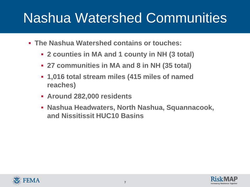
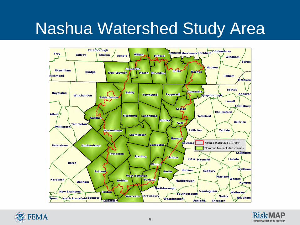
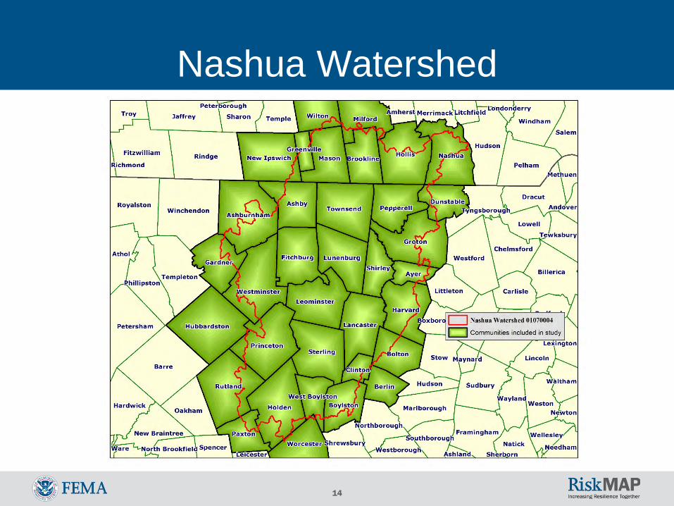
Nashua Watershed Communities The Nashua Watershed contains or touches:
2 counties in MA and 1 county in NH (3 total) 27 communities in MA and 8 in NH (35 total) 1,016 total stream miles (415 miles of named
reaches) Around 282,000 residents Nashua Headwaters, North Nashua, Squannacook,
and Nissitissit HUC10 Basins
8
Nashua Watershed Study Area
9
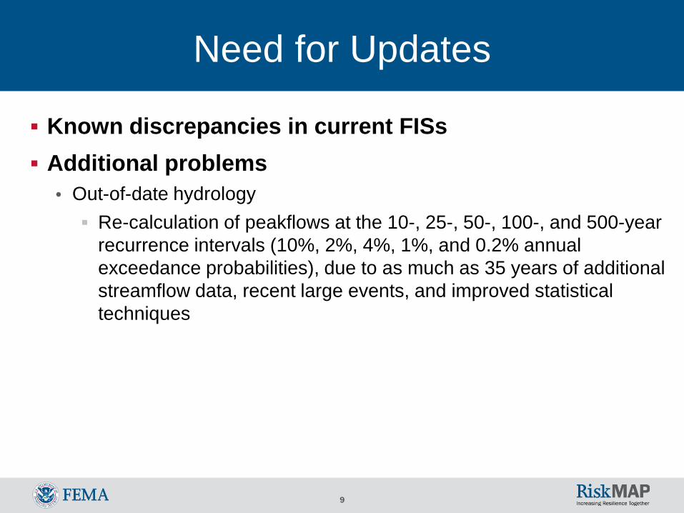
Need for Updates
Known discrepancies in current FISs Additional problems
• Out-of-date hydrology Re-calculation of peakflows at the 10-, 25-, 50-, 100-, and 500-year
recurrence intervals (10%, 2%, 4%, 1%, and 0.2% annual exceedance probabilities), due to as much as 35 years of additional streamflow data, recent large events, and improved statistical techniques
10
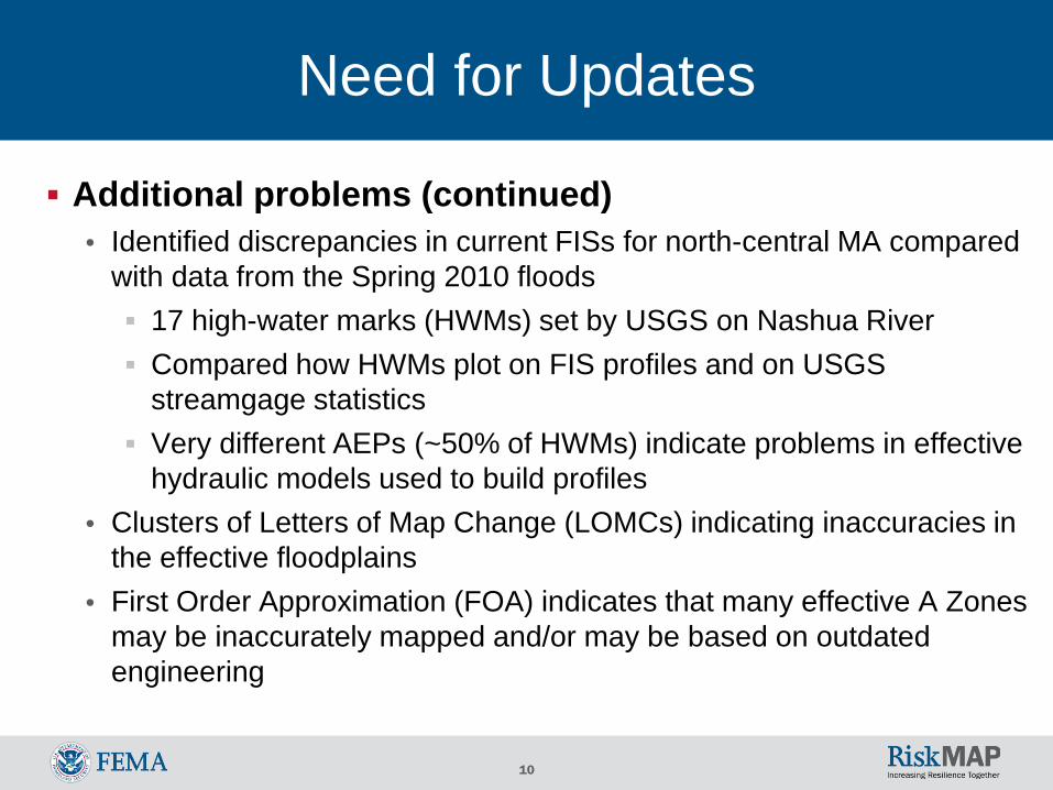
Need for Updates
Additional problems (continued)• Identified discrepancies in current FISs for north-central MA compared
with data from the Spring 2010 floods 17 high-water marks (HWMs) set by USGS on Nashua River Compared how HWMs plot on FIS profiles and on USGS
streamgage statistics Very different AEPs (~50% of HWMs) indicate problems in effective
hydraulic models used to build profiles• Clusters of Letters of Map Change (LOMCs) indicating inaccuracies in
the effective floodplains• First Order Approximation (FOA) indicates that many effective A Zones
may be inaccurately mapped and/or may be based on outdated engineering
11
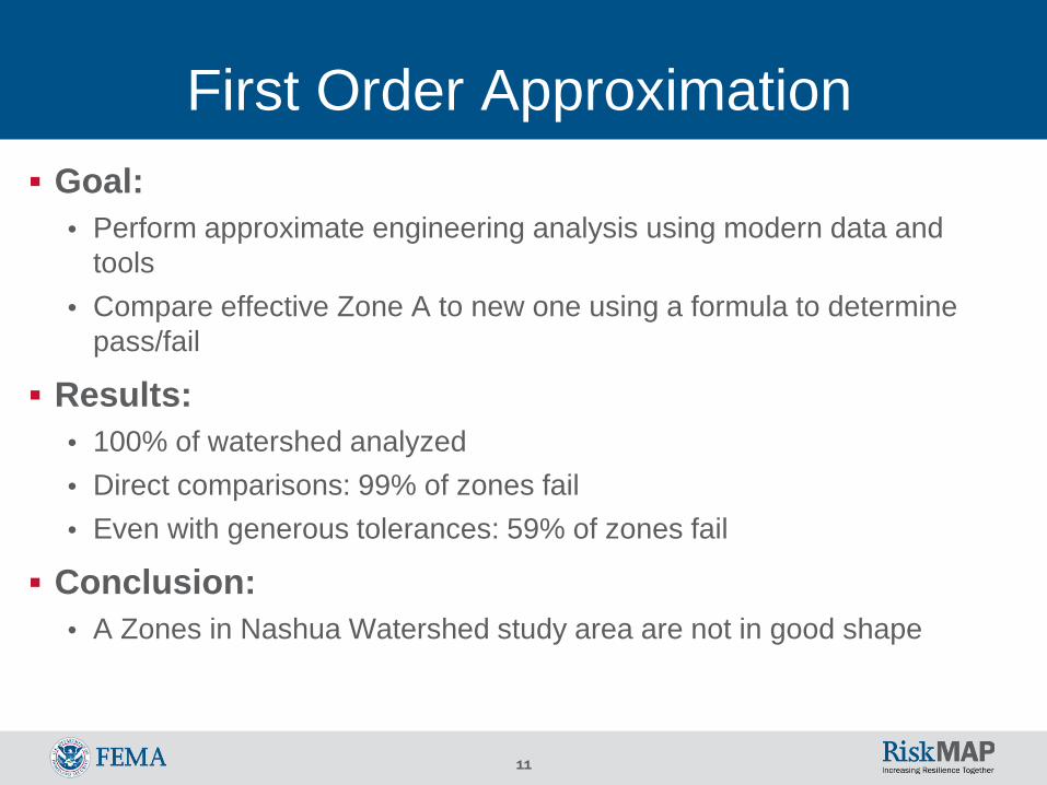
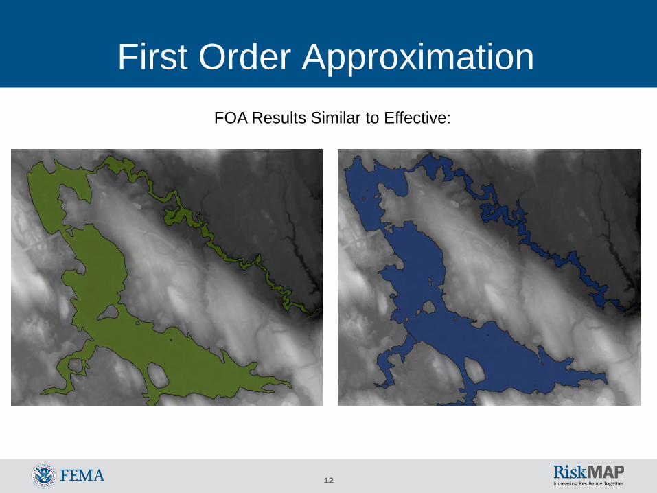
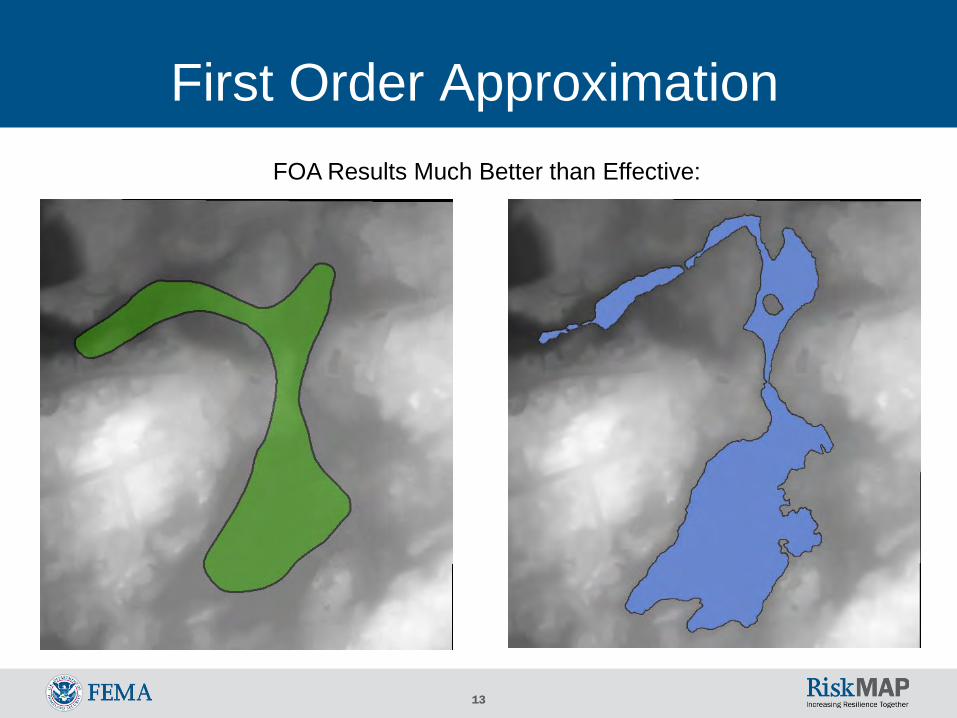
First Order Approximation Goal:
• Perform approximate engineering analysis using modern data and tools
• Compare effective Zone A to new one using a formula to determine pass/fail
Results:• 100% of watershed analyzed• Direct comparisons: 99% of zones fail• Even with generous tolerances: 59% of zones fail
Conclusion:• A Zones in Nashua Watershed study area are not in good shape
12
First Order ApproximationFOA Results Similar to Effective:
13
First Order ApproximationFOA Results Much Better than Effective:
14
Nashua Watershed
15
Nashua Watershed Rivers Nashua River North Nashua River Squannacook River Nissitissit River Quinapoxet River Stillwater River Whitman River Catacoonamug Brook Falulah Brook Mulpus Brook Nonacoicus Brook Phillips Brook Other smaller rivers and tributaries
16
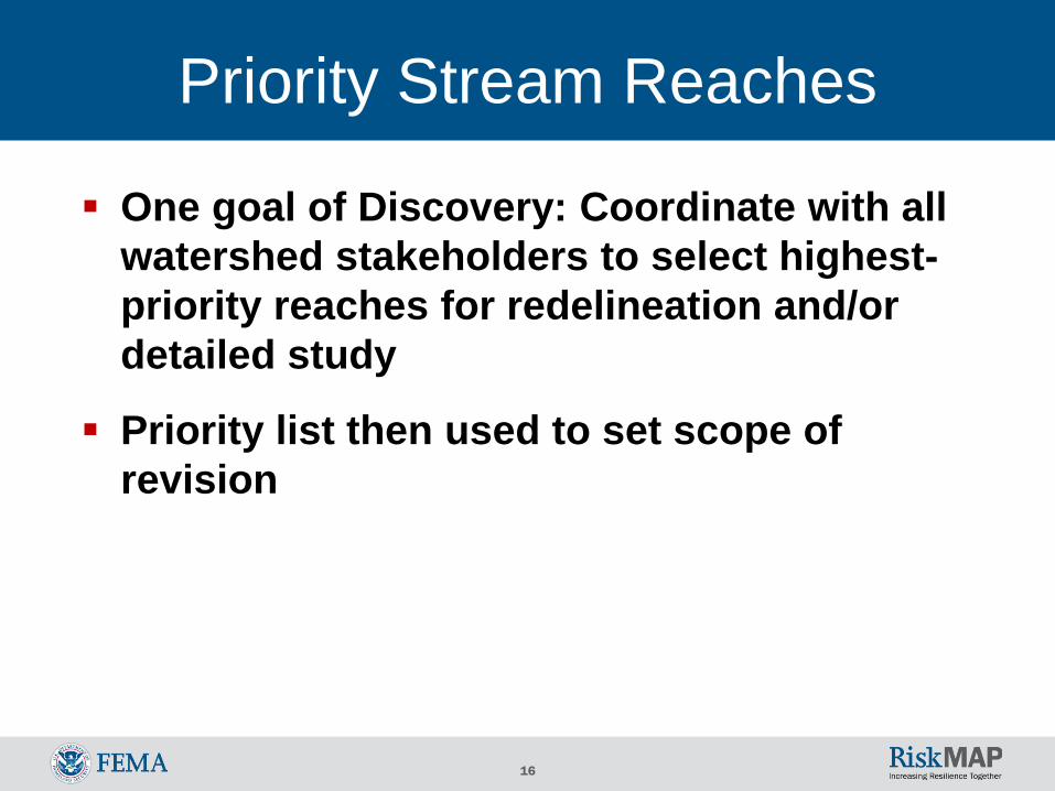
One goal of Discovery: Coordinate with all watershed stakeholders to select highest-priority reaches for redelineation and/or detailed study
Priority list then used to set scope of revision
Priority Stream Reaches
17
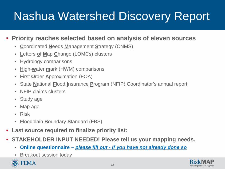
Nashua Watershed Discovery Report
Priority reaches selected based on analysis of eleven sources• Coordinated Needs Management Strategy (CNMS)• Letters of Map Change (LOMCs) clusters• Hydrology comparisons• High-water mark (HWM) comparisons• First Order Approximation (FOA)• State National Flood Insurance Program (NFIP) Coordinator’s annual report• NFIP claims clusters• Study age• Map age• Risk• Floodplain Boundary Standard (FBS)
Last source required to finalize priority list: STAKEHOLDER INPUT NEEDED! Please tell us your mapping needs.
• Online questionnaire – please fill out - if you have not already done so• Breakout session today
18
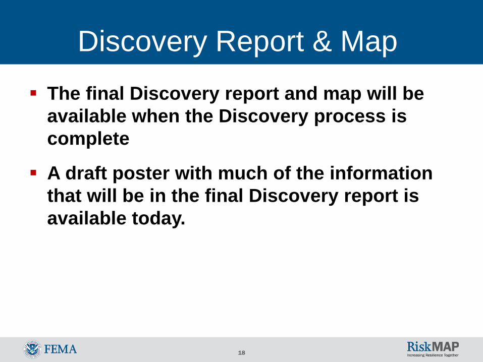
Discovery Report & Map The final Discovery report and map will be
available when the Discovery process is complete
A draft poster with much of the information that will be in the final Discovery report is available today.
19
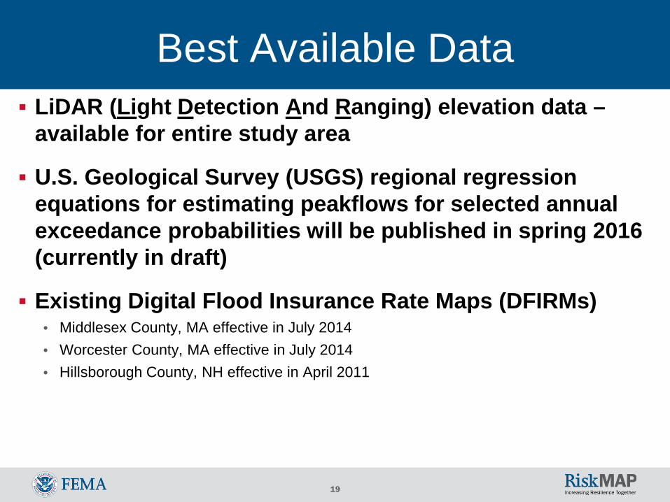
Best Available Data LiDAR (Light Detection And Ranging) elevation data –
available for entire study area
U.S. Geological Survey (USGS) regional regression equations for estimating peakflows for selected annual exceedance probabilities will be published in spring 2016 (currently in draft)
Existing Digital Flood Insurance Rate Maps (DFIRMs)• Middlesex County, MA effective in July 2014• Worcester County, MA effective in July 2014• Hillsborough County, NH effective in April 2011
20
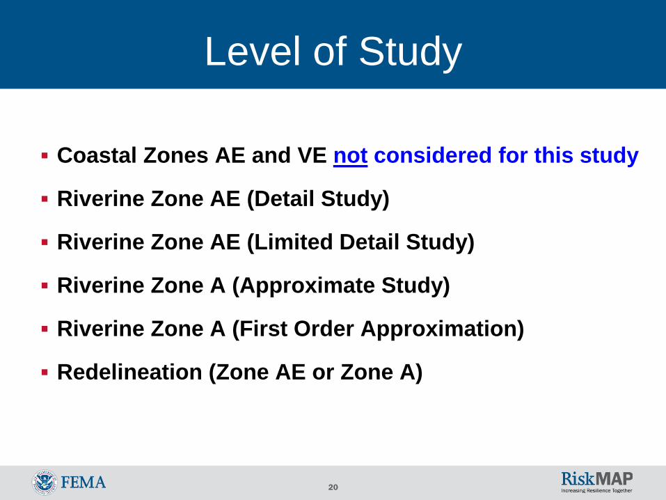
Level of Study
Coastal Zones AE and VE not considered for this study
Riverine Zone AE (Detail Study)
Riverine Zone AE (Limited Detail Study)
Riverine Zone A (Approximate Study)
Riverine Zone A (First Order Approximation)
Redelineation (Zone AE or Zone A)
21
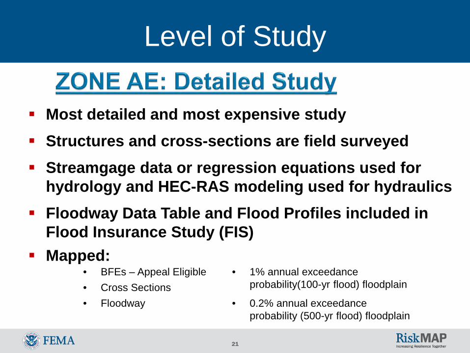
Most detailed and most expensive study Structures and cross-sections are field surveyed Streamgage data or regression equations used for
hydrology and HEC-RAS modeling used for hydraulics Floodway Data Table and Flood Profiles included in
Flood Insurance Study (FIS) Mapped:
• BFEs – Appeal Eligible• Cross Sections
• 1% annual exceedance probability(100-yr flood) floodplain
• 0.2% annual exceedance probability (500-yr flood) floodplain
• Floodway
Level of Study
22
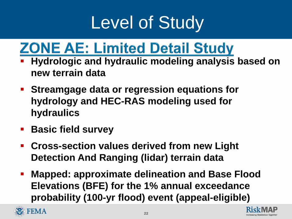
Hydrologic and hydraulic modeling analysis based on new terrain data
Streamgage data or regression equations for hydrology and HEC-RAS modeling used for hydraulics
Basic field survey Cross-section values derived from new Light
Detection And Ranging (lidar) terrain data Mapped: approximate delineation and Base Flood
Elevations (BFE) for the 1% annual exceedance probability (100-yr flood) event (appeal-eligible)
Level of Study
23
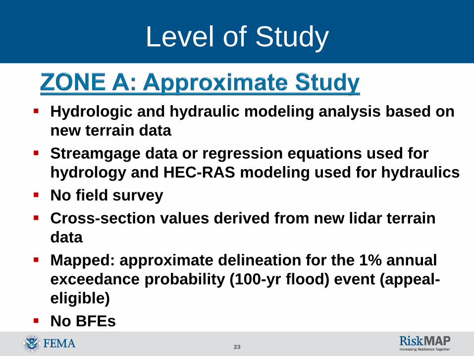
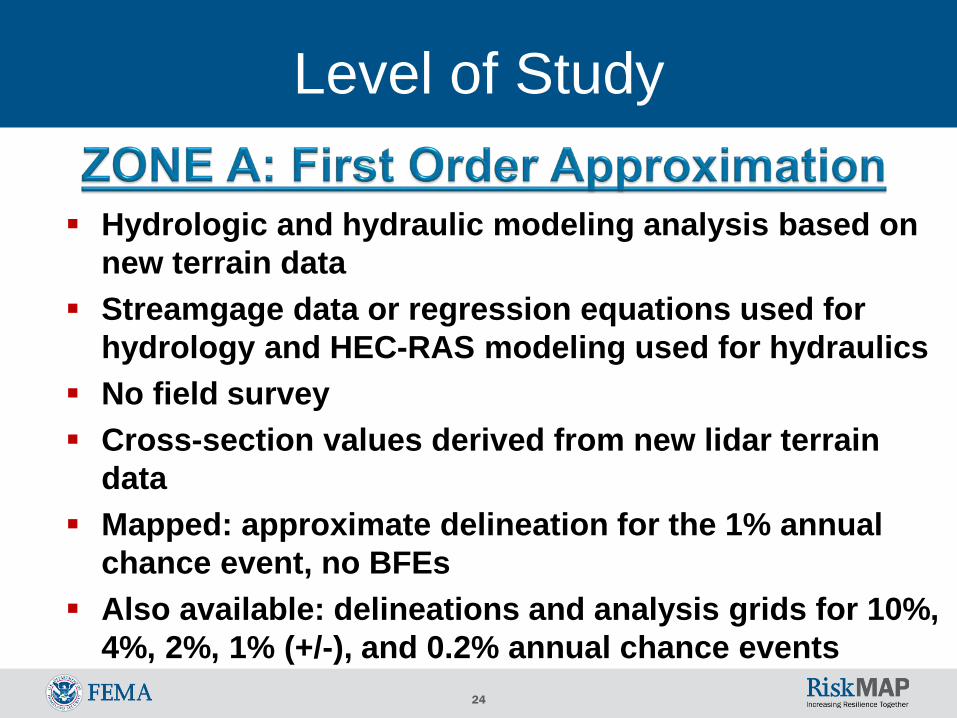
Hydrologic and hydraulic modeling analysis based on new terrain data
Streamgage data or regression equations used for hydrology and HEC-RAS modeling used for hydraulics
No field survey Cross-section values derived from new lidar terrain
data Mapped: approximate delineation for the 1% annual
exceedance probability (100-yr flood) event (appeal-eligible)
No BFEs
Level of Study
24
Hydrologic and hydraulic modeling analysis based on new terrain data
Streamgage data or regression equations used for hydrology and HEC-RAS modeling used for hydraulics
No field survey Cross-section values derived from new lidar terrain
data Mapped: approximate delineation for the 1% annual
chance event, no BFEs Also available: delineations and analysis grids for 10%,
4%, 2%, 1% (+/-), and 0.2% annual chance events
Level of Study
25
Level of Study
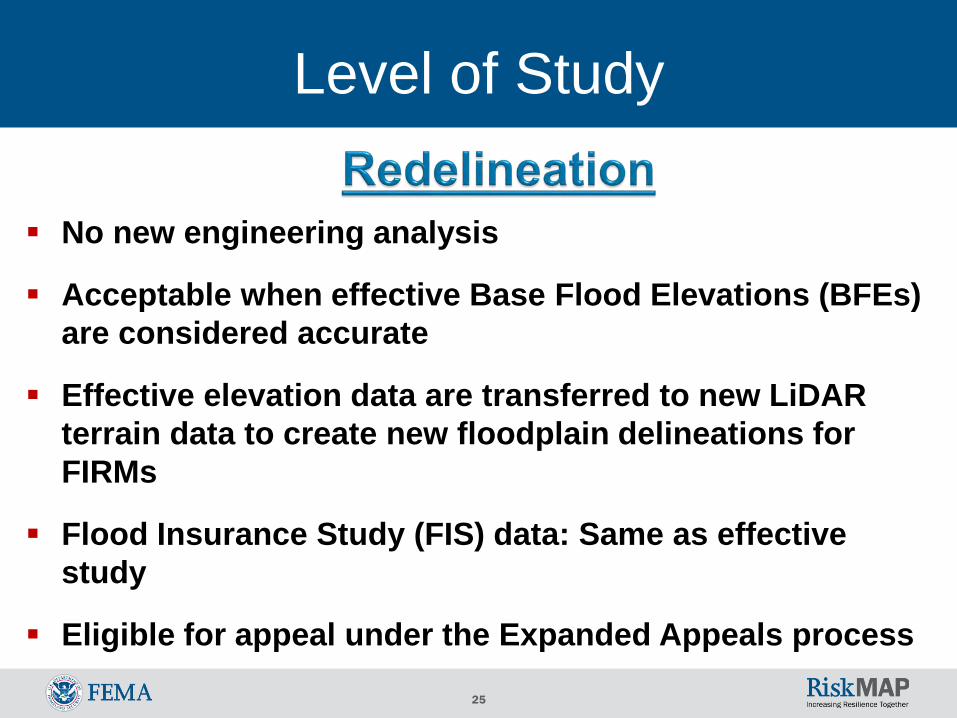
No new engineering analysis
Acceptable when effective Base Flood Elevations (BFEs) are considered accurate
Effective elevation data are transferred to new LiDAR terrain data to create new floodplain delineations for FIRMs
Flood Insurance Study (FIS) data: Same as effective study
Eligible for appeal under the Expanded Appeals process
26
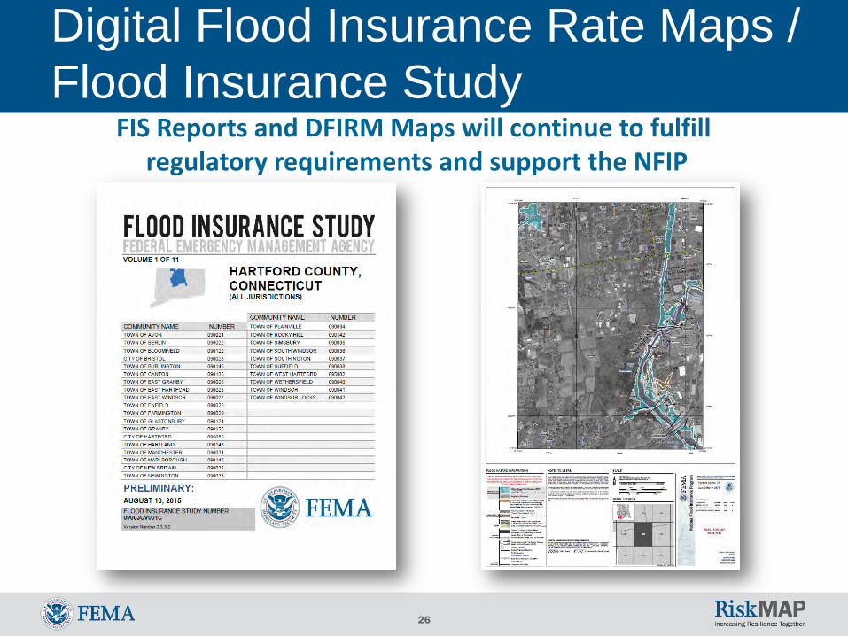
Digital Flood Insurance Rate Maps / Flood Insurance Study
FIS Reports and DFIRM Maps will continue to fulfillregulatory requirements and support the NFIP
27
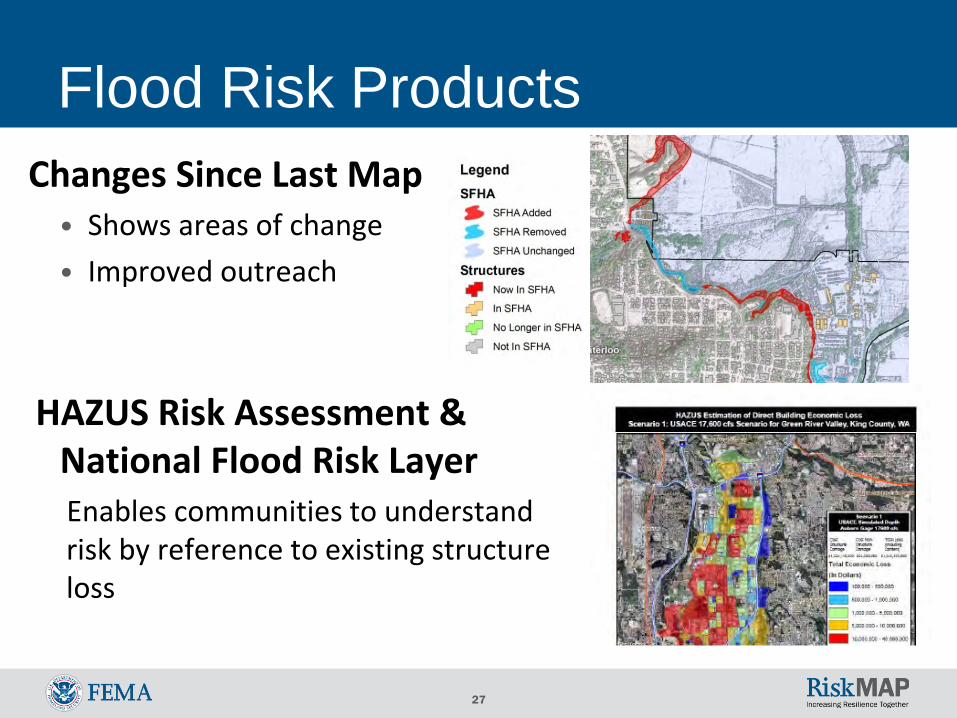
Flood Risk ProductsChanges Since Last Map
• Shows areas of change• Improved outreach
HAZUS Risk Assessment & National Flood Risk LayerEnables communities to understand risk by reference to existing structure loss
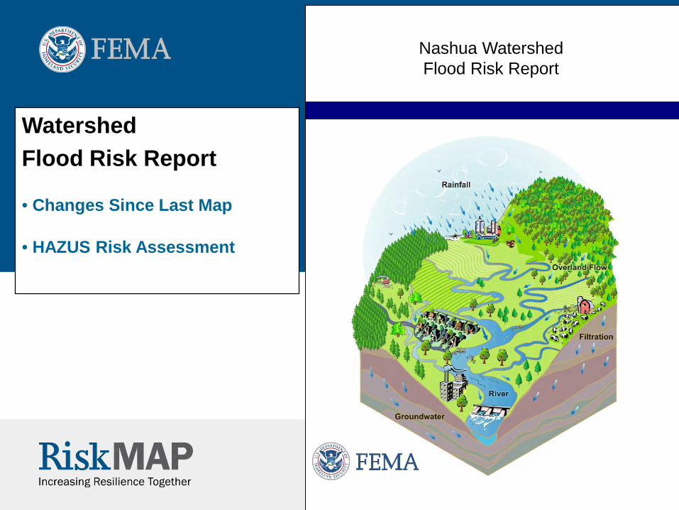
Nashua WatershedFlood Risk Report
Watershed Flood Risk Report
• Changes Since Last Map
• HAZUS Risk Assessment

29
Nashua Watershed Timeline Activities Project Timeline Products
Projected Preliminary
Projected Effective
Projected CCO MeetingDiscovery MeetingApril 2016
Projected Flood Study ReviewWork Map Meeting
Projected LFD
30
Discover the Watershed CommunitiesUnderstand local interest, issues, capabilities of communities
• Status of Mitigation Plans • Communication desire, skills, resources• Interest in and resources for mitigation• Experience with flood disasters and recovery• Floodplain administration• Mitigation support needs and interests
31
Nashua Watershed
Hazard Mitigation Plan Status
Please see handout
32
Discover FEMA ProgramsFlood Mitigation Assistance – annual funding to reduce risk to NFIP-
insured structuresHazard Mitigation Grant Program – declared disaster funding for long-
term hazard mitigation measuresPre-Disaster Mitigation Program – annual funding for hazard mitigation
planning and implementationCommunity Rating System – proactive communities receive insurance
discounts for residentsNational Dam Safety Program – dam safety standards
33
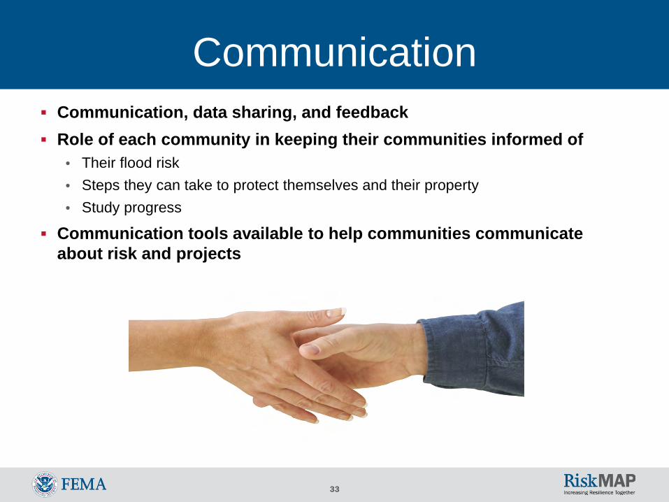
Communication Communication, data sharing, and feedback Role of each community in keeping their communities informed of
• Their flood risk • Steps they can take to protect themselves and their property• Study progress
Communication tools available to help communities communicate about risk and projects
34
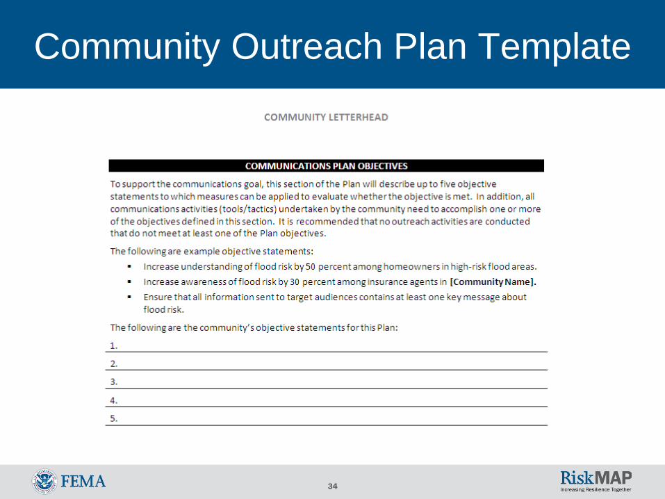
Community Outreach Plan Template
35
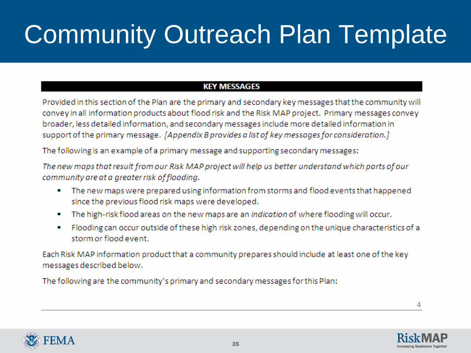
Community Outreach Plan Template
36
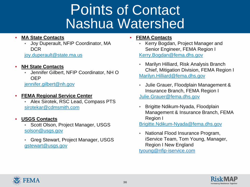
Points of ContactNashua Watershed
MA State Contacts• Joy Duperault, NFIP Coordinator, MA
NH State Contacts• Jennifer Gilbert, NFIP Coordinator, NH O
FEMA Regional Service Center • Alex Sirotek, RSC Lead, Compass [email protected]
USGS Contacts• Scott Olson, Project Manager, [email protected]
• Greg Stewart, Project Manager, [email protected]
FEMA Contacts• Kerry Bogdan, Project Manager and
Senior Engineer, FEMA Region [email protected]
• Marilyn Hilliard, Risk Analysis Branch Chief, Mitigation Division, FEMA Region I
• Julie Grauer, Floodplain Management & Insurance Branch, FEMA Region I
• Brigitte Ndikum-Nyada, Floodplain Management & Insurance Branch, FEMA Region I
• National Flood Insurance Program, iService Team, Tom Young, Manager, Region I New England
37
General Points of Contact For general FEMA mapping and Letter of Map Change (LOMC)
questions contact FEMA’s Map Information Exchange (FMIX): 1-877-FEMA MAP (1-877-336-2627) or email a Map Specialist: [email protected]
Map Service Center (MSC): where you can view effective maps online for free http://www.msc.fema.gov/
To learn more about the National Flood Insurance Program (NFIP): http://www.floodsmart.gov/floodsmart/ or call 1-888-379-9531
38
Data Request Names, titles, roles, addresses, emails, and numbers of community
officials involved in NFIP program, floodplain management, etc. Desired study reaches Existing data studies Available funding or data to contribute to a potential study Areas of Mitigation Interest Existing, proposed, or altered dams and levees Past mitigation successes, future mitigation goals Environmentally sensitive areas Community-level flood hazard, risk, or general GIS data Outreach or training methods, goals, and needs
See questionnaire, and/or provide information whenever possible
39
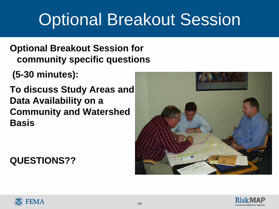
Optional Breakout SessionOptional Breakout Session for
community specific questions(5-30 minutes):To discuss Study Areas and Data Availability on a Community and Watershed Basis
QUESTIONS??
40
Nashua Watershed Timeline Activities Project Timeline Products
Projected Preliminary
Projected Effective
Projected CCO MeetingDiscovery MeetingApril 2016
Projected Flood Study ReviewWork Map Meeting
Projected LFD

![Risk MAP and Discovery FEMA Region [#], [WATERSHED NAME] Watershed Information Exchange Sessions [DATES]](https://img.pdfslide.us/doc/110x75/56649ed05503460f94bde97e/risk-map-and-discovery-fema-region-watershed-name-watershed-information.jpg)


![Risk MAP and Discovery FEMA Region [#], [WATERSHED NAME] Watershed Discovery Meetings [DATE]](https://img.pdfslide.us/doc/110x75/56649d005503460f949d2390/risk-map-and-discovery-fema-region-watershed-name-watershed-discovery.jpg)


![Risk MAP and Discovery FEMA Region [#], [WATERSHED NAME] Watershed](https://img.pdfslide.us/doc/110x75/56815ed1550346895dcd5fd2/risk-map-and-discovery-fema-region-watershed-name-watershed.jpg)