Embed Size (px)
Citation preview
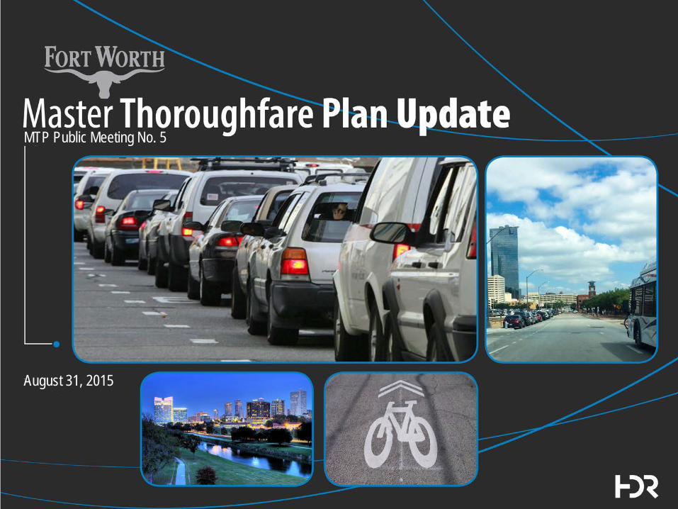
MTP Public Meeting No. 5
August 31, 2015

Agenda • Follow up from Initial Round of Public Meetings • Draft MTP Goals and Objectives • Review of Project Framework • Draft Cross Sections and Selection Process • Description of Street Type Map • Description of Lanes Map • Results of Peer Cities Review • Next Steps • Discussion and Feedback
2

Follow Up from Initial
Public Meetings
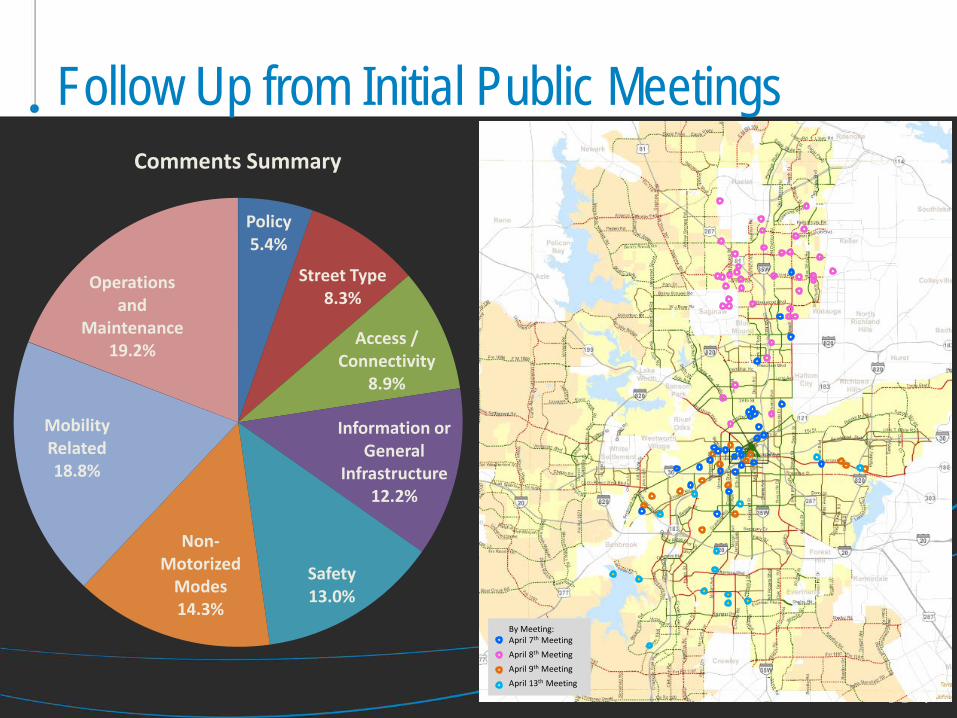
Follow Up from Initial Public Meetings
By Meeting: April 7th Meeting
April 8th Meeting
April 9th Meeting
April 13th Meeting
Policy 5.4%
Street Type 8.3%
Access / Connectivity
8.9%
Information or General
Infrastructure 12.2%
Safety 13.0%
Non-Motorized
Modes 14.3%
Mobility Related 18.8%
Operations and
Maintenance 19.2%
Comments Summary

Dispensation of Public Comments Public Meeting Exit Interview Card Comments – April 7-13th Meeting
Date
Information wanted or
General Infrastructure
comment
Policy related
comment
Mobility related
comment
Non-Auto Mode Choice related
comment
Access or Connectivit
y related
Safety Related
Operations and
Maintenance related
Street Type
comment Comment dispensation
Question 1 - 1. What are your top three transportation concerns when you think of getting around the Fort Worth; getting to and from work or school, etc.? 4/7/2015 i p m mo a s o&m ST As a cyclist and commuter, I'd like to see more "share the road" signs and sharrows. i Passed on to Bike/Ped team for consideration Mass transit, poor bike lanes i Distributed for consideration in MTP Update Bus Rapid Transit with dedicated ROW. Don’t think we will see light rail or streetcars in my lifetime mo Distributed for consideration in MTP Update Ability to ride a bicycle, ability to walk, ability to take transit mo Distributed for consideration in MTP Update Safety, accessibility, congestion m s Distributed for consideration in MTP Update Travel time due to traffic. Proper stop lights and cross walks. Bike & pedestrian friendly road ways. m o&m Distributed for consideration in MTP Update Make more pedestrian friendly streets and bikes mo Passed on to Bike/Ped team for consideration Lack of transit orientated design, luck of transportation and facilities integration planning in urban corridors in the central city mo Distributed for consideration in MTP Update Mitigation of bottlenecks. Access to highways/major road o&m Distributed for consideration in MTP Update Align/increase throughput on major thoroughfares to confirm to motorists expectations; EGG 199 northbound out of downtown, US 377 NB FTW to Keller m Geocoded and Passed to TXDOT for consideration Slow traffic down! More bike lanes and greater pedestrian safety mo s Distributed for consideration in MTP Update
Question 3 - What street or intersection in FW would you like to see more of and why? The "road diet" with the traffic islands on Rosedale in the Southside. It slows down traffic. The traffic circles on Riverside. i mo Distributed for consideration in MTP Update Crosstown bike lanes have designated off road bike lanes mo Passed on to Bike/Ped team for consideration Forest Park Blvd. should look for bus connectivity and more economic development a Distributed for consideration in MTP Update Berry Street by TCU - calmed traffic, nice sidewalks, landscaping, etc. i m Distributed for consideration in MTP Update Magnolia - slow speeds, plenty of crosswalks, moderate parking i m Distributed for consideration in MTP Update No comment No Comment No comment No Comment Carverly and Rosedale - safety hazard. Degrades neighborhood openness. m s Distributed for consideration in MTP Update No comment No Comment Create a safe, bikeable link between Fairmount/Southside and Alamo Heights. (Restore Vickery Blvd Bridge Across Trinity, or build a trail bridge near the Zoo train bridge. mo a Passed on to Bike/Ped team for consideration Magnolia. Traffic is calmed and bike lanes are comfortable to use. mo Passed on to Bike/Ped team for consideration
Question 4 - What street or intersection do you not want to see more of and why? Wide "Houston" boulevards (four and five lanes) st Distibuted for consideration in MTP Update West Lancaster from I-35 West no bike lanes then narrow going under I-35 ramp then no bike lanes going into Park m mo Passed on to Bike/Ped team for consideration No comment No Comment Berry Street between Hemphill & TCU - 6 lanes and turn lane is too wide, cars travel fast, divides residential neighborhoods m st Distibuted for consideration in MTP Update W 7th St. and Carroll, Light Patterns add to congestions, left hand turn lane on Carroll creates accidents. Very difficult to cross as pedestrian. s o&m Distibuted for consideration in MTP Update No comment No Comment Hulen & I20 intersections need improvements to reduce congestion. Improvement needed on Main & Jenning from downtown to near Southside. i m s Distibuted for consideration in MTP Update No comment o&m No Comment A couple of intersections have unprotected Left Turns. These cause left turners to "jump the gun" and turn left in front to it Distributed for consideration in MTP Update Remove the yellow plastic warning marks from the center of W. Magnolia Ave. They cause drivers to encroach upon cyclists who are using the bike lane. i s Passed on to Bike/Ped team for consideration W. 7th/University. Traffic fast and hard to use on bike until bike lane begins. mo s Passed on to Bike/Ped team for consideration
Comments I believe more traffic circles instead of intersections help with the flow. Roads that have shoulders should be bike lanes. Really wide boulevards should have a bike lane or sharrows. Raised bike lanes are the future! i Passed on to Bike/Ped team for consideration Cycling is more than just a sport. It is transportation and needs to be treated as such. mo Passed on to Bike/Ped team for consideration Transit should be discussed at every city council meeting. I would like to know each council members long term transportation vision. i Distributed for consideration in MTP Update I'm excited to see the focus move from just moving vehicles to moving people. Hemphill street feels wider than needed; narrower lanes/bike facilities could help to calm traffic m mo s Distributed for consideration in MTP Update With FW growing so quickly, construction has become almost constant. Plan needs to be put in place to handle traffic during construction periods i Distributed for consideration in MTP Update No comment No Comment No comment No Comment Need to pay more attention to Miller to 820, project and the flow of traffic in the city. Look at percentage of workforce affected. m Geocoded, addressed in MTP evaluation No comment No Comment Left turn on to NB 8th - Cleburne Rd. Stop line and in-road metal detector (trigger) should be before the RR Track. Add signs "Do not stop on track" (This is also an issue further south on Cleburne Rd. at Benbrook Blvd.) i s o&m Comment to TPW I hope Fort Worth can include more bicycle usage into areas like Camp Bowie, Hemphill and Berry Street. WE need a way to cross North of 820 on bicycles. mo a Passed on to Bike/Ped team for consideration
DRAFT GOALS
AND OBJECTIVES

Purpose and Interrelationships
PROJECT FRAMEWORK
8

MTP Committee Structure • Council Appointed Task Force
– Michael Bennett (Chair) – Carlos Flores – Malcom Louden – Rusty Fuller – Scott Willingham – Tom Galbreath – Brian O’Neill – Erma Bonner-Platte – Jason Brown
9
City Plan Commission
Project Team City/Consultant
Resource Panel/ Technical Committee
City Council
MTP Task Force

Role & Responsibilities of Task Force
• Provide input on specific thoroughfare alignments • Provide feedback on street types and design elements • Review and comment on MTP Update proposals at key project
milestones • Review input from Resource Panel • Monitor comments from public meetings • Offer recommendations on update to Plan Commission and
City Council
10

Resource Panel
• Provide stakeholder feedback on: – Current and proposed MTP
alignments – Elements of the street types
and design elements – Milestones of the project – Current MTP amendment
processes
11
City Plan Commission
Project Team City/Consultant
Resource Panel/ Technical Committee
City Council
MTP Task Force

Resource Panel Members • Community Groups • Neighborhood Groups • Business Groups • Streams & Valleys • Blue Zones • Economic Development Organizations • Large Property Owners/Developers • School Districts • Interdepartmental city team • County representatives • Regional Partners (TxDOT, NCTCOG, The-T, etc.) • Fort Worth Bike Sharing • Public Health • Utility providers
12

NEW ARTERIAL
STREET TYPES FOR FORT WORTH

Current Classification System is Limited
Principal Arterial
Major Arterial
Minor Arterial

New System Incorporates “Complete Streets” Elements
Bike Lanes Parking
Shared-Use Paths
Transit Lanes
Median Options

How to Implement a Flexible System? Step 1: Overhauled Street Types, Tailored to the Surroundings
Activity Street
Commerce/Mixed-Use Street
Neighborhood Connector
Commercial Connector
System Link
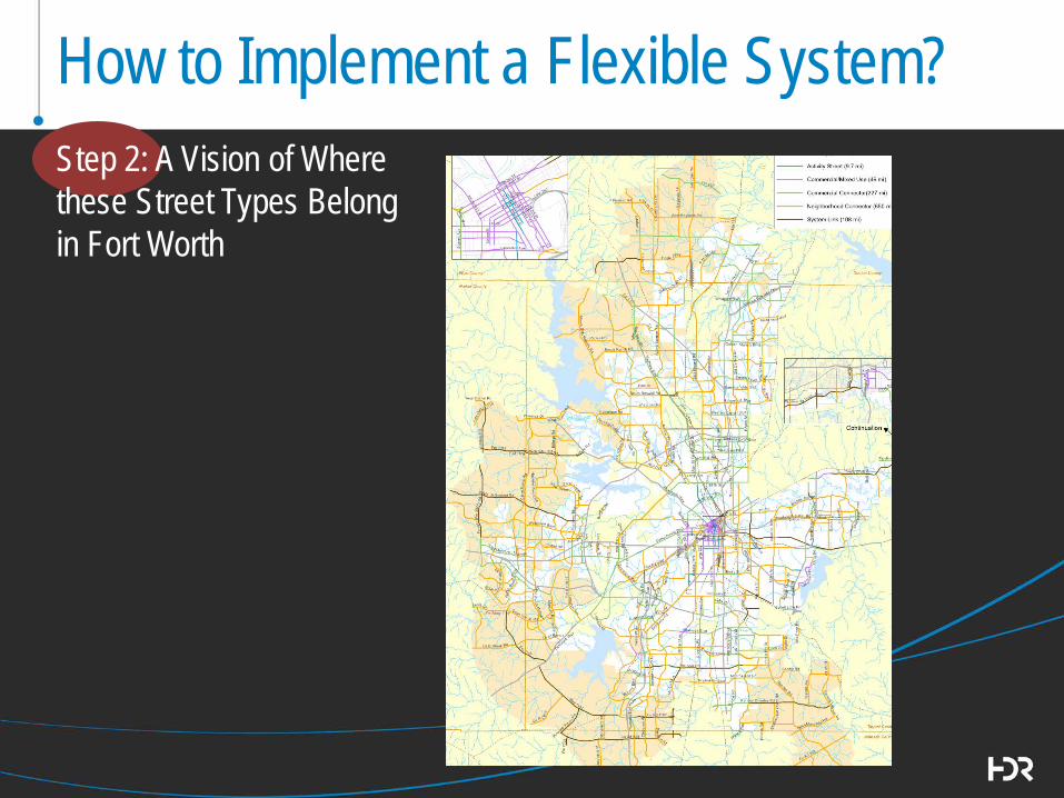
How to Implement a Flexible System? Step 2: A Vision of Where these Street Types Belong in Fort Worth
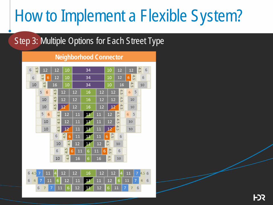
How to Implement a Flexible System? Step 3: Multiple Options for Each Street Type
Neighborhood Connector

Neighborhood Connector
How to Implement a Flexible System? Step 3: Multiple Options for Each Street Type
Bike Auto Median Buffer Ped
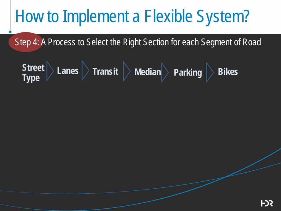
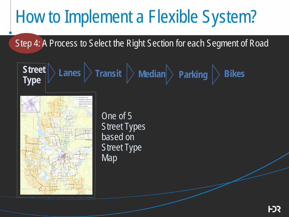
How to Implement a Flexible System? Step 4: A Process to Select the Right Section for each Segment of Road
Street Type
Lanes
Transit
Bikes
Median
Parking
How to Implement a Flexible System? Step 4: A Process to Select the Right Section for each Segment of Road
Street Type
Lanes
Transit
Median One of 5
Street Types based on Street Type Map
Bikes
Parking

How to Implement a Flexible System? Step 4: A Process to Select the Right Section for each Segment of Road
Street Type
Lanes
Transit
Bikes
Median
Parking
Number of lanes in each direction from Lanes Map
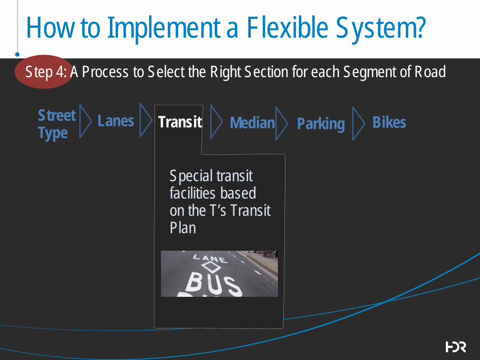
How to Implement a Flexible System? Step 4: A Process to Select the Right Section for each Segment of Road
Street Type
Lanes
Transit
Bikes
Median
Parking
Special transit facilities based on the T’s Transit Plan

How to Implement a Flexible System? Step 4: A Process to Select the Right Section for each Segment of Road
Street Type
Lanes
Transit
Bikes
Median
Parking
Median Type based on traffic volumes, number of lanes, other corridor features

How to Implement a Flexible System? Step 4: A Process to Select the Right Section for each Segment of Road
Street Type
Lanes
Transit
Bikes
Median
Parking
Parking type (parallel, angle, none) based on traffic volumes and number of lanes

How to Implement a Flexible System? Step 4: A Process to Select the Right Section for each Segment of Road
Street Type
Lanes
Transit
Bikes
Median
Parking
Bike facility based on Bike Fort Worth Plan, traffic volumes, parking type, and other corridor features
How to Implement a Flexible System? Step 4
Street Type
Lanes
Transit
Median
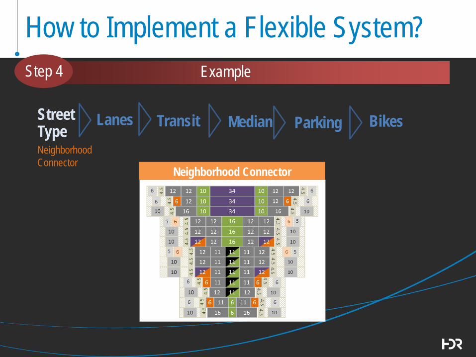
Neighborhood Connector
Bikes
Parking
Example
Bikes
Parking
Neighborhood Connector

How to Implement a Flexible System?
Street Type
Lanes
Transit
Bikes
Median
Parking
Neighborhood Connector
Neighborhood Connector
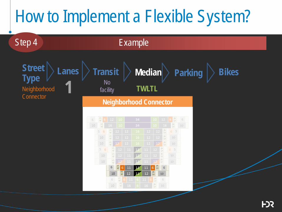
1
Step 4 Example

How to Implement a Flexible System?
Street Type
Lanes
Transit
Bikes
Median
Parking
Neighborhood Connector
Neighborhood Connector
1 No facility
Step 4 Example
How to Implement a Flexible System?
Street Type
Lanes
Transit
Bikes
Median
Parking
Neighborhood Connector
Neighborhood Connector
1 No facility
Step 4 Example
TWLTL
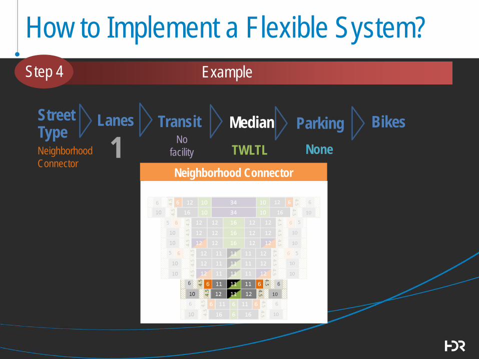
How to Implement a Flexible System?
Street Type
Lanes
Transit
Bikes
Median
Parking
Neighborhood Connector
Neighborhood Connector
1 No facility
Step 4 Example
TWLTL None
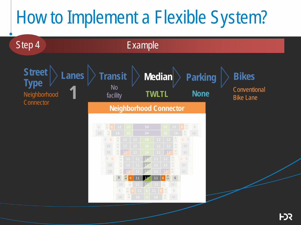
How to Implement a Flexible System?
Street Type
Lanes
Transit
Bikes
Median
Parking
Neighborhood Connector
Neighborhood Connector
1 No facility
Step 4 Example
TWLTL None Conventional Bike Lane
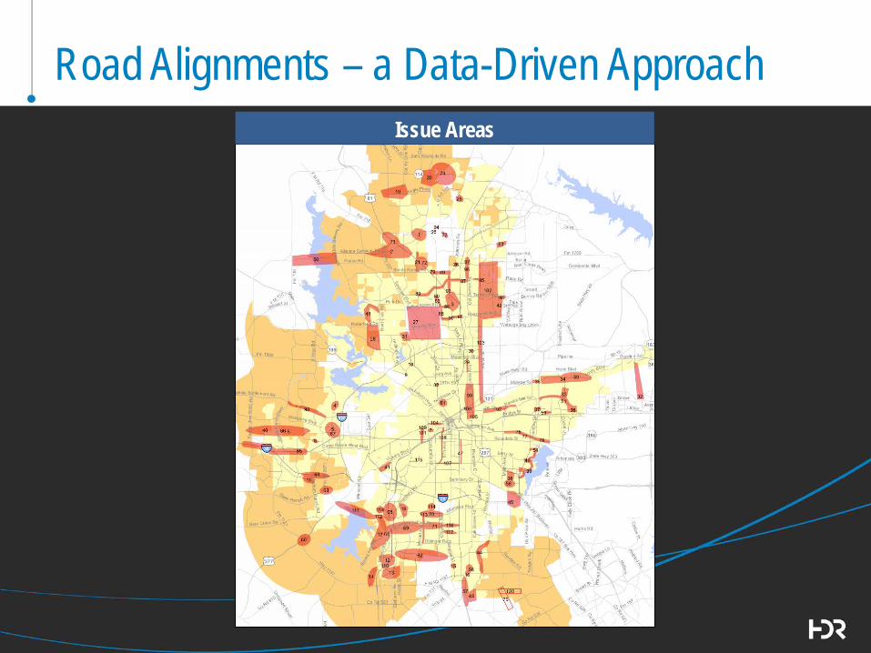
Road Alignments – a Data-Driven Approach Issue Areas

Road Alignments – a Data-Driven Approach
No Change
MTP Roads
Issues Raised?
No change
Investigate & resolve
Screen All Roads
No Change
New alignment/
remove
TDM GIS Issues Raised
Problems/Issues?
Unbuilt / Unimproved Built to Final Configuration
Evaluate in more detail
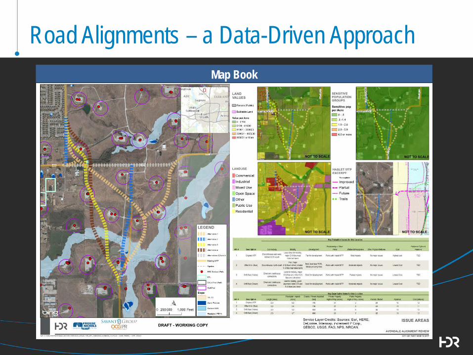
Road Alignments – a Data-Driven Approach Map Book
PEER CITIES REVIEW FINDINGS

Purpose
• Identify Applicable Concepts, Policies, and Processes
Selection Criteria
• Pro-active in Master Thoroughfare Planning and
Complete Streets Application
• Progressive Approach to Street Design
• Comparable Size and Population.
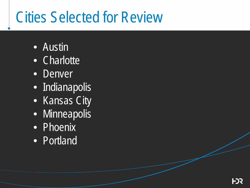
Cities Selected for Review
• Austin • Charlotte • Denver • Indianapolis • Kansas City • Minneapolis • Phoenix • Portland

Innovative Practices with Potential Application to Fort Worth
o Complete Streets: Complete Streets Performance Metrics/Replace Standard
Levels of Service/Lower LOS Thresholds Complete Streets Advisory Board Design Element Matrix - User Perspectives Complete Streets Improvements Fund Before/After Studies to Support Policies
o Retrofitting Complete Streets Checklist/Decision Tree/Adaptive Street
Strategies/Prioritization Methodology for Constrained Rights of Way
Guidelines that Allow Design Flexibility “Nodes of Shade” and Parklets

Innovative Practices with Potential Application to Fort Worth
o Project Prioritization Goals and Objectives used to Prioritize Projects
o Safety Allow Back-in Angled Parking All-Pedestrian Signal Phases in Pedestrian-Priority
Areas o Plan Development MTP Updated to Correspond to Land Use whenever
Platting Occurs Connectivity Ratios for Collector Streets Street Type Applied Regardless of Ownership and
Maintenance Responsibility Right Sizing Roadways to Maximize Tax Base

NEXT STEPS
42
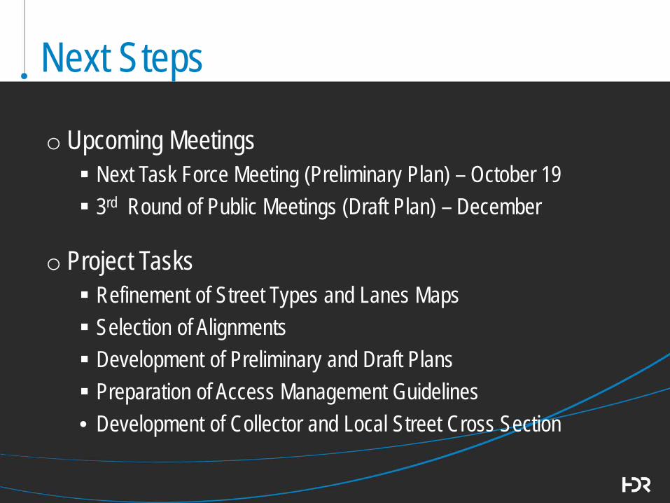
Next Steps
o Upcoming Meetings Next Task Force Meeting (Preliminary Plan) – October 19 3rd Round of Public Meetings (Draft Plan) – December
o Project Tasks Refinement of Street Types and Lanes Maps Selection of Alignments Development of Preliminary and Draft Plans Preparation of Access Management Guidelines • Development of Collector and Local Street Cross Section
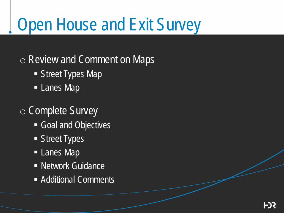
Open House and Exit Survey
o Review and Comment on Maps Street Types Map Lanes Map
o Complete Survey Goal and Objectives Street Types Lanes Map Network Guidance Additional Comments
For More Information
Visit our project website for upcoming events and information updates
fortworthtexas.gov/MTP
45
Thank You for Participating !