Embed Size (px)
Citation preview
Modeling to Revise Coastal Inundation and Flooding Modeling to Revise Coastal Inundation and Flooding Estimates in Georgia and Northeast FloridaEstimates in Georgia and Northeast FloridaEstimates in Georgia and Northeast FloridaEstimates in Georgia and Northeast Florida
February 9, 2012
Ashley Naimaster, EIChristopher Bender, PhD, PE, D.CE
William Miller, PhD, PE
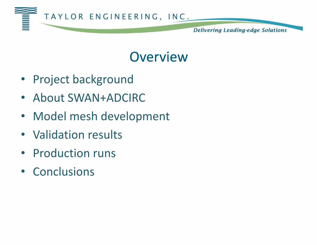
OverviewOverview• Project background• About SWAN+ADCIRC• Model mesh development• Model mesh development• Validation results• Production runs• Conclusions
OverviewOverview
Model mesh developmentModel mesh development
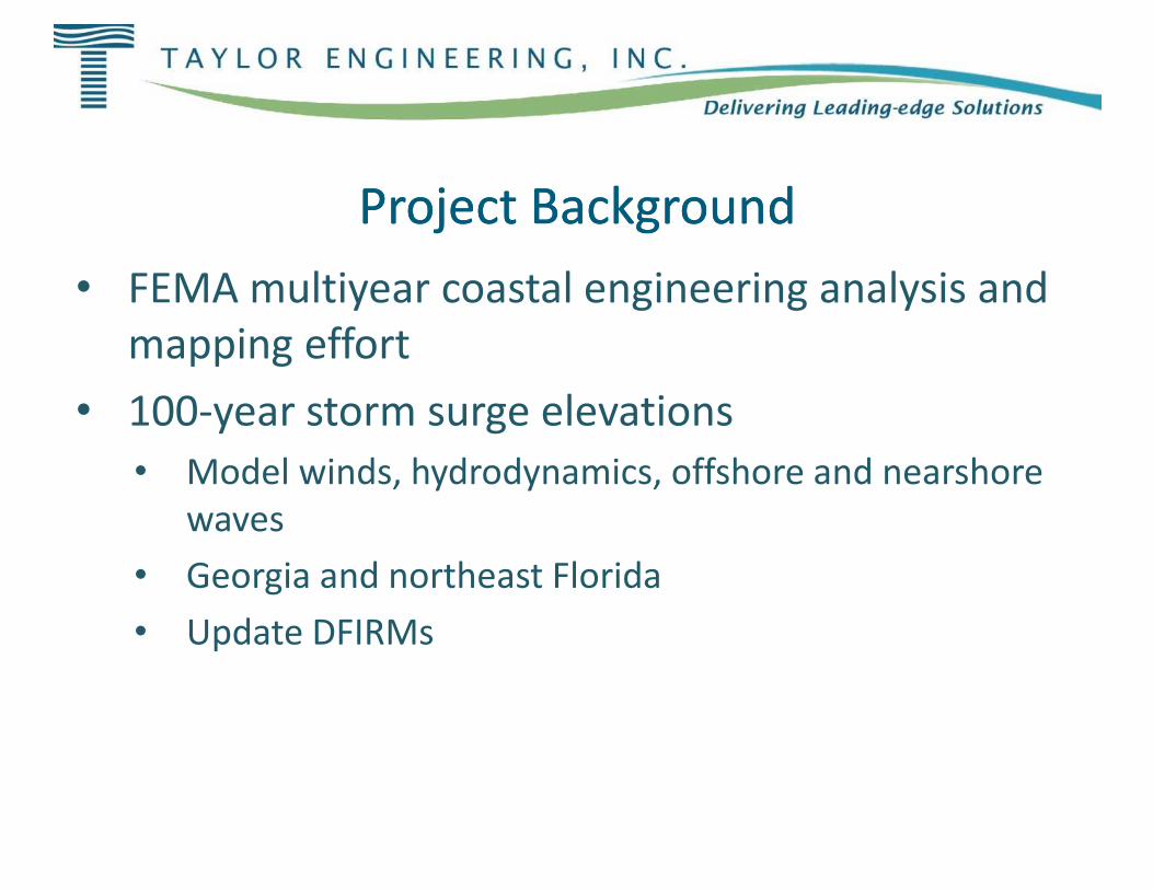
Project BackgroundProject Background• FEMA multiyear coastal engineering analysis and
mapping effort• 100-year storm surge elevations• Model winds, hydrodynamics, offshore and nearshore
waves• Georgia and northeast Florida• Update DFIRMs
Project BackgroundProject BackgroundFEMA multiyear coastal engineering analysis and
year storm surge elevationsModel winds, hydrodynamics, offshore and nearshore
Georgia and northeast Florida
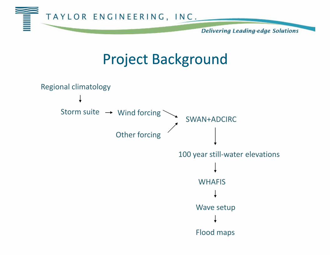
Project BackgroundProject Background
Storm suite Wind forcing
Regional climatology
Other forcing
Project BackgroundProject Background
SWAN+ADCIRC
100 year still-water elevations
WHAFIS
Wave setup
Flood maps
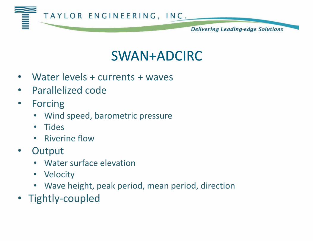
SWAN+ADCIRCSWAN+ADCIRC• Water levels + currents + waves• Parallelized code• Forcing
• Wind speed, barometric pressure•• Tides• Riverine flow
• Output• Water surface elevation• Velocity• Wave height, peak period, mean period, direction
• Tightly-coupled
SWAN+ADCIRCSWAN+ADCIRCWater levels + currents + waves
Wind speed, barometric pressure
Wave height, peak period, mean period, direction
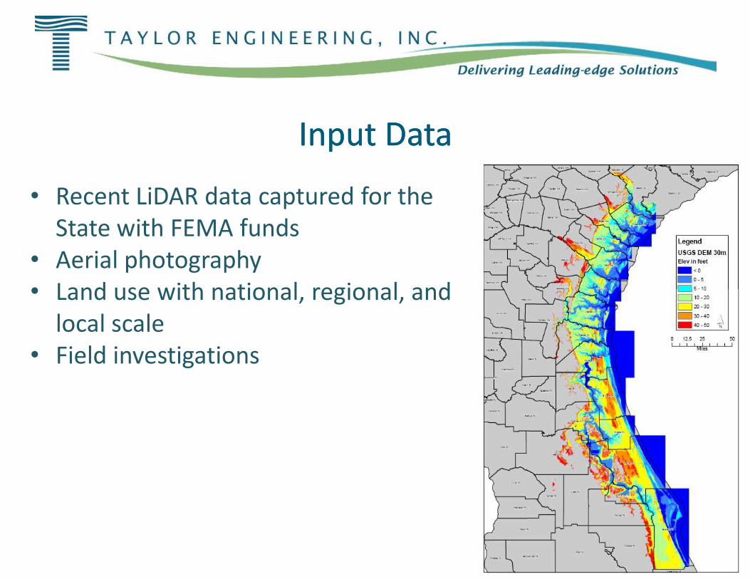
Input DataInput Data
• Recent LiDAR data captured for the State with FEMA funds
• Aerial photography• Land use with national, regional, • Land use with national, regional,
local scale• Field investigations
Input DataInput Data
Recent LiDAR data captured for the
regional, and regional, and

Model Mesh DevelopmentModel Mesh Development
• Surface-water Modeling System
• Need to digitize:• Need to digitize:• Obstructions to flow• Flow paths
• Mesh quality
Model Mesh DevelopmentModel Mesh Development
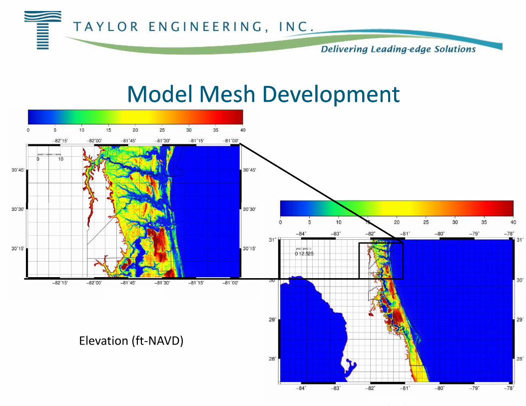
Model Mesh Model Mesh DD
Elevation (ft-NAVD)
DDevelopmentevelopment

Model Mesh DevelopmentModel Mesh Development
• 2.9 million nodes• Minimum nodal spacing = 50 m
Model Mesh DevelopmentModel Mesh Development
Minimum nodal spacing = 50 m
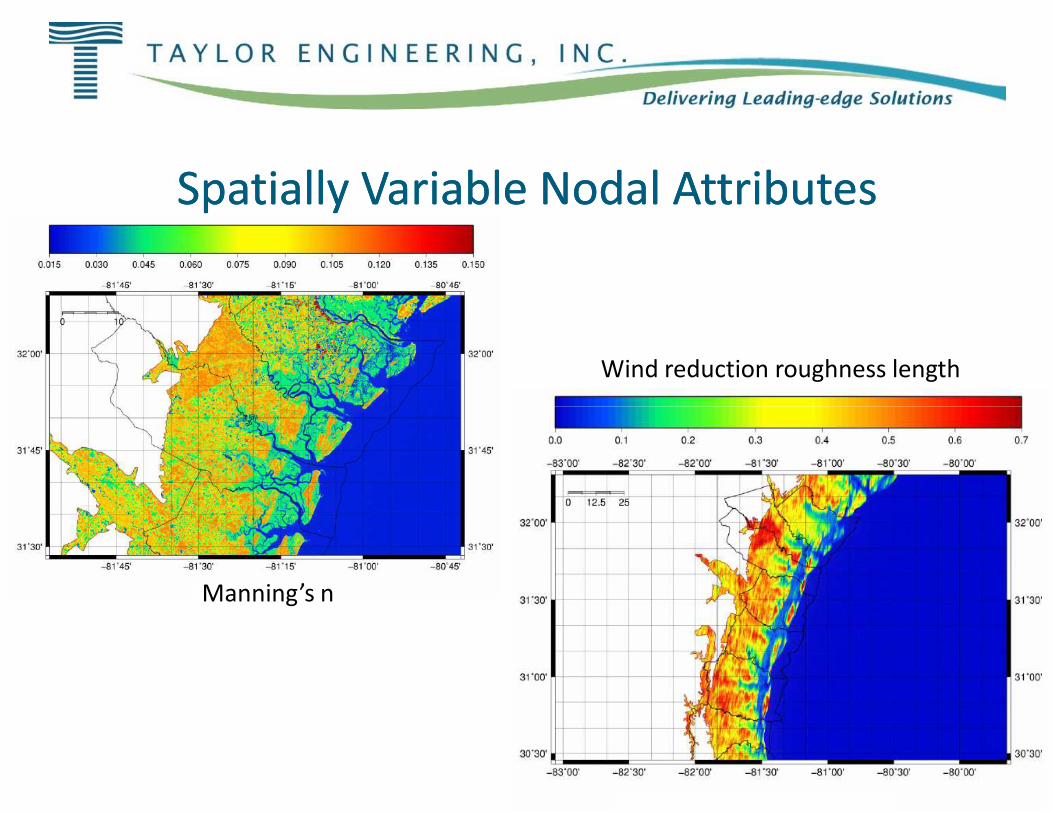
Spatially Variable Nodal AttributesSpatially Variable Nodal Attributes
Manning’s n
Spatially Variable Nodal AttributesSpatially Variable Nodal Attributes
Wind reduction roughness length
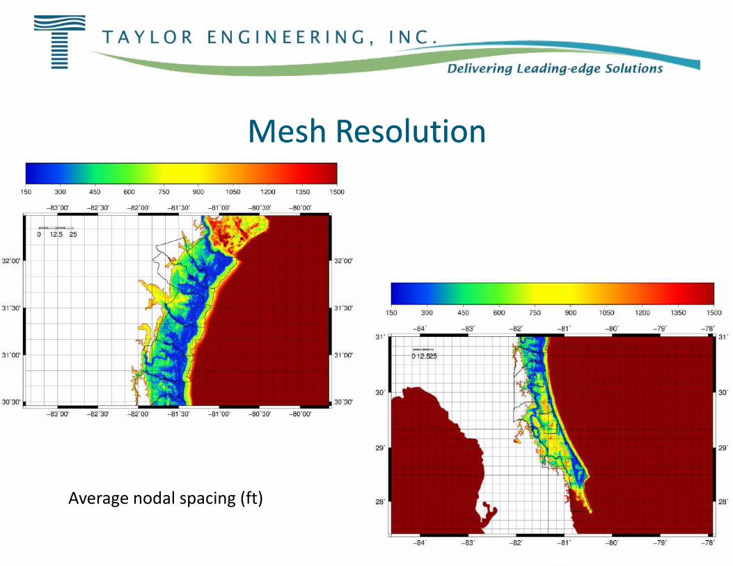
Mesh ResolutionMesh Resolution
Average nodal spacing (ft)
Mesh ResolutionMesh Resolution
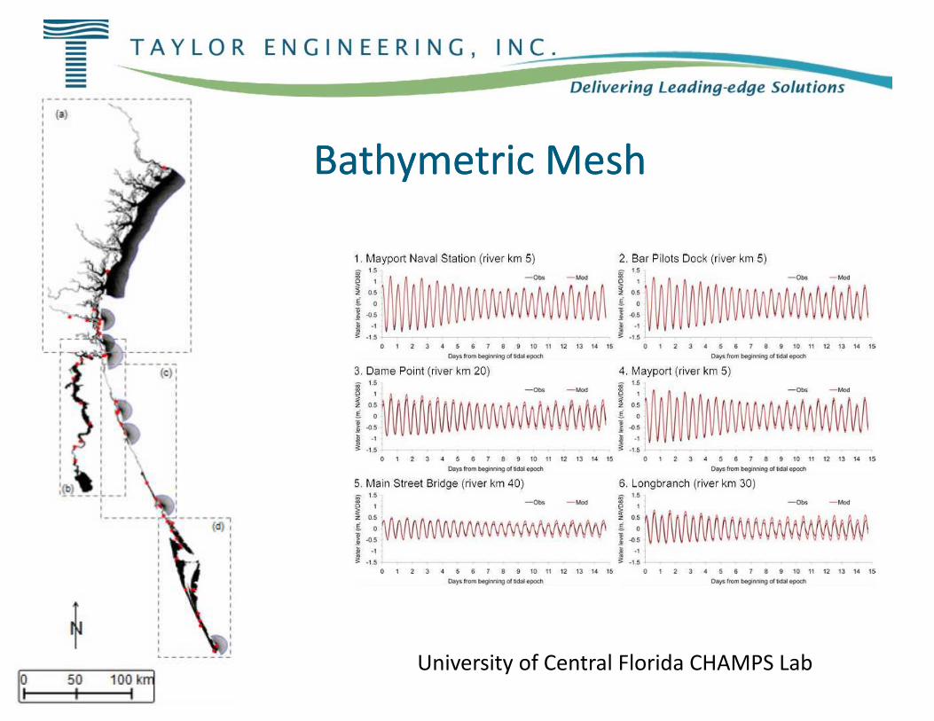
Bathymetric MeshBathymetric Mesh
University of Central Florida CHAMPS Lab
Bathymetric MeshBathymetric Mesh
University of Central Florida CHAMPS Lab

Storm ValidationStorm Validation
• Hurricane Dora• Hurricane David• Hurricane Frances• Tropical Storm Tammy• Tropical Storm Tammy• Tropical Storm Fay
Storm ValidationStorm Validation
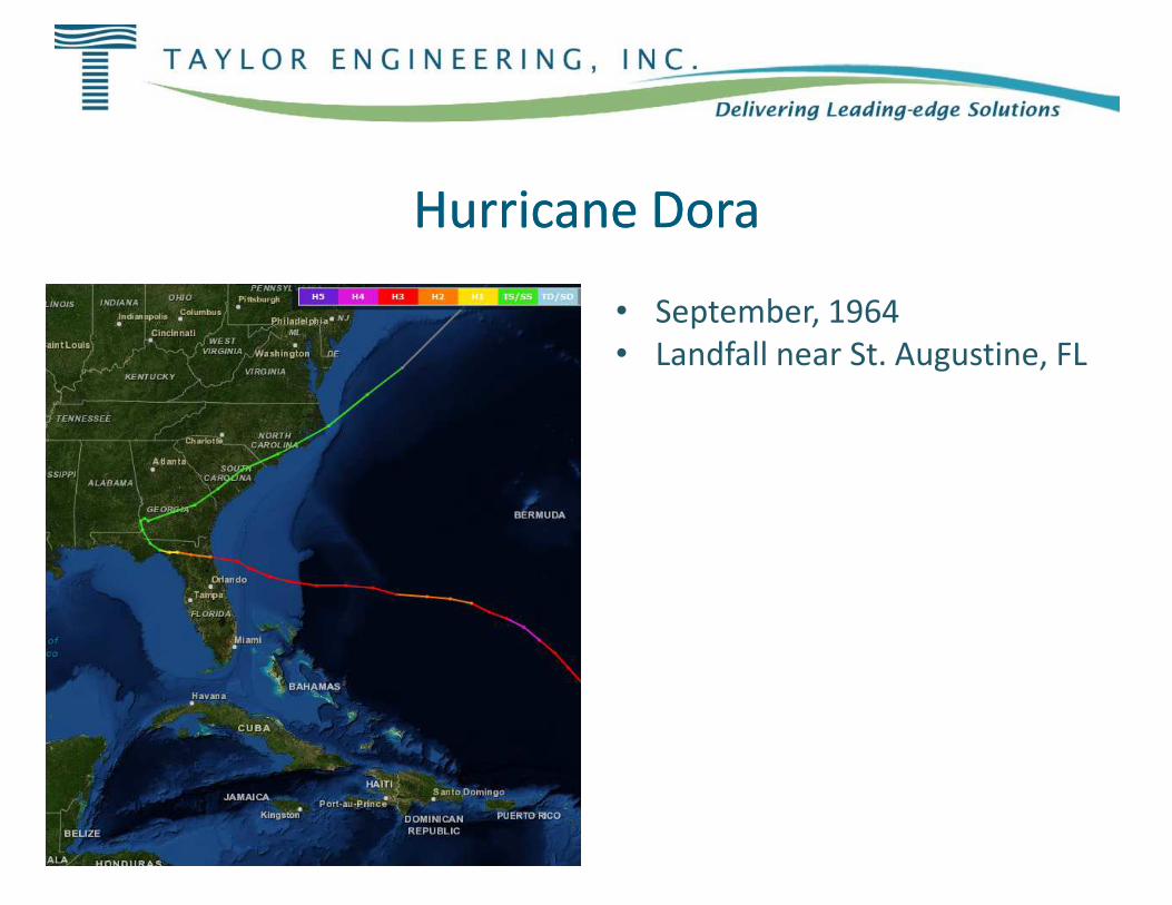
Hurricane DoraHurricane DoraHurricane DoraHurricane Dora
• September, 1964• Landfall near St. Augustine, FL
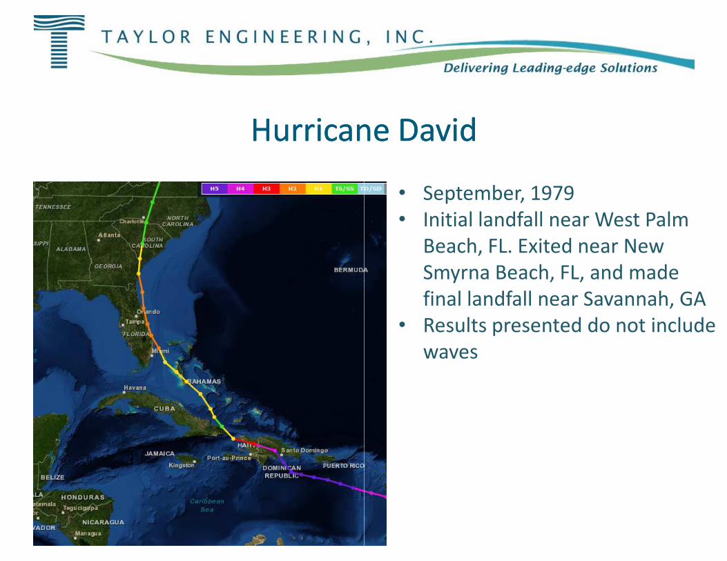
Hurricane DavidHurricane DavidHurricane DavidHurricane David
• September, 1979• Initial landfall near West Palm
Beach, FL. Exited near New Smyrna Beach, FL, and made Smyrna Beach, FL, and made final landfall near Savannah, GA
• Results presented do not include waves
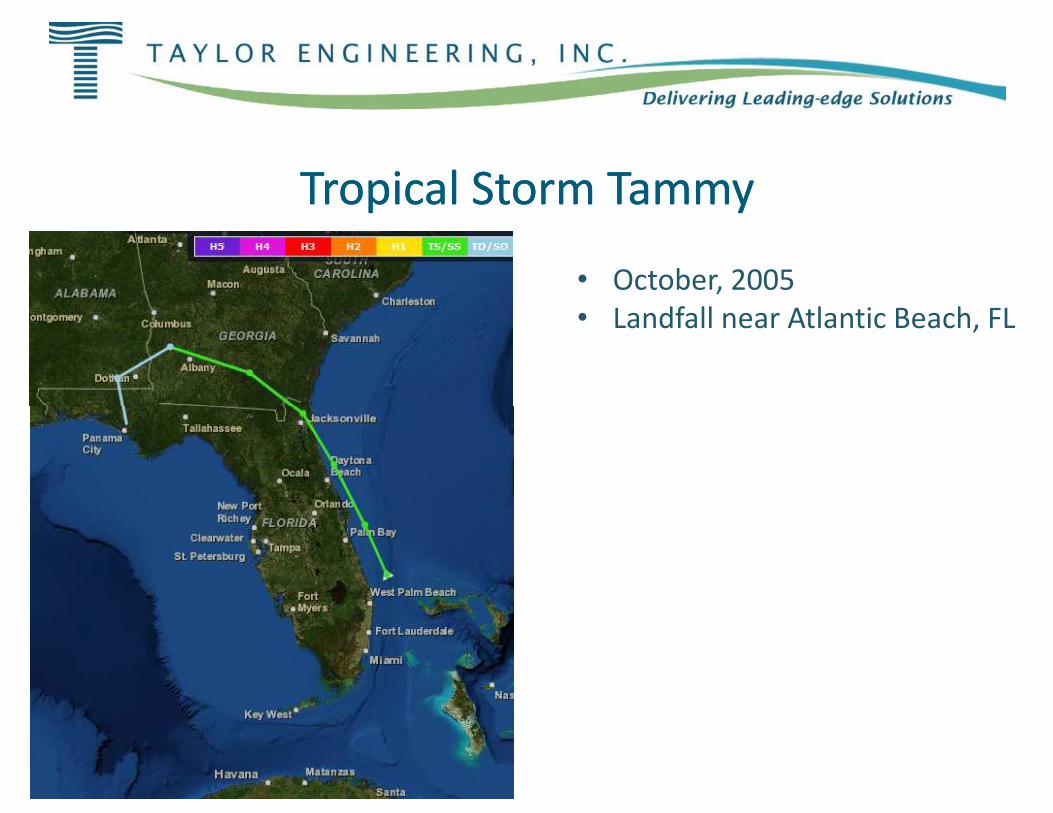
Tropical Storm TammyTropical Storm TammyTropical Storm TammyTropical Storm Tammy
• October, 2005• Landfall near Atlantic Beach, FL
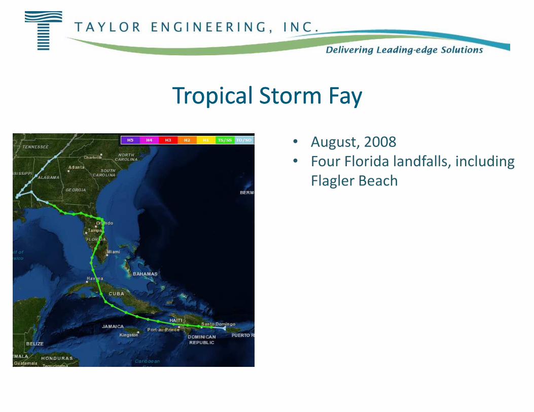
Tropical Storm FayTropical Storm FayTropical Storm FayTropical Storm Fay
• August, 2008• Four Florida landfalls, including
Flagler Beach
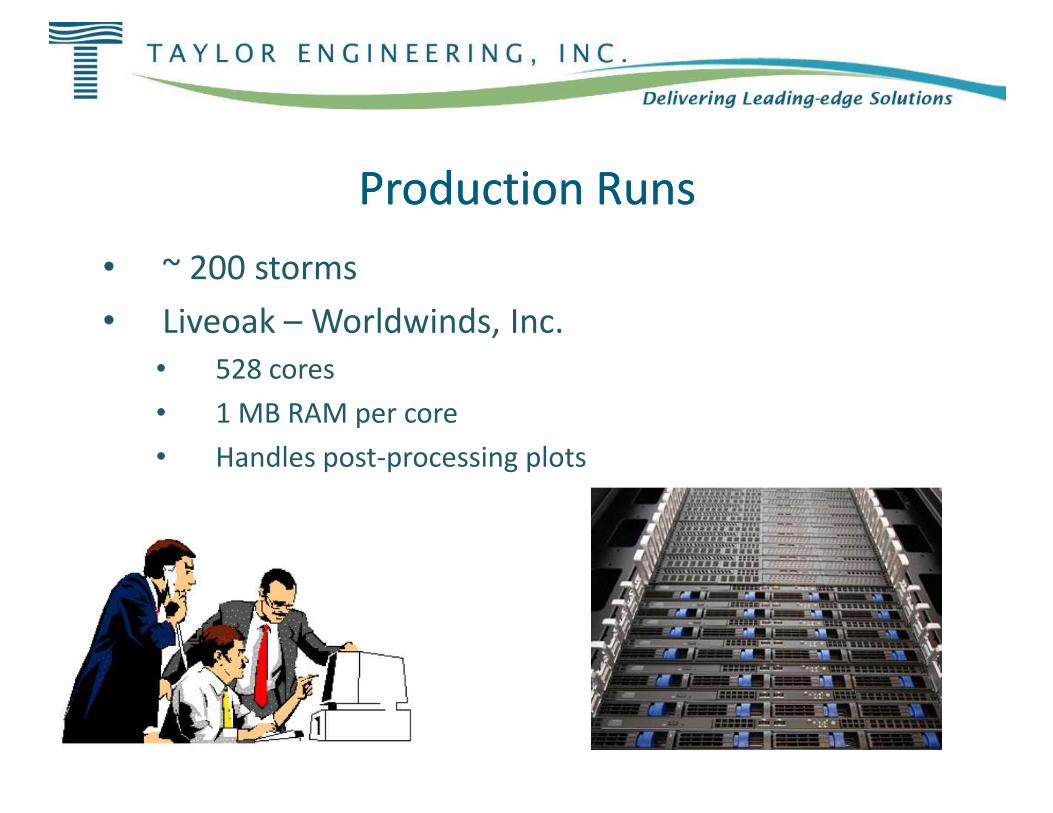
Production RunsProduction Runs
• ~ 200 storms• Liveoak – Worldwinds, Inc.
• 528 cores• 1 MB RAM per core• 1 MB RAM per core• Handles post-processing plots
Production RunsProduction Runs
Worldwinds, Inc.
processing plots
ConclusionsConclusions
• Preliminary results appear reasonable• Next steps:• Investigate amplitude issue in St. John’s River• Address stability problems in Caribbean • Address stability problems in Caribbean • Incorporate further DEM revisions• Wave data comparison• Sensitivity testing with ADCIRC and SWAN parameters• Tide validation
ConclusionsConclusions
Preliminary results appear reasonable
Investigate amplitude issue in St. John’s RiverAddress stability problems in Caribbean - DavidAddress stability problems in Caribbean - DavidIncorporate further DEM revisions
Sensitivity testing with ADCIRC and SWAN parameters

Questions?Questions?Questions?Questions?Questions?Questions?Questions?Questions?