Embed Size (px)
Citation preview
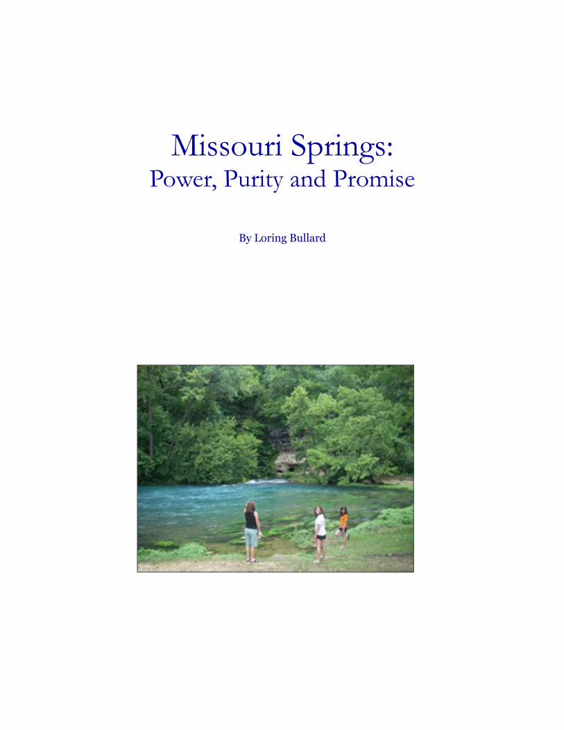
Missouri Springs:Power, Purity and Promise
By Loring Bullard

© Watershed Press Design by: Kelly Guenther
Missouri Springs: Power, Purity and Promise 3
Missouri Springs:Power, Purity and Promise
By: Loring Bullard
Introduction
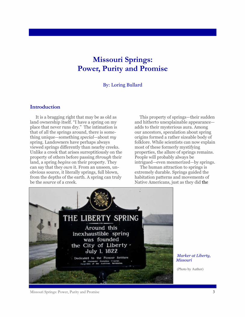
Marker at Liberty, Missouri
(Photo by Author)
It is a bragging right that may be as old as land ownership itself. “I have a spring on my place that never runs dry.” The intimation is that of all the springs around, there is some-thing unique—something special—about myspring. Landowners have perhaps always viewed springs differently than nearby creeks. Unlike a creek that arises surreptitiously on the property of others before passing through their land, a spring begins on their property. They can say that they own it. From an unseen, un-obvious source, it literally springs, full blown, from the depths of the earth. A spring can truly be the source of a creek.
This property of springs—their sudden and hitherto unexplainable appearance—adds to their mysterious aura. Among our ancestors, speculation about spring origins formed a rather sizeable body of folklore. While scientists can now explain most of these formerly mystifying properties, the allure of springs remains. People will probably always be intrigued—even mesmerized—by springs. The human attraction to springs is extremely durable. Springs guided the habitation patterns and movements of Native Americans, just as they did the
Missouri Springs: Power, Purity and Promise 4
Introduction
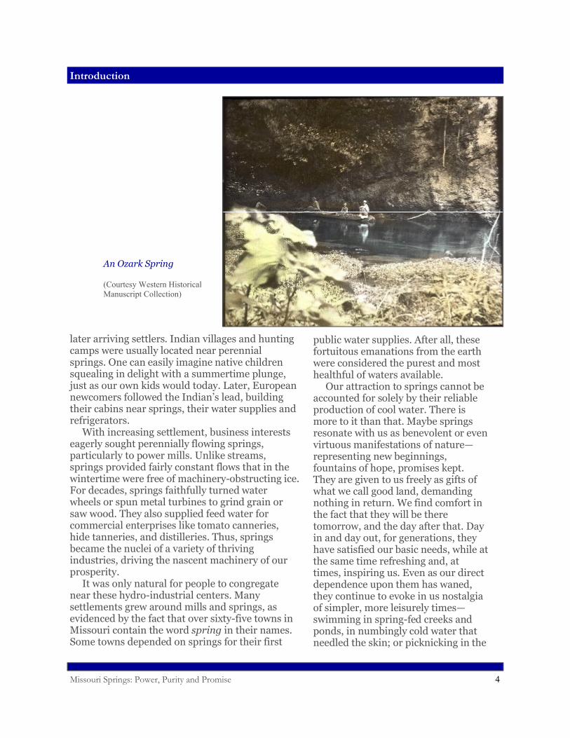
An Ozark Spring
(Courtesy Western Historical Manuscript Collection)
later arriving settlers. Indian villages and hunting camps were usually located near perennial springs. One can easily imagine native children squealing in delight with a summertime plunge, just as our own kids would today. Later, European newcomers followed the Indian’s lead, building their cabins near springs, their water supplies and refrigerators. With increasing settlement, business interests eagerly sought perennially flowing springs, particularly to power mills. Unlike streams, springs provided fairly constant flows that in the wintertime were free of machinery-obstructing ice. For decades, springs faithfully turned water wheels or spun metal turbines to grind grain or saw wood. They also supplied feed water for commercial enterprises like tomato canneries, hide tanneries, and distilleries. Thus, springs became the nuclei of a variety of thriving industries, driving the nascent machinery of our prosperity. It was only natural for people to congregate near these hydro-industrial centers. Many settlements grew around mills and springs, as evidenced by the fact that over sixty-five towns in Missouri contain the word spring in their names. Some towns depended on springs for their first
public water supplies. After all, these fortuitous emanations from the earth were considered the purest and most healthful of waters available. Our attraction to springs cannot be accounted for solely by their reliable production of cool water. There is more to it than that. Maybe springs resonate with us as benevolent or even virtuous manifestations of nature—representing new beginnings, fountains of hope, promises kept. They are given to us freely as gifts of what we call good land, demanding nothing in return. We find comfort in the fact that they will be there tomorrow, and the day after that. Day in and day out, for generations, they have satisfied our basic needs, while at the same time refreshing and, at times, inspiring us. Even as our direct dependence upon them has waned, they continue to evoke in us nostalgia of simpler, more leisurely times—swimming in spring-fed creeks and ponds, in numbingly cold water that needled the skin; or picknicking in the
Missouri Springs: Power, Purity and Promise 5
Springs at Work
cool shade of a lush spring glen, escaping the summer heat, feasting on watermelon and homemade ice cream. This booklet is in no way meant to diminish our sense of wonder or curiosity about springs. Instead, our intended purpose is to answer some questions commonly asked about them: Why is this spring here? Where does the water come from? Why is it so cool? Why are some springs so blue? You will also learn how our ill-conceived or uncaring manipulations on the land can sometimes have disastrous consequences for springs—the very objects of our affection. Hopefully, a deeper understand-ing of the workings of springs will helps us to more fully honor, preserve and protect these priceless natural assets. That would be our greatest gift to those who follow us to their everlasting waters.
Springs at Work
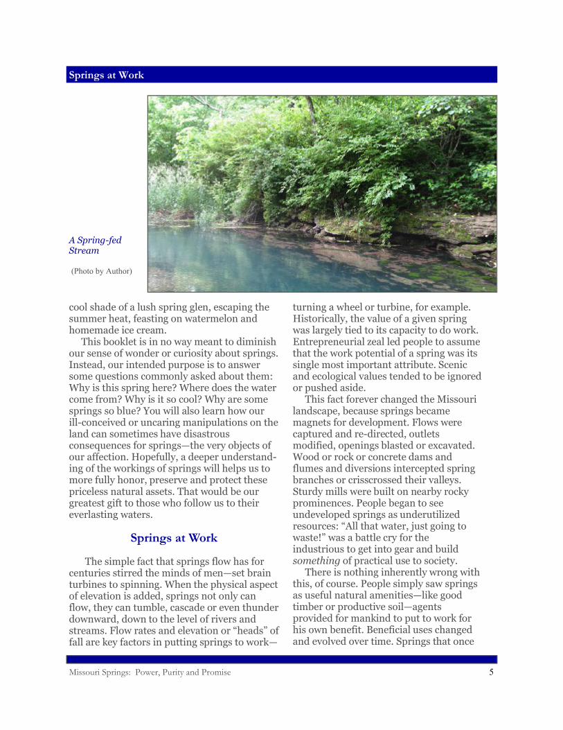
The simple fact that springs flow has for centuries stirred the minds of men—set brain turbines to spinning. When the physical aspect of elevation is added, springs not only can flow, they can tumble, cascade or even thunder downward, down to the level of rivers and streams. Flow rates and elevation or “heads” of fall are key factors in putting springs to work—
turning a wheel or turbine, for example. Historically, the value of a given spring was largely tied to its capacity to do work. Entrepreneurial zeal led people to assume that the work potential of a spring was its single most important attribute. Scenic and ecological values tended to be ignored or pushed aside. This fact forever changed the Missouri landscape, because springs became magnets for development. Flows were captured and re-directed, outlets modified, openings blasted or excavated. Wood or rock or concrete dams and flumes and diversions intercepted spring branches or crisscrossed their valleys. Sturdy mills were built on nearby rocky prominences. People began to see undeveloped springs as underutilized resources: “All that water, just going to waste!” was a battle cry for the industrious to get into gear and build something of practical use to society. There is nothing inherently wrong with this, of course. People simply saw springs as useful natural amenities—like good timber or productive soil—agents provided for mankind to put to work for his own benefit. Beneficial uses changed and evolved over time. Springs that once
A Spring-fed Stream
(Photo by Author)
Missouri Springs: Power, Purity and Promise 6
Springs at Work
served grist mills or sawmills were refitted for more modern applications like the generation of electricity or raising of fish. Almost every large spring in Missouri, at some point in time, was at least considered for some type of development project. It was not until large numbers of them had been harnessed, throttled, diverted or otherwise exploited that we began to see them in a different light. The story of our evolving relationship with springs, and our changing attitudes about them, can be exemplified by the tale of one spring, Missouri’s second largest. The year is 1905; the location, south-central Missouri.
* * * Edward Shepard’s mind remained clear, his body relatively strong, in spite of his late middle age. He sported thick woolen breeches, tucked into his lace-up boots, as protection against thorns and brambles and even snakebite, although that was unlikely at this time of year. He wore round, wire-rimmed spectacles. A neatly trimmed gray moustache protruded below the shade of his wide-brimmed hat. He was wiry and trim and in spite of his fifty-two years of life, could still negotiate the rocky trails and terrain of the Missouri Ozarks. He skirted the loudly banging grist mill and began hiking down the steep switch-back trail behind it. The sky arched an intense blue, cloudless and cool, over oaks and hickories just now flush with tiny mint green leaves. Shepard kept his head down, his eyes on the trail ahead. Above him he heard constant chirping from a steel
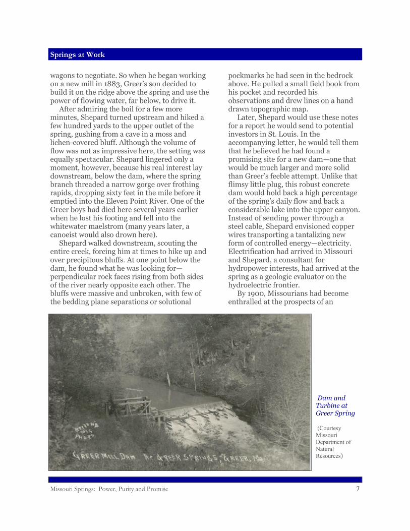
cable rolling over iron pulleys. After ten minutes of dodging boulders and skidding down steep inclines, he arrived at the bottom of the valley and the end of the trail. He stopped and stood, staring, at the amazing boil of greenish-blue water at his feet. Churning vigorously from the stream bed, the spring looked even more spectacular than he had remembered it. A few hundred feet downstream a dam, now mossy and green, had been thrown across the channel, forming a shallow pond. A slot in the dam allowed water to sluice through a turbine. Shepard could see the horizontal iron shaft spinning and its grooved wheel, loudly rotating, which held the moving cable. This transmitted the power of flowing water up to the mill, a few hundred vertical feet higher and almost a quarter of a mile distant. Shepard knew that Samuel Greer bought this property near the Eleven Point River in the late 1850s and had constructed the first mill here, near the spring, before the Civil War. But that mill had burned about twenty-five years ago—an unfortunate event, but one which provided the Greer family an opportunity to solve a serious access problem. The rutted road from the ridge top down to the mill was treacherously steep, making it difficult for loaded
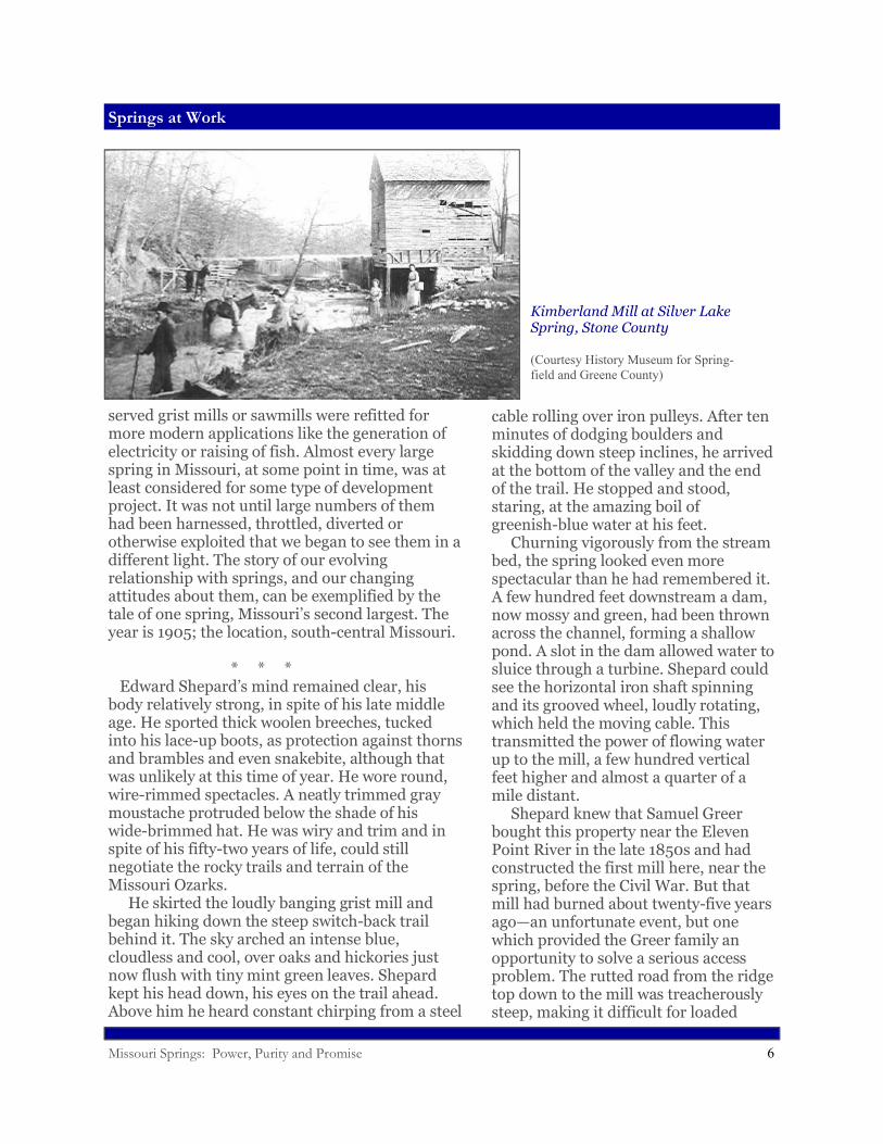
Kimberland Mill at Silver Lake Spring, Stone County
(Courtesy History Museum for Spring-field and Greene County)
Missouri Springs: Power, Purity and Promise 7
Springs at Work
Dam and Turbine at Greer Spring
(Courtesy Missouri Department of Natural Resources)
wagons to negotiate. So when he began working on a new mill in 1883, Greer’s son decided to build it on the ridge above the spring and use the power of flowing water, far below, to drive it. After admiring the boil for a few more minutes, Shepard turned upstream and hiked a few hundred yards to the upper outlet of the spring, gushing from a cave in a moss and lichen-covered bluff. Although the volume of flow was not as impressive here, the setting was equally spectacular. Shepard lingered only a moment, however, because his real interest lay downstream, below the dam, where the spring branch threaded a narrow gorge over frothing rapids, dropping sixty feet in the mile before it emptied into the Eleven Point River. One of the Greer boys had died here several years earlier when he lost his footing and fell into the whitewater maelstrom (many years later, a canoeist would also drown here). Shepard walked downstream, scouting the entire creek, forcing him at times to hike up and over precipitous bluffs. At one point below the dam, he found what he was looking for—perpendicular rock faces rising from both sides of the river nearly opposite each other. The bluffs were massive and unbroken, with few of the bedding plane separations or solutional
pockmarks he had seen in the bedrock above. He pulled a small field book from his pocket and recorded his observations and drew lines on a hand drawn topographic map. Later, Shepard would use these notes for a report he would send to potential investors in St. Louis. In the accompanying letter, he would tell them that he believed he had found a promising site for a new dam—one that would be much larger and more solid than Greer’s feeble attempt. Unlike that flimsy little plug, this robust concrete dam would hold back a high percentage of the spring’s daily flow and back a considerable lake into the upper canyon. Instead of sending power through a steel cable, Shepard envisioned copper wires transporting a tantalizing new form of controlled energy—electricity. Electrification had arrived in Missouri and Shepard, a consultant for hydropower interests, had arrived at the spring as a geologic evaluator on the hydroelectric frontier. By 1900, Missourians had become enthralled at the prospects of an
Missouri Springs: Power, Purity and Promise 8
Springs at Work
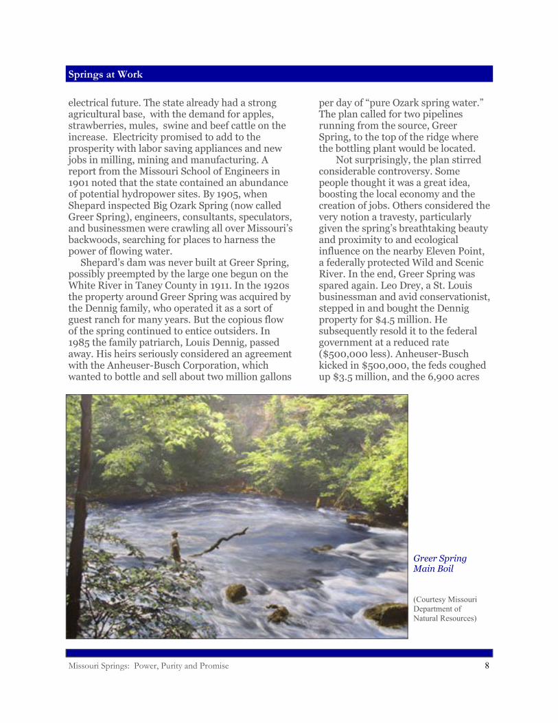
Greer Spring Main Boil
(Courtesy Missouri Department ofNatural Resources)
electrical future. The state already had a strong agricultural base, with the demand for apples, strawberries, mules, swine and beef cattle on the increase. Electricity promised to add to the prosperity with labor saving appliances and new jobs in milling, mining and manufacturing. A report from the Missouri School of Engineers in 1901 noted that the state contained an abundance of potential hydropower sites. By 1905, when Shepard inspected Big Ozark Spring (now called Greer Spring), engineers, consultants, speculators, and businessmen were crawling all over Missouri’s backwoods, searching for places to harness the power of flowing water. Shepard’s dam was never built at Greer Spring, possibly preempted by the large one begun on the White River in Taney County in 1911. In the 1920s the property around Greer Spring was acquired by the Dennig family, who operated it as a sort of guest ranch for many years. But the copious flow of the spring continued to entice outsiders. In 1985 the family patriarch, Louis Dennig, passed away. His heirs seriously considered an agreement with the Anheuser-Busch Corporation, which wanted to bottle and sell about two million gallons
per day of “pure Ozark spring water.” The plan called for two pipelines running from the source, Greer Spring, to the top of the ridge where the bottling plant would be located. Not surprisingly, the plan stirred considerable controversy. Some people thought it was a great idea, boosting the local economy and the creation of jobs. Others considered the very notion a travesty, particularly given the spring’s breathtaking beauty and proximity to and ecological influence on the nearby Eleven Point, a federally protected Wild and Scenic River. In the end, Greer Spring was spared again. Leo Drey, a St. Louis businessman and avid conservationist, stepped in and bought the Dennig property for $4.5 million. He subsequently resold it to the federal government at a reduced rate ($500,000 less). Anheuser-Busch kicked in $500,000, the feds coughed up $3.5 million, and the 6,900 acres
Missouri Springs: Power, Purity and Promise 9
Springs at Work
Steury Spring and Natural Bridge, Greene County
(Courtesy History Museum for Springfield and Greene County)
around Greer Spring became a part of the Mark Twain National Forest, designated as a natural area and special preserve. In retrospect, we shouldn’t unduly criticize Shepard or Anheuser-Busch for eyeing Greer Spring with speculative hunger. That prodigious quantity of clean, cold groundwater issuing directly from the rock almost begs to be “used,” somehow. But there have also long been advocates for preserving natural wonders like Greer Spring in an undeveloped condition. Even in the nineteenth century, when mankind
seemed determined to manipulate and control nature’s powers, a few of Missouri’s citizens argued that our most magnificent natural features deserved some level of benevolent oversight and protection. Luella Owen, one of these early protagonists, was a curly-haired, bright-eyed amateur geologist from St. Joseph. In the 1890s, she explored and wrote about the caves of the Black Hills and the Ozarks, including Marvel Cave near Branson and Grand Gulf near Koshkonong. She endured a long, bumpy wagon ride from
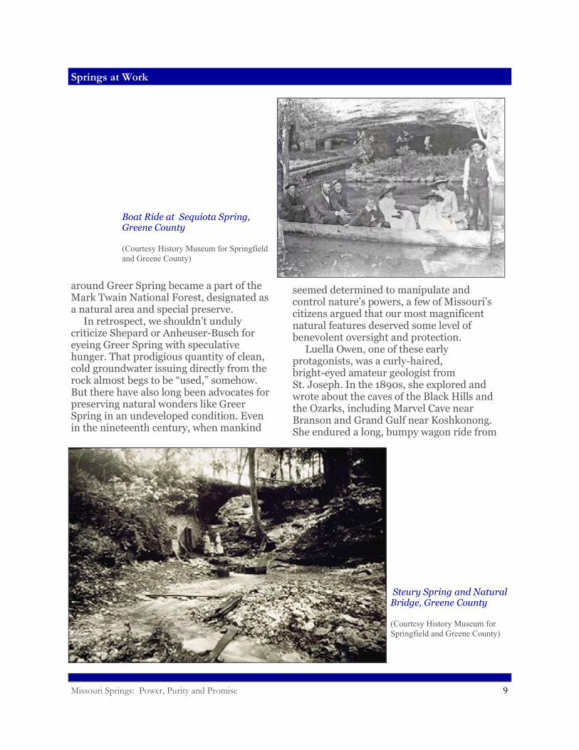
Boat Ride at Sequiota Spring,Greene County
(Courtesy History Museum for Springfield and Greene County)
Missouri Springs: Power, Purity and Promise 10
Spring Anatomy
West Plains to Greer Spring, where she was captivated by the spring’s beauty and awesome grandeur. While there, she noticed that rocks were being collected for the intended construction of a larger dam. While recognizing the commercial importance of the mighty spring, she also lamented the loss of “artistic” value that would inevitably result from further damming it. Owen could be characterized as an early eco-tourist. Like many later Missourians, she appreciated the scenic as well as the pragmatic potential of springs. Of course, the dynamic tension between urges to exploit versus efforts to preserve continues today. But the legacy of springs as industrial centers now resides more comfortably with the native scenery, as old mills and dams and ponds have themselves become historic and nostalgic icons. For the most part, springs no longer do work for us. But they do continue to pro-vide many other services that are equally valuable.
Spring Anatomy
Missouri’s springs were obviously of great practical
use to its inhabitants—but they were also mysterious. The workings of the underworld held a profound fascination for our forefathers, just as it does for many of us today. Many people find it difficult to believe that springs continue flowing, day after day, between infrequent rainfall events, without some massive additional input of water, such as a distant river, somehow diverted into the system. The frigidity of springs has led many people to believe that their water must originate in lands far to the north—from the Great Lakes, perhaps, or massive glaciers. Some of these notions held sway until the sciences of geology and hydrology began to provide reasonable alternative explanations. But even in the face of scientific evidence, some people remain unconvinced. The Ozarks of southern Missouri boasts one of the highest concentrations of springs in the world,
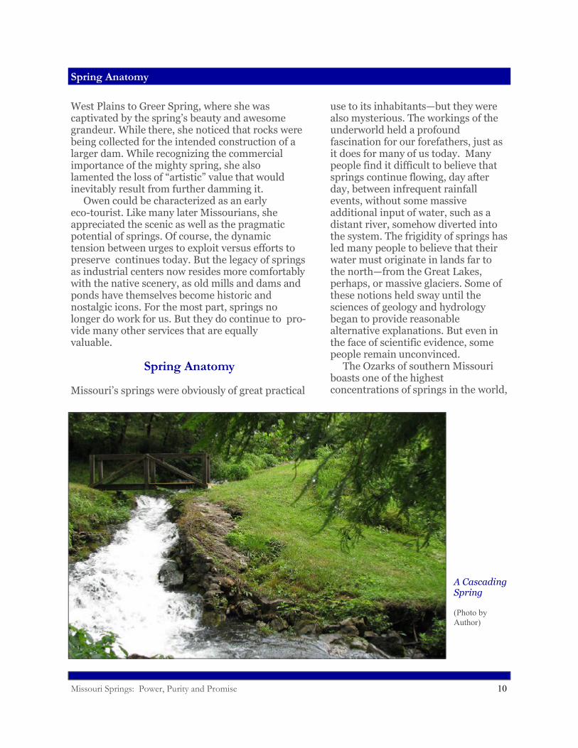
A Cascading Spring
(Photo by Author)
Missouri Springs: Power, Purity and Promise 11
Spring Anatomy
as well as some of the planet’s most powerfully flowing springs. Big Spring, Missouri’s largest, with an average flow rate of 275 million gallons per day (and measured high flows of over 800), ranks among the top handful of largest single outlet springs in the world. By way of comparison, the entire city of St. Louis uses on average about 125 million gallons of water per day, less than half of the daily flow of Big Spring. How do we account for the impressive numbers and flows of Missouri’s springs? At heart, the answer lies in the unique nature of the land. Springs are products of karst topography; a type of terrain that forms on carbonate bedrock—rocks of oceanic origin that will dissolve in acidic water. Acidity is a key, because limestone and its cousin dolostone, common components of Missouri’s bedrock, won’t dissolve to any extent in pure water. But as rainwater percolates down through the soil, it comes into contact with carbon dioxide, the gas we exhale with every breath. In the soil, CO2 comes from the breathing of earthworms and insects and millions of other animals. Under higher pressure in the soil than in the atmosphere above it, the gas is forced to dissolve into the downward percolating rainwater, creating a weak carbonic acid solution (the same as in carbonated beverages), which can then eat away at the walls of the cracks in the rock. It is important to realize that percolating
subterranean water only dissolves and enlarges existing openings—it does not create new openings. The downward flowing water follows a pre-existing network of cracks, whether they are vertical fractures through the rocks created by tilting or warping, or bedding planes, horizontal separations between different layers of rock. As water dissolves these cracks wider, more and more water can funnel through, allowing the embryonic spring system to grow. The amount of rock dissolved by large springs is truly prodigious. Jerry Vineyard, co-author of Springs of Missouri, has calculated that Missouri’s largest spring, Big Spring, flowing at an average rate of 275 million gallons per day, in that same day dissolves and removes from the underground 175 tons of rock. Over a year’s time that amounts to 64,000 tons, equivalent to the creation of a new cave passage ten by ten feet in cross section over a mile long. It could be a slightly unsettling thought to some people that flowing springs have been continuously
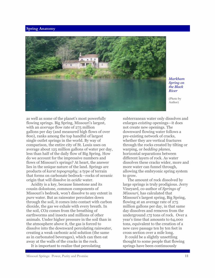
Markham Spring on the Black River
(Photo by Author)
Missouri Springs: Power, Purity and Promise 12
Spring Anatomy
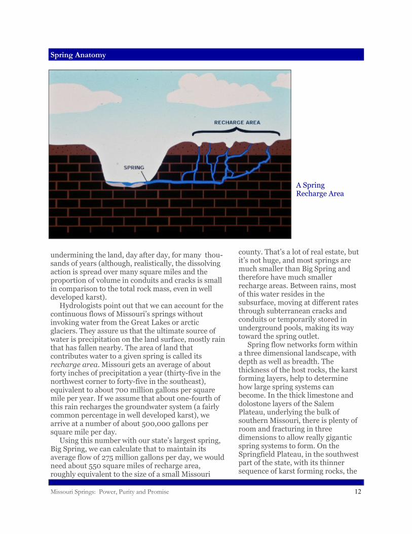
undermining the land, day after day, for many thou-sands of years (although, realistically, the dissolving action is spread over many square miles and the proportion of volume in conduits and cracks is small in comparison to the total rock mass, even in well developed karst). Hydrologists point out that we can account for the continuous flows of Missouri’s springs without invoking water from the Great Lakes or arctic glaciers. They assure us that the ultimate source of water is precipitation on the land surface, mostly rain that has fallen nearby. The area of land that contributes water to a given spring is called its recharge area. Missouri gets an average of about forty inches of precipitation a year (thirty-five in the northwest corner to forty-five in the southeast), equivalent to about 700 million gallons per square mile per year. If we assume that about one-fourth of this rain recharges the groundwater system (a fairly common percentage in well developed karst), we arrive at a number of about 500,000 gallons per square mile per day. Using this number with our state’s largest spring, Big Spring, we can calculate that to maintain its average flow of 275 million gallons per day, we would need about 550 square miles of recharge area, roughly equivalent to the size of a small Missouri
county. That’s a lot of real estate, but it’s not huge, and most springs are much smaller than Big Spring and therefore have much smaller recharge areas. Between rains, most of this water resides in the subsurface, moving at different rates through subterranean cracks and conduits or temporarily stored in underground pools, making its way toward the spring outlet. Spring flow networks form within a three dimensional landscape, with depth as well as breadth. The thickness of the host rocks, the karst forming layers, help to determine how large spring systems can become. In the thick limestone and dolostone layers of the Salem Plateau, underlying the bulk of southern Missouri, there is plenty of room and fracturing in three dimensions to allow really gigantic spring systems to form. On the Springfield Plateau, in the southwest part of the state, with its thinner sequence of karst forming rocks, the
A Spring Recharge Area
Missouri Springs: Power, Purity and Promise 13
Spring Anatomy
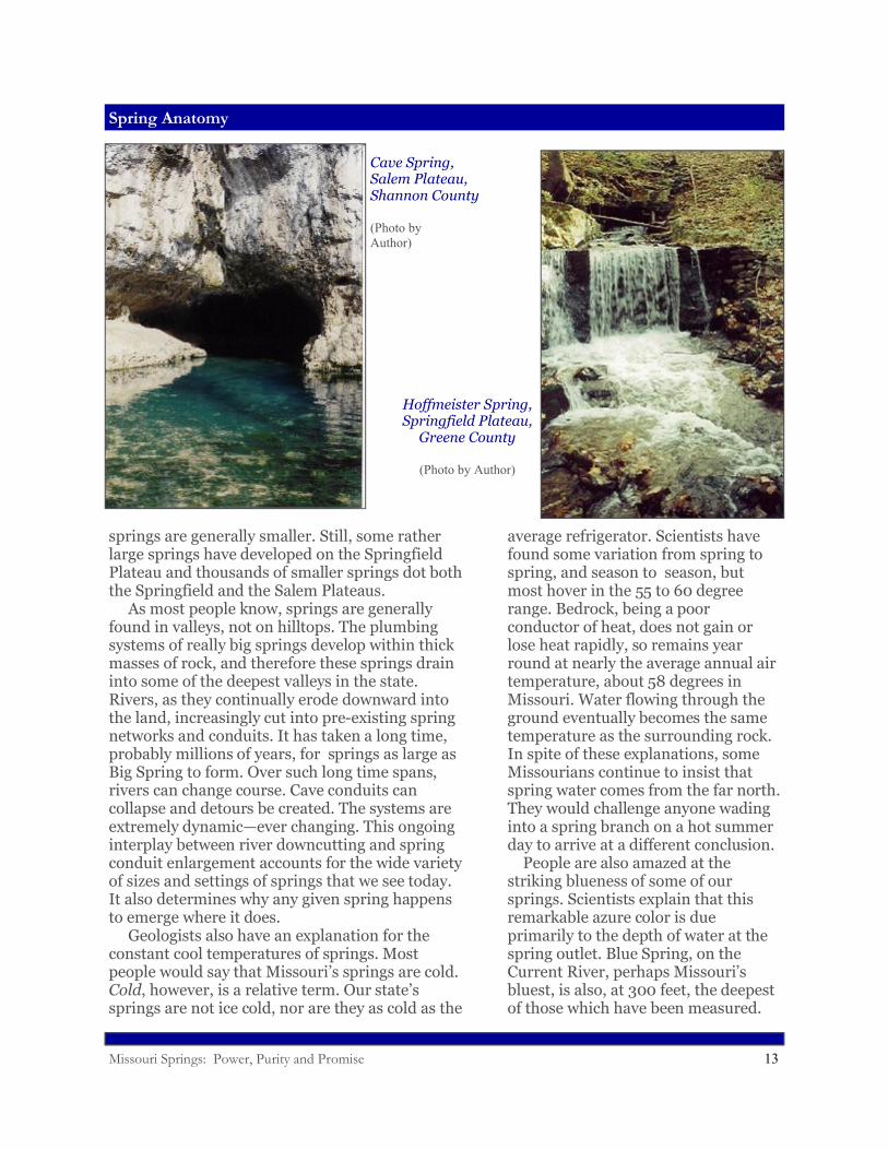
springs are generally smaller. Still, some rather large springs have developed on the Springfield Plateau and thousands of smaller springs dot both the Springfield and the Salem Plateaus. As most people know, springs are generally found in valleys, not on hilltops. The plumbing systems of really big springs develop within thick masses of rock, and therefore these springs drain into some of the deepest valleys in the state. Rivers, as they continually erode downward into the land, increasingly cut into pre-existing spring networks and conduits. It has taken a long time, probably millions of years, for springs as large as Big Spring to form. Over such long time spans, rivers can change course. Cave conduits can collapse and detours be created. The systems are extremely dynamic—ever changing. This ongoing interplay between river downcutting and spring conduit enlargement accounts for the wide variety of sizes and settings of springs that we see today. It also determines why any given spring happens to emerge where it does. Geologists also have an explanation for the constant cool temperatures of springs. Most people would say that Missouri’s springs are cold. Cold, however, is a relative term. Our state’s springs are not ice cold, nor are they as cold as the
average refrigerator. Scientists have found some variation from spring to spring, and season to season, but most hover in the 55 to 60 degree range. Bedrock, being a poor conductor of heat, does not gain or lose heat rapidly, so remains year round at nearly the average annual air temperature, about 58 degrees in Missouri. Water flowing through the ground eventually becomes the same temperature as the surrounding rock. In spite of these explanations, some Missourians continue to insist that spring water comes from the far north. They would challenge anyone wading into a spring branch on a hot summer day to arrive at a different conclusion. People are also amazed at the striking blueness of some of our springs. Scientists explain that this remarkable azure color is due primarily to the depth of water at the spring outlet. Blue Spring, on the Current River, perhaps Missouri’s bluest, is also, at 300 feet, the deepest of those which have been measured.
Cave Spring,Salem Plateau,Shannon County
(Photo by Author)
Hoffmeister Spring,Springfield Plateau,
Greene County
(Photo by Author)
Missouri Springs: Power, Purity and Promise 14
Going with the Flow
But subtle variations in hue are also affected by particles in the water and the angle and intensity of sunlight. The fact that this optical phenomenon can be explained by the physics of light and its scattering by particles doesn’t diminish the age old fascination. The sheer intensity of the blue color in certain springs nearly overwhelms human senses, touching neurons deep in the brain that must surely register indescribable beauty.
Going with the Flow
While science has explained a lot about springs, many questions remain about their origins and ages and how they work. One Missourian who has devoted the greater part of his life to unraveling the mysteries of springs is Tom Aley. Tall, lanky, with a long white beard and prominent forehead where he often rests his palm when thinking, Tom can sometimes be found at his home, which also serves as offices for the Ozark Underground Labo-ratory near Protem, Missouri (which is not really near anywhere, Tom likes to say). He speaks slowly, in measured tones, occasionally wrinkling his nose in a nervous tic. He loves to tell stories
about the “old days” when Missouri had a deficit of karst scientists and even the word karst had hardly entered the vernacular. In fact, Tom entered the field through a side door himself. In the late 1950s, he received a degree in forestry from the University of California at Berkley. He became attracted to forestry, he said, because it was held out as the “premier discipline of renewable resource management,” although in practice, he jokes, it was often regarded as “the profession where you make sawdust.” Knowing that the National Forests had been set aside for both timber and water management, Tom went to work for the Forest Service, hoping from the beginning to incorporate into a forestry career his burning interest in caves and springs. Prior to this time, he suggests, water had been given “short shrift” in forest management. Tom eventually left the Forest
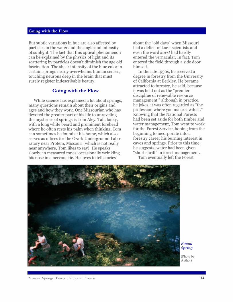
Round Spring
(Photo by Author)
Missouri Springs: Power, Purity and Promise 15
Going with the Flow
Service and went on his own, purchasing Tumbling Creek Cave in southern Missouri in the mid 1960s, where he planned to establish an unusual research facility—an underground laboratory. But the mortgage left him scratching for income, and he walked into the local Forest Service headquarters in Springfield one day, ready to take any kind of forestry job to support his cave lab project. Unbeknownst to him, during his absence the Forest Service had begun to take watersheds more seriously, and had placed an increased emphasis on forest hydrology. The Service, in fact, was under a Congressional mandate to hire people with professional water expertise, and the agency currently had fourteen openings for hydrologists in the eastern U.S. Upon hearing that Tom had a forestry background, the Supervisor in Springfield tried to convince him to rejoin the agency. But Tom had just bought the cave, and intended to put down roots in Missouri—roots that would surely find their way into the cave lurking below his rocky, overgrazedland. “Is there a job on this forest—here in Missouri?” he asked the supervisor. “Yes. But we’re not at the top of the list.” “If I put on the form that I’ll only work, here,what would happen?” “You’d get the job.”
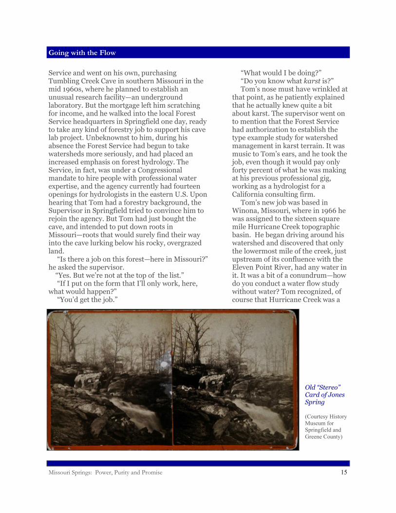
Old “Stereo” Card of Jones Spring
(Courtesy History Museum for Springfield and Greene County)
“What would I be doing?” “Do you know what karst is?” Tom’s nose must have wrinkled at that point, as he patiently explained that he actually knew quite a bit about karst. The supervisor went on to mention that the Forest Service had authorization to establish the type example study for watershed management in karst terrain. It was music to Tom’s ears, and he took the job, even though it would pay only forty percent of what he was making at his previous professional gig, working as a hydrologist for a California consulting firm. Tom’s new job was based in Winona, Missouri, where in 1966 he was assigned to the sixteen square mile Hurricane Creek topographic basin. He began driving around his watershed and discovered that only the lowermost mile of the creek, just upstream of its confluence with the Eleven Point River, had any water in it. It was a bit of a conundrum—how do you conduct a water flow study without water? Tom recognized, of course that Hurricane Creek was a
Missouri Springs: Power, Purity and Promise 16
Going with the Flow
classic losing stream, with most of its flow moving underground a good part of the time. He went to work getting ready for times of flow, supplying the basin with rain gages and weirs to measure surface flows, when they occurred—installing these devices himself, since no technicians were available to help. In his spare time, he even repaired, without authorization, the old mill at Falling Spring (the Forest Service had recently acquired this property), rebuilding the old flume and overshot water wheel. Tom didn’t get much of a lecture about his well-intentioned misdeed, however, other than “that’s not supposed to be the way we do things here.” For their part, the locals applauded the Forest Service for showing some interest in the decaying property and for saving the historic mill from ruin. Tom decided that he needed to do dye tracing to see where the lost flow of Hurricane Creek went. He studied dye tracing techniques, consulting a United States Geological Survey (USGS) publication from 1906 as well as more recent literature from Yugoslavia, at the time a hotbed of karst research. Dye tracing, he discovered, was not all that simple. First, there is the matter of what dye to use. Of course, any substance composed of
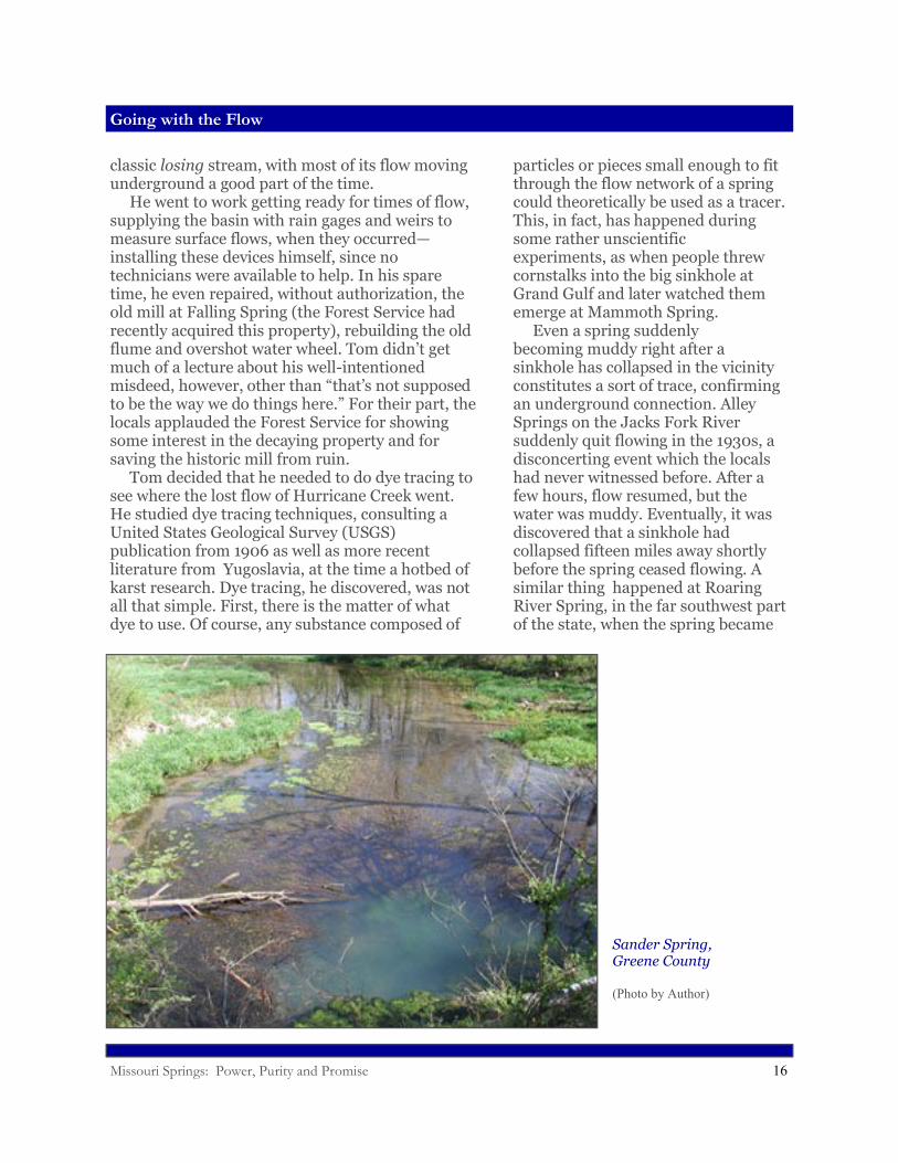
Sander Spring,Greene County
(Photo by Author)
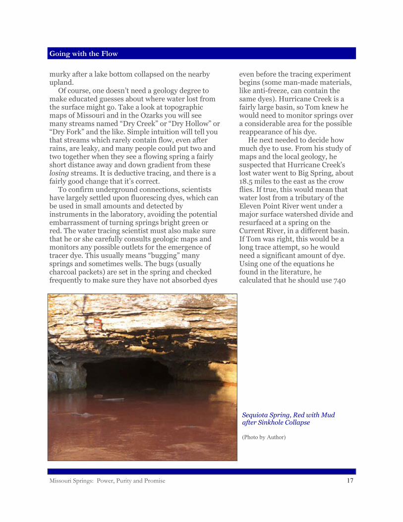
particles or pieces small enough to fit through the flow network of a spring could theoretically be used as a tracer. This, in fact, has happened during some rather unscientific experiments, as when people threw cornstalks into the big sinkhole at Grand Gulf and later watched them emerge at Mammoth Spring. Even a spring suddenly becoming muddy right after a sinkhole has collapsed in the vicinity constitutes a sort of trace, confirming an underground connection. Alley Springs on the Jacks Fork River suddenly quit flowing in the 1930s, a disconcerting event which the locals had never witnessed before. After a few hours, flow resumed, but the water was muddy. Eventually, it was discovered that a sinkhole had collapsed fifteen miles away shortly before the spring ceased flowing. A similar thing happened at Roaring River Spring, in the far southwest part of the state, when the spring became
Missouri Springs: Power, Purity and Promise 17
Going with the Flow
murky after a lake bottom collapsed on the nearby upland. Of course, one doesn’t need a geology degree to make educated guesses about where water lost from the surface might go. Take a look at topographic maps of Missouri and in the Ozarks you will see many streams named “Dry Creek” or “Dry Hollow” or “Dry Fork” and the like. Simple intuition will tell you that streams which rarely contain flow, even after rains, are leaky, and many people could put two and two together when they see a flowing spring a fairly short distance away and down gradient from these losing streams. It is deductive tracing, and there is a fairly good change that it’s correct. To confirm underground connections, scientists have largely settled upon fluorescing dyes, which can be used in small amounts and detected by instruments in the laboratory, avoiding the potential embarrassment of turning springs bright green or red. The water tracing scientist must also make sure that he or she carefully consults geologic maps and monitors any possible outlets for the emergence of tracer dye. This usually means “bugging” many springs and sometimes wells. The bugs (usually charcoal packets) are set in the spring and checked frequently to make sure they have not absorbed dyes
Sequiota Spring, Red with Mud after Sinkhole Collapse
(Photo by Author)
even before the tracing experiment begins (some man-made materials, like anti-freeze, can contain the same dyes). Hurricane Creek is a fairly large basin, so Tom knew he would need to monitor springs over a considerable area for the possible reappearance of his dye. He next needed to decide how much dye to use. From his study of maps and the local geology, he suspected that Hurricane Creek’s lost water went to Big Spring, about 18.5 miles to the east as the crow flies. If true, this would mean that water lost from a tributary of the Eleven Point River went under a major surface watershed divide and resurfaced at a spring on the Current River, in a different basin. If Tom was right, this would be a long trace attempt, so he would need a significant amount of dye. Using one of the equations he found in the literature, he calculated that he should use 740
Missouri Springs: Power, Purity and Promise 18
Going with the Flow
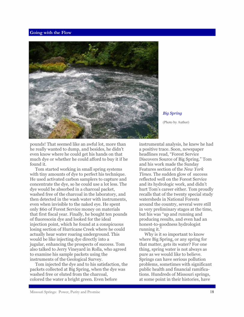
pounds! That seemed like an awful lot, more than he really wanted to dump, and besides, he didn’t even know where he could get his hands on that much dye or whether he could afford to buy it if he found it. Tom started working in small spring systems with tiny amounts of dye to perfect his technique. He used activated carbon samplers to capture and concentrate the dye, so he could use a lot less. The dye would be absorbed in a charcoal packet, washed free of the charcoal in the laboratory, and then detected in the wash water with instruments, even when invisible to the naked eye. He spent only $60 of Forest Service money on materials that first fiscal year. Finally, he bought ten pounds of fluorescein dye and looked for the ideal injection point, which he found at a conspicuous losing section of Hurricane Creek where he could actually hear water roaring underground. This would be like injecting dye directly into a jugular, enhancing the prospects of success. Tom also talked to Jerry Vineyard in Rolla, who agreed to examine his sample packets using the instruments of the Geological Survey. Tom injected the dye and to his satisfaction, the packets collected at Big Spring, when the dye was washed free or eluted from the charcoal, colored the water a bright green. Even before
Big Spring
(Photo by Author)
instrumental analysis, he knew he had a positive trace. Soon, newspaper headlines read, “Forest Service Discovers Source of Big Spring.” Tom and his work made the Sunday Features section of the New York Times. The sudden glow of success reflected well on the Forest Service and its hydrologic work, and didn’t hurt Tom’s career either. Tom proudly recalls that of the twenty special study watersheds in National Forests around the country, several were still in very preliminary stages at the time, but his was “up and running and producing results, and even had an honest-to-goodness hydrologist running it.” Why is it so important to know where Big Spring, or any spring for that matter, gets its water? For one thing, spring water is not always as pure as we would like to believe. Springs can have serious pollution problems, sometimes with significant public health and financial ramifica-tions. Hundreds of Missouri springs, at some point in their histories, have
Missouri Springs: Power, Purity and Promise 19
A Question of Purity
been used for drinking water supplies or supported some type of business—and for the most part, water pollution is bad for business. When springs get polluted, people using or living near them, as well as agencies charged with groundwater protection, want to know where to look for the cause of the problem. Regulations may have been violated, or are too weak to adequately protect groundwater and therefore need to be strengthened. And thoughtful, responsible citizens want to know how to prevent such a thing from happening again.
A Question of Purity
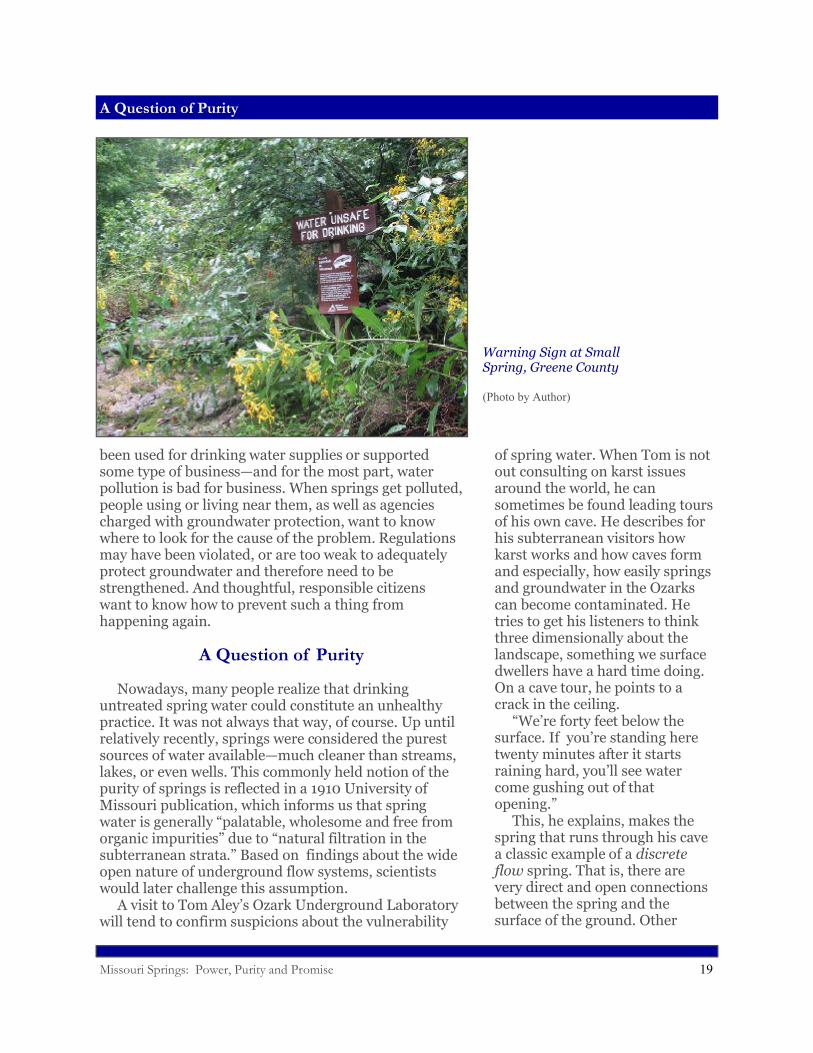
Nowadays, many people realize that drinking untreated spring water could constitute an unhealthy practice. It was not always that way, of course. Up until relatively recently, springs were considered the purest sources of water available—much cleaner than streams, lakes, or even wells. This commonly held notion of the purity of springs is reflected in a 1910 University of Missouri publication, which informs us that spring water is generally “palatable, wholesome and free from organic impurities” due to “natural filtration in the subterranean strata.” Based on findings about the wide open nature of underground flow systems, scientists would later challenge this assumption. A visit to Tom Aley’s Ozark Underground Laboratory will tend to confirm suspicions about the vulnerability
Warning Sign at Small Spring, Greene County
(Photo by Author)
of spring water. When Tom is not out consulting on karst issues around the world, he can sometimes be found leading tours of his own cave. He describes for his subterranean visitors how karst works and how caves form and especially, how easily springs and groundwater in the Ozarks can become contaminated. He tries to get his listeners to think three dimensionally about the landscape, something we surface dwellers have a hard time doing. On a cave tour, he points to a crack in the ceiling. “We’re forty feet below the surface. If you’re standing here twenty minutes after it starts raining hard, you’ll see water come gushing out of that opening.” This, he explains, makes the spring that runs through his cave a classic example of a discrete flow spring. That is, there are very direct and open connections between the spring and the surface of the ground. Other
Missouri Springs: Power, Purity and Promise 20
A Question of Purity
springs, usually smaller ones, derive their flow from systems that are less open, with tighter cracks in the rock. These are called diffuse flow springs. They rise more slowly when it rains but also drain more slowly. The openness of the spring network has a direct bearing on how quickly and how easily the spring can become contaminated by pollu-tion in the recharge area. Of polluting events, Missouri springs have had their share. One of the first scientists in Missouri to investigate the contamination of springs was Edward Shepard, the man who explored Greer Spring in 1905. Shepard arrived from the northeastern United States
Sinkhole Collapse, Barry County
(Courtesy Missouri Department of Natural Resources)
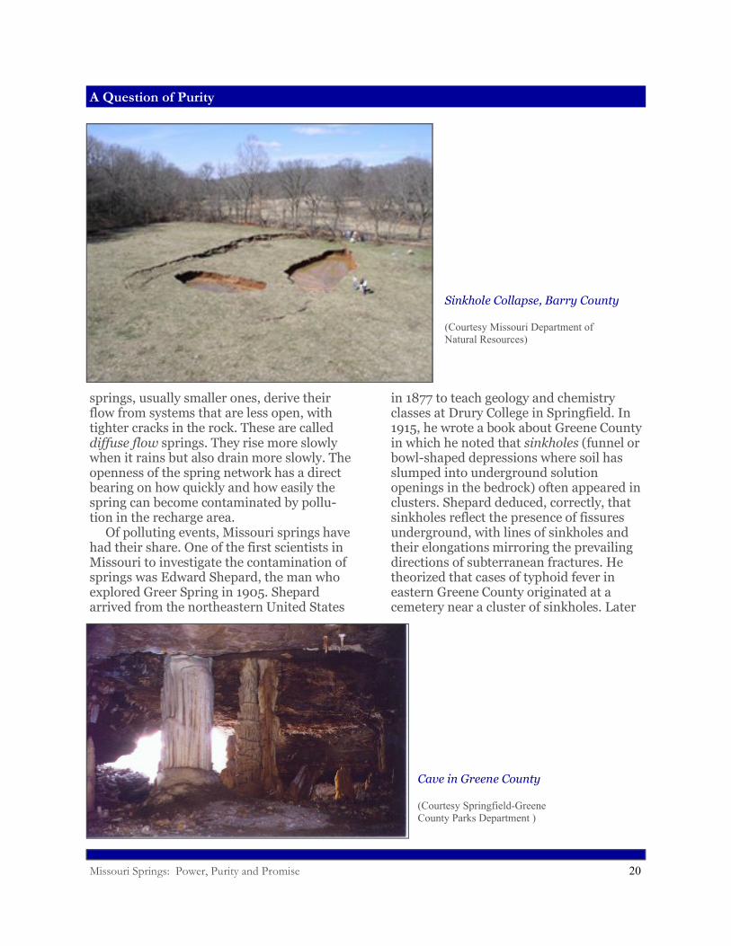
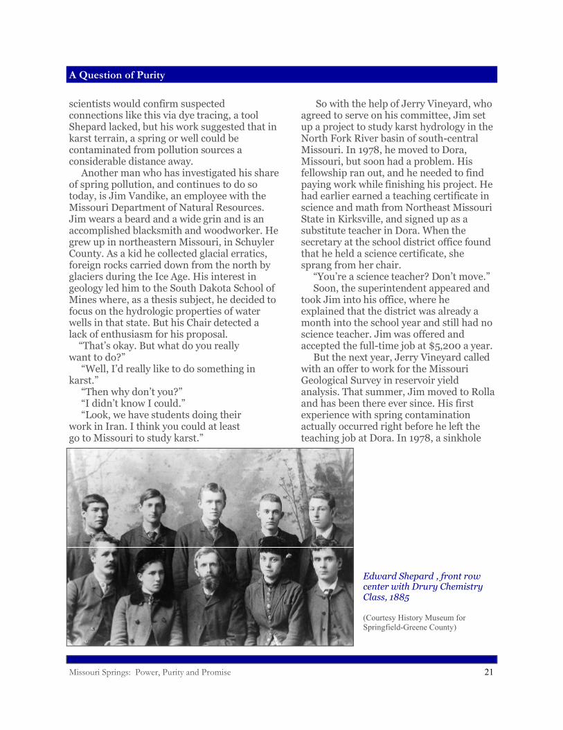
in 1877 to teach geology and chemistry classes at Drury College in Springfield. In 1915, he wrote a book about Greene County in which he noted that sinkholes (funnel or bowl-shaped depressions where soil has slumped into underground solution openings in the bedrock) often appeared in clusters. Shepard deduced, correctly, that sinkholes reflect the presence of fissures underground, with lines of sinkholes and their elongations mirroring the prevailing directions of subterranean fractures. He theorized that cases of typhoid fever in eastern Greene County originated at a cemetery near a cluster of sinkholes. Later
Cave in Greene County
(Courtesy Springfield-Greene County Parks Department )
Missouri Springs: Power, Purity and Promise 21
A Question of Purity
scientists would confirm suspected connections like this via dye tracing, a tool Shepard lacked, but his work suggested that in karst terrain, a spring or well could be contaminated from pollution sources a considerable distance away. Another man who has investigated his share of spring pollution, and continues to do so today, is Jim Vandike, an employee with the Missouri Department of Natural Resources. Jim wears a beard and a wide grin and is an accomplished blacksmith and woodworker. He grew up in northeastern Missouri, in Schuyler County. As a kid he collected glacial erratics, foreign rocks carried down from the north by glaciers during the Ice Age. His interest in geology led him to the South Dakota School of Mines where, as a thesis subject, he decided to focus on the hydrologic properties of water wells in that state. But his Chair detected a lack of enthusiasm for his proposal. “That’s okay. But what do you really want to do?” “Well, I’d really like to do something inkarst.” “Then why don’t you?” “I didn’t know I could.” “Look, we have students doing theirwork in Iran. I think you could at leastgo to Missouri to study karst.”
So with the help of Jerry Vineyard, who agreed to serve on his committee, Jim set up a project to study karst hydrology in the North Fork River basin of south-central Missouri. In 1978, he moved to Dora, Missouri, but soon had a problem. His fellowship ran out, and he needed to find paying work while finishing his project. He had earlier earned a teaching certificate in science and math from Northeast Missouri State in Kirksville, and signed up as a substitute teacher in Dora. When the secretary at the school district office found that he held a science certificate, she sprang from her chair. “You’re a science teacher? Don’t move.” Soon, the superintendent appeared and took Jim into his office, where he explained that the district was already a month into the school year and still had no science teacher. Jim was offered and accepted the full-time job at $5,200 a year. But the next year, Jerry Vineyard called with an offer to work for the Missouri Geological Survey in reservoir yield analysis. That summer, Jim moved to Rolla and has been there ever since. His first experience with spring contamination actually occurred right before he left the teaching job at Dora. In 1978, a sinkhole
Edward Shepard , front row center with Drury Chemistry Class, 1885
(Courtesy History Museum for Springfield-Greene County)
Missouri Springs: Power, Purity and Promise 22
A Question of Purity
suddenly opened up in the bottom of the West Plains wastewater lagoon, emptying most of its contents, about thirty to forty million gallons of sewage, into the shallow groundwater. Because Jim had worked in the North Fork basin, immediately west of West Plains, and had produced new maps from dye tracing and other geologic field work, he was called in to help. Not surprisingly, at least to geologists, the most serious problems from the leaking lagoon showed up at Mammoth Spring, which previous dye tracing had shown to be hydrologically connected to the West Plains area. This gigantic spring, pouring from the ground right on the Missouri-Arkansas line, supports a fish hatchery and gives birth to the Spring River, a popular canoeing stream. After the lagoon collapse in West Plains, bacterial levels jumped and dissolved oxygen slumped in the spring. As strange as it might sound, however, the situation could have been worse, illustrating one slightly redeeming feature of wide open groundwater flow systems. The lost sewage followed a beeline trajectory toward Mammoth Spring, seemingly polluting very few wells along the way. “Springs,” Jim explains, “take water from a
fairly wide area and concentrate the flow into one or a very few well defined flow paths, rather than stuff in the flow path going out into the aquifer. So unless you were unlucky enough to have your well go into over very near the conduit, there was a good change you didn’t see any impact.” In the fall of 1981, Jim got a call from Mr. Gallagher, the hatchery manager at Meramec Spring in central Missouri, who told him that dissolved oxygen levels in the spring had dropped precipitously and the fish were getting sick. Fall is normally a fairly quiet time of the year, when water quality doesn’t change much, and there hadn’t been any recent rain. Jim checked with his DNR cohort, Jim Williams, who recalled that a pipeline had ruptured on the Phelps-Dent County line the week before, near the little town of Lake Spring. The old oil pipeline had been converted to carry liquid fertilizer, a mix of ammonium nitrate and urea containing about 32% nitrogen by weight. The product had also been tagged with fluorescein dye, so that a leak would tint any contaminated water a sickly yellowish green.
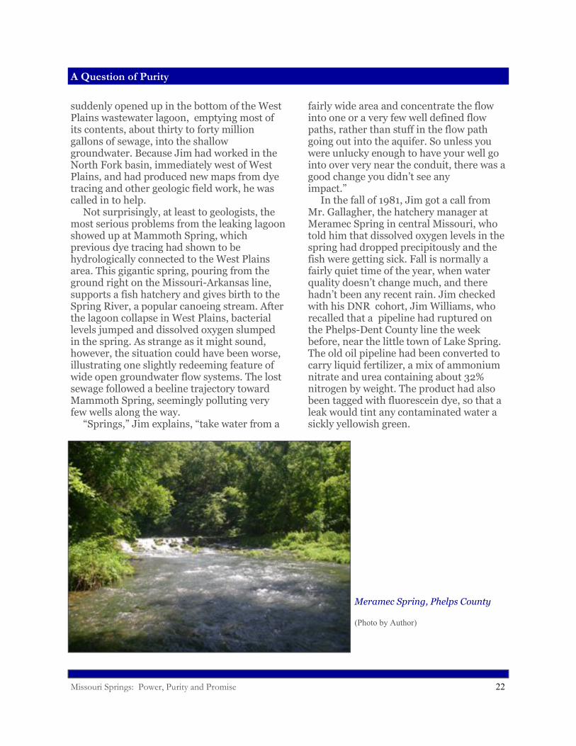
Meramec Spring, Phelps County
(Photo by Author)
Missouri Springs: Power, Purity and Promise 23
A Question of Purity
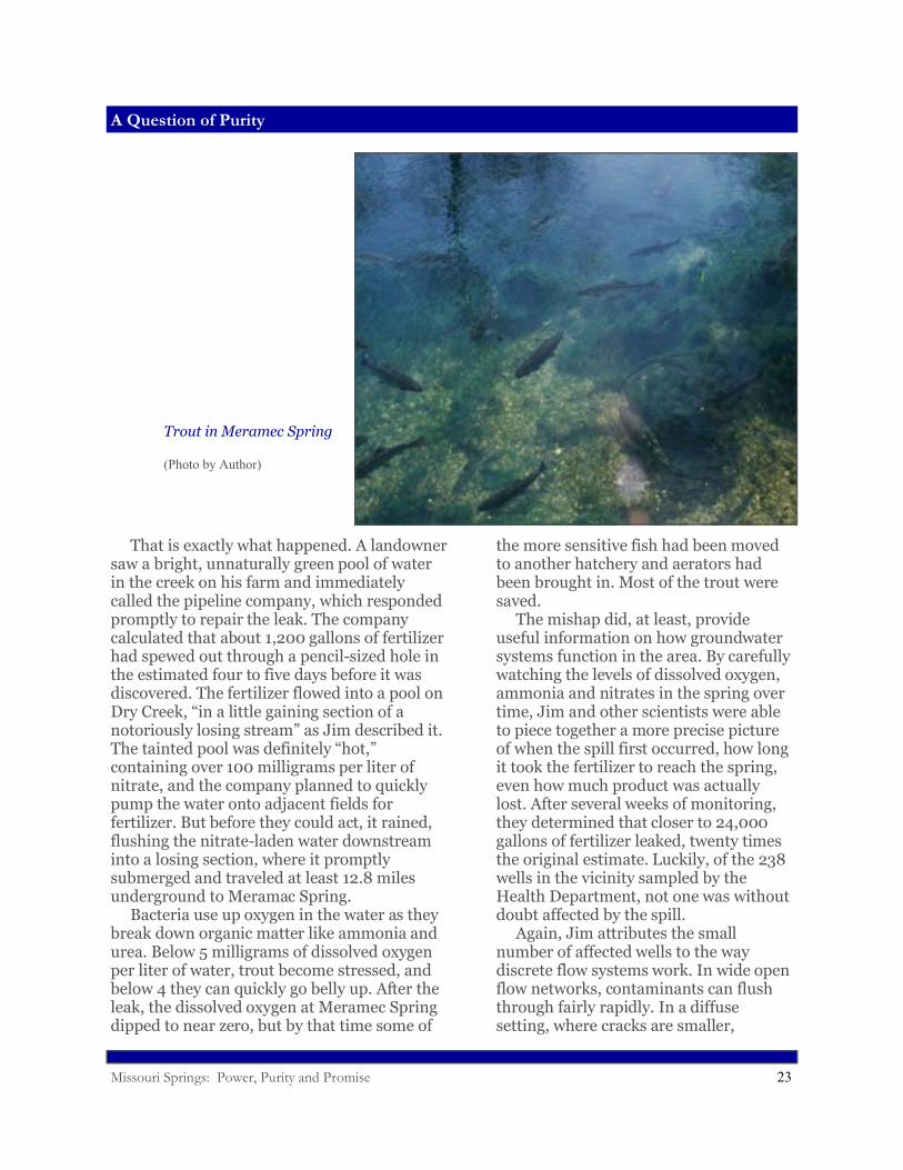
That is exactly what happened. A landowner saw a bright, unnaturally green pool of water in the creek on his farm and immediately called the pipeline company, which responded promptly to repair the leak. The company calculated that about 1,200 gallons of fertilizer had spewed out through a pencil-sized hole in the estimated four to five days before it was discovered. The fertilizer flowed into a pool on Dry Creek, “in a little gaining section of a notoriously losing stream” as Jim described it. The tainted pool was definitely “hot,” containing over 100 milligrams per liter of nitrate, and the company planned to quickly pump the water onto adjacent fields for fertilizer. But before they could act, it rained, flushing the nitrate-laden water downstream into a losing section, where it promptly submerged and traveled at least 12.8 miles underground to Meramac Spring. Bacteria use up oxygen in the water as they break down organic matter like ammonia and urea. Below 5 milligrams of dissolved oxygen per liter of water, trout become stressed, and below 4 they can quickly go belly up. After the leak, the dissolved oxygen at Meramec Spring dipped to near zero, but by that time some of
the more sensitive fish had been moved to another hatchery and aerators had been brought in. Most of the trout were saved. The mishap did, at least, provide useful information on how groundwater systems function in the area. By carefully watching the levels of dissolved oxygen, ammonia and nitrates in the spring over time, Jim and other scientists were able to piece together a more precise picture of when the spill first occurred, how long it took the fertilizer to reach the spring, even how much product was actually lost. After several weeks of monitoring, they determined that closer to 24,000 gallons of fertilizer leaked, twenty times the original estimate. Luckily, of the 238 wells in the vicinity sampled by the Health Department, not one was without doubt affected by the spill. Again, Jim attributes the small number of affected wells to the way discrete flow systems work. In wide open flow networks, contaminants can flush through fairly rapidly. In a diffuse setting, where cracks are smaller,
Trout in Meramec Spring
(Photo by Author)
Missouri Springs: Power, Purity and Promise 24
A Question of Purity
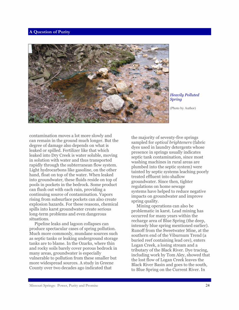
contamination moves a lot more slowly and can remain in the ground much longer. But the degree of damage also depends on what is leaked or spilled. Fertilizer like that which leaked into Dry Creek is water soluble, moving in solution with water and thus transported rapidly through the subterranean flow system. Light hydrocarbons like gasoline, on the other hand, float on top of the water. When leaked into groundwater, these fluids reside on top of pools in pockets in the bedrock. Some product can flush out with each rain, providing a continuing source of contamination. Vapors rising from subsurface pockets can also create explosion hazards. For these reasons, chemical spills into karst groundwater create serious long-term problems and even dangerous situations. Pipeline leaks and lagoon collapses can produce spectacular cases of spring pollution. Much more commonly, mundane sources such as septic tanks or leaking underground storage tanks are to blame. In the Ozarks, where thin and rocky soils barely cover porous bedrock in many areas, groundwater is especially vulnerable to pollution from these smaller but more widespread sources. A study in Greene County over two decades ago indicated that
the majority of seventy-five springs sampled for optical brighteners (fabric dyes used in laundry detergents whose presence in springs usually indicates septic tank contamination, since most washing machines in rural areas are plumbed into the septic system) were tainted by septic systems leaching poorly treated effluent into shallow groundwater. Since then, tighter regulations on home sewage systems have helped to reduce negative impacts on groundwater and improve spring quality. Mining operations can also be problematic in karst. Lead mining has occurred for many years within the recharge area of Blue Spring (the deep, intensely blue spring mentioned earlier). Runoff from the Sweetwater Mine, at the southern end of the Viburnum Trend (a buried reef containing lead ore), enters Logan Creek, a losing stream and a tributary of the Black River. Dye tracing, including work by Tom Aley, showed that the lost flow of Logan Creek leaves the Black River Basin and goes to the south, to Blue Spring on the Current River. In
Heavily Polluted Spring
(Photo by Author)
Missouri Springs: Power, Purity and Promise 25
A Question of Purity
1977 and 1978, flooding caused mine dams to be breached, allowing tailings to flow into Logan Creek, muddying it for over forty miles downstream. USGS scientists monitoring Blue Spring found elevated levels of sodium, sulfate and chloride. Other contaminants, such as metals, might have been elevated, but there was insufficient background data on the spring to know for sure. This illustrates another difficulty with monitoring Missouri’s springs. Most of them are infrequently sampled, if ever, so baseline information is often lacking. It is very helpful to know the recharge area of a spring before pollution occurs, allowing a more immediate and effective response. This is one of the main reasons to perform dye tracing. But even in the absence of such tracing, geologists, using their understanding of local geology and the transmissivity (the rate at which water can pass through rock) of the karst bedrock, can estimate the approximate size of a given spring’s recharge area based solely on its volume of flow. For example, Tom Aley calculated that for springs in his Hurricane Creek study area, one square mile of recharge area should produce a springflow of roughly one cubic foot per second (650,000 gallons per day). This
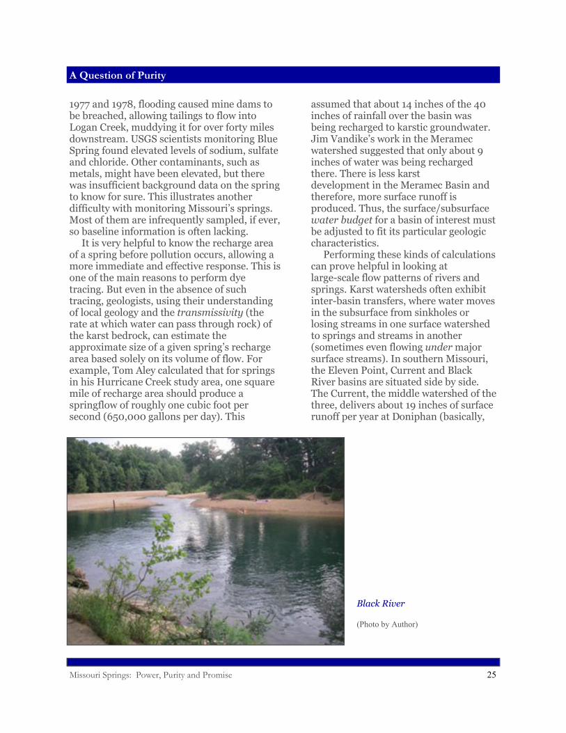
assumed that about 14 inches of the 40 inches of rainfall over the basin was being recharged to karstic groundwater. Jim Vandike’s work in the Meramec watershed suggested that only about 9 inches of water was being recharged there. There is less karst development in the Meramec Basin and therefore, more surface runoff is produced. Thus, the surface/subsurface water budget for a basin of interest must be adjusted to fit its particular geologic characteristics. Performing these kinds of calculations can prove helpful in looking at large-scale flow patterns of rivers and springs. Karst watersheds often exhibit inter-basin transfers, where water moves in the subsurface from sinkholes or losing streams in one surface watershed to springs and streams in another (sometimes even flowing under major surface streams). In southern Missouri, the Eleven Point, Current and Black River basins are situated side by side. The Current, the middle watershed of the three, delivers about 19 inches of surface runoff per year at Doniphan (basically,
Black River
(Photo by Author)
Missouri Springs: Power, Purity and Promise 26
Mineral Springs
the equivalent of nineteen inches of rain over the entire basin leaving as runoff). The Eleven Point, to the west, delivers only 12 to 12.5 inches and the Black, to the east, 12 to 13 inches. Obviously, it doesn’t rain on average seven inches more on the Current Watershed. Instead, the Current steals, or pirates, water from the basins on either side. Losing streams and sinkholes in the Eleven Point and Black basins funnel water to springs along the Current River, bolstering its flow and supporting year round fishing and canoeing. Big Spring on the Current River, Missouri’s largest, steals half of its water from the Eleven Point basin—from places like Hurricane Creek, where Tom Aley did his studies. As we learned earlier, the Black River Basin supplies water to Blue Spring, also on the Current River, and the Meramec Basin, to the north, loses some of its water to springs like Welch Spring on the upper Current River. The Current seems to be greedy, but we are the beneficiaries of that plunder in the magnificent and beautiful springs that
grace this scenic, well-watered section of the state.
Mineral Springs
When Missourians think of springs, they usually picture cold, clear, good tasting water issuing from holes in the rock. This could fairly describe most Ozarks springs. But not all of Missouri’s springs are of this type, particularly in areas outside the Ozarks. Some springs have strong sulfur smells and taste salty or bitter or otherwise disgusting. Where they flow, they leave orange stains on rocks and leaves. They sometimes contain long, slimy growths of algae or strands of white or purple bacteria wafting in their currents. These springs are not the deep blue, picturesque beauties shown in travel magazines—the ones people plan vacations around. They are for the most part shunned or ignored. But in times past, some of them were of great commercial interest. In fact, they formed centerpieces of some of the state’s early and, in some cases, highly successful business enterprises.
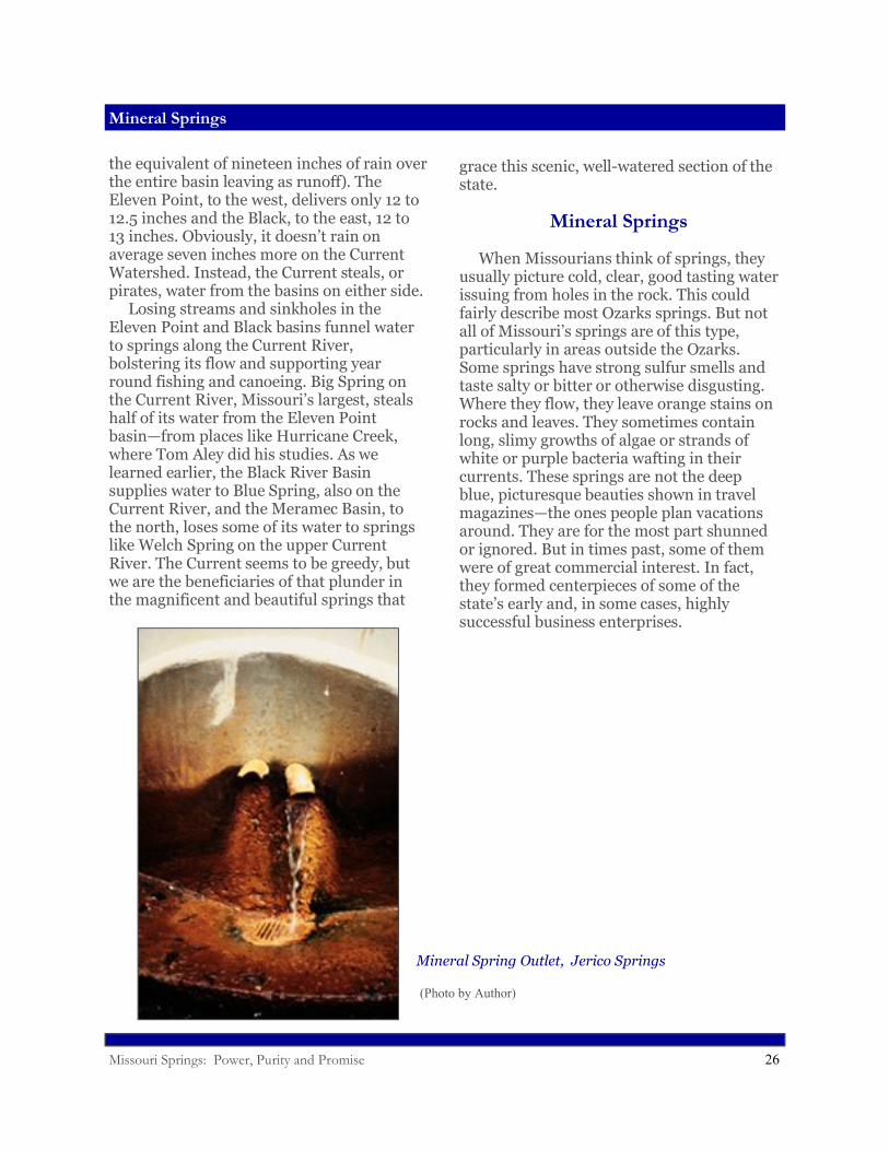
Mineral Spring Outlet, Jerico Springs
(Photo by Author)
Missouri Springs: Power, Purity and Promise 27
Mineral Springs
* * * Like many pioneers, Nathan Boone, Daniel’s son, was a businessman. In Missouri, he tried to support himself and his family by hunting and trapping, as befits a true frontiersman. But that line of work became difficult as more settlers poured in, depleting the game. Furthermore, indigenous people began to push back more fiercely against the tide of settlement. Nathan, in fact, was escaping from a close encounter with hostile Indians while trapping in 1804 in what would become western Missouri, far from his home, when he stumbled across a salty spring near the Missouri River. To him, this wasn’t so odd, since his father had introduced him to similar waters in Kentucky. Nathan realized the business potential of this find and later returned, with his brother and a few other men, to manufacture salt. Salt springs had been worked in the region for many years before the Boones arrived, but the saltworks at “Boons Lick” became famous, serving the needs of Missouri River settlements for years. Salt was a frontier necessity, especially useful for preserving food. But it was expensive to
buy salt in Missouri produced in New York or on the Ohio River. Locally manufactured salt became a highly sought after commodity, and entrepreneurs eagerly sought salt springs where they could set up manufacturing operations. Settlers frequently referred to salty springs or seeps as “licks,” because buffalo and elk and deer went there in large numbers to lick the salt (along with mastadons, at one time, such as at the salt springs near Mastodon State Park in Kimmswick). These animals wore deep trails to the licks and gouged out wallows long before any humans arrived. Indians were said to have visited certain of these springs and carried caked salt back to their villages. By the mid 1700s Frenchmen and others were boiling spring water in French Louisiana (later, Missouri) to make salt, often hauling it long distances downriver to sell. Illustrative of the importance of salt to Missouri’s early economy, the state at its for-mation in 1821 reserved for its own use large tracts of land around at least a dozen salt springs, primarily in Ralls, Boone, Howard and Saline Counties. Saline County once boasted the largest salt spring in the state,
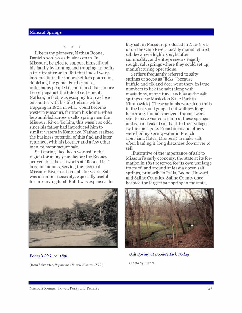
Boone’s Lick, ca. 1890
(from Schweiter, Report on Mineral Waters, 1892 )
Salt Spring at Boone’s Lick Today
(Photo by Author)
Missouri Springs: Power, Purity and Promise 28
Mineral Springs
discharging from a round outlet forty feet in diameter thousands of gallons per day of effervescent, white colored water. Today, there is virtually nothing left of this spring but a low, marshy spot. No saltworks survive in the state, either. Salt production in Missouri was never large in comparison to other states, and as interstate transportation became more economical, the state’s salt simply could not compete in a national market. Salt produced in New York and shipped via the Erie Canal or even hauled from overseas became very cheap, even in Missouri. But by the mid 1800s, when Missouri salt production was already in decline, the state’s mineralized springs were supplying water for new kinds of enterprises—business founded upon the search for health, or even the quest for relaxation and fun.
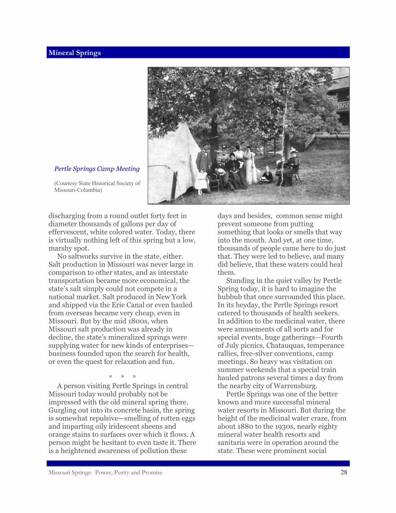
* * * A person visiting Pertle Springs in central Missouri today would probably not be impressed with the old mineral spring there. Gurgling out into its concrete basin, the spring is somewhat repulsive—smelling of rotten eggs and imparting oily iridescent sheens and orange stains to surfaces over which it flows. A person might be hesitant to even taste it. There is a heightened awareness of pollution these
days and besides, common sense might prevent someone from putting something that looks or smells that way into the mouth. And yet, at one time, thousands of people came here to do just that. They were led to believe, and many did believe, that these waters could heal them. Standing in the quiet valley by Pertle Spring today, it is hard to imagine the hubbub that once surrounded this place. In its heyday, the Pertle Springs resort catered to thousands of health seekers. In addition to the medicinal water, there were amusements of all sorts and for special events, huge gatherings—Fourth of July picnics, Chatauquas, temperance rallies, free-silver conventions, camp meetings. So heavy was visitation on summer weekends that a special train hauled patrons several times a day from the nearby city of Warrensburg. Pertle Springs was one of the better known and more successful mineral water resorts in Missouri. But during the height of the medicinal water craze, from about 1880 to the 1930s, nearly eighty mineral water health resorts and sanitaria were in operation around the state. These were prominent social
Pertle Springs Camp Meeting
(Courtesy State Historical Society of Missouri-Columbia)
Missouri Springs: Power, Purity and Promise 29
Mineral Springs
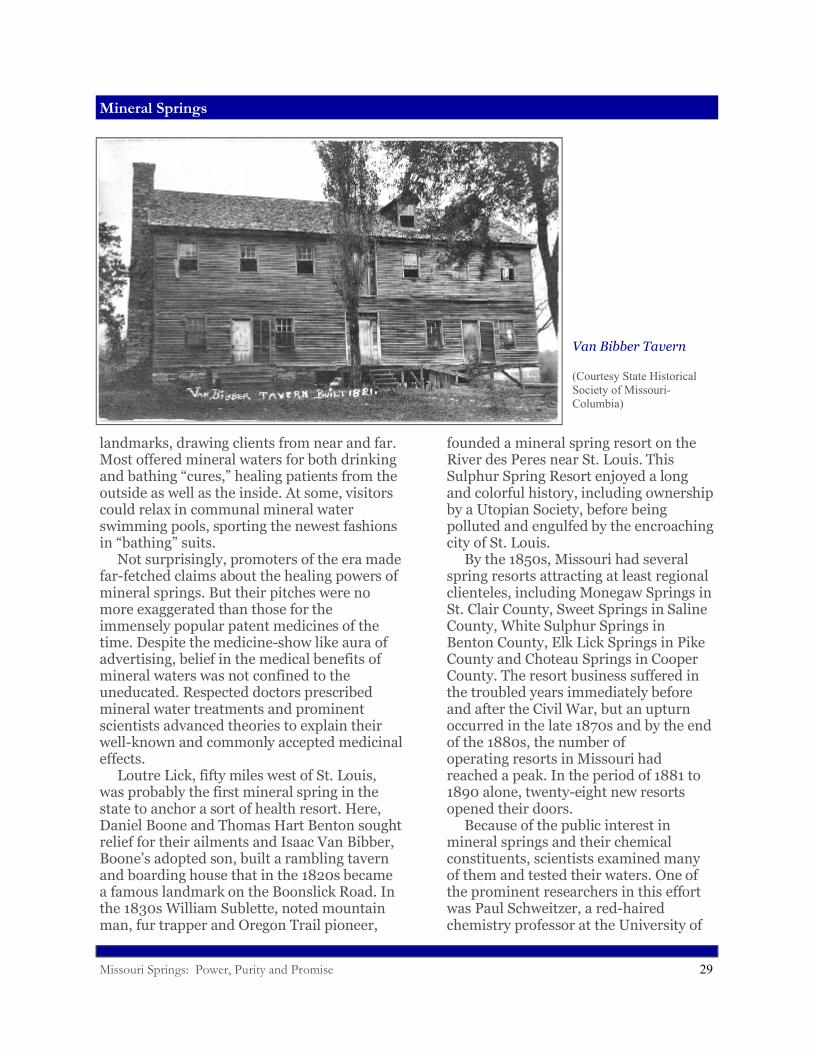
landmarks, drawing clients from near and far. Most offered mineral waters for both drinking and bathing “cures,” healing patients from the outside as well as the inside. At some, visitors could relax in communal mineral water swimming pools, sporting the newest fashions in “bathing” suits. Not surprisingly, promoters of the era made far-fetched claims about the healing powers of mineral springs. But their pitches were no more exaggerated than those for the immensely popular patent medicines of the time. Despite the medicine-show like aura of advertising, belief in the medical benefits of mineral waters was not confined to the uneducated. Respected doctors prescribed mineral water treatments and prominent scientists advanced theories to explain their well-known and commonly accepted medicinal effects. Loutre Lick, fifty miles west of St. Louis, was probably the first mineral spring in the state to anchor a sort of health resort. Here, Daniel Boone and Thomas Hart Benton sought relief for their ailments and Isaac Van Bibber, Boone’s adopted son, built a rambling tavern and boarding house that in the 1820s became a famous landmark on the Boonslick Road. In the 1830s William Sublette, noted mountain man, fur trapper and Oregon Trail pioneer,
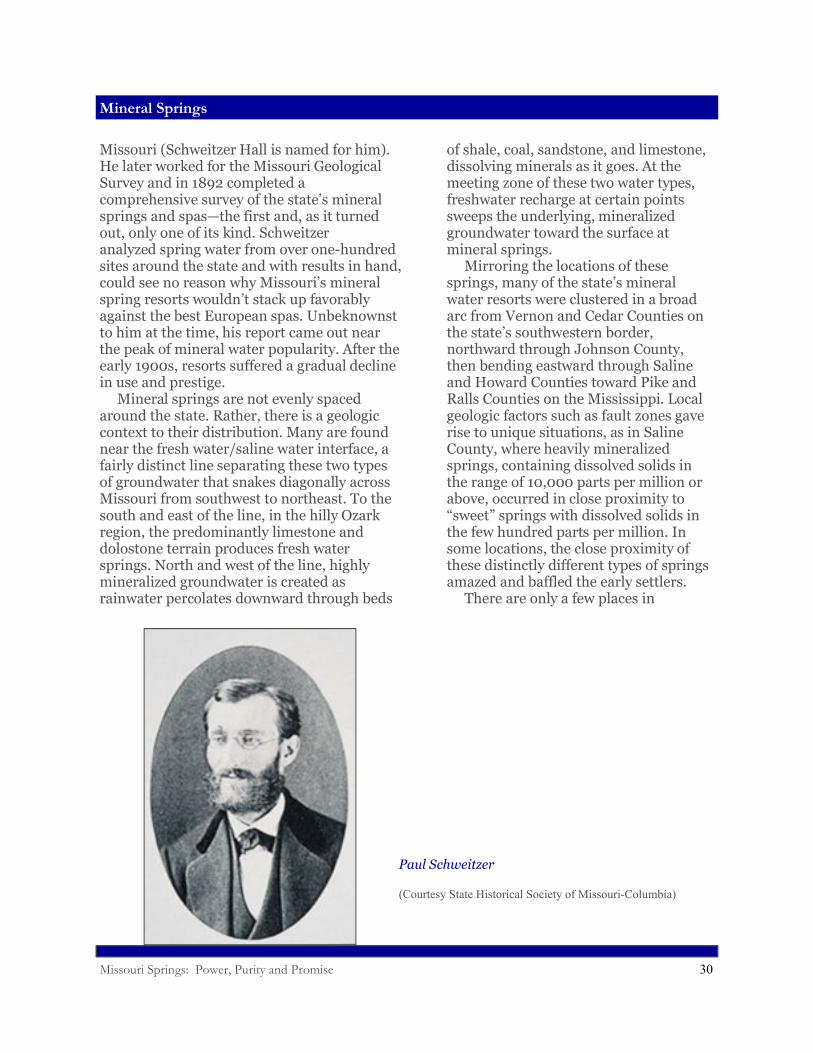
founded a mineral spring resort on the River des Peres near St. Louis. This Sulphur Spring Resort enjoyed a long and colorful history, including ownership by a Utopian Society, before being polluted and engulfed by the encroaching city of St. Louis. By the 1850s, Missouri had several spring resorts attracting at least regional clienteles, including Monegaw Springs in St. Clair County, Sweet Springs in Saline County, White Sulphur Springs in Benton County, Elk Lick Springs in Pike County and Choteau Springs in Cooper County. The resort business suffered in the troubled years immediately before and after the Civil War, but an upturn occurred in the late 1870s and by the end of the 1880s, the number of operating resorts in Missouri had reached a peak. In the period of 1881 to 1890 alone, twenty-eight new resorts opened their doors. Because of the public interest in mineral springs and their chemical constituents, scientists examined many of them and tested their waters. One of the prominent researchers in this effort was Paul Schweitzer, a red-haired chemistry professor at the University of
Van Bibber Tavern
(Courtesy State Historical Society of Missouri-Columbia)
Missouri Springs: Power, Purity and Promise 30
Mineral Springs
Missouri (Schweitzer Hall is named for him). He later worked for the Missouri Geological Survey and in 1892 completed a comprehensive survey of the state’s mineral springs and spas—the first and, as it turned out, only one of its kind. Schweitzer analyzed spring water from over one-hundred sites around the state and with results in hand, could see no reason why Missouri’s mineral spring resorts wouldn’t stack up favorably against the best European spas. Unbeknownst to him at the time, his report came out near the peak of mineral water popularity. After the early 1900s, resorts suffered a gradual decline in use and prestige. Mineral springs are not evenly spaced around the state. Rather, there is a geologic context to their distribution. Many are found near the fresh water/saline water interface, a fairly distinct line separating these two types of groundwater that snakes diagonally across Missouri from southwest to northeast. To the south and east of the line, in the hilly Ozark region, the predominantly limestone and dolostone terrain produces fresh water springs. North and west of the line, highly mineralized groundwater is created as rainwater percolates downward through beds
of shale, coal, sandstone, and limestone, dissolving minerals as it goes. At the meeting zone of these two water types, freshwater recharge at certain points sweeps the underlying, mineralized groundwater toward the surface at mineral springs. Mirroring the locations of these springs, many of the state’s mineral water resorts were clustered in a broad arc from Vernon and Cedar Counties on the state’s southwestern border, northward through Johnson County, then bending eastward through Saline and Howard Counties toward Pike and Ralls Counties on the Mississippi. Local geologic factors such as fault zones gave rise to unique situations, as in Saline County, where heavily mineralized springs, containing dissolved solids in the range of 10,000 parts per million or above, occurred in close proximity to “sweet” springs with dissolved solids in the few hundred parts per million. In some locations, the close proximity of these distinctly different types of springs amazed and baffled the early settlers. There are only a few places in
Paul Schweitzer
(Courtesy State Historical Society of Missouri-Columbia)
Missouri Springs: Power, Purity and Promise 31
Life in the Cold (and Dark)
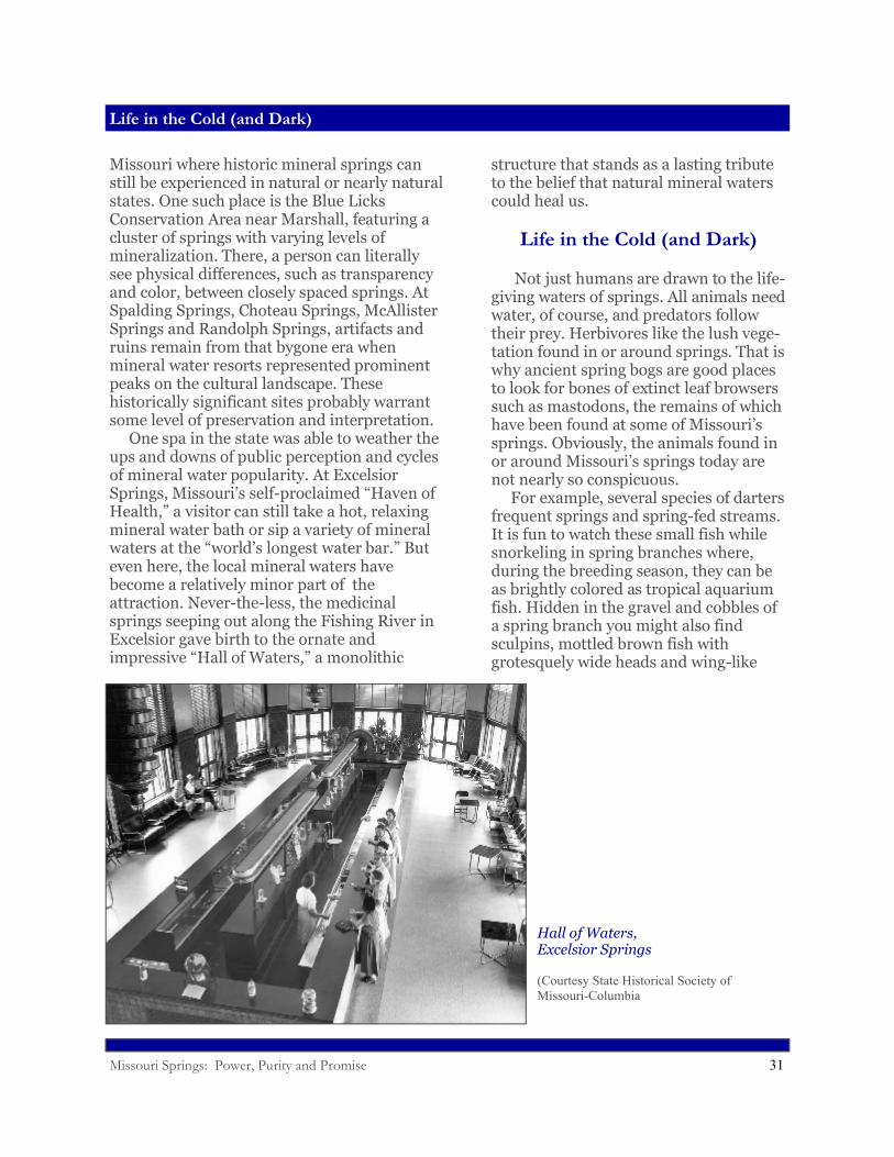
Missouri where historic mineral springs can still be experienced in natural or nearly natural states. One such place is the Blue Licks Conservation Area near Marshall, featuring a cluster of springs with varying levels of mineralization. There, a person can literally see physical differences, such as transparency and color, between closely spaced springs. At Spalding Springs, Choteau Springs, McAllister Springs and Randolph Springs, artifacts and ruins remain from that bygone era when mineral water resorts represented prominent peaks on the cultural landscape. These historically significant sites probably warrant some level of preservation and interpretation. One spa in the state was able to weather the ups and downs of public perception and cycles of mineral water popularity. At Excelsior Springs, Missouri’s self-proclaimed “Haven of Health,” a visitor can still take a hot, relaxing mineral water bath or sip a variety of mineral waters at the “world’s longest water bar.” But even here, the local mineral waters have become a relatively minor part of the attraction. Never-the-less, the medicinal springs seeping out along the Fishing River in Excelsior gave birth to the ornate and impressive “Hall of Waters,” a monolithic
structure that stands as a lasting tribute to the belief that natural mineral waters could heal us.
Life in the Cold (and Dark)
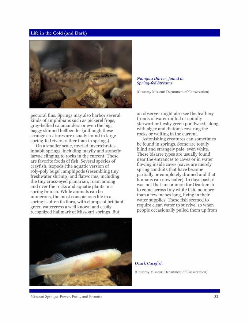
Not just humans are drawn to the life-giving waters of springs. All animals need water, of course, and predators follow their prey. Herbivores like the lush vege-tation found in or around springs. That is why ancient spring bogs are good places to look for bones of extinct leaf browsers such as mastodons, the remains of which have been found at some of Missouri’s springs. Obviously, the animals found in or around Missouri’s springs today are not nearly so conspicuous. For example, several species of darters frequent springs and spring-fed streams. It is fun to watch these small fish while snorkeling in spring branches where, during the breeding season, they can be as brightly colored as tropical aquarium fish. Hidden in the gravel and cobbles of a spring branch you might also find sculpins, mottled brown fish with grotesquely wide heads and wing-like
Hall of Waters, Excelsior Springs
(Courtesy State Historical Society of Missouri-Columbia
Missouri Springs: Power, Purity and Promise 32
Life in the Cold (and Dark)
pectoral fins. Springs may also harbor several kinds of amphibians such as pickerel frogs, gray-bellied salamanders or even the big, baggy skinned hellbender (although these strange creatures are usually found in large spring-fed rivers rather than in springs). On a smaller scale, myriad invertebrates inhabit springs, including mayfly and stonefly larvae clinging to rocks in the current. These are favorite foods of fish. Several species of crayfish, isopods (the aquatic version of roly-poly bugs), amphipods (resembling tiny freshwater shrimp) and flatworms, including the tiny cross-eyed planarian, roam among and over the rocks and aquatic plants in a spring branch. While animals can be numerous, the most conspicuous life in a spring is often its flora, with clumps of brilliant green watercress a well known and easily recognized hallmark of Missouri springs. But
an observer might also see the feathery fronds of water milfoil or spindly starwort or fleshy green pondweed, along with algae and diatoms covering the rocks or wafting in the current. Astonishing creatures can sometimes be found in springs. Some are totally blind and strangely pale, even white. These bizarre types are usually found near the entrances to caves or in water flowing inside caves (caves are merely spring conduits that have become partially or completely drained and that humans can now enter). In days past, it was not that uncommon for Ozarkers to to come across tiny white fish, no more than a few inches long, living in their water supplies. These fish seemed to require clean water to survive, so when people occasionally pulled them up from
Niangua Darter, found in Spring-fed Streams
(Courtesy Missouri Department of Conservation)
Ozark Cavefish
(Courtesy Missouri Department of Conservation)
Missouri Springs: Power, Purity and Promise 33
Life in the Cold (and Dark)
a shallow well they figured the water had to be good. Thus, the miniature piscids became known as “well-keepers.” A fearless female explorer first introduced some of these strange spring and cave-dwelling creatures to the scientific community. Ruth Hoppin, an amateur biologist living near Sarcoxie, Missouri, found some tiny white fish in a cave near her home in the late 1880s. She sent a specimen of this fish to a national scientific expert, Samuel Garman, who announced that it was a cavefish, a kind of fish highly adapted to life in the total darkness of caves and groundwater. He declared that this species was new to science, the first cavefish of its kind identified west of the Mississippi River. It was similar to cavefish previously discovered in Mammoth Cave, Kentucky, but its eyes had degenerated even further. The identification of the Ozark Cavefish raised all sorts of interesting questions. If it was descended from the Mammoth Cave (Southern) Cavefish, how did it get across (or under) the Mississippi River? How does it spread from cave to cave? How does it find food in the total darkness? How long does it live?
Biologists are still trying to answer some of these questions. Reclusive and rare, the Ozark Cavefish is a difficult subject for study. In spite of that, its’ presence in isolated caves and shallow wells in southwestern Missouri and northwestern Arkansas has been taken to mean that the local groundwater is relatively unpolluted. The cavefish has thus been likened to the “canary in the coal mine,” in that its disappearance from previously known habitat would indicate some kind of problem. There are some difficulties with this concept, however. Scientists have discovered that the metabolism of cavefish is very low. This allows the fish to survive on meals that can be few and far between in un-derground waters. Unlike many other species, cavefish might be able to simply “wait out” some episodes of pollution or temporarily move into cleaner water further back in the bedrock. Many kinds of creatures inhabit caves and cave streams (which are actually springs, of course), some of them, like the cavefish, with special adaptations to
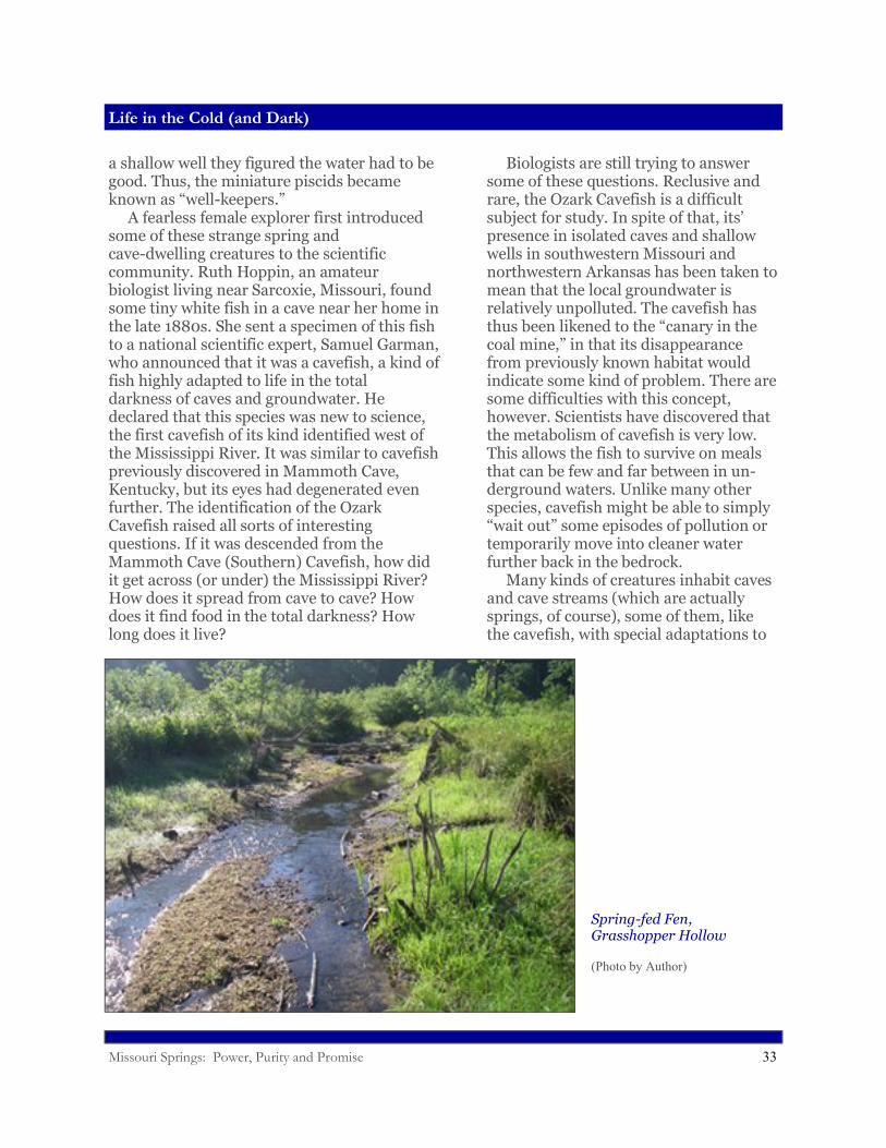
Spring-fed Fen, Grasshopper Hollow
(Photo by Author)
Missouri Springs: Power, Purity and Promise 34
Life in the Cold (and Dark)
the total darkness. For example, several species of blind, white salamanders, crayfish and crustaceans inhabit cave streams. But because of the limiting environment of the cave (no green plants, for example) there tend to be fewer kinds of creatures and less total biomass in caves than in aquatic habitat above ground. Just as in regular streams, the numbers and kinds of animals found in cave streams, as well as in springs and spring branches, can be good indicators of their relative health. But because these unique habitats have not been as thoroughly studied, indices are not yet as refined as those used to measure the health of surface streams. When people think of springs, they often think of trout. Trout are not native to Missouri’s waters, but they do thrive in the cold water of springs and spring-fed streams, and even in dam tail waters and deep reservoirs. Raising trout in large springs and spring-fed ponds has become a major industry in Missouri at both public and private facilities. These fish do not typically reproduce in the state’s waters, so regular stocking is necessary to support active fisheries. Never-the-less, angling for trout has become a major source of tourism dollars in
the state. Springs are natural magnets for life. But their influence on the native landscape extends far beyond their immediate outlets. Their ecological significance cannot be overstated. They provide life-sustaining flows to rivers and streams and lakes that would otherwise be bone dry during Missouri’s long, parching summers. Without springs to cool and bolster flows, the state’s waters would be much impoverished in habitat, fish and wildlife in general. And as we have seen, spring water flowing underground supports entire unique ecosystems, complete with creatures known from only a few locations in Missouri and found nowhere else in the world. It is remarkable to think that there are creatures like these living out their entire lives in the total darkness beneath our feet. It is also exciting to imagine that unknown biological curiosities could remain hidden in the subterranean realm of springs, waiting to be discovered by a new generation of intrepid explorers.
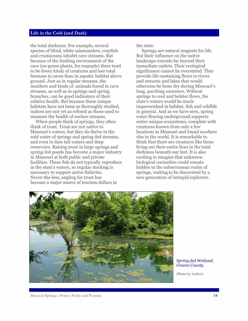
Spring-fed Wetland, Greene County
(Photo by Author)
Missouri Springs: Power, Purity and Promise 35
What Good are Springs?
What Good are Springs?
Hardly anyone would deny that Big Spring, churning out a full-fledged, crystal clear river, is an amazing sight. But it is difficult to quantify its actual value. Is it measured by the dollars generated from gawking tourists? What about other springs, most of them much less impressive than Big Spring? What is their worth? Can it be determined from the sales of food, ice and beer to floaters using spring-fed rivers? Is it calculated from the gear bought or pounds of fish caught by anglers—fish requiring cool spring water to survive? Yes, obviously, to all of these. Springs provide valuable and quantifiable recreational benefits, especially at state parks like Meramec, Montauk, Roaring River and Bennett Spring, where they sustain hatcheries and fisheries and canoeing and tourism. But these are human-centered benefits. It is much more difficult to place a dollar value on the ecological services delivered by springs. Even with his utilitarian slant, Edward Shepard understood something of the importance of springs. Late in his career, he warned that springs could easily become contaminated in the country “where the karst topography prevails.” But Shepard was also a
product of his times. His answer to the problem was not to halt pollution, which he may have considered the inevitable price of progress, but to turn away from the use of springs for drinking water sources and instead exploit the deeper groundwater, which he knew to be less vulnerable to pollution. That is exactly what we have done. We no longer depend on springs, to any major extent, for drinking water supplies—or, for that matter, to drive mills or cool food or brew whiskey or can tomatoes. Unfortunately, because of our lessened direct reliance on springs, the constitu-ency for their protection has become somewhat muted. There is no doubt that magnificent blue springs (Jerry Vineyard refers to them as the “jewels” of the Ozarks) attracts large numbers of visitors to Missouri’s state parks and natural areas every year. But what about the thousands of lesser springs? We pay much less attention to these smaller springs, especially to the land at the upstream ends of their plumbing systems—their recharge areas. We have been slow to carefully manage our activities on the land where the rain falls and, as a result,
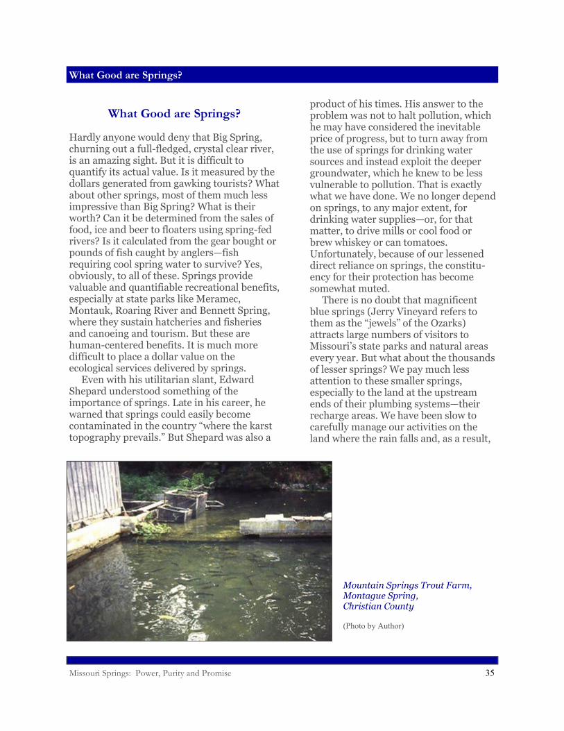
Mountain Springs Trout Farm,Montague Spring,Christian County
(Photo by Author)
Missouri Springs: Power, Purity and Promise 36
What Good are Springs?
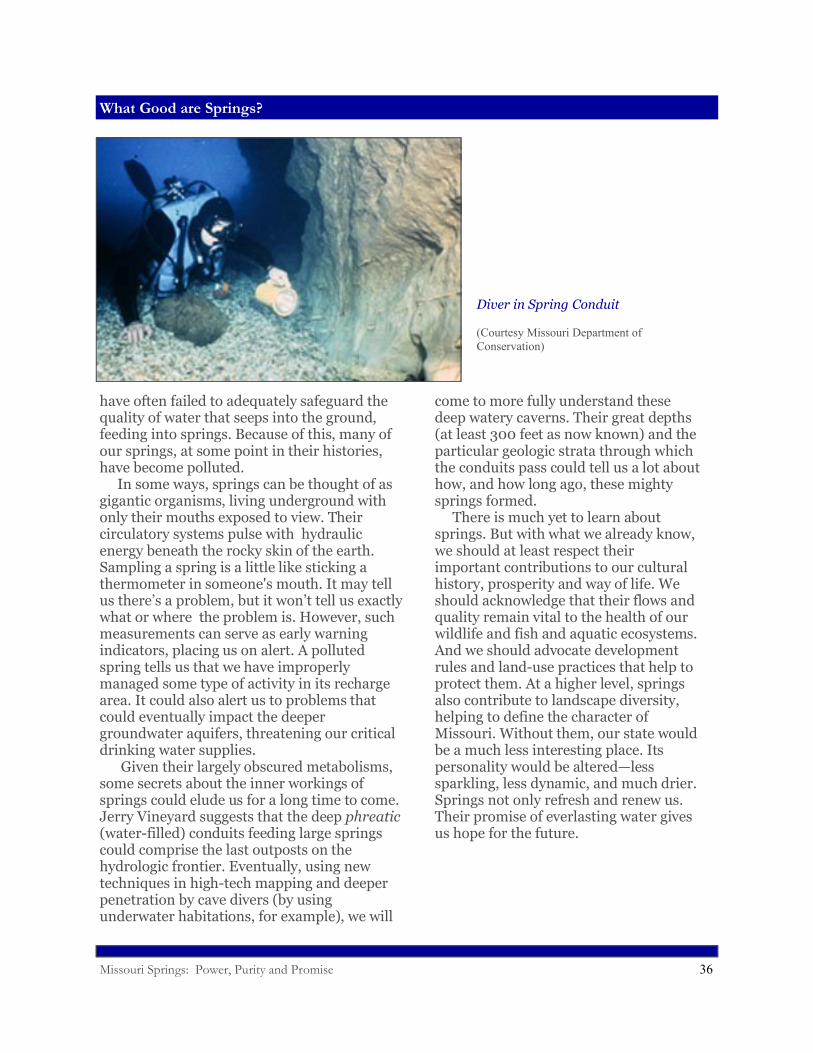
have often failed to adequately safeguard the quality of water that seeps into the ground, feeding into springs. Because of this, many of our springs, at some point in their histories, have become polluted. In some ways, springs can be thought of as gigantic organisms, living underground with only their mouths exposed to view. Their circulatory systems pulse with hydraulic energy beneath the rocky skin of the earth. Sampling a spring is a little like sticking a thermometer in someone's mouth. It may tell us there’s a problem, but it won’t tell us exactly what or where the problem is. However, such measurements can serve as early warning indicators, placing us on alert. A polluted spring tells us that we have improperly managed some type of activity in its recharge area. It could also alert us to problems that could eventually impact the deeper groundwater aquifers, threatening our critical drinking water supplies. Given their largely obscured metabolisms, some secrets about the inner workings of springs could elude us for a long time to come. Jerry Vineyard suggests that the deep phreatic(water-filled) conduits feeding large springs could comprise the last outposts on the hydrologic frontier. Eventually, using new techniques in high-tech mapping and deeper penetration by cave divers (by using underwater habitations, for example), we will
come to more fully understand these deep watery caverns. Their great depths (at least 300 feet as now known) and the particular geologic strata through which the conduits pass could tell us a lot about how, and how long ago, these mighty springs formed. There is much yet to learn about springs. But with what we already know, we should at least respect their important contributions to our cultural history, prosperity and way of life. We should acknowledge that their flows and quality remain vital to the health of our wildlife and fish and aquatic ecosystems. And we should advocate development rules and land-use practices that help to protect them. At a higher level, springs also contribute to landscape diversity, helping to define the character of Missouri. Without them, our state would be a much less interesting place. Its personality would be altered—less sparkling, less dynamic, and much drier. Springs not only refresh and renew us. Their promise of everlasting water gives us hope for the future.
Diver in Spring Conduit
(Courtesy Missouri Department of Conservation)
Missouri Springs: Power, Purity and Promise 37
Sources
Springs at Work1. Website, http://umsl.edu/~joellaws/ozark_caving/sprinsgs/greer.htm (Greer Spring).2. Letter, Edward Shepard to Louis Houck, September 19, 1905; folder 5, Edward Martin Shepard Papers, Western Historical Manuscript Collection, University of Missouri-Columbia (Greer Spring Dam)3. University of Missouri School of Engineers, Water Power of Missouri, Columbia, Mo. 1901.4. Luella Agnes Owen, Cave Regions of the Ozarks and Black Hills, the Editor Publishing Co., Cincinnati 1898.5. Columbia Daily Tribune, August 2, 1987 p. 29 (Bottling Water at Greer Spring).
Spring Anatomy1. Jerry D. Vineyard and Gerald L. Feder, Springs of Missouri, Missouri Geological Survey and Water Resources, Water Resources Report No. 29, Rolla 1974.
Going with the Flow1. Tom Aley, Ozark Underground Laboratory, personal interview, January 9, 2009.2. H.C. Beckman and N. S. Hinchey, The Large Springs of Missouri, Missouri Geological Survey and Water Re-sources Report No. 29, Rolla 1944.
A Question of Purity1. Karl McVey, Water Supply for Country Homes, University of Missouri Engineering Experiment Station, Bulle-tin No. 2, University of Missouri, Columbia 1910.2. Edward M. Shepard, Prehistoric Races, Early Explorations and the Geology of Greene County, Missouri, A. W. Bowen and Co. Publishers, Indianapolis 1915.3. Jim Vandike, Missouri Department of Natural Resources, personal interview January 22, 2009.4. United States Geological Survey, Hydrologic Investigations Concerning Lead Mining Issues in Southeastern Missouri, Scientific Investigations Report 2008-5140, Reston, Va. 2008.
Mineral Springs1. Douglas R. Hurt, Nathan Boone and the American Frontier, University of Missouri Press, Columbia 1998.2. Loring Bullard, Healing Waters: Missouri’s Historic Mineral Springs and Spas, University of Missouri Press, Columbia 2004.3. Paul Schweitzer, A Report on the Mineral Waters of Missouri, Geological Survey of Missouri, Vol. III, Jefferson City 1892.4. John C. Miller, Groundwater Resources of Saline County, Missouri, Water Resources Report No. 26, Missouri Geological Survey and Water Resources, Rolla 1971.
Life in the Cold (and Dark)1. William L Pflieger, “Fauna of Missouri Springs,” in Springs of Missouri (Vineyard and Feder, 1982).2. Website, http://members.socket.net/joschaper/luella.html, (Luella Owen).3. Samuel Garman, “Cave Animals from Southwestern Missouri,” in Bulletin of the Museum of Comparative Zool-ogy at Harvard College, Vol. 17 No. 6, 1889.4. Rick Horton, Missouri Department of Conservation, personal interview March 3, 2009.
What Good Are Springs?Jerry D. Vineyard, personal interview, February 13, 2009.