Embed Size (px)
Citation preview
© PCI Geomatics Inc. All rights reserved.
Download the Free Trial Todaywww.GetGeomatica.com
In-Situ Validation
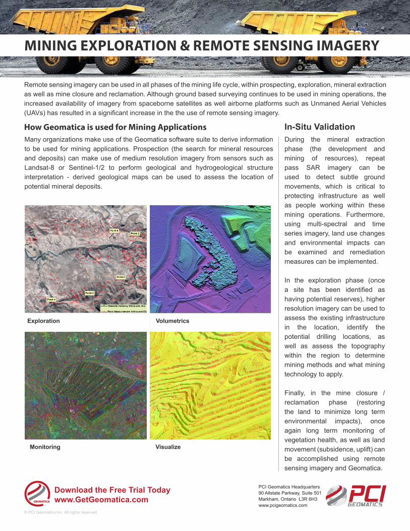
Monitoring
VolumetricsExploration
Visualize
Remote sensing imagery can be used in all phases of the mining life cycle, within prospecting, exploration, mineral extraction as well as mine closure and reclamation. Although ground based surveying continues to be used in mining operations, the increased availability of imagery from spaceborne satellites as well airborne platforms such as Unmaned Aerial Vehicles (UAVs) has resulted in a significant increase in the the use of remote sensing imagery.
During the mineral extraction phase (the development and mining of resources), repeat pass SAR imagery can be used to detect subtle ground movements, which is critical to protecting infrastructure as well as people working within these mining operations. Furthermore, using multi-spectral and time series imagery, land use changes and environmental impacts can be examined and remediation measures can be implemented.
In the exploration phase (once a site has been identified as having potential reserves), higher resolution imagery can be used to assess the existing infrastructure in the location, identify the potential drilling locations, as well as assess the topography within the region to determine mining methods and what mining technology to apply.
Finally, in the mine closure / reclamation phase (restoring the land to minimize long term environmental impacts), once again long term monitoring of vegetation health, as well as land movement (subsidence, uplift) can be accomplished using remote sensing imagery and Geomatica.
MINING EXPLORATION & REMOTE SENSING IMAGERY
PCI Geomatics Headquarters 90 Allstate Parkway, Suite 501Markham, Ontario L3R 6H3www.pcigeomatics.com
Many organizations make use of the Geomatica software suite to derive information to be used for mining applications. Prospection (the search for mineral resources and deposits) can make use of medium resolution imagery from sensors such as Landsat-8 or Sentinel-1/2 to perform geological and hydrogeological structure interpretation - derived geological maps can be used to assess the location of potential mineral deposits.
How Geomatica is used for Mining Applications