Embed Size (px)
Citation preview
original Miami River Corridor Urban Infill Planidentified 38 catalyst “opportunity sites”, and this document identifies additional opportunity sites for further reviewand consideration. The Miami River is a “Working River”, featuring a thriving marine industry including 24 certifiedInternational Shipping Terminals, numerous recreational boatyards, several commercial fishing businesses andrecreational marinas. The 2005 “Biscayne Bay Economic Study”, prepared by Hazen and Sawyer EnvironmentalEngineers and Scientists, in association with the Planning and Economics Group, concluded waterborne commerce onthe Miami River generated $805 million in output, $406 million in income, 6,700 jobs, and $44 million in taxrevenues in Southeast Florida. Recent Growth, Current Activity, and Economic Impacts of Mega-Yachts on SoutheastFlorida, prepared by Thomas J. Murray, concluded every time a mega-yacht is serviced, it generates $385,000 in localeconomic input. Therefore, the preservation and improvement of the Miami River’s historic marine industry is in thebest interest of our local economy. The Miami River Commission seeks to maintain a balance of mixed-uses on theMiami River, including water-dependent marine industrial businesses, as planned for in the award winning MiamiRiver Corridor Urban Infill Plan. The 40% complete Miami River maintenance dredging project is improving vesselnavigation by restoring the designated 15-foot depth of the federal navigable channel. In addition, the designatedEnterprise Zone, Empowerment Zone, and Historically Underutilized Business Zone provide numerous economicincentives designed to attract new and expanding businesses along the Miami River.
1
The
Salinity DamNorth River Dr.
South River Dr.
NW 3
7 Av
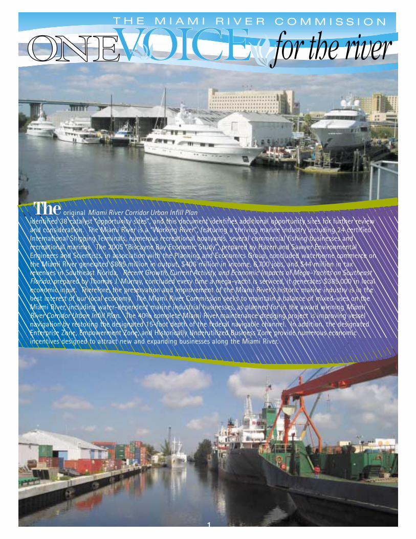
e.Miami Dade County Transit and the Miami-DadeExpressway authority are planning fixed bridges forMetrorail to connect with the Miami Intermodal Center,and a State Road 112 interconnector. The proposed fixedbridges have a 40 foot vertical clearance, thereforerequiring a shortening of the Miami River’s designatedfederal navigable channel, which requires a 75 footvertical clearance. The MRC recommended the publicrights-of-way adjacent to and beneath the proposedfixed bridges to have marine industrial uses, includingbut not limited to a customs freight forwarding center,tug boat basin, truck depot, short sea shipping, etc.
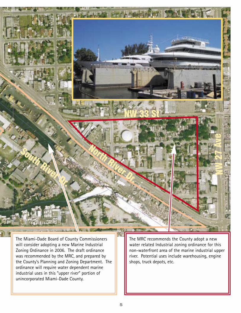
The Miami-Dade Board of County Commissionerswill consider adopting a new Marine IndustrialZoning Ordinance in 2006. The draft ordinancewas recommended by the MRC, and prepared bythe County’s Planning and Zoning Department. Theordinance will require water dependent marineindustrial uses in this “upper river” portion ofunincorporated Miami-Dade County.”
2
NW 31 St
North River Dr.
NW 3
6 Av
e.
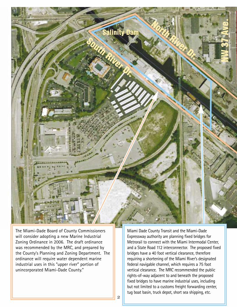
The MRC recommends theCounty adopt a new waterrelated Industrial zoningordinance for this non-waterfront area of themarine industrial upper river.Potential uses includewarehousing, engine shops,truck depots, etc.
The Miami-Dade Board of CountyCommissioners will consideradopting a new Marine IndustrialZoning Ordinance in 2006. Thedraft ordinance was recommendedby the MRC, and prepared by theCounty’s Planning and ZoningDepartment. The ordinance willrequire water dependent marineindustrial uses in this “upper river”portion of unincorporated Miami-Dade County.3
NW 33 St
NW 3
2 Av
e.
This 8-acre Miami DadeCounty owned area iscurrently being used for theMiami River maintenancedredging project. Uponcompletion of the project, thesite should be considered for a major marine industrialrelated facility, such as afreight forwarding center,short sea shipping, etc.
4
North River Dr.
NW 3
7 Av
e
NW 21 St
South River Dr.
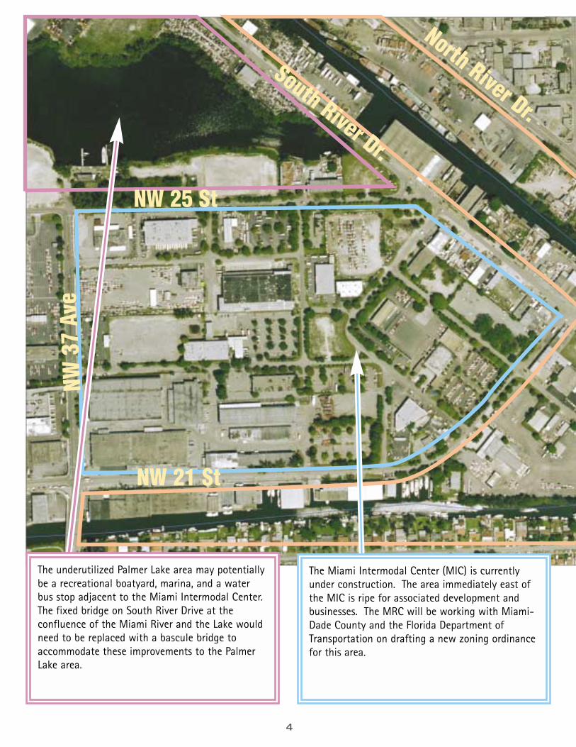
NW 25 St
The Miami Intermodal Center (MIC) is currentlyunder construction. The area immediately east ofthe MIC is ripe for associated development andbusinesses. The MRC will be working with Miami-Dade County and the Florida Department ofTransportation on drafting a new zoning ordinancefor this area.
The underutilized Palmer Lake area may potentiallybe a recreational boatyard, marina, and a waterbus stop adjacent to the Miami Intermodal Center.The fixed bridge on South River Drive at theconfluence of the Miami River and the Lake wouldneed to be replaced with a bascule bridge toaccommodate these improvements to the PalmerLake area.
5
NW 33 St
The MRC recommends the County adopt a newwater related Industrial zoning ordinance for thisnon-waterfront area of the marine industrial upperriver. Potential uses include warehousing, engineshops, truck depots, etc.
North River Dr.
South River Dr.
The Miami-Dade Board of County Commissionerswill consider adopting a new Marine IndustrialZoning Ordinance in 2006. The draft ordinancewas recommended by the MRC, and prepared bythe County’s Planning and Zoning Department. Theordinance will require water dependent marineindustrial uses in this “upper river” portion ofunincorporated Miami-Dade County.
NW 2
7 Av
e
6
NW 2
7 Av
e.
NW 16 St. Road
NW 14 St.
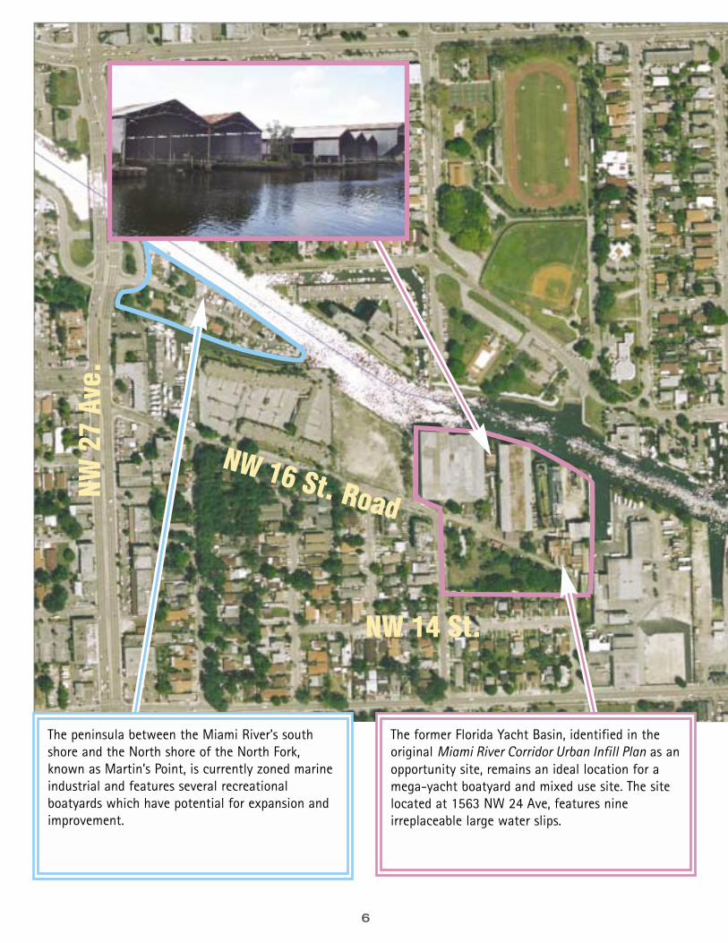
The peninsula between the Miami River’s southshore and the North shore of the North Fork,known as Martin’s Point, is currently zoned marineindustrial and features several recreationalboatyards which have potential for expansion andimprovement.
The former Florida Yacht Basin, identified in theoriginal Miami River Corridor Urban Infill Plan as anopportunity site, remains an ideal location for amega-yacht boatyard and mixed use site. The sitelocated at 1563 NW 24 Ave, features nineirreplaceable large water slips.
7
NW 2
2 Av
e.
North River Dr.
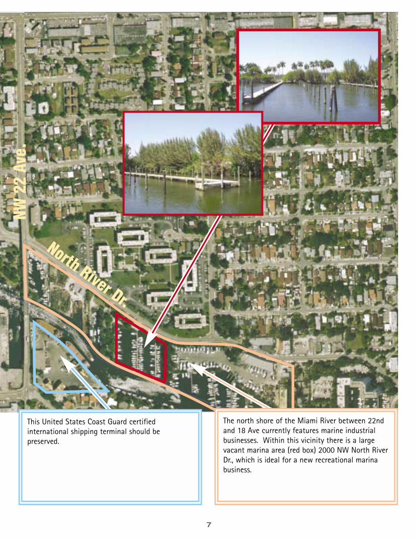
The north shore of the Miami River between 22ndand 18 Ave currently features marine industrialbusinesses. Within this vicinity there is a largevacant marina area (red box) 2000 NW North RiverDr., which is ideal for a new recreational marinabusiness.
This United States Coast Guard certifiedinternational shipping terminal should bepreserved.
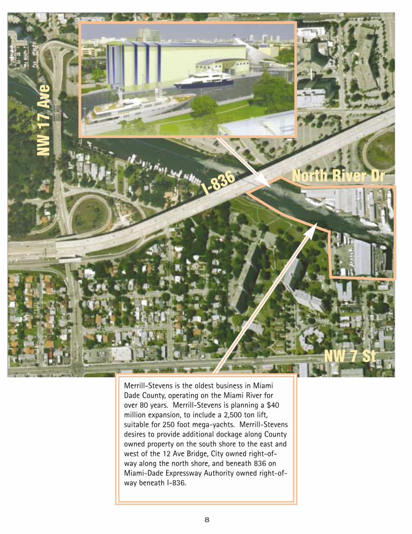
8
North River Dr
NW 7 St
NW17
Ave
I-836
Merrill-Stevens is the oldest business in MiamiDade County, operating on the Miami River forover 80 years. Merrill-Stevens is planning a $40million expansion, to include a 2,500 ton lift,suitable for 250 foot mega-yachts. Merrill-Stevensdesires to provide additional dockage along Countyowned property on the south shore to the east andwest of the 12 Ave Bridge, City owned right-of-way along the north shore, and beneath 836 onMiami-Dade Expressway Authority owned right-of-way beneath I-836.
9
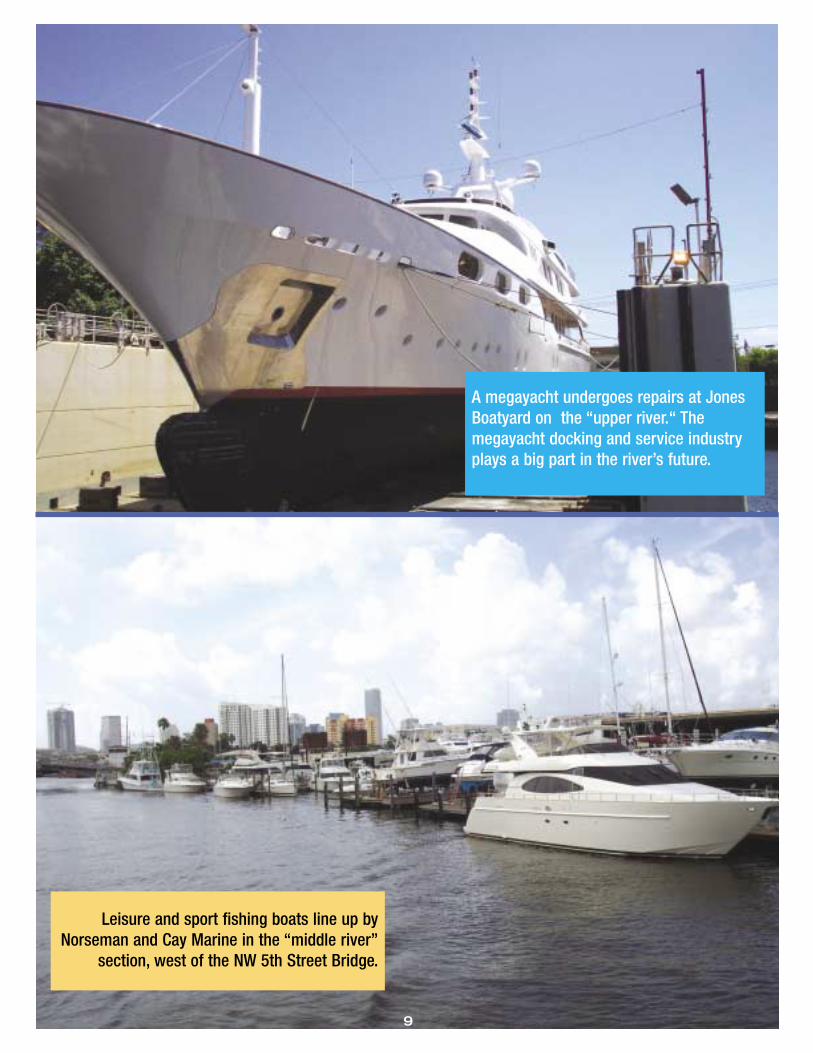
Leisure and sport fishing boats line up byNorseman and Cay Marine in the “middle river”
section, west of the NW 5th Street Bridge.
A megayacht undergoes repairs at JonesBoatyard on the “upper river.“ Themegayacht docking and service industryplays a big part in the river’s future.
10
Flagler St
South River Dr
NW 7
Ave
NW 5 St Brid
ge
SE 1 St.
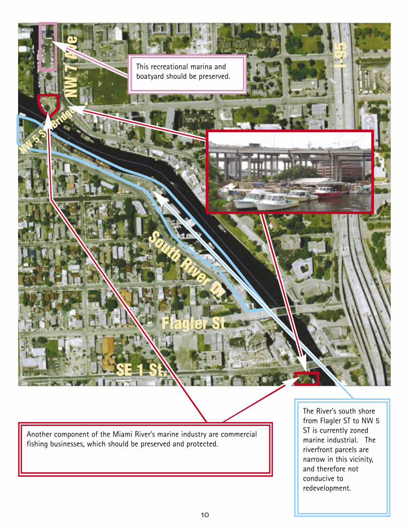
The River’s south shorefrom Flagler ST to NW 5ST is currently zonedmarine industrial. Theriverfront parcels arenarrow in this vicinity,and therefore notconducive toredevelopment.
Another component of the Miami River’s marine industry are commercialfishing businesses, which should be preserved and protected.
I-95
This recreational marina andboatyard should be preserved.
11
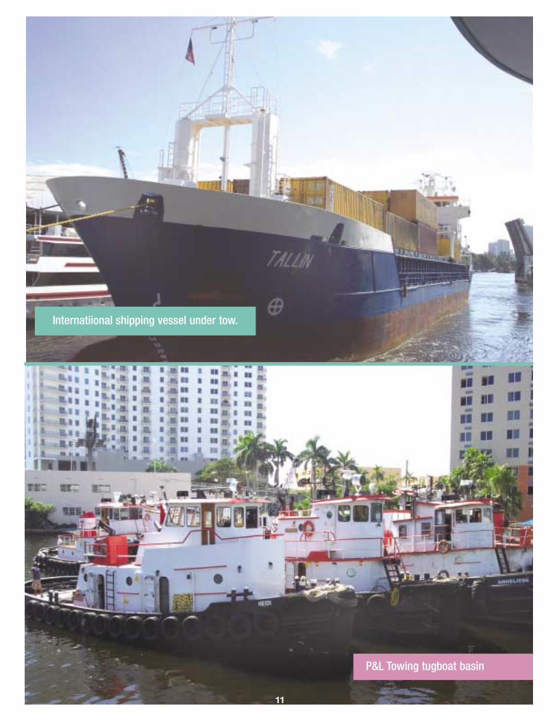
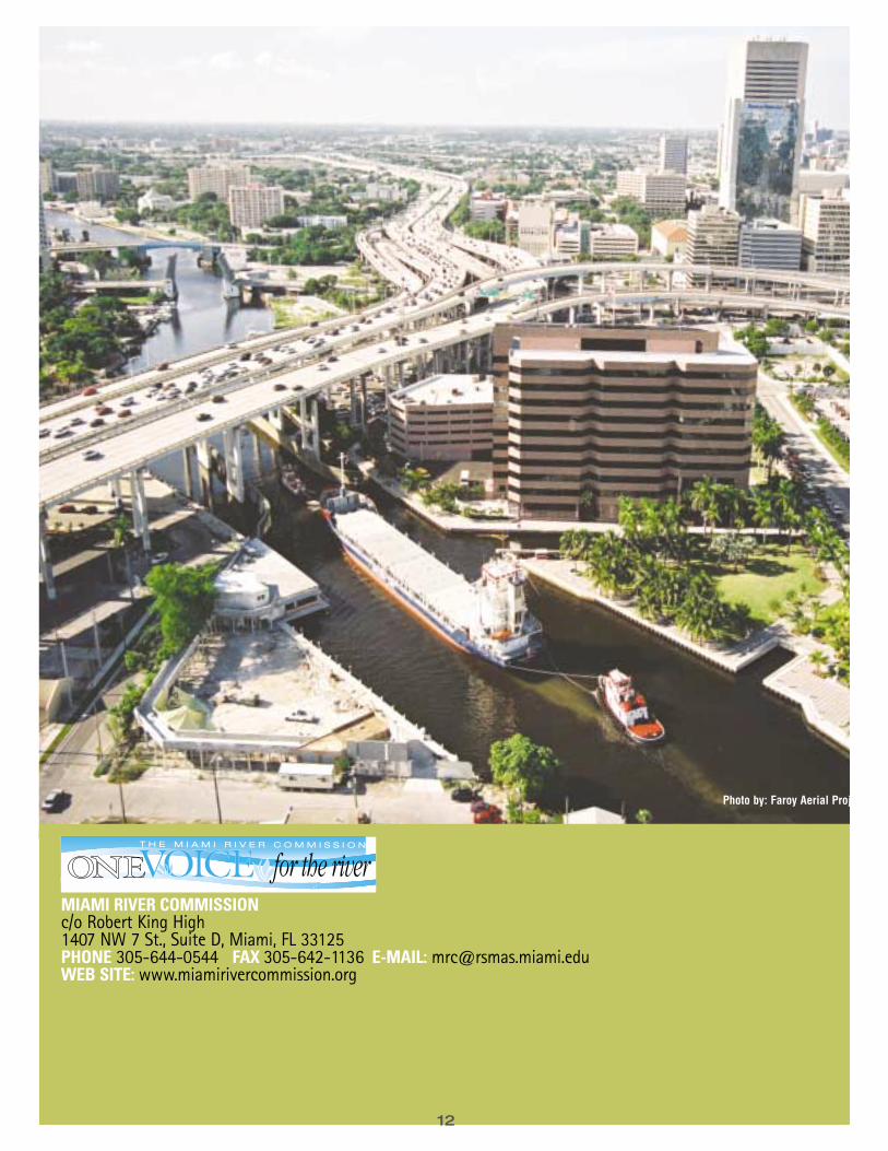
P&L Towing tugboat basin
Internatiional shipping vessel under tow.
MIAMI RIVER COMMISSIONc/o Robert King High 1407 NW 7 St., Suite D, Miami, FL 33125PHONE 305-644-0544 FAX 305-642-1136 E-MAIL: [email protected] SITE: www.miamirivercommission.org
12
Photo by: Faroy Aerial Projects