Embed Size (px)
Citation preview
MH370: Sonar Contacts
24 July 2015
BackgroundThe ATSB is leading the search for missing Malaysia Airlines flight 370 in the southern Indian Ocean. Geoscience Australia is providing advice, expertise and support to the ATSB. With the bathymetric survey completed, the underwater search commenced in October 2014.
SummaryThe underwater search is being carried out utilising vessels equipped with a towfish – an underwater vehicle which carries various instruments used to survey the seafloor. The key instruments are side scan sonar and the multi-beam echo sounders which survey the nadir (the gap in side scan sonar coverage under the towfish). There is also an Autonomous Underwater Vehicle (AUV) used to scan those portions of the search area that cannot be searched effectively using the towfish.
As the search progresses, sonar analysts on board the vessels and ashore, identify and assess sonar ‘contacts’ – features or objects on the seabed that stand out from their surrounds which may require further investigation. Contacts of interest include anything that appears to be man-made or potentially exhibits characteristics of an aircraft debris field. All contacts are given classifications which differentiate the extent to which they warrant further inspection.
How are sonar contacts classified?There are three classifications for sonar contacts which are identified during the course of the underwater search.
Classification 3 is assigned to sonar contacts that are of some interest as they stand out from their surroundings but have low probability of being significant to the search. The underwater search so far has identified more than 400 seabed features that have been classified as category 3.
MH370
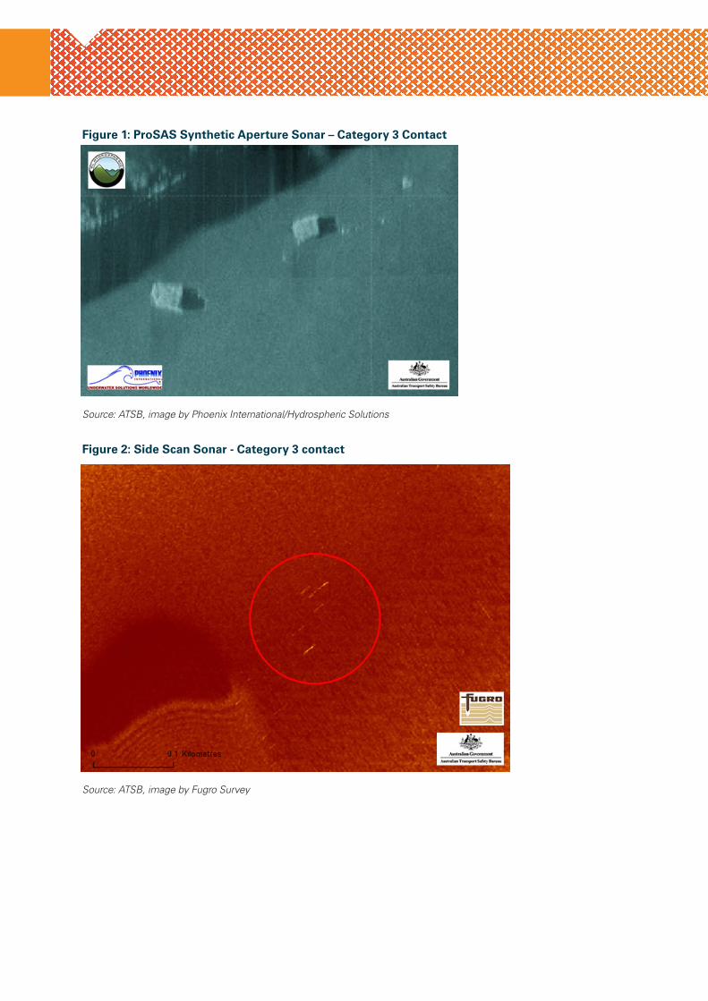
Figure 1: ProSAS Synthetic Aperture Sonar – Category 3 Contact
Source: ATSB, image by Phoenix International/Hydrospheric Solutions
Figure 2: Side Scan Sonar - Category 3 contact
Source: ATSB, image by Fugro Survey
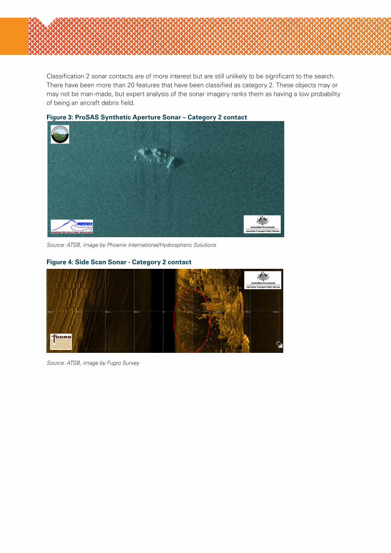
Classification 2 sonar contacts are of more interest but are still unlikely to be significant to the search. There have been more than 20 features that have been classified as category 2. These objects may or may not be man-made, but expert analysis of the sonar imagery ranks them as having a low probability of being an aircraft debris field.
Figure 3: ProSAS Synthetic Aperture Sonar – Category 2 contact
Source: ATSB, image by Phoenix International/Hydrospheric Solutions
Figure 4: Side Scan Sonar - Category 2 contact
Source: ATSB, image by Fugro Survey
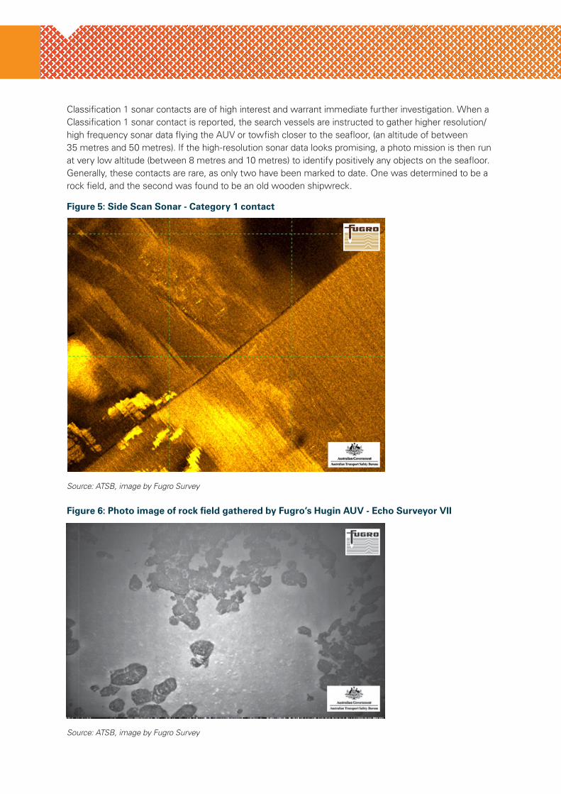
Classification 1 sonar contacts are of high interest and warrant immediate further investigation. When a Classification 1 sonar contact is reported, the search vessels are instructed to gather higher resolution/high frequency sonar data flying the AUV or towfish closer to the seafloor, (an altitude of between 35 metres and 50 metres). If the high-resolution sonar data looks promising, a photo mission is then run at very low altitude (between 8 metres and 10 metres) to identify positively any objects on the seafloor. Generally, these contacts are rare, as only two have been marked to date. One was determined to be a rock field, and the second was found to be an old wooden shipwreck.
Figure 5: Side Scan Sonar - Category 1 contact
Source: ATSB, image by Fugro Survey
Figure 6: Photo image of rock field gathered by Fugro’s Hugin AUV - Echo Surveyor VII
Source: ATSB, image by Fugro Survey
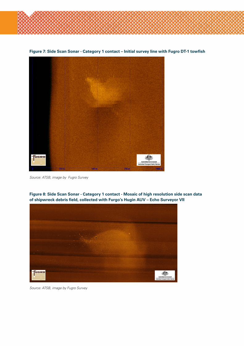
Figure 7: Side Scan Sonar - Category 1 contact – Initial survey line with Fugro DT-1 towfish
Source: ATSB, image by Fugro Survey
Figure 8: Side Scan Sonar - Category 1 contact - Mosaic of high resolution side scan data of shipwreck debris field, collected with Furgo’s Hugin AUV – Echo Surveyor VII
Source: ATSB, image by Fugro Survey
24 Hours 1800 020 616 › Web www.atsb.gov.au
Twitter @ATSBinfo › Email [email protected]
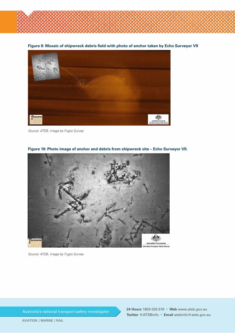
Figure 9: Mosaic of shipwreck debris field with photo of anchor taken by Echo Surveyor VII
Source: ATSB, image by Fugro Survey
Figure 10: Photo image of anchor and debris from shipwreck site – Echo Surveyor VII.
Source: ATSB, image by Fugro Survey


![MH370 & The Bayes Theory [autosaved]](https://img.pdfslide.us/doc/110x75/53ea7b2d8d7f7289708b5119/mh370-the-bayes-theory-autosaved.jpg)