Embed Size (px)
Citation preview
MetroOffering a premium image layer over the biggest cities across the globe, DigitalGlobe’s Metro product is a high-resolution, high-accuracy mosaic over 6,000 metropolitan areas, including major world capitals, the largest cities by population, and high-interest areas based on transportation or future growth. Metro areas extend beyond the city center to provide coverage over the wider metropolitan area and can be bundled with DigitalGlobe’s Vivid product to provide complete, high-quality coverage over any project area. With committed annual refresh, the Metro image layer provides a predictable and reliable current view of the ever-changing urban landscape.
See a better world.®METRO
DATA SHEET
° Images are ortho-rectified, enabling measurements, area calculations, and other analysis
° Committed annual refresh
° Meets strict accuracy, currency, and aesthetics required for analysis, accurate decision making, and regulatory reporting
° 30 cm resolution imagery over 3,000 areas
° 50 cm resolution imagery over 3,000 areas
° High-resolution imagery assures key features are visible and discernable including land use, structures, vegetation, and vehicles
° Covers over 20% of the world’s population
° Flexible access: available offline or online via EarthWatch
° Immediate, cost-effective, off-the-shelf imagery, ready now with no new collection or traditional order processing requirements
° Save time and resources with no need to search, procure, manipulate, aggregate, and stitch imagery data
° Refresh at “best time to collect” ensures quality
° Best-in-class combination of resolution, ground truth accurate, currency, and aesthetics required for evaluating, planning, and detecting change over time
° Image layer updates within weeks of collection
Features & Benefits
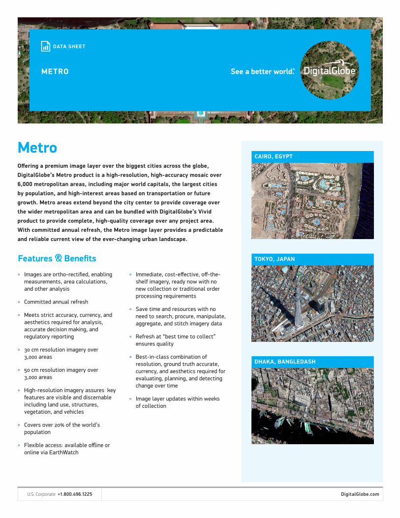
CAIRO, EGYPT
TOKYO, JAPAN
DHAKA, BANGLEDASH
U.S. Corporate +1.800.496.1225 DigitalGlobe.com

Specifications
DS-DGBM-METRO 06/18
Coverage 6,000 metro areas
Product type Or thomosaic
Image Bands 3-band pan sharpened natural color
Image Age <1 2 months; <24 months
Spatial Resolution 3,000 30 cm; 3,000 50 cm
Accuracy <4 .2M C E90; <10 .2M C E 90
Cloud Cover <3% target ; <20% allowed
Off Nadir Angle <30 deg
Sun Elevation >30 deg; >15 deg allowed
Bit Depth 8
Projection/Datum Geographic / U T M
Format Geot i f f
Deliverables
° Metro can be delivered offline via FTP or hard drive for use on premise. When desired, the product can be formatted in a portal-ready tile cache.
° Metro is also available via streaming services or online via DigitalGlobe’s web portal through the EarthWatch product. www.digitalglobe.com/products/earthwatch
GLOBAL METRO COVERAGE
U.S. Corporate +1.800.496.1225 DigitalGlobe.com