Embed Size (px)
Citation preview
Vision | Economics | Strategy | Finance | Implementation
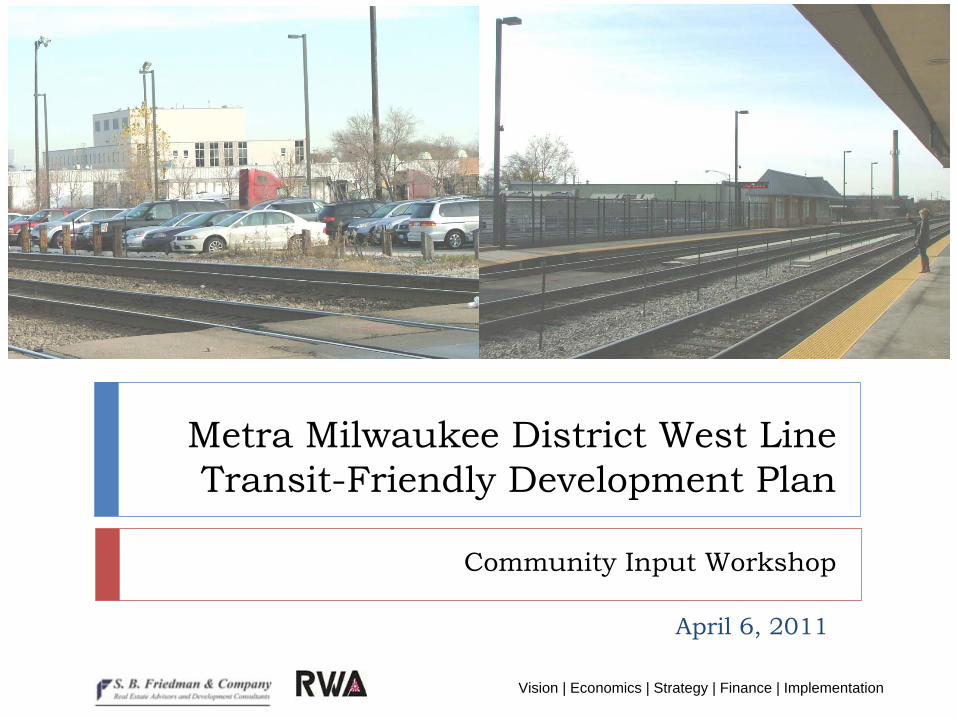
Metra
Milwaukee District West Line Transit-Friendly Development Plan
April 6, 2011
Community Input Workshop
Vision | Economics | Strategy | Finance | Implementation2
Overview of Presentation
Workshop GoalsStudy ContextExisting Conditions
Market OverviewEmployment and CommutingPopulationResidential and Retail MarketLand Use and TransportationOpportunity Sites
Question and AnswerBreak-out SessionsGroup Reports
Vision | Economics | Strategy | Finance | Implementation3
Workshop Goals
Learn about transportation, land use, and real estate market conditions in the five-station study areaDiscuss goals for future development and transportation improvements around each stationBrainstorm concepts for each station based on goalsGoals and concepts will inform draft concept plans to be presented at next workshop
Vision | Economics | Strategy | Finance | Implementation4
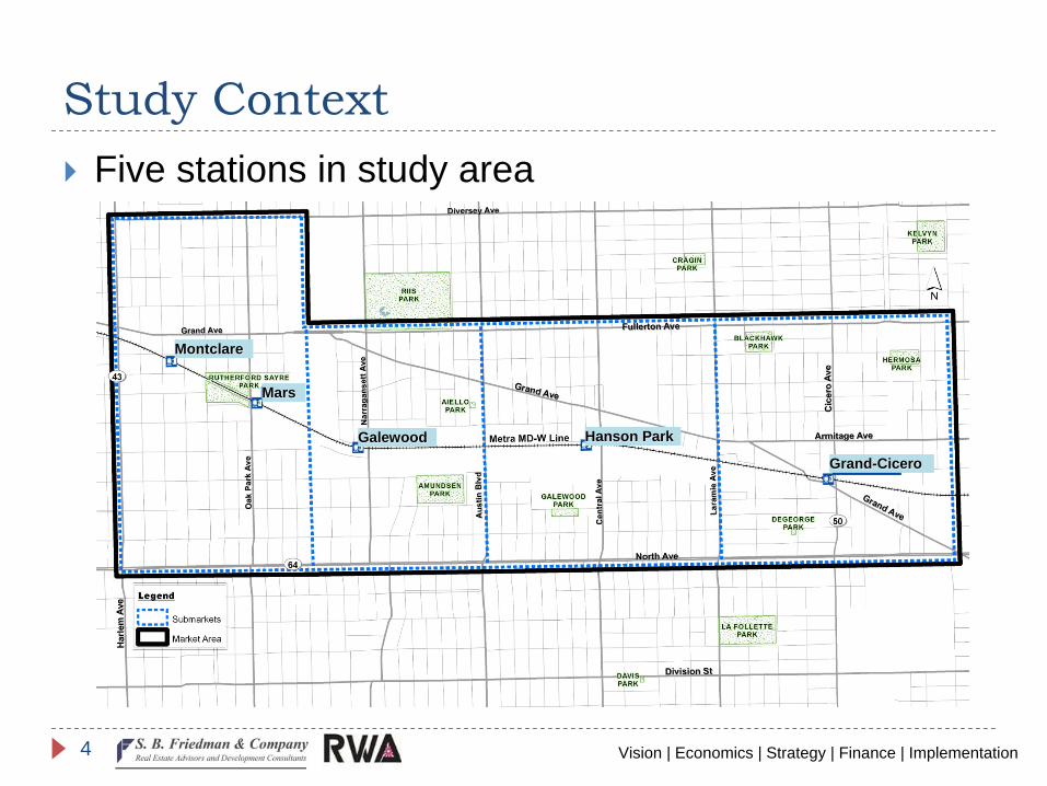
Study ContextFive stations in study area
MontclareMontclare
MarsMars
GalewoodGalewood Hanson ParkHanson Park
GrandGrand--CiceroCicero
Vision | Economics | Strategy | Finance | Implementation5
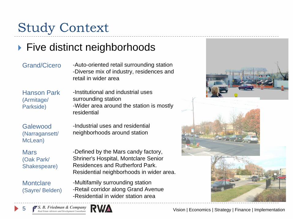
Study ContextFive distinct neighborhoods
Grand/Cicero -Auto-oriented retail surrounding station -Diverse mix of industry, residences and retail in wider area
Hanson Park (Armitage/ Parkside)
-Institutional and industrial uses surrounding station -Wider area around the station is mostly residential
Galewood(Narragansett/ McLean)
-Industrial uses and residential neighborhoods around station
Mars(Oak Park/ Shakespeare)
-Defined by the Mars candy factory, Shriner's Hospital, Montclare Senior Residences and Rutherford Park. Residential neighborhoods in wider area.
Montclare(Sayre/ Belden)
-Multifamily surrounding station -Retail corridor along Grand Avenue -Residential in wider station area
Vision | Economics | Strategy | Finance | Implementation6
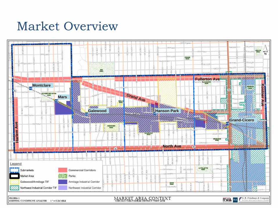
Market Overview
MontclareMontclare
MarsMars
GalewoodGalewood Hanson ParkHanson Park
GrandGrand--CiceroCicero
Grand Ave
Fullerton Ave
North Ave
Har
lem
AveK
ostnerAve
Vision | Economics | Strategy | Finance | Implementation7
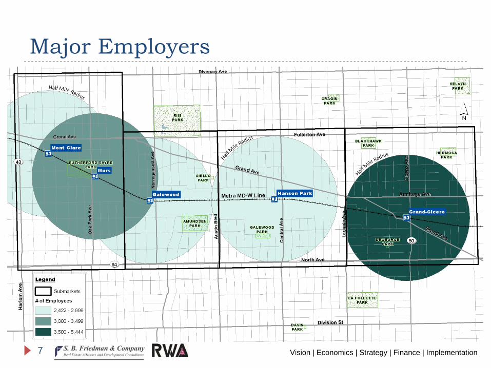
Major Employers
Vision | Economics | Strategy | Finance | Implementation8
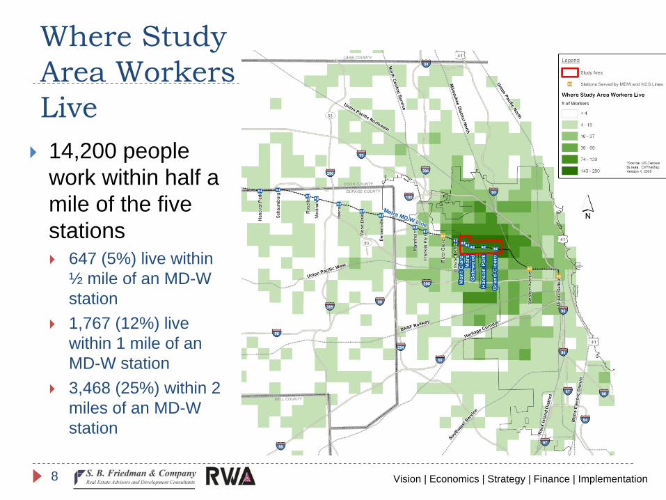
Where Study Area Workers Live14,200 people work within half a mile of the five stations
647 (5%) live within ½ mile of an MD-W station1,767 (12%) live within 1 mile of an MD-W station3,468 (25%) within 2 miles of an MD-W station
Vision | Economics | Strategy | Finance | Implementation9
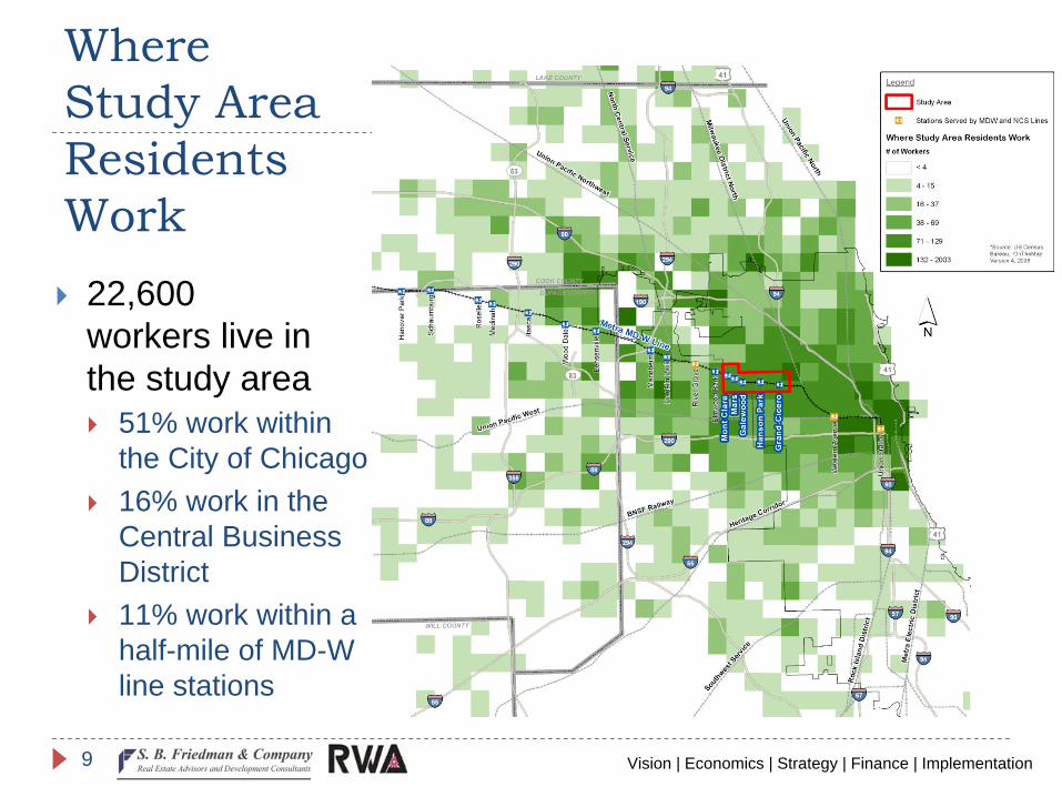
Where Study Area Residents Work
22,600 workers live in the study area
51% work within the City of Chicago16% work in the Central Business District11% work within a half-mile of MD-W line stations
Vision | Economics | Strategy | Finance | Implementation10
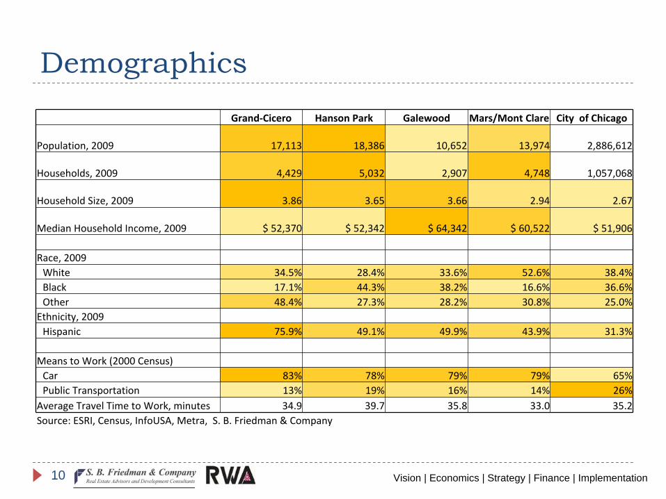
Demographics
Grand‐Cicero Hanson Park Galewood Mars/Mont Clare City of Chicago
Population, 2009 17,113 18,386 10,652 13,974 2,886,612
Households, 2009 4,429 5,032 2,907 4,748 1,057,068
Household Size, 2009 3.86 3.65 3.66 2.94 2.67
Median Household Income, 2009 $ 52,370 $ 52,342 $ 64,342 $ 60,522 $ 51,906
Race, 2009White 34.5% 28.4% 33.6% 52.6% 38.4%Black 17.1% 44.3% 38.2% 16.6% 36.6%Other 48.4% 27.3% 28.2% 30.8% 25.0%
Ethnicity, 2009Hispanic 75.9% 49.1% 49.9% 43.9% 31.3%
Means to Work (2000 Census)Car 83% 78% 79% 79% 65%Public Transportation 13% 19% 16% 14% 26%
Average Travel Time to Work, minutes 34.9 39.7 35.8 33.0 35.2Source: ESRI, Census, InfoUSA, Metra, S. B. Friedman & Company
Vision | Economics | Strategy | Finance | Implementation11
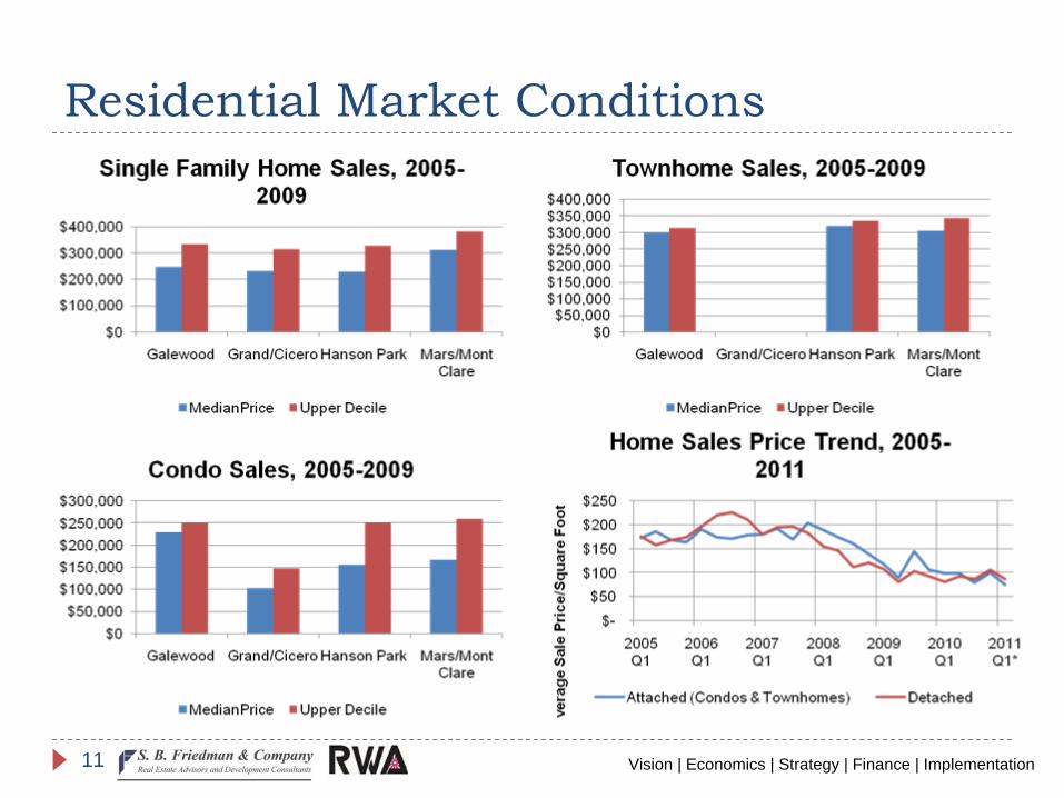
Residential Market Conditions
Vision | Economics | Strategy | Finance | Implementation12
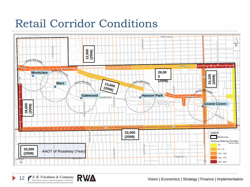
Retail Corridor Conditions
MontclareMontclare
MarsMars
GalewoodGalewood Hanson ParkHanson Park
GrandGrand--CiceroCicero
24,1
00(2
009)
13,600(2006)
33,000(2009)
26,90 0(2006)
12,5
00(2
006)
18,6
00(2
009)
33,000(2009) AADT of Roadway (Year)
Vision | Economics | Strategy | Finance | Implementation13
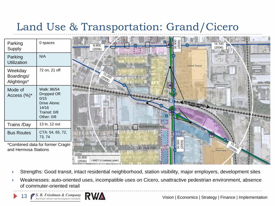
Land Use & Transportation: Grand/CiceroParking Supply
0 spaces
Parking Utilization
N/A
Weekday Boardings/ Alightings*
72 on, 21 off
Mode of Access (%)*
Walk: 86/54Dropped Off: 0/15Drive Alone: 14/16Transit: 0/8Other: 0/8
Trains /Day 13 in, 12 out
Bus Routes CTA: 54, 65, 72, 73, 74
Strengths: Good transit, intact residential neighborhood, station visibility, major employers, development sitesWeaknesses: auto-oriented uses, incompatible uses on Cicero, unattractive pedestrian environment, absence of commuter-oriented retail
*Combined data for former Cragin and Hermosa Stations
Vision | Economics | Strategy | Finance | Implementation14
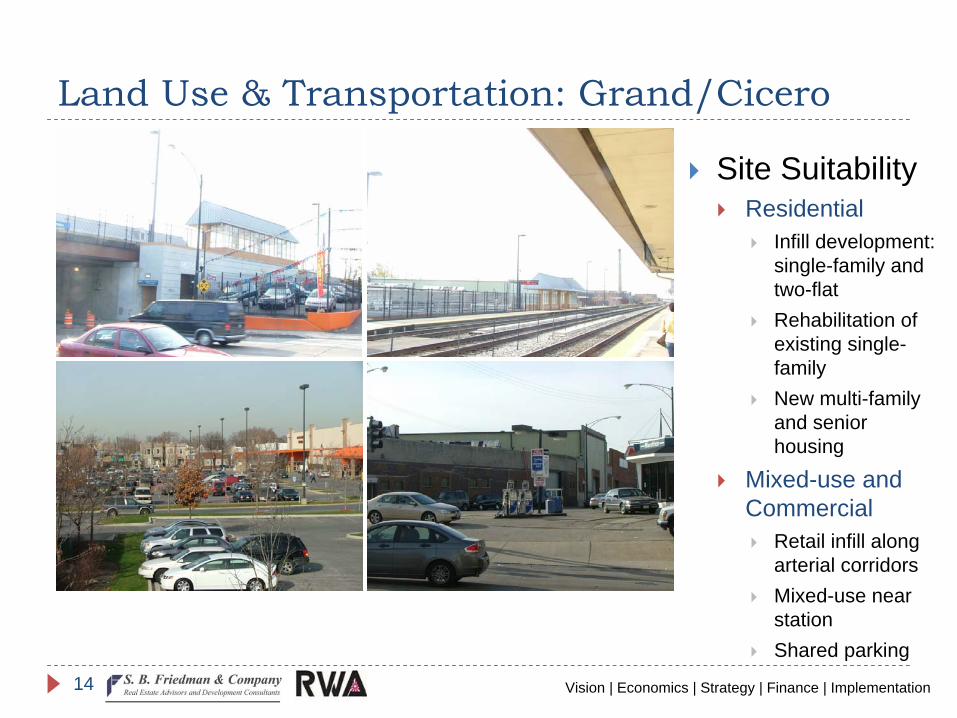
Land Use & Transportation: Grand/Cicero
Site SuitabilityResidential
Infill development: single-family and two-flatRehabilitation of existing single-familyNew multi-family and senior housing
Mixed-use and Commercial
Retail infill along arterial corridorsMixed-use near stationShared parking
Vision | Economics | Strategy | Finance | Implementation15
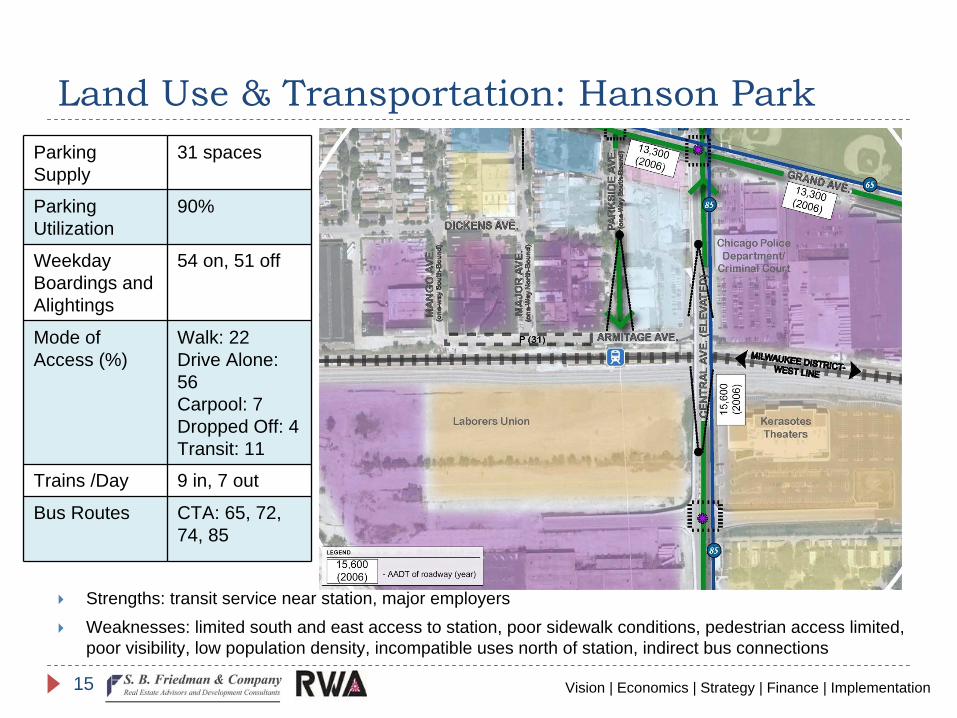
Land Use & Transportation: Hanson ParkParking Supply
31 spaces
Parking Utilization
90%
Weekday Boardings and Alightings
54 on, 51 off
Mode of Access (%)
Walk: 22Drive Alone: 56Carpool: 7Dropped Off: 4Transit: 11
Trains /Day 9 in, 7 out
Bus Routes CTA: 65, 72, 74, 85
Strengths: transit service near station, major employersWeaknesses: limited south and east access to station, poor sidewalk conditions, pedestrian access limited, poor visibility, low population density, incompatible uses north of station, indirect bus connections
Vision | Economics | Strategy | Finance | Implementation16
Land Use & Transportation: Hanson Park
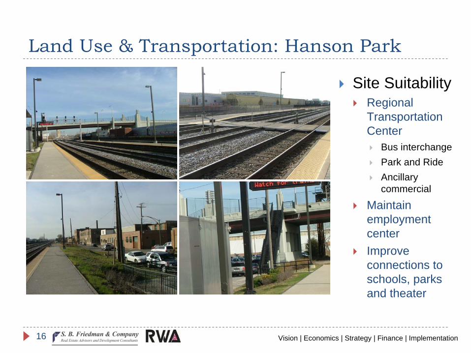
Site SuitabilityRegional Transportation Center
Bus interchangePark and RideAncillary commercial
Maintain employment centerImprove connections to schools, parks and theater
Vision | Economics | Strategy | Finance | Implementation17
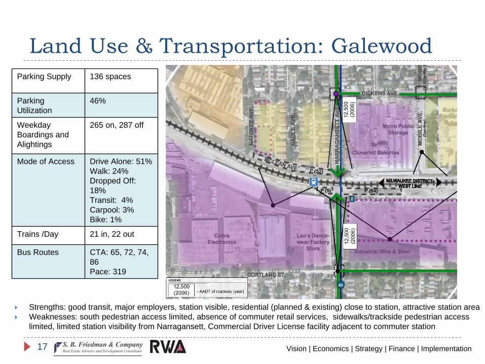
Land Use & Transportation: GalewoodParking Supply 136 spaces
Parking Utilization
46%
Weekday Boardings and Alightings
265 on, 287 off
Mode of Access Drive Alone: 51%Walk: 24%Dropped Off: 18%Transit: 4%Carpool: 3%Bike: 1%
Trains /Day 21 in, 22 out
Bus Routes CTA: 65, 72, 74, 86 Pace: 319
Strengths: good transit, major employers, station visible, residential (planned & existing) close to station, attractive station areaWeaknesses: south pedestrian access limited, absence of commuter retail services, sidewalks/trackside pedestrian access limited, limited station visibility from Narragansett, Commercial Driver License facility adjacent to commuter station
Vision | Economics | Strategy | Finance | Implementation18
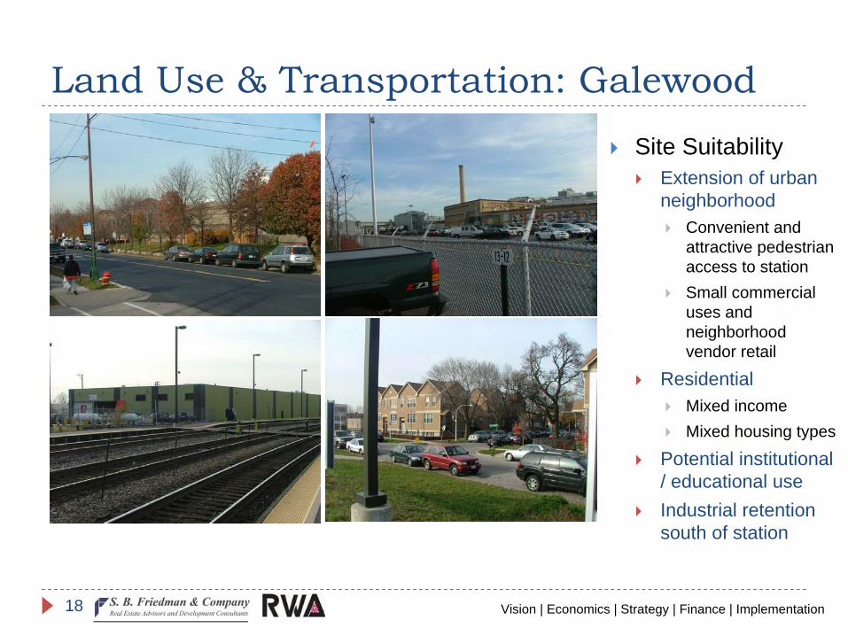
Land Use & Transportation: Galewood
Site SuitabilityExtension of urban neighborhood
Convenient and attractive pedestrian access to stationSmall commercial uses and neighborhood vendor retail
ResidentialMixed incomeMixed housing types
Potential institutional / educational useIndustrial retention south of station
Vision | Economics | Strategy | Finance | Implementation19
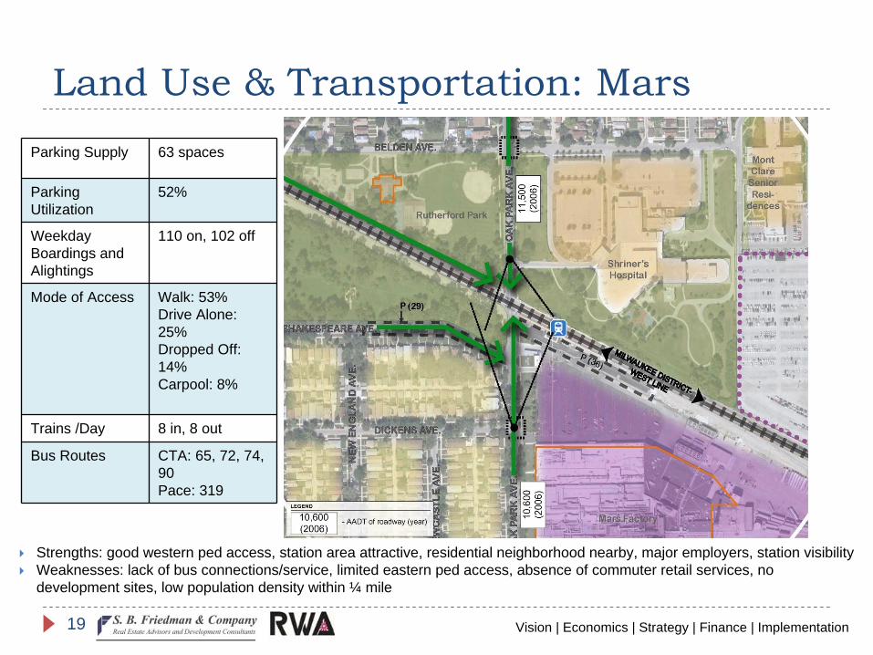
Land Use & Transportation: MarsParking Supply 63 spaces
Parking Utilization
52%
Weekday Boardings and Alightings
110 on, 102 off
Mode of Access Walk: 53%Drive Alone: 25%Dropped Off: 14%Carpool: 8%
Trains /Day 8 in, 8 out
Bus Routes CTA: 65, 72, 74, 90Pace: 319
Strengths: good western ped access, station area attractive, residential neighborhood nearby, major employers, station visibilityWeaknesses: lack of bus connections/service, limited eastern ped access, absence of commuter retail services, no development sites, low population density within ¼ mile
Vision | Economics | Strategy | Finance | Implementation20
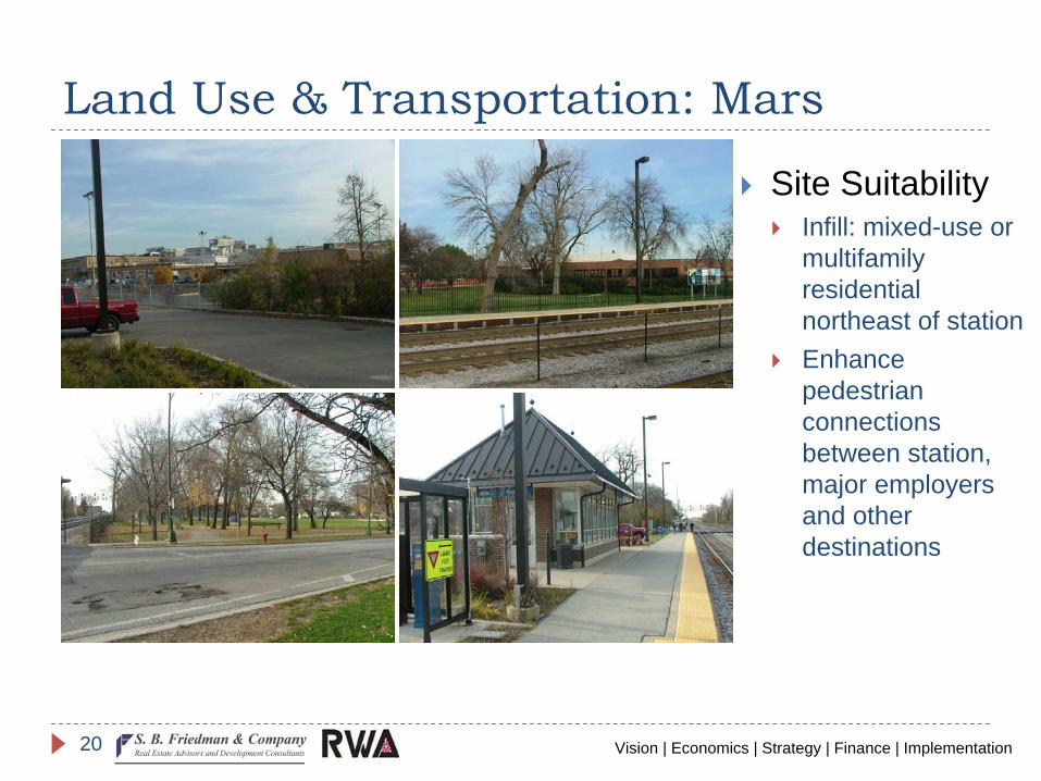
Land Use & Transportation: Mars
Site SuitabilityInfill: mixed-use or multifamily residential northeast of stationEnhance pedestrian connections between station, major employers and other destinations
Vision | Economics | Strategy | Finance | Implementation21
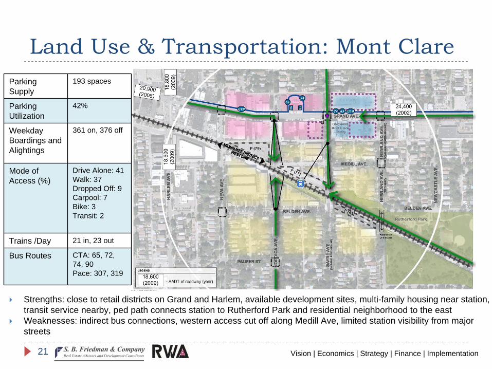
Land Use & Transportation: Mont ClareParking Supply
193 spaces
Parking Utilization
42%
Weekday Boardings and Alightings
361 on, 376 off
Mode of Access (%)
Drive Alone: 41Walk: 37Dropped Off: 9Carpool: 7Bike: 3Transit: 2
Trains /Day 21 in, 23 out
Bus Routes CTA: 65, 72, 74, 90Pace: 307, 319
Strengths: close to retail districts on Grand and Harlem, available development sites, multi-family housing near station, transit service nearby, ped path connects station to Rutherford Park and residential neighborhood to the eastWeaknesses: indirect bus connections, western access cut off along Medill Ave, limited station visibility from major streets
Vision | Economics | Strategy | Finance | Implementation22
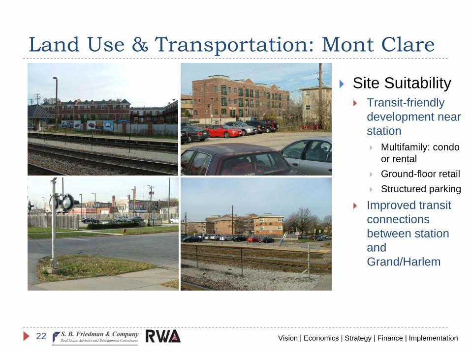
Land Use & Transportation: Mont Clare
Site SuitabilityTransit-friendly development near station
Multifamily: condo or rentalGround-floor retailStructured parking
Improved transit connections between station and Grand/Harlem
Vision | Economics | Strategy | Finance | Implementation23
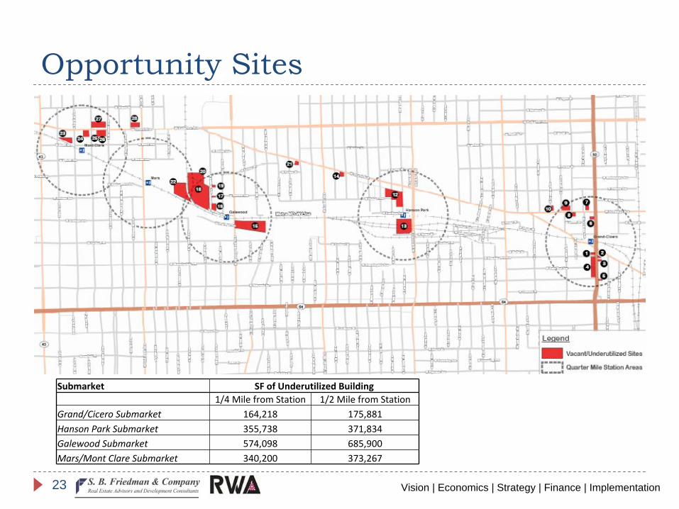
Opportunity Sites
Submarket SF of Underutilized Building1/4 Mile from Station 1/2 Mile from Station
Grand/Cicero Submarket 164,218 175,881 Hanson Park Submarket 355,738 371,834 Galewood
Submarket 574,098 685,900 Mars/Mont Clare Submarket 340,200 373,267
Vision | Economics | Strategy | Finance | Implementation24
Questions?
Vision | Economics | Strategy | Finance | Implementation25
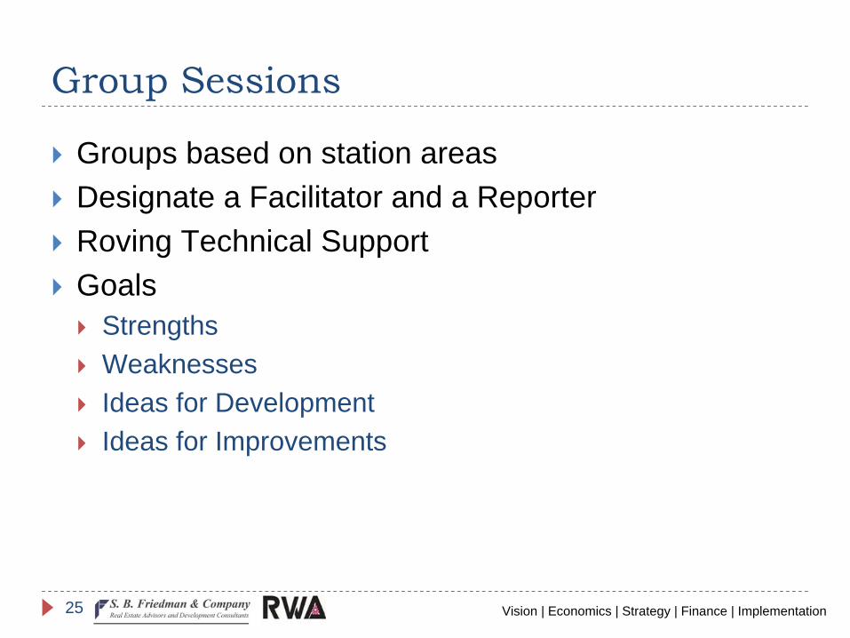
Group Sessions
Groups based on station areasDesignate a Facilitator and a ReporterRoving Technical SupportGoals
StrengthsWeaknessesIdeas for DevelopmentIdeas for Improvements
Vision | Economics | Strategy | Finance | Implementation26
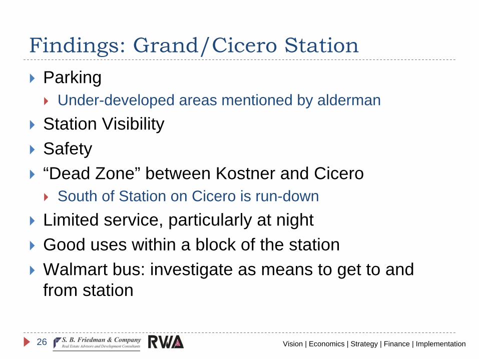
Findings: Grand/Cicero StationParking
Under-developed areas mentioned by aldermanStation VisibilitySafety“Dead Zone” between Kostner and Cicero
South of Station on Cicero is run-downLimited service, particularly at nightGood uses within a block of the stationWalmart bus: investigate as means to get to and from station
Vision | Economics | Strategy | Finance | Implementation27
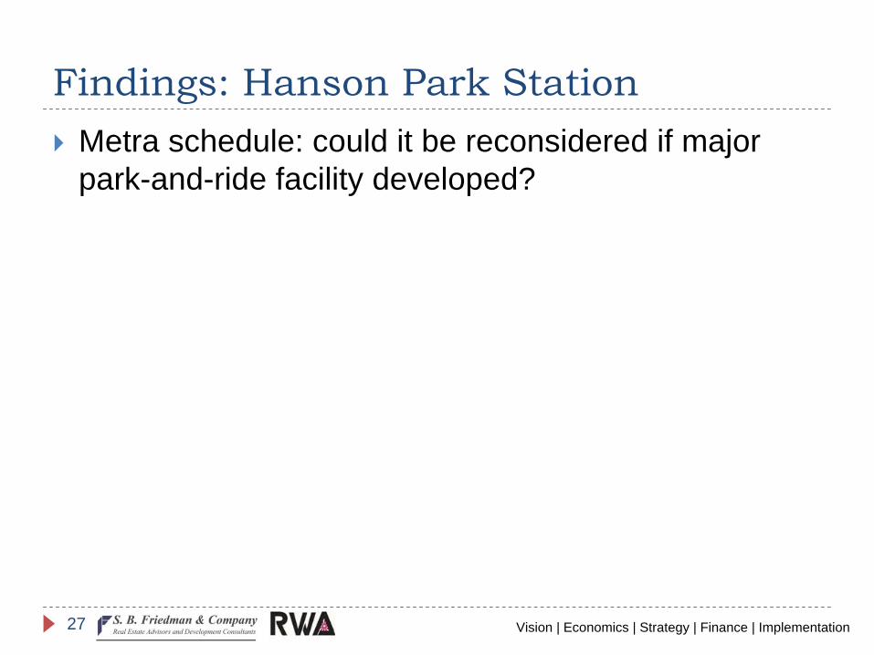
Findings: Hanson Park StationMetra schedule: could it be reconsidered if major park-and-ride facility developed?
Vision | Economics | Strategy | Finance | Implementation28
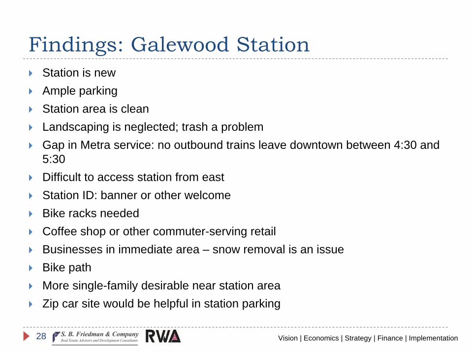
Findings: Galewood
StationStation is newAmple parkingStation area is cleanLandscaping is neglected; trash a problemGap in Metra service: no outbound trains leave downtown between 4:30 and 5:30Difficult to access station from eastStation ID: banner or other welcomeBike racks neededCoffee shop or other commuter-serving retailBusinesses in immediate area – snow removal is an issueBike pathMore single-family desirable near station areaZip car site would be helpful in station parking
Vision | Economics | Strategy | Finance | Implementation29
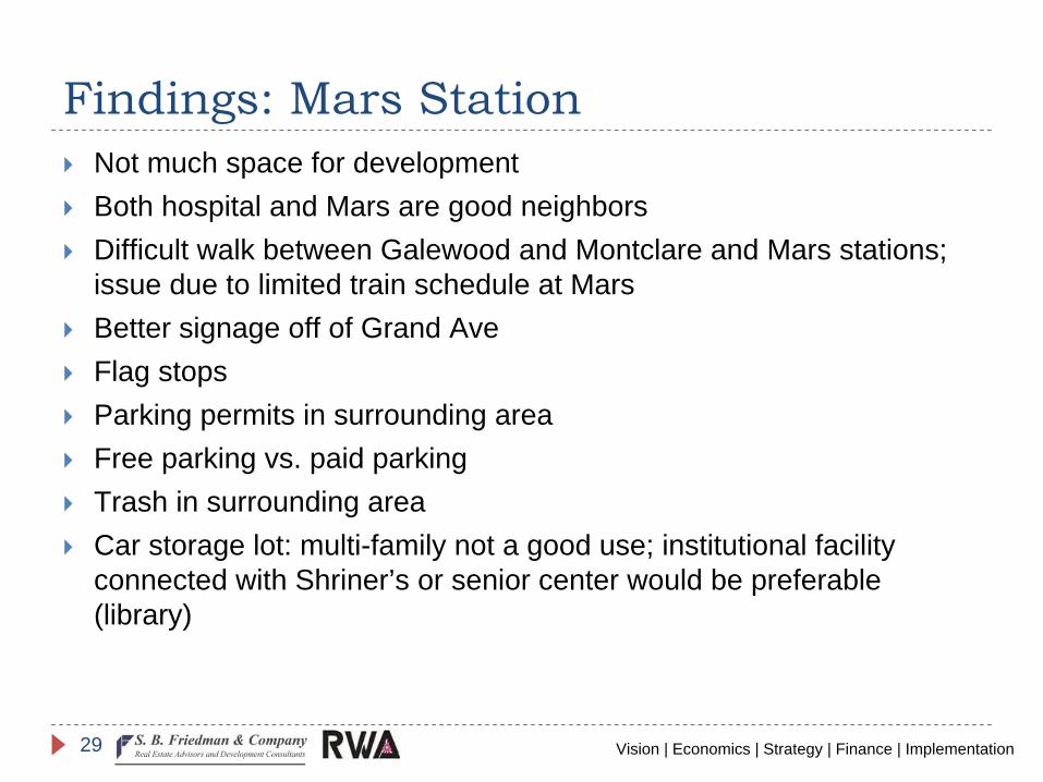
Findings: Mars StationNot much space for developmentBoth hospital and Mars are good neighborsDifficult walk between Galewood and Montclare and Mars stations; issue due to limited train schedule at MarsBetter signage off of Grand AveFlag stopsParking permits in surrounding areaFree parking vs. paid parkingTrash in surrounding areaCar storage lot: multi-family not a good use; institutional facility connected with Shriner’s or senior center would be preferable (library)
Vision | Economics | Strategy | Finance | Implementation30
Findings: Montclare
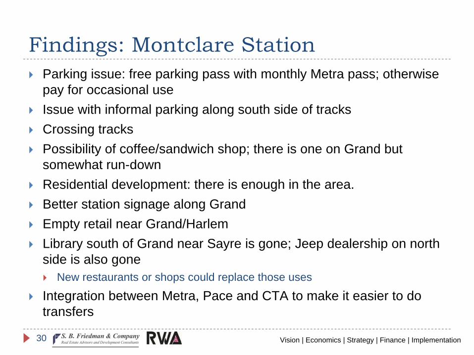
StationParking issue: free parking pass with monthly Metra pass; otherwise pay for occasional useIssue with informal parking along south side of tracksCrossing tracksPossibility of coffee/sandwich shop; there is one on Grand but somewhat run-downResidential development: there is enough in the area.Better station signage along GrandEmpty retail near Grand/HarlemLibrary south of Grand near Sayre is gone; Jeep dealership on north side is also gone
New restaurants or shops could replace those uses
Integration between Metra, Pace and CTA to make it easier to do transfers