Memorandum To: Re - Oxford · Memorandum To: Mayor and Board of Aldermen From: Judy Daniel, AICP,...
8
Memorandum To: Mayor and Board of Aldermen From: Judy Daniel, AICP, Director of Planning Date: September 20, 2016 Re: Request for Preliminary Plat Approval for the Grove at Grand Oaks, Phase V Please consider this request for Preliminary Plat Approval for the Grove at Grand Oaks Phase, V, a single family residential development located in Parcels 6a, 6b, and 6c of the Grand Oaks Planned Unit Development II. The applicant is proposing 23 lots on +/- 20.4 acres, ranging in size from just under a half acre to just over a full acre. At the September 2016 Planning Commission meeting, the Planning Commission recommended approval of the Preliminary Plat with the following conditions: 1. Approval is for the plans as submitted. 2. A stamped copy of the covenants as recorded in the Chancery Clerks office to be submitted to the Planning Department prior to permitting. 3. Required mitigation funds to be submitted to the Tree Escrow Fund in three payments prior to final plat approval. 4. Approval of the language of the easement that provides for continued maintenance of the lake which is used for detention by the City Attorney. 5. Include standard language on the Final Plat placing common responsibility for the detention pond maintenance with the Property Owners Association and the lot owners individually; and tying all lots to their responsibilities to the Common Areas. 6. Approval of ‘The Grove at Grand Oaks, Phase V by the Board of Alderman. If you need additional information or have further questions, please feel free to contact the Planning Department.
Memorandum To: Re - Oxford · Memorandum To: Mayor and Board of Aldermen From: Judy Daniel, AICP, Director of Planning Date: September 20, 2016 ... Larry L. Britt, Managing Member
Re: Request for Preliminary Plat Approval for the Grove at Grand Oaks, Phase V Please consider this request for Preliminary Plat Approval for the Grove at Grand Oaks Phase, V, a single family residential development located in Parcels 6a, 6b, and 6c of the Grand Oaks Planned Unit Development II. The applicant is proposing 23 lots on +/- 20.4 acres, ranging in size from just under a half acre to just over a full acre.
At the September 2016 Planning Commission meeting, the Planning Commission recommended approval of the Preliminary Plat with the following conditions:
1. Approval is for the plans as submitted. 2. A stamped copy of the covenants as recorded in the Chancery Clerks office to be
submitted to the Planning Department prior to permitting. 3. Required mitigation funds to be submitted to the Tree Escrow Fund in three payments
prior to final plat approval. 4. Approval of the language of the easement that provides for continued maintenance of
the lake which is used for detention by the City Attorney. 5. Include standard language on the Final Plat placing common responsibility for the
detention pond maintenance with the Property Owners Association and the lot owners individually; and tying all lots to their responsibilities to the Common Areas.
6. Approval of ‘The Grove at Grand Oaks, Phase V by the Board of Alderman.
If you need additional information or have further questions, please feel free to contact the Planning Department.
1
Case 2100
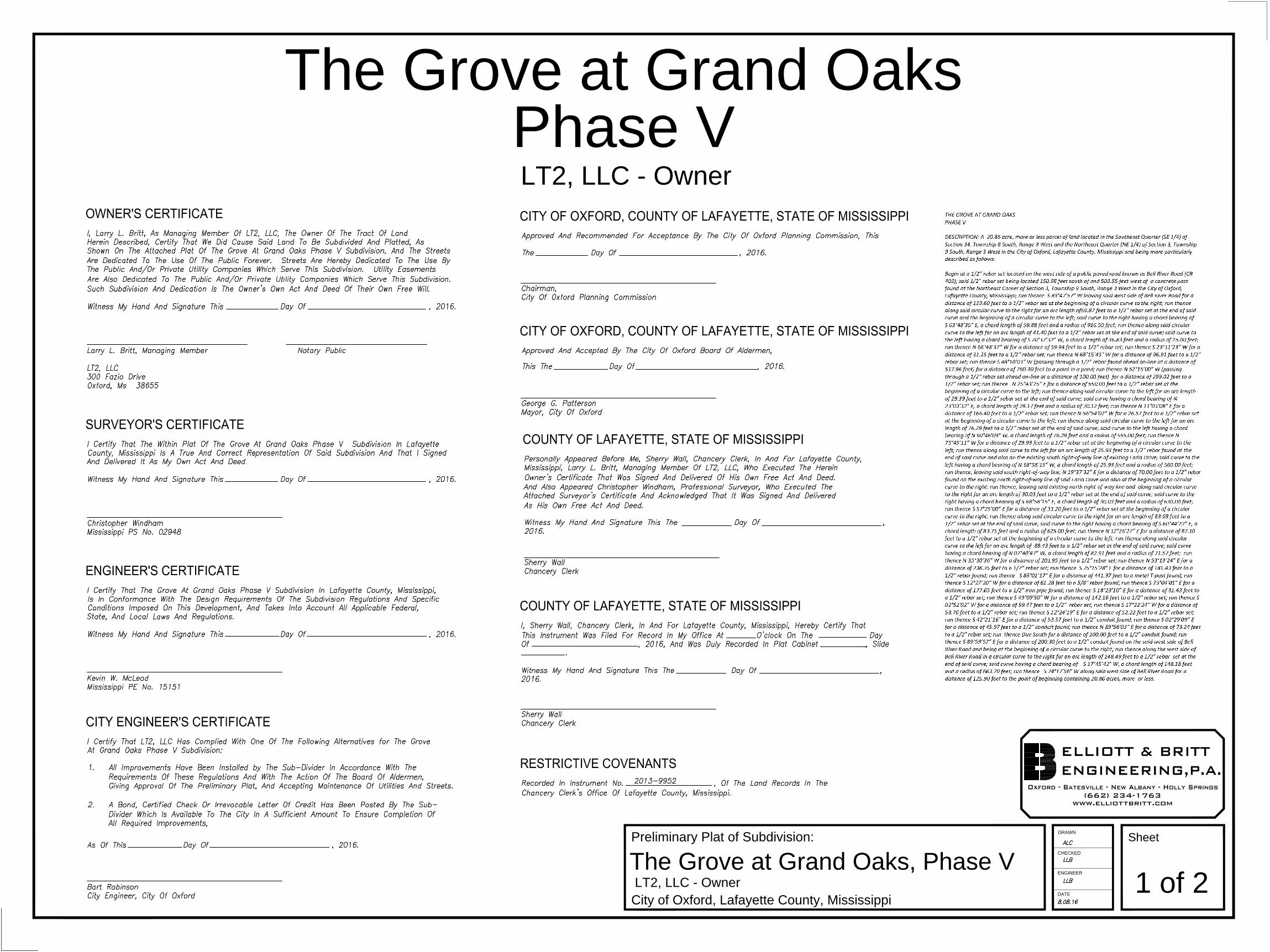
To: Oxford Planning Commission From: Judy Daniel, AICP; Director of Planning Date: September 2, 2016 Applicant: LT2, LLC Owner: Same Request: Preliminary Plat Approval “The Grove at Grand Oaks”, Phase V Location: Grand Oaks (PUD) Planned Unit Development, located off of Fazio Drive near Bell
River Road. (PPIN #8949) Zoning: (PUD) Planned Unit Development / (R1A) Single Family Residential History: Case #1990 – Establish Underlying Zoning – Approved January 2015 Surrounding Uses and Zoning: All surrounding uses are (PUD) Planned Unit Development
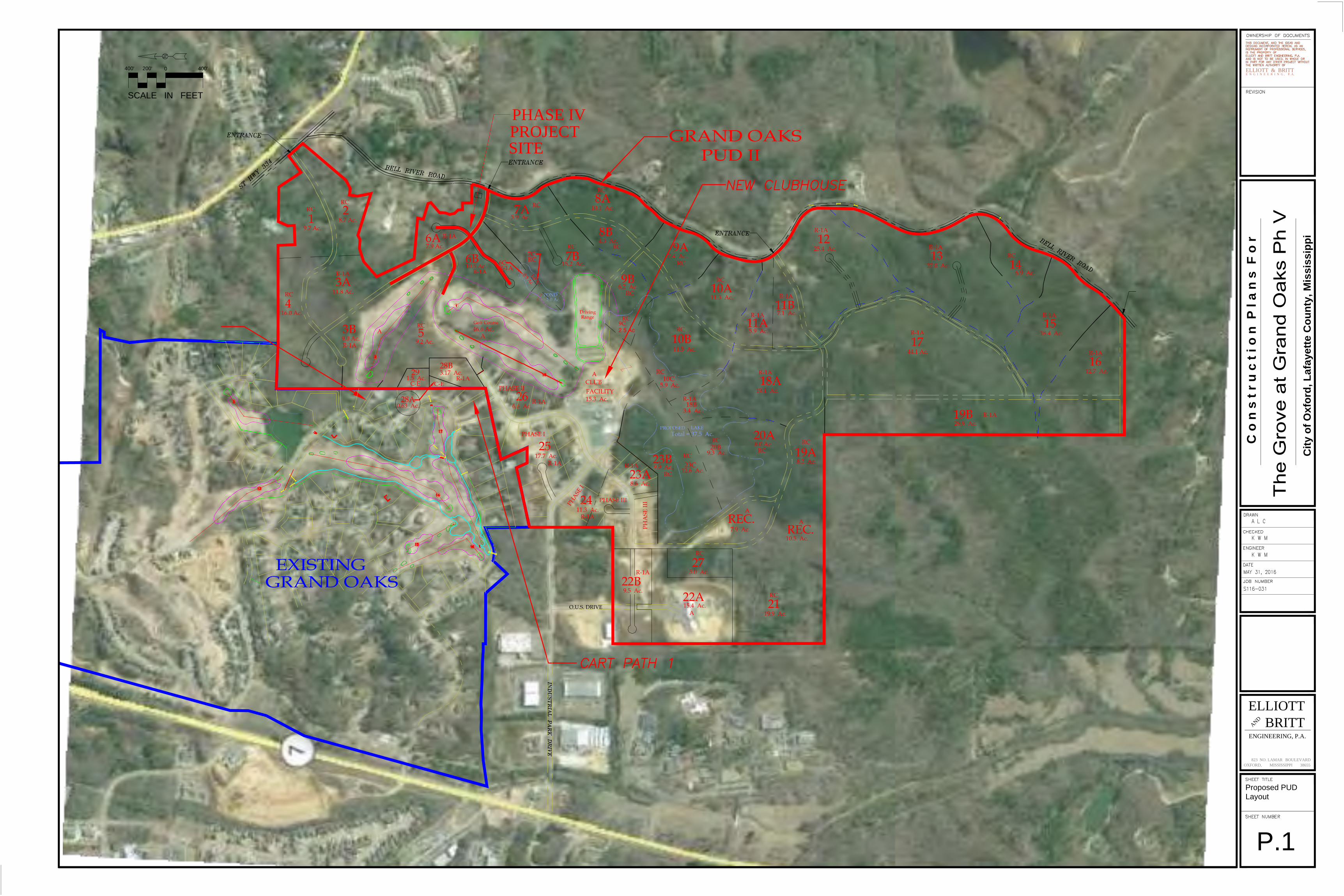
Planners Comments: The subject property is Phase V of “The Grove of Grand Oaks” subdivision located in Parcels 6a, 6b and 6c of the Grand Oaks Planned Unit Development, Phase II. It is located in the northeastern portion of the PUD and measures approximately 20.4 acres. The topography is severe in several areas and there is mature vegetation throughout. Proposed access to Phase V is via Fazio Drive ending at the proposed Palmer Drive, which bisects the parcels and terminates at Bell River Road located in the county off of Highway 334.
When Phase II of the Grand Oaks, PUD was amended in 2015 the subject property was given a (R1A) Single-Family Residential zoning designation. The proposed phase consists of 23 lots ranging in size from just under a half acre to just over a full acre and considerably less dense relative to its designated zone. All common open space/green space will be maintained by LT2, LLC and the HOA.
The Site Plan Review Committee has met on several occasions and approved the plan with the conditions noted below. Substantial mitigation is required for this site, and the applicant has chosen to contribute to the Tree Escrow Fund.
The only remaining issue related to this Preliminary Plat is the wording of the easements related to continued maintenance of the lake adjoining lots 70 and 70, which is used for
2
detention for the development. Public Work staff has sent a copy of the proposed easement to the City Attorney for review and the recommendation of approval for the Preliminary Plat is contingent upon their approval of the easement wording. Recommendation: Approve the request for Preliminary Plat for Phase V of “The Grove at Grand Oaks” in the Grand Oaks (PUD) Planned Unit Development with the following conditions:
1. Approval is for the plans as submitted. 2. A stamped copy of the covenants as recorded in the Chancery Clerks office to be
submitted to the Planning Department prior to permitting. 3. Required mitigation funds to be submitted to the Tree Escrow Fund in three payments
prior to final plat approval. 4. Approval of the language of the easement that provides for continued maintenance of
the lake which is used for detention by the City Attorney. 5. Include standard language on the Final Plat placing common responsibility for the
detention pond maintenance with the Property Owners Association and the lot owners individually; and tying all lots to their responsibilities to the Common Areas.
6. Approval of ‘The Grove at Grand Oaks, Phase V by the Board of Alderman.
City of Oxford, Lafayette County, Mississippi
The Grove at Grand Oaks, Phase V
DRAWN
CHECKED
ENGINEER
DATE
Preliminary Plat of Subdivision:
1 of 2
Sheet
LT2, LLC - Owner
ELLIOTT & BRITTENGINEERING,P.A.
Oxford - Batesville - New Albany - Holly Springs(662) 234-1763
www.elliottbritt.com
The Grove at Grand Oaks
LT2, LLC - Owner
OWNER'S CERTIFICATE
SURVEYOR'S CERTIFICATE
ENGINEER'S CERTIFICATE
RESTRICTIVE COVENANTS
CITY OF OXFORD, COUNTY OF LAFAYETTE, STATE OF MISSISSIPPI
CITY OF OXFORD, COUNTY OF LAFAYETTE, STATE OF MISSISSIPPI
COUNTY OF LAFAYETTE, STATE OF MISSISSIPPI
Phase V
CITY ENGINEER'S CERTIFICATE
COUNTY OF LAFAYETTE, STATE OF MISSISSIPPI
AutoCAD SHX Text
ALC
AutoCAD SHX Text
LLB
AutoCAD SHX Text
LLB
AutoCAD SHX Text
8.08.16
AutoCAD SHX Text
I, Larry L. Britt, As Managing Member Of LT2, LLC, The Owner Of The Tract Of Land
AutoCAD SHX Text
Herein Described, Certify That We Did Cause Said Land To Be Subdivided And Platted, As
AutoCAD SHX Text
Shown On The Attached Plat Of The Grove At Grand Oaks Phase V Subdivision, And The Streets
AutoCAD SHX Text
Are Dedicated To The Use Of The Public Forever. Streets Are Hereby Dedicated To The Use By
AutoCAD SHX Text
The Public And/Or Private Utility Companies Which Serve This Subdivision. Utility Easements
AutoCAD SHX Text
Are Also Dedicated To The Public And/Or Private Utility Companies Which Serve This Subdivision.
AutoCAD SHX Text
Such Subdivision And Dedication Is The Owner's Own Act And Deed Of Their Own Free Will.
AutoCAD SHX Text
Witness My Hand And Signature This Day Of , 2016.
AutoCAD SHX Text
Larry L. Britt, Managing Member Notary Public
AutoCAD SHX Text
LT2, LLC
AutoCAD SHX Text
300 Fazio Drive
AutoCAD SHX Text
Oxford, Ms 38655
AutoCAD SHX Text
I Certify That The Within Plat Of The Grove At Grand Oaks Phase V Subdivision In Lafayette
AutoCAD SHX Text
County, Mississippi Is A True And Correct Representation Of Said Subdivision And That I Signed
AutoCAD SHX Text
And Delivered It As My Own Act And Deed.
AutoCAD SHX Text
Witness My Hand And Signature This Day Of , 2016.
AutoCAD SHX Text
Christopher Windham
AutoCAD SHX Text
Mississippi PS No. 02948
AutoCAD SHX Text
I Certify That The Grove At Grand Oaks Phase V Subdivision In Lafayette County, Mississippi,
AutoCAD SHX Text
Is In Conformance With The Design Requirements Of The Subdivision Regulations And Specific
AutoCAD SHX Text
Conditions Imposed On This Development, And Takes Into Account All Applicable Federal,
AutoCAD SHX Text
State, And Local Laws And Regulations.
AutoCAD SHX Text
Witness My Hand And Signature This Day Of , 2016.
AutoCAD SHX Text
Kevin W. McLeod
AutoCAD SHX Text
Mississippi PE No. 15151
AutoCAD SHX Text
Recorded In Instrument No. , Of The Land Records In The
AutoCAD SHX Text
Chancery Clerk's Office Of Lafayette County, Mississippi.
AutoCAD SHX Text
Approved And Recommended For Acceptance By The City Of Oxford Planning Commission, This
AutoCAD SHX Text
The Day Of , 2016.
AutoCAD SHX Text
Chairman,
AutoCAD SHX Text
City Of Oxford Planning Commission
AutoCAD SHX Text
Approved And Accepted By The City Of Oxford Board Of Aldermen,
AutoCAD SHX Text
This The Day Of , 2016.
AutoCAD SHX Text
George G. Patterson
AutoCAD SHX Text
Mayor, City Of Oxford
AutoCAD SHX Text
I, Sherry Wall, Chancery Clerk, In And For Lafayette County, Mississippi, Hereby Certify That
AutoCAD SHX Text
This Instrument Was Filed For Record In My Office At O'clock On The Day
AutoCAD SHX Text
Of , 2016, And Was Duly Recorded In Plat Cabinet , Slide
AutoCAD SHX Text
.
AutoCAD SHX Text
Witness My Hand And Signature This The Day Of ,
AutoCAD SHX Text
2016.
AutoCAD SHX Text
Sherry Wall
AutoCAD SHX Text
Chancery Clerk
AutoCAD SHX Text
I Certify That LT2, LLC Has Complied With One Of The Following Alternatives for The Grove
AutoCAD SHX Text
At Grand Oaks Phase V Subdivision:
AutoCAD SHX Text
1. All Improvements Have Been Installed by The Sub-Divider In Accordance With The
AutoCAD SHX Text
As Of This Day Of , 2016.
AutoCAD SHX Text
Bart Robinson
AutoCAD SHX Text
City Engineer, City Of Oxford
AutoCAD SHX Text
Requirements Of These Regulations And With The Action Of The Board Of Aldermen,
AutoCAD SHX Text
Giving Approval Of The Preliminary Plat, And Accepting Maintenance Of Utilities And Streets.
AutoCAD SHX Text
2. A Bond, Certified Check Or Irrevocable Letter Of Credit Has Been Posted By The Sub-
AutoCAD SHX Text
Divider Which Is Available To The City In A Sufficient Amount To Ensure Completion Of
AutoCAD SHX Text
All Required Improvements,
AutoCAD SHX Text
Personally Appeared Before Me, Sherry Wall, Chancery Clerk, In And For Lafayette County,
AutoCAD SHX Text
Mississippi, Larry L. Britt, Managing Member Of LT2, LLC, Who Executed The Herein
AutoCAD SHX Text
Owner's Certificate That Was Signed And Delivered Of His Own Free Act And Deed.
AutoCAD SHX Text
Witness My Hand And Signature This The Day Of ,
AutoCAD SHX Text
2016.
AutoCAD SHX Text
Sherry Wall
AutoCAD SHX Text
Chancery Clerk
AutoCAD SHX Text
And Also Appeared Christopher Windham, Professional Surveyor, Who Executed The
AutoCAD SHX Text
Attached Surveyor's Certificate And Acknowledged That It Was Signed And Delivered
AutoCAD SHX Text
As His Own Free Act And Deed.
AutoCAD SHX Text
2013-9952
City of Oxford, Lafayette County, Mississippi
The Grove at Grand Oaks, Phase V
DRAWN
CHECKED
ENGINEER
DATE
Preliminary Plat of Subdivision:
2 of 2
Sheet
LT2, LLC - Owner
ELLIOTT & BRITTENGINEERING,P.A.
Oxford - Batesville - New Albany - Holly Springs(662) 234-1763
www.elliottbritt.com
AutoCAD SHX Text
73
AutoCAD SHX Text
35,159.54 SF
AutoCAD SHX Text
0.80 ACRES
AutoCAD SHX Text
72
AutoCAD SHX Text
34,434.51 SF
AutoCAD SHX Text
0.79 ACRES
AutoCAD SHX Text
71
AutoCAD SHX Text
35,082.08 SF
AutoCAD SHX Text
0.80 ACRES
AutoCAD SHX Text
70
AutoCAD SHX Text
36,152.16 SF
AutoCAD SHX Text
0.83 ACRES
AutoCAD SHX Text
69
AutoCAD SHX Text
36,021.42 SF
AutoCAD SHX Text
0.83 ACRES
AutoCAD SHX Text
68
AutoCAD SHX Text
35,200.36 SF
AutoCAD SHX Text
0.80 ACRES
AutoCAD SHX Text
67
AutoCAD SHX Text
34,529.70 SF
AutoCAD SHX Text
0.79 ACRES
AutoCAD SHX Text
66
AutoCAD SHX Text
36,602.12 SF
AutoCAD SHX Text
0.84 ACRES
AutoCAD SHX Text
65
AutoCAD SHX Text
32,245.46 SF
AutoCAD SHX Text
0.74 ACRES
AutoCAD SHX Text
64
AutoCAD SHX Text
30,722.43 SF
AutoCAD SHX Text
0.70 ACRES
AutoCAD SHX Text
21,378.91 SF
AutoCAD SHX Text
0.49 ACRES
AutoCAD SHX Text
27,801.19 SF
AutoCAD SHX Text
0.63 ACRES
AutoCAD SHX Text
20,869.95 SF
AutoCAD SHX Text
0.47 ACRES
AutoCAD SHX Text
20,808.65 SF
AutoCAD SHX Text
0.48 ACRES
AutoCAD SHX Text
24,613.86 SF
AutoCAD SHX Text
0.56 ACRES
AutoCAD SHX Text
20,946.04 SF
AutoCAD SHX Text
0.48 ACRES
AutoCAD SHX Text
21,448.41 SF
AutoCAD SHX Text
0.49 ACRES
AutoCAD SHX Text
21,222.86 SF
AutoCAD SHX Text
0.48 ACRES
AutoCAD SHX Text
20,690.58 SF
AutoCAD SHX Text
0.47 ACRES
AutoCAD SHX Text
21,280.14 SF
AutoCAD SHX Text
0.48 ACRES
AutoCAD SHX Text
21,461.50 SF
AutoCAD SHX Text
0.49 ACRES
AutoCAD SHX Text
76
AutoCAD SHX Text
77
AutoCAD SHX Text
75
AutoCAD SHX Text
78
AutoCAD SHX Text
79
AutoCAD SHX Text
80
AutoCAD SHX Text
81
AutoCAD SHX Text
83
AutoCAD SHX Text
84
AutoCAD SHX Text
85
AutoCAD SHX Text
82
AutoCAD SHX Text
37,556.17 SF
AutoCAD SHX Text
0.86 ACRES
AutoCAD SHX Text
74
AutoCAD SHX Text
34,381.74 SF
AutoCAD SHX Text
0.78 ACRES
AutoCAD SHX Text
86
AutoCAD SHX Text
25,046.72 SF
AutoCAD SHX Text
0.57 ACRES
AutoCAD SHX Text
GREEN SPACE
AutoCAD SHX Text
S 85°01'17" E - 441.37'
AutoCAD SHX Text
S25°15'28"E - 181.43'
AutoCAD SHX Text
S 49°09'50" W
AutoCAD SHX Text
142.16'
AutoCAD SHX Text
S 48°10'03" W - 760.30'
AutoCAD SHX Text
N 25°43'25" E - 650.00'
AutoCAD SHX Text
N 11°03'08" E - 166.40'
AutoCAD SHX Text
263.17'
AutoCAD SHX Text
S 72°15'34" W
AutoCAD SHX Text
185.65'
AutoCAD SHX Text
281.31'
AutoCAD SHX Text
N 51°53'22" W
AutoCAD SHX Text
265.61'
AutoCAD SHX Text
176.22'
AutoCAD SHX Text
S 45°59'00" E
AutoCAD SHX Text
S 51°42'45" E - 238.04'
AutoCAD SHX Text
N 52°32'57" W
AutoCAD SHX Text
N 52°32'57" W
AutoCAD SHX Text
218.86'
AutoCAD SHX Text
S 46°30'02" E
AutoCAD SHX Text
211.71'
AutoCAD SHX Text
N 32°09'39" E
AutoCAD SHX Text
106.23'
AutoCAD SHX Text
S 70°49'26" W
AutoCAD SHX Text
S 70°36'08" E
AutoCAD SHX Text
169.81'
AutoCAD SHX Text
S 70°49'26" W
AutoCAD SHX Text
197.27'
AutoCAD SHX Text
N 87°26'49" E
AutoCAD SHX Text
134.97'
AutoCAD SHX Text
S 85°15'19" E
AutoCAD SHX Text
155.22'
AutoCAD SHX Text
S 58°46'58" E
AutoCAD SHX Text
192.92'
AutoCAD SHX Text
N 11°25'45" E - 247.20'
AutoCAD SHX Text
L2
AutoCAD SHX Text
N66°08'07"E
AutoCAD SHX Text
L1
AutoCAD SHX Text
L3
AutoCAD SHX Text
L4
AutoCAD SHX Text
L6
AutoCAD SHX Text
L7
AutoCAD SHX Text
L8
AutoCAD SHX Text
L9
AutoCAD SHX Text
L12
AutoCAD SHX Text
L13
AutoCAD SHX Text
L14
AutoCAD SHX Text
L15
AutoCAD SHX Text
L16
AutoCAD SHX Text
L17
AutoCAD SHX Text
L18
AutoCAD SHX Text
L19
AutoCAD SHX Text
L21
AutoCAD SHX Text
L22
AutoCAD SHX Text
L23
AutoCAD SHX Text
N 55°08'11" E
AutoCAD SHX Text
N 55°50'58" E
AutoCAD SHX Text
210.65'
AutoCAD SHX Text
295.24'
AutoCAD SHX Text
174.28'
AutoCAD SHX Text
161.38'
AutoCAD SHX Text
110.39'
AutoCAD SHX Text
127.75'
AutoCAD SHX Text
157.61'
AutoCAD SHX Text
138.19'
AutoCAD SHX Text
308.91'
AutoCAD SHX Text
79.22'
AutoCAD SHX Text
83.07'
AutoCAD SHX Text
112.15'
AutoCAD SHX Text
158.82'
AutoCAD SHX Text
87.10'
AutoCAD SHX Text
125.22'
AutoCAD SHX Text
124.13'
AutoCAD SHX Text
105.34'
AutoCAD SHX Text
69.74'
AutoCAD SHX Text
N 00°24'33" W
AutoCAD SHX Text
95.55'
AutoCAD SHX Text
131.11'
AutoCAD SHX Text
134.21'
AutoCAD SHX Text
187.46'
AutoCAD SHX Text
87.43'
AutoCAD SHX Text
87.38'
AutoCAD SHX Text
126.85'
AutoCAD SHX Text
60.00'
AutoCAD SHX Text
49.50'
AutoCAD SHX Text
N 53°13'24" E - 236.35'
AutoCAD SHX Text
SOUTH
AutoCAD SHX Text
100.00'
AutoCAD SHX Text
200.30'
AutoCAD SHX Text
107.02'
AutoCAD SHX Text
140.18'
AutoCAD SHX Text
83.53'
AutoCAD SHX Text
83.53'
AutoCAD SHX Text
L5
AutoCAD SHX Text
S 12°27'20" W
AutoCAD SHX Text
61.28'
AutoCAD SHX Text
L10
AutoCAD SHX Text
L11
AutoCAD SHX Text
S89%%D56'03"W
AutoCAD SHX Text
73.24'
AutoCAD SHX Text
L20
AutoCAD SHX Text
C1
AutoCAD SHX Text
C2
AutoCAD SHX Text
C3
AutoCAD SHX Text
C4
AutoCAD SHX Text
C5
AutoCAD SHX Text
C6
AutoCAD SHX Text
C7
AutoCAD SHX Text
C9
AutoCAD SHX Text
C10
AutoCAD SHX Text
C11
AutoCAD SHX Text
C12
AutoCAD SHX Text
C13
AutoCAD SHX Text
C14
AutoCAD SHX Text
C15
AutoCAD SHX Text
C16
AutoCAD SHX Text
C17
AutoCAD SHX Text
C18
AutoCAD SHX Text
C19
AutoCAD SHX Text
C20
AutoCAD SHX Text
C21
AutoCAD SHX Text
C22
AutoCAD SHX Text
C23
AutoCAD SHX Text
C24
AutoCAD SHX Text
C26
AutoCAD SHX Text
C27
AutoCAD SHX Text
C28
AutoCAD SHX Text
C29
AutoCAD SHX Text
C30
AutoCAD SHX Text
C31
AutoCAD SHX Text
C32
AutoCAD SHX Text
C34
AutoCAD SHX Text
C35
AutoCAD SHX Text
C36
AutoCAD SHX Text
C37
AutoCAD SHX Text
C38
AutoCAD SHX Text
C39
AutoCAD SHX Text
C40
AutoCAD SHX Text
C41
AutoCAD SHX Text
C42
AutoCAD SHX Text
C43
AutoCAD SHX Text
C44
AutoCAD SHX Text
C45
AutoCAD SHX Text
C46
AutoCAD SHX Text
C47
AutoCAD SHX Text
C48
AutoCAD SHX Text
C49
AutoCAD SHX Text
C51
AutoCAD SHX Text
C52
AutoCAD SHX Text
C53
AutoCAD SHX Text
C54
AutoCAD SHX Text
C56
AutoCAD SHX Text
#2 TEE
AutoCAD SHX Text
#1 GREEN
AutoCAD SHX Text
EXISTING FAZIO DR.
AutoCAD SHX Text
53.76'
AutoCAD SHX Text
45.97'
AutoCAD SHX Text
S17°22'24"W
AutoCAD SHX Text
S12°24'19"E
AutoCAD SHX Text
52.22'
AutoCAD SHX Text
S42°21'16"E
AutoCAD SHX Text
53.57'
AutoCAD SHX Text
S02°29'09"E
AutoCAD SHX Text
S02°52'02"W
AutoCAD SHX Text
59.46'
AutoCAD SHX Text
CR 403 (BELL RIVER ROAD)
AutoCAD SHX Text
R53
AutoCAD SHX Text
%%P0.35 AC.
AutoCAD SHX Text
OUT PARCEL
AutoCAD SHX Text
N 35°30'36" W-201.95'
AutoCAD SHX Text
N 52°15'00" W-299.02'
AutoCAD SHX Text
199.02'
AutoCAD SHX Text
25' REAR SETBACK
AutoCAD SHX Text
20' SIDE SETBACK
AutoCAD SHX Text
35' FRONT SETBACK
AutoCAD SHX Text
10' SIDE SETBACK
AutoCAD SHX Text
25' FRONT SETBACK
AutoCAD SHX Text
15' REAR SETBACK
AutoCAD SHX Text
S 23°51'53" E
AutoCAD SHX Text
262.78'
AutoCAD SHX Text
186.33'
AutoCAD SHX Text
S 23°51'53" E
AutoCAD SHX Text
91.92'
AutoCAD SHX Text
L26
AutoCAD SHX Text
S36°43'37"E
AutoCAD SHX Text
87.40'
AutoCAD SHX Text
5,794.42 SF
AutoCAD SHX Text
0.13 ACRES
AutoCAD SHX Text
GREEN SPACE
AutoCAD SHX Text
145.82'
AutoCAD SHX Text
161.34'
AutoCAD SHX Text
S 70°57'07" W
AutoCAD SHX Text
137.72'
AutoCAD SHX Text
N 24°53'41" W
AutoCAD SHX Text
127.24'
AutoCAD SHX Text
S 48°37'57" E
AutoCAD SHX Text
141.72'
AutoCAD SHX Text
N 18°46'40" W
AutoCAD SHX Text
148.70'
AutoCAD SHX Text
N 80°13'47" E
AutoCAD SHX Text
214.04'
AutoCAD SHX Text
S 73°04'01" E
AutoCAD SHX Text
177.65'
AutoCAD SHX Text
SOUTH
AutoCAD SHX Text
205.92'
AutoCAD SHX Text
1/2" Conduit
AutoCAD SHX Text
5/8" Rebar
AutoCAD SHX Text
Metal T-post
AutoCAD SHX Text
Fnd.
AutoCAD SHX Text
1/2" Rebar Fnd.
AutoCAD SHX Text
Fnd.
AutoCAD SHX Text
S 18°23'10" E
AutoCAD SHX Text
31.42'
AutoCAD SHX Text
Fnd.
AutoCAD SHX Text
1/2" Conduit
AutoCAD SHX Text
Fnd.
AutoCAD SHX Text
S 89%%D59'57" E
AutoCAD SHX Text
89.36'
AutoCAD SHX Text
143.37'
AutoCAD SHX Text
N 66°48'37" W
AutoCAD SHX Text
59.94'
AutoCAD SHX Text
S24°19'31"W-182.92'
AutoCAD SHX Text
122.92'
AutoCAD SHX Text
S 53°12'42" W
AutoCAD SHX Text
EXISTING
AutoCAD SHX Text
CART PATH
AutoCAD SHX Text
PALMER DRIVE
AutoCAD SHX Text
PALMER DRIVE
AutoCAD SHX Text
FAZIO DR.
AutoCAD SHX Text
1/2" Rebar Fnd.
AutoCAD SHX Text
on-line at a distance
AutoCAD SHX Text
1/2" Iron
AutoCAD SHX Text
Pipe Fnd.
AutoCAD SHX Text
1/2" Conduit
AutoCAD SHX Text
Fnd.
AutoCAD SHX Text
25' FRONT SETBACK
AutoCAD SHX Text
15' REAR SETBACK
AutoCAD SHX Text
25' FRONT SETBACK
AutoCAD SHX Text
35' FRONT SETBACK
AutoCAD SHX Text
of 517.96'
AutoCAD SHX Text
1/2" Rebar Fnd.
AutoCAD SHX Text
on-line at a distance
AutoCAD SHX Text
of 100.00'
AutoCAD SHX Text
NICKLAUS COVE
AutoCAD SHX Text
HOGAN COVE
AutoCAD SHX Text
138.53'
AutoCAD SHX Text
N12°26'27"E
AutoCAD SHX Text
CITY OF OXFORD LIMITS
AutoCAD SHX Text
46.31'
AutoCAD SHX Text
N19°37'32"E
AutoCAD SHX Text
70.00'
AutoCAD SHX Text
1/2" Rebar
AutoCAD SHX Text
Fnd.
AutoCAD SHX Text
1/2" Rebar
AutoCAD SHX Text
Fnd.
AutoCAD SHX Text
CL=25.93'
AutoCAD SHX Text
CD=N68%%D58'15"W
AutoCAD SHX Text
L=25.93'
AutoCAD SHX Text
R=560.00'
AutoCAD SHX Text
CL=76.24'
AutoCAD SHX Text
CD=N60%%D46'09"W
AutoCAD SHX Text
L=76.29'
AutoCAD SHX Text
R=565.00'
AutoCAD SHX Text
FUTURE STREET TO OTHER PARCELS
AutoCAD SHX Text
for Proposed Sewer Lift Station to be
AutoCAD SHX Text
Owned and Maintained by LT2,LLC and HOA.
AutoCAD SHX Text
R50'
AutoCAD SHX Text
C50
AutoCAD SHX Text
L24
AutoCAD SHX Text
L25
AutoCAD SHX Text
PALMER DRIVE
AutoCAD SHX Text
EXISTING
AutoCAD SHX Text
CART PATH
AutoCAD SHX Text
EXISTING
AutoCAD SHX Text
CART PATH
AutoCAD SHX Text
OWNER:
AutoCAD SHX Text
THE GROVE AT GRAND
AutoCAD SHX Text
OAKS PHASE V, HOA
AutoCAD SHX Text
OWNER:
AutoCAD SHX Text
THE GROVE AT GRAND
AutoCAD SHX Text
OAKS PHASE V, HOA
AutoCAD SHX Text
AS SHOWN ON MASTER PLAN
AutoCAD SHX Text
FUTURE STREET TO OTHER PARCELS
AutoCAD SHX Text
AS SHOWN ON MASTER PLAN
AutoCAD SHX Text
Green Space and Permanent Easement
AutoCAD SHX Text
100.00'
AutoCAD SHX Text
278.35'
AutoCAD SHX Text
N 39°40'14" E
AutoCAD SHX Text
140.98'
AutoCAD SHX Text
S 46°30'02" E
AutoCAD SHX Text
201.42'
AutoCAD SHX Text
N23°14'45"E
AutoCAD SHX Text
53.00'
AutoCAD SHX Text
S 65°40'53" E
AutoCAD SHX Text
138.60'
AutoCAD SHX Text
114.64'
AutoCAD SHX Text
139.60'
AutoCAD SHX Text
C55
AutoCAD SHX Text
C8
AutoCAD SHX Text
91.45'
AutoCAD SHX Text
60.00'
AutoCAD SHX Text
C25
AutoCAD SHX Text
C33
AutoCAD SHX Text
S48°10'03"W
AutoCAD SHX Text
L27
AutoCAD SHX Text
36,341.98 SF
AutoCAD SHX Text
0.83 ACRES
AutoCAD SHX Text
GREEN SPACE
AutoCAD SHX Text
OWNER:
AutoCAD SHX Text
THE GROVE AT GRAND
AutoCAD SHX Text
OAKS PHASE V, HOA
AutoCAD SHX Text
5,844.22 SF
AutoCAD SHX Text
0.13 ACRES
AutoCAD SHX Text
GREEN SPACE
AutoCAD SHX Text
70.88'
AutoCAD SHX Text
49.21'
AutoCAD SHX Text
C57
AutoCAD SHX Text
L28
AutoCAD SHX Text
N.T.S.
AutoCAD SHX Text
VICINITY MAP
AutoCAD SHX Text
R 3 W
AutoCAD SHX Text
T 9 S
AutoCAD SHX Text
MS HWY NO. 7
AutoCAD SHX Text
BOULEVARD
AutoCAD SHX Text
SOUTH LAMAR
AutoCAD SHX Text
BELK
AutoCAD SHX Text
OAKS
AutoCAD SHX Text
GRAND
AutoCAD SHX Text
3
AutoCAD SHX Text
T 8 S
AutoCAD SHX Text
4
AutoCAD SHX Text
33
AutoCAD SHX Text
34
AutoCAD SHX Text
PHASE I
AutoCAD SHX Text
PHASE II
AutoCAD SHX Text
PHASE III
AutoCAD SHX Text
INDUSTRIAL PARK DRIVE
AutoCAD SHX Text
SCHOOL
AutoCAD SHX Text
OXFORD-UNIVERSITY
AutoCAD SHX Text
O.U.S. DRIVE
AutoCAD SHX Text
PROJECT
AutoCAD SHX Text
SITE
AutoCAD SHX Text
%%UCB HOLDINGS
AutoCAD SHX Text
INSTRUMENT #201211050
AutoCAD SHX Text
ZONED: PUD - ARIG
AutoCAD SHX Text
%%UCB HOLDINGS
AutoCAD SHX Text
INSTRUMENT #201211050
AutoCAD SHX Text
ZONED: PUD - RC
AutoCAD SHX Text
%%UCB HOLDINGS
AutoCAD SHX Text
INSTRUMENT #201211050
AutoCAD SHX Text
ZONED: PUD - ARIG
AutoCAD SHX Text
PHASE IV
AutoCAD SHX Text
48
AutoCAD SHX Text
47
AutoCAD SHX Text
ALC
AutoCAD SHX Text
LLB
AutoCAD SHX Text
LLB
AutoCAD SHX Text
8.08.16
AutoCAD SHX Text
SCALE 1" = 100'
AutoCAD SHX Text
4. BUILDING SETBACKS FOR LOTS 64-73 ARE AS FOLLOWS:
AutoCAD SHX Text
1. THIS PROPERTY IS SUBJECT TO ALL CITY OF OXFORD SUBDIVISION REGULATIONS.
AutoCAD SHX Text
2. THIS PROPERTY IS SUBJECT TO ALL ROAD AND UTILITY EASEMENTS AND
AutoCAD SHX Text
RIGHTS-OF-WAY OF RECORD.
AutoCAD SHX Text
FRONT - 35 FEET, REAR - 25 FEET, SIDES - 20 FEET
AutoCAD SHX Text
3. ALL SETBACKS WILL ALSO SERVE AS UTILITY AND DRAINAGE EASEMENTS TO
AutoCAD SHX Text
5. THIS PROPERTY DOES NOT LIE IN A FLOOD HAZARD AREA ACCORDING TO THE