Embed Size (px)
Citation preview

Planning, Building & Environmental Services
1195 Third Street, Suite 210
Napa, CA 94559 www.countyofnapa.org
David Morrison
Director
M E M O R A N D U M
To: Heather Phillips, Chair
Napa County Planning Commission
From: Donald Barrella
Planner III
Date: July 10, 2015 Re: Syar Napa Quarry
Surface Mining Permit P08-00337
Alternative Analysis
I. PURPOSE:
On August 12, 2015, the Commission will consider certifying a Final Environmental Impact Report (Final
EIR) for the Syar Napa Quarry expansion project and subsequently considering action on the associated
Surface Mining Permit (SMP) to allow an expansion to the Syar Napa Quarry including an increase in
production levels. As part of the Commission’s review and consideration of the proposed Project the
Commission, as the decision making body, is obligated to consider alternatives to the proposed Project.
Section 15126.6 of the California Environmental Quality Act (CEQA) Guidelines requires considerate of
alternatives that could reduce to a less-than-significant level or eliminate any significant adverse
environmental effects, or would avoid or substantially lessen any of the significant effects of the
proposed project, including alternatives that may be more costly or could otherwise impede the
proposed project’s objectives. Alternatives considered must include those that offer substantial
environmental advantages over the proposed project. However, an EIR is not required to consider every
possible alternative, but must consider a reasonable range of potentially feasible alternatives that will
foster informed decision making and public participation.
The purpose of this analysis is to clarify and refine the potential benefits and detriments of each
alternative identified in the Draft EIR and provide the Commission, at their direction, with an additional
alternative (or Hybrid Alternative) for their consideration. The Hybrid Alternative is primarily intended
to further lessen impacts that were identified to be less than significant with or without mitigation
incorporated; however could still be considered disruptive to the neighboring community due to the
facilities location and surrounding uses. Following the Background discussion below there is a
table/matrix showing the potential benefits and detriments of each alternative including the Hybrid
Alternative (or the Reduced Production and Footprint Alternative).
Napa Valley College Board of Trustees September 10, 2015, Regular Meeting Agenda Item 14.1 .
Page 1 of 20
Page 2 of 11
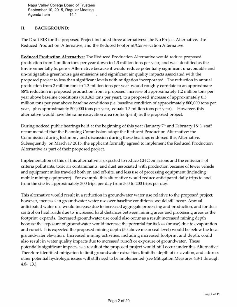
II. BACKGROUND:
The Draft EIR for the proposed Project included three alternatives: the No Project Alternative, the
Reduced Production Alternative, and the Reduced Footprint/Conservation Alternative.
Reduced Production Alternative: The Reduced Production Alternative would reduce proposed
production from 2 million tons per year down to 1.3 million tons per year, and was identified as the
Environmentally Superior Alternative because it would reduce potentially significant unavoidable and
un-mitigatable greenhouse gas emissions and significant air quality impacts associated with the
proposed project to less than significant levels with mitigation incorporated. The reduction in annual
production from 2 million tons to 1.3 million tons per year would roughly correlate to an approximate
58% reduction in proposed production from a proposed increase of approximately 1.2 million tons per
year above baseline conditions (810,363 tons per year), to a proposed increase of approximately 0.5
million tons per year above baseline conditions (i.e. baseline condition of approximately 800,000 tons per
year, plus approximately 500,000 tons per year, equals 1.3 million tons per year). However, this
alternative would have the same excavation area (or footprint) as the proposed project.
During noticed public hearings held at the beginning of this year (January 7th and February 18th), staff
recommended that the Planning Commission adopt the Reduced Production Alternative: the
Commission during testimony and discussion during these hearings endorsed this Alternative.
Subsequently, on March 17 2015, the applicant formally agreed to implement the Reduced Production
Alternative as part of their proposed project.
Implementation of this of this alternative is expected to reduce GHG emissions and the emissions of
criteria pollutants, toxic air contaminants, and dust associated with production because of fewer vehicle
and equipment miles traveled both on and off-site, and less use of processing equipment (including
mobile mining equipment). For example this alternative would reduce anticipated daily trips to and
from the site by approximately 300 trips per day from 500 to 200 trips per day.
This alternative would result in a reduction in groundwater water use relative to the proposed project;
however, increases in groundwater water use over baseline conditions would still occur. Annual
anticipated water use would increase due to increased aggregate processing and production, and for dust
control on haul roads due to increased haul distances between mining areas and processing areas as the
footprint expands. Increased groundwater use could also occur as a result increased mining depth
because the exposure of groundwater would increase the potential for its loss (or use) due to evaporation
and runoff. It is expected the proposed mining depth (50 above mean seal level) would be below the local
groundwater elevation. Increased mining activities, including increased footprint and depth, could
also result in water quality impacts due to increased runoff or exposure of groundwater. These
potentially significant impacts as a result of the proposed project would still occur under this Alternative.
Therefore identified mitigation to limit groundwater extraction, limit the depth of excavation, and address
other potential hydrologic issues will still need to be implemented (see Mitigation Measures 4.8-1 through
4.8- 13.).
Napa Valley College Board of Trustees September 10, 2015, Regular Meeting Agenda Item 14.1 .
Page 2 of 20

Page 3 of 11
With respect to biological, aesthetic, and cultural impacts, this alternative would result in the same
impacts identified in the DEIR as with the proposed project. Therefore, identified impact levels to these
resources and associated mitigation measures identified in the DEIR would need to be implemented with
this alternative.
As indicated the Reduced Production Alternative is expected to reduce potentially significant and
unavoidable impacts and result in fewer impacts than the proposed project, primarily those associated air
quality, water use, and traffic, due to substantially decreased annual production levels, however it would
have the same footprint as the proposed project. Therefore, potential noise and esthetic impacts to
adjacent uses could be perceived as more disruptive to the surrounding community and uses and to
Skyline Wilderness Park (SWP) and users of SWP.
No Project Alternative: Under the No Project Alternative, the quarry would continue to operate under
current entitlement that has limited to no specific limitations or mitigations that are specialized to
current mining and quarrying operations. Approximately 497 acres of the site would continue to be
mined and aggregate processing would continue. Annual production would not have specified
limitations. After mining of mineral resources had been completed, reclamation would commence on
the entirety of the site per the existing Reclamation Plan. Current practices implemented by the operator
to reduce environmental impacts, such as watering the unpaved roads to control fugitive dust and
implementing best management practices to control polluted and/or increased runoff, are expected. No
changes to the existing facilities or the authorized mining footprint would occur.
Through continued aggregate mining and processing under current entitlements, there are
approximately 114-acres of oak woodland, grassland, and chamise that have not been disturbed by
current mining activities that could be mined based on current entitlements. Most of this undisturbed
acreage occurs in isolated patches within the larger 497-acre quarry, except for an approximate 14.75-
acre area along the eastern property line adjacent to the Pasini Parcel and an approximate 47.3-acre area
located in between and south of the State Gray and State Blue Pits could be mined. Effects of mining
under current entitlements would essentially remain the same with on-going air pollutant emissions,
noise, disturbances to biological resources, storm water runoff, traffic, and greenhouse gas emissions.
Mining operations would continue to comply with state and federal permitting requirements that
influence mining activities, such as ongoing air permits issued though the Bay Area Air Quality
Management District for stationary equipment and ongoing implementation of the Storm Water
Pollution Prevention Plan (SWPPP) to address potential water quality issues.
Existing views of the quarry and the existing visual character of the area would continue to change over
time as mining continues under the existing entitlements. Changes to the existing visual character of the
site and area are not expected to substantially altered because most of the approximate 114-acres of
land under current entitlements that has not been disturbed is isolated patches within the larger mining
area there is the potential for noticeable changes because of the approximate 14.75-acre undisturbed area
located along the eastern property line adjacent to the Pasini Parcel and portions of an approximate
47.3-acre area located in between and south of the State Gray and State Blue Pits could be mined.
Air pollutant and GHG emissions associated with existing mining and processing activities would
Napa Valley College Board of Trustees September 10, 2015, Regular Meeting Agenda Item 14.1 .
Page 3 of 20

Page 4 of 11
continue under the No Project Alternative. While increases in pollutant emissions are not expected to
occur provided production does not exceed baseline condition there would be potential air quality and
GHG impacts with production over baseline conditions.
With the No Project Alternative, approximately 350 feet of rock wall located on APN 046-390-003 at the
northern end of the Snake Pit could be removed in the course of mining activities, and other
unidentified cultural resources could be encountered.
Noise and vibration effects of the No Project Alternative would remain essentially the same as existing
conditions as mining would generally not extend closer to adjacent receptors. However, as previously
noted there is an approximate 30-acre area along the eastern property line adjacent to the Pasini Parcel
that has not been disturbed/mined that could under current entitlements. Mining of this area would
bring mining closer to SWP.
Traffic associated with the facility would generally remain the same provided production does not
exceed baseline condition.
Under the No Project Alternative, impacts associated with air quality, greenhouse gas emissions, and
traffic congestion could increase after operation of the Quarry has ceased because demand for local
aggregate is expected to continue with or without the Quarry. Without a local source, construction
projects would need to find an alternative source of aggregate products. The Quarry primarily serves
several cities in the immediate area, such as: Napa, American Canyon, Yountville, St. Helena,
Calistoga, and Vallejo as well as a majority of unincorporated Napa County. These service areas are
between one and 26 miles from the Quarry. Depending on the location of a particular construction
projects, the next closest source of aggregated supply could be a quarry in the Lake Herman Quarry in
Solano County located approximately 15 miles to the southeast, or quarries in Sonoma and Contra
Costa County located approximately 40 miles to the southeast and west. This would potentially
increase the distance between aggregate supply and service areas from one to 26 miles, to a range of 16
to 66 miles. As such this alternative may not further promote General Plan land use policies and goals,
since it would not necessarily provide for a continuing local source of aggregate products.
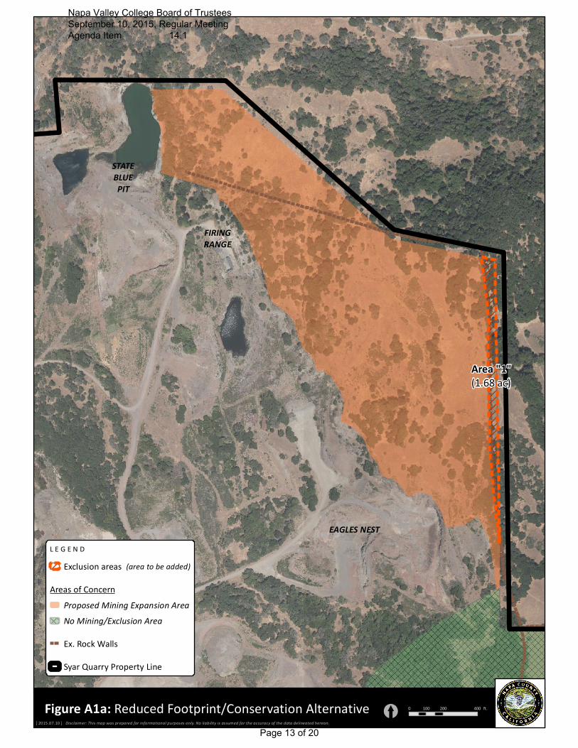
Reduced Footprint/Conservation Alternative: Under the Reduced Footprint/Conservation Alternative
approximately 35-acres would be removed from the proposed mining footprint: these areas are
located in the proposed expansion areas as further described below (see Figures A1a and A1b).
Under this alternative the originally proposed production of 2 million tons per year would remain,
therefore potential impacts that are associated with this production amount, such as air quality, noise,
traffic, greenhouse gas emissions, and water use would remain the same as with the proposed project.
The objective of the Reduced Footprint/Conservation Alternative is to further reduce potential
impacts and effects of the proposed project beyond the mitigated project, such as visual/aesthetic
changes, biological resources, and cultural resources, whether or not such impacts are required to be
mitigated or are considered to be less than significant to conserve and maintain more environmental
characteristics of the site.
While the project would not result in significant impacts to aesthetics, it would result in visual changes,
Napa Valley College Board of Trustees September 10, 2015, Regular Meeting Agenda Item 14.1 .
Page 4 of 20

Page 5 of 11
as topographic and vegetative features are removed. Removal of these features would reduce buffering
and screening between SWP and mining activities, in particular from some of the more remote areas of
SWP. These changes would not occur in the southeast portion of the project area under the Reduced
Footprint/Conservation Alternative because the knoll and associated vegetation in the northern portion
of the Pasini Parcel would essentially remain, thereby maintaining existing visual shielding of mining
activities from portions of the park, as well as maintaining this feature as see from SWP. Generally only
the southern foot-slopes of the Pasisi knoll would be mined under this alternative. Retention of the
knoll would also reduce the amount of visual change as seen from the west. While this alternative
would provide an expanded buffer along the eastern property line in the vicinity of the State Blue Pit, it
would not materially change the visual changes that would occur in this portion of the quarry under
the proposed project as seen from SWP or other off-site locations. This alternative would also preserve
the Pasini Pond which is an aesthetic feature of the area as seen from portions of SWP. Under the
proposed project the drainages that supply the pond with runoff water would be removed, thereby
effectively eliminating the pond.
Because the acoustical shielding provided by the knoll and associated vegetation that separates the
park from the quarry would remain, this alternative would substantially reduce potential noise and
vibration effects in the southern portions of SWP. Potential noise and vibration effects in the northern
portions of SWP and to public institutional and residential uses to the north would remain the same as
under the proposed project because the increased buffer along the eastern property line in the vicinity of
the State Blue Pit would not retain any significant amounts of acoustical shielding (i.e. terrain and
vegetation) between the quarry and adjacent uses in this area.
As indicated this alternative would reduce the proposed footprint by approximately 35-acres, resulting in
approximately 28-acres of oak woodland being retained. While the areas retained do not contain special
or unique habitat, the biological functions and value provided by these oak woodlands and grasslands
would be maintained. Additionally, the biological function and value of the pond on the Pasini Parcel
provides would also be retained.
The Reduced Footprint/Conservation Alternative would increase Exclusion Areas in the following
areas:
A. Increase the buffer at the interface between SWP and the quarry in the vicinity of the State
Blue Pit (i.e. along the eastern property line of APN 046-370-012) to ensure its preservation and
provide it with a 10 foot buffer from adjacent mining activities. This Exclusion Area increase
would remove approximately 1.5-acres from the project and retain approximately 0.75-acre of
oak woodland. This increase buffer would also provide greater protection to the existing rock
wall that runs along the eastern property line (see Figure A1a – Area B).
B. Increase the Exclusion Area to include the knoll located within the northern portion of the
Pasini Parcel (APN 046-390-002) from the mining footprint. The modified Exclusion Area
would extend out to approximately the 800 foot elevation line so that mining in this area would
generally be at or below elevations within SWP. This Exclusion Area increase would remove
approximately 30-acres from the project and retain approximately 25-acres of oak woodland
(see Figure A1a – Area B).
Napa Valley College Board of Trustees September 10, 2015, Regular Meeting Agenda Item 14.1 .
Page 5 of 20
Page 6 of 11
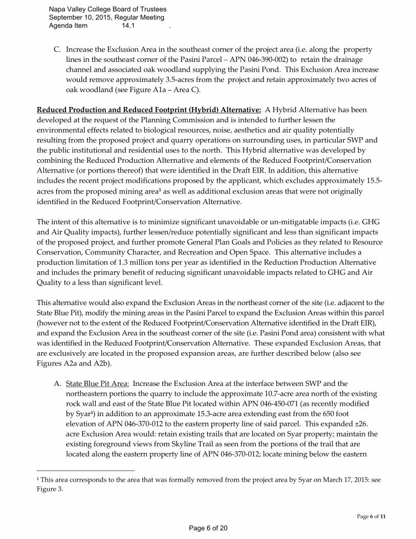
C. Increase the Exclusion Area in the southeast corner of the project area (i.e. along the property
lines in the southeast corner of the Pasini Parcel – APN 046-390-002) to retain the drainage
channel and associated oak woodland supplying the Pasini Pond. This Exclusion Area increase
would remove approximately 3.5-acres from the project and retain approximately two acres of
oak woodland (see Figure A1a – Area C).
Reduced Production and Reduced Footprint (Hybrid) Alternative: A Hybrid Alternative has been
developed at the request of the Planning Commission and is intended to further lessen the
environmental effects related to biological resources, noise, aesthetics and air quality potentially
resulting from the proposed project and quarry operations on surrounding uses, in particular SWP and
the public institutional and residential uses to the north. This Hybrid alternative was developed by
combining the Reduced Production Alternative and elements of the Reduced Footprint/Conservation
Alternative (or portions thereof) that were identified in the Draft EIR. In addition, this alternative
includes the recent project modifications proposed by the applicant, which excludes approximately 15.5-
acres from the proposed mining area1 as well as additional exclusion areas that were not originally
identified in the Reduced Footprint/Conservation Alternative.
The intent of this alternative is to minimize significant unavoidable or un-mitigatable impacts (i.e. GHG
and Air Quality impacts), further lessen/reduce potentially significant and less than significant impacts
of the proposed project, and further promote General Plan Goals and Policies as they related to Resource
Conservation, Community Character, and Recreation and Open Space. This alternative includes a
production limitation of 1.3 million tons per year as identified in the Reduction Production Alternative
and includes the primary benefit of reducing significant unavoidable impacts related to GHG and Air
Quality to a less than significant level.
This alternative would also expand the Exclusion Areas in the northeast corner of the site (i.e. adjacent to the
State Blue Pit), modify the mining areas in the Pasini Parcel to expand the Exclusion Areas within this parcel
(however not to the extent of the Reduced Footprint/Conservation Alternative identified in the Draft EIR),
and expand the Exclusion Area in the southeast corner of the site (i.e. Pasini Pond area) consistent with what
was identified in the Reduced Footprint/Conservation Alternative. These expanded Exclusion Areas, that
are exclusively are located in the proposed expansion areas, are further described below (also see
Figures A2a and A2b).
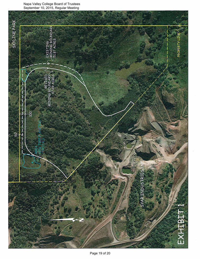
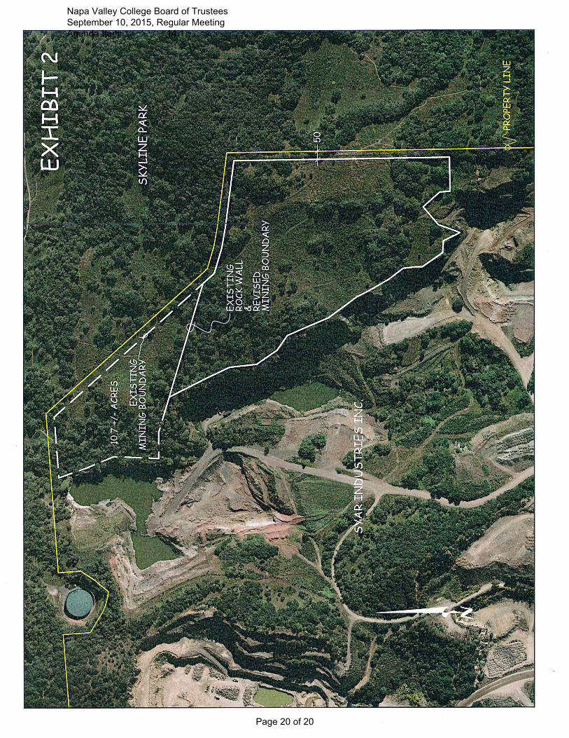
A. State Blue Pit Area: Increase the Exclusion Area at the interface between SWP and the
northeastern portions the quarry to include the approximate 10.7-acre area north of the existing
rock wall and east of the State Blue Pit located within APN 046-450-071 (as recently modified
by Syar1) in addition to an approximate 15.3-acre area extending east from the 650 foot
elevation of APN 046-370-012 to the eastern property line of said parcel. This expanded ±26.
acre Exclusion Area would: retain existing trails that are located on Syar property; maintain the
existing foreground views from Skyline Trail as seen from the portions of the trail that are
located along the eastern property line of APN 046-370-012; locate mining below the eastern
1 This area corresponds to the area that was formally removed from the project area by Syar on March 17, 2015: see
Figure 3.
Napa Valley College Board of Trustees September 10, 2015, Regular Meeting Agenda Item 14.1 .
Page 6 of 20
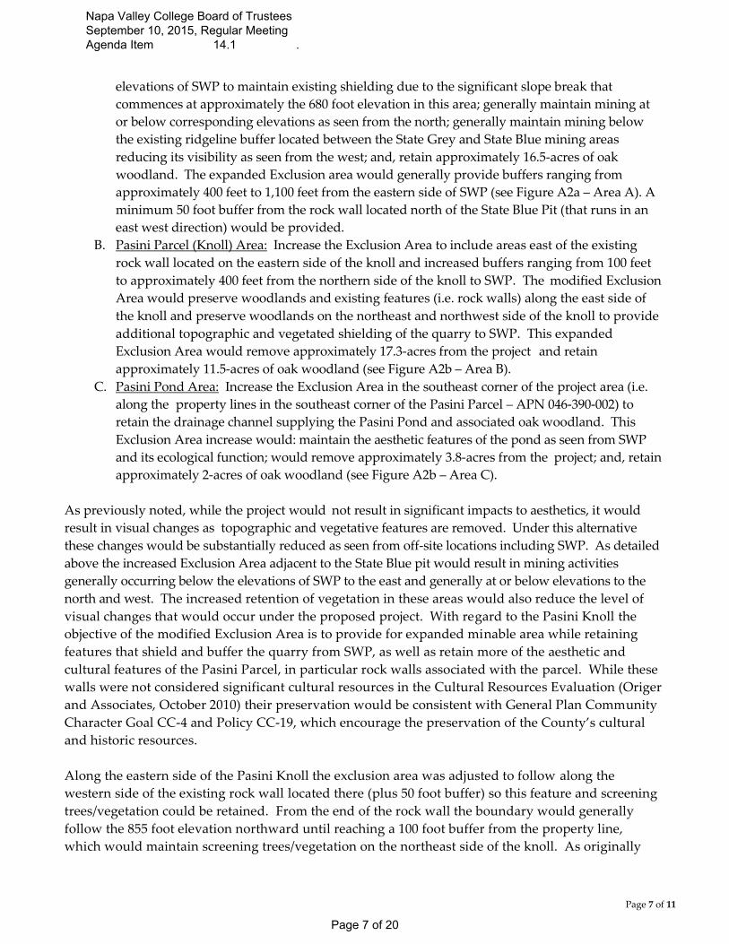
Page 7 of 11
elevations of SWP to maintain existing shielding due to the significant slope break that
commences at approximately the 680 foot elevation in this area; generally maintain mining at
or below corresponding elevations as seen from the north; generally maintain mining below
the existing ridgeline buffer located between the State Grey and State Blue mining areas
reducing its visibility as seen from the west; and, retain approximately 16.5-acres of oak
woodland. The expanded Exclusion area would generally provide buffers ranging from
approximately 400 feet to 1,100 feet from the eastern side of SWP (see Figure A2a – Area A). A
minimum 50 foot buffer from the rock wall located north of the State Blue Pit (that runs in an
east west direction) would be provided.
B. Pasini Parcel (Knoll) Area: Increase the Exclusion Area to include areas east of the existing
rock wall located on the eastern side of the knoll and increased buffers ranging from 100 feet
to approximately 400 feet from the northern side of the knoll to SWP. The modified Exclusion
Area would preserve woodlands and existing features (i.e. rock walls) along the east side of
the knoll and preserve woodlands on the northeast and northwest side of the knoll to provide
additional topographic and vegetated shielding of the quarry to SWP. This expanded
Exclusion Area would remove approximately 17.3-acres from the project and retain
approximately 11.5-acres of oak woodland (see Figure A2b – Area B).
C. Pasini Pond Area: Increase the Exclusion Area in the southeast corner of the project area (i.e.
along the property lines in the southeast corner of the Pasini Parcel – APN 046-390-002) to
retain the drainage channel supplying the Pasini Pond and associated oak woodland. This
Exclusion Area increase would: maintain the aesthetic features of the pond as seen from SWP
and its ecological function; would remove approximately 3.8-acres from the project; and, retain
approximately 2-acres of oak woodland (see Figure A2b – Area C).
As previously noted, while the project would not result in significant impacts to aesthetics, it would
result in visual changes as topographic and vegetative features are removed. Under this alternative
these changes would be substantially reduced as seen from off-site locations including SWP. As detailed
above the increased Exclusion Area adjacent to the State Blue pit would result in mining activities
generally occurring below the elevations of SWP to the east and generally at or below elevations to the
north and west. The increased retention of vegetation in these areas would also reduce the level of
visual changes that would occur under the proposed project. With regard to the Pasini Knoll the
objective of the modified Exclusion Area is to provide for expanded minable area while retaining
features that shield and buffer the quarry from SWP, as well as retain more of the aesthetic and
cultural features of the Pasini Parcel, in particular rock walls associated with the parcel. While these
walls were not considered significant cultural resources in the Cultural Resources Evaluation (Origer
and Associates, October 2010) their preservation would be consistent with General Plan Community
Character Goal CC-4 and Policy CC-19, which encourage the preservation of the County’s cultural
and historic resources.
Along the eastern side of the Pasini Knoll the exclusion area was adjusted to follow along the
western side of the existing rock wall located there (plus 50 foot buffer) so this feature and screening
trees/vegetation could be retained. From the end of the rock wall the boundary would generally
follow the 855 foot elevation northward until reaching a 100 foot buffer from the property line,
which would maintain screening trees/vegetation on the northeast side of the knoll. As originally
Napa Valley College Board of Trustees September 10, 2015, Regular Meeting Agenda Item 14.1 .
Page 7 of 20
Page 8 of 11
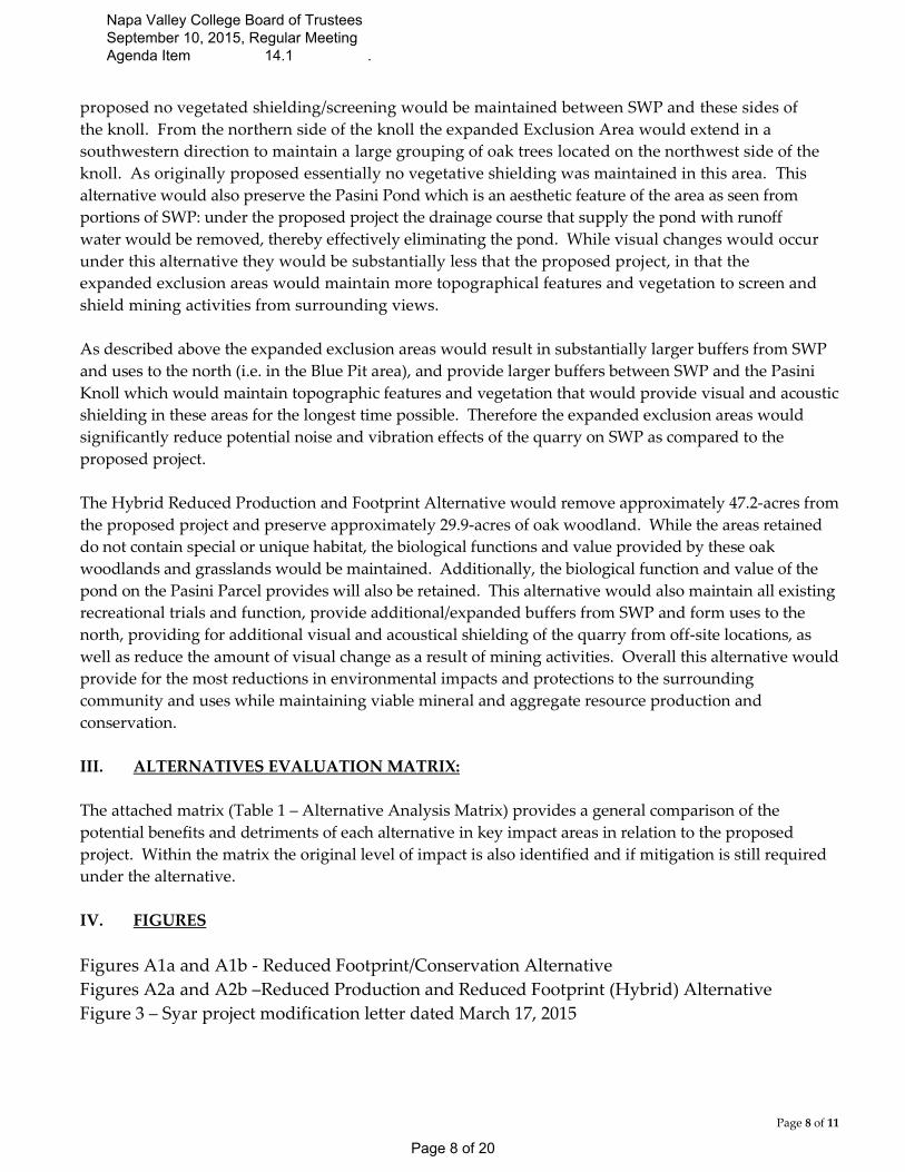
proposed no vegetated shielding/screening would be maintained between SWP and these sides of
the knoll. From the northern side of the knoll the expanded Exclusion Area would extend in a
southwestern direction to maintain a large grouping of oak trees located on the northwest side of the
knoll. As originally proposed essentially no vegetative shielding was maintained in this area. This
alternative would also preserve the Pasini Pond which is an aesthetic feature of the area as seen from
portions of SWP: under the proposed project the drainage course that supply the pond with runoff
water would be removed, thereby effectively eliminating the pond. While visual changes would occur
under this alternative they would be substantially less that the proposed project, in that the
expanded exclusion areas would maintain more topographical features and vegetation to screen and
shield mining activities from surrounding views.
As described above the expanded exclusion areas would result in substantially larger buffers from SWP
and uses to the north (i.e. in the Blue Pit area), and provide larger buffers between SWP and the Pasini
Knoll which would maintain topographic features and vegetation that would provide visual and acoustic
shielding in these areas for the longest time possible. Therefore the expanded exclusion areas would
significantly reduce potential noise and vibration effects of the quarry on SWP as compared to the
proposed project.
The Hybrid Reduced Production and Footprint Alternative would remove approximately 47.2-acres from
the proposed project and preserve approximately 29.9-acres of oak woodland. While the areas retained
do not contain special or unique habitat, the biological functions and value provided by these oak
woodlands and grasslands would be maintained. Additionally, the biological function and value of the
pond on the Pasini Parcel provides will also be retained. This alternative would also maintain all existing
recreational trials and function, provide additional/expanded buffers from SWP and form uses to the
north, providing for additional visual and acoustical shielding of the quarry from off-site locations, as
well as reduce the amount of visual change as a result of mining activities. Overall this alternative would
provide for the most reductions in environmental impacts and protections to the surrounding
community and uses while maintaining viable mineral and aggregate resource production and
conservation.
III. ALTERNATIVES EVALUATION MATRIX:
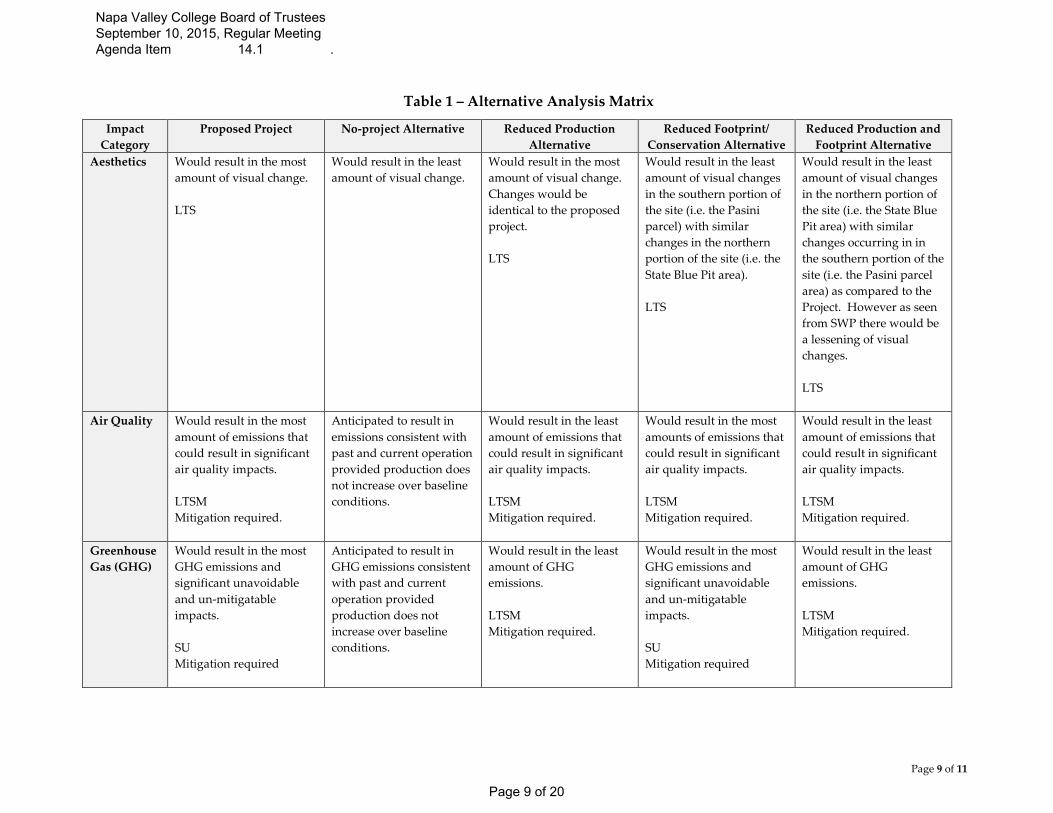
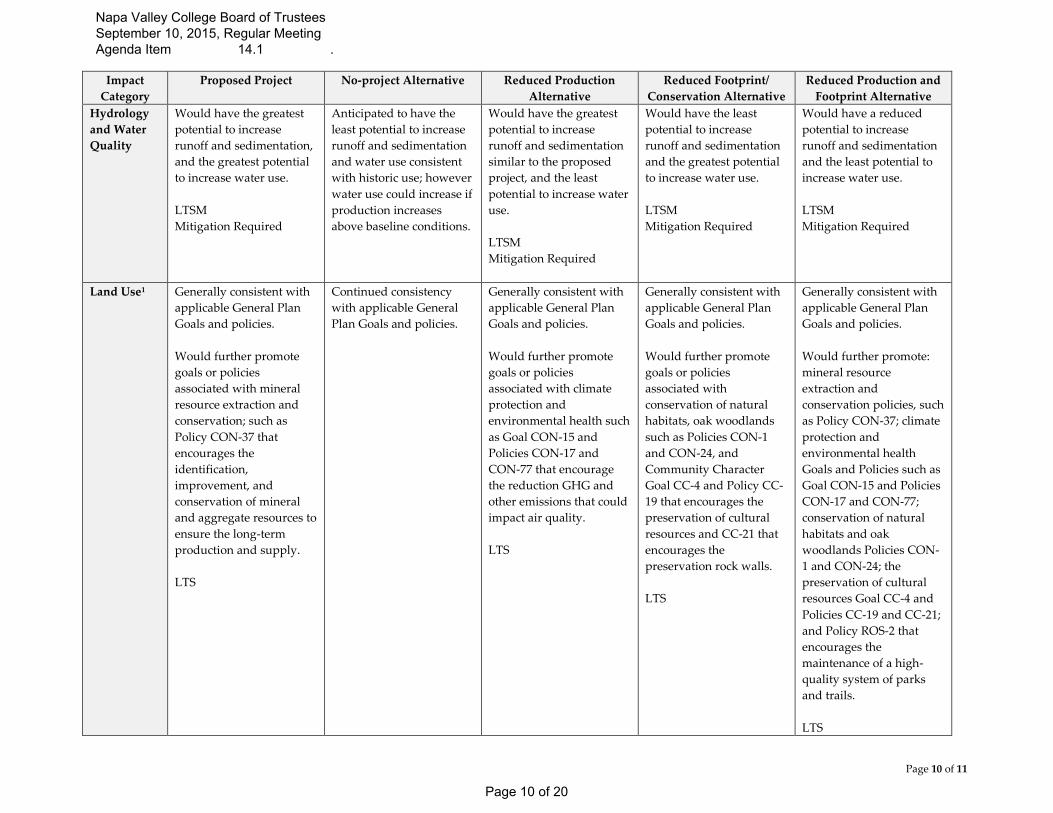
The attached matrix (Table 1 – Alternative Analysis Matrix) provides a general comparison of the
potential benefits and detriments of each alternative in key impact areas in relation to the proposed
project. Within the matrix the original level of impact is also identified and if mitigation is still required
under the alternative.
IV. FIGURES
Figures A1a and A1b - Reduced Footprint/Conservation Alternative
Figures A2a and A2b –Reduced Production and Reduced Footprint (Hybrid) Alternative
Figure 3 – Syar project modification letter dated March 17, 2015
Napa Valley College Board of Trustees September 10, 2015, Regular Meeting Agenda Item 14.1 .
Page 8 of 20
Page 9 of 11
Table 1 – Alternative Analysis Matrix
Impact
Category
Proposed Project No-project Alternative Reduced Production
Alternative
Reduced Footprint/
Conservation Alternative
Reduced Production and
Footprint Alternative
Aesthetics Would result in the most
amount of visual change.
LTS
Would result in the least
amount of visual change.
Would result in the most
amount of visual change.
Changes would be
identical to the proposed
project.
LTS
Would result in the least
amount of visual changes
in the southern portion of
the site (i.e. the Pasini
parcel) with similar
changes in the northern
portion of the site (i.e. the
State Blue Pit area).
LTS
Would result in the least
amount of visual changes
in the northern portion of
the site (i.e. the State Blue
Pit area) with similar
changes occurring in in
the southern portion of the
site (i.e. the Pasini parcel
area) as compared to the
Project. However as seen
from SWP there would be
a lessening of visual
changes.
LTS
Air Quality Would result in the most
amount of emissions that
could result in significant
air quality impacts.
LTSM
Mitigation required.
Anticipated to result in
emissions consistent with
past and current operation
provided production does
not increase over baseline
conditions.
Would result in the least
amount of emissions that
could result in significant
air quality impacts.
LTSM
Mitigation required.
Would result in the most
amounts of emissions that
could result in significant
air quality impacts.
LTSM
Mitigation required.
Would result in the least
amount of emissions that
could result in significant
air quality impacts.
LTSM
Mitigation required.
Greenhouse
Gas (GHG)
Would result in the most
GHG emissions and
significant unavoidable
and un-mitigatable impacts.
SU
Mitigation required
Anticipated to result in
GHG emissions consistent
with past and current
operation provided
production does not
increase over baseline
conditions.
Would result in the least
amount of GHG
emissions.
LTSM
Mitigation required.
Would result in the most
GHG emissions and
significant unavoidable
and un-mitigatable
impacts.
SU
Mitigation required
Would result in the least
amount of GHG
emissions.
LTSM
Mitigation required.
Napa Valley College Board of Trustees September 10, 2015, Regular Meeting Agenda Item 14.1 .
Page 9 of 20
Page 10 of 11
Impact
Category
Proposed Project No-project Alternative Reduced Production
Alternative
Reduced Footprint/
Conservation Alternative
Reduced Production and
Footprint Alternative
Hydrology
and Water
Quality
Would have the greatest
potential to increase
runoff and sedimentation,
and the greatest potential
to increase water use.
LTSM
Mitigation Required
Anticipated to have the
least potential to increase
runoff and sedimentation
and water use consistent
with historic use; however
water use could increase if
production increases
above baseline conditions.
Would have the greatest
potential to increase
runoff and sedimentation
similar to the proposed
project, and the least
potential to increase water
use.
LTSM
Mitigation Required
Would have the least
potential to increase
runoff and sedimentation
and the greatest potential
to increase water use.
LTSM
Mitigation Required
Would have a reduced
potential to increase
runoff and sedimentation
and the least potential to
increase water use.
LTSM
Mitigation Required
Land Use1 Generally consistent with
applicable General Plan
Goals and policies.
Would further promote
goals or policies
associated with mineral
resource extraction and
conservation; such as
Policy CON-37 that
encourages the
identification,
improvement, and
conservation of mineral
and aggregate resources to
ensure the long-term
production and supply.
LTS
Continued consistency
with applicable General
Plan Goals and policies.
Generally consistent with
applicable General Plan
Goals and policies.
Would further promote
goals or policies
associated with climate
protection and
environmental health such
as Goal CON-15 and
Policies CON-17 and
CON-77 that encourage
the reduction GHG and
other emissions that could
impact air quality.
LTS
Generally consistent with
applicable General Plan
Goals and policies.
Would further promote
goals or policies
associated with
conservation of natural
habitats, oak woodlands
such as Policies CON-1
and CON-24, and
Community Character
Goal CC-4 and Policy CC-
19 that encourages the
preservation of cultural
resources and CC-21 that
encourages the
preservation rock walls.
LTS
Generally consistent with
applicable General Plan
Goals and policies.
Would further promote:
mineral resource
extraction and
conservation policies, such
as Policy CON-37; climate
protection and
environmental health
Goals and Policies such as
Goal CON-15 and Policies
CON-17 and CON-77;
conservation of natural
habitats and oak
woodlands Policies CON-
1 and CON-24; the
preservation of cultural
resources Goal CC-4 and
Policies CC-19 and CC-21;
and Policy ROS-2 that
encourages the
maintenance of a high-
quality system of parks
and trails.
LTS
Napa Valley College Board of Trustees September 10, 2015, Regular Meeting Agenda Item 14.1 .
Page 10 of 20

Page 11 of 11
Impact
Category
Proposed Project No-project Alternative Reduced Production
Alternative
Reduced Footprint/
Conservation Alternative
Reduced Production and
Footprint Alternative
Mineral
Resources
Would result in continued
operations into the future
to provide a reliable local
source of aggregate.
LTS
May result in limited
future operations that
could negatively affect the
reliability of locally
sourced aggregate.
Anticipated to result in
continued future
operations to provide a
reliable source of
aggregate; however
reduced annual
production limits could
affect annual sourcing
given demand.
LTS
Anticipated to result in
continued operations and
a reliable local source of
aggregate; however,
reduced reserves may
have an effect on future
sourcing.
LTS
Anticipated to result in
continued operations and
a reliable local source of
aggregate; however
reduced annual
production limits could
affect annual sourcing
given demand and
reduced reserves may
have an effect on future
sourcing.
LTS
Noise and
Vibration
Would result in the
greatest potential noise
and vibration effects to
surround community and
uses.
LTSM
Mitigation Required
Anticipated to generally
result in noise and
vibration effects to
surround community and
uses similar to existing
operations.
Would result in the
greatest potential noise
and vibration effects to
surround community and
uses; however, on an
annual basis they are
anticipated to be less that
the proposed project.
LTSM
Mitigation Required
Would result in the
greatest potential noise
and vibration effects to
community and uses to
the north and east, and the
least amount of effects to
the southeastern portions
of SWP.
LTSM
Mitigation Required
Anticipated to result in the
least potential for noise
and vibration effects to
surrounding community
and uses however there
could be minimal
increases in the
southeastern portion of
SWP.
LTSM
Mitigation Required
Traffic Would result in the
greatest increase in
potential trips to the
Quarry.
LTSM
Mitigation Required
Anticipated to result in
potential trips to the
Quarry consistent with
past and current
operation; however trips
could increase if
production increases from
baseline conditions.
Would result in the least
increase in potential trips
to the Quarry.
LTS
Would result in the
greatest increase in
potential trips to the
Quarry.
LTSM
Mitigation Required
Would result in the least
increase in potential trips
to the Quarry.
LTS
1. While the alternatives would generally result in consistency with applicable General Plan Goals and Policies to varying degrees (see General Plan Consistency
Memo), each specific alternative would have the tendency to further promote Goals and Policies within specific elements of the General Plan such as Conservation,
Community Character, and Recreation and Open Space. For example, while the reduced production alternative would further promote climate and air quality goals
and polices it may not further promote recreation goals and policies (such as maintaining a high-quality park system). SU = Significant and Unavoidable; LTS = Less Than Significant; LTSM = LTS with Mitigation
Napa Valley College Board of Trustees September 10, 2015, Regular Meeting Agenda Item 14.1 .
Page 11 of 20

This
Pag
e In
ten
tio
nal
ly L
eft
Bla
nk
Napa Valley College Board of Trustees September 10, 2015, Regular Meeting Agenda Item 14.1 .
Page 12 of 20
EAGLES NEST
FIRINGRANGE
STATEBLUEPIT
Area "1"(1.68 ac)
Figure A1a: Reduced Footprint/Conservation Alternative [[ 2015.07.10 ] Disclaimer: This map was prepared for informational purposes only. No liability is assumed for the accuracy of the data delineated hereon.
0 200 400100 ft.
L E G E N DExclusion areas (area to be added)
Areas of ConcernProposed Mining Expansion AreaNo Mining/Exclusion AreaEx. Rock Walls Syar Quarry Property Line
Napa Valley College Board of Trustees September 10, 2015, Regular Meeting Agenda Item 14.1 .
Page 13 of 20
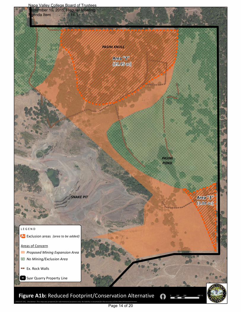
SNAKE PIT
PASINIPOND
PASINI KNOLL
Area "2"(29.45 ac)
Area "3"(3.84 ac)
Figure A1b: Reduced Footprint/Conservation Alternative [[ 2015.07.10 ] Disclaimer: This map was prepared for informational purposes only. No liability is assumed for the accuracy of the data delineated hereon.
0 200 400100 ft.
L E G E N DExclusion areas (area to be added)
Areas of ConcernProposed Mining Expansion AreaNo Mining/Exclusion AreaEx. Rock Walls Syar Quarry Property Line
Napa Valley College Board of Trustees September 10, 2015, Regular Meeting Agenda Item 14.1 .
Page 14 of 20
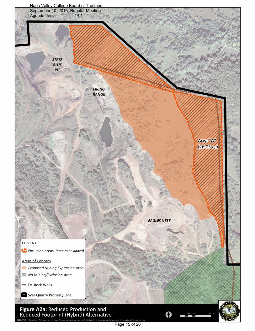
EAGLES NEST
FIRINGRANGE
STATEBLUEPIT
Area "A"(26.05 ac)
Figure A2a: Reduced Production andReduced Footprint (Hybrid) Alternative [[ 2015.07.10 ] Disclaimer: This map was prepared for informational purposes only. No liability is assumed for the accuracy of the data delineated hereon.
0 200 400100 ft.
L E G E N DExclusion areas (area to be added)
Areas of ConcernProposed Mining Expansion AreaNo Mining/Exclusion AreaEx. Rock Walls Syar Quarry Property Line
Napa Valley College Board of Trustees September 10, 2015, Regular Meeting Agenda Item 14.1 .
Page 15 of 20
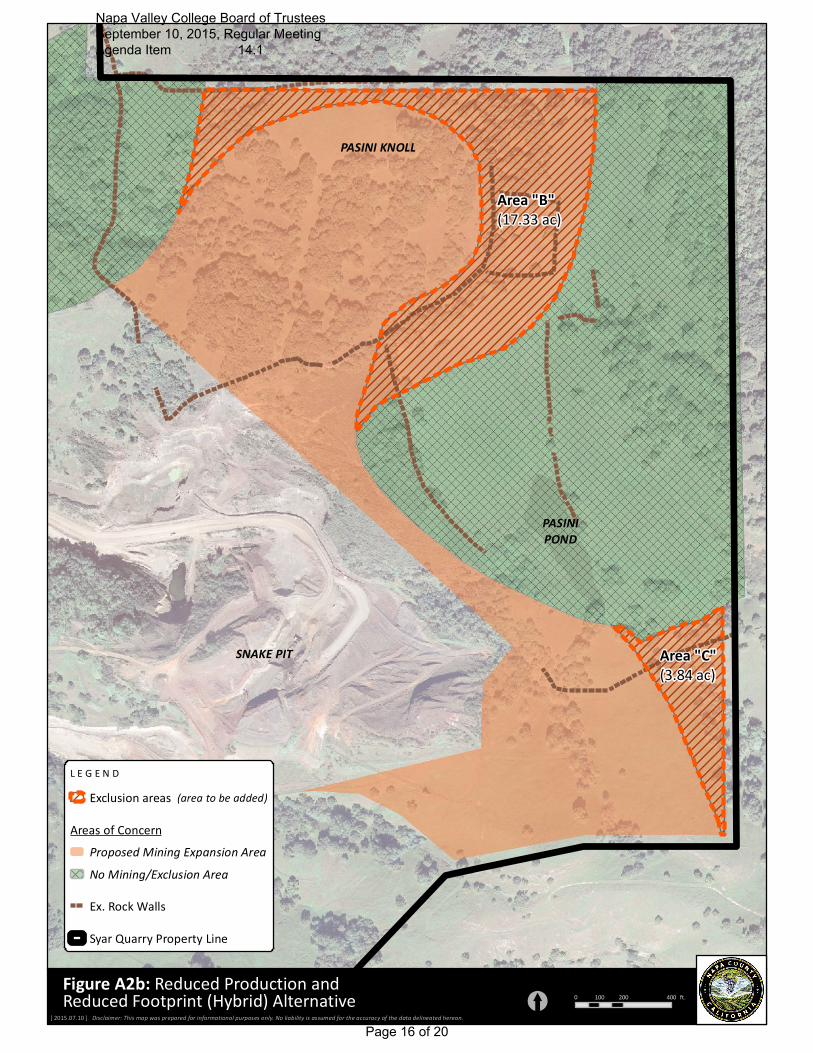
SNAKE PIT
PASINIPOND
PASINI KNOLL
Area "B"(17.33 ac)
Area "C"(3.84 ac)
Figure A2b: Reduced Production andReduced Footprint (Hybrid) Alternative [[ 2015.07.10 ] Disclaimer: This map was prepared for informational purposes only. No liability is assumed for the accuracy of the data delineated hereon.
0 200 400100 ft.
L E G E N DExclusion areas (area to be added)
Areas of ConcernProposed Mining Expansion AreaNo Mining/Exclusion AreaEx. Rock Walls Syar Quarry Property Line
Napa Valley College Board of Trustees September 10, 2015, Regular Meeting Agenda Item 14.1 .
Page 16 of 20
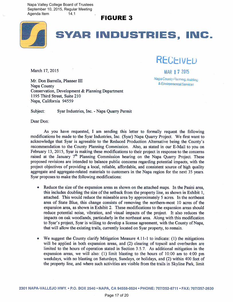
FIGURE 3
Napa Valley College Board of Trustees September 10, 2015, Regular Meeting Agenda Item 14.1 .
Page 17 of 20
Napa Valley College Board of Trustees September 10, 2015, Regular Meeting Agenda Item 14.1 .
Page 18 of 20
Napa Valley College Board of Trustees September 10, 2015, Regular Meeting Agenda Item 14.1 .
Page 19 of 20
Napa Valley College Board of Trustees September 10, 2015, Regular Meeting Agenda Item 14.1 .
Page 20 of 20