Embed Size (px)
Citation preview
1
Meiringspoort An unique ecosystem
Introduction:
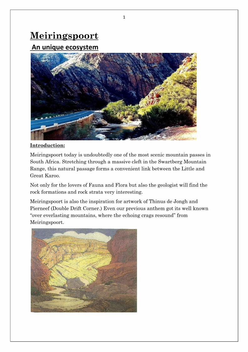
Meiringspoort today is undoubtedly one of the most scenic mountain passes in
South Africa. Stretching through a massive cleft in the Swartberg Mountain
Range, this natural passage forms a convenient link between the Little and
Great Karoo.
Not only for the lovers of Fauna and Flora but also the geologist will find the
rock formations and rock strata very interesting.
Meiringspoort is also the inspiration for artwork of Thinus de Jongh and
Pierneef (Double Drift Corner.) Even our previous anthem got its well known
“over everlasting mountains, where the echoing crags resound” from
Meiringspoort.
2
History:
Meiringspoort is named after Petrus Johannes Meiring. He was born in 1799 and
was a grandson of Dominee Arnoldus Meiring who arrived in 1743 from Lingen,
Germany.
In 1800 Petrus made the first recorded transit of the poort. Later he and Gerome
Marincowitz from the farm Vrolikheid, near Klaarstroom at the northern end of
the poort, opened up a bridle path along the Grootriver , then known as ’ De
Groote Stroom’.
In 1854 after many petitions from wool farmers of the Great Karoo, farmers from
George, Mossel Bay and Oudtshoorn, who wished to trade wood, furniture,
potatoes and sweet potatoes, decisions were made to build a road.
In August of that year John Molteno,( destined to become Prime Minister),
Andrew Geddes Bain, his son Thomas Bain, and Charles Pritchard, a Beaufort
West lawyer, travelled from Beaufort West by horse to examine the route
through the mountains.
As a result of the subsequent report it was decided that the so called ‘boer’ road,
which would be subject to frequent wash-aways, was the answer. An amount of
£5000 was made available.
As the Governor of the Cape Colony, Sir George Grey, was in favour of the road
through the poort, the Legislative Assembly allocated £ 5000 for the building of
the road. In August 1856 work on the road started.
Meiringspoort was officially opened to traffic early on the morning of the 3rd of
March 1858. There was a colourful procession and a tearful guest of honour – the
champagne bottle only broke after the third attempt! It was as previous stated
named after Petrus Johannes Meiring from De Rust. The first freight of wool
(twaalf lange wolwagens) from the interior was dispatched to Mossel Bay on the
same day as the official opening of Meiringspoort.
The Meiringspoort road opened doors for trading from the south and to the north
of the poort. Tollhouses that were built, they also served as shops and dwelling
houses. The first toll- keeper Rankin functioned here for 15 years. He became
famous as the local herbalist and tooth-extractor.
It was reported on the 3rd of June 1870 more than one million kilograms of wool
was transported through Meiringspoort and sold at Mossel Bay. By then the two
villages De Rust and Klaarstoom on either side of the poort were well
established.
In 1885 a flash flood washed away most of the road and Thomas Bain was asked
for assistance. He was busy with the Swartberg Pass but nevertheless saw to the
construction of Meiringspoort and by 1886, he redirect the course to eliminate a
number of river crossings.
3
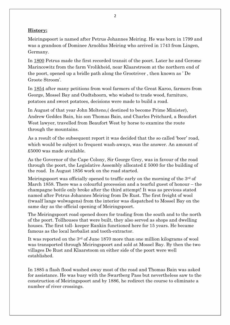
1920 – 1930.
An amount of £10 000 was made available for the reconstruction of
Meiringspoort. Many of the dry stone walls and supporting stone bulwarks
from that time are still visible.
1948 – 1953.
All the drifts in Meiringspoort were replaced by causeways at a cost of
£14 928.
3 March 1958.
A centenary was commemorated at Varkenskraal.
1966 – 1971.
Up to now the road was still untarred and caused a major bottleneck. The
civil engineer Roy Peterson tasked with the project to tar the road through
the poort, walked the old “boer road” to try and avoid sharp bends. Most
building materials like dolomite were brought in from Renosterkop, near
Three Sisters 180 km away. The cost of the road came to R1,6 million.
April 1988.
One of the worst floods in living memory devastated large areas in the
country but Roy Peterson’s tarred road, causeways and stone re-enforcing
held, and only minimal damage was caused.
November 1996.
A big flood and major redesign and reconstruction had to be carried out.
The poort was effectively closed for several months to traffic.
December 1999.
Fully reopened to traffic but finishing touches were still being done.
March 2000.
Another flood occurred that delayed the official opening for six months.
Total cost of the project R70 million.
20 October 2000.
Meiringspoort was officially opened after a construction period of four
years.
4
Geology:
Meiringspoort is the spectacular final product of geological processes that
have taken place over more than 200 million years. Here it is clear how the
sandstone layers of the Cape Mountains were lifted up, pleated and folded
back and forth. This can be seen throughout the drive through Meiringspoort.
Terrestrial forces, greater than we can imagine, created an impressive home
for a wide variety of living organisms in this area. Meiringspoort took shape
about 250 million years ago when Africa was still part of a larger continent.
Africa, Australia, South America, Antarctica and India were known as
Gondwanaland. An inland mountain range was formed by lateral forces
which pushed against each other gradually heaved up layers of rock. At first,
water from this old mountain range drained towards the north. The streams
cut ravines into the northern slopes of the mountain range. About 100 million
years later, Gondwanaland broke up and the adjacent continents began to
drift away.
The rock formations of the mountain range toppled to the south. New rivers
formed ravines in a southerly direction. Another 120 million years later, the
mountain range was heaved up again, causing streams to cut deeper ravines
in the mountain. The gradual distortion and upheaval of the earth’s crust
formed the Swartberg range, with Meiringspoort ravine cutting through it.
At least three different formations of the Table Mountain Sandstone group
are visible near the waterfall.
The Tchando formation at the top, a narrow shale band of the Cederberg
formation lower down and below it, is a much folded cliff which consists of a
75 meter layer of Peninsula sandstone. These different formations differ in
drainage pattern, the degree of eroding ability and nutrient content. Different
plants and animal species occur on each of them. The variation in the geology
is one of the reasons why such a great diversity of plants and animals occur in
this region. It is important to note that the road in Meiringspoort crosses the
same ravine in 25 places. The so-called drifts.
The Flora:
The plant diversity of Meiringspoort is one of its main attractions. The
species diversity is so high that, for a similar sized area elsewhere in the
world, it would be difficult to rival. In 1689, Hendrik Oldenland collected the
wild geranium (Pelargonium zonale) that occurs here. Seeds and cuttings
were later sent to Europe where the Duchess of Beaufort in England started
cultivating them as soon as 1710. They have used this as the basis for the
massive geranium industry in Europe and America.
The Swartberg Mountain range divides the Klein and Groot Karoo, and there
is a dramatic change in the vegetation from the Klein and Groot Karoo linked
by Meiringspoort.
5
Tree and fern species that is more distinctive of the wetter Knysna forest
occur inside the Poort. Mixed amongst these are Klein and Great Karoo plant
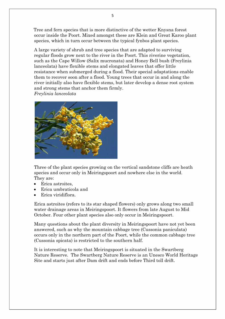
species, which in turn occur between the typical fynbos plant species. A large variety of shrub and tree species that are adapted to surviving
regular floods grow next to the river in the Poort. This riverine vegetation,
such as the Cape Willow (Salix mucronata) and Honey Bell bush (Freylinia
lanceolata) have flexible stems and elongated leaves that offer little
resistance when submerged during a flood. Their special adaptations enable
them to recover soon after a flood. Young trees that occur in and along the
river initially also have flexible stems, but later develop a dense root system
and strong stems that anchor them firmly.
Freylinia lanceolata
Three of the plant species growing on the vertical sandstone cliffs are heath
species and occur only in Meiringspoort and nowhere else in the world.
They are:
Erica astroites,
Erica umbraticola and
Erica viridiflora.
Erica astroites (refers to its star shaped flowers) only grows along two small
water drainage areas in Meiringspoort. It flowers from late August to Mid
October. Four other plant species also only occur in Meiringspoort.
Many questions about the plant diversity in Meiringspoort have not yet been
answered, such as why the mountain cabbage tree (Cussonia paniculata)
occurs only in the northern part of the Poort, while the common cabbage tree
(Cussonia spicata) is restricted to the southern half.
It is interesting to note that Meiringspoort is situated in the Swartberg
Nature Reserve. The Swartberg Nature Reserve is an Unesco World Heritage
Site and starts just after Dam drift and ends before Third toll drift.
6
Plants that you will also there locate are:
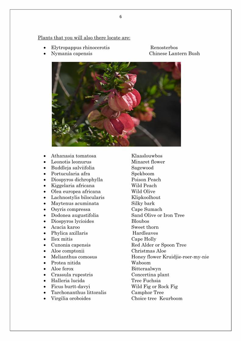
Elytropappus rhinocerotis Renosterbos
Nymania capensis Chinese Lantern Bush
Athanasia tomatosa Klaaslouwbos
Leonotis leonurus Minaret flower
Buddleja salviifolia Sagewood
Portucularia afra Spekboom
Diospyros dichrophylla Poison Peach
Kiggelaria africana Wild Peach
Olea europea africana Wild Olive
Lachnostylis bilocularis Klipkoolhout
Maytenus acuminata Silky bark
Osyris compressa Cape Sumach
Dodonea augustifolia Sand Olive or Iron Tree
Diospyros lycioides Bloubos
Acacia karoo Sweet thorn
Phylica axillaris Hardleaves
Ilex mitis Cape Holly
Cunonia capensis Red Alder or Spoon Tree
Aloe comptonii Christmas Aloe
Melianthus comosus Honey flower Kruidjie-roer-my-nie
Protea nitida Waboom
Aloe ferox Bitteraalwyn
Crassula rupestris Concertina plant
Halleria lucida Tree Fuchsia
Ficus burtt-davyi Wild Fig or Rock Fig
Tarchonanthus littoralis Camphor Tree
Virgilia oroboides Choice tree Keurboom
7
Fauna:
Meiringspoort forms part of the Swartberg Nature Reserve and private farms
like Meijer rust and Varkenskraal.
Animals vary from small rodents like field mice, to the shy cape leopard.
Dassies are found on the rocky slopes. In the water or close by you will find
water mongoose. Klipspringers are found on higher slopes and kudu
especially in the northern part of the Poort. At dusk or early morning you
should be careful when driving in Meiringspoort because wildlife is abound.
Baboons can be seen close to the road. You will also be able to see caracal,
Cape clawless otter, grysbok or large spotted genet at daybreak or dusk.
The birds of Meiringspoort have totally adapted to the environment in which
they live.
Birds to be seen:
Cape bunting
Cape rock thrush
Cape wagtail
Lesser double-collared sunbird
Malachite sunbird
Black eagle
Rock pigeon
Cape turtledove
Laughing dove
Cape bulbul
Karoo pinia
Red-winged starling
Cape white-eye
Alpine swift
Greater striped swallows
About 76 species of birds can be seen in Meiringspoort.
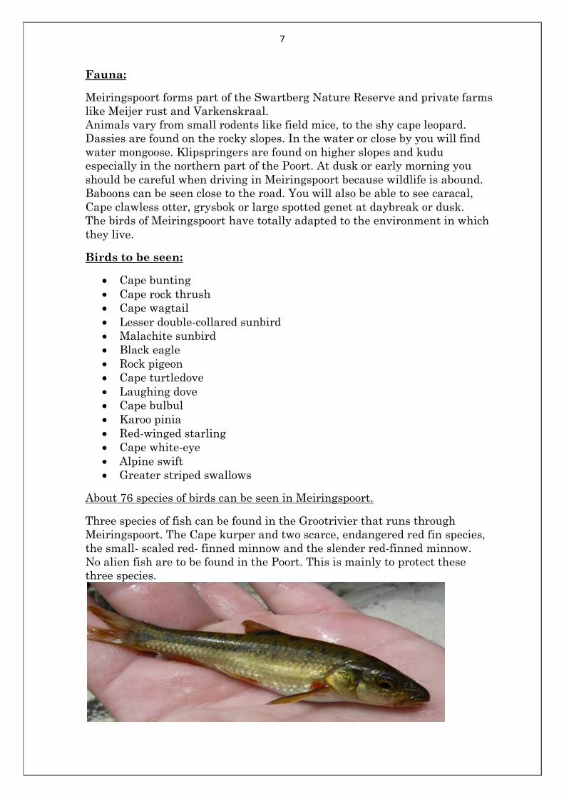
Three species of fish can be found in the Grootrivier that runs through
Meiringspoort. The Cape kurper and two scarce, endangered red fin species,
the small- scaled red- finned minnow and the slender red-finned minnow.
No alien fish are to be found in the Poort. This is mainly to protect these
three species.
8
Apart from dragonflies and a variety of butterflies, some of the world’s most
interesting beetle species are also to be found on the higher peaks of
Meiringspoort. The Colophon Stag beetles or Cape Stag beetles or
Barnard’s Stag beetles are all endangered species in South Africa.
So if you see Colophon berrisfordi, cassoni or whitei please leave them
alone!
One butterfly the Acraea horta species is common in Meiringspoort during
spring and summer. Its larvae feed on the leaves of the wild peach
(Kiggelaria africana) trees where they accumulate a poisonous substance
(Cyanide).
This poison makes the mature butterflies unpalatable to most birds. The
mature butterflies feed on the nectar of flowers (E.g. wild geranium –
Pelargonium zonale) and pollinate them in the process. In the Swartberg
above Meiringspoort you will also find Chrysoritis Pyranus balli or Ball’s
Opal.
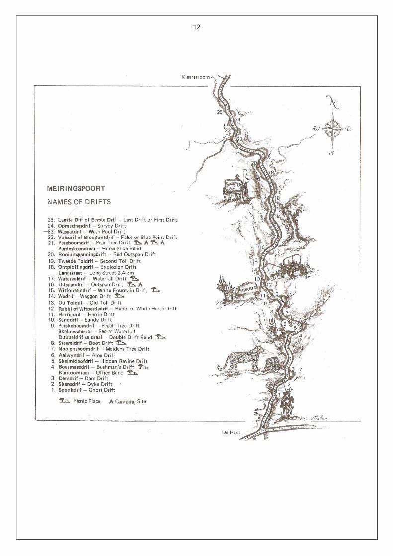
Drifts of Meiringspoort:
The drifts are numbered from the southern (De Rust) entrance.
1. Spookdrif (Ghost drift):
A supernatural light, in the form of a ball of fire was seen at this drift.
2. Skansdrif (Dyke drift):
Stone ramparts are often built in the river bed to keep storm water from
flooding fields. The first primitive ramparts were frequently washed away,
but now more effective method envelopes the stones in a steel mesh.
3. Damdrif (Dam drift):
Immediately upstream from this ford was a large waterhole. It was very
deceptive, especially to strangers and vehicles were frequently bogged down.
Just to the west of the river-bank, the Centenary Monument was erected. At
the next drift on the old road there was a
sharp bend, known as Kantoordraai (Office Corner) where many vehicles
collided, resulting in several court (office) cases. Between Dam drift and
Bushman’s drift there are two picnic spots, without ablutions.
4. Boesmansdrif (Bushman’s drift):
Just beyond this place, to the west, there are broad, deep clefts in the rocks,
where Bushmen lived. As late as 1965 their artefacts were still found. Today
this area is overgrown by fig trees.
5. Skelmkloofdrif (Hiddenravine drift):
On the eastern side of this drift there is a well hidden ravine. From here
water trickles down the rock face into the Groot River. There is a legend that
layabouts (in Afrikaans “skelms”) living in this ravine stole Petrus Meiring’s
sheep.
9
6. Aalwyndrif (Aloe drift):
Against the north face of the cliff overhanging this ford, there are beautiful
mountain aloes (Aloe giganticus), which bloom from July to September. In the
days of itinerant traders these aloes grew so densely that a man stopped here
to tap and boil the sap, which they then sold as a much sought – after
medicine. Here is also a very nice picnic spot with ablution and braai
facilities.
7. Nooiensboomdrif (Maidens Tree drift):
This name originated from the two big Kiepersol trees (maiden trees) that
grew on either side of the road, their branches intertwining. Between this
ford and the next there is a peaceful lay-by with the expressive name
“baboon’s waterfall “(bobbejaan’s waterval)
8. Steweldrif (Boot drift):
Tradition has it that Petrus Meiring’s wagoner’s boots were washed away
here, causing him to return home for another pair. Dubbeldrif (Double drift)
disappeared with the building of the tarred road. Here Roy Petersen raised
the surface of the road five meters above its old bed, gutting out Double drift.
However the name has been transferred to the bend, now known as Dubbele
drif se draai (Double drift corner).There is a rock formation at Double drift
that resembles a pointing finger. After an accident where a man and his wife
were drowned it was said: “Look, the finger is pointing to where the couple
drowned because they were driving on a Sunday”. During the great ostrich-
feather slump of 1914, an insolvent local man committed suicide by hanging
himself from the “finger rock”. A little further on, to the east, is the
Skelmwaterval (Secret waterfall), to be seen after good rains in the
mountains.
9. Perskeboomdrif (Peach Tree drift):
Once a few peach trees grew at this ford, probably from pips discarded by
passers-by. According to Ryk Meiring, the baboons were the only ones who
ate the fruit. These trees have now vanished, but the name remains.
10. Sanddrif (Sand drift):
Obstructions caused by sandbanks frequently occurred at Sand drift. In 1948
the first concrete causeway was built here. A little further on, on the western
side, is the well known “Herrieklip” (Herrie’s Stone).
11. Herrie se Drif of Nagasdrif ( Herrie’s or Naga’s drift)
This drift, just beyond Herrie’s stone, was first known as Naga’s drift named
after Nagas, the chief of the Bushman tribe that lived higher up in the deep
recesses. After 1929, when Herrie had been chiselled into the stone, the
change of name came naturally. Herrie’s Stone was declared a National
Monument on 3 August 1971. The name Herrie was chiselled by
Langenhoven as a monument to the imaginary elephant from his story
“Herrie op die Tremspoor”.
10
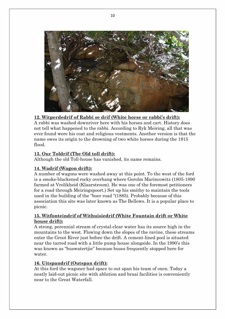
12. Witperdedrif of Rabbi se drif (White horse or rabbi’s drift):
A rabbi was washed downriver here with his horses and cart. History does
not tell what happened to the rabbi. According to Ryk Meiring, all that was
ever found were his coat and religious vestments. Another version is that the
name owes its origin to the drowning of two white horses during the 1915
flood.
13. Our Toldrif (The Old toll drift):
Although the old Toll-house has vanished, its name remains.
14. Wadrif (Wagon drift):
A number of wagons were washed away at this point. To the west of the ford
is a smoke-blackened rocky overhang where Gerolm Marincowitz (1805-1890
farmed at Vrolikheid (Klaarstroom). He was one of the foremost petitioners
for a road through Meiringspoort.) Set up his smithy to maintain the tools
used in the building of the “boer road “(1885). Probably because of this
association this site was later known as The Bellows. It is a popular place to
picnic.
15. Witfonteindrif of Withuisiedrif (White Fountain drift or White
house drift):
A strong, perennial stream of crystal-clear water has its source high in the
mountains to the west. Flowing down the slopes of the ravine, these streams
enter the Groot River just before the drift. A cement-lined pool is situated
near the tarred road with a little pump house alongside. In the 1990’s this
was known as “buswatertjie” because buses frequently stopped here for
water.
16. Uitspandrif (Outspan drift):
At this ford the wagoner had space to out span his team of oxen. Today a
neatly laid-out picnic site with ablution and braai facilities is conveniently
near to the Great Waterfall.
11
17. Waterval drif (Waterfall drift):
Waterfall drift is named after the nearby waterfall. Langstraat (Long Street),
a stretch of road with no river crossings comes after this drift (2,9km). Again
a nice picnic spot with ablution facilities.
18. Ontploffingsdrif (Explosion drift):
A wagon loaded with dynamite is believed to have travelled at such a speed
over the bumpy “boer road” that its freight exploded spontaneously at this
ford. The wagon and mule-team did not survive, but miraculously the driver
did. The old “boer road” can be seen on your right hand side. At this bend
English soldiers fighting in the Anglo-Boer War (1899- 1902) built a fort with
stone walls.
19. Toldrif (Tollhouse drift):
Nowadays marked as Third toll drift. This was the third toll-house in the
Poort. The second Toll was ruined with the rebuilding of the road.
20. Rooiuitspanning of Langstraatdrif (Red outspan or Longstreet
drift):
To the right of this ford there was room enough for a number of wagons to out
span. The name originated from the red colour of soil. Here was the ending of
Long Street which was mentioned earlier.
21. Pereboomdrif (Pear tree drift):
An enormous saffron pear tree grew nearby making this a popular gathering
place and out span. Along the road was a house where two spinsters lived.
When one died the other spinster buried her in the dining room. The survivor
disappeared without anybody seeing her again. Here you can find two picnic
sites located at each side of the drift, with ablution and braai facilities.
22. Bloupuntdrif of Wasgatdrif (Blue point rift or Wash-pool drift):
Just before this drift a turn-off leads to the farm Blue Point (Bloupunt), which
later gave its name to the drift. At this drift, wagoners coming from the Great
Karoo encountered the first really deep pools. Here water barrels could be
filled and the dust of the Karoo washed off.
23. Valsdrif (False drift):
Wagon-teams frequently got stuck in this ford because of the loose gravel and
deep sand drift.
24. Opmetingsdrif (Survey drift):
In 1912 a survey was done to decide whether to build a dam across this ford,
the narrowest point in the gorge.
25. Laaste drif of Eerste drif (Last or First drift):
Depending on which way you are travelling, this is either the first drift
southwards or the last drift northwards.
All the picnic spots and ablution facilities are well maintained and serviced
regularly.
12
13
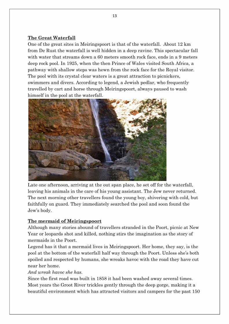
The Great Waterfall
One of the great sites in Meiringspoort is that of the waterfall. About 12 km
from De Rust the waterfall is well hidden in a deep ravine. This spectacular fall
with water that streams down a 60 meters smooth rock face, ends in a 9 meters
deep rock pool. In 1925, when the then Prince of Wales visited South Africa, a
pathway with shallow steps was hewn from the rock face for the Royal visitor.
The pool with its crystal clear waters is a great attraction to picnickers,
swimmers and divers. According to legend, a Jewish pedlar, who frequently
travelled by cart and horse through Meiringspoort, always paused to wash
himself in the pool at the waterfall.
Late one afternoon, arriving at the out span place, he set off for the waterfall,
leaving his animals in the care of his young assistant. The Jew never returned.
The next morning other travellers found the young boy, shivering with cold, but
faithfully on guard. They immediately searched the pool and soon found the
Jew’s body.
The mermaid of Meiringspoort
Although many stories abound of travellers stranded in the Poort, picnic at New
Year or leopards shot and killed, nothing stirs the imagination as the story of
mermaids in the Poort.
Legend has it that a mermaid lives in Meiringspoort. Her home, they say, is the
pool at the bottom of the waterfall half way through the Poort. Unless she’s both
spoiled and respected by humans, she wreaks havoc with the road they have cut
near her home.
And wreak havoc she has.
Since the first road was built in 1858 it had been washed away several times.
Most years the Groot River trickles gently through the deep gorge, making it a
beautiful environment which has attracted visitors and campers for the past 150
14
years. Before that it was impenetrable. Its caves and ravines home to the San
people who had lived there undisturbed for centuries.
Once or twice a decade-sometimes more, sometimes less – heavy rains turn the
trickle into a terrifying torrent which becomes impossible to cross, and destroys
every touch man’s hand has made.
One of the big floods was in 1996. The road was destroyed and repair work
impossible. A new road had to be built and other solutions found to compensate
for the wrath of the angry mermaid basking in her pool at the waterfall.
After the floods the story spread that the mermaid had gone too far and had also
been washed away. Her body, local lore has it, was caught in a net by a
fisherman in Mossel Bay and taken to the CP Nel Museum in Oudtshoorn where
she was kept in a tank of spirits.
The museum’s curator says staff had a tough time keeping the crowds at bay and
the switchboard jammed as people phoned to find out if the story was really true.
To pacify the crowds a doll was given a mermaid’s tail and laid in the clock tower
where more than 2000 people filed past to see “the mermaid”.
Eventually the curator had to phone the police and asked them to ceremoniously
take the mermaid back to her home.
As the new road was nearing completion the mermaid, clearly not dead and still
angry, struck again. This time “little floods” washed away some of the new road,
setting the project back by months and costing millions more to repair.
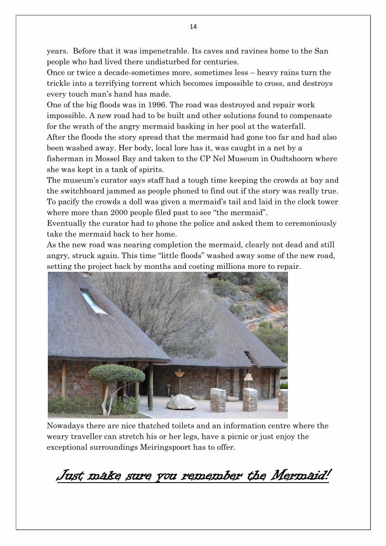
Nowadays there are nice thatched toilets and an information centre where the
weary traveller can stretch his or her legs, have a picnic or just enjoy the
exceptional surroundings Meiringspoort has to offer.
Just make sure you remember the Mermaid!
15
Bibliography:
Marincowitz, Helena 1990. Meiringspoort: A scenic gorge through the Swartberg
range. Bowles, Oudtshoorn.
Ross, Graham 2002. The romance of Cape Mountain Passes. David Philip
Publishers.
Brochure: Meiringspoort. Cape Nature Conservation.
Pamphlet: Names given to drifts of Meiringspoort. Oudtshoorn and De Rust
Tourism.
Compiled by: W.J. Immelman
Cell: 0829522001