Embed Size (px)
Citation preview
FachbeitragThöne, Meeting the Environmental Issues – A Challenge …
203137. Jg. 4/2012 zfv
SummaryA better public perception of the surveying profession re-quires a campaign to improve the general image of the pro-fession and raise awareness of its fundamental contribution to key socio-political issues and global megatrends. Regard-ing environmental issues, such as energy provision, climatic changes, demography, bio-diversity, societal modernization, disaster risk prevention and security policy, surveyors have to act as change managers. The global footprint of the surveying branch has to be pointed out through pro-active communica-tion. This paper addresses the new professional orientation for surveyors in Germany and describes DVW’s integrative role as a platform and a stakeholder for the entire geo-community, shaping networks between politics, government, administra-tion, private economy, industry, geo-business, science, re-search, education and other professional associations.
ZusammenfassungGeodäten befassen sich von Berufs wegen mit der Frage, wie Veränderungen zu Erfolgen geführt werden können. Bei der Gestaltung des demographischen, energetischen und sozio-ökonomischen Wandels in Deutschland oder des Glo-bal Change ergeben sich für die Geodäsie als Wissenschaft und Fachgemeinschaft vielfältige Arbeitsfelder im Change Manage ment, die beispielhaft dargestellt werden. Die Rück-bindung geodätischer Aktivitäten an gesellschaftliche Me-gatrends und Umbrüche wie Energiewende, Klimawandel, Umweltpolitik, Erhalt der Biodiversität, Modernisierung des Staatswesens, Katastrophenmanagement, Sicherheitspolitik und die Bewältigung der Banken- und Staatsschuldenkrise stellt zugleich eine wirksame Kommunikationsstrategie nach innen und außen dar. In diesem Kontext werden die integrative Rolle des DVW mit seinen Landesvereinen, Arbeitskreisen, der zfv, der INTER GEO® und den internationalen Netzwerken FIG und CLGE sowie das erfolgreiche Zusammenwirken mit den Schwesterorganisationen bei Imagewerbung für die Dach-marke Geodäsie, Nachwuchsaktivitäten und Koordination von beruflicher Weiterbildung beschrieben.
Keywords: Global Megatrends, Land Governance, Surveying Profession, Environment, Surveying Associations
1 Introduction
Surveyors are engineers with a technical and mathemati-cal background. It’s beyond doubt that we enjoy a good reputation by doing our job well and precise. However, it’s also a fact that surveying is a service discipline in a value-added chain. Thus, usually surveyors are not identi-fied with the final product – in contrast, for example, to a civil-engineer and the bridge, he has constructed. Hence, we have to improve our communication and promotion capabilities so as to allow for a better public understand-ing of the essential role of surveyors. In regards to our serious “young blood problem” and generally the lack of engineers in Germany, which threatens to impact seri-ously the innovative power of our economy, DVW (Ger-man Surveying Association), in collaboration with our sister organizations, has developed an image campaign for geodesy, geo-information and land management and their protagonists. The main goal consists simply of making engineering sciences, especially in the field of surveying, again more attractive for young people, who – following a trend over the last decade – have turned towards studying courses with better income potential. Essentially, the growing demand cannot be met by the available alumni.
Predominantly, this article is concerned with specific German experiences pertaining to how to shape envi-ronmental and societal change through surveying activi-ties and how to support those processes through a strong professional association. Further, it is assumed that many countries face similar challenges. In this respect the pre-sented approach may give helpful suggestions for appli-cable solutions.
2 Global Megatrends and the Surveying Profession
The key for a better understanding is to make the fun-damental contribution of the surveying profession to regional, national and global development visible in re-gards to societal megatrends and the key socio-political issues. The allegory of the two stone masons makes the context clear: a traveller comes along and asks the first stone mason what he is doing there. His answer: I hew stones. The second mason, however, answers: I am work-ing on a cathedral!
Let’s face the main challenges of Global Change and the function of surveyors with the ideology of the second
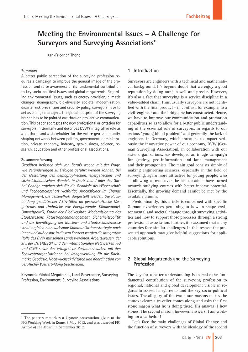
Meeting the Environmental Issues – A Challenge for Surveyors and Surveying Associations*
Karl-Friedrich Thöne
* The paper summarizes a keynote presentation given at the FIG Working Week in Rome, 8 May 2012, and was awarded FIG Article of the Month in September 2012.
Fachbeitrag Thöne, Meeting the Environmental Issues – A Challenge …
204 zfv 4/2012 137. Jg.
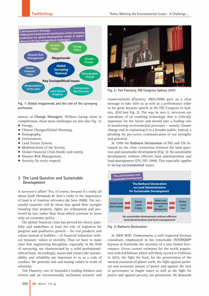
mason, as Change Managers. Without laying claim to completeness, those main challenges are (see also Fig. 1):p Energy,p Climate Changes/Global Warming,p Demography,p Environment,p Land Tenure System,p Modernization of the Society,p Global Financial Crisis (banks and states),p Disaster Risk Management,p Security (in every respect).
3 The Land Question and Sustainable Development
A surveyor’s affair? Yes, of course, because it’s really all about land! Hernando de Soto’s credo to the importance of land is of timeless relevance (de Soto 2000). The suc-cessful countries will be those that spend their energies ensuring that property rights are widespread and pro-tected by law, rather than those which continue to focus only on economic policy.
The global financial crisis has proved his theory pain-fully and underlines at least the role of engineers for progress and qualitative growth – for real products and values instead of bubbles – of financial behaviour with-out measure, values or morality. Thus we have to make clear that engineering disciplines, especially in the field of surveying, are characterised by a solid professional-ethical basis. Accordingly, issues and virtues like sustain-ability and reliability are important to us as a code of conduct. We generate real and lasting values in terms of solutions.
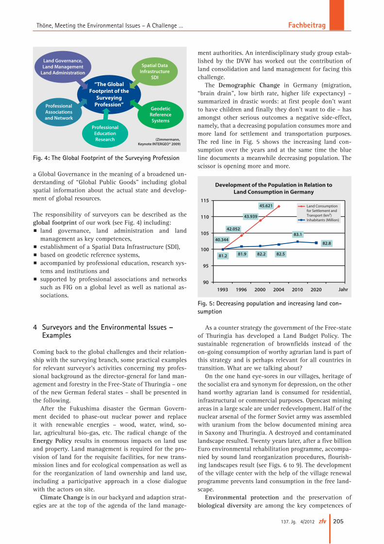
Tim Flannery, one of Australia’s leading thinkers and writers and an internationally acclaimed scientist and
conservationist (Flannery 2005/2008) gave us a clear message to take with us as well as a performance order in his great keynote speech at the FIG Congress in Syd-ney, 2010 (see Fig. 2). The way he sees it, surveyors are custodians of an enabling technology that is critically important for the future and should take a leading role in monitoring environmental processes – namely climate change and in explaining it to a broader public. Indeed, a pleading for pro-active communication of our strengths and potential.
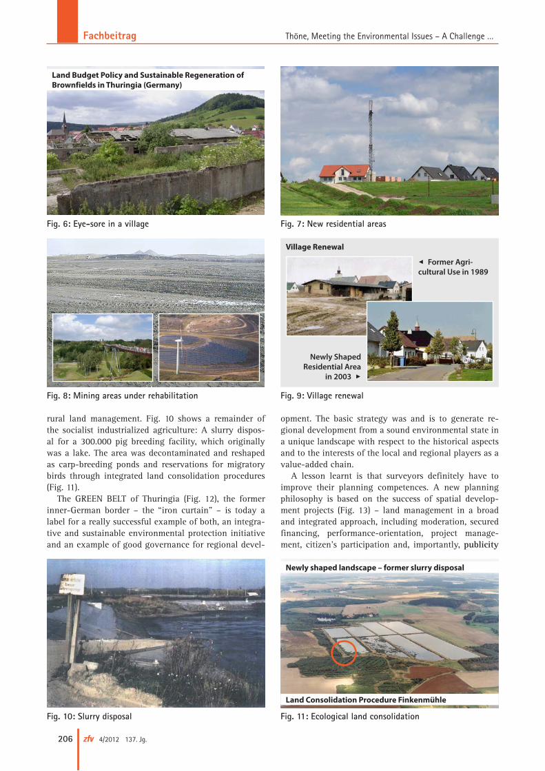
In 1999 the Bathurst Declaration of FIG and UN fo-cussed on the close connection between the land ques-tion and sustainable development (Fig. 3): No sustainable development without efficient land administration and land management (UN, FIG 1999). This especially applies to facing environmental issues.
In 2009 Willi Zimmermann, a well respected German consultant, emphasized in his remarkable INTER GEO® keynote in Karlsruhe the necessity of a new Global Gov-ernance. Given current estimates for the world popula-tion with 6.8 billions which will likely exceed to 9 billions in 2035, the fight for food, for the preservation of the natural resources of planet earth, the fight against politi-cal and economic misuse of power and against the lack of governance in fragile states as well as the fight for justice and against poverty, are paramount. He demands
GlobalSurveyingNational
EnergyPolicy
ClimateChange
DemographicChange
EnvironmentBio-DiversityLand Tenure
Property
Modernizationof the state
SecurityPolicy
Desaster RiskManagement
GlobalFinancial
Crisis
Communication Strategy:
Making the fundamental contribution of the surveying
profession for global development visible in depen-
dance to the key sociopolitical challenges!
Megatrends
Key Sociopolitical Issues
Fig. 1: Global megatrends and the role of the surveying profession
Fig. 2: Tim Flannery, FIG Congress Sydney 2010
The Bathurst Declarationon Land Administration
for Sustainable Development
Good LandInformation
BetterLand
Policy
Better LandAdministration
andManagement
BetterLandUse
No sustainable development without e�cientland administration and land management!
The Land Question and
Sustainable Development
Fig. 3: Bathurst Declaration
FachbeitragThöne, Meeting the Environmental Issues – A Challenge …
205137. Jg. 4/2012 zfv
a Global Governance in the meaning of a broadened un-derstanding of “Global Public Goods” including global spatial information about the actual state and develop-ment of global resources.
The responsibility of surveyors can be described as the global footprint of our work (see Fig. 4) including:p land governance, land administration and land
manage ment as key competences,p establishment of a Spatial Data Infrastructure (SDI),p based on geodetic reference systems,p accompanied by professional education, research sys-
tems and institutions andp supported by professional associations and networks
such as FIG on a global level as well as national as-sociations.
4 Surveyors and the Environmental Issues – Examples
Coming back to the global challenges and their relation-ship with the surveying branch, some practical examples for relevant surveyor’s activities concerning my profes-sional background as the director-general for land man-agement and forestry in the Free-State of Thuringia – one of the new German federal states – shall be presented in the following.
After the Fukushima disaster the German Govern-ment decided to phase-out nuclear power and replace it with renewable energies – wood, water, wind, so-lar, agricultural bio-gas, etc. The radical change of the Energy Policy results in enormous impacts on land use and property. Land management is required for the pro-vision of land for the requisite facilities, for new trans-mission lines and for ecological compensation as well as for the reorganization of land ownership and land use, including a participative approach in a close dialogue with the actors on site.
Climate Change is in our backyard and adaption strat-egies are at the top of the agenda of the land manage-
ment authorities. An interdisciplinary study group estab-lished by the DVW has worked out the contribution of land consolidation and land management for facing this challenge.
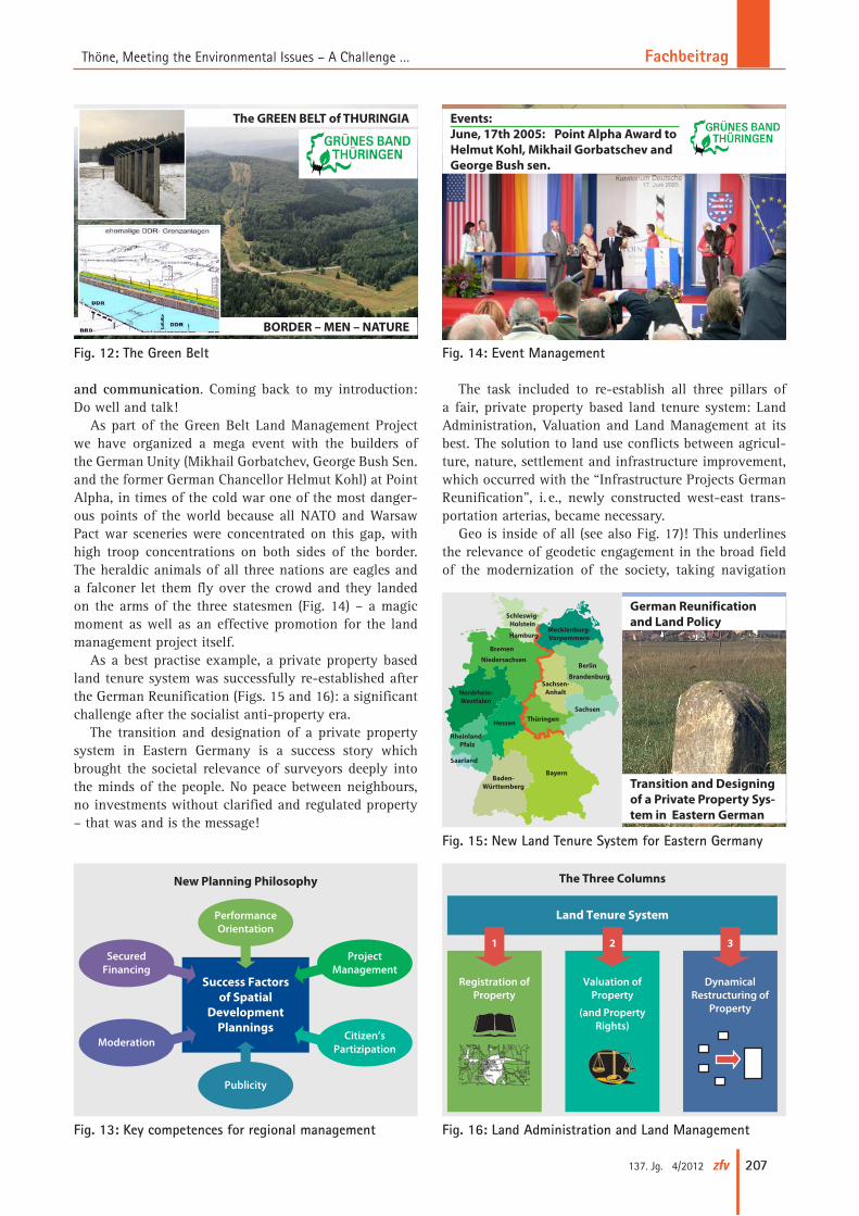
The Demographic Change in Germany (migration, “brain drain”, low birth rate, higher life expectancy) – summarized in drastic words: at first people don’t want to have children and finally they don’t want to die – has amongst other serious outcomes a negative side-effect, namely, that a decreasing population consumes more and more land for settlement and transportation purposes. The red line in Fig. 5 shows the increasing land con-sumption over the years and at the same time the blue line documents a meanwhile decreasing population. The scissor is opening more and more.
As a counter strategy the government of the Free-state of Thuringia has developed a Land Budget Policy. The sustainable regeneration of brownfields instead of the on-going consumption of worthy agrarian land is part of this strategy and is perhaps relevant for all countries in transition. What are we talking about?
On the one hand eye-sores in our villages, heritage of the socialist era and synonym for depression, on the other hand worthy agrarian land is consumed for residential, infrastructural or commercial purposes. Opencast mining areas in a large scale are under redevelopment. Half of the nuclear arsenal of the former Soviet army was assembled with uranium from the below documented mining area in Saxony and Thuringia. A destroyed and contaminated landscape resulted. Twenty years later, after a five billion Euro environmental rehabilitation programme, accompa-nied by sound land reorganization procedures, flourish-ing landscapes result (see Figs. 6 to 9). The development of the village center with the help of the village renewal programme prevents land consumption in the free land-scape.
Environmental protection and the preservation of biological diversity are among the key competences of
“The GlobalFootprint of the
SurveyingProfession”
Land Governance,Land Management
Land Administration
ProfessionalAssociationsand Network
ProfessionalEducationResearch
GeodeticReferenceSystems
Spatial DataInfrastructure
SDI
(Zimmermann, Keynote INTERGEO® 2009)
Fig. 4: The Global Footprint of the Surveying Profession
90
95
100
105
110
115
1993 1996 2000 2004 2010 2020
Land Consumptionfor Settlement and Transport (km²)Inhabitants (Million)
40.344
42.052
43.939
45.621
81.2 81.9 82.2 82.5
83.1
82.8
Jahr
Development of the Population in Relation toLand Consumption in Germany
Fig. 5: Decreasing population and increasing land con-sumption
Fachbeitrag Thöne, Meeting the Environmental Issues – A Challenge …
206 zfv 4/2012 137. Jg.
rural land management. Fig. 10 shows a remainder of the socialist industrialized agriculture: A slurry dispos-al for a 300.000 pig breeding facility, which originally was a lake. The area was decontaminated and reshaped as carp-breeding ponds and reservations for migratory birds through integrated land consolidation procedures (Fig. 11).
The GREEN BELT of Thuringia (Fig. 12), the former inner-German border – the “iron curtain” – is today a label for a really successful example of both, an integra-tive and sustainable environmental protection initiative and an example of good governance for regional devel-
opment. The basic strategy was and is to generate re-gional development from a sound environmental state in a unique landscape with respect to the historical aspects and to the interests of the local and regional players as a value-added chain.
A lesson learnt is that surveyors definitely have to improve their planning competences. A new planning philosophy is based on the success of spatial develop-ment projects (Fig. 13) – land management in a broad and integrated approach, including moderation, secured financing, performance-orientation, project manage-ment, citizen’s participation and, importantly, publicity
Fig. 10: Slurry disposal Fig. 11: Ecological land consolidation
Newly shaped landscape – former slurry disposal
Land Consolidation Procedure Finkenmühle
Fig. 8: Mining areas under rehabilitation
Fig. 7: New residential areasFig. 6: Eye-sore in a village
Land Budget Policy and Sustainable Regeneration of Brownfields in Thuringia (Germany)
Fig. 9: Village renewal
Village Renewal
7 Former Agricultural Use in 1989
Newly Shaped Residential Area
in 2003 3
FachbeitragThöne, Meeting the Environmental Issues – A Challenge …
207137. Jg. 4/2012 zfv
and communication. Coming back to my introduction: Do well and talk!
As part of the Green Belt Land Management Project we have organized a mega event with the builders of the German Unity (Mikhail Gorbatchev, George Bush Sen. and the former German Chancellor Helmut Kohl) at Point Alpha, in times of the cold war one of the most danger-ous points of the world because all NATO and Warsaw Pact war sceneries were concentrated on this gap, with high troop concentrations on both sides of the border. The heraldic animals of all three nations are eagles and a falconer let them fly over the crowd and they landed on the arms of the three statesmen (Fig. 14) – a magic moment as well as an effective promotion for the land management project itself.
As a best practise example, a private property based land tenure system was successfully re-established after the German Reunification (Figs. 15 and 16): a significant challenge after the socialist anti-property era.
The transition and designation of a private property system in Eastern Germany is a success story which brought the societal relevance of surveyors deeply into the minds of the people. No peace between neighbours, no investments without clarified and regulated property – that was and is the message!
The task included to re-establish all three pillars of a fair, private property based land tenure system: Land Administration, Valuation and Land Management at its best. The solution to land use conflicts between agricul-ture, nature, settlement and infrastructure improvement, which occurred with the “Infrastructure Projects German Reunification”, i. e., newly constructed west-east trans-portation arterias, became necessary.
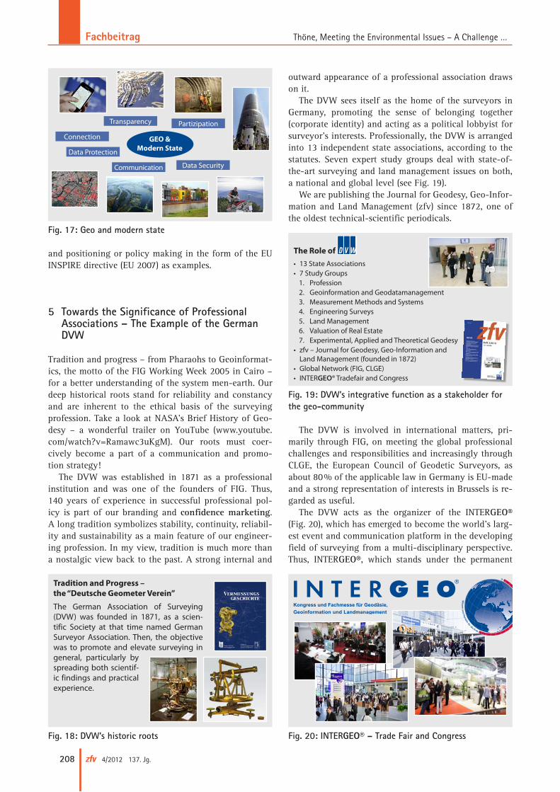
Geo is inside of all (see also Fig. 17)! This underlines the relevance of geodetic engagement in the broad field of the modernization of the society, taking navigation
Fig. 12: The Green Belt
The GREEN BELT of THURINGIA
BORDER – MEN – NATURE
Fig. 14: Event Management
Events:June, 17th 2005: Point Alpha Award to Helmut Kohl, Mikhail Gorbatschev and George Bush sen.
Citizen’sPartizipation
ProjectManagement
PerformanceOrientation
SecuredFinancing
Moderation
Publicity
Success Factorsof Spatial
DevelopmentPlannings
New Planning Philosophy
Fig. 13: Key competences for regional management
Fig. 15: New Land Tenure System for Eastern Germany
German Reunification and Land Policy
Transition and Designing of a Private Property Sys-tem in Eastern German
BayernBaden-
Württemberg
Rheinland-Pfalz
Saarland
Hessen ThüringenSachsen
Sachsen-Anhalt
Brandenburg
Berlin
Mecklenburg-Vorpommern
Nordrhein-Westfalen
Niedersachsen
Bremen
Hamburg
Schleswig-Holstein
The Three Columns
Land Tenure System
Registration ofProperty
Valuation ofProperty
(and PropertyRights)
DynamicalRestructuring of
Property
1 2 3
Fig. 16: Land Administration and Land Management
Fachbeitrag Thöne, Meeting the Environmental Issues – A Challenge …
208 zfv 4/2012 137. Jg.
and positioning or policy making in the form of the EU INSPIRE directive (EU 2007) as examples.
5 Towards the Significance of Professional Associations – The Example of the German DVW
Tradition and progress – from Pharaohs to Geoinformat-ics, the motto of the FIG Working Week 2005 in Cairo – for a better understanding of the system men-earth. Our deep historical roots stand for reliability and constancy and are inherent to the ethical basis of the surveying profession. Take a look at NASA’s Brief History of Geo-desy – a wonderful trailer on YouTube (www.youtube.com/watch?v=Ramawc3uKgM). Our roots must coer-cively become a part of a communication and promo- tion strategy!
The DVW was established in 1871 as a professional institution and was one of the founders of FIG. Thus, 140 years of experience in successful professional pol-icy is part of our branding and confidence marketing. A long tradition symbolizes stability, continuity, reliabil-ity and sustainability as a main feature of our engineer-ing profession. In my view, tradition is much more than a nostalgic view back to the past. A strong internal and
outward appearance of a professional association draws on it.
The DVW sees itself as the home of the surveyors in Germany, promoting the sense of belonging together (corporate identity) and acting as a political lobbyist for surveyor’s interests. Professionally, the DVW is arranged into 13 independent state associations, according to the statutes. Seven expert study groups deal with state-of-the-art surveying and land management issues on both, a national and global level (see Fig. 19).
We are publishing the Journal for Geodesy, Geo-Infor-mation and Land Management (zfv) since 1872, one of the oldest technical-scientific periodicals.
The DVW is involved in international matters, pri-marily through FIG, on meeting the global professional challenges and responsibilities and increasingly through CLGE, the European Council of Geodetic Surveyors, as about 80 % of the applicable law in Germany is EU-made and a strong representation of interests in Brussels is re-garded as useful.
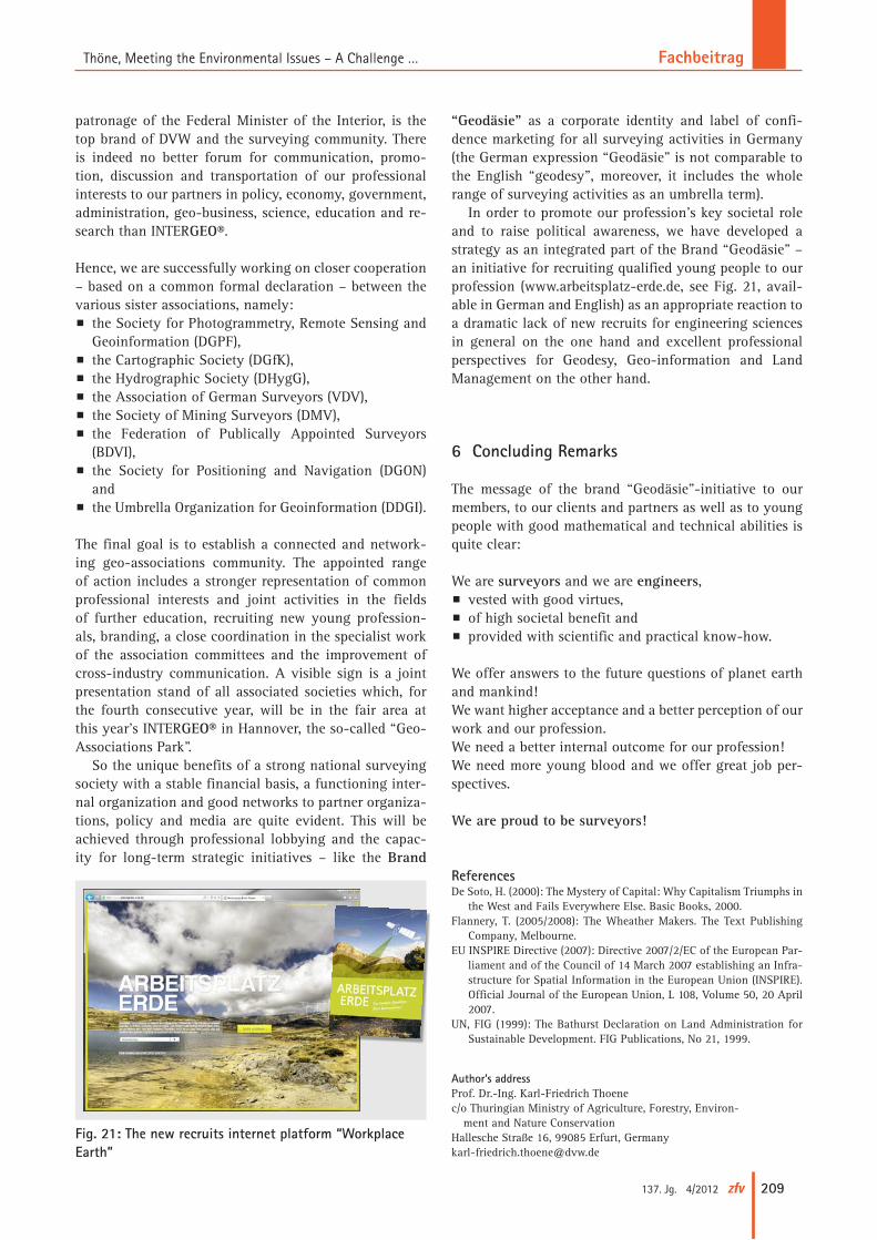
The DVW acts as the organizer of the INTER GEO® (Fig. 20), which has emerged to become the world’s larg-est event and communication platform in the developing field of surveying from a multi-disciplinary perspective. Thus, INTER GEO®, which stands under the permanent
Fig. 18: DVW’s historic roots
Tradition and Progress – the “Deutsche Geometer Verein”
The German Association of Surveying (DVW) was founded in 1871, as a scien-tific Society at that time named German Surveyor Association. Then, the objective was to promote and elevate surveying in general, particularly by spreading both scientif-ic findings and practical experience.
Fig. 19: DVW’s integrative function as a stakeholder for the geo-community
• 13 State Associations• 7 Study Groups
1. Profession2. Geoinformation and Geodatamanagement3. Measurement Methods and Systems4. Engineering Surveys5. Land Management6. Valuation of Real Estate7. Experimental, Applied and Theoretical Geodesy
• zfv – Journal for Geodesy, Geo-Information and Land Management (founded in 1872)
• Global Network (FIG, CLGE) • INTERGEO® Tradefair and Congress
The Role of
Fig. 17: Geo and modern state
GEO & Modern State
Connection
Data Protection
Communication
PartizipationTransparency
Data Security
Fig. 20: INTERGEO® – Trade Fair and Congress
FachbeitragThöne, Meeting the Environmental Issues – A Challenge …
209137. Jg. 4/2012 zfv
patronage of the Federal Minister of the Interior, is the top brand of DVW and the surveying community. There is indeed no better forum for communication, promo-tion, discussion and transportation of our professional interests to our partners in policy, economy, government, administration, geo-business, science, education and re-search than INTER GEO®.
Hence, we are successfully working on closer cooperation – based on a common formal declaration – between the various sister associations, namely:p the Society for Photogrammetry, Remote Sensing and
Geoinformation (DGPF),p the Cartographic Society (DGfK),p the Hydrographic Society (DHygG),p the Association of German Surveyors (VDV),p the Society of Mining Surveyors (DMV),p the Federation of Publically Appointed Surveyors
(BDVI),p the Society for Positioning and Navigation (DGON)
andp the Umbrella Organization for Geoinformation (DDGI).
The final goal is to establish a connected and network-ing geo-associations community. The appointed range of action includes a stronger representation of common professional interests and joint activities in the fields of further education, recruiting new young profession-als, branding, a close coordination in the specialist work of the association committees and the improvement of cross-industry communication. A visible sign is a joint presentation stand of all associated societies which, for the fourth consecutive year, will be in the fair area at this year’s INTER GEO® in Hannover, the so-called “Geo-Associations Park”.
So the unique benefits of a strong national surveying society with a stable financial basis, a functioning inter-nal organization and good networks to partner organiza-tions, policy and media are quite evident. This will be achieved through professional lobbying and the capac-ity for long-term strategic initiatives – like the Brand
“Geodäsie” as a corporate identity and label of confi-dence marketing for all surveying activities in Germany (the German expression “Geodäsie” is not comparable to the English “geodesy”, moreover, it includes the whole range of surveying activities as an umbrella term).
In order to promote our profession’s key societal role and to raise political awareness, we have developed a strategy as an integrated part of the Brand “Geodäsie” – an initiative for recruiting qualified young people to our profession (www.arbeitsplatz-erde.de, see Fig. 21, avail-able in German and English) as an appropriate reaction to a dramatic lack of new recruits for engineering sciences in general on the one hand and excellent professional perspectives for Geodesy, Geo-information and Land Management on the other hand.
6 Concluding Remarks
The message of the brand “Geodäsie”-initiative to our members, to our clients and partners as well as to young people with good mathematical and technical abilities is quite clear:
We are surveyors and we are engineers,p vested with good virtues,p of high societal benefit andp provided with scientific and practical know-how.
We offer answers to the future questions of planet earth and mankind!We want higher acceptance and a better perception of our work and our profession.We need a better internal outcome for our profession!We need more young blood and we offer great job per-spectives.
We are proud to be surveyors!
ReferencesDe Soto, H. (2000): The Mystery of Capital: Why Capitalism Triumphs in
the West and Fails Everywhere Else. Basic Books, 2000.Flannery, T. (2005/2008): The Wheather Makers. The Text Publishing
Company, Melbourne.EU INSPIRE Directive (2007): Directive 2007/2/EC of the European Par-
liament and of the Council of 14 March 2007 establishing an Infra-structure for Spatial Information in the European Union (INSPIRE). Official Journal of the European Union, L 108, Volume 50, 20 April 2007.
UN, FIG (1999): The Bathurst Declaration on Land Administration for Sustainable Development. FIG Publications, No 21, 1999.
Author’s addressProf. Dr.-Ing. Karl-Friedrich Thoenec/o Thuringian Ministry of Agriculture, Forestry, Environ- ment and Nature ConservationHallesche Straße 16, 99085 Erfurt, [email protected]
Fig. 21: The new recruits internet platform “Workplace Earth”